Have Clock, Will Travel

[Image: From The Hunt For Red October, via Quora].

There’s a line in The Hunt For Red October where a submarine navigator jokes, “Give me a stopwatch and a map, and I’ll fly the Alps in a plane with no windows.” I was reminded of that comment by reports of a new atomic clock that will allegedly enable “futuristic navigation schemes”:

“Every single spacecraft exploring deep space today relies on navigation that’s performed back here at Earth,” said [Jill] Seubert, who’s based at NASA’s Jet Propulsion Laboratory in Pasadena, Calif. Earth-based antennas send signals to spacecraft, which the spacecraft echo back. By measuring a signal’s round-trip time within a billionth of a second, ground-based atomic clocks in the Deep Space Network help pinpoint the spacecraft’s location.

With the new Deep Space Atomic Clock, “we can transition to what we call one-way tracking,” Seubert said. A spaceship would use such a clock onboard to measure the time it takes for a tracking signal to arrive from Earth, without having to send that signal back for measurement with ground-based atomic clocks. That would allow a spacecraft to judge its own trajectory.

One might say that the ship is navigating time as much as it is traveling through space—steering through the time between things rather than simply following the lines that connect one celestial object to another.

The general problem of ship orientation and navigation in deep space is a fascinating one, and it has led to ideas like using “dead stars” as fixed directional beacons, a kind of thanato-stellar GPS. This is “the long-sought technology known as pulsar navigation,” Nature reported last year. “For decades, aerospace engineers have dreamed of using these consistently repeating signals for navigation, just as they use the regular ticking of atomic clocks on satellites for GPS.” You head toward something that’s only consistent because it’s dead.

There is something really interesting here, where human navigators and their far-flung machines are confronted with a landscape so vast it is all but devoid of local landmarks. Imagine the cognitive skills necessary for early humans to wander forth, on foot, across colossal and empty steppes, long before modern navigational tools, or picture autonomous, near-frozen hard-drives falling endlessly outward toward stars they might never reach: these scenarios lend themselves to metaphor just as much as they present real-world cartographic problems masked as an encounter with landscapes impossibly huge.

A landscape so big it becomes time, and only a clock can conquer it; or a space so empty, its only fixed points are long dead.

Opens Coat, Flashes Links

[Image: The “former constellation” Argo Navis, via Wikipedia].

Taps mic… Is this thing still on…

1. Hidden Charms was a conference on “the magical protection of buildings,” organized by Brian Hoggard. The one-day symposium looked at everything from ritual “protection marks” to dead cats stored in glass jars, put there “to keep the witches away.”

2. Amazon wants to put robots in every home. “The retail and cloud computing giant has embarked on an ambitious, top-secret plan to build a domestic robot, according to people familiar with the plans. Codenamed ‘Vesta,’ after the Roman goddess of the hearth, home and family,” the robot “could be a sort of mobile Alexa,” Businessweek speculates, “accompanying customers in parts of their home where they don’t have Echo devices. Prototypes of the robots have advanced cameras and computer vision software and can navigate through homes like a self-driving car.”

3. A woman in Austin, Texas, went missing in 2015. Without monthly payments, her house was eventually seized and sold by the bank—but the home’s new owners found the skeletal remains of a body inside one of the walls back in March. It was the missing woman. “In the attic, there was a broken board that led down to the space” where the skeleton was found, a coroner’s spokesperson explained. “Law enforcement thinks she may have been up in the attic and fell through the attic floor.” Horrifically, whether she was killed by the fall or remained alive, trapped inside the wall, is unclear.

4. At an event here in Los Angeles a few weeks ago, artist and writer Julia Christensen drew my attention to officially recognized “former constellations,” or named star groups that are no longer considered referentially viable.

5. The Roman monetary system left a planetary-archaeological trace in Greenland’s ice sheet, according to Rob Meyer of The Atlantic. “A team of archaeologists, historians, and climate scientists have constructed a history of Rome’s lead pollution,” Meyer explains, “which allows them to approximate Mediterranean economic activity from 1,100 b.c. to 800 a.d. They found it hiding thousands of miles from the Roman Forum: deep in the Greenland Ice Sheet, the enormous, miles-thick plate of ice that entombs the North Atlantic island.” With this data, they have “reconstructed year-by-year economic data documenting the rise and fall of the Roman Republic and Empire.” Oddly enough, this means the Greenland Ice Sheet is a landscape-scale archive of Roman financial data.

6. Speaking of economic data mined from indirect sources, “satellite imagery that tracks changes in the level of nighttime lighting within and between countries over time” might also reveal whether countries are lying about the strengths of their economies. According to researcher Luis R. Martinez, “increases in nighttime lighting generally track with increases in GDP,” and this becomes of interest when lighting levels don’t correspond with officially given numbers. Of course, this is not the first time that satellite imagery has been used to estimate economic data.

7. “Today our experience of the night differs significantly from that of our ancestors,” Nancy Gonlin and April Nowell write for Sapiens. “Before they mastered fire, early humans lived roughly half their lives in the dark.” Cue the rise of “archaeological inquiries into the night,” or what Gonlin and Nowell have evocatively named the “archaeology of night.”

8. There was an amazing article by Jake Halpern published in The New Yorker two years ago about Nazi gold fever in Poland and the incredible amount of amateur detective operations there dedicated to finding an alleged buried fortune. It’s a wild mix of abandoned WWII bunkers, secret underground cities in the forest, and urban legends of untold wealth. It turns out, however, there is a (vaguely) similar obsession with lost or buried gold in northwestern Pennsylvania: “For decades, treasure hunters in Pennsylvania have suspected that there is a trove of Civil War gold lost in a rural forest in the northwestern part of the state,” the New York Times reports. “The story of the gold bars was pieced together from old documents, a map and even a mysterious note found decades ago in a hiding place on the back of a bed post in Caledonia,” the paper explains.

9. People are drawn to forests for all sorts of reasons. As Alex Mar wrote last autumn for the Virginia Quarterly Review, the Slender Man phenomenon—that inspired two young girls to try to murder a classmate—also had a forest element. “Girls lured out into the dark woods—this is the stuff of folk tales from so many countries,” Mar writes, “a New World fear of the Puritans, an image at the heart of witchcraft and the occult, timeless.” Mar points out that, after the attempted murder, the two girls began heading “to Wisconsin’s Nicolet National Forest on foot, nearly 200 miles north. They were convinced that, once there, if they pushed farther and farther into the nearly 700,000-acre forest, they would find the mansion in which their monster [Slender Man] dwells and he would welcome them.” The whole article is an interesting look at childhood, folklore, and the sometimes dark allure of the wild.

10. More treasure hunts: is there a cache of buried armaments, stolen from a National Guard armory in 1970, hidden somewhere in Amesbury, Massachusetts? According to a commenter on the Cast Boolits forum, William Gilday, who once “led an assault on a National Guard armory in Newburyport” and who spent nearly half of his life in prison for killing a police officer, confessed on his death bed that he buried guns and ammunition stolen from the armory somewhere in his hometown of Amesbury. “It’s one of those ‘what if’ things,” the commenter continues. “I’ve known about the confession for years, and I walk my dog in the ‘suspected’ vicinity just about every day. The problem is that the ‘authorities’ claim that everything that was stolen was recovered. But, a few weeks ago, I emailed a local radio talk show host who was involved in the death bed confession and I asked her if she thought that stolen items really had been buried in my town and she replied, ‘Yes…do you know where they are?’”

11. “A dispute between Serbia and Kosovo has disrupted the electric power grid for most of the Continent, making certain kinds of clocks—many of those on ovens, in heating systems and on radios—run up to six minutes slow,” the New York Times reported back in March. “The fluctuation in the power supply is infinitesimally small—not nearly enough to make a meaningful difference for most powered devices—and if it were a brief disturbance, the effect on clocks might be too little to worry about.” But this six-minute lag is enough to cause subtle effects in people’s lives. A bad first novel could be written about slow clocks, distant political disputes, and some sort of disastrous event—a missed train, a skipped meeting—in the narrator’s personal life.

12. The above story reminds me of the suspicion last year that Russia was using some sort of large-scale GPS jamming device in the Black Sea. “Reports of satellite navigation problems in the Black Sea suggest that Russia may be testing a new system for spoofing GPS,” David Hambling reported for New Scientist. “This could be the first hint of a new form of electronic warfare available to everyone from rogue nation states to petty criminals.” The reason I say this is because you can easily imagine a scenario where someone is driving around, totally lost, receiving contradictory if not frankly nonsensical navigation instructions, and it’s because they are an unwitting, long-distance victim of geographic weaponry being used in a war zone far away.

13. The legendary music fest Sónar has been sending music to “a potentially habitable exoplanet” called GJ273b, attempting to contact alien intelligence with transmissions of electronic music. Transmission 1 was sent back in October; Transmission 2 ended today. The transmissions should arrive at the planet in November 2030.

Many Norths

[Image: Many Norths: Building in a Shifting Territory].

Architects Lola Sheppard and Mason White of Lateral Office have a new book out, Many Norths: Building in a Shifting Territory, published by Actar.

The book is something of a magnum opus for the office, compiling many years’ worth of research—architectural, infrastructural, geopolitical—including original interviews, maps, diagrams, and historical analyses of the Canadian North. Or the Canadian Norths, as Sheppard and White make clear.

[Image: A spread from the book, featuring a slightly different, unused layout; via Actar].

The plural nature of this remote territory is the book’s primary emphasis—that no one model or description fits despite superficial resemblances, whether they be economic, ecological, climatic, or even military, across massive geographic areas.

“For better or for worse,” they write in the book’s opening chapter, “if nothing else [the Norths are] a shifting, multivalent territory: culturally dynamic, environmentally changing, and socially evolving. Digital and physical mobility networks expand, ground conditions change, treelines shift, species hybridize, and cultures remain dynamic and cross-pollinating.”

Exploring these differences, they add, was “the motivation for this book.”


[Images: Spreads from Many Norths].

Their secondary point, however, is that this sprawling, multidimensional region of shifting ground planes and emergent resource wealth is now the site of “a distinct northern vernacular,” or “polar vernacular,” a still-developing architectural language that the book also exhaustively documents, from adjustable foundation piles to passive ventilation.

There are Mars simulations, remote scientific facilities, schools, military bases, temporary snowmobile routes (snowmobile psychogeography!), and communal utilities corridors.


[Images: Spreads from Many Norths].

The book is cleanly designed, but its strength is not in its visual impact; it’s in how it combines rigorous primary research with architectural documentation.

The interviews are a particular highlight.

Among more than a dozen other subjects, there are discussions with anthropologist Claudio Aporto on “wayfinding techniques and spatial perception” among the Inuit, with “master mariner” Thomas Paterson on the logistics of Arctic shipping, with historian Shelagh Grant on “sovereignty” and “security” in the far north, and with Baffin Island native whale hunter Charlie Qumuatuq on seasonal food webs.


[Images: Spreads from Many Norths].

While the focus of Many Norths is, of course, specifically Canadian, its topics are relevant not only to other Arctic nations but to other extreme environments and remote territories.

In fact, the book serves as a challenging precedent for similar undertakings—one can easily imagine a Many Wests, for example, documenting various modes of inhabiting the American Southwest, with implications for desert regions all over the world.

[Image: Spread from Many Norths].

In any case, I’ve long been a fan of Lateral Office’s work and was thrilled to see this come out.

For those of you already familiar with Lateral’s earlier design propositions published in their Pamphlet Architecture installment, Coupling, Many Norths can be seen as an archive of directly relevant supporting materials. The two books thus make a useful pair, exemplifying the value of developing a deep research archive while simultaneously experimenting with those materials’ speculative design applications.

(Thanks to Mason White for sending me a copy of the book. Vaguely related: Landscape Futures and Landscape Futures Arrives).

Spells Against Autonomy

[Image: From “Autonomous Trap 001” by James Bridle].

By now, you’ve probably seen James Bridle’s “Autonomous Trap 001,” a magic salt circle for ensnaring the sensory systems of autonomous vehicles.

By surrounding a self-driving vehicle with a mandala of inescapable roadway markings—after all, even a person wearing a t-shirt with a STOP sign on it can affect the navigational capabilities of autonomous cars—the project explores the possibility that these machines could be trapped, frozen in a space of infinite indecision, as if locked in place by magic.

[Image: From “Autonomous Trap 001” by James Bridle].

Five years from now, rogue highway painting crews well-versed in ritual magic and LiDAR sigils shut down all machine-vision systems on the west coast…

As Bridle explained to Creators, there should be at least a handful of more examples of this automotive counter-wizardry to come.

(Earlier on BLDGBLOG: Robot War and the Future of Perceptual Self-Deception. See also The Dream Life of Driverless Cars.)

The Doomway

[Image: The beginning of the Broomway path, at Wakering Stairs].

One of my favorite chapters in Robert Macfarlane’s recent book, The Old Ways: A Journey On Foot, has been excerpted over at the BBC—and, although the excerpt itself is well worth reading in full, it only reminds me of how good the entire chapter really is (note, as well, that the following quotations come from Macfarlane’s book, not from the BBC excerpt, lest there be variations in text).

The chapter documents a hike along the Broomway, an eerie coastal path across tidally exposed sands out where the Thames meets the North Sea.

The satellite photo, above, shows the Broomway’s launching point, at a place called Wakering Stairs. From there it heads into a shifting marine landscape of tidal flats—a “vast revealed world,” in Macfarlane’s words, of mud, half-buried guideposts, and omnipresent quicksand.

The path is also known as the Doomway: it is a path that leads “straight out to sea.”

[Image: One possible end-point—not the furthest—of the “Doomway” path].

The Broomway is “allegedly ‘the deadliest’ path in Britain,” Macfarlane writes, “and certainly the unearthliest path I have ever walked.”

It only exists at low tide, for starters, and it can often be followed only with the visual help of unstable wooden poles driven into the ground to mark its route across the landscape. Its unusual name, in fact, comes from “the 400 or so ‘brooms’ that were formerly placed at intervals of between thirty and sixty yards on either side of the track, thereby indicating the safe passage on the hard sand that lay between them.”

Without those brooms, the path—and not just where it’s heading, but the route you’ve already walked to get there–would disappear from view entirely, in effect stranding you at sea.

That might sound easy enough to account for, if you have a good sense of direction. “When the tide comes back in, though,” Macfarlane warns, “it comes fast—galloping over the sands quicker than a human can run.”

[Image: The endpoint of the Broomway tidal path].

A sense of how difficult the Broomway can be to follow is revealed by Macfarlane’s description of how people used to walk it in bad weather. “Until hand-held compasses became available to walkers, the safest way of navigating in bad conditions, when it was impossible to see from broom to broom, was with stone and thread. Walkers carried a 200-foot length of linen thread, with one end tied to a small stone. They would place the stone next to a broom and then walk away in what they believed to be the right direction, unspooling the thread as they went, until they could see the next broom.”

They would then either haul the stone up to their current position and start the process all over again, or they would search back through the mist and darkness for the correct route forward.

The path “is thought to have killed more than a hundred people over the centuries,” and what an utterly lost and disoriented death it must have been.

If you’re tempted to hike it—as am I—please take the necessary precautions; consider reading Macfarlane’s book the first necessary step.

(On a side note, it is very much not the same thing, but Andrew Michael Hurley’s novel The Loney takes place in a coastal British landscape that has its own disappearing footpath across the tidal sands; it can be, at times, uneven, but it is a good read for any fellow fans of Gothic horror).

The Season of Burning Trucks

Stories of GPS directions run amok are a dime a dozen these days: gullible travelers led astray by their iPhones or dashboard navigation systems, driving for hours into the desert night, straight into mountain lakes, up unpaved rural roads that are clearly no more than footpaths, or even halfway across Iceland before they realize something’s wrong.

But there is still something remarkable and almost Raymond Carver-esque about this story of a small town in Arkansas being visited—over and over again—by runaway trucks, their drivers misled by GPS, their vehicles mechanically unprepared for the town’s sharp curves and steep terrain. “Several of them go through here with their brakes smoking or on fire,” a local resident tells ArkansasOnline.

This vision of a town—population a mere 100—now seeing the blazing and violent side-effects of digital navigation technology is both hilarious and beautifully symbolic of the larger phenomenon, of people becoming over-reliant upon algorithmic systems and finding their journeys no longer proceeding as planned.

Like freak weather caused by atmospheric events halfway across the country—bringing unexpected local snow or unseasonably heavy rain hundreds of miles away—intangible changes in route-mapping software send burning trucks roaring through a remote mountain town.

It is both a macabre spectacle and a symptom of bigger technological shifts—before, of course, those same algorithms receive slights tweaks and all those trucks, as mysteriously as they first arrived one night, halo’d in oily flames, now cease to appear.

Imagine being five or six years old in a town like that, not knowing what GPS is, looking out from the darkness of your bedroom over several weeks of late nights, and living through this season of burning trucks, those infernal visitors from further up the mountainside, tumbling down past houses, trailed by smoke, their fiery wheels reflecting bright red in the windows of parked cars. It’s like the visions of Ezekiel, updated for an age of car accidents and Google Maps.

Where are they coming from? And why? Then it all stops and the mystery deepens.

The London Time Ball

timeball[Image: The London “time ball” at Greenwich, courtesy Royal Museums Greenwich].

Thanks to the effects of jet lag getting worse as I get older, I was basically awake for five days in London last week—but, on the bright side, it meant I got to read a ton of books.

Amongst them was an interesting new look at the history of weather science and atmospheric forecasting—sky futures!—by Peter Moore called The Weather Experiment. There were at least two things in it worth commenting on, one of which I’ll save for the next post.

This will doubtless already be common knowledge for many people, of course, but I was thrilled to learn about something called the London “time ball.” Installed at the Greenwich Royal Observatory in 1833 by John Pond, England’s Royal Astronomer, the time ball was a kind of secular church bell, an acoustic spacetime signal for ships.

It was “a large metal ball,” Moore writes, “attached to a pole at the Royal Observatory. At 1 p.m. each day it dropped to earth with an echoing thud so that ships in the Thames could calibrate their chronometers.” As such, it soon “became a familiar part of the Greenwich soundscape,” an Enlightenment variation on the Bow Bells. Born within sound of the time signal…

timeball1[Image: Historic shot of the time ball, via the South London Branch of the British Horological Institute].

There are many things I love about this, but one is the sheer fact that time was synchronized by something as unapologetically blunt as a sound reverberating over the waters. It would have passed through all manner of atmospheric conditions—through fog and smoke, through rain and wind—as well as through a labyrinth of physical obstructions, amidst overlapping ships and buildings, as if shattering the present moment into an echo chamber.

Calculating against these distortions would have presented a fascinating sort of acoustic relativity, as captains and their crew members would have needed to determine exactly how much time had been lost between the percussive thudding of the signal and their inevitably delayed hearing of it.

In fact, this suggests an interesting future design project: time-signal reflection landscapes for the Thames, or time-reflection surfaces and other acoustic follies for maritime London, helping mitigate against adverse atmospheric effects on antique devices of synchronization.

In any case, the other thing I love here is the abstract idea that, at this zero point for geography—that is, the prime meridian of the modern world—a perfect Platonic solid would knock out a moment of synchrony, and that Moore’s “echoing thud” at this precise dividing line between East and West would thus be encoded into the navigational plans of captains sailing out around the curvature of the earth, their expeditions grounded in time by this mark of sonic punctuation.

Books Received

tadao[Image: Inside Tadao Ando’s studio in Osaka; photo by Kaita Takemura, via designboom].

Somewhere, despite the weather here, it’s spring. If you’re like me, that means you’re looking for something new to read. Here is a selection of books that have crossed my desk over the past few months—though, as always, I have not read every book listed here. I have, however, included only books that have caught my eye or seem particularly well-fit for BLDGBLOG readers due to their focus on questions of landscape, design, architecture, urbanism, and more.

For previous book round-ups, meanwhile, don’t miss the back-links at the bottom of this post.

FirstCovers

1) The Strait Gate: Thresholds and Power in Western History by Daniel Jütte (Yale University Press)

Daniel Jütte’s The Strait Gate seems largely to have slipped under the radar, but it’s my pick for the most interesting architectural book of the last year (it came out in 2015). It has a deceptively simple premise. In it, Jütte tells the story of the door in European history: the door’s ritual symbolism, its legal power, its artistic possibilities, even its betrayal through basic crimes such as trespassing and burglary. He calls it “a study of doors, gates, and keys and a history of the hopes and anxieties that Western culture has attached to them”; it is a way of “looking at history through doors.”

Jütte describes locks (and their absence), city walls (and their destruction), marriage (and the literal threshold a newly joined couple must cross), medicinal rituals (connected “with the idea of passing through a doorway”), even the doorway to Hell (and its miraculous sundering). You know you’re reading a good book, I’d suggest, when something pops up on nearly every page that you need to mark with a note for coming back to later or that gives you some unexpected new historical or conceptual detail you want to write about more yourself. An entire seminar could be based on this one book alone.

2) Witches of America by Alex Mar (Farrar, Straus and Giroux)

Witches of America is simultaneously an introduction to alternative religious practices in the United States—specifically, contemporary paganism, broadly understood—and a first-person immersion in those movements and their cultures. As such, the book is a personal narrative of attraction to—but also ongoing frustration with—the world found outside mainstream beliefs or creeds.

As such, it ostensibly falls beyond the pale of BLDGBLOG, yet the book is worth including here for what it reveals about the spatial settings of these new and, for me, surprisingly vibrant communities. There is the abandoned churchyard in New Orleans, for example, now repurposed—and redecorated—by a group of 21st-century acolytes of Aleister Crowley; there is the remote stone circle built in Northern California by what I would describe as a post-hippie couple with access to land-moving equipment; there is the otherwise indistinguishable collegiate house in central Massachusetts where future “priests” train in the shadow of New England’s peculiar history with witch trials; there is the corporate convention center in downtown San Jose; the overgrown tombs of the Mississippi Delta, where we meet a rather extraordinary—and macabre—burglar; there is even what sounds like an Airbnb rental gone unusually haywire in the hills of New Hampshire.

While descriptions of these settings are certainly not the subject of Alex Mar’s book, it is nonetheless fascinating to see the world of the esoteric, the otherworldly, or, yes, the occult presented in the context of our own everyday surroundings, with all of their often-mundane dimensions and atmosphere. This alone should make this an interesting read, even for those who might not share the author’s curiosity about the “witches of America.”

3) The Work of the Dead: A Cultural History of Mortal Remains by Thomas W. Laqueur (Princeton University Press)

The Work of the Dead looks at the role not just of death but specifically of dead bodies in shaping our cities, our landscapes, our battlefields, and our imaginations. The question of what to do with the human corpse—how to venerate it, but also how to do dispose of it and how to protect ourselves from its perceived pestilence—has led, and continues to lead, to any number of spatial solutions.

Laqueur writes that “there seems to be a universally shared feeling not only that there is something deeply wrong about not caring for the dead body in some fashion, but also that the uncared-for body, no matter the cultural norms, is unbearable. The corpse demands the attention of the living.”

Graveyards, catacombs, monuments, charnel grounds: these are landscapes designed in response to human mortality, reflective of a culture’s attitude to personal disappearance and emotional loss. While author Thomas Laqueur’s approach is often dry (and long-winded), the book’s thorough framing of its subject lends it an appropriate weight for something as universal as the end of life.

If this topic interests you, meanwhile, I also recommend Necropolis: London and Its Dead by Catharine Arnold (Simon & Schuster), as well as Making an Exit: From the Magnificent to the Macabre—How We Dignify the Dead by Sarah Murray (Picador).

4) The Invention of Nature: Alexander von Humboldt’s New World by Andrea Wulf (Alfred A. Knopf)

Andrea Wulf’s biography of Alexander von Humboldt has justifiably won the author a series of literary awards. Its subject matter is by no means light, yet the book has the feel of an adventure tale, pulling double duty as the life-story of a European scientist and explorer but also as a history of scientific ideas, ranging from the origins of color and the nature of speciation to some of the earliest indications of global atmospheric shifts—that is, of the possibility of climate change.

Natural selection, cosmology, volcanoes—even huge South American lakes full of electric eels—the book is a great reminder of the importance of curiosity and travel, not to mention the value of an inhuman world against which we should regularly measure ourselves (and come out lacking). “In a world where we tend to draw a sharp line between the sciences and the arts, between the subjective and the objective,” Wulf writes, “Humboldt’s insight that we can only truly understand nature by using our imagination makes him a visionary.”

SecondBooks

5) Sounding the Limits of Life: Essays in the Anthropology of Biology and Beyond by Stefan Helmreich (Princeton University Press)

You might recall seeing Stefan Helmreich’s work described here before—specifically his earlier book, Alien Ocean: Anthropological Voyages in Microbial Seas—but Sounding the Limits of Life is arguably even more relevant to many of the ongoing themes explored here on the blog.

In his new book, Helmreich outlines a kind of acoustic ecology of the oceans, placing deep-sea creatures and shallow reefs alike in a world of immersive sound and ambient noise, now all too often interrupted by the deafening pings of naval sonar. He also uses the seemingly alien environment of the seas, however, to expand the conversation to include speculation about what life might be like elsewhere, using maritime biology as a launching point for discussing SETI, artificial digital lifeforms, Martian fossils (from Martian seas), and much more.

It’s a book about how our “definition of ‘life’ is becoming unfastened from its familiar grounding in earthly organisms,” Helmreich writes, as well as an attempt to explore “what life is, has been, and may yet become—whether that life is simulated, microbial, extraterrestrial, cetacean, anthozoan, planetary, submarine, oceanic, auditory, or otherwise.”

6) Pinpoint: How GPS Is Changing Technology, Culture, and Our Minds by Greg Milner (W.W. Norton)

I had been looking forward to this book, exploring the relationship between mapping and the world, ever since reading an op-ed by the author, Greg Milner, in The New York Times about “death by GPS.” Milner’s book is specifically about the Global Positioning System and its power over our lives: how GPS shapes our sense of direction and geography, what it has done for navigation on a planetary scale, and even how it has transformed the way we grow our global food supply.

7) The Stack: On Software and Sovereignty by Benjamin Bratton (MIT Press)

Design theorist Benjamin Bratton’s magnum opus is a fever-dream of computational geopolitics, “accidental megastructures,” cloud warfare, predictive mass surveillance, speculative anthropology, digital futurism, infrastructural conspiracy theory—a complete list would be as long as Bratton’s already substantial book, and would also overlap quite well with the utopian/dystopian science fiction it often seems inspired by.

In Bratton’s hands, these abstract topics become, at times, almost incantatory—as if William S. Burroughs had taken a day job with the RAND Corporation. As information technology continues to exhibit geopolitical effects, Bratton writes, “borderlines are rewritten, dashed, curved, erased, automated; algorithms count as continental divides; (…) interfaces upon interfaces accumulate into networks, which accumulate into territories, which accumulate into geoscapes (…); the flat, looping planes of jurisdiction multiply and overlap into towered, interwoven stacks…” He writes of “supercomputational utopias” and the “ambient geopolitics of consumable electrons.”

It’s a mind-bending and utterly unique take on technology’s intersection with—and forced mutation of—governance.

8) You Belong To The Universe: Buckminster Fuller and the Future by Jonathon Keats (Oxford University Press)

Jonathon Keats’s new book simultaneously attempts to debunk and to clarify some of the cultural myths surrounding Buckminster Fuller, a man who described himself, Keats reminds us, as a “comprehensive anticipatory design scientist.” For fans of Fuller’s work, you’ll find the usual suspects here—his jewel-like geodesic domes, his prescient-if-ungainly Dymaxion homes—but also a chapter about Fuller’s work with and influence on the U.S. military in an age of nuclear war games and “domino theories” overshadowing Vietnam.

ThirdCovers

9) Rome Measured and Imagined: Early Modern Maps of the Eternal City by Jessica Maier (University of Chicago Press)

Art historian Jessica Maier’s book suggests that changes in the way the city of Rome was mapped over the centuries simultaneously reveal larger shifts in European cultural understandings of space and geography. Her argument hinges on a sequence of surveys and maps chosen not just for their visual or cartographic power—which is considerable, as the book has many gorgeous reproductions of old engraved city maps, views, and diagrams—but for their influence on later geographic projects to come.

Broadly speaking, the documents Maier discusses are meant to be seen as passing from being artistic, narrative, or abstractly emblematic of the idea of greater “Rome” to a more rigorous, modern approach based in measurement, not mythology.

This widely accepted historical narrative begins to crumble, however, as Maier puts pressure on it, especially through the example of Giovanni Battista Piranesi’s etching of the Campus Martius. This is an image of Rome that “was neither documentary nor reconstructive,” Maier suggests, and that thus had more in common with those earlier, more folkloristic emblems of the city. In today’s vocabulary, we might even describe Piranesi’s Campus Martius as an example of “design fiction.”

10) Till We Have Built Jerusalem: Architects of the New City by Adina Hoffman (Farrar, Straus and Giroux)

This is a remarkable and often beautifully written history of modern Jerusalem, as told from the point of view of its architecture. Jerusalem is a city, author Adina Hoffman writes, that “has a funny way of burying much of what it builds.” It is a place of “burials, erasures, and attempts to mark political turf by means of culturally symbolic architecture and hastily rewritten maps.” The book, she adds, “is an excavation in search of the traces of three Jerusalems and the singular builders who envisioned them.”

Indeed, the book is structured around the lives of three architects. The story of German Jewish designer Erich Mendelsohn—probably most well-known today for his futurist “Einstein Tower” in Potsdam—looms large, as do the lives of Austen St. Barbe Harrison, “Palestine’s chief government architect,” and the “possibly Greek, possibly Arab” Spyro Houris.

Hoffman’s work is a mix of the archaeological, the biographical, and even the geopolitical, as individual building sites—even specific businesses and kilns—become microcosms of territorial significance, embedded in and misused by nationalistic narratives that continue to reach far beyond the boundaries of the city.

11) City of Demons: Violence, Ritual, and Christian Power in Late Antiquity by Dayna S. Kalleres (University of California Press)

City of Demons looks at three cities—Antioch, Jerusalem, and Milan—in the context of early Christianity, when the streets and back alleys of each metropolis were still lined with temples dedicated to older gods and when alleged opportunities for spiritual corruption seemed to lie around every corner. Historian Dayna Kalleres writes that the cities of late antiquity were all but contaminated with demons: imagined malignant forces that had to be repelled by Christian ritual and belief. Cities, in other words, had to be literally exorcized by a practice of “urban demonology,” driven out of the metropolis by such things as church-building schemes and public processions.

While the book is, of course, an academic history, it is also evocative of something much more literary and thrilling, which is a nearly-forgotten phase of Western urban history when forces of black magic lurked in nearly every doorway and civilians faced security threats not from terrorists but from “the marginal, ambiguous, and protean,” from these hidden demonological influences that the righteous were compelled to expunge.

12) City of Thorns: Nine Lives in the World’s Largest Refugee Camp by Ben Rawlence (Picador)

City of Thorns looks at the Dadaab refugee camp in northern Kenya through various lenses: economic, political, and humanitarian, to be sure, but also ethical and anthropological, even to a certain extent architectural.

While author Ben Rawlence’s goal is not, thankfully, to discuss the camp in terms of its design, he does nevertheless offer a crisp descriptive introduction to life in a sprawling settlement such as this, from its cinemas and police patrols to its health facilities and homes. “Our myths and religions are steeped in the lore of exile,” he writes, “and yet we fail to treat the living examples of that condition as fully human.” The camp, we might say in this context, is the urbanism of exile.

FourthCovers

13) Ghettoside: A True Story of Murder in America by Jill Leovy (Spiegel & Grau)

I went through a nearly three-year spate of reading law-enforcement memoirs and books about urban policing while researching my own book, A Burglar’s Guide to the City. The excellent Ghettoside by Jill Leovy came out at the very end of that peculiar literary diet—but it also showed up the rest of those books quite handily.

Ghettoside is bracing, sympathetic, and emotionally nuanced in its week-by-week portrayal of LAPD homicide detectives investigating the murder of a fellow detective’s teenage son. Much larger than this, however, is Leovy’s dedication throughout the book to sorting through the overlapping mazes of media disinformation that have turned “black-on-black” crime into nothing more than a dismissive explanation of something genuinely horrific, a way to paper-over “racist interpretations of homicide statistics,” in reviewer Hari Kunzru’s words. More damningly, Ghettoside insists, this ongoing wave of murders and revenge-killings is not some new urban state of nature, but is entirely capable of being stopped.

Indeed, Leovy clearly and soberly shows through years of L.A. homicide reporting that today’s epidemic of violence primarily targeting African-American males is due to a failure of law enforcement—or, in her words, “where the criminal justice system fails to respond vigorously to violent injury and death, homicide becomes endemic.” Yet the answer, she explains, is more policing, not less. As an endorsement of effective, community-centered police work, the book is unparalleled.

No matter what side you think you might be on in the growing—and entirely unnecessary—divide between police and the populace they are hired to serve, this is a superb guide to the complexities of law enforcement in contemporary Los Angeles and, by extension, in every American metropolis.

14) The City That Never Was by Christopher Marcinkoski (Princeton Architectural Press)

Christopher Marcinkoski’s book is a fascinating exploration of the relationships between “volatile fiscal events” and “speculative urbanization,” with a specific focus on a cluster of failed urban projects in Spain. Marcincoski defines speculative urbanization as “the construction of new urban infrastructure or settlement for primarily political or economic purposes, rather than to meet real (as opposed to artificially projected) demographic or market demand.”

Although the author jokes that his book is actually quite late to the conversation—discussing the spatial fallout of a global financial crisis that was already five years old by the time he began writing—it is actually a remarkably timely study, as well as a sad assessment of how easily architectural production can become ensnared in economic forces far more powerful than humanism or design.

15) Slow Manifesto: Lebbeus Woods Blog edited by Clare Jacobson (Princeton Architectural Press)

Lebbeus Woods was both a friend and a personal hero of mine; his blog, which lasted from 2007 to shortly before his death in 2012, has now been collated, edited, and preserved by Princeton Architectural Press, with more than 300 individual entries. While primarily text, the books also includes several black-and-white images, including pages from his otherworldly sketchbooks. Thoughts on “wild buildings,” war, borders, September 11th, the now also deceased designer Zaha Hadid, and Woods’s own intriguing mix of cinematic/fictional and analytic/documentary modes of writing abound.

FifthCovers

16) Almost Nature by Gerco de Ruijter (Timmer Art Books)

I’ve written about Dutch photographer Gerco de Ruijter fairly extensively in the past—most recently in a piece about “grid corrections”—so I was thrilled to see that some of his aerial work has been collected in a new, beautifully realized edition. It collects photos of stabilized coastlines and tree farms, grids and borders.

“Is the wilderness wild?” an accompanying text by Dirk van Weelden asks. “Cities and industrial farming make it seem man is in perfect control,” van Weelden continues later in the essay. “The reality is far more interesting. (…) The truly uncontrollable forces of nature are mutation, chance, hybridity, and contamination,” all subjects de Ruijter’s photos document at various scales, in every season.

17) Niche Tactics: Generative Relationships Between Architecture and Site by Caroline O’Donnell (Routledge)

In the guise of what looks—and even, to some extent, physically feels—like a textbook there is hidden a fantastic study of how buildings relate to their surroundings.

More precisely, Caroline O’Donnell’s investigation of “architecture and site” hopes to reveal how, during the design process, the context of a building affects that building’s final form. Questions of autonomy (do buildings need to reflect or refer to their settings at all?) and generation (can the essence of a site be “extracted” to give shape to the final building?) are woven through a series of essays about ugliness, architectural history, colonialism, monstrosity, and more.

18) How to Thrive in the Next Economy: Designing Tomorrow’s World Today by John Thackara (Thames & Hudson)

John Thackara is already widely known for his advocacy of “sustainability” in design—a word I deliberately put in scare-quotes because Thackara himself would prefer, I presume, a term more like transformative or even revolutionary design. That is, design that can flip the world on its head, not through violence, but through unexpected and strategic solutions to problems that often remain undiagnosed or overlooked. This new, short book looks at everything from mass transit to internet access, clothing manufacture to desertification, aging to fresh water, seeking nothing less than “a new concept of the world.” “The core value of this emerging economy is stewardship,” he writes, “rather than extraction.”

19) Design and Violence edited by Paola Antonelli and Jamer Hunt (Museum of Modern Art)

This book, crisply designed by Shaz Madani, documents an exhibition and debate series of the same name hosted by the Museum of Modern Art. Presented here as a combination of short essays by various authors—myself included—and provocative design objects, products, and public events, the aim is both to startle and to moderate. That is, the book seeks to bring together conflicting sides of often quite fierce arguments about the role of design, including how design can be used to mitigate or even, on occasion, to perpetuate violence. There are 3D-printed guns and a short history of the AK-47 alongside examples of prison architecture, classified surveillance aircraft, slaughterhouse diagrams, and border walls, to name but a few.

• • •

Briefly noted. Other books that have crossed my desk this season include Pandemic: Tracking Contagions, from Cholera to Ebola and Beyond by Sonia Shah (Farrar, Straus and Giroux), Pirates, Prisoners, and Lepers: Lessons from Life Outside the Law by Paul H. Robinson and Sarah M. Robinson (Potomac Books), Memories of the Moon Age by Lukas Feireiss (Spector Books), Shanshui City by Ma Yansong (Lars Müller Publishers), the double publication of Scaling Infrastructure and Infrastructural Monument from the MIT Center for Advanced Urbanism (Princeton Architectural Press), Living Complex: From Zombie City to the New Communal by Niklas Maak (Hirmer), and Smoke Gets in Your Eyes: And Other Lessons from the Crematory by Caitlin Doughty (W.W. Norton).

Finally, although I have mentioned it many times before, I do also have a new book of my own that just came out last week, called A Burglar’s Guide to the City; if you’d prefer to sample the goods before purchasing, however, you can check out an excerpt in The New York Times Magazine. But please consider supporting BLDGBLOG by ordering a copy—not least because then we can talk about burglary, architecture, and heists…

Thanks!

All Books Received: August 2015, September 2013, December 2012, June 2012, December 2010 (“Climate Futures List”), May 2010, May 2009, and March 2009.

Panopticops

blade[Image: Flying with the LAPD Air Support Division; Instagram by BLDGBLOG].

Over the past three years, I’ve gone on multiple flights with the LAPD Air Support Division, during both the day and night; my goal was to understand how police see the city from above.

freeway-webside-web[Image: Freeways and escape routes; Instagrams by BLDGBLOG].

Does the aerial view afford new insights into how distant neighborhoods are connected, for example, or how criminals might attempt to hide—or flee—from police oversight? Where are these other, illicit routes and refuges?

More importantly, are they temporary accidents of criminal behavior and urban geography, or are they much deeper flaws and vulnerabilities hidden in the city’s very design?

above-webgotaltitude-web[Images: Instagrams by BLDGBLOG].

Aerial patrols seems to promise a ubiquitous, and near-omniscient, amplification of police vision, even as the fabric of the city itself is put to alternative use by the activities of criminals.

I documented these flights through hundreds of photographs—many of which can be seen here—as well as in my forthcoming book, A Burglar’s Guide to the City.

However, an excerpt of that book has also been adapted for this weekend’s New York Times Magazine, including a look at Thomas More’s Utopia in the context of the LAPD, the navigational “rules of four,” and a look at the array of technical devices installed aboard each police helicopter.

screen-webdashboard-web[Images: Inside the airship; Instagrams by BLDGBLOG].

The “rules of four,” for example, as I write in the piece, are “guidelines [that] fall somewhere between a rule of thumb and an algorithm, and they allow for nearly instantaneous yet accurate aerial navigation.”

“The way the parcels work in the city of Los Angeles,” [LAPD Chief Tactical Flight Officer Cole Burdette explained to me], “is that Main Street and First Street are the hub of the city.” The street numbers radiate outward — by quadrant, east, west, north, south — with blocks advancing by hundreds (the 3800 block below 38th Street) and building numbers advancing by fours (3804, 3808, 3812, etc.). The rest is arithmetic.
(…)
With the rules of four, an otherwise intimidating and uncontrollable knot of streets takes on newfound clarity. It is no coincidence that the Los Angeles Police Department built its main headquarters at the center of it all, at the intersection of First and Main. It placed the department at the numerological heart of the metropolis, the zero point from which everything else emanates.

What fascinates me through all of this is how the city can be used as a tool of police authority, a seemingly endless crystalline grid of numbers and addresses continually re-scanned from above by helicopter—

binocs-webbinoculars-webshoulder-web[Image: Watchers; photo by BLDGBLOG].

—yet, at the same time, the city can also be manipulated from below, against those same figures of aerial power, becoming an instrument of criminal evasion and spatial camouflage.

matrix-web[Image: Night flight across the grid; Instagram by BLDGBLOG].

The very notion of the “getaway route” is revealing here for what it implies about a city’s secondary use as a means of escape, offering hidden lines of flight from figures of authority.

In the book, I explore this a bit more through, among other things, the work of Grégoire Chamayou, including his research into the history of manhunts and his brief look at the speculative re-design of Paris as a kind of immersive police catalog in which “every move will be recorded.”

subdivision-websuburbs-web
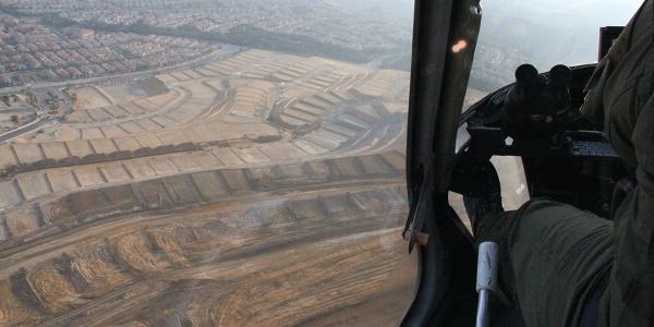
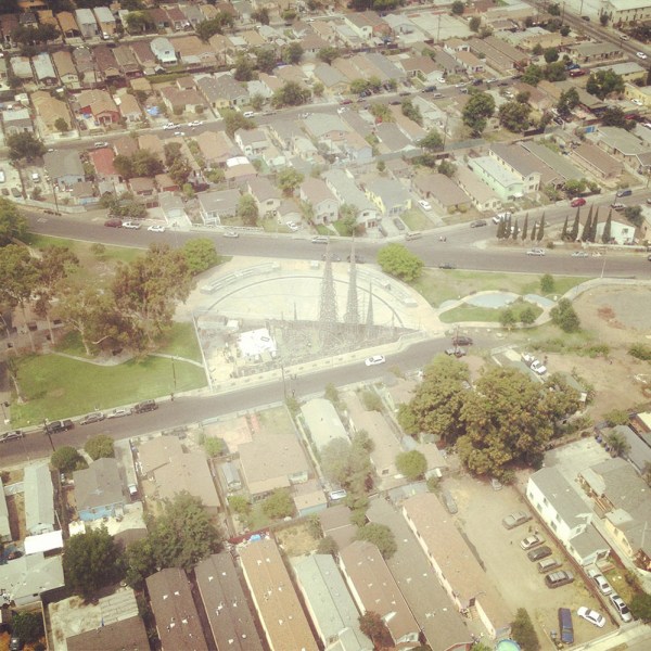
[Image: Over Porter Ranch and the San Fernando Valley; photos by BLDGBLOG].

Paris, Chamayou writes, “was to be divided into distinct districts, each receiving a letter, and each being subdivided into smaller sub-districts.”

In each sub-district each street had accordingly to receive a specific name. On each street, each house had to receive a number, engraved on the front house—which was not the case at the time. Each floor of each building was also to have a number engraved on the wall. On each floor, each door should be identified with a letter. Every horse car should also bear a number plate. In short, the whole city was to be reorganized according to the principles of a rationalized addressing system.

In that context, the Air Support Division’s “rules of four” as a police-navigation strategy take on a particularly interesting nuance—as do hypothetical means of resistance to police power through the deliberate complication of local addressing systems.

mapping-webbanking-webpanopticops-web[Images: Moving maps and binoculars over L.A.; Instagrams by BLDGBLOG].

The book excerpt in the Times also briefly picks up on some themes elaborated in an article I wrote for Cabinet Magazine a few years ago, discussing how the infrastructure of Los Angeles itself inadvertently permits certain classes of criminal activity.

turning-web
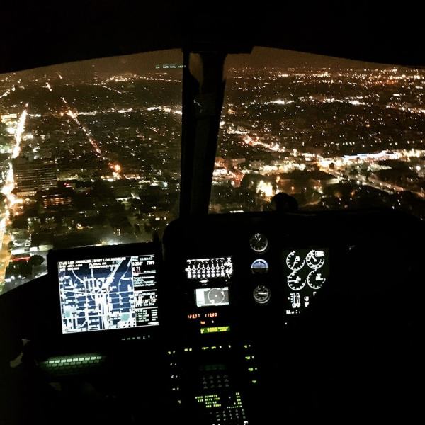
[Image: Night flying; photo by BLDGBLOG].

The most obvious example of this unintended side-effect of transportation planning is the so-called “stop-and-rob.” From The New York Times Magazine:

The construction of the city’s freeway system in the 1960s helped to instigate a later spike in bank-crime activity by offering easy getaways from financial institutions constructed at the confluence of on-ramps and offramps. This is a convenient location for busy commuters—but also for prospective bandits, who can pull off the freeway, rob a bank and get back on the freeway practically before the police have been alerted. The maneuver became so common in the 1990s that the Los Angeles police have a name for it: a “stop-and-rob.”

In any case, the book obviously elaborates on these themes in much greater length—and it comes out next week, so please consider pre-ordering a copy—but The New York Times Magazine excerpt is a great place to start.

points-web[Image: Somewhere over the San Fernando Valley; Instagram by BLDGBLOG].

Meanwhile, if you yourself are planning any illicit activities, as an added bonus the article includes insights from Air Support Division pilots and tactical flight officers on the limitations of their own surveillance techniques, such as how the streets around Los Angeles International Airport have become a popular hiding spot for criminals fleeing police helicopters by car and some especially unlikely tactics used to evade thermal detection by the LAPD’s Forward-Looking Infrared or FLIR cameras.

When in doubt—although this is not mentioned in the article—drive into the fog, where the helicopters can’t follow you.

horizon-web[Image: Urban horizon lines; Instagram by BLDGBLOG].

For now, here are a bunch of photos, including many Instagrams, taken from July 2013 to March 2016, including night flights in January 2014 and March 2016—

cockpit-webflying-webhollywood-webmorecityhall-webnighflight-webtennis-webbanktower-webusbank-webnickersonnight-webspot-web[Images: Night from above; photos & Instagrams by BLDGBLOG].

—as well as day and early evening flights taken in July 2013 and March 2016.

nickerson-webwattstowers-webgrid-webplane-web[Images: Note the shot of Watts Towers; Instagrams by BLDGBLOG].

Finally, a chunk of non-Instagram shots, in case those colored filters are making your eyes cross over.

jiujitsu-webcops-webgunsdrawn-webtfo-webLAKings-weblooking-web
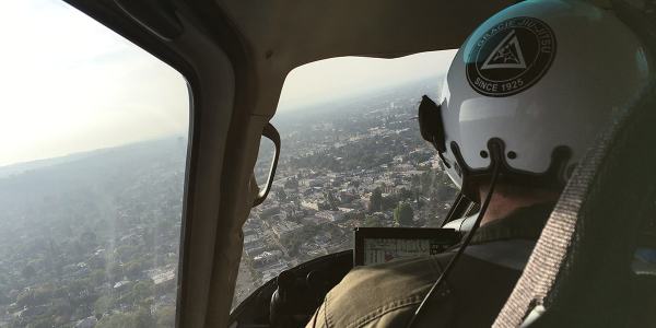
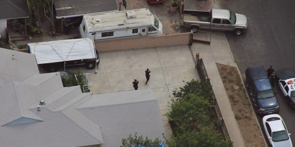
[Images: Photos by BLDGBLOG, many featuring a home barricade call in Pacoima].

Check out the article—and let me know what you think of the book, once it’s published.

sunset-web[Image: Sunset approaching downtown L.A.; cropped Instagram by BLDGBLOG].

Subterranean Lightning Brigade

[Image: “Riggers install a lightning rod” atop the Empire State Building “in preparation for an investigation into lightning by scientists of the General Electric Company” (1947), via the Library of Congress].

This is hardly news, but I wanted to post about the use of artificial lightning as a navigational aid for subterranean military operations.

This was reported at the time as a project whose goal was “to let troops navigate about inside huge underground enemy tunnel complexes by measuring energy pulses given off by lightning bolts,” where those lightning bolts could potentially be generated on-demand by aboveground tactical strike teams.

Such a system would replace the use of GPS—whose signals cannot penetrate into deep subterranean spaces—and it would operate by way of sferics, or radio atmospheric signals generated by electrical activity in the sky.

The proposed underground navigational system—known as “Sferics-Based Underground Geolocation” or S-BUG—would be capable of picking up these signals even from “hundreds of miles away. Receiving signals from lighting strikes in multiple directions, along with minimal information from a surface base station also at a distance, could allow operators to accurately pinpoint their position.” They could thus maneuver underground, even in hundreds—thousands—of feet below the earth’s surface in enemy caves or bunkers.

Hundreds of miles is a very wide range, of course—but what if there is no natural lightning in the area?

Enter artificial military storm generators, or the charge of the lightning brigade.

Back in 2009, DARPA also put out of a request for proposals as part of something called Project Nimbus. NIMBUS is “a fundamental science program focused on obtaining a comprehensive understanding of the lightning process.” However, it included a specific interest in developing machines for “triggering lightning”:

Experimental Set-up for Triggering Lightning: Bidders should fully describe how they would attempt to trigger lightning and list all potential pieces of equipment necessary to trigger lightning, as well as the equipment necessary to measure and characterize the processes governing lightning initiation, propagation, and attachment.

While it’s easy enough to wax conspiratorial here about future lightning weapons or militarized storm cells—after all, DARPA themselves write that they want to understand “how [lightning] ties into the global charging circuit,” as if “the global charging circuit” is something that could be instrumentalized or controlled—I actually find it more interesting to speculate that generating lightning would be not for offensive purposes at all, but for guiding underground navigation.

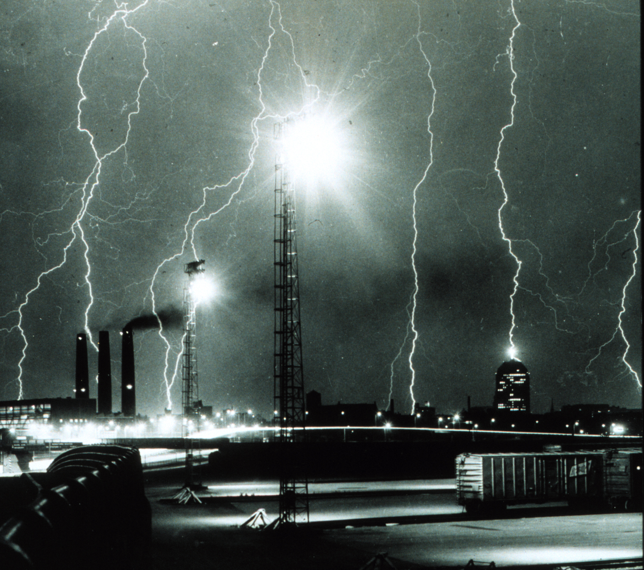
[Image: Lightning storm over Boston; via Wikimedia/NOAA].

Something akin to a strobe light begins pulsing atop a small camp of unmarked military vehicles parked far outside a desert city known for its insurgent activities. These flashes gradual lengthen, both temporally and physically, lasting longer and stretching upward into the sky; the clouds above are beginning to thicken, grumbling with quiet rolls of thunder.

Then the lightning strikes begin—but they’re unlike any natural lightning you’ve ever seen. They’re more like pops of static electricity—a pulsing halo or toroidal crown of light centered on the caravan of trucks below—and they seem carefully timed.

To defensive spotters watching them through binoculars in the city, it’s obvious what this means: there must be a team of soldiers underground somewhere, using artificial sferics to navigate. They must be pushing forward relentlessly through the sewers and smuggling tunnels, crawling around the roots of buildings and maneuvering through the mazework of infrastructure that constitutes the city’s underside, locating themselves by way of these rhythmic flashes of false lightning.

Of course, this equipment would eventually be de-militarized and handed down to the civilian sector, in which case you can imagine four friends leaving REI on a Friday afternoon after work with an artificial lightning generator split between them; no larger than a camp stove, it would eventually be set up with their other weekend caving equipment, used to help navigate through deep, stream-slick caves an hour and a half outside town, beneath tall mountains where GPS can’t always be trusted.

Or, perhaps fifty years from now, salvage teams are sent deep into the flooded cities of the eastern seaboard to look for and retrieve valuable industrial equipment. They install an artificial lightning unit on the salt-bleached roof of a crumbling Brooklyn warehouse before heading off in a small armada of marsh boats, looking for entrances to old maintenance facilities whose basement storage rooms might have survived rapid sea-level rise.

Disappearing down into these lost rooms—like explorers of Egyptian tombs—they are guided by bolts of artificial lightning that spark upward above the ruins, reflected by tides.

[Image: Lightning via NOAA].

Or—why not?—perhaps we’ll send a DARPA-funded lightning unit to one of the moons of Jupiter and let it flash and strobe there for as long as it needs. Called Project Miller-Urey, its aim is to catalyze life from the prebiotic, primordial soup of chemistry swirling around there in the Cthulhoid shadow of eternal ice mountains.

Millions and millions of years hence, proto-intelligent lifeforms emerge, never once guessing that they are, in fact, indirect descendants of artificial lightning technology. Their spark is not divine but military, the electrical equipment that sparked their ancestral line long since fallen into oblivion.

In any case, keep your eyes—and cameras—posted for artificial lightning strikes coming to a future military theater near you…

Full-Spectrum Mandala

[Image: Via the Pacific Cold War Patrol Museum].

Somewhat randomly—though I suppose I have a thing for antennas—I came across a blog post looking at the layout of Circularly Disposed Antenna Arrays.

A Circularly Disposed Antenna Array, he explains, was “sometimes referred to as a Circularly Disposed Dipole Array (CDDA)” and was “used for radio direction finding. The military used these to triangulate radio signals for radio navigation, intelligence gathering and search and rescue.”

[Image: Via the Pacific Cold War Patrol Museum].

While discussing the now-overgrown landscapes found on old military sites in Hawaii, the post’s author points out the remains of old antenna set-ups still visible in the terrain.

A series of photos, that you can find over at the original post, show how these abandoned circular land forms—like electromagnetic stone circles—exist just below the surface of the Hawaiian landscape, thanks to the archipelago’s intense militarization over the course of the 20th century.

He then cleverly juxtaposes these madala-like technical diagrams with what he calls a “Polynesian guidance system for navigating the Pacific” (bringing to mind our earlier look at large-scale weather systems in the South Pacific and how they might have guided human settlement there).

[Image: Via the Pacific Cold War Patrol Museum].

The idea that Polynesian shell map geometries and the antenna designs of Cold War-era military radio sites might inadvertently echo one another is hugely evocative, albeit purely a poetic analogy.

Finally, I couldn’t resist this brief passage, describing many of these ruined antenna sites: “Their exact Cold War era use, frequencies and purpose isn’t yet known but were most likely for aircraft radio navigation, direction finding, intelligence gathering and for search and rescue.”

You can all but picture the opening shots of a film here, as concerned military radio operators, surrounded by the arcane, talismanic geometries of antenna structures in the fading light of a Pacific summer evening, pick up the sounds of something vast and strange moving at the bottom of the sea.