
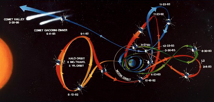
 [Image: A diagram of the elaborate loops and ribbons of self-intersecting movement allowed by gravity-assisted travel, in this case heading toward a comet; original artist unknown].
Gravity-assisted space travel is when you use the gravitational pull of one planet or other celestial body as a fuel-efficient way to “slingshot” yourself toward another, more distant goal, someplace you could not have reached without assistance, either in terms of your velocity or even your basic direction.
You head toward one place to get to another—or “by indirections find directions out,” we might say.
These “gravity assists” can be pieced together to form almost a kind of invisible jungle gym, helping send probes into the outer solar system or even toward Mercury and the sun. As the Planetary Society explains:
Voyager 2 famously used gravity assists to visit Jupiter, Saturn, Uranus and Neptune in the late 1970s and 1980s. Cassini used two assists at Venus and one each at Earth and Jupiter in order to reach Saturn. New Horizons will arrive at Pluto in 2015 thanks to an assist at Jupiter. And Messenger used assists at Earth, Venus and three times at Mercury itself not to speed up, but to slow down enough to finally be captured by Mercury.
This can result in all sorts of insane weaving maneuvers, as objects can be made to loop stars, double back on themselves, veer off unpredictably, or even stop moving altogether, effectively parking themselves in space, as this GIF by David Shortt illustrates.
 [Image: GIF by David Shortt, via The Planetary Society].
It’s like gravitational judo: using the speed and mass of your opponent as a counterbalance to perform something extraordinary yourself. Or perhaps it’s more like interplanetary spirography, where you could even loop-the-loop and slingshot your way between stars.
In any case, these types of assists can be made far more fuel-efficient—if not even possible in the first place—if you launch your journey at certain times rather than at others. In other words, you deliberately wait until the orbital cycles of Mars or Jupiter bring them near particular locations in space so that you can better use them to loop further outward toward, say, Neptune, a destination whose future position you will also have calculated in advance. If you want to use as little fuel and energy as possible, or even just to be as graceful as you can, you don’t just launch whenever you want and hope for the best.
The metaphoric potential of all this is obviously incredibly rich, but the real reason I’m writing this is because of a fascinating comment or two found in Brian Fagan’s book Beyond the Blue Horizon.
While discussing the human settlement of extremely remote islands in the South Pacific, what Fagan calls “remote Oceania,” he explains how ancient mariners relied on “seasonal winds” and celestial navigation to push “ever farther east” to the most extreme outer island edges of Polynesia. These seasonal winds formed part of what he calls “the Pacific’s waltz of atmosphere and ocean,” whereby known or predictable climatological events could be used to help propel people from one archipelago to another.
Here, Fagan writes that “[e]arly human settlement of the offshore Pacific revolved, in part, around enduring, large-scale meteorological phenomena that are still little understood. Ultimately, most of them depend on what one might call an elaborate, usually slow-moving waltz involving two partners—the atmosphere and the ocean.”
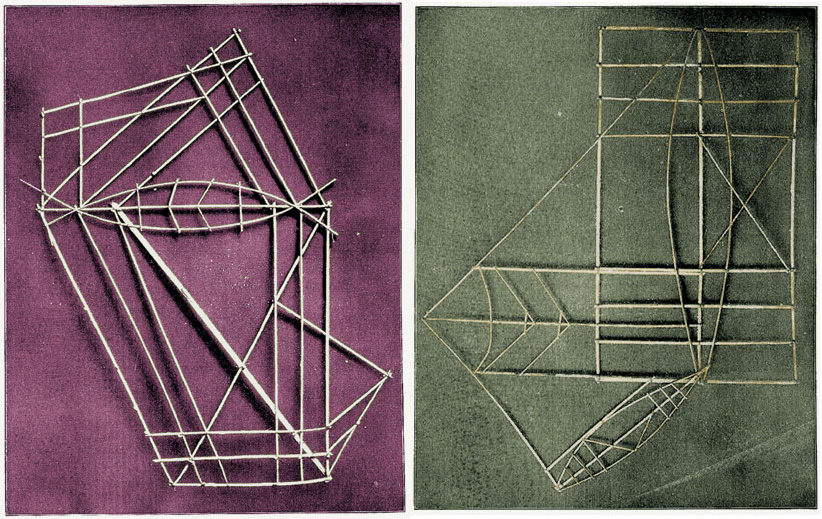 [Images: Polynesian “stick charts,” via The Nonist].
What fascinates me here is the idea that we can draw a rough analogy between Fagan’s “enduring, large-scale meteorological phenomena that are still little understood” and gravity-assisted space travel.
You can imagine, in other words, a well-organized group of extreme maritime navigators standing on the shores of a remote Pacific island chain, looking further out to sea together, knowing that there are distant land masses out there, implied by the winds and currents—but, more crucially, knowing that they will need a particular atmospheric event strong enough to take them there. They are thus timing their launch.
As people basically sat around waiting till the skies were right, Fagan’s “enduring, large-scale meteorological phenomena” would have produced amazing local mythologies of storms yet to come and other atmospheric folklore.
Like NASA scientists calculating the positions of Mars and Jupiter as they hoped to slingshot themselves beyond the black horizon of the solar system, these beach-going super-navigators would have known that the regional winds move in seven- or ten-year cycles, or even that a one-hundred year storm is required to bring them further out into the oceanic. They thus temporarily become land-based, settling there on a particular island chain and raising their children on tales of a journey yet to come. Navigators in waiting.
 [Images: Polynesian “stick charts,” via The Nonist].
Imagine the diagrams or folklore that might have explained all this, like Arthur C. Clarke tales passed down family to family a thousand years ago on a windswept atoll—a science fiction not of interplanetary travel but a kind of anthropological Star Trek of outer-sea navigation.
Then the winds pick up, or strange Antarctic clouds begin to appear again for the first time in a generation, and everyone knows what it means: the signs are right and the skies are clicking back into place, and they start to build canoes, those little wooden space probes for pushing the limits of a maritime universe.
It’s just a different kind of slingshotting: not slingshotting yourself between planets using gravity, but slingshotting yourself from island chain to island chain, riding the long tail of predictable winds you know can’t last and that only appear once per generation. Those future storms will take you to distant archipelagoes where your descendants will have to wait another decade—or century or millennium—memorizing wind patterns and plotting their woven way through Fagan’s “slow-moving waltz” of rhythmic wind patterns and currents.

 [Image: The Very Low Frequency antenna field at Cutler, Maine, a facility for communicating with at-sea submarine crews].
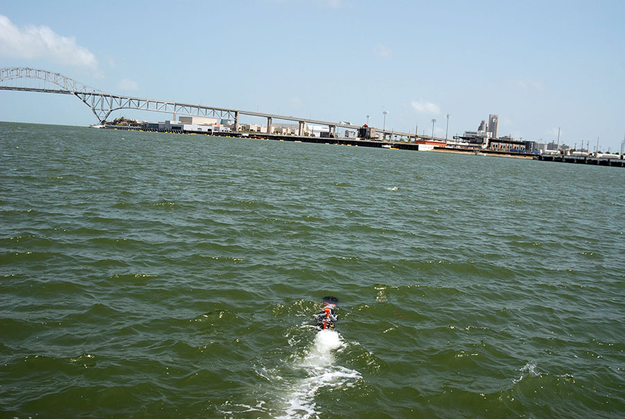 [Image: An unmanned underwater vehicle; U.S. Navy photo by S. L. Standifird].
 [Image: The
 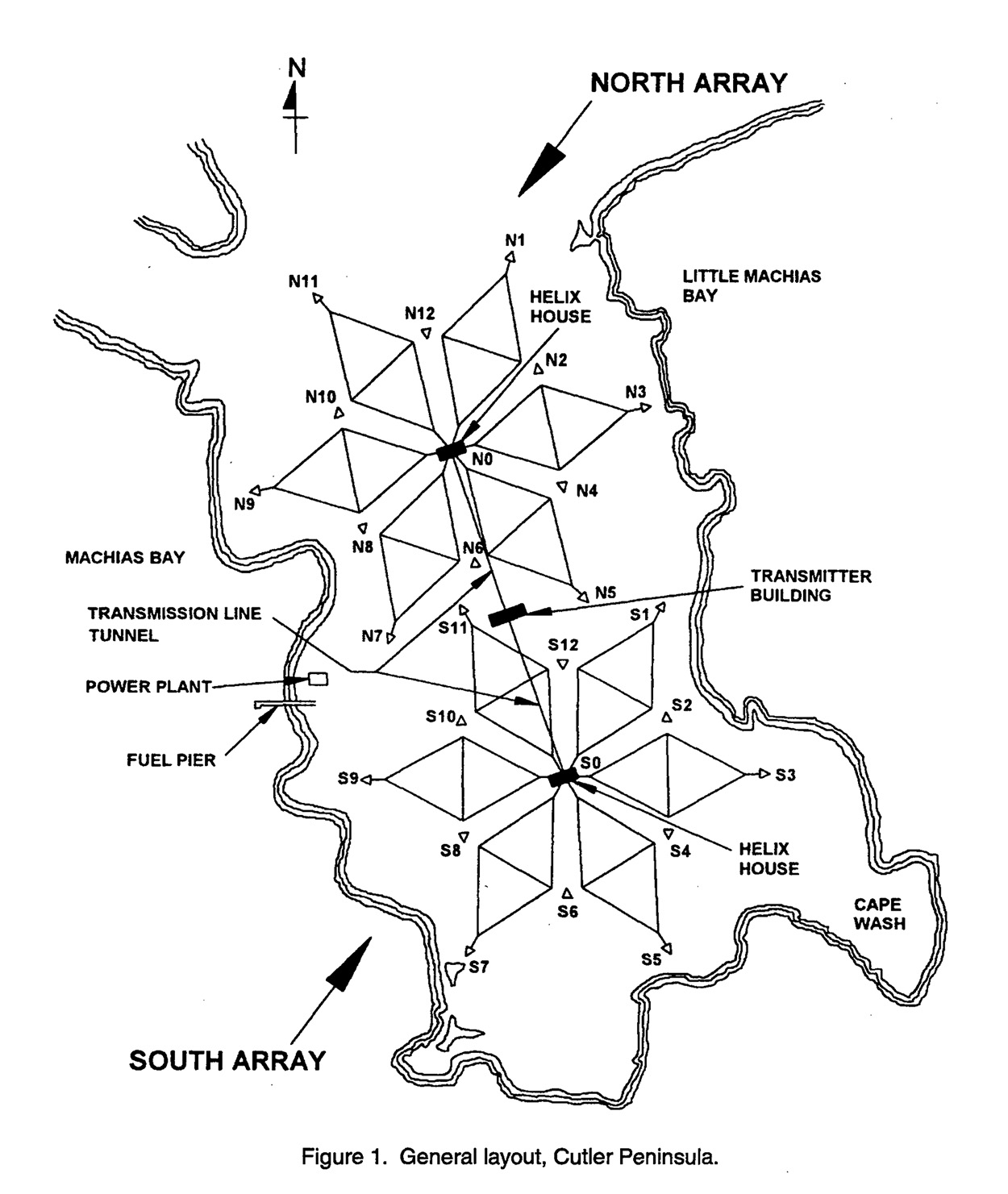 So what does this thing do? “The Navy’s very-low-frequency (VLF) station at Cutler, Maine, provides communication to the United States strategic submarine forces,” a January 1998 white paper called “Technical Report 1761” explains. It is basically an east coast version of the so-called
  [Image: A diagram of the antennas, from the aforementioned January 1998 research paper].
 [Image: Courtesy of
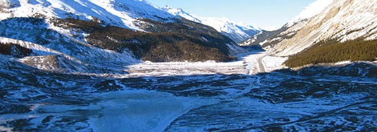 [Image: Jasper National Park, courtesy of
 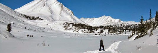 [Image: Jasper National Park, courtesy of
 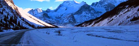 [Image: Jasper National Park, courtesy of
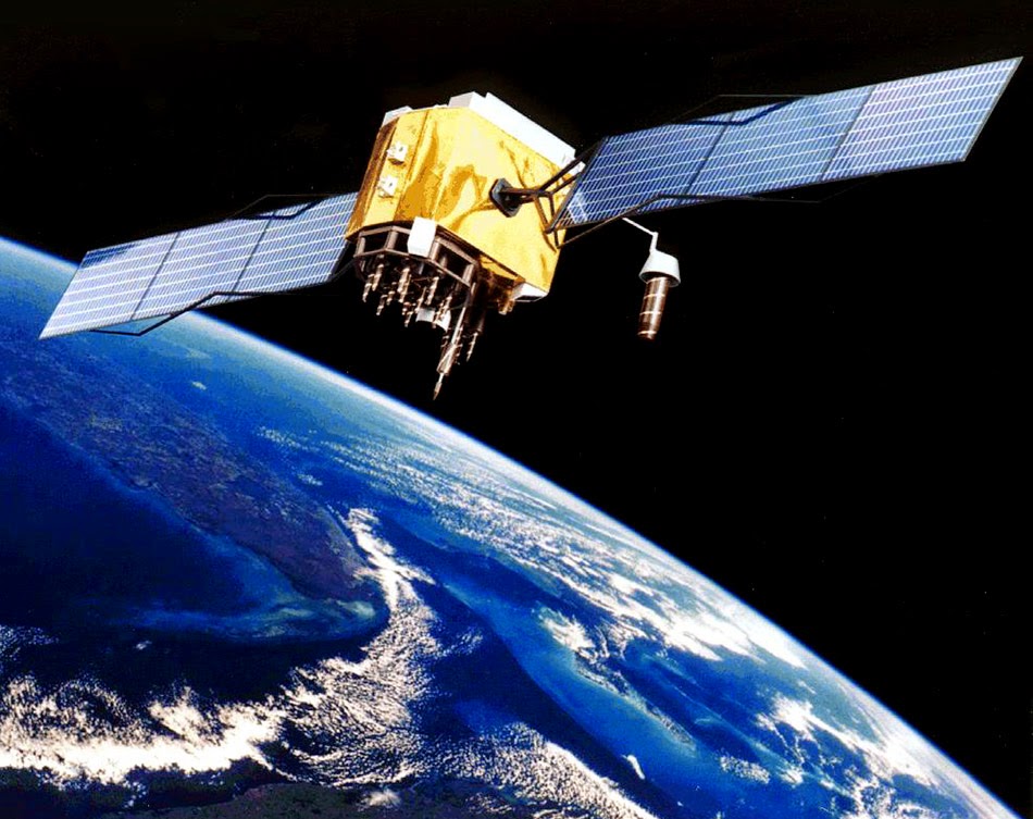 [Image: Artist’s rendering of a GPS satellite, via Wikipedia].
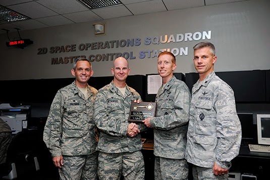 [Image: Transferring control over the GPS constellation. Photo courtesy U.S. Air Force/no photographer given].
 [Image: A “Master of Space” badge from Schriever Air Force Base].
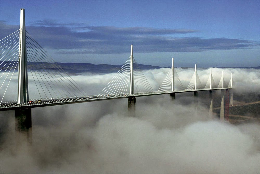 [Image: The Millau Viaduct, courtesy of
 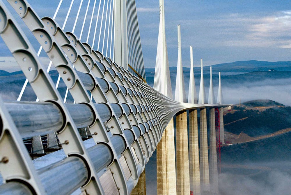 [Image: The Millau Viaduct, courtesy of
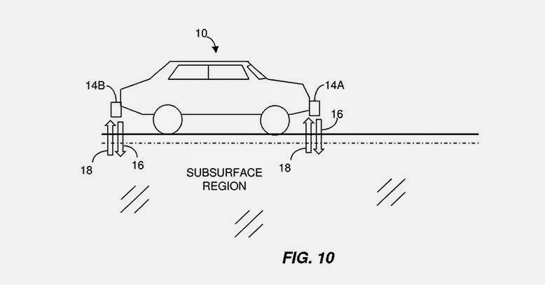 [Image: From a patent filed by MIT, courtesy
 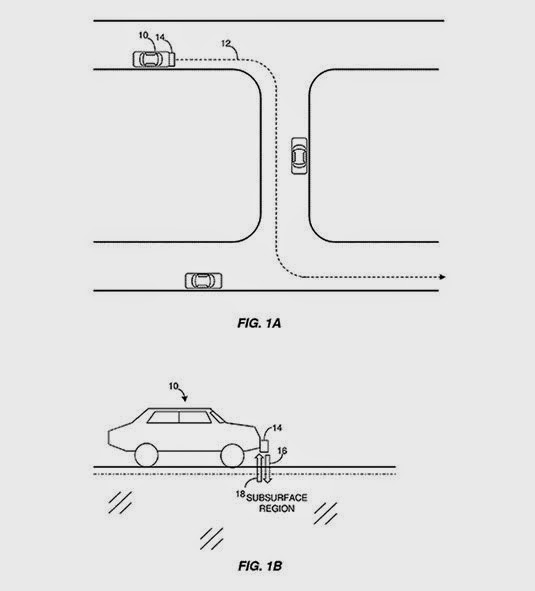 [Image: From a patent filed by MIT, courtesy
  [Image: From a patent filed by MIT, courtesy
 [Images: A “trap street” on Google Maps, documented by
  [Image: Photo by