Terrestrial Warfare, Drowned Lands

While looking at maps of rural New York State, roughly 70 miles northwest of Manhattan, near the border with New Jersey, I noticed a series of small communities called “Islands.” Pine Island, Maple Island, Black Walnut Island, Pellets Island, etc.—these are tiny hamlets otherwise surrounded by dry land, well away from the sea, the Hudson, or any other large bodies of water.

It turns out these are the “drowned lands of the Wallkill,” a river with such an irregular bed, that so commonly flooded every season, that high points in the landscape would become temporary islands.

According to The History of Sussex and Warren Co., NJ by James P. Snell, it wasn’t until legislation was passed in 1807—creating wonderfully named “drowned-land commissioners”—that the region was eventually drained.

Briefly, anyone interested in liminal landscapes should find Snell’s description of the Drowned Lands, prior to their drainage, fascinating. The Wallkill itself had no real path or bed, Snell explains, the meadows it flowed through were naturally dammed at one end by glacial boulders from the Ice Age, the whole place was clogged with “rank vegetation,” malarial pestilence, and tens of thousands of eels, and, what’s more, during flood season “the entire valley from Denton to Hamburg became a lake from eight to twenty feet deep.”

The landscape is also almost literally Biblical: “On the Southwestern border of the swamp, in the town of Warwick, two lofty and isolated mountains rear their summits. They are called Adam and Eve. Formerly they swarmed with rattlesnakes, but these the inhabitants have exterminated.”

In any case, this eerie, terrestrial-aquatic borderland—reminiscent of John Langan’s novel The Fisherman—was radically redesigned following the construction of a large drainage canal and a subsequent series of dams.

But the dams were controversial, and this is where things get novelistic.

A half-century of “war” broke out among local supporters of the dams and their foes: “The dam-builders were called the ‘beavers’; the dam destroyers were known as ‘muskrats.’ The muskrat and beaver war was carried on for years,” with skirmishes always breaking out over new attempts to dam the floods.

Here’s one example, like a scene written by Victor Hugo transplanted to New York State: “A hundred farmers, on the 20th of August, 1869, marched upon the dam to destroy it. A large force of armed men guarded the dam. The farmers routed them and began the work of destruction. The ‘beavers’ then had recourse to the law; warrants were issued for the arrest of the farmers. A number of their leaders were arrested, but not before the offending dam had been demolished. The owner of the dam began to rebuild it; the farmers applied for an injunction. Judge Barnard granted it, and cited the owner of the dam to appear and show cause why the injunction should not be made perpetual. Pending a final hearing, high water came and carried away all vestige of the dam.”

And so on and so forth, dams rising and falling, lands drowning and being drained again, farmers pitted against hydrologists, for generations. You can easily imagine this as the backdrop for a historical epic, set within a day’s journey from Manhattan on the cusp of modernity, a family committed to raising land from ambiguity and murk colliding with primordial forces led by hostile neighbors dedicated to maintaining inundation.

Two visions of landscape, at war.

Today, the land is hugely fertile and apparently a great source of topsoil; it has become known as the Black Dirt Region. You can even buy Black Dirt Bourbon.

But still, these isolated hills and ridges call themselves islands, as if awaiting the return of the flood.

(All images via Google Maps. Vaguely related on BLDGBLOG: Tactical Landscaping and Terrain Deformation; readers might also enjoy David Blackbourn’s superb book, The Conquest of Nature: Water, Landscape, and the Making of Modern Germany.)

The Remnants

[Image: From An Enduring Wilderness: Toronto’s Natural Parklands by Robert Burley].

Photographer Robert Burley has a new book due out in two weeks called An Enduring Wilderness: Toronto’s Natural Parklands.

[Images: From An Enduring Wilderness: Toronto’s Natural Parklands by Robert Burley].

While it would seem at first to be only of local interest to those living in and around Toronto, the photos themselves are gorgeous and the conditions they document are nearly universal for other North American cities: scenes of natural, remnant ecosystems butting up against, but nonetheless resisting, the brute force of urban development.

[Image: From An Enduring Wilderness: Toronto’s Natural Parklands by Robert Burley].

As Burley explains, many of the parks depicted are informal—that is, they are undesigned—and almost all of them follow old creeks and ravines that meander through the ancestral terrain. (This, as you might recall, is also the premise for much of Michael Cook’s work, who has been tracking those same waterways in their Stygian journey underground.)

[Images: From An Enduring Wilderness: Toronto’s Natural Parklands by Robert Burley].

However, Burley warns, “these ravine systems are in danger of being loved to death by city dwellers desperate for green space.” From the book:

Toronto has one of the largest urban park systems in the world, and yet it is unknown to most, including many of the city’s three million inhabitants. This extensive ravine network of sunken rivers, forested vales, and an expansive shoreline has historically been overlooked, neglected, or forgotten, but in recent years these unique wild spaces have been rediscovered by a growing population embracing nature inside the city limits. The parklands were not designed or constructed for a greater public good but rather are landscape remnants of pre-settlement times that have stubbornly refused to conform to urban development.

The book comes out later this month, and a number of events are planned in Toronto over the coming week, including an exhibition of Burley’s work from the book; more info is available at the John B. Aird Gallery.

Many Norths

[Image: Many Norths: Building in a Shifting Territory].

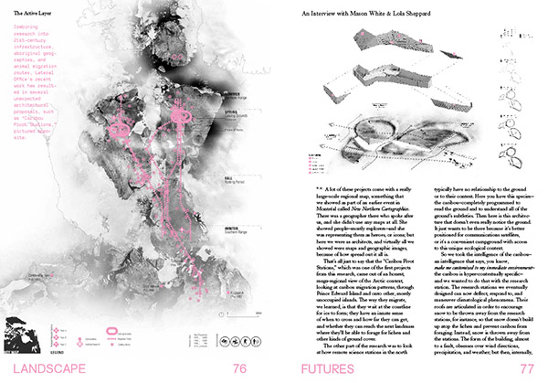
Architects Lola Sheppard and Mason White of Lateral Office have a new book out, Many Norths: Building in a Shifting Territory, published by Actar.

The book is something of a magnum opus for the office, compiling many years’ worth of research—architectural, infrastructural, geopolitical—including original interviews, maps, diagrams, and historical analyses of the Canadian North. Or the Canadian Norths, as Sheppard and White make clear.

[Image: A spread from the book, featuring a slightly different, unused layout; via Actar].

The plural nature of this remote territory is the book’s primary emphasis—that no one model or description fits despite superficial resemblances, whether they be economic, ecological, climatic, or even military, across massive geographic areas.

“For better or for worse,” they write in the book’s opening chapter, “if nothing else [the Norths are] a shifting, multivalent territory: culturally dynamic, environmentally changing, and socially evolving. Digital and physical mobility networks expand, ground conditions change, treelines shift, species hybridize, and cultures remain dynamic and cross-pollinating.”

Exploring these differences, they add, was “the motivation for this book.”


[Images: Spreads from Many Norths].

Their secondary point, however, is that this sprawling, multidimensional region of shifting ground planes and emergent resource wealth is now the site of “a distinct northern vernacular,” or “polar vernacular,” a still-developing architectural language that the book also exhaustively documents, from adjustable foundation piles to passive ventilation.

There are Mars simulations, remote scientific facilities, schools, military bases, temporary snowmobile routes (snowmobile psychogeography!), and communal utilities corridors.


[Images: Spreads from Many Norths].

The book is cleanly designed, but its strength is not in its visual impact; it’s in how it combines rigorous primary research with architectural documentation.

The interviews are a particular highlight.

Among more than a dozen other subjects, there are discussions with anthropologist Claudio Aporto on “wayfinding techniques and spatial perception” among the Inuit, with “master mariner” Thomas Paterson on the logistics of Arctic shipping, with historian Shelagh Grant on “sovereignty” and “security” in the far north, and with Baffin Island native whale hunter Charlie Qumuatuq on seasonal food webs.


[Images: Spreads from Many Norths].

While the focus of Many Norths is, of course, specifically Canadian, its topics are relevant not only to other Arctic nations but to other extreme environments and remote territories.

In fact, the book serves as a challenging precedent for similar undertakings—one can easily imagine a Many Wests, for example, documenting various modes of inhabiting the American Southwest, with implications for desert regions all over the world.

[Image: Spread from Many Norths].

In any case, I’ve long been a fan of Lateral Office’s work and was thrilled to see this come out.

For those of you already familiar with Lateral’s earlier design propositions published in their Pamphlet Architecture installment, Coupling, Many Norths can be seen as an archive of directly relevant supporting materials. The two books thus make a useful pair, exemplifying the value of developing a deep research archive while simultaneously experimenting with those materials’ speculative design applications.

(Thanks to Mason White for sending me a copy of the book. Vaguely related: Landscape Futures and Landscape Futures Arrives).

Terrain Jam

[Image: “arid wilderness areas” from @witheringsystem].

I’ve long been a fan of generative landscapes—topographies created according to some sort of underlying algorithmic code—and I’m thus always happy to stumble upon new, visually striking examples.

Of course, geology itself is already “generative,” as entire continents are formed and evolve over hundreds of millions of years following deeper logics of melting, crystallization, erosion, tectonic drift, and thermal metamorphosis; so digital examples of this sort of thing are just repeating in miniature something that has long been underway at a much larger scale.

In any case, @witheringsystem is a joint project between Katie Rose Pipkin and Loren Schmidt, the same artists behind the widely-known “moth generator” and last year’s “Fermi Paradox Jam,” among other collaborations. It is not exactly new, but it’s been tweeting some great shots lately from an algorithmic world of cuboid terrains; the image seen here depicts “arid wilderness areas,” offered without further context.

See several more examples over on their Twitter feed.

(Spotted via Martin Isaac; earlier on BLDGBLOG: British Countryside Generator and Sometimes the house you come out of isn’t the same one you went into.”)

To roam hither and thither rather than plod a linear course

The blog Landscapism takes a look at the “integral but largely uncharted topography” of the combe, the “amphitheatre-like landform that can be found at the head of a valley.” There, the post’s author writes, amidst lichen-covered rubble and interrupted creeks, “these watery starting lines disguised as cul-de-sacs are a gift to the rural flâneur; sheep tracks, streams, crags, ruined sheep folds—all encourage the curious visitor to roam hither and thither rather than plod a linear course.”

The Drowned World

[Image: From Terra Forming: Engineering the Sublime by Adam Lowe and Jerry Brotton].

Artists Adam Lowe and Jerry Brotton’s project Terra Forming: Engineering the Sublime simultaneously explores the history of different geographic projections—including how these have been used to misrepresent and distort the earth’s surface—and at the future of that earth in an era of rising sea levels.

[Image: From Terra Forming: Engineering the Sublime by Adam Lowe and Jerry Brotton].

As Factum Arte explain, their chosen geographic projections offer “a way of engaging with the Earth from different points of view, and reflect historical ways of mapping the world from the Greeks to Google Earth.”

[Image: From Terra Forming: Engineering the Sublime by Adam Lowe and Jerry Brotton].

The projections are milled into beautiful 3D topographic models, with the vertical axis exaggerated to allow for changes in altitude to become visible.

The Andes, for example, become an abrupt spine of skyscraping pinnacles on the edge of an otherwise dead-flat continent, and deep-sea plains become spiky fields of underwater needles and pins.

[Images: From Terra Forming: Engineering the Sublime by Adam Lowe and Jerry Brotton].

As the artists write, “distortion was used because without it the globe’s surface would appear almost totally flat”—which interestingly suggests that representational distortion, with a great deal of irony, is actually central to giving our planet geographic legibility.

To map it or to know it, the implication seems to be, you must first alter it.

[Image: From Terra Forming: Engineering the Sublime by Adam Lowe and Jerry Brotton].

This is only half the project, however.

The artists refer to Terra Forming as “a cartographic response to the advent of the Anthropocene“—which is why the resulting topographic models are then flooded.

[Images: From Terra Forming: Engineering the Sublime by Adam Lowe and Jerry Brotton].

“The installation will mimic the passage of time as well as space,” Factum Arte write, “by flooding the world with water over several days, until we reach current sea levels; the world will then be flooded completely, leaving us with a drowned world, a prescient image for those parts of the world facing rising sea levels, as well as those such as parts of the Arabian Peninsula which is trying to reclaim land from the sea.”

You can watch a short video of the project’s gradual submergence on Vimeo—or embedded below.


And you can read much more about the project over at Factum Arte.

“We don’t have an algorithm for this”

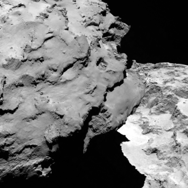
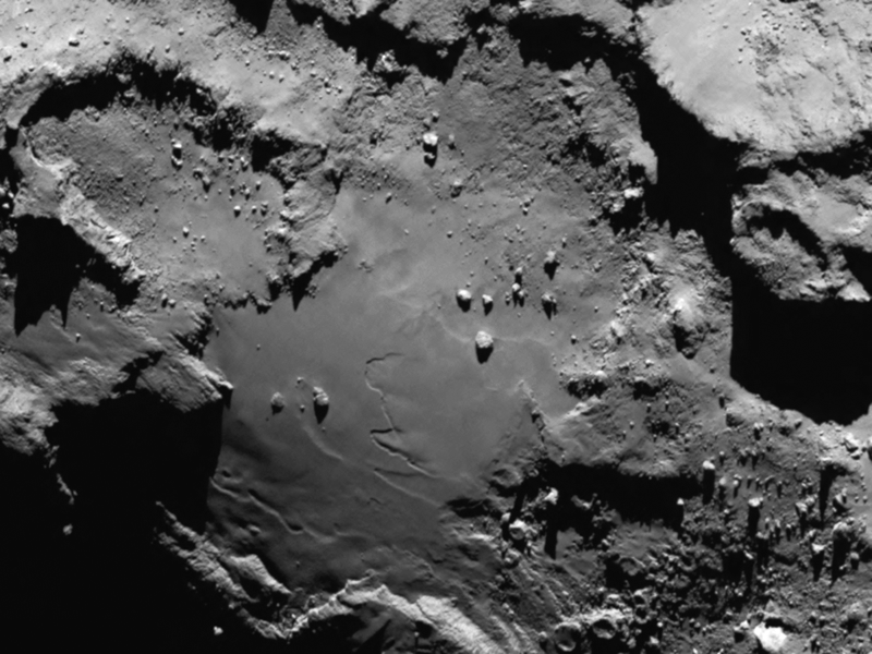
[Image: Comet 67P, via ESA].

In the story of how European Space Agency researchers are scrambling to locate—and possibly move—the Philae probe, which they successfully landed on Comet 67P two days ago, there’s an interesting comment about computer vision and the perception of exotic landscapes.

[Image: Comet 67P, via New Scientist].

“We’re working our eyes off,” one of the scientists says to New Scientist, describing how they are personally and individually poring over photographs of the comet.

“It’s an entirely manual process,” New Scientist continues, “because the complex and bizarre landscape of comet 67P defies any kind of automated search. ‘We don’t have an algorithm for this,’ he says.”

We don’t have an algorithm for this.

[Image: The irregular terrain of Comet 67P, via ESA].

It would be interesting to develop a taxonomy of landscapes based on their recognizability to algorithms. This would tell you as much about how computers see the world as it would about the aesthetic assumptions—even the geological biases—of the people who programmed those computers.

Think, for example, of Adam Harvey’s work, asking When Is An Apple No Longer An Apple? That project explored the point at which machine-learning algorithms could no longer distinguish the iconic fruit from a jumble of colorful objects.

Or take Harvey’s more recent CV Dazzle experiment, which looked at how to prevent facial recognition software from identifying a face at all through the clever use of cosmetic camouflage.

However, in the case of Comet 67P and other extreme topographic environments, we would be looking at when a landscape is no longer a landscape, so to speak, at least in terms of the computer-vision algorithms programmed to analyze it.

[Image: Comet 67P, via ESA].

What other landscapes fall within this category—of spatial environments unrecognizable to machines—and what do those spaces reveal about the dimensional prejudices of the algorithm? Light and shadow; depth and range; foreground and background; geometry and complexity.

Bump Adam Harvey’s investigations up to the scale of a landscape, and a million potential design projects beckon. Learning from Comet 67P.

(Earlier on BLDGBLOG: The Comet as Landscape Art).

Touchscreen Landscapes

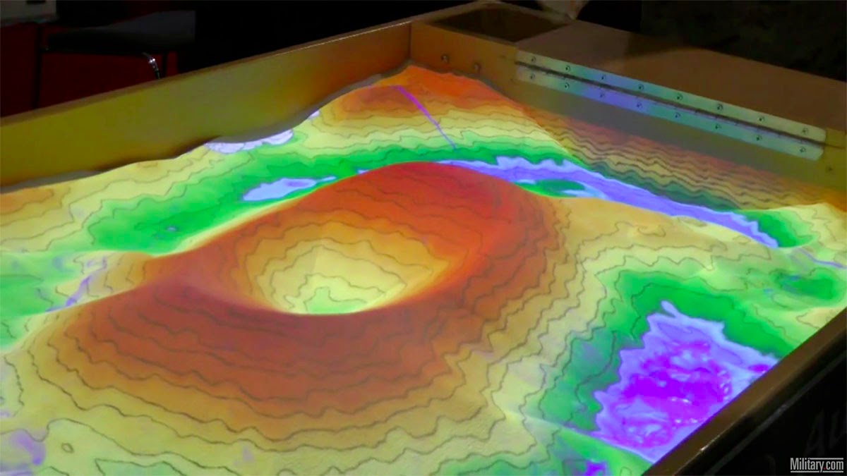
[Image: Screen grab via military.com].

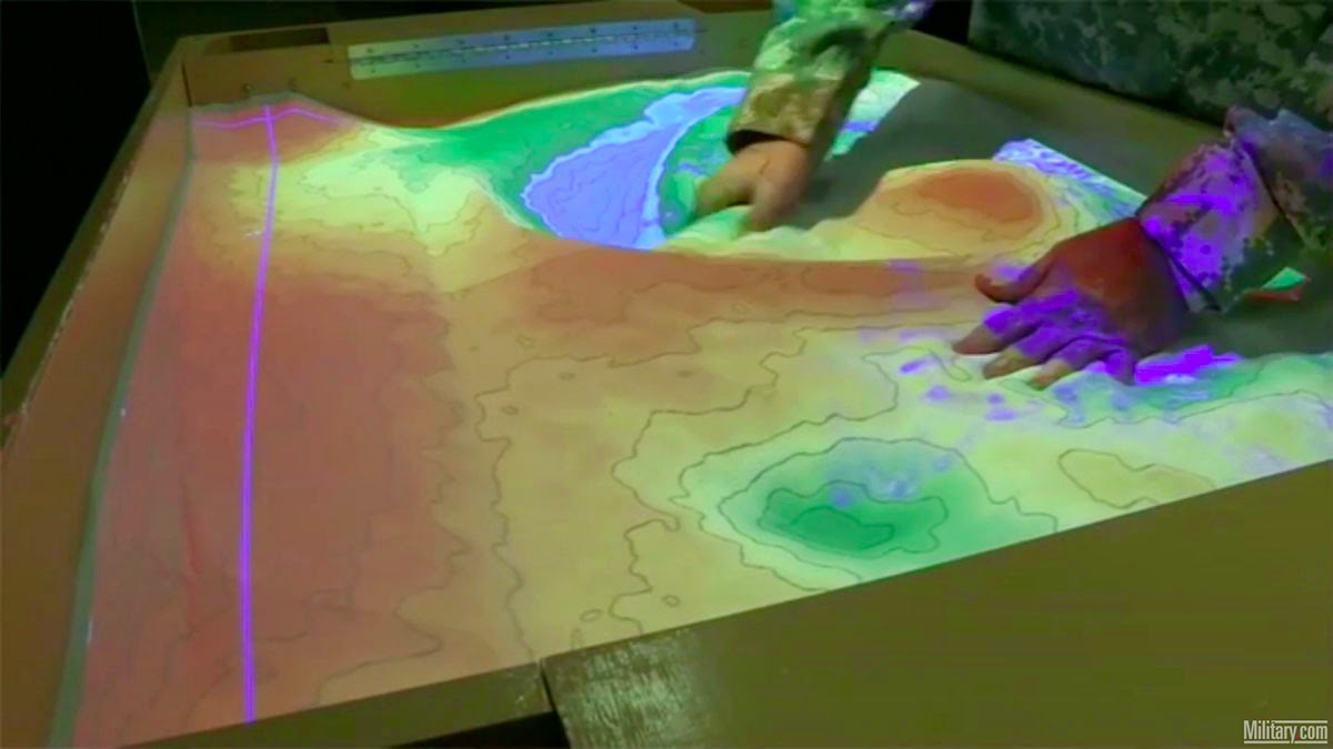
This new, partly digital sand table interface developed for military planning would seem to have some pretty awesome uses in an architecture or landscape design studio.

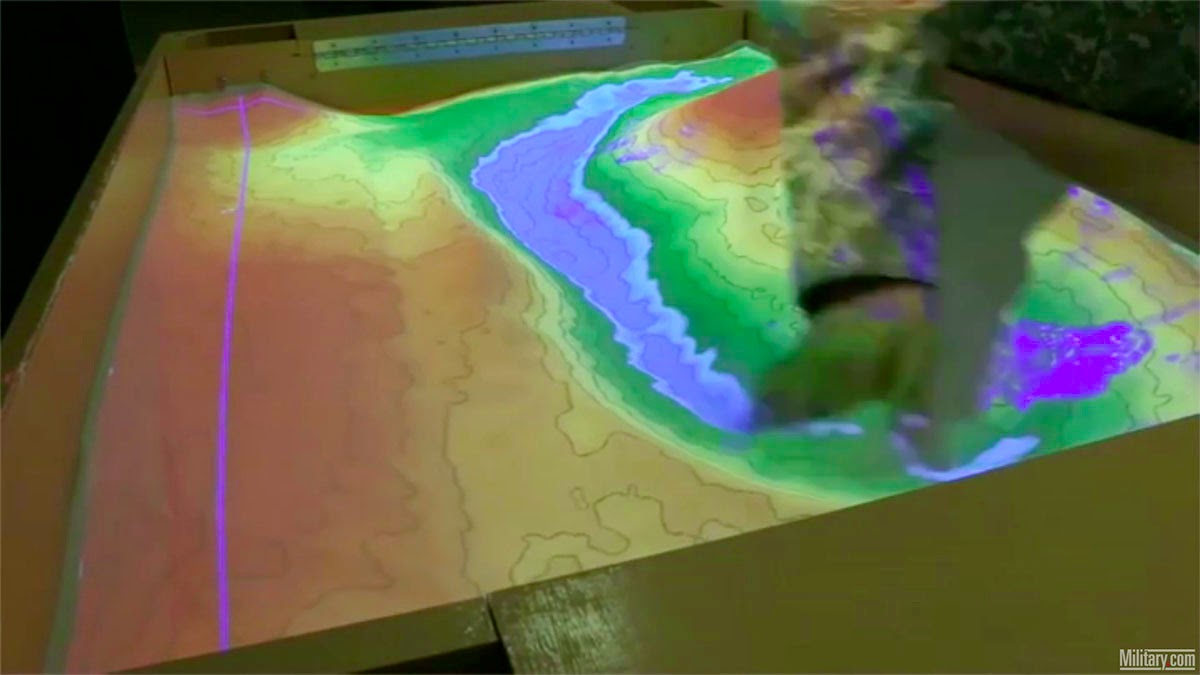
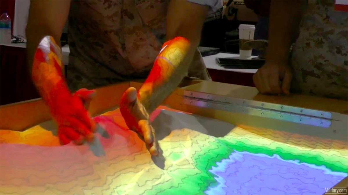
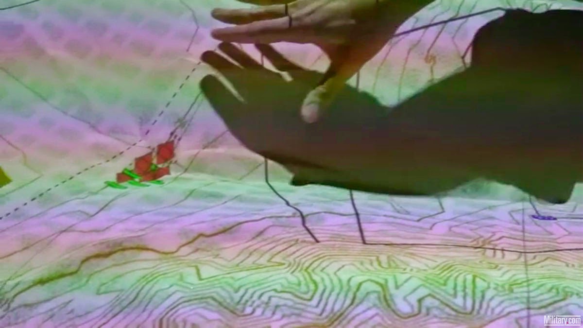
Using 3D terrain data—in the military’s case, gathered in real-time from its planetary network of satellites—and a repurposed Kinect sensor, the system can adapt to hand-sculpted transformations in the sand by projecting new landforms and elevations down onto those newly molded forms.

You can thus carve a river in real-time through the center of the sandbox, and watch as projected water flows in—

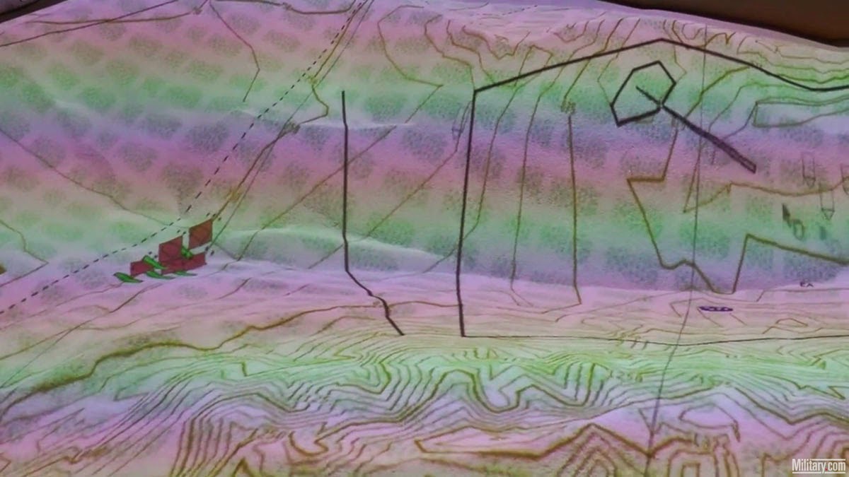
[Image: Screen grabs via military.com].

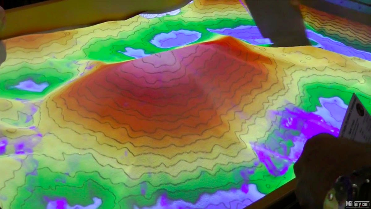
—or you can simply squeeze sand together into new hills, and even make a volcanic crater.

[Image: Screen grabs via military.com].

The idea of projecting adaptive landscape imagery down onto a sandbox is brilliant; being able to interact with both the imagery and the sand itself by way of a Kinect sensor is simply awesome.

Imagine scaling this thing up to the size of a children’s playground, and you’d never see your kids again, lost in a hypnotic topography of Minecraft-like possibilities, or just donate some of these things to a landscape design department and lose several hours (weeks?) of your life, staring ahead in a state of geomorphic Zen at this touchscreen landscape of rolling hills and valleys, with its readymade rivers and a thousand on-demand plateaus.

The military, of course, uses it to track and kill people, filling their sandbox with projections of targeting coordinates and geometric representations of tanks.

[Image: Screen grabs via military.com].

But there’s no reason those coordinates couldn’t instead be the outlines of a chosen site for your proposed architecture project, or why those little clusters of trucks and hidden snipers couldn’t instead be models of new buildings or parks you’re hoping will be constructed.

Watch the original video for more.

The Comet as Landscape Art

[Image: Photo courtesy ESA].

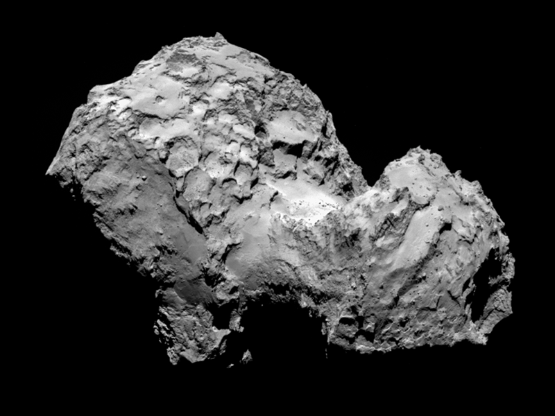
Intrigued by these images as an example of how the tradition of landscape representation has rapidly progressed—from the Romantics and the Hudson River School to Rosetta—I felt compelled to post a few photos of the craggy and glacial surface of Comet 67P/Churyumov–Gerasimenko, sent back to Earth yesterday from the European Space Agency’s Rosetta spacecraft.

The surface of the comet “is porous, with steep cliffs and house-sized boulders,” making it earth-like yet deeply treacherous, an irregular terrain to photograph and a dangerous place to land.

[Image: Photo courtesy ESA].

It is the notion of “land” here that is most interesting, however, as this is really just the imposition of a terrestrial metaphor onto a deeply alien body. Yet the comet is, in effect, literally a glacier: a malleable yet permanently frozen body of ice hurtling through space, occasionally exploding in comas and tails of vapor.

It is “an ancient landscape,” we read, “and yet one that looks strangely contemporary as the sun vaporizes ice, reworking the terrain like a child molding clay.”

Think Antarctica in a winter storm, not southern Utah—or Glacier National Park, not the Grand Canyon.

[Image: Photo courtesy ESA].

Along those lines, some of the most provocative writing on what it means to visually represent the frozen and hostile landscapes of the Antarctic is by writer William L. Fox, whose work offers some useful resonance here.

Fox has written, for example, about the technical and even neurological difficulties in accurately representing—let alone comprehending or simply navigating—Antarctic space and the vast forms that frame it.

Distant landscapes distorted by thermal discontinuities; white levels pushed to the absolute limit of film chemistry; impossible contours throwing off any attempt at depth perception; even the difficulty of distinguishing complicated mirages from actual landforms: these are all part of the challenge of creating images of an exotic landscape such as the Antarctic.

As Fox writes, it was even specifically the tradition of Dutch landscape painting, combined with the maritime practice of sketching coastal profiles, that first introduced the visual world of the Antarctic to western viewers: it was thus seen as an ominous, ice-clogged horizon of fog and low clouds looming always just slightly out of ship’s reach at the bottom of the world.

He calls this the genre of “representational exploration art.”

[Image: Photo by Stuart Klipper from his fantastic book, The Antarctic: From the Circle to the Pole, with a foreword by William L. Fox].

In one interesting passage in his book Terra Antarctica, he suggests that the south polar landscape is so extreme, it often resists natural analogy. As Fox describes it, the wind-carved boulders and isolated pillars and cliffs of ice are more like “artworks by Salvador Dalí and Henry Moore, evoking the spirit of surrealism with the former and modernist forms with the latter. The Antarctic is so extreme to our visual expectations that, once we attempt to move beyond measurement to describe it, analogies with other parts of nature fall short, and we resort to comparisons with cultural artifacts that push at the boundaries of our perceptions.”

These include “cultural artifacts such as sculpture and architecture, products more of the imagination than of nature.”

Consider, for instance, that comet 67P is widely known today as the “rubber-duck comet” due to its bifurcated structure, implying, as Fox suggests with the Antarctic, that no natural analogy seemed adequate for describing the comet’s geometry.

[Image: The gateway arches of the Antarctic; photo by Stuart Klipper from, The Antarctic: From the Circle to the Pole, foreword by William L. Fox].
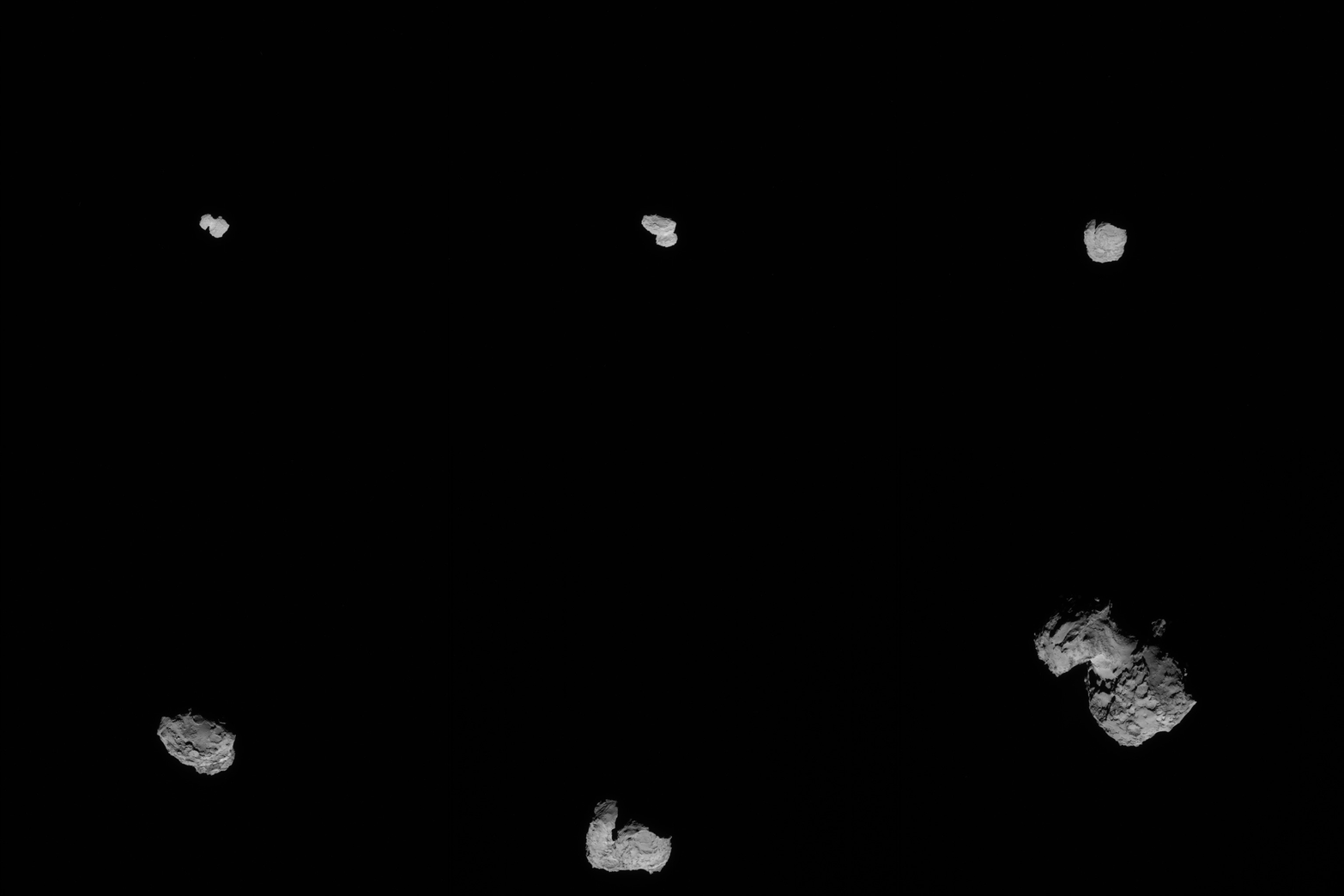
But what are we to make of comet 67P now that we can see it as a physical landscape, not just an ephemeral optical phenomenon passing, at great distance, through the sky? When a blur becomes focused as terrain, what is the best way to describe it? What visual or textual traditions are the most useful or evocative—vedas and sutras or laboratory reports?

Put another way, is poetry as appropriate as a scientific survey in such a circumstance—should “we attempt to move beyond measurement to describe it,” in Fox’s words—and, if not, what new genres of exploration art might result from this spatial encounter?

I’m reminded here of poet Christian Bök’s wry remark on Twitter: “I am still amazed that poets insist on writing about their divorces, when robots are taking pictures of orange, ethane lakes on Titan…”

Now that humans are beginning to land semi-autonomous camera-ships on the frozen ice fields of passing comets, sending back the (off)world’s strangest landscape art—as if a direct line runs from, say, the pastoral landscapes of Claude Lorrain or the elemental weirdness of J.M.W. Turner to the literally extraterrestrial boulders and gullies depicted by Rosetta—how should our own descriptive traditions adapt? What, we might ask, is comet 67P’s role in art history?

[Image: Approaching 67P, via the ESA].

Landscape Futures Arrives

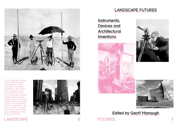
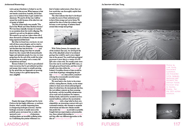
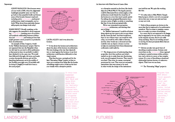
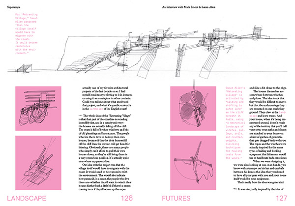
[Image: Internal title page from Landscape Futures; book design by Everything-Type-Company].

At long last, after a delay from the printer, Landscape Futures: Instruments, Devices and Architectural Inventions is finally out and shipping internationally.

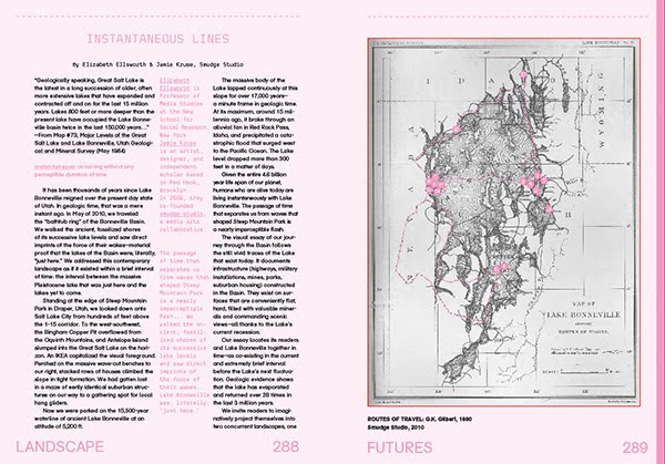
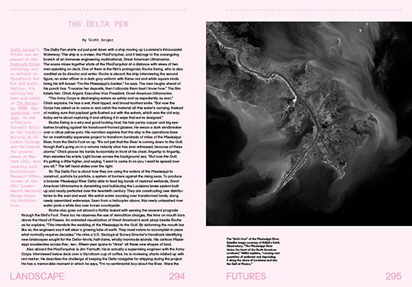
I am incredibly excited about the book, to be honest, and about the huge variety of content it features, including an original essay by Elizabeth Ellsworth & Jamie Kruse of Smudge Studio, a short piece of landscape fiction by Pushcart Prize-winning author Scott Geiger, and a readymade course outline—open for anyone looking to teach a course on oceanographic instrumentation—by Mammoth’s Rob Holmes.

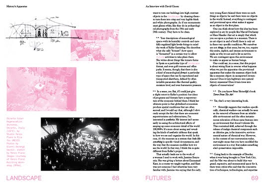
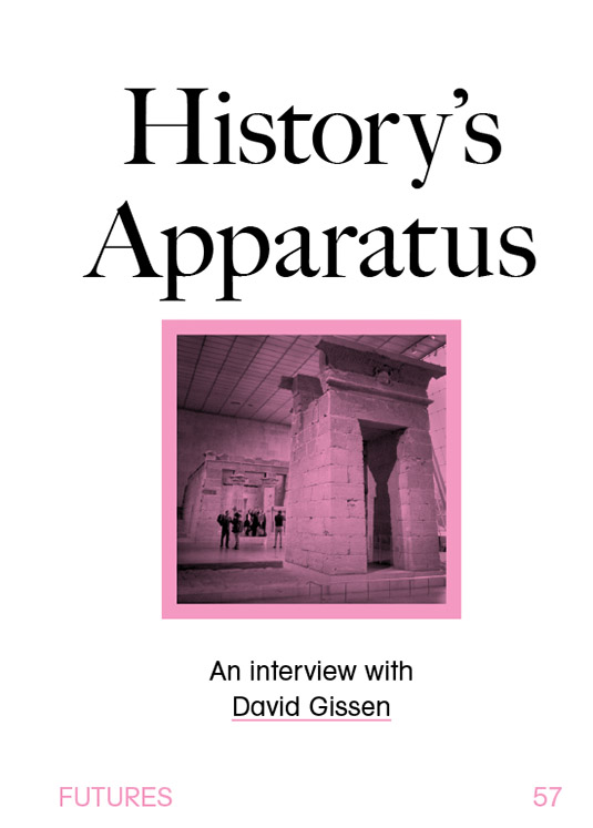
These join reprints of classic texts by geologist Jan Zalasiewicz, on the incipient fossilization of our cities 100 million years from now; a look at the perverse history of weather warfare and the possibility of planetary-scale climate manipulation by James Fleming; and a brilliant analysis of the Temple of Dendur, currently held deep in the controlled atmosphere of New York’s Metropolitan Museum of Art, and its implications for architectural preservation elsewhere.

And even these are complemented by an urban hiking tour by the Center for Land Use Interpretation that takes you up into the hills of Los Angeles to visit check dams, debris basins, radio antennas, and cell phone towers, and a series of ultra-short stories set in a Chicago yet to come by Pruned‘s Alexander Trevi.

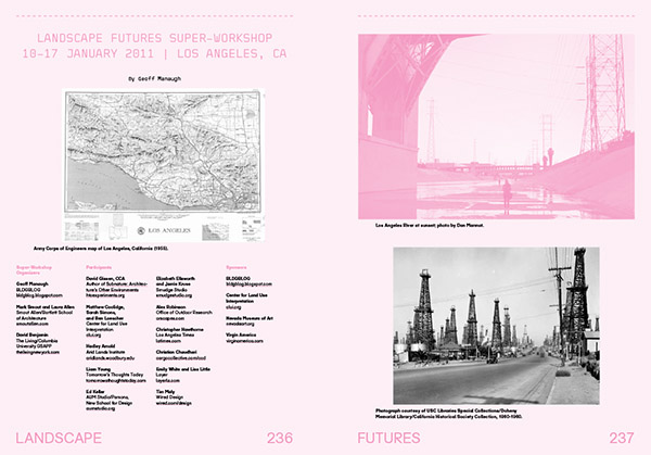
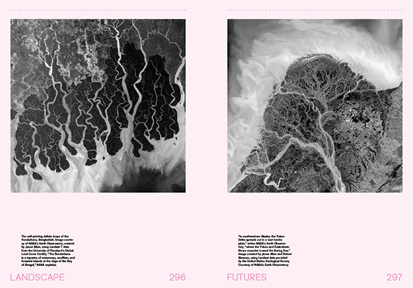
[Images: A few spreads from the “Landscape Futures Sourcebook” featured in Landscape Futures; book design by Everything-Type-Company].
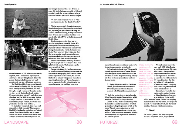
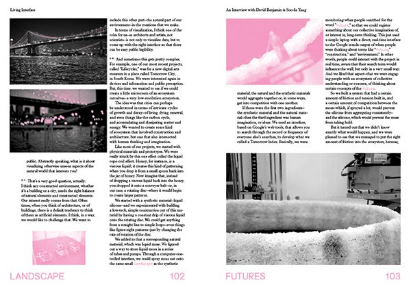
Of course, everything just listed supplements and expands on the heart of the book, which documents the eponymous exhibition hosted at the Nevada Museum of Art, featuring specially commissioned work by Smout Allen, David Gissen, and The Living, and pre-existing work by Liam Young, Chris Woebken & Kenichi Okada, and Lateral Office.

Extensive original interviews with the exhibiting architects and designers, and a long curator’s essay—describing the exhibition’s focus on the intermediary devices, instruments, and spatial machines that can fundamentally transform how human beings perceive and understand the landscapes around them—complete the book, in addition to hundreds of images, many maps, and an extensive use of metallic and fluorescent inks.

The book is currently only $17.97 on Amazon.com, as well, which seems like an almost unbelievable deal; now is an awesome time to buy a copy.

[Images: Interview spreads from Landscape Futures; book design by Everything-Type-Company].

In any case, I’ve written about Landscape Futures here before, and an exhaustive preview of it can be seen in this earlier post.

I just wanted to put up a notice that the book is finally shipping worldwide, with a new publication date of August 2013, and I look forward to hearing what people think. Enjoy!

Working the Line

Tomorrow night in Los Angeles, at the Center for Land Use Interpretation, David Taylor will be presenting his project “Working the Line.”

[Image: U.S./Mexico border marker #184; photograph by David Taylor].

Taylor has been documenting “276 obelisks, installed between the years 1892 and 1895, that mark the U.S./Mexico boundary from El Paso/Juarez to San Diego/Tijuana. He will present this work, and describe his experiences along this often remote and dramatic linear and liminal space.”

As geographer Michael Dear—who spoke about border issues back at Postopolis! LA—describes these obelisks:

The monuments erected by the boundary survey played a pivotal role in securing the line after the Mexican-American War. These obelisks and stone mounds literally marked on the ground the southernmost edges of the nation; they became fundamental points of reference in subsequent boundary disputes (of which there were many) and in the resurvey of the border that took place at the end of the 19th century.

In the context of Taylor’s project, it’s interesting to read a 2006 discussion about “GeoCaching the Mexican Border Obelisk Monuments,” in which a project nearly identical to Taylor’s was presented as “extreme & dangerous,” and thus all but impossible to achieve. Rhetorically speaking, I also want to point out CLUI’s use of the terms “remote and dramatic” to describe what the geocaching site sees as “extreme & dangerous”—an intriguing insight into the spirit of the two approaches. In any case, the ensuing conversation there includes fascinating technical details of the obelisks themselves—their materiality and scale—as well as precise coordinate locations for several dozen of them.

The talk kicks off at 7pm, on Wednesday, August 4, at CLUI’s gallery space in Culver City; here’s a map.

(Random book link: Obelisk: A History).