Terrestrial Warfare, Drowned Lands

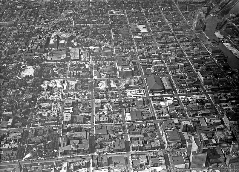
While looking at maps of rural New York State, roughly 70 miles northwest of Manhattan, near the border with New Jersey, I noticed a series of small communities called “Islands.” Pine Island, Maple Island, Black Walnut Island, Pellets Island, etc.—these are tiny hamlets otherwise surrounded by dry land, well away from the sea, the Hudson, or any other large bodies of water.

It turns out these are the “drowned lands of the Wallkill,” a river with such an irregular bed, that so commonly flooded every season, that high points in the landscape would become temporary islands.

According to The History of Sussex and Warren Co., NJ by James P. Snell, it wasn’t until legislation was passed in 1807—creating wonderfully named “drowned-land commissioners”—that the region was eventually drained.

Briefly, anyone interested in liminal landscapes should find Snell’s description of the Drowned Lands, prior to their drainage, fascinating. The Wallkill itself had no real path or bed, Snell explains, the meadows it flowed through were naturally dammed at one end by glacial boulders from the Ice Age, the whole place was clogged with “rank vegetation,” malarial pestilence, and tens of thousands of eels, and, what’s more, during flood season “the entire valley from Denton to Hamburg became a lake from eight to twenty feet deep.”

The landscape is also almost literally Biblical: “On the Southwestern border of the swamp, in the town of Warwick, two lofty and isolated mountains rear their summits. They are called Adam and Eve. Formerly they swarmed with rattlesnakes, but these the inhabitants have exterminated.”

In any case, this eerie, terrestrial-aquatic borderland—reminiscent of John Langan’s novel The Fisherman—was radically redesigned following the construction of a large drainage canal and a subsequent series of dams.

But the dams were controversial, and this is where things get novelistic.

A half-century of “war” broke out among local supporters of the dams and their foes: “The dam-builders were called the ‘beavers’; the dam destroyers were known as ‘muskrats.’ The muskrat and beaver war was carried on for years,” with skirmishes always breaking out over new attempts to dam the floods.

Here’s one example, like a scene written by Victor Hugo transplanted to New York State: “A hundred farmers, on the 20th of August, 1869, marched upon the dam to destroy it. A large force of armed men guarded the dam. The farmers routed them and began the work of destruction. The ‘beavers’ then had recourse to the law; warrants were issued for the arrest of the farmers. A number of their leaders were arrested, but not before the offending dam had been demolished. The owner of the dam began to rebuild it; the farmers applied for an injunction. Judge Barnard granted it, and cited the owner of the dam to appear and show cause why the injunction should not be made perpetual. Pending a final hearing, high water came and carried away all vestige of the dam.”

And so on and so forth, dams rising and falling, lands drowning and being drained again, farmers pitted against hydrologists, for generations. You can easily imagine this as the backdrop for a historical epic, set within a day’s journey from Manhattan on the cusp of modernity, a family committed to raising land from ambiguity and murk colliding with primordial forces led by hostile neighbors dedicated to maintaining inundation.

Two visions of landscape, at war.

Today, the land is hugely fertile and apparently a great source of topsoil; it has become known as the Black Dirt Region. You can even buy Black Dirt Bourbon.

But still, these isolated hills and ridges call themselves islands, as if awaiting the return of the flood.

(All images via Google Maps. Vaguely related on BLDGBLOG: Tactical Landscaping and Terrain Deformation; readers might also enjoy David Blackbourn’s superb book, The Conquest of Nature: Water, Landscape, and the Making of Modern Germany.)

Under the Dome

[Image: Courtesy U.S. Department of the Interior Bureau of Ocean Energy Management (BOEM)].

A gigapixel bathymetric map of the Gulf of Mexico’s seabed has been released, and it’s incredible. The newly achieved level of detail is almost hard to believe.

[Images: Courtesy U.S. Department of the Interior Bureau of Ocean Energy Management (BOEM)].

The geology of the region is “driven not by plate tectonics but by the movement of subsurface bodies of salt,” Eos reported last week. “Salt deposits, a remnant of an ocean that existed some 200 million years ago, behave in a certain way when overlain by heavy sediments. They compact, deform, squeeze into cracks, and balloon into overlying material.”

This means that the bottom of the Gulf of Mexico “is a terrain continually in flux.”

How the salt got there is the subject of a long but fascinating description at Eos.

It is hypothesized that the salt precipitated out of hypersaline seawater when Africa and South America pulled away from North America during the Triassic and Jurassic, some 200 million years ago. The [Gulf of Mexico] was initially an enclosed, restricted basin into which seawater infiltrated and then evaporated in an arid climate, causing the hypersalinity (similar to what happened in the Great Salt Lake in Utah and the Dead Sea between Israel and Jordan).

Salt filled the basin to depths of thousands of meters until it was opened to the ancestral Atlantic Ocean and consequently regained open marine circulation and normal salinities. As geologic time progressed, river deltas and marine microfossils deposited thousands more meters of sediments into the basin, atop the thick layer of salt.

The salt, subjected to the immense pressure and heat of being buried kilometers deep, deformed like putty over time, oozing upward toward the seafloor. The moving salt fractured and faulted the overlying brittle sediments, in turn creating natural pathways for deep oil and gas to seep upward through the cracks and form reservoirs within shallower geologic layers.

These otherwise invisible landscape features “oozing upward” from beneath the seabed are known as salt domes, and they are not only found at the bottom of the Gulf of Mexico.

[Image: Avery Island, Louisiana, archived by the U.S. Library of Congress].

The black and white photos you see here are from a salt mine on Avery Island, Louisiana, archived by the U.S. Library of Congress. The photos date back as far as 1900, and they’re gorgeous.

[Image: Avery Island, Louisiana, archived by the U.S. Library of Congress].

This is what it looks like inside those salt domes, you might way, once industrially equipped human beings have carved wormlike topological spaces into the deformed, ballooning salt deposits of the region.

[Image: Avery Island, Louisiana, archived by the U.S. Library of Congress].

Obviously, the Gulf of Mexico is not the only salt-rich region of the United States; there is a huge salt mine beneath the city of Detroit, for example, and the nation’s first nuclear waste repository, the Waste Isolation Pilot Plant, or WIPP—which my wife and I had the surreal pleasure of visiting in person back in 2012—is dug into a huge underground salt deposit near the New Mexico/Texas border.

[Image: Inside WIPP; photo by Nicola Twilley].

Nonetheless, the Louisiana/Gulf of Mexico salt dome region has lent itself to some particularly provocative landscape myths.

You might recall, for example, the story of Lake Peigneur, an inland body of water that was almost entirely drained from below when a Texaco drilling rig accidentally punctured a salt dome beneath the lake.

This led to the sight of a rapid, Edgar Allan Poe-like maelström of swirling water disappearing into the abyss, pulling no fewer than eleven barges into the terrestrial deep.

[Image: Avery Island, Louisiana, archived by the U.S. Library of Congress].

But there is also the story of Bayou Corne, one of my favorite conspiracy theories of all time.

[Images: Avery Island, Louisiana, archived by the U.S. Library of Congress].

As the New York Times reported back in 2013, “in the predawn blackness of Aug. 3, 2012, the earth opened up—a voracious maw 325 feet across and hundreds of feet deep, swallowing 100-foot trees, guzzling water from adjacent swamps and belching methane from a thousand feet or more beneath the surface.”

One resident of the area is quoted as saying, “I think I caught a glimpse of hell in it.”

More than a year after it appeared, the Bayou Corne sinkhole is about 25 acres and still growing, almost as big as 20 football fields, lazily biting off chunks of forest and creeping hungrily toward an earthen berm built to contain its oily waters. It has its own Facebook page and its own groupies, conspiracy theorists who insist the pit is somehow linked to the Gulf of Mexico 50 miles south and the earthquake-prone New Madrid fault 450 miles north. It has confounded geologists who have struggled to explain this scar in the earth.

To oversimplify things, the overall theory—that is, the conspiratorial part of all this—is that the entire landscape of the Gulf region is on the verge of subterranean dissolution. The very salt deposits so beautifully mapped by the Bureau of Ocean Energy Management are all lined up for eventual flooding.

As this vast underground landscape of salt dissolves, everything from east Texas to west Florida will be sucked down into the abyss.

[Image: Avery Island, Louisiana, archived by the U.S. Library of Congress].

It’s unlikely that this will happen, I should say. You can sleep well at night.

In the meantime, the sorts of salt-mining operations depicted here in these photographs have carved their worming, subterranean way into the warped terrains of salt that dynamically ooze their way up to the surface from geological prehistory.

[Image: Avery Island, Louisiana, archived by the U.S. Library of Congress].

Be sure to check out the full gigapixel BOEM map, and the helpful write-up over at Eos is worth a read, as well. As for the Bayou Corne conspiracy—I suppose we’ll just have to wait.

(Bathymetric maps spotted via Chris Rowan; salt mine photos originally spotted a very long time ago via Attila Nagy).

Quick Links

Some midweek reading material…

[Images: Muons beneath the Alps; via and via].

I’m pretty much obsessed with muons—subatomic particles that have been used to map the interiors of archaeological ruins—so I was interested to see that muons have now also been put to work mapping the bedrock beneath glaciers in the Swiss Alps. It is the “first application of the technique in glacial geology,” Eos reports. Even better, it uses underground railway infrastructure—the Jungfrau rail tunnel—as part of its experimental apparatus.

[Image: Mountain, written by Robert Macfarlane].

Robert Macfarlane has written a movie called Mountain, narrated by Willem Defoe. Macfarlane also recently joined Twitter, where he has rapidly accumulated nearly 28,000 followers.

The world’s sand is running out—indeed, “it’s scarcer than you think,” David Owen writes for The New Yorker. As highlighted on Twitter by @lowlowtide, the piece includes this great line: “The problems start when people begin to think of mutable landforms as permanent property.” Sand, and the peculiar economies that value it, has gotten quite a bit of attention over the past few years; among other coverage, a long feature in Wired two years ago is worth checking out.

Researchers at Penn State have figured out a way to generate electricity from the chemical mixing point where freshwater rivers reach the sea. “‘The goal of this technology is to generate electricity from where the rivers meet the ocean,’ said Christopher Gorski, assistant professor in environmental engineering at Penn State. ‘It’s based on the difference in the salt concentrations between the two water sources.’”

Hawaii is experiencing an unusually intense barrage of high tides, known as “king tides.” “For the people of Hawaii, alarm bells are ringing,” Adrienne LaFrance writes for The Atlantic. “King tides like this aren’t just a historic anomaly; they’re a sign of what’s to come… Scientists believe Hawaii could experience a sea-level increase of three feet by the year 2100, which is in line with global predictions of sea-level change and which would substantially reshape life on the Islands. That’s part of why scientists are enlisting volunteers to help photograph and describe incremental high tides across Hawaii.” Read more at The Atlantic.

[Image: Courtesy Places Journal/Zach Mortice].

Over at Places, landscape architect Zach Mortice takes a long look at what he calls “perpetual neglect” and the challenge of historic preservation in African-American burial grounds. Badly maintained—and, in some cases, almost entirely erased—black cemeteries reveal “that the racism and inequality that plague African Americans in life are perpetuated in death,” Mortice suggests. This is “nothing less than a preservation crisis for black burial grounds across the country.”

I recently discovered the existence of something called Betonamit. Betonamit is a “non-explosive cracking agent,” essentially a “non-toxic” powder that can be used for the slow-motion demolition of buildings and geological forms. “When mixed with water and poured into holes 1 1/4″, 1 3/8″ or 1 1/2″ diameter, it hardens and expands, exerting pressures of 12,000 psi. Reinforced concrete, boulders, and ledge[s] are fractured overnight with no noise, vibration, or flyrock.” I’m imagining a truck full of this stuff overturning on a crack-laden bridge somewhere, just an hour before a rainstorm begins, or a storage yard filled with crates of this stuff being ripped apart in the summer wind; a seemingly innocuous grey powder drifts out across an entire neighborhood for the next few hours, settling down into cracks on brick rooftops and stone facades, in sidewalks and roadbeds. Then the rains begin. The city crumbles. Weaponized demolition powder.

In any case, I actually stumbled upon Betonamit after reading a few blog posts on that company’s in-house blog. Atlas Preservation has a handful of interesting short articles up documenting their preservation work, including what might be the oldest gravestone in the United States and the challenges of open-air cemetery preservation. Let’s hope no one goes wandering amongst the tombs with a bucket of Betonamit…

The BBC went into horror-movie mode earlier this month, asking, “what would happen if we were suddenly exposed to deadly bacteria and viruses that have been absent for thousands of years, or that we have never met before? We may be about to find out. Climate change is melting permafrost soils that have been frozen for thousands of years, and as the soils melt they are releasing ancient viruses and bacteria that, having lain dormant, are springing back to life.” The headline is straight-forward enough, I suppose: “There are diseases hidden in ice, and they are waking up.”

[Images: Courtesy Waxwork Records].

Fans of John Carpenter’s (excellent) 1982 film The Thing might be interested to hear that the original score has been remastered and released on vinyl. The final product is visually gorgeous—and temporarily sold out. Keep your ears peeled for further pressings.

A retired F.B.I. investigator has newly dedicated himself to tracking down lost apple varietals of the Pacific Northwest. They are not extinct; they have simply disappeared into the background, both ecologically and historically. They are trees that have “faded into woods, or were absorbed by parks or other public lands,” but the apples that grow from them can still be enjoyed and cultivated.

If you are interested in apples and their history, meanwhile, don’t miss the late Roger Deakin’s superb book, Wildwood: A Journey Through Trees.

[Images: Courtesy Public Domain Review].

Blending into the natural landscape is the subject of a fascinating piece over at Public Domain Review about the early wildlife photographers, Richard and Cherry Kearton. In order not to scare away their subject matter, the Keartons constructed artificial trees, put on short, deliberately misleading performative displays for wildlife, and carved masks that would help camouflage them against the woodlands.

There’s more—always more!—to link to and read, but I’ll leave it at that. For other, ongoing links, I am also on Twitter.

Fewer Gardens, More Shipwrecks

[Image: Peder Balke, “Seascape” (1848), courtesy of the Athenaeum].

As cities like New York prepare for “permanent flooding,” and as we remember submerged historical landscapes such as Doggerland, lost beneath the waves of a rising North Sea, it’s interesting to read that humanity’s ancient past—not just its looming future—might be fundamentally maritime, rather than landlocked. Or oceanic rather than terrestrial, we might say.

In his recent book The Human Shore, historian John R. Gillis suggests that, due to a variety of factors, including often extreme transportation difficulties presented by inland terrain, traveling by sea was the obvious choice for early human migrants.

People, after all, have been seafaring for at least 130,000 years.

This focus on seas and waterways came with political implications, Gillis writes. Even when European merchant-explorers reached North America, “It would be a very long time, almost three hundred years, before Europeans realized the full extent of the Americas’ continental character and grasped the fact that they might have to abandon the ways of seaborne empires for those of territorial states.” In fact, he adds, “for the first century or more, northern Europeans showed more interest in navigational rights to certain waterways and sea tenures than in territorial possession as such.”

At the risk of anachronism, you might say that their power was defined by logistical concerns, rather than by territorial ones: by dynamic, just-in-time access to ports and routes, rather than by the stationary establishment of landed borders and policed frontiers.

[Image: “Ship in a Storm” (ca. 1826), by Joseph Mallord William Turner; courtesy Tate Britain].

Gillis goes much further than this, however, suggesting that—as 130,000 years of seafaring history seems to indicate—humans simply are not a landlocked species.

“Even today,” Gillis claims, “we barely acknowledge the 95 percent of human history that took place before the rise of agricultural civilization.” That is, 95 percent of human history spent migrating both over land and over water, including the use of early but sophisticated means of marine transportation that proved resistant to archaeological preservation. For every lost village or forgotten house, rediscovered beneath a quiet meadow, there are a thousand ancient shipwrecks we don’t even know we should be looking for.

Perhaps speaking only for myself, this is where things get particularly interesting. Gillis points out that humanity’s deep maritime history has been almost entirely written out of our myths and religions.

In his words, “the book of Genesis would have us believe that our beginnings were wholly landlocked, but it was written at the time that the Hebrews were settling down to an agrarian existence.” That is, the myth of Genesis was written from the point of view of a culture already turning away from the sea, mastering animal domestication, mining, and wheeled transport, and settling down away from the coastline. It was learning to cultivate gardens: “The story of Eden served admirably as the foundational myth for agricultural society,” Gillis writes, but it performs very poorly when seen in the context of humanity’s seagoing past.

Briefly, I have to wonder what might have happened had works of literature—or, more realistically, highly developed oral traditions—from this earlier era been better preserved. Seen this way, The Odyssey would merely be one, comparatively recent example of seafaring mythology, and from only one maritime culture. But what strange, aquatic world of gods and monsters might we still be in thrall of today had these pre-Edenic myths been preserved—as if, before the Bible, there had been some sprawling Lovecraftian world of coral reefs, lost ships, and distant archipelagoes, from the Mediterranean to Southeast Asia?

[Image: “Storm at Sea” (ca. 1824), by Joseph Mallord William Turner; courtesy Tate Britain].

This is where this post’s title comes from. “In short,” Gillis concludes, “we require a new narrative, one with, as Steve Mentz suggests, ‘fewer gardens, and more shipwrecks.’”

Fewer gardens, more shipwrecks. We are more likely, Gillis and Mentz imply, to be the outcast descendants of sunken ships and abandoned expeditions than we are the landed heirs of well-tended garden plots.

Seen this way, even if only for the purpose of a thought experiment, human history becomes a story of the storm, the wreck, the crash—the distant island, the unseen reef, the undertow—not the farm or even the garden, which would come to resemble merely a temporary domestic twist in this much more ancient human engagement with the sea.

Sunken Cities

[Image: Raising a house to help survive future floods; photo by Eliot Dudik, courtesy The New York Times].

The climate change-induced flooding of coastal cities along the U.S. eastern seaboard has already begun, the New York Times suggests.

“For decades, as the global warming created by human emissions caused land ice to melt and ocean water to expand, scientists warned that the accelerating rise of the sea would eventually imperil the United States’ coastline,” we read. “Now, those warnings are no longer theoretical: The inundation of the coast has begun.” In many places, “the sea is now so near the brim in many places that [scientists] believe the problem is likely to worsen quickly.”

The article is full of specific details that would not be out of place in a well-constructed novel, including dead lawns killed by exposure to seawater, vacuum trucks sent out “to suck saltwater off the streets,” and “huge vertical rulers” installed along roads to help drivers judge if the floodwaters “are too deep to drive through.”

These are the new, everyday practices of life on a future seabed: preparatory behaviors as the waters rise and whole communities face permanent inundation.

What’s so interesting about this, in fact, is the apparent lack of panic and catastrophe. While this seeming calmness is no doubt based purely in denial—not just denial that excessive carbon dioxide in the atmosphere retains more heat, leading to warming, but denial of the fact that this is the new normal, that these floods are not flukes but early glimpses of a fundamentally transformed landscape to come—people are nonetheless simply getting on with their lives, even as radical change occurs around them at every scale.

I’m still haunted by a small detail from a similar story published a few years ago, following Hurricane Sandy, about a place called Broad Channel, an outer neighborhood of New York City. There, rising coastal waters have been causing more and more flooding, to the extent that it has become a regular occurrence—not something terrifying, just mildly irritating.

This is true to the extent that residents have now developed otherwise calm and perfectly rational ways of warning one another that the waters are back, that the streets are flooding, and—more to the point—that they should perhaps consider moving their cars.

Broad Channel is now “a place where residents cling to tide clocks and, some joke, every child gets wading boots for Christmas. Neighbors will honk a car horn in the middle of the night to warn others of an approaching tide, and some have made pencil markings on their homes to show water levels from storms past.”

If we ask ourselves what life will be like in the Anthropocene, after the ever-mounting effects of climate change become real, it’s worth remembering these people “honk[ing] a car horn in the middle of the night to warn others of an approaching tide.”

In other words, the Anthropocene will look perfectly normal: people will simply vacuum-pump seawater out of their carports and garages, scrub encrusted salt from the walls of the homes, give each other waterproof boots for Christmas, and otherwise go on as if the world hasn’t changed.

The secret of the Anthropocene is that it’s just another kind of everyday life.

Preparing for the Flood

Despite taking a strong public stance against modern climate science, oil firms such as Mobil and Shell have calculated the effects of climate change-induced sea-level rise into the construction of their drilling platforms and coastal facilities, the Los Angeles Times reports.

The Drowned World

[Image: From Terra Forming: Engineering the Sublime by Adam Lowe and Jerry Brotton].

Artists Adam Lowe and Jerry Brotton’s project Terra Forming: Engineering the Sublime simultaneously explores the history of different geographic projections—including how these have been used to misrepresent and distort the earth’s surface—and at the future of that earth in an era of rising sea levels.

[Image: From Terra Forming: Engineering the Sublime by Adam Lowe and Jerry Brotton].

As Factum Arte explain, their chosen geographic projections offer “a way of engaging with the Earth from different points of view, and reflect historical ways of mapping the world from the Greeks to Google Earth.”

[Image: From Terra Forming: Engineering the Sublime by Adam Lowe and Jerry Brotton].

The projections are milled into beautiful 3D topographic models, with the vertical axis exaggerated to allow for changes in altitude to become visible.

The Andes, for example, become an abrupt spine of skyscraping pinnacles on the edge of an otherwise dead-flat continent, and deep-sea plains become spiky fields of underwater needles and pins.

[Images: From Terra Forming: Engineering the Sublime by Adam Lowe and Jerry Brotton].

As the artists write, “distortion was used because without it the globe’s surface would appear almost totally flat”—which interestingly suggests that representational distortion, with a great deal of irony, is actually central to giving our planet geographic legibility.

To map it or to know it, the implication seems to be, you must first alter it.

[Image: From Terra Forming: Engineering the Sublime by Adam Lowe and Jerry Brotton].

This is only half the project, however.

The artists refer to Terra Forming as “a cartographic response to the advent of the Anthropocene“—which is why the resulting topographic models are then flooded.

[Images: From Terra Forming: Engineering the Sublime by Adam Lowe and Jerry Brotton].

“The installation will mimic the passage of time as well as space,” Factum Arte write, “by flooding the world with water over several days, until we reach current sea levels; the world will then be flooded completely, leaving us with a drowned world, a prescient image for those parts of the world facing rising sea levels, as well as those such as parts of the Arabian Peninsula which is trying to reclaim land from the sea.”

You can watch a short video of the project’s gradual submergence on Vimeo—or embedded below.


And you can read much more about the project over at Factum Arte.

Abandoned Basements as Stormwater Basins

[Image: Rendering of a possible “BaseTern” landscape by students Brett Harris, Andrew D’Arcy, and Heidi Petersen, via Landscape Architecture Magazine].

Not all the news coming out of Milwaukee involves misguided highway megaprojects or tax-funded crony capitalism—though there is that.

For example, Wisconsin governor Scott Walker—confusing an earlier generation’s urban mistakes with how a city is meant to function—has been plowing billions of dollars’ worth of taxpayer money into “freeway megaprojects” for which “the pricetag got so big that leaders from his own party rejected his plan as fiscally irresponsible, leaving the state budget in limbo,” Politico reports:

As the state has shifted resources into freeway megaprojects, 71 percent of [Wisconsin’s] roads are in mediocre or poor condition, according to federal data. Fourteen percent of its bridges are structurally deficient or functionally obsolete, which is actually better than the national average. Walker and his fellow Republicans have killed plans for light rail, commuter rail, high-speed rail, and dedicated bus lanes on major highways, so there is almost no public transportation connecting Milwaukee to its suburbs, intensifying divisions in one of the nation’s most racially, economically and politically segregated metropolitan areas. Yet Walker, who is running for president as a staunch fiscal conservative, has pushed a $250 million-per-mile plan to widen Interstate 94 between the Marquette and the Zoo despite fierce local opposition.

If that sounds both avoidable and unfortunate, consider the fact that “Walker also killed a ‘Complete Streets’ program that pushed road builders to accommodate bicyclists and pedestrians.”

[Images: (top) Milwaukee’s Marquette interchange, nearly the same size as the city it cuts through; (bottom) Milwaukee before the interchange. Images via Politico].
At the same time, Walker has also “championed a high-profile proposal to spend a quarter of a billion dollars of taxpayer money to help finance a new Milwaukee Bucks arena—all while pushing to slash roughly the same amount from state funding for higher education,” the International Business Times reports.

But, hey, why does Wisconsin need universities when everyone can just go to an NBA game? Not that benefitting the public is even Walker’s goal: “One of those who stands to benefit from the controversial initiative is a longtime Walker donor and Republican financier who has just been appointed by the governor to head his presidential fundraising operation.”

In any case, an interesting landscape test-project is currently underway in Milwaukee, called the “BaseTern” program.

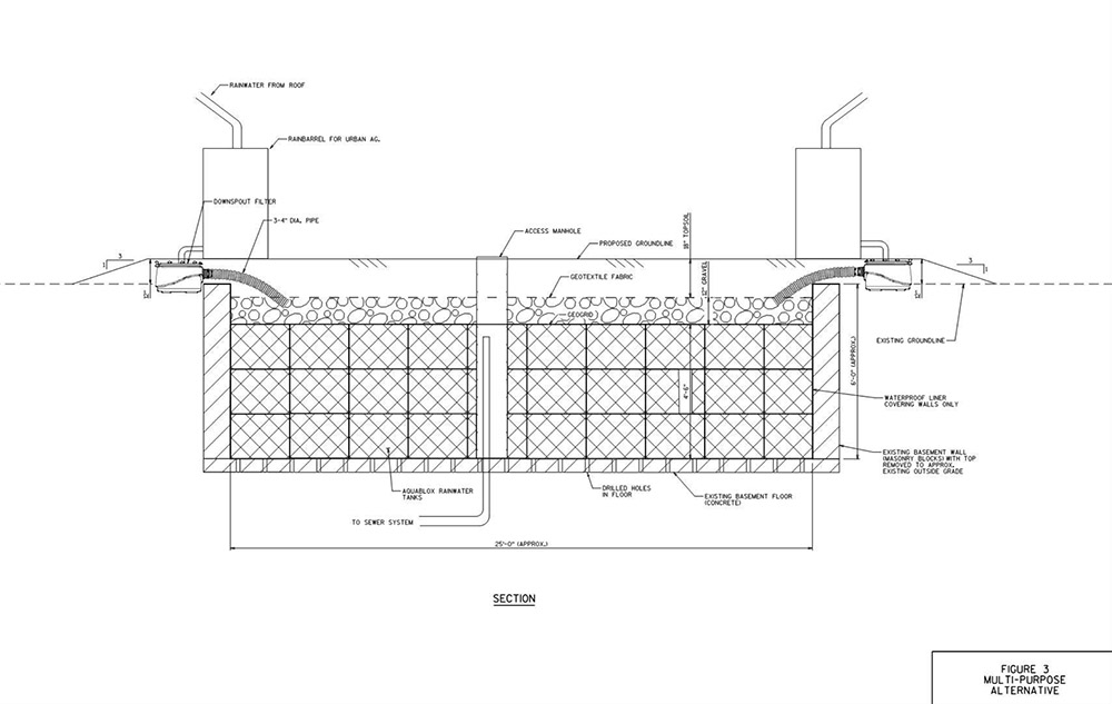
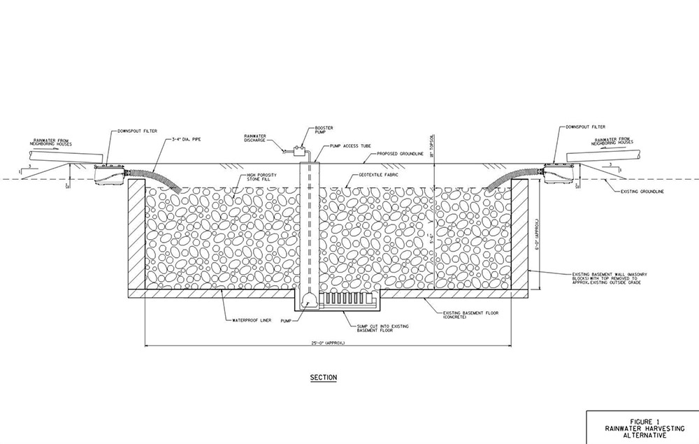
As the city explains it, a “BaseTern” is “an underground stormwater management or rainwater harvesting structure created from the former basement of an abandoned home that has been slated for demolition.” Why is the city doing this?

By using abandoned basements, the City saves the cost of demolition on these structures (filing the basement and grading the surface) and on excavation for the new structure. In addition, BaseTerns provide significant stormwater storage capacity on a single site, the equivalent of up to 600 rain barrels.

The result, the city is keen to add, is “not an open pit. Rather a BaseTern is a covered structure, which is covered with topsoil and grass, and will appear the same as conventional vacant lot.”

In their July 2015 issue, Landscape Architecture Magazine explained that this is, in fact, “the world’s first such system.” Conceived—and actually trademarked—by a city official named Erick Shambarger, the idea was inspired by a GIS-fueled discovery that the worst flooding in the city always “occurred in neighborhoods with high rates of foreclosures. The city controls roughly 900 foreclosed properties, many of which it plans to demolish. Shambarger figured the city could preserve the basement structure and put it to use.”

[Images: Two BaseTern design diagrams, taken from Milwaukee’s “Vacant Basements for Stormwater Management Feasibility Study“].

While there is something metaphorically unsettling in the idea that parts of a blighted, financially underwater neighborhood might soon literally be underwater—transformed into a kind of urban sponge for the rest of Milwaukee—the notion that the city can discover in its own economic misfortune a possible new engineering approach for dealing with seasonal flooding and super-storms is an inspiring thing to see.

The BaseTern program also potentially suggests a stopgap measure for coastal cities set to face rising sea levels well within the lifetimes of the coming generation.

In the all but inevitable managed retreat from the coast that seems set to kick off both en masse and in earnest by midcentury—something that is already happening in New York City, post-Sandy—perhaps the subterranean ruins of old neighborhoods left behind can be temporarily repurposed as minor additions to a broader coastal program intent on reducing flooding for residents further inland.

Before, of course, those underground voids—former guest bedrooms, dens, man caves, she sheds, and basements—are inundated for good.

Read more about BaseTerns over at Landscape Architecture Magazine.

100 Views of a Drowning World

[Image: Kahn & Selesnick, courtesy Yancey Richardson].

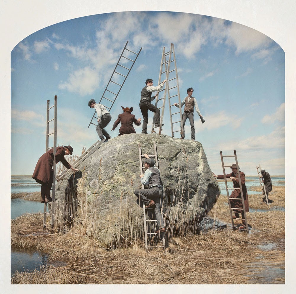
I’ve mentioned the work of artists Kahn & Selesnick before; their surreal narratives are illustrated with elaborately propped photos that fall somewhere between avant-garde theater and landscape fiction, with mountain glaciers, salt mines, alien planets, utopian cityscapes, and, as seen here, the slowly flooding marshes of an unidentified hinterland.

[Image: Kahn & Selesnick, courtesy Yancey Richardson].

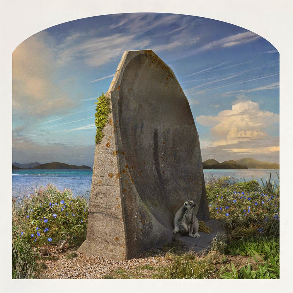
These images are from a new project, called Truppe Fledermaus & The Carnival at the End of the World, that opened at New York’s Yancey Richardson gallery last week. “Utilizing photography, drawing, printmaking, sculpture and performance,” the gallery writes, “the artists create robust mythic realities for each project, building imaginary, character-driven fictions from kernels of obscure historical truth.”

Kahn & Selesnick’s latest project follows a fictitious cabaret troupe—Truppe Fledermaus (Bat Troupe)—who travel the countryside staging absurd and inscrutable performances in abandoned landscapes for an audience of no one. The playful but dire message presented by the troupe is of impending ecological disaster, caused by rising waters and a warming planet, the immediate consequences of which include the extinction of the Bat, in this mythology a shamanistic figure representing both nature and humanity. In one sense, the entire cabaret troupe can be seen as a direct reflection of the artists themselves, both entities employing farce and black humor to engage utterly serious concerns.

The particular scenes shown here, all on display until July 3, 2014, are from a sub-series within the project called “100 Views of a Drowning World.”

[Image: Kahn & Selesnick, courtesy Yancey Richardson].

Eccentric residents of a drowning landscape live lives indistinguishable from absurdist stagecraft, as they wander through seemingly wild landscapes that are actually ruins and that will eventually all disappear beneath the deceptively placid tidal flats flowing around them.

[Image: Kahn & Selesnick, courtesy Yancey Richardson].

These anonymous coastal dwellers simulate a nature that is already artificial—a kind of maritime grotesque of overgrown animal forms and humans buried beneath ropes and seaweed—and they set off on doomed expeditions through terrains whose original inhabitants have long been forgotten.

[Image: Kahn & Selesnick, courtesy Yancey Richardson].

Lone figures in boats look out into what will soon be sea, attempting to navigate land as if it is already an ocean.

[Images: Kahn & Selesnick, courtesy Yancey Richardson].

And others attempt to escape into some new strain of Romanticism, witnesses of large-scale terrestrial change who know that this moment on the Earth is rare—though not unique—for the extraordinary transitions that lie over the horizon.

[Image: Kahn & Selesnick, courtesy Yancey Richardson].

In the end, then, the idea is not that these characters’ actions somehow represent or propose a new humanist response to climate change, or that the artists are offering us any sort of practical or ethical insight into what futures might face us in a drowned world, but that these absurd rituals and dreamlike antics instead simply illustrate “a world that is sinking into a marsh.”

It is, as the show’s title suggests, just a carnival at the end of the world.

[Image: Kahn & Selesnick, courtesy Yancey Richardson].

The Yancey Richardson gallery is on W. 22nd Street, over near the High Line; be sure to stop by before July 3. Here is a map and here are more images.

Watershed Down

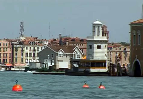
[Image: Mike Bouchet’s Watershed being towed through Venice towards the Arsenale basin, against a backdrop of Italian palazzi].
Note: This is a guest post by Nicola Twilley.

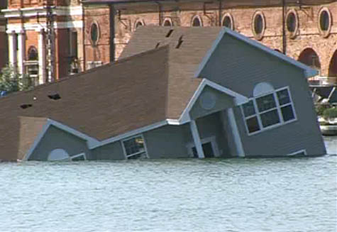
The 2009 Venice Biennale opened this week with an unexpected and quite beautiful piece of performance art. Artist Mike Bouchet had built a one-to-one scale replica of a typical American surburban home that he planned to install on floating pontoons in the Venice Arsenale basin. He called the project Watershed.

David Birnbaum, the Biennale’s curator, told camera crews filming the installation that he thought the project “sounded a bit megalomaniac,” but the sight of the oversized house, clad in beige vinyl, flimsily bobbing up and down against a backdrop of palazzi and piazzi as it was towed through Venice’s canals, was breathtaking. It was an architectural icon of the American Dream revealed in all its formulaic absurdity.

Amazingly, then, one of the pontoons capsized, and the entire house sank to the bottom of the canal—an unintentional yet utterly perfect coda to the house’s own built-in commentary. Now, a fake generic American suburban home will add its ruins to the underwater archaeology of Venice.

[Image: Mike Bouchet’s Watershed goes down].

A two-minute video of the house’s journey, and eventual fate, can be seen in full on YouTube.

(Originally spotted on Flavorwire).

Watermarks

Last night in Bristol, England, marked the start of Chris Bodle’s Watermarks Project. For the next week, Bodle will be projecting onto the facades of buildings throughout Bristol estimated future high-tide marks should the entire Greenland ice cap melt.

[Image: From Chris Bodle’s Watermarks Project].

The idea is brilliant; I love the idea of mapping the future earth onto the earth of the present, of overlaying onto our present geography the virtual presence of a geography yet to come.

In many ways, I’d even say that this project can be divorced from its immediate context of climate change science and applied to any number of terrestrial processes, from the projected future and the hypothesized past. Whether mapping lost lakes of a different era or tracing the edges of disappeared lagoons that still haunt the streets of San Francisco – or reminding urbanites of the sport-fishing possibilities beneath Manhattan – we are alive within laminations we will never fully map or comprehend.

And these geographic superimpositions needn’t all by hydrological: the constant erasures and revisions of the earth through plate tectonics represent an unlimited supply of counter-landscapes we might explore.

I’m reminded of John McPhee’s fantastic book Assembling California – part of his equally great collection Annals of the Former World. There, McPhee describes how entire “Newfoundlands, Madagascars, New Zealands, Sumatras, [and] Japans” have all come together, rammed into place, one into the other over millions of years, to form what we now call California. Walking around Los Angeles, or through the coastal hills of Bug Sur, you’re not walking on unified ground at all, then, but across “the metamorphosed remains of what had once been an island arc.”

The ground here is all wandering, nomadic wreckage, only it’s been temporarily “consolidated as California,” McPhee writes.

So could all those old islands be flagged, their mutated and compressed remains – sheer gravel, lone hillsides, folded slopes, and whole mountain ranges – marked out with surveyors’ tape? The Archipelago Project. You cross and recross lost geographies made visible through an artist’s intervention – or follow a new state hiking path that meanders around the edges of minor fault lines yet to open.

[Image: From Chris Bodle’s Watermarks Project].

In any case, projecting the earth’s future oceans onto a contemporary cityscape is an almost unbelievably stimulating idea.

These are the data points of a world yet to come, you might say, made visible here on the fronts of a hundred buildings – a future or alternative version of the earth coming into focus all around us.

(Via the RSA’s Arts & Ecology site, thanks to Nicky!)