Quick Links

Some midweek reading material…

[Images: Muons beneath the Alps; via and via].

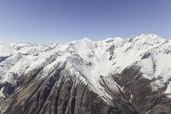
I’m pretty much obsessed with muons—subatomic particles that have been used to map the interiors of archaeological ruins—so I was interested to see that muons have now also been put to work mapping the bedrock beneath glaciers in the Swiss Alps. It is the “first application of the technique in glacial geology,” Eos reports. Even better, it uses underground railway infrastructure—the Jungfrau rail tunnel—as part of its experimental apparatus.

[Image: Mountain, written by Robert Macfarlane].

Robert Macfarlane has written a movie called Mountain, narrated by Willem Defoe. Macfarlane also recently joined Twitter, where he has rapidly accumulated nearly 28,000 followers.

The world’s sand is running out—indeed, “it’s scarcer than you think,” David Owen writes for The New Yorker. As highlighted on Twitter by @lowlowtide, the piece includes this great line: “The problems start when people begin to think of mutable landforms as permanent property.” Sand, and the peculiar economies that value it, has gotten quite a bit of attention over the past few years; among other coverage, a long feature in Wired two years ago is worth checking out.

Researchers at Penn State have figured out a way to generate electricity from the chemical mixing point where freshwater rivers reach the sea. “‘The goal of this technology is to generate electricity from where the rivers meet the ocean,’ said Christopher Gorski, assistant professor in environmental engineering at Penn State. ‘It’s based on the difference in the salt concentrations between the two water sources.’”

Hawaii is experiencing an unusually intense barrage of high tides, known as “king tides.” “For the people of Hawaii, alarm bells are ringing,” Adrienne LaFrance writes for The Atlantic. “King tides like this aren’t just a historic anomaly; they’re a sign of what’s to come… Scientists believe Hawaii could experience a sea-level increase of three feet by the year 2100, which is in line with global predictions of sea-level change and which would substantially reshape life on the Islands. That’s part of why scientists are enlisting volunteers to help photograph and describe incremental high tides across Hawaii.” Read more at The Atlantic.

[Image: Courtesy Places Journal/Zach Mortice].

Over at Places, landscape architect Zach Mortice takes a long look at what he calls “perpetual neglect” and the challenge of historic preservation in African-American burial grounds. Badly maintained—and, in some cases, almost entirely erased—black cemeteries reveal “that the racism and inequality that plague African Americans in life are perpetuated in death,” Mortice suggests. This is “nothing less than a preservation crisis for black burial grounds across the country.”

I recently discovered the existence of something called Betonamit. Betonamit is a “non-explosive cracking agent,” essentially a “non-toxic” powder that can be used for the slow-motion demolition of buildings and geological forms. “When mixed with water and poured into holes 1 1/4″, 1 3/8″ or 1 1/2″ diameter, it hardens and expands, exerting pressures of 12,000 psi. Reinforced concrete, boulders, and ledge[s] are fractured overnight with no noise, vibration, or flyrock.” I’m imagining a truck full of this stuff overturning on a crack-laden bridge somewhere, just an hour before a rainstorm begins, or a storage yard filled with crates of this stuff being ripped apart in the summer wind; a seemingly innocuous grey powder drifts out across an entire neighborhood for the next few hours, settling down into cracks on brick rooftops and stone facades, in sidewalks and roadbeds. Then the rains begin. The city crumbles. Weaponized demolition powder.

In any case, I actually stumbled upon Betonamit after reading a few blog posts on that company’s in-house blog. Atlas Preservation has a handful of interesting short articles up documenting their preservation work, including what might be the oldest gravestone in the United States and the challenges of open-air cemetery preservation. Let’s hope no one goes wandering amongst the tombs with a bucket of Betonamit…

The BBC went into horror-movie mode earlier this month, asking, “what would happen if we were suddenly exposed to deadly bacteria and viruses that have been absent for thousands of years, or that we have never met before? We may be about to find out. Climate change is melting permafrost soils that have been frozen for thousands of years, and as the soils melt they are releasing ancient viruses and bacteria that, having lain dormant, are springing back to life.” The headline is straight-forward enough, I suppose: “There are diseases hidden in ice, and they are waking up.”

[Images: Courtesy Waxwork Records].

Fans of John Carpenter’s (excellent) 1982 film The Thing might be interested to hear that the original score has been remastered and released on vinyl. The final product is visually gorgeous—and temporarily sold out. Keep your ears peeled for further pressings.

A retired F.B.I. investigator has newly dedicated himself to tracking down lost apple varietals of the Pacific Northwest. They are not extinct; they have simply disappeared into the background, both ecologically and historically. They are trees that have “faded into woods, or were absorbed by parks or other public lands,” but the apples that grow from them can still be enjoyed and cultivated.

If you are interested in apples and their history, meanwhile, don’t miss the late Roger Deakin’s superb book, Wildwood: A Journey Through Trees.

[Images: Courtesy Public Domain Review].

Blending into the natural landscape is the subject of a fascinating piece over at Public Domain Review about the early wildlife photographers, Richard and Cherry Kearton. In order not to scare away their subject matter, the Keartons constructed artificial trees, put on short, deliberately misleading performative displays for wildlife, and carved masks that would help camouflage them against the woodlands.

There’s more—always more!—to link to and read, but I’ll leave it at that. For other, ongoing links, I am also on Twitter.

Where Borders Melt

[Image: From Italian Limes. Photo by Delfino Sisto Legnani, courtesy of Folder].

One of the most interesting sites from a course I taught several years ago at Columbia—Glacier, Island, Storm—was the glacial border between Italy and Switzerland.

The border there is not, in fact, permanently determined, as it actually shifts back and forth according to the height of the glaciers.

This not only means that parts of the landscape there have shifted between nations without ever really going anywhere—a kind of ghost dance of the nation-states—but also that climate change will have a very literal effect on the size and shape of both countries.

[Image: Due to glacial melt, Switzerland has actually grown in size since 1940; courtesy swisstopo].
This could result in the absurd scenario of Switzerland, for example, using its famed glacier blankets, attempting to preserve glacial mass (and thus sovereign territory), or it might even mean designing and cultivating artificial glaciers as a means of aggressively expanding national territory.

As student Marissa Looby interpreted the brief, there would be small watchtowers constructed in the Alps to act as temporary residential structures for border scientists and their surveying machines, and to function as actual physical marking systems visible for miles in the mountains, somewhere between architectural measuring stick for glacial growth and modular micro-housing.

But the very idea that a form of thermal warfare might break out between two countries—with Switzerland and Italy competitively growing and preserving glaciers under military escort high in the Alps—is a compelling (if not altogether likely) thing to consider. Similarly, the notion that techniques borrowed from landscape and architectural design could be used to actually make countries bigger—eg. through the construction of glacier-maintenance structures, ice-growing farms, or the formatting of the landscape to store seasonal accumulations of snow more effectively—is absolutely fascinating.

[Images: From Italian Limes. Photos by Delfino Sisto Legnani, courtesy of Folder].

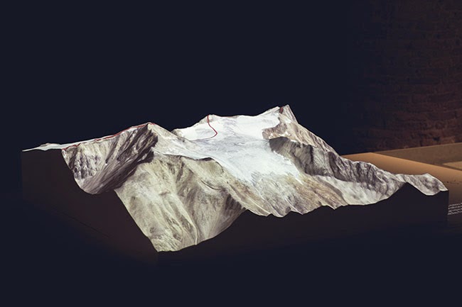
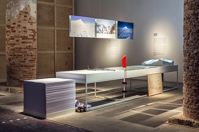
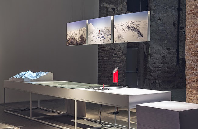
I was thus interested to read about a conceptually similar but otherwise unrelated new project, a small exhibition on display at this year’s Venice Biennale called—in English, somewhat unfortunately—Italian Limes, where “Limes” is actually Latin for limits or borders (not English for a small acidic fruit). Italian Limes explores “the most remote Alpine regions, where Italy’s northern frontier drifts with glaciers.”

In effect, this is simply a project looking at this moving border region in the Alps from the standpoint of Italy.

[Image: From Italian Limes. Photo by Delfino Sisto Legnani, courtesy of Folder].

As the project description explains, “Italy is one of the rare continental countries whose entire confines are defined by precise natural borders. Mountain passes, peaks, valleys and promontories have been marked, altered, and colonized by peculiar systems of control that played a fundamental role in the definition of the modern sovereign state.”

[Images: From Italian Limes. Photos by Delfino Sisto Legnani, courtesy of Folder].

However, they add, between 2008 and 2009, Italy negotiated “a new definition of the frontiers with Austria, France and Switzerland.”

Due to global warming and and shrinking Alpine glaciers, the watershed—which determines large stretches of the borders between these countries—has shifted consistently. A new concept of movable border has thus been introduced into national legislation, recognizing the volatility of any watershed geography through regular alterations of the physical benchmarks that determine the exact frontier.

[Images: From Italian Limes. Photos by Delfino Sisto Legnani, courtesy of Folder].

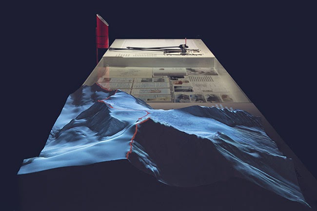
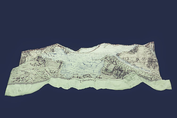
The actual project that resulted from this falls somewhere between landscape surveying and technical invention—and is a pretty awesome example of where territorial management, technological databases, and national archives all intersect:

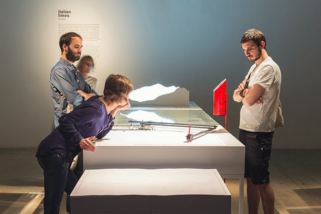
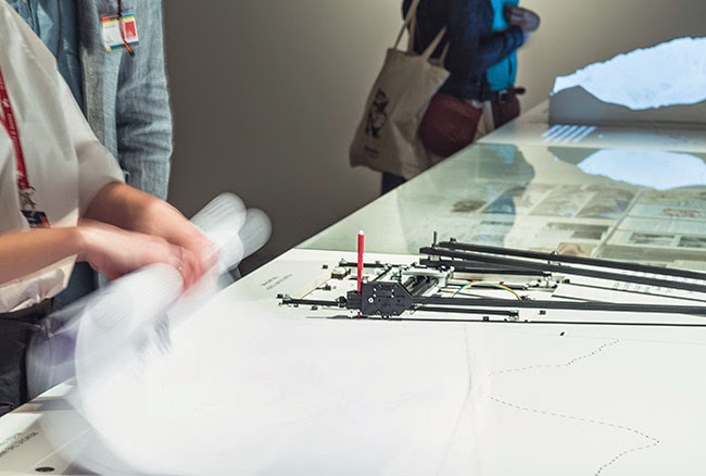
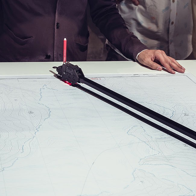
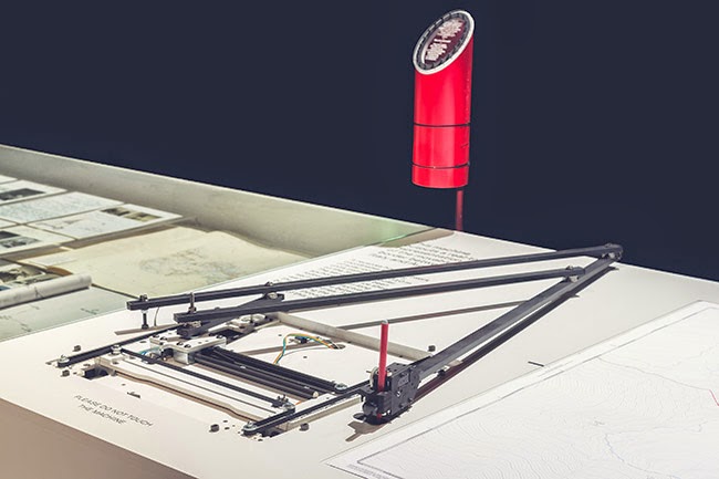
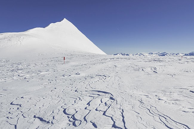
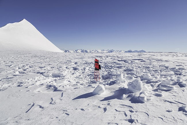
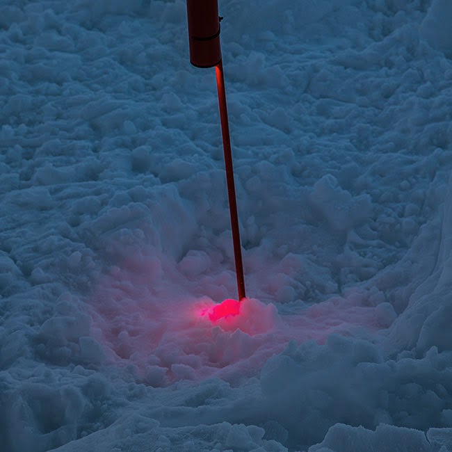
On May 4th, 2014, the Italian Limes team installed a network of solar-powered GPS units on the surface of the Similaun glacier, following a 1-km-long section of the border between Italy and Austria, in order to monitor the movements of the ice sheet throughout the duration of the exhibition at the Corderie dell’Arsenale. The geographic coordinates collected by the sensors are broadcasted and stored every hour on a remote server via a satellite connection. An automated drawing machine—controlled by an Arduino board and programmed with Processing—has been specifically designed to translated the coordinates received from the sensors into a real-time representation of the shifts in the border. The drawing machine operates automatically and can be activated on request by every visitor, who can collect a customized and unique map of the border between Italy and Austria, produced on the exact moment of his [or her] visit to the exhibition.

The drawing machine, together with the altered maps and images it produces, are thus meant to reveal “how the Alps have been a constant laboratory for technological experimentation, and how the border is a compex system in evolution, whose physical manifestation coincides with the terms of its representation.”

The digital broadcast stations mounted along the border region are not entirely unlike Switzerland’s own topographic markers, over 7,000 “small historical monuments” that mark the edge of the country’s own legal districts, and also comparable to the pillars or obelisks that mark parts of the U.S./Mexico border. Which is not surprising: mapping and measuring border is always a tricky thing, and leaving physical objects behind to mark the route is simply one of the most obvious techniques.

As the next sequence of images shows, these antenna-like sentinels stand alone in the middle of vast ice fields, silently recording the size and shape of a nation.

[Images: From Italian Limes. Photos by Delfino Sisto Legnani, courtesy of Folder].

The project, including topographic models, photographs, and examples of the drawing machine network, will be on display in the Italian Pavilion of the Venice Biennale until November 23, 2014. Check out their website for more.

Meanwhile, the research and writing that went into Glacier, Island, Storm remains both interesting and relevant today, if you’re looking for something to click through. Start here, here, or even here.

[Image: From Italian Limes. Photo by Delfino Sisto Legnani, courtesy of Folder].

Italian Limes is a project by Folder (Marco Ferrari, Elisa Pasqual) with Pietro Leoni (interaction design), Delfino Sisto Legnani (photography), Dawid Górny, Alex Rothera, Angelo Semeraro (projection mapping), Claudia Mainardi, Alessandro Mason (team).

Mountain View

[Image: Courtesy of the U.S. Library of Congress Prints & Photographs Division].

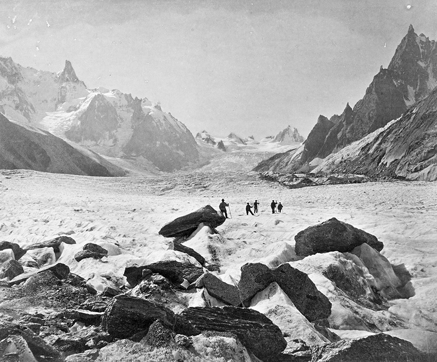
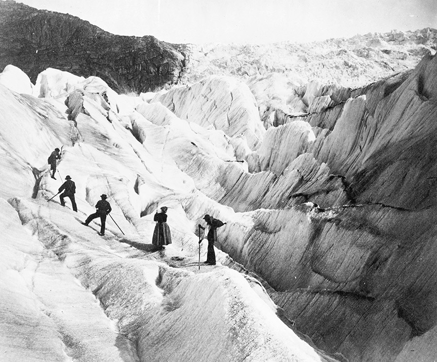
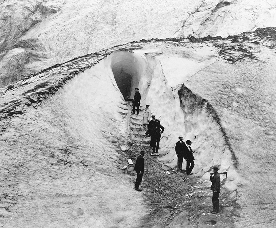
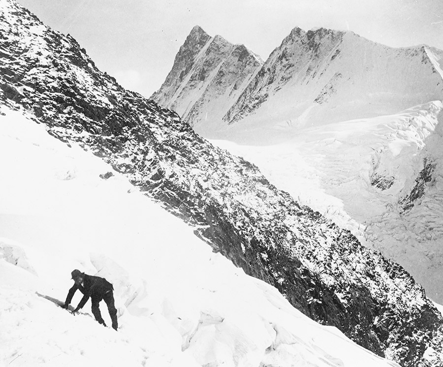
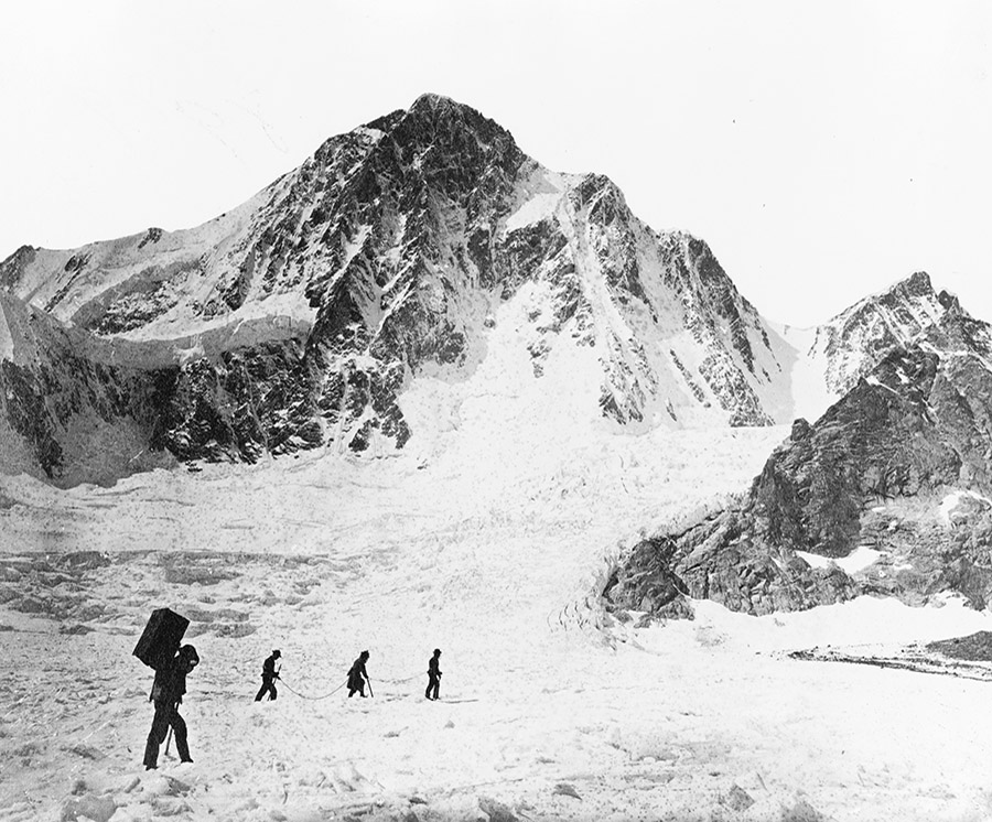
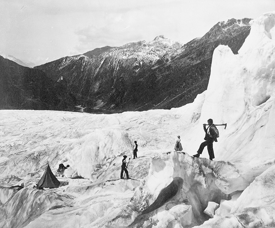
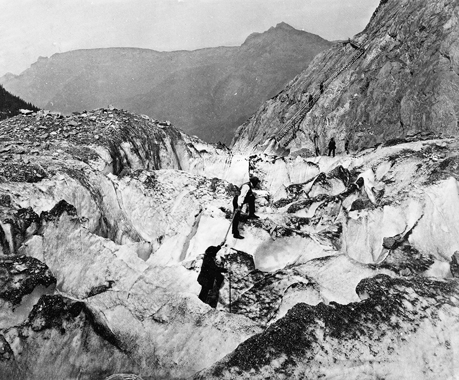
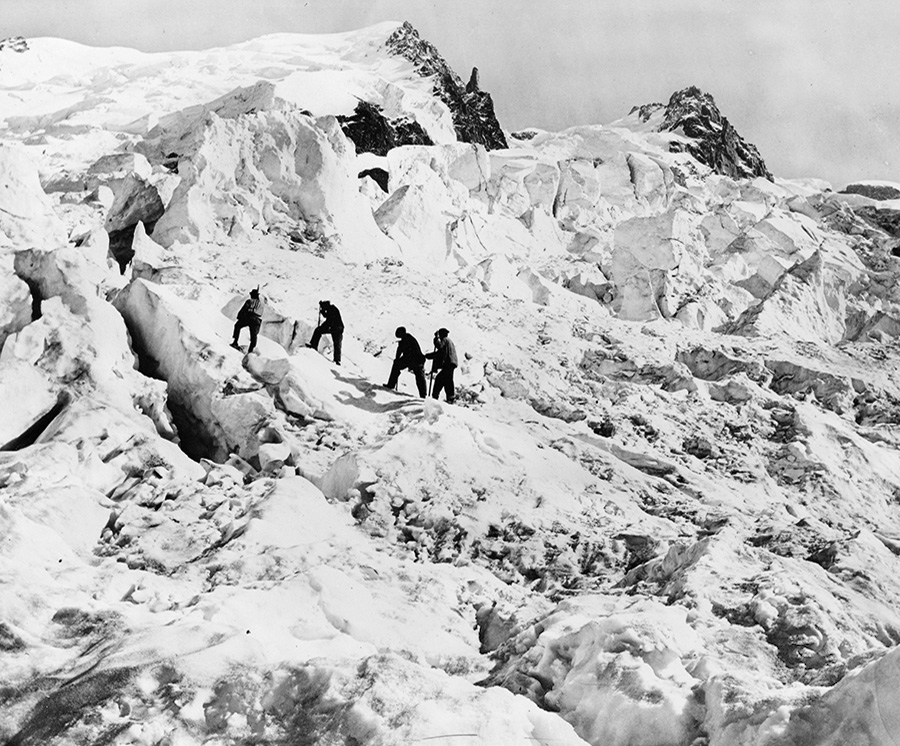
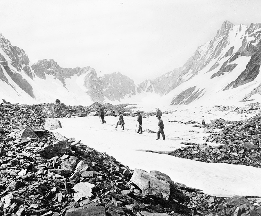
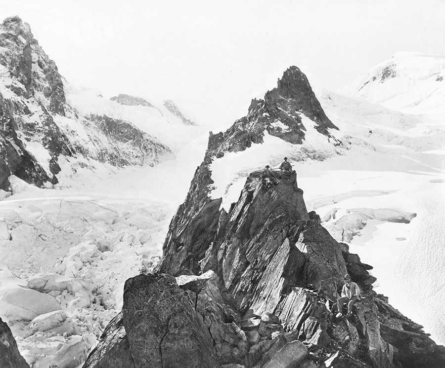
After posting several of these images in our recent Venue interview with outdoor equipment strategist Scott McGuire—easily one of my favorite interviews of late, touching on everything from civilianized military gear used in everyday hiking to REI-augmented wilderness camp sites as the true heirs of Archigram—I was so taken by their weirdly haunting views of humans wandering through extreme landscapes, dressed in 19th-century suits and top hats, carrying canes, that I thought I’d post a larger selection.

[Images: Courtesy of the U.S. Library of Congress Prints & Photographs Division].

Middle class gentlemen and ladies in hooped skirts walk into ice caves and step gingerly across the cracked, abyssal surfaces of old mountain glaciers, pointing up at things they don’t understand.

[Image: Courtesy of the U.S. Library of Congress Prints & Photographs Division].

At times, these feel almost like photos from some as-yet-unwritten Gothic horror story, perhaps a 19th-century Swiss prequel to John Carpenter’s The Thing, in which purely accidental sequences of photos—

[Images: Courtesy of the U.S. Library of Congress Prints & Photographs Division].

—imply a narrative of genial discovery, focused exploration, and eventual solo flight down the mountainside in terror.

In fact, I could easily imagine an Alpine variation on Michelle Paver’s memorably unsettling Arctic ghost novel Dark Matter set in such geologically extravagant landscapes, as humans struggle to survive, both physically and psychologically, in this encounter with an incomprehensibly over-sized landscape millions of years older than they might ever be, naively setting up camp amidst a wilderness that does not want them there.

[Images: Courtesy of the U.S. Library of Congress Prints & Photographs Division].

But then, at other times, these photos are almost like exaggerated set pieces by artists Kahn & Selesnick, whose work proposes fictional expeditions to otherworldly landscapes, missions to the moon, ancient salt cities, and more, all told through an almost unbelievably elaborate series of props, fake postcards, paintings, photographs, and more.

Like some unrealized backstory for their “Eisbergfreistadt” project, for example, or their “Circular River” expedition, men in wool vests pull one another up abstract glacial forms, as an incredible wooden staircase—if you look closely at the next image—races up the mountainside in the middle of nowhere.

[Image: Courtesy of the U.S. Library of Congress Prints & Photographs Division].

After a point, these scenes are Chaplinesque and ridiculous, like turn-of-the-century bankers who got lost on a glacier in a Modernist play.

[Image: Courtesy of the U.S. Library of Congress Prints & Photographs Division].

In any case, these all come courtesy of the U.S. Library of Congress Prints & Photographs Division, where substantially higher-res versions of each photo are available; but don’t miss the additional photos in the interview with Scott McGuire over at Venue.

[Images: Courtesy of the U.S. Library of Congress Prints & Photographs Division].