
I’ve been remiss in posting about a graduate course I’ll be co-teaching with the brilliant Nicholas de Monchaux up at UC Berkeley for the 2018-2019 academic year. The application period is currently open through December 2017.
Called “Drawing Science/Drawing Fiction: The Future of Californian Ecology,” the year-long Master’s course will be a combination of architectural design, experimental drawing methods, and narrative speculation, exploring what de Monchaux calls a “new relationship between architecture, media, ecology, and craft.”
The idea is to look ahead, not just at the future of California, but at the future of what California represents: cutting-edge industrial design, the global cinematic imagination, unparalleled demographic integration, agricultural innovation, adaptive infrastructure, and, of course, the risks of climate change.
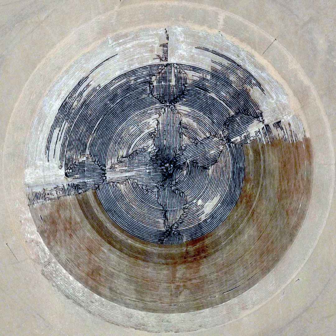
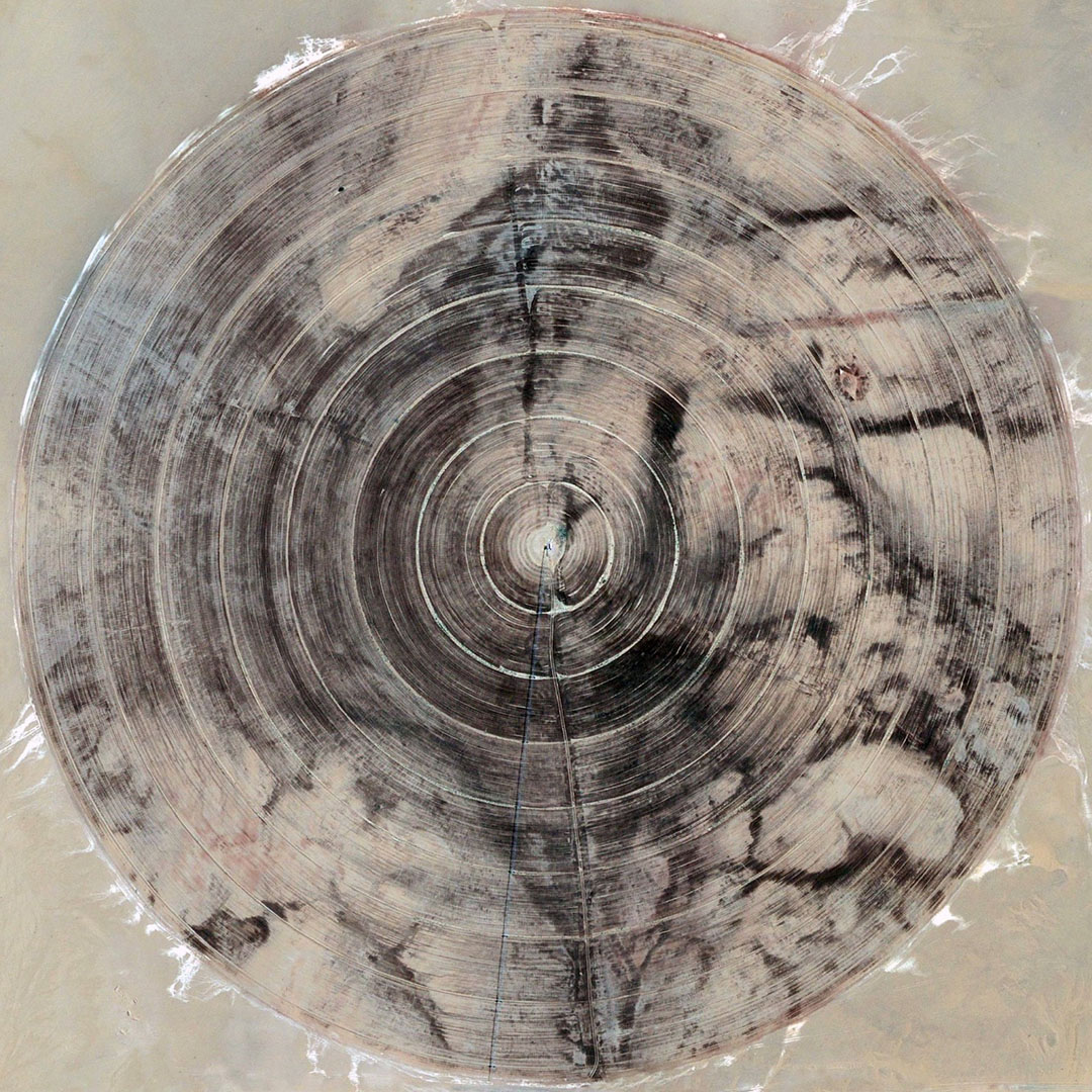
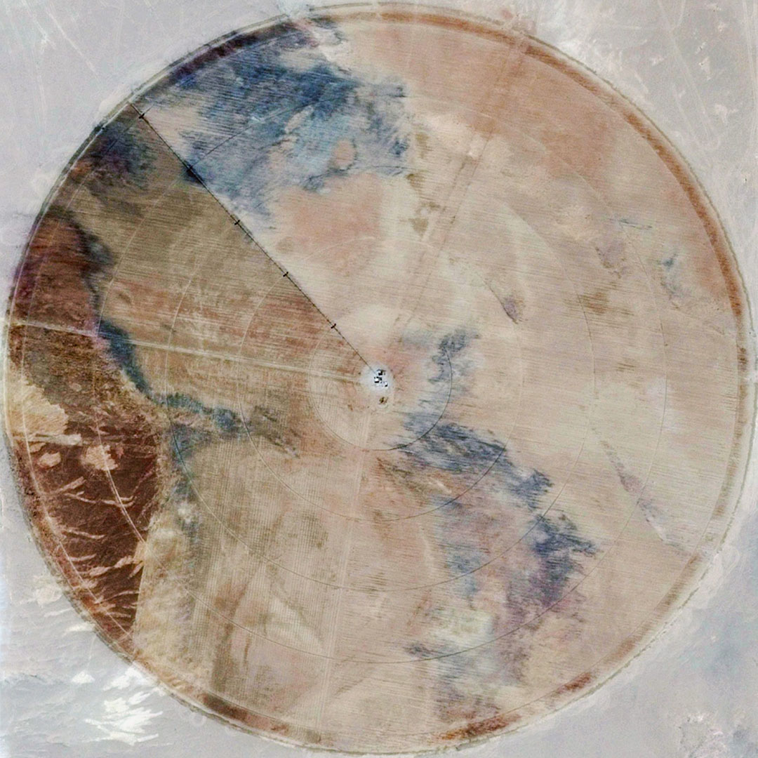
 [Image: From David Maisel’s “The Lake Project”; used with permission of the artist].
With the entire state of California at their disposal, students will be able to focus on everything from the U.S./Mexico border to the San Andreas Fault, from Silicon Valley and space tourism to the sci-fi productions of Hollywood. Agriculture, Artificial Intelligence, electric cars; species loss, wildfire, drought; policing, governance, human labor.
There are architectural scenarios to design and explore for all of these.
 [Image: California’s Ivanpah Solar Energy Generating System photographed by Ethan Miller for Getty Images, via The Atlantic].
In an interview with Boom California published in 2014, novelist Kim Stanley Robinson—who was also interviewed here on BLDGBLOG way back in 2007—commented on the science-fictional appeal of California. By the time he went to college, he remarked, the landscape of the state had fundamentally changed; it was being terraformed for human habitation by the forces of industry and suburban development.
California, he realized, was itself a design project.

 [Images: From David Maisel’s “The Lake Project”; used with permission of the artist].
Robinson explained to Boom that, in the blink of an eye, California became a “completely different landscape. At that same time I started reading science fiction (…) and it struck me that it was an accurate literature, that it was what my life felt like; so I thought science fiction was the literature of California. I still think California is a science fictional place. The desert has been terraformed. The whole water system is unnatural and artificial. This place shouldn’t look like it looks, so it all comes together for me. I’m a science fiction person, and I’m a Californian.”
Science fiction is the literature of California.
 [Image: Early rendering for Michael Maltzan’s Six Street Viaduct in Los Angeles].
Briefly, this theme was developed further by an essay by Michael Ziser published in the same issue of Boom. “Postwar science fiction is to a surprising degree a phenomenon of the western United States,” Ziser wrote. It was also quite specifically Californian.
“As the producers of Golden Age sci-fi were lured to the region by the new economic opportunities available to writers in the pulp, television, and film industries of Southern California,” Ziser continued, “they were also drawn into an imaginative relationship with California’s physical novelty as a place sprung de novo from the plans of hydraulic engineers, road builders, and tract housing developers.”
Many of the major themes of science fiction in this period—the experience of living in an arid Martian colony, the palpable sense of depending in a very direct way on large technological systems, unease with the scope and direction of the military and aeronautics industries, the navigation of new social rules around gender and race—can be read as barely veiled references to everyday life in California. For sci-fi writers, teasing out the implications of an era in which entire new civilizations could be conjured almost from nothing through astonishing feats of engineering and capital was a form of realism. They were writing an eyewitness account of what was the most radical landscape-scale engineering project in the history of the world.
This idea of an “imaginative relationship with California’s physical novelty” is something we will be exploring in architectural form throughout the Studio One experience. In the process, we will approach California itself as a subject of design and compare the state to other regions currently experiencing their own de novo re-inventions, whether it’s a thawing Arctic or China’s ongoing building boom.
 [Image: Floating caisson during the construction of the original Bay Bridge; photo by Clyde Sunderland, courtesy Library of Congress].
To develop and articulate their visions, students will be pushed to experiment with new forms of architectural representation, modeling, and drawing—or, as de Monchaux writes, “Our chief medium will be drawing, but we will engage and embrace a world of devices and tools—from scripting through mapping and virtual reality-that are changing, and expanding, the capacity of architecture to influence the world.”
I will be up in the Bay Area multiple times for this throughout the academic year, although not on a full-time basis; if you’re a fan of de Monchaux’s work, of science fiction, of architecture, of design’s potential for conjuring radical visions of landscape futures, then please consider applying. You have roughly two more months to do so.
 [Image: Farming California, via Google Maps].
More information is available over at UC Berkeley.
 [Image: Test-crash from “
 [Image: From
  [Image: Peder Balke, “
 [Image: “
 [Image: “
 [Image: From “
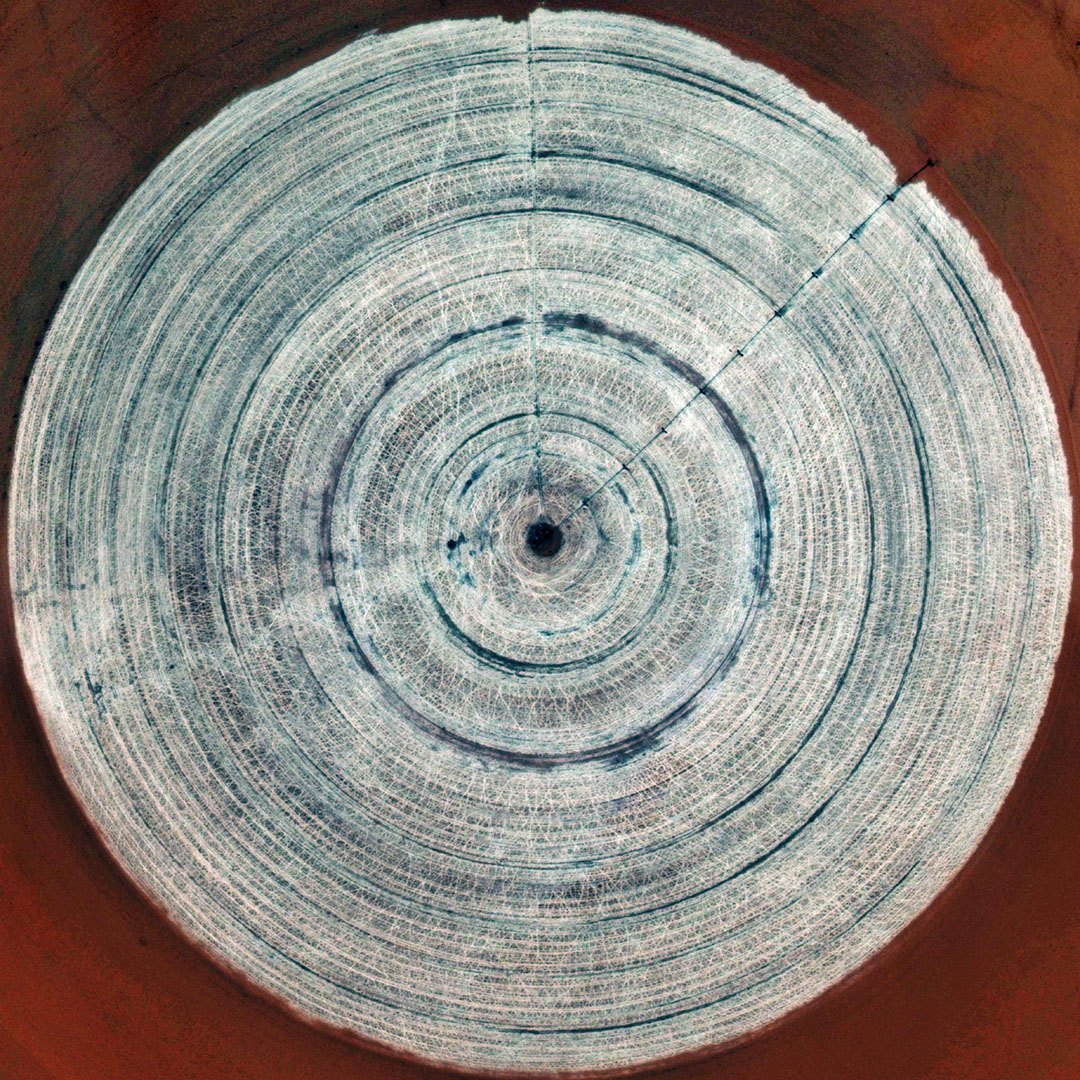 [Image: From “
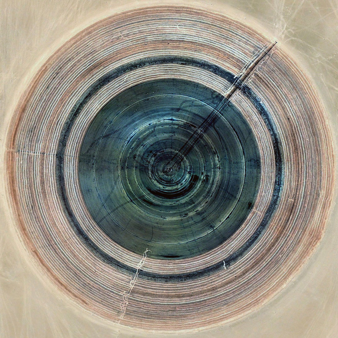
 [Images: From “
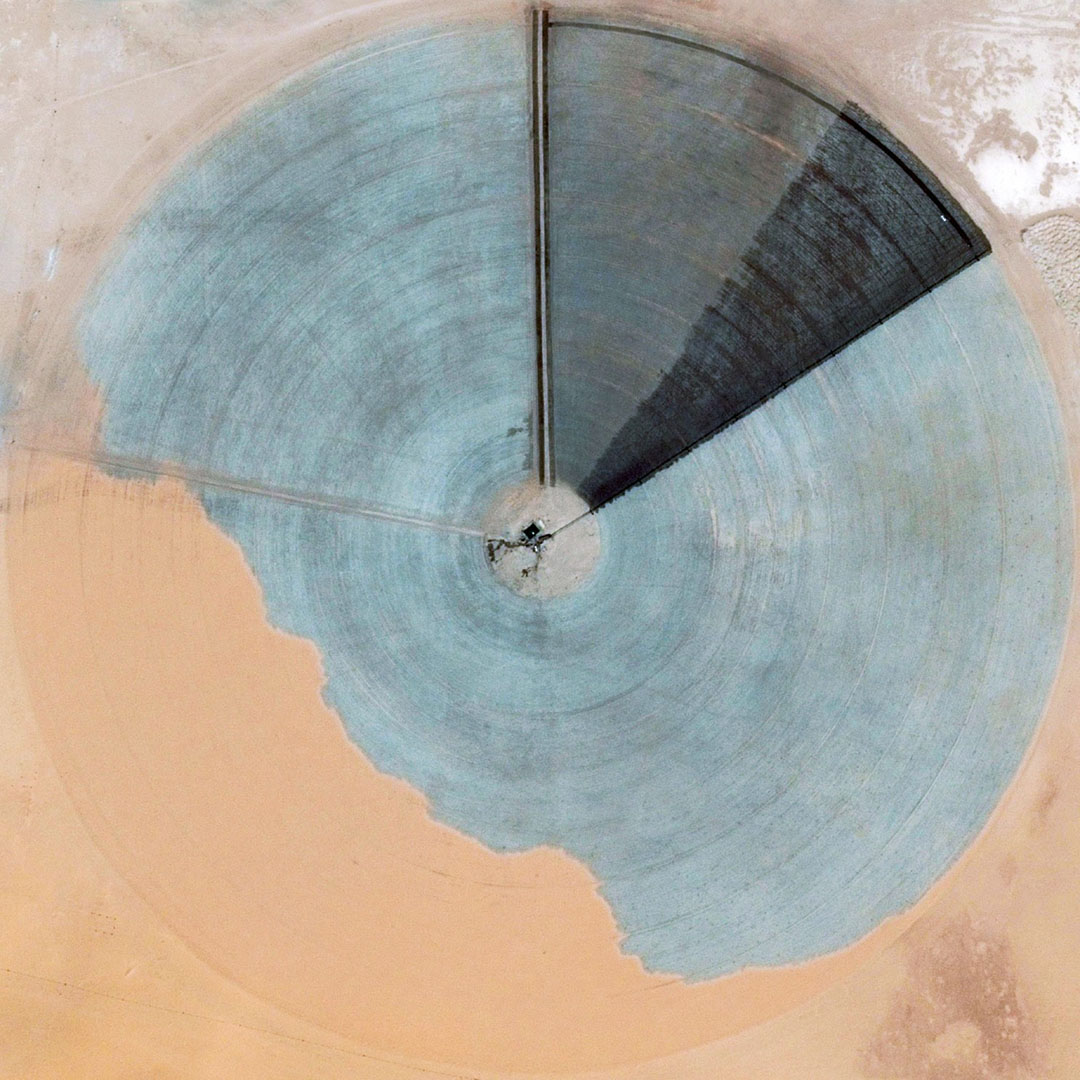 [Image: From “
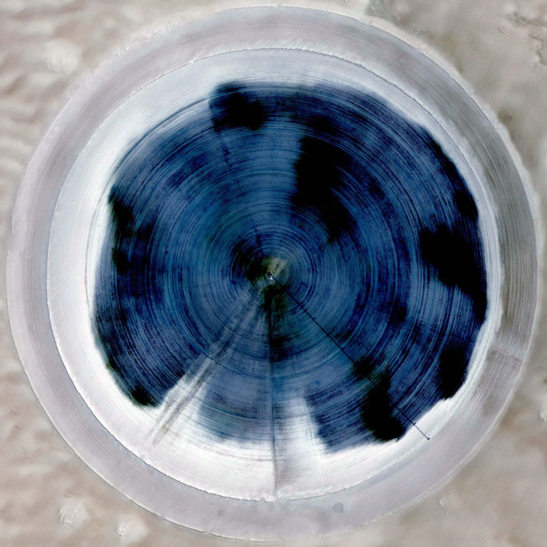 [Image: From “
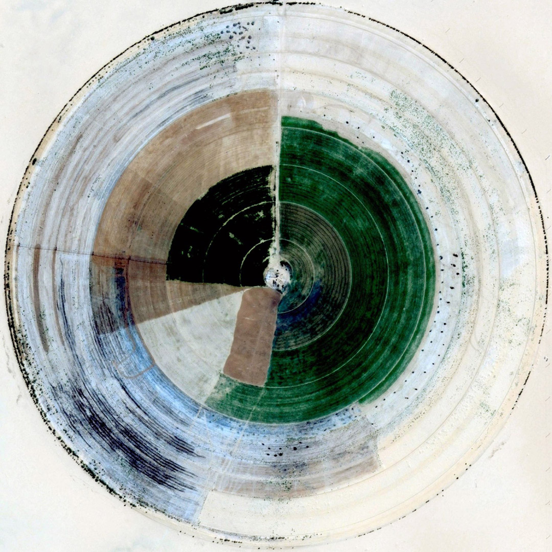 [Image: From “
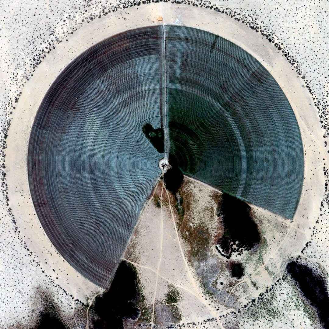
 [Images: From “
 [Image:
  [Image:
  [Image:
  [Image:
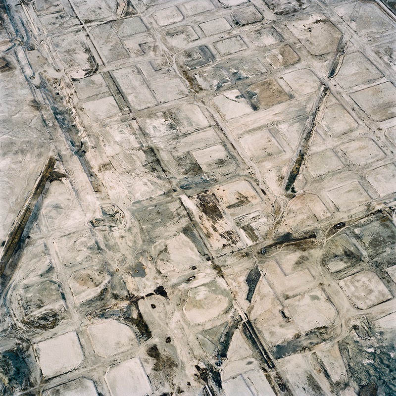
 [Images:
  [Image:
  [Image:
 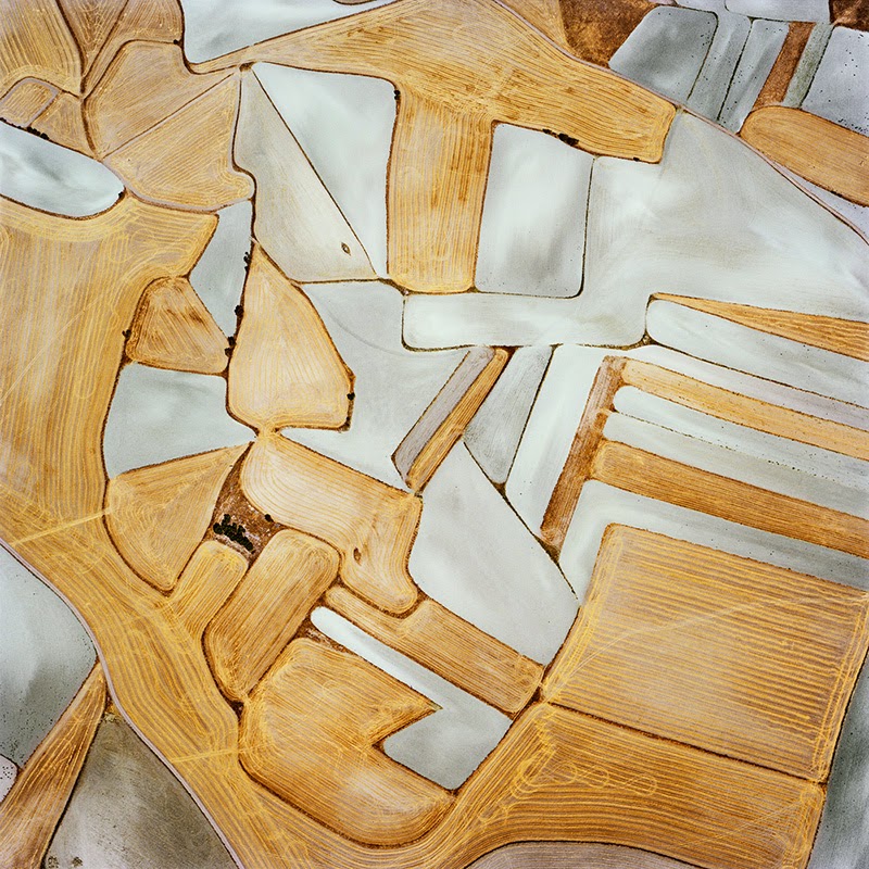 [Image:
 [Images:
 [Images:
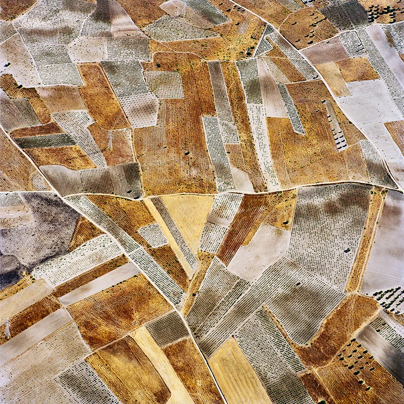
 [Images:
 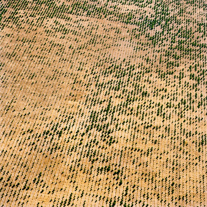 [Images:
 [Image: “Cultivating the Map” by Danny Wills].

 [Images: “Cultivating the Map” by Danny Wills].


 [Images: “Cultivating the Map” by Danny Wills].
 [Images: “Cultivating the Map” by Danny Wills].
 [Image: “Cultivating the Map” by Danny Wills].


 [Images: “Cultivating the Map” by Danny Wills].


 [Images: “Cultivating the Map” by Danny Wills].


 [Images: “Cultivating the Map” by Danny Wills].
 [Images: “Cultivating the Map” by Danny Wills].


 [Images: “Cultivating the Map” by Danny Wills].


 [Images: “Cultivating the Map” by Danny Wills].
 [Image: “
 [Image: From “
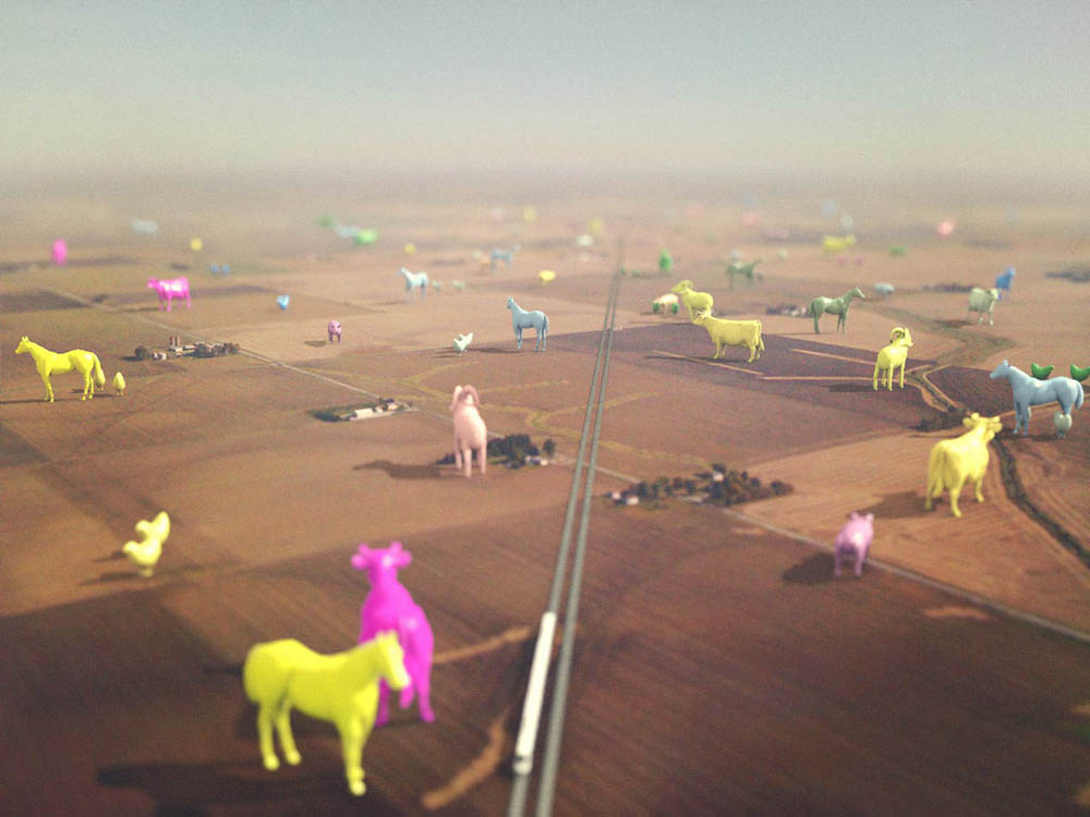 [Image: From “
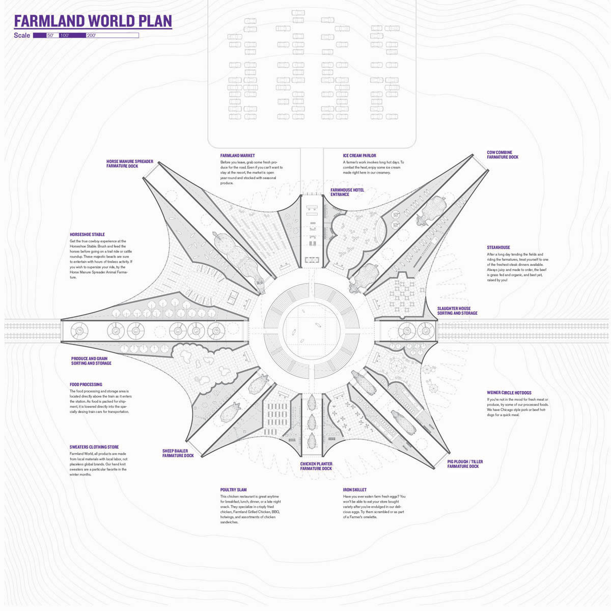 [Image: From “
 [Image: From “
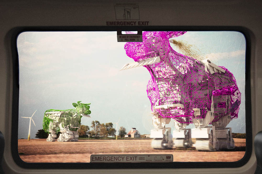
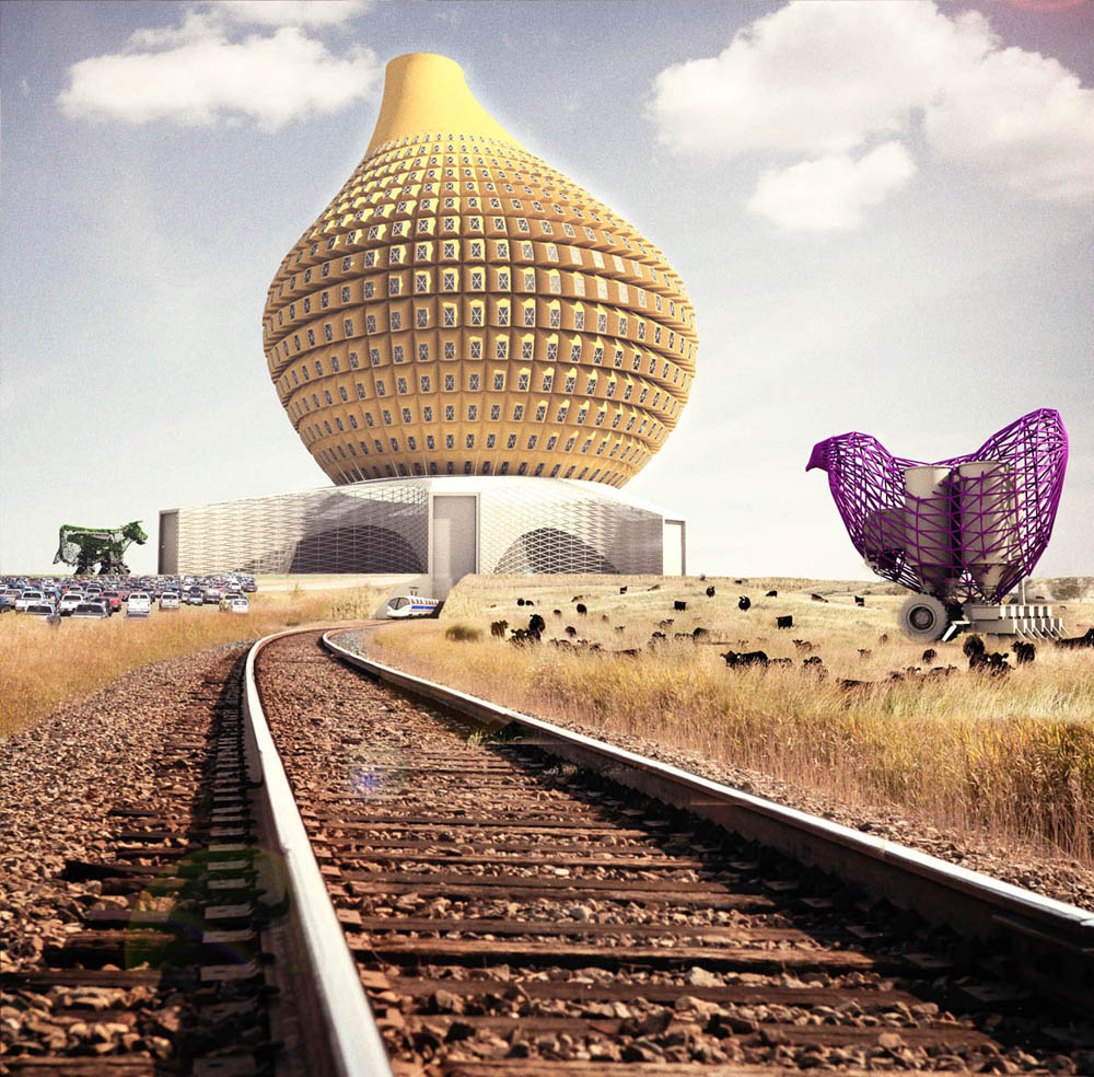
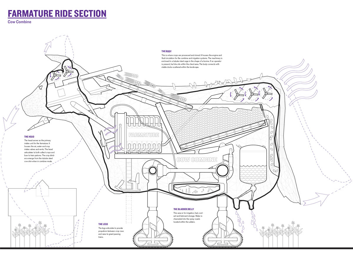 [Images: The robotic super-cows of “
 [Image: From “
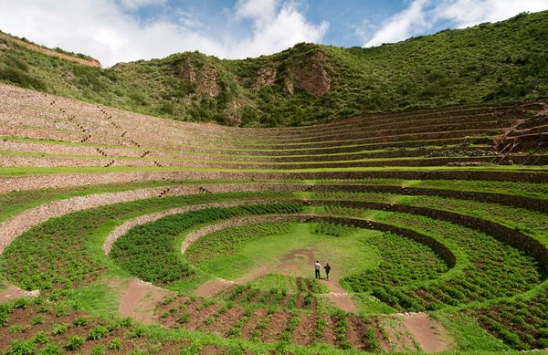 [Image: The weather bowl at Moray, Peru; photo by Ian Wood/Alamy, courtesy of
  [Image: From
 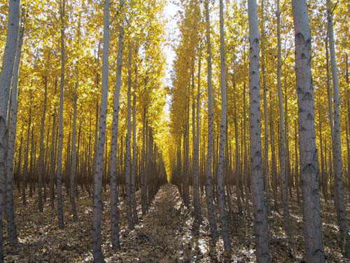 [Image: The Duplicative Forest—17,000 acres of identical trees—awaits; photo courtesy of
  [Image: Shiitake logs on racks in the Mittagong mushroom tunnel. All photos by the
  [Image: The mushroom tunnel, on the left, was originally built in 1886 to house a single-track railway line. By 1919, it had to be replaced with the still-functioning double-track tunnel to its right, built to cope with the rise in traffic on the route following the founding of
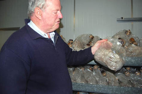

 [Images: (top) Dr. Arrold with a bag of mushroom spawn. He keeps his mushroom cultures in test-tubes filled with boiled potato and agar, and initially incubates the spawn on rye or wheat grains in clear plastic bags sealed with sponge anti-mould filters before transferring it to jars, black bin bags, or plastic-wrapped logs; (middle) Shimeji and (bottom) pink oyster mushrooms cropping on racks inside the tunnel. Dr. Arrold came up with the simple but clever idea of growing mushrooms in black bin bags with holes cut in them. Previously, mushrooms were typically grown inside clear plastic bags. The equal exposure to light meant that the mushrooms fruited all over, which made it harder to harvest without missing some].
 [Images: (top) Logs on racks (Taiwanese style) and mounted on the wall (Chinese style) in the tunnel; (bottom) Wood-ear mushrooms grow through diagonal slashes in plastic bags filled with chopped wheat straw].
 [Image: Renderings of Fabric’s “Tower of Atmospheric Relations,” showing the stacked volumes of air and the resulting climate simulations].

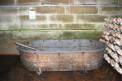 [Images: (top) Li-Sun employees unwrap mushroom logs before putting them on racks in the tunnel. The logs are made by mixing steamed bran or wheat, sawdust from thirty-year-old eucalyptus, and lime in a concrete mixer, packing it into plastic cylinders, and inoculating them with spawn. (middle) Fruiting Shiitake logs on racks in the tunnel. Once their mushrooms are harvested, the logs make great firewood. (bottom) The Shiitake log shock tank – Dr. Arrold explained that the logs crop after one week in the tunnel, and then sit dormant for three weeks, until they are “woken up” with a quick soak in a tub of water, after which they are productive for three or four more weeks. “Shiitake,” said Dr. Arrold, in a resigned tone, “are the most trouble – and the biggest market.”]


 [Images: (top) The paper cone around the top of the enoki jar helps the mushrooms grow tall and thin. (second) Chestnut mushrooms grow in jars for seven weeks: four to fruit, and three more to sprout to harvest size above the jar’s rim. (third) Thousands of mushroom jars are stacked from floor to ceiling. Dr. Arrold starting growing these mushroom varieties in jars two years ago, and hasn’t had a holiday since. (fourth) Empty mushroom jars are sterilised in the autoclave between crops, so that disease doesn’t build up. (bottom) The clean jars are filled with sterilised substrate using a Japanese-designed machine, before being inoculated with spawn].
 [Image: Temperature map of the London Underground system (via the
  [Image: A very amateur bit of Photoshop work: Li-Sun Mushrooms as packaged for Australian supermarket chain
 [Images: Shiitake logs on racks in the Mittagong mushroom tunnel].