Nature Machine

[Image: Illustration by Benjamin Marra for the New York Times Magazine].

As part of a package of shorter articles in the New York Times Magazine exploring the future implications of self-driving vehicles—how they will affect urban design, popular culture, and even illegal drug activity—writer Malia Wollan focuses on “the end of roadkill.”

Her premise is fascinating. Wollan suggests that the precision driving enabled by self-driving vehicle technology could put an end to vehicular wildlife fatalities. Bears, deer, raccoons, panthers, squirrels—even stray pets—might all remain safe from our weapons-on-wheels. In the process, self-driving cars would become an unexpected ally for wildlife preservation efforts, with animal life potentially experiencing dramatic rebounds along rural and suburban roads. This will be both good and bad. One possible outcome sounds like a tragicomic Coen Brothers film about apocalyptic animal warfare in the American suburbs:

Every year in the United States, there are an estimated 1.5 million deer-vehicle crashes. If self-driving cars manage to give deer safe passage, the fast-reproducing species would quickly grow beyond the ability of the vegetation to sustain them. “You’d get a lot of starvation and mass die-offs,” says Daniel J. Smith, a conservation biologist at the University of Central Florida who has been studying road ecology for nearly three decades… “There will be deer in people’s yards, and there will be snipers in towns killing them,” [wildlife researcher Patricia Cramer] says.

While these are already interesting points, Wollan explains that, for this to come to pass, we will need to do something very strange. We will need to teach self-driving cars how to recognize nature.

“Just how deferential [autonomous vehicles] are toward wildlife will depend on human choices and ingenuity. For now,” she adds, “the heterogeneity and unpredictability of nature tends to confound the algorithms. In Australia, hopping kangaroos jumbled a self-driving Volvo’s ability to measure distance. In Boston, autonomous-vehicle sensors identified a flock of sea gulls as a single form rather than a collection of individual birds. Still, even the tiniest creatures could benefit. ‘The car could know: “O.K., this is a hot spot for frogs. It’s spring. It’s been raining. All the frogs will be moving across the road to find a mate,”’ Smith says. The vehicles could reroute to avoid flattening amphibians on that critical day.”

One might imagine that, seen through the metaphoric eyes of a car’s LiDAR array, all those hopping kangaroos appeared to be a single super-body, a unified, moving wave of flesh that would have appeared monstrous, lumpy, even grotesque. Machine horror.

What interests me here is that, in Wollan’s formulation, “nature” is that which remains heterogeneous and unpredictable—that which remains resistant to traditional representation and modeling—yet this is exactly what self-driving car algorithms will have to contend with, and what they will need to recognize and correct for, if we want them to avoid colliding with a nonhuman species.

In particular, I love Wollan’s use of the word “deferential.” The idea of cars acting with deference to the natural world, or to nonhuman species in general, opens up a whole other philosophical conversation. For example, what is the difference between deference and reverence, and how we might teach our fellow human beings, let alone our machines, to defer to, even to revere, the natural world? Put another way, what does it mean for a machine to “encounter” the wild?

Briefly, Wollan’s piece reminded me of Robert MacFarlane’s excellent book The Wild Places for a number of reasons. Recall that book’s central premise: the idea that wilderness is always closer than it appears. Roadside weeds, overgrown lots, urban hikes, peripheral species, the ground beneath your feet, even the walls of the house around you: these all constitute “wilderness” at a variety of scales, if only we could learn to recognize them as such. Will self-driving cars spot “nature” or “wilderness” in sites where humans aren’t conceptually prepared to see it?

The challenge of teaching a car how to recognize nature thus takes on massive and thrilling complexity here, all wrapped up in the apparently simple goal of ending roadkill. It’s about where machines end and animals begin—or perhaps how technology might begin before the end of wilderness.

In any case, Wollan’s short piece is worth reading in full—and don’t miss a much earlier feature she wrote on the subject of roadkill for the New York Times back in 2010.

Spells Against Autonomy

[Image: From “Autonomous Trap 001” by James Bridle].

By now, you’ve probably seen James Bridle’s “Autonomous Trap 001,” a magic salt circle for ensnaring the sensory systems of autonomous vehicles.

By surrounding a self-driving vehicle with a mandala of inescapable roadway markings—after all, even a person wearing a t-shirt with a STOP sign on it can affect the navigational capabilities of autonomous cars—the project explores the possibility that these machines could be trapped, frozen in a space of infinite indecision, as if locked in place by magic.

[Image: From “Autonomous Trap 001” by James Bridle].

Five years from now, rogue highway painting crews well-versed in ritual magic and LiDAR sigils shut down all machine-vision systems on the west coast…

As Bridle explained to Creators, there should be at least a handful of more examples of this automotive counter-wizardry to come.

(Earlier on BLDGBLOG: Robot War and the Future of Perceptual Self-Deception. See also The Dream Life of Driverless Cars.)

Under the Bridge

Photographer Gisela Erlacher has been documenting “the spaces found hidden underneath highways and flyovers across Europe and China,” as seen in the many photos posted over at Creative Boom. “Each photograph reveals not only her own fascination with these massive concrete monstrosities, but also her interest in how they’re now being used by the people who choose to wedge themselves into these forgotten areas.”

Lost Highways

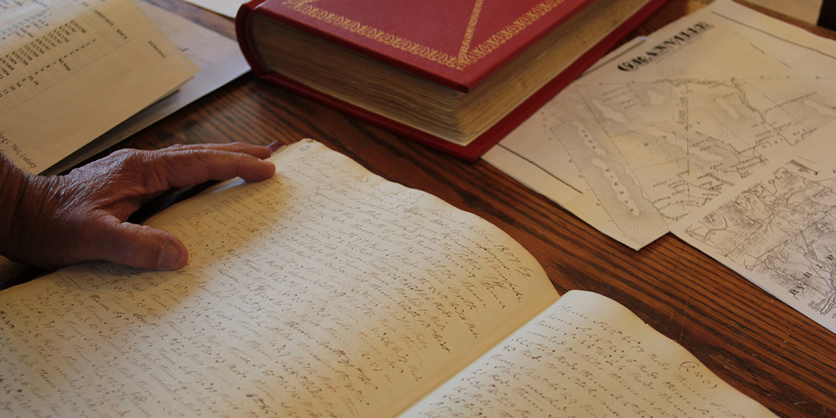
[Image: Reviewing old property deeds and land surveys; photo by Geoff Manaugh].

A story I’ve been obsessed with since first learning about it back in 2008 is the problem of “ancient roads” in Vermont.

Vermont is unusual in that, if a road has been officially surveyed and, thus, added to town record books—even if that road was never physically constructed—it will remain legally recognized unless it has been explicitly discontinued.

[Image: More Granville property deeds; photo by Geoff Manaugh].

This means that roads surveyed as far back as the 1790s remain present in the landscape as legal rights of way—with the effect that, even if you cannot see this ancient road cutting across your property, it nonetheless persists, undercutting your claims to private ownership (the public, after all, has the right to use the road) and making it difficult, if not impossible, to obtain title insurance.

Faced with a rising number of legal disputes from homeowners, Vermont passed Act 178 back in 2006. Act 178 was the state’s attempt to scrub Vermont’s geography of these dead roads.

[Image: Geographic coordinates for lost roadways; photo by Geoff Manaugh].

The Act’s immediate effects, however, were to kick off a rush of new research into the state’s lost roadways.

This meant going back through property deeds and mortgage records, dating back to the late 18th-century, deciphering old handwriting, making sense of otherwise location-less survey coordinates, and then reconciling all this with on-the-ground geologic features or local landmarks.

[Image: Zooming into survey descriptions of rods and chains; photo by Geoff Manaugh].

Not every town was enthusiastic about finding them, hoping instead that the old roads would simply disappear.

Other towns—and specific townspeople—responded with far more enthusiasm, as if finding an excuse to rediscover their own histories, the region’s past, and the lives of the other families or settlers who once lived there.

Anything they found and officially submitted for inclusion on Vermont’s state highway map would continue to exist as a state-recognized throughway; anything left undocumented, or specifically called out for discontinuance, would disappear, losings its status as a road and becoming mere landscape.

July 1, 2015, was the deadline, after which anything left undiscovered is meant to remain undiscovered.

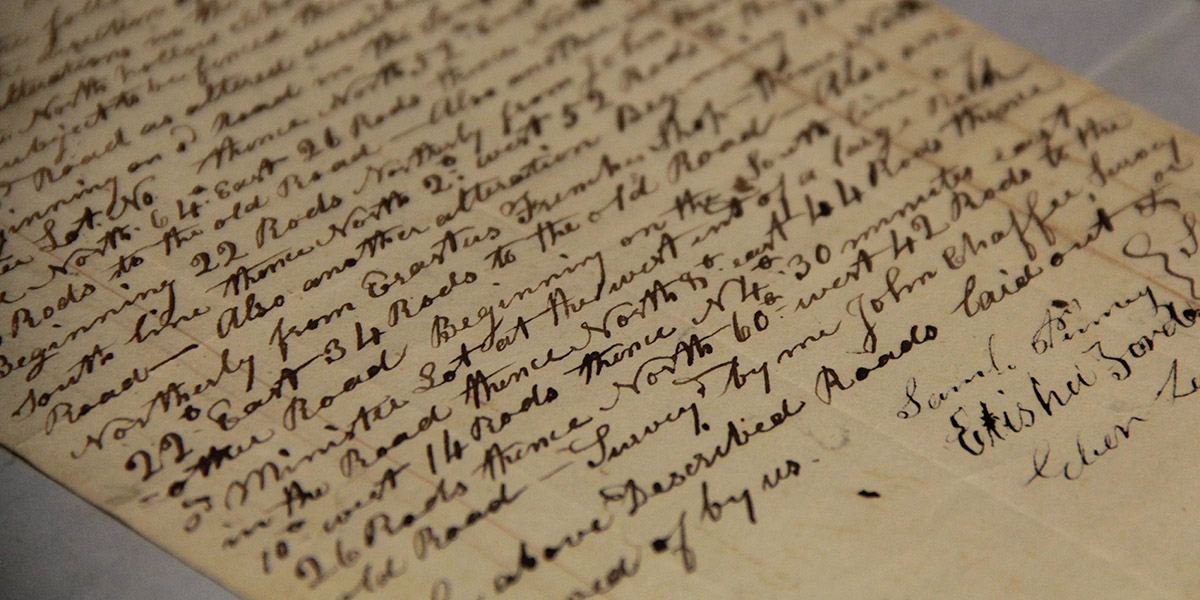
[Image: Ancient road descriptions; photo by Geoff Manaugh].

I had an amazing opportunity to visit the tiny town of Granville, Vermont, ten days ago, where I met with a retired forester and self-enlisted local historian named Norman Arseneault.

Arseneault became so involved in the search for Granville’s ancient roads that he is not only self-publishing an entire book documenting his quest, but he was also pointed out to me as an exemplar of rigor and organization by Johnathan Croft, chief of the Mapping Section at the Vermont Agency of Transportation (where there is an entire page dedicated to “Ancient Roads“).

His hunt for old roads seems to fall somewhere between Robert Macfarlane’s recent work and the old Western trail research of Glenn R. Scott.

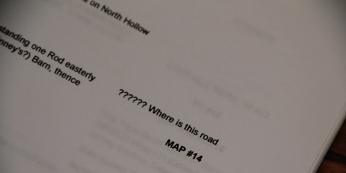
[Image: “?????? Where is this road”; photo by Geoff Manaugh].

While I was there in Granville, Arseneault took me into the town vault, flipping back through nearly 225 years of local property deeds. We then hit the old forest roads in his pick-up truck, to hike many of the “ancient roads” his research had uncovered.

I wrote up the whole experience for The New Yorker, and I have to say it was one of the more interesting article research processes I’ve ever been involved with; check it out, if any of this sounds of interest.

It’s worth pointing out, meanwhile, that the problem of “ancient roads” is not, in fact, likely to go away; the recent introduction of LiDAR data, on top of some confusingly written legal addenda, make it all but certain that other property owners will yet find long-forgotten public routes crossing their land, or that a future private development count still find its unbuilt plots placed squarely atop invisible roads made newly available to town use.

The hows and whys of this are, I hope, explained a bit more over at The New Yorker.

Striper

Speaking of the accidental artistry of colorful street markings, artist Simon Rouby became fascinated by the ongoing painting and repainting of traffic lines on the freeways and streets of Los Angeles, like some vast and unacknowledged readymade art project.

[Images: Photos by Simon Rouby for “Yellow Line“].

Could this huge urban painting apparatus be temporarily repurposed, Rouby wondered—leading him to contact Caltrans directly and embark upon a project with the rather straightforward name of “Yellow Line.”

That project, Rouby explains, introduced him “to the California Transportation ‘Striping Crew.’ I followed them while they poured miles of yellow paint onto the concrete of Los Angeles. With them I got to know the biggest and most congested network of freeways in the United States, and built my understanding of Los Angeles, a gigantic city where people meet everyday, but at 60 miles per hour on the freeways. Millions of cars per day, from which 75% drive alone, despite traffic and smog.”

“We also did canvases,” Rouby adds, “painted directly with their trucks.”

[Image: From “Yellow Line” by Simon Rouby].

Nonetheless, it’s not those canvases but the project’s most basic conceptual move—putting the Caltrans striping crews into the same context as, say, Jackson Pollack or Marcel Duchamp—that interests me the most here, implying new possibilities for interpretation, even whole new futures for art history and landscape criticism, with this recognition of avant-garde projects going on disguised as the everyday environment.

[Image: From “Yellow Line” by Simon Rouby].

Pushing this further, the transportation system itself becomes an earthworks project that dwarfs the—by contrast—embarrassingly unambitious Michael Heizer or Robert Smithson, revealing Caltrans, not Field Operations or any other white-collar design firm, as one of the most high-stakes landscape practitioners—a parallel civilization of mound builders hidden in plain sight—at work in the world today.

In any case, Simon Rouby’s “Yellow Line” is on display at the Caltrans District 7 Building—100 South Main Street, Los Angeles—until 28 September 2012.