Infrastructural Voodoo Doll

For the past few months, on various trips out west to Los Angeles, I’ve been working on an exclusive story about a new intelligence-gathering unit at LAX, the Los Angeles International Airport.

To make a long story short, in the summer of 2014 Los Angeles World Airports—the parent organization in control of LAX—hired two intelligence analysts, both with top secret clearance, in order to analyze global threats targeting the airport.

There were many things that brought me to this story, but what particularly stood out was the very idea that a piece of transportation infrastructure could now punch above its weight, taking on the intelligence-gathering and analytical capabilities not just of a city, but of a small nation-state.

It implied a kind of parallel intelligence organization created to protect not a democratic polity but an airfield. This suggested to me that perhaps our models of where power actually lies in the contemporary city are misguided—that, instead of looking to City Hall, for example, we should be focusing on economic structures, ports, sites of logistics, places that wield a different sort of influence and require a new kind of protection and security.

From the article, which is now online at The Atlantic:

Under the moniker of “critical infrastructure protection,” energy-production, transportation-logistics, waste-disposal, and other sites have been transformed from often-overlooked megaprojects on the edge of the metropolis into the heavily fortified, tactical crown jewels of the modern state. Bridges, tunnels, ports, dams, pipelines, and airfields have an emergent geopolitical clout that now rivals democratically elected civic institutions.

For me, this has incredible implications:

It might sound like science fiction, but, in 20 years’ time, it could very well be that LAX has a stronger international-intelligence game than many U.S. allies. LAX field agents could be embedded overseas, cultivating informants, sussing out impending threats. It will be an era of infrastructural intelligence, when airfields, bridges, ports, and tunnels have, in effect, their own internal versions of the CIA—and LAX will be there first.

There are obvious shades here of Keller Easterling’s notion of “extrastatecraft,” where infrastructure has come to assume a peculiar form of political authority.

As such, it also resembles an initiative undertaken by the NYPD in the years immediately following 9/11—a story well told by at least three books, Peter Bergen’s excellent United States of Jihad, Christopher Dickey’s Securing the City, and, more critically, Enemies Within by Matt Apuzzo and Adam Goldman.

However, there is at least one key difference here: the NYPD unit was operating as an urban-scale intelligence apparatus, whereas the L.A. initiative exists at the level of a piece of transportation infrastructure. Imagine the Holland Tunnel, I-90, or the M25 hiring its own in-house intel team, and you can begin to imagine the strange new powers and influence this implies.

In any case, the bulk of the piece is focused on introducing readers to the core group of people behind the program.

There is Anthony McGinty, a former D.C. homicide detective and Marine Reserve veteran, kickstarting a second career on the west coast; there is Michelle Sosa, a trilingual Boston University grad with a background in intelligence analysis; and there is Ethel McGuire, one of the first black female agents in FBI history, who undertook their hiring.

There are, of course, literally thousands of others of people involved, from baggage handlers and the LAX Fire Department to everyday travelers. LAX, after all, is a city in miniature:

At more than five square miles, it is only slightly smaller than Beverly Hills. More than 50,000 badged employees report to work there each day, many with direct access to the airfield—and thus to the vulnerable aircraft waiting upon it. More than 100,000 passenger vehicles use the airport’s roads and parking lots every day, and, in 2015 alone, LAX hosted 75 million passengers in combined departures and arrivals.

LAX is also policed like a city. The airport has its own SWAT team—known as the Emergency Services Unit—and employs roughly 500 sworn police officers, double the number of cops in the well-off city of Pasadena and more than the total number of state police in all of Rhode Island.

However, the actual space of the airport—the built landscape of logistics—is probably the main potential source of interest for BLDGBLOG readers.

For example, at the western edge of the airfield, there is an abandoned suburb called Surfridge, its empty streets and sand dunes now used as a butterfly sanctuary and as a place for police-training simulations. The runways themselves are vast symbolic landscapes painted with geometric signs that have to be read to be navigated. And then there are the terminals, currently undergoing a massive, multibillion dollar renovation campaign.

At one point, I found myself sitting inside the office complex of Gavin de Becker, an anti-assassination security expert who has worked for celebrities, foreign dignitaries, and even U.S. presidents. Protected behind false-front signage, de Becker’s hidden complex houses a full-scale airplane fuselage for emergency training, as well as ballistic dummies and a soundproofed shooting range.

I had a blast working on this piece, and am thrilled that it’s finally online. Check it out, if you get a chance, and don’t miss the speculative “case files” at the end, brief examples of what might be called infrastructural security fiction.

(Thanks to Ross Andersen and Sacha Zimmerman at The Atlantic for the edits. All images in this post from Google Maps, filtered through Instagram).

Panopticops

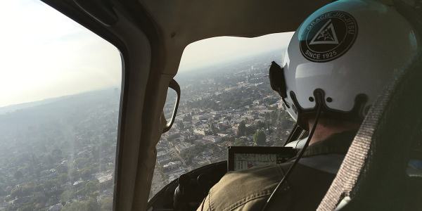
blade[Image: Flying with the LAPD Air Support Division; Instagram by BLDGBLOG].

Over the past three years, I’ve gone on multiple flights with the LAPD Air Support Division, during both the day and night; my goal was to understand how police see the city from above.

freeway-webside-web[Image: Freeways and escape routes; Instagrams by BLDGBLOG].

Does the aerial view afford new insights into how distant neighborhoods are connected, for example, or how criminals might attempt to hide—or flee—from police oversight? Where are these other, illicit routes and refuges?

More importantly, are they temporary accidents of criminal behavior and urban geography, or are they much deeper flaws and vulnerabilities hidden in the city’s very design?

above-webgotaltitude-web[Images: Instagrams by BLDGBLOG].

Aerial patrols seems to promise a ubiquitous, and near-omniscient, amplification of police vision, even as the fabric of the city itself is put to alternative use by the activities of criminals.

I documented these flights through hundreds of photographs—many of which can be seen here—as well as in my forthcoming book, A Burglar’s Guide to the City.

However, an excerpt of that book has also been adapted for this weekend’s New York Times Magazine, including a look at Thomas More’s Utopia in the context of the LAPD, the navigational “rules of four,” and a look at the array of technical devices installed aboard each police helicopter.

screen-webdashboard-web[Images: Inside the airship; Instagrams by BLDGBLOG].

The “rules of four,” for example, as I write in the piece, are “guidelines [that] fall somewhere between a rule of thumb and an algorithm, and they allow for nearly instantaneous yet accurate aerial navigation.”

“The way the parcels work in the city of Los Angeles,” [LAPD Chief Tactical Flight Officer Cole Burdette explained to me], “is that Main Street and First Street are the hub of the city.” The street numbers radiate outward — by quadrant, east, west, north, south — with blocks advancing by hundreds (the 3800 block below 38th Street) and building numbers advancing by fours (3804, 3808, 3812, etc.). The rest is arithmetic.
(…)
With the rules of four, an otherwise intimidating and uncontrollable knot of streets takes on newfound clarity. It is no coincidence that the Los Angeles Police Department built its main headquarters at the center of it all, at the intersection of First and Main. It placed the department at the numerological heart of the metropolis, the zero point from which everything else emanates.

What fascinates me through all of this is how the city can be used as a tool of police authority, a seemingly endless crystalline grid of numbers and addresses continually re-scanned from above by helicopter—

binocs-webbinoculars-webshoulder-web[Image: Watchers; photo by BLDGBLOG].

—yet, at the same time, the city can also be manipulated from below, against those same figures of aerial power, becoming an instrument of criminal evasion and spatial camouflage.

matrix-web[Image: Night flight across the grid; Instagram by BLDGBLOG].
The very notion of the “getaway route” is revealing here for what it implies about a city’s secondary use as a means of escape, offering hidden lines of flight from figures of authority.

In the book, I explore this a bit more through, among other things, the work of Grégoire Chamayou, including his research into the history of manhunts and his brief look at the speculative re-design of Paris as a kind of immersive police catalog in which “every move will be recorded.”

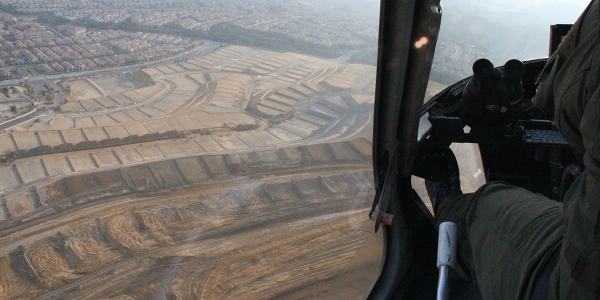
subdivision-websuburbs-web[Image: Over Porter Ranch and the San Fernando Valley; photos by BLDGBLOG].

Paris, Chamayou writes, “was to be divided into distinct districts, each receiving a letter, and each being subdivided into smaller sub-districts.”

In each sub-district each street had accordingly to receive a specific name. On each street, each house had to receive a number, engraved on the front house—which was not the case at the time. Each floor of each building was also to have a number engraved on the wall. On each floor, each door should be identified with a letter. Every horse car should also bear a number plate. In short, the whole city was to be reorganized according to the principles of a rationalized addressing system.

In that context, the Air Support Division’s “rules of four” as a police-navigation strategy take on a particularly interesting nuance—as do hypothetical means of resistance to police power through the deliberate complication of local addressing systems.

mapping-webbanking-webpanopticops-web[Images: Moving maps and binoculars over L.A.; Instagrams by BLDGBLOG].

The book excerpt in the Times also briefly picks up on some themes elaborated in an article I wrote for Cabinet Magazine a few years ago, discussing how the infrastructure of Los Angeles itself inadvertently permits certain classes of criminal activity.

turning-web[Image: Night flying; photo by BLDGBLOG].

The most obvious example of this unintended side-effect of transportation planning is the so-called “stop-and-rob.” From The New York Times Magazine:

The construction of the city’s freeway system in the 1960s helped to instigate a later spike in bank-crime activity by offering easy getaways from financial institutions constructed at the confluence of on-ramps and offramps. This is a convenient location for busy commuters—but also for prospective bandits, who can pull off the freeway, rob a bank and get back on the freeway practically before the police have been alerted. The maneuver became so common in the 1990s that the Los Angeles police have a name for it: a “stop-and-rob.”

In any case, the book obviously elaborates on these themes in much greater length—and it comes out next week, so please consider pre-ordering a copy—but The New York Times Magazine excerpt is a great place to start.

points-web[Image: Somewhere over the San Fernando Valley; Instagram by BLDGBLOG].

Meanwhile, if you yourself are planning any illicit activities, as an added bonus the article includes insights from Air Support Division pilots and tactical flight officers on the limitations of their own surveillance techniques, such as how the streets around Los Angeles International Airport have become a popular hiding spot for criminals fleeing police helicopters by car and some especially unlikely tactics used to evade thermal detection by the LAPD’s Forward-Looking Infrared or FLIR cameras.

When in doubt—although this is not mentioned in the article—drive into the fog, where the helicopters can’t follow you.

horizon-web[Image: Urban horizon lines; Instagram by BLDGBLOG].
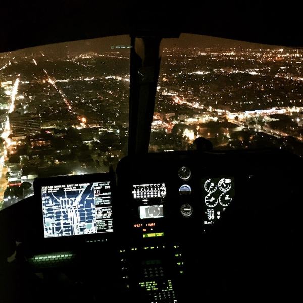
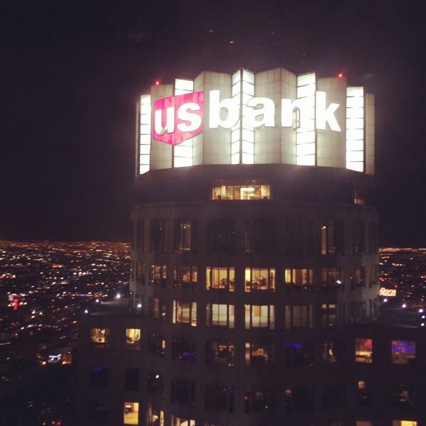
For now, here are a bunch of photos, including many Instagrams, taken from July 2013 to March 2016, including night flights in January 2014 and March 2016—

cockpit-webflying-webhollywood-webmorecityhall-webnighflight-webtennis-webbanktower-webusbank-webnickersonnight-webspot-web[Images: Night from above; photos & Instagrams by BLDGBLOG].
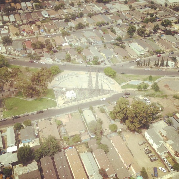
—as well as day and early evening flights taken in July 2013 and March 2016.

nickerson-webwattstowers-webgrid-webplane-web[Images: Note the shot of Watts Towers; Instagrams by BLDGBLOG].

Finally, a chunk of non-Instagram shots, in case those colored filters are making your eyes cross over.

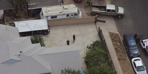
jiujitsu-webcops-webgunsdrawn-webtfo-webLAKings-weblooking-web[Images: Photos by BLDGBLOG, many featuring a home barricade call in Pacoima].

Check out the article—and let me know what you think of the book, once it’s published.

sunset-web[Image: Sunset approaching downtown L.A.; cropped Instagram by BLDGBLOG].

A Burglar’s Guide to the City

burglars
For the past several years, I’ve been writing a book about the relationship between burglary and architecture. Burglary, as it happens, requires architecture: it is a spatial crime. Without buildings, burglary, in its current legal form, could not exist. Committing it requires an inside and an outside; it’s impossible without boundaries, thresholds, windows, and walls. In fact, one needn’t steal anything at all to be a burglar. In a sense, as a crime, it is part of the built environment; the design of any structure always implies a way to break into it.

You can see burglary’s architectural connections anywhere. Watch nearly any heist film, for example, and at some point there will be an architectural discussion: inevitably, the characters will point at floor plans or lean in close to study maps, arguing over how to get from one room to another, whether or not two buildings might actually be connected, or how otherwise separate spaces and structures—sometimes whole neighborhoods—might be secretly knit together. Seen this way, heists are the most architectural genre of all.

BurglarEntersHouse[Image: “How The Burglar Gets Into Your House” (1903), via The Saint Paul Globe].

When a burglary is committed in the real world, you often see stunned business owners stammering to morning TV crews about how strange the burglars’ method of entry was. They came in through the walls or jumped down through a hole in the ceiling—or crawled in through a drop-off chute—rather than going through the front door as the rest of us would, never using buildings the way they’re supposed to be used.

This notion—that burglary, at heart, is an architectural crime—serves as the core of my new book. It comes out in less than a month, on April 5th, from FSG. It’s called A Burglar’s Guide to the City.

I’m strangely thrilled to see it’s been categorized as “Architecture/True Crime.”

Burglars-FinalCover[Image: The complete front/back cover for A Burglar’s Guide to the City, designed by Nayon Cho].

Researching A Burglar’s Guide to the City has been a fascinating process—not to mention an incredible experience. It took me up into the sky over Los Angeles with the LAPD Air Support Division to learn how police see the city, out to visit a lock-picking group in northwest Chicago to pop open some padlocks and understand the limitations of physical security, and into the heavily fortified modular “panic rooms” designed by a retired New Jersey cop.

I spoke with a Toronto burglar who learned to use his city’s fire code as a targeting mechanism for future burglaries; I talked to the woman who arrested a kind of live-in burglar nicknamed “Roofman” who, incredibly, built a fake apartment for himself inside the walls of a Toys “R” Us; and I met the retired FBI Special Agent once tasked with tracking down a crew of subterranean bank bandits who pulled off a still-unsolved bank heist in 1986 Los Angeles, involving weeks of tunneling and a detailed knowledge of the the city’s sewer system. I spoke with one of the originators of the UK’s surreal “capture house” program, where entire fake apartments are kitted out and run by the police to trap—or capture—specific burglars, and I even visited the grave of a 19th-century super-burglar who used his training as an architect to lead a crew responsible for an astonishing 80% of all U.S. bank robberies at the time.

lapd[Image: Flying with the LAPD Air Support Division; Instagram by BLDGBLOG].

The book includes tunnel jobs from ancient Rome, a survey of door-breaching tools, an interview with architect Bernard Tschumi about crime and the city, some thoughts on Die Hard, even tips for the ultimate getaway from a reformed bank robber in California, and on and on and on.

In any case, I’m genuinely excited for the Burglar’s Guide to be out in the world. I can’t wait to discuss it with readers, so please check it out if you get a chance.

Meanwhile, there will be a short book tour this April and May. Keep an eye on burglarsguide.com for more information as it develops, but, for the time being, if you’re anywhere near New York, Boston, Chicago, Los Angeles, San Francisco, Portland, Seattle, or Washington D.C., save the dates to come by and say hello.

Mossman_Invite_B_Web

The first event will be hosted by the incredible John M. Mossman Lock Collection at the General Society of Mechanics and Tradesmen of the City of New York on Tuesday, April 5, with beer provided by my friends at Sixpoint Brewery and books for sale courtesy of The Strand Book Store. Even better, Radiolab’s Robert Krulwich will be leading a live conversation about the book—and the event itself is free, although you must RSVP.

I could go on at great length—and undoubtedly will, in the weeks to come—but, for now, consider pre-ordering a copy of the book. Thanks!