Infrastructural Voodoo Doll

For the past few months, on various trips out west to Los Angeles, I’ve been working on an exclusive story about a new intelligence-gathering unit at LAX, the Los Angeles International Airport.

To make a long story short, in the summer of 2014 Los Angeles World Airports—the parent organization in control of LAX—hired two intelligence analysts, both with top secret clearance, in order to analyze global threats targeting the airport.

There were many things that brought me to this story, but what particularly stood out was the very idea that a piece of transportation infrastructure could now punch above its weight, taking on the intelligence-gathering and analytical capabilities not just of a city, but of a small nation-state.

It implied a kind of parallel intelligence organization created to protect not a democratic polity but an airfield. This suggested to me that perhaps our models of where power actually lies in the contemporary city are misguided—that, instead of looking to City Hall, for example, we should be focusing on economic structures, ports, sites of logistics, places that wield a different sort of influence and require a new kind of protection and security.

From the article, which is now online at The Atlantic:

Under the moniker of “critical infrastructure protection,” energy-production, transportation-logistics, waste-disposal, and other sites have been transformed from often-overlooked megaprojects on the edge of the metropolis into the heavily fortified, tactical crown jewels of the modern state. Bridges, tunnels, ports, dams, pipelines, and airfields have an emergent geopolitical clout that now rivals democratically elected civic institutions.

For me, this has incredible implications:

It might sound like science fiction, but, in 20 years’ time, it could very well be that LAX has a stronger international-intelligence game than many U.S. allies. LAX field agents could be embedded overseas, cultivating informants, sussing out impending threats. It will be an era of infrastructural intelligence, when airfields, bridges, ports, and tunnels have, in effect, their own internal versions of the CIA—and LAX will be there first.

There are obvious shades here of Keller Easterling’s notion of “extrastatecraft,” where infrastructure has come to assume a peculiar form of political authority.

As such, it also resembles an initiative undertaken by the NYPD in the years immediately following 9/11—a story well told by at least three books, Peter Bergen’s excellent United States of Jihad, Christopher Dickey’s Securing the City, and, more critically, Enemies Within by Matt Apuzzo and Adam Goldman.

However, there is at least one key difference here: the NYPD unit was operating as an urban-scale intelligence apparatus, whereas the L.A. initiative exists at the level of a piece of transportation infrastructure. Imagine the Holland Tunnel, I-90, or the M25 hiring its own in-house intel team, and you can begin to imagine the strange new powers and influence this implies.

In any case, the bulk of the piece is focused on introducing readers to the core group of people behind the program.

There is Anthony McGinty, a former D.C. homicide detective and Marine Reserve veteran, kickstarting a second career on the west coast; there is Michelle Sosa, a trilingual Boston University grad with a background in intelligence analysis; and there is Ethel McGuire, one of the first black female agents in FBI history, who undertook their hiring.

There are, of course, literally thousands of others of people involved, from baggage handlers and the LAX Fire Department to everyday travelers. LAX, after all, is a city in miniature:

At more than five square miles, it is only slightly smaller than Beverly Hills. More than 50,000 badged employees report to work there each day, many with direct access to the airfield—and thus to the vulnerable aircraft waiting upon it. More than 100,000 passenger vehicles use the airport’s roads and parking lots every day, and, in 2015 alone, LAX hosted 75 million passengers in combined departures and arrivals.

LAX is also policed like a city. The airport has its own SWAT team—known as the Emergency Services Unit—and employs roughly 500 sworn police officers, double the number of cops in the well-off city of Pasadena and more than the total number of state police in all of Rhode Island.

However, the actual space of the airport—the built landscape of logistics—is probably the main potential source of interest for BLDGBLOG readers.

For example, at the western edge of the airfield, there is an abandoned suburb called Surfridge, its empty streets and sand dunes now used as a butterfly sanctuary and as a place for police-training simulations. The runways themselves are vast symbolic landscapes painted with geometric signs that have to be read to be navigated. And then there are the terminals, currently undergoing a massive, multibillion dollar renovation campaign.

At one point, I found myself sitting inside the office complex of Gavin de Becker, an anti-assassination security expert who has worked for celebrities, foreign dignitaries, and even U.S. presidents. Protected behind false-front signage, de Becker’s hidden complex houses a full-scale airplane fuselage for emergency training, as well as ballistic dummies and a soundproofed shooting range.

I had a blast working on this piece, and am thrilled that it’s finally online. Check it out, if you get a chance, and don’t miss the speculative “case files” at the end, brief examples of what might be called infrastructural security fiction.

(Thanks to Ross Andersen and Sacha Zimmerman at The Atlantic for the edits. All images in this post from Google Maps, filtered through Instagram).

Landscapes of Inevitable Catastrophe

[Image: Illustration by David McConochie, courtesy of The Art Market, via The Guardian].

Last month, The Economist reported on the widespread presence of radioactive tailings piles—waste rock left over from Soviet mining operations—in southern Kyrgyzstan. Many of the country’s huge, unmonitored mountains of hazardous materials are currently leaching into the local water supply.

In a particularly alarming detail, even if you wanted to avoid the danger, you might not necessarily know where to find it: “Fences and warning signs have been looted for scrap metal,” we read.

Frequent landslides and seasonal floods also mean that the tailings are at risk of washing downriver into neighboring countries, including into “Central Asia’s breadbasket, the Fergana Valley, which is home to over 10m people… A European aid official warns of a ‘creeping environmental disaster.'”

Attempts at moving the piles have potentially made things worse, releasing “radioactive dust” that might be behind a spike in local cancers.

In addition to the sheer aesthetic horror of the landscape—a partially radioactive series of river valleys, lacking in warning signs, that writer Robert Macfarlane would perhaps call “eerie,” a place where “suppressed forces pulse and flicker beneath the ground and within the air… waiting to erupt or to condense”—it’s worth noting at least two things:

One, there appears to be no end in sight; as The Economist points out, the neighboring countries “are hardly on speaking terms, so cross-border co-operation is non-existent,” and the costs of moving highly contaminated mine waste are well out of reach for the respective governments.

This means we can more or less confidently predict that, over the coming decades, many of these tailings piles will wash away, slowly but relentlessly, fanning out into the region’s agricultural landscape.

Once these heavy metals and flecks of uranium have dispersed into the soil, silt, and even plantlife, they will be nearly impossible to re-contain; this will have effects not just over the span of human lifetimes but on a geological timescale.

Second, most of these piles are unguarded: unwatched, unmonitored, unsecured. They contain radioactive materials. They are in a region known for rising religious extremism.

Given all this, surely finding a solution here is rather urgent, before these loose mountains of geological toxins assume an altogether more terrifying new role in some future news cycle—at which point, in retrospect, articles like The Economist‘s will seem oddly understated.

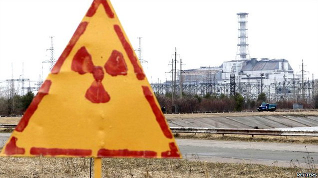
[Image: Hand-painted radiation sign at Chernobyl, via the BBC].

Indeed, our ability even to comprehend threats posed on a geologic timescale—let alone to act on those threats politically—is clearly not up to the task of grappling with events or landscapes such as these.

To go back to Robert Macfarlane, he wrote another article earlier this year about the specialized vocabulary that has evolved for naming, describing, or cataloging terrestrial phenomena. By contrast, he suggests, we now speak with “an impoverished language for landscape” in an era during when “a place literacy is leaving us.”

As Macfarlane writes, “we lack a Terra Britannica, as it were: a gathering of terms for the land and its weathers—terms used by crofters, fishermen, farmers, sailors, scientists, miners, climbers, soldiers, shepherds, poets, walkers and unrecorded others for whom particularised ways of describing place have been vital to everyday practice and perception.”

Channeling Macfarlane, where is the vocabulary—where are our cognitive templates—for describing and understanding these landscapes of long-term danger and slow catastrophe?

It often seems that we can stare directly into the wasteland without fear, not because there is nothing of risk there, but because our own words simply cannot communicate the inevitability of doom.

Out of the Mountains

[Image: David Kilcullen, from Out of the Mountains].

Military strategist David Kilcullen was in New York City earlier this week to talk about the future of urban warfare at the World Policy Institute. I tagged along to learn more about “future conflicts and future cities,” as Kilcullen describes it, and to see what really happens when urban environments fail: when cities fall apart or disintegrate into ungovernable canyons of semi-derelict buildings ruled by cartels, terrorist groups, and paramilitary gangs.

Kilcullen’s overall thesis is a compelling one: remote desert battlegrounds and impenetrable mountain tribal areas are not, in fact, where we will encounter the violence of tomorrow. For Kilcullen—indeed, for many military theorists writing today—the war in Afghanistan was not the new normal, but a kind of geographic fluke, an anomaly in the otherwise clear trend for conflicts of an increasingly urban nature.

The title of Kilcullen’s book—Out of the Mountains—suggests this. War is coming down from the wild edges of the world, driving back toward our lights and buildings from the unstructured void of the desert, and arriving, at full force, in the hearts of our cities, in our markets and streets. The recent siege in Nairobi and the Mumbai attacks, to name only two examples that came up in Kilcullen’s discussion, are evidence of the urbanization of violence and war. 

But if cities—particularly in the world’s coastal, developing regions—are a hotbed for future aggression, as Kilcullen and other military theorists suggest, then is it possible that we could somehow design away this growing problem? Kilcullen, a former soldier with the Australian military, said repeatedly that there is no military solution here. If we want to war-proof our cities, so to speak, then we’ll need more than guns and ammo.

So violence is coming down out of the mountains, Kilcullen explained, and it is taking root in the spaces of everyday life, in cities and suburbs where both infrastructure and governance have failed. This is the “future environment” or operational theater that military planners both fear and rigorously prepare for, one populated by feral cities—one of my favorite phrases of all time, coined in 2003 by Richard Norton—dystopian urban wastelands ruled over by loose constellations of gangs.

However, these same military planners are not the ones who should be most closely focused on the darkening horizon: rather, Kilcullen emphasized, we need to push civilian designers and professionals into thinking about “urban environments that are dramatically under stress,” as he phrased it during his talk. 

Kilcullen’s own professional role—a member of the executive team at Caerus Associates, a “strategy and design firm” working with architects and urban planners from its base in Washington D.C.—is, in and of itself, a vote of confidence in a non-military solution. “We help clients understand and thrive in complex, conflict-afflicted, and disaster-affected environments,” they write. 

[Image: David Kilcullen, from Out of the Mountains].

An articulate and precise speaker—his somewhat menacing message, of overpopulated cities trapped in death spirals, tempered only slightly by a soothing and intact Aussie accent—Kilcullen outlined where the cities of the world are going, how violence is following them, and where this conflict comes from in the first place. There were multiple take-aways. 

Crime is Warfare on Another Scale

There has been “a blurring of the distinction between crime and warfare” in urban environments, he pointed out. Armed gangs and paramilitary terrorist groups are blurring together. Look no further than cartel violence in northern Mexico and you can see that a sufficiently organized criminal is no different than a warlord.

We might say that a large enough crime spree is indistinguishable from an insurgency—a revolution against order in the city.

Feral Suburbs

It is not always correct to call these environments “cities,” on the other hand, nor to assume that all of the violence is, in fact, truly “urban”—rather, much of these conflicts are bred in what Kilcullen described as “diffuse” environments, or informal settlements on the “peri-urban” edge of the metropolis.

So, while we might say feral cities or cities gone wild, the problem is actually the violence of the diffuse and the decentered—the disorganized and the anti-urban—unexpectedly popping up in the city core.

Urban Embassies

We need to move beyond the nation-state and to think, instead, at the level of cities. Kilcullen here made the observation that, rather than having an India desk or an Egypt desk, for example, whether at a major newspaper or in the U.S. State Department, we should think much more specifically: assigning groups of analysts to particular conurbations for their unique urban needs. A Mumbai desk, a Nairobi desk.

As but one example, Kilcullen mentioned the NYPD has established what are, in effect, “New York embassies,” in Kilcullen’s words, in cities abroad. These overseas branches of the New York Police Department form a global circuit of city-to-city intelligence gathering operations; these are important sources of coordination and local expertise, both more subtle and far cheaper than a military operation.  

Even beyond this, Kilcullen emphasized the growing political importance of cities, as administrative units, and the urgency with which we need to understand their functioning. His analysis also suggests a new and surprising geopolitical actor in the world: the mayor. The mayor of a mega-city like New York can be far more important on the international stage than even the leader of a nation-state, and the city itself—whether it’s Lagos or Mexico City—can often punch far above the weight of the nation-state it’s found within. 

Failure From Above

During the Q&A, Kilcullen briefly mentioned the work of Crisis Mappers, who have developed tools for visually analyzing urban form using satellite photos. According to Kilcullen, they are able to do this with an astonishing degree of accuracy, diagnosing what parts of cities seem most prone to failure. Whether this is due to empty lots and abandoned buildings or to infrastructural isolation from the rest of the city, the factors that determine “ferality” in the built environment is a kind of aerial application of the Broken Windows theory.

The implication—conceptually fascinating, but by no means convincing, at least for me—was that we could, in theory, develop a visual algorithm for identifying environments tending toward failure, and thus find a way to intervene before things truly fall apart. Teams of architects with their own dedicated satellites could thus scan the cities of the world from above, algorithmically identifying urban regions prone to collapse, then intervening with a neighborhood redesign. It sounds great—it’s very high-tech and would make a great comic book—but it seems highly unlikely as the true way forward.  

In the end, then, it was this larger notion of “intervening” that became the elephant in the room. How is it to be done? What is intervention in the first place? How do we de-stress an urban landscape through design?

Again, this is something not achieved by blowing things up with cruise missiles, Kilcullen made clear, but by reorganizing the city, strengthening local lines of communication and governance, and treating urban planning as an alternative to war. 

In any case, Kilcullen himself is a better advocate of his ideas, and his book is a better place to start, delving into all of the above points in greater detail (and including further examples, such a series of drug raids in Kingston, Jamaica, and their spatial legacy in British colonialism).  

(This post originally appeared on Gizmodo; reproduced with permission.)

Impact / Collapse

[Image: A ghostlike “sonographic image” taken from part of Mark Bain’s sound file].
On the 10th anniversary of the 9/11 attacks, sound artist Mark Bain has released the full audio file of the sound of the Twin Towers collapsing, a melancholic howl terrestrially amplified by the region’s geology. You can listen to it here:

What you’re hearing is the “audification of the seismological data record,” as Bain explains it, “which occurred in the area of New York State, New Jersey, and New England during the collapse of the World Trade Center buildings on September eleventh, 2001.”

The data streams were acquired from Columbia University’s Geological survey lab, which run a network of earth monitoring stations in the area; with the closest being 34 km away from the epicenter of the event. A process of data conversion and signal translation was used to make the normally inaudible seismic waveforms both audible and to play back in real-time as the event unfolded. No other processing or effects were added to the tracks. The registration includes four events, two impacts and the two collapses along with the inbetween sounds of the drone of the earth. The heaviest impact of the collapse registered 2.4 on the Richter scale, a signal which traveled throughout the earth.

The piece is not intended as a memorial, Bain adds, but as “a bell-like alarm denoting histories in the making.”

Cities Under Siege

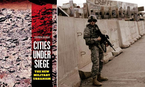
[Image: Stephen Graham’s Cities Under Siege].

In a 2003 paper for the Naval War College Review, author Richard J. Norton defined the term feral cities. “Imagine a great metropolis covering hundreds of square miles,” Norton begins, as if narrating the start of a film pitch. “Once a vital component in a national economy, this sprawling urban environment is now a vast collection of blighted buildings, an immense petri dish of both ancient and new diseases, a territory where the rule of law has long been replaced by near anarchy in which the only security available is that which is attained through brute power.”

With the city’s infrastructure having collapsed long ago—or perhaps having never been built in the first place—there are no works of public sanitation, no sewers, no licensed doctors, no reliable food supply, no electricity. The feral city is a kind of return to medievalism, we might say, back to the future of a dark age for anyone but criminals, gangs, and urban warlords. It is a space of illiterate power—strength unresponsive to rationality or political debate.

From the perspective of a war planner or soldier, the feral city is also spatially impenetrable, a maze resistant to aerial mapping. Indeed, its “buildings, other structures, and subterranean spaces, would offer nearly perfect protection from overhead sensors, whether satellites or unmanned aerial vehicles,” Norton writes.

This is something Russell W. Glenn, formerly of the RAND Corporation—an Air Force think tank based in Southern California—calls “combat in Hell.” In his 1996 report of that name, Glenn pointed out that “urban terrain confronts military commanders with a synergism of difficulties rarely found in other environments,” many of which are technological. For instance, the effects of radio communications and global positioning systems can be radically limited by dense concentrations of architecture, turning what might otherwise be an exotic experience of pedestrian urbanism into a claustrophobic labyrinth inhabited by unseen enemy combatants.

Add to this the fact that military ground operations of the near future are more likely to unfold in places like Sadr City, Iraq—not in paragons of city planning like Vancouver—and you have an environment in which soldiers are as likely to die from tetanus, rabies, and wild dog attacks, Norton suggests, as from actual armed combat.

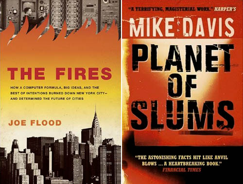
Put another way, as Mike Davis wrote in Planet of Slums, “the cities of the future, rather than being made out of glass and steel as envisioned by earlier generations of urbanists, are instead largely constructed out of crude brick, straw, recycled plastic, cement blocks, and scrap wood. Instead of cities of light soaring toward heaven, much of the twenty-first-century urban world squats in squalor, surrounded by pollution, excrement, and decay.”

But feral cities are one thing, cities under siege are something else.

[Images: The Fires by Joe Flood and Planet of Slums by Mike Davis].

In his new book Cities Under Siege, published just two weeks ago, geographer Stephen Graham explores “the extension of military ideas of tracking, identification and targeting into the quotidian spaces and circulations of everyday life,” including “dramatic attempts to translate long-standing military dreams of high-tech omniscience and rationality into the governance of urban civil society.” This is just part of a “deepening crossover between urbanism and militarism,” one that will only become more pronounced, Graham fears, over time.

One particularly fascinating example of this encroachment of “military dreams… into the governance of urban civil society” is actually the subject of a forthcoming book by Joe Flood. The Fires tells the story of “an alluring proposal” offered by the RAND Corporation, back in 1968, “to a city on the brink of economic collapse [New York City]: using RAND’s computer models, which had been successfully implemented in high-level military operations, the city could save millions of dollars by establishing more efficient public services.” But all did not go as planned:

Over the next decade—a time New York City firefighters would refer to as “The War Years”—a series of fires swept through the South Bronx, the Lower East Side, Harlem, and Brooklyn, gutting whole neighborhoods, killing more than two thousand people and displacing hundreds of thousands. Conventional wisdom would blame arson, but these fires were the result of something altogether different: the intentional withdrawal of fire protection from the city’s poorest neighborhoods—all based on RAND’s computer modeling systems.

In any case, Graham’s interest is in the city as target, both of military operations and of political demonization. In other words, cities themselves are portrayed “as intrinsically threatening or problematic places,” Graham writes, and thus feared as sites of economic poverty, moral failure, sexual transgression, rampant criminality, and worse (something also addressed in detail by Steve Macek’s book Urban Nightmares). All cities, we are meant to believe, already exist in a state of marginal ferality. I’m reminded here of Frank Lloyd Wright’s oft-repeated remark that “the modern city is a place for banking and prostitution and very little else.”

In some of the book’s most interesting sections, Graham tracks the growth of urban surveillance and the global “homeland security market.” He points out that major urban events—like G8 conferences, the Olympics, and the World Cup, among many others—offer politically unique opportunities for the installation of advanced tracking, surveillance, and facial-recognition technologies. Deployed in the name of temporary security, however, these technologies are often left in place when the event is over: a kind of permanent crisis, in all but name, takes over the city, with remnant, military-grade surveillance technologies gazing down upon the streets (and embedded in the city’s telecommunications infrastructure). A moment of exception becomes the norm.

Graham outlines a number of dystopian scenarios here, including one in which “swarms of tiny, armed drones, equipped with advanced sensors and communicating with each other, will thus be deployed to loiter permanently above the streets, deserts, and highways” of cities around the world, moving us toward a future where “militarized techniques of tracking and targeting must permanently colonize the city landscape and the spaces of everyday life.”

In the process, any real distinction between a “homeland” and its “colonies” is irreparably blurred. Here, he quotes Michel Foucault: “A whole series of colonial models was brought back to the West, and the result was that the West could practice something resembling colonization, or an internal colonialism, on itself.” If it works in Baghdad, the assumption goes, then let’s try it out in Detroit.

This is just one of many “boomerang effects” from militarized urban experiments overseas, Graham writes.

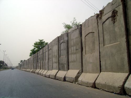
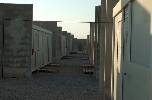
[Images: Blast walls in Iraq].

But what does this emerging city—this city under siege—actually look like? What is its architecture, its urban design, its local codes? What is its infrastructure?

Graham has many evocative answers for this. The city under siege is a place in which “hard, military-style borders, fences and checkpoints around defended enclaves and ‘security zones,’ superimposed on the wider and more open city, are proliferating.”

Jersey-barrier blast walls, identity checkpoints, computerized CCTV, biometric surveillance and military styles of access control protect archipelagos of fortified social, economic, political or military centers from an outside deemed unruly, impoverished and dangerous. In the most extreme examples, these encompass green zones, military prisons, ethnic and sectarian neighborhoods and military bases; they are growing around strategic financial districts, embassies, tourist and consumption spaces, airport and port complexes, sports arenas, gated communities and export processing zones.

Cities Under Siege also extensively covers urban warfare, a topic that intensely interests me. From Graham’s chapter “War Re-Enters the City”:

Indeed, almost unnoticed within “civil” urban social science, a shadow system of military urban research is rapidly being established, funded by Western military research budgets. As Keith Dickson, a US military theorist of urban warfare, puts it, the increasing perception within Western militaries is that “for Western military forces, asymmetric warfare in urban areas will be the greatest challenge of this century… The city will be the strategic high ground—whoever controls it will dictate the course of future events in the world.”

Ralph Peters phrased this perhaps most dramatically when he wrote, back in 1996 for the U.S. Army War College Quarterly, that “the future of warfare lies in the streets, sewers, high-rise buildings, industrial parks, and the sprawl of houses, shacks, and shelters that form the broken cities of our world.” The future of warfare, that is, lies in feral cities.

In this context, Graham catalogs the numerous ways in which “aggressive physical restructuring,” as well as “violent reorganization of the city,” is used, and has been used throughout history, as a means of securing and/or controlling a city’s population. At its most extreme, Graham calls this “place annihilation.” The architectural redesign of cities can thus be used as a military policing tactic as much as it can be discussed as a topic in academic planning debates. There are clearly echoes of Eyal Weizman in this.

On one level, these latter points are obvious: small infrastructural gestures, like public lighting, can transform alleyways from zones of impending crime to walkways safe for pedestrian use—and, in the process, expand political control and urban police presence into that terrain. But, as someone who does not want to be attacked in an alleyway any time soon, I find it very positive indeed when the cityscape around me becomes both safer by design and better policed. Equally obvious, though, when these sorts of interventions are scaled-up—from public lighting, say, to armed checkpoints in a militarized reorganization of the urban fabric—then something very drastic, and very wrong, is occurring in the city. Instead of a city simply with more cops (or fire departments), you begin a dark transition toward a “city under siege.”

I could go on at much greater length about all of this—but suffice it to say that Cities Under Siege covers a huge array of material, from the popularity of SUVs in cities to the blast-wall geographies of Baghdad, from ASBOs in London to drone helicopters in the skies above New York. Raytheon’s e-Borders program opens the book, and Graham closes it all with a discussion of “countergeographies.”

(Parts of this post, on feral cities, originally appeared in AD: Architectures of the Near Future, edited by Nic Clear).