Ten years ago, this would have been a speculative design project by SaschaPohflepp: “hyper-accumulating” plants are being used to concentrate, and thus “mine,” valuable metals from soil.
[Image: Nickel-rich sap; photo by Antony van der Ent, courtesy New York Times.]
“With roots that act practically like magnets, these organisms—about 700 are known—flourish in metal-rich soils that make hundreds of thousands of other plant species flee or die,” the New York Times reported last week. “Slicing open one of these trees or running the leaves of its bush cousin through a peanut press produces a sap that oozes a neon blue-green. This ‘juice’ is actually one-quarter nickel, far more concentrated than the ore feeding the world’s nickel smelters.”
A while back, I went on a road-trip with Edible Geography to visit some maple syrup farms north of where we lived at the time, in New York City. The woods all around us were tubed together in a huge, tree-spanning network—“forest hydraulics,” as Edible Geography phrased it at the time—as the trees’ valuable liquid slowly flowed toward a pumping station in the center of the forest.
It was part labyrinth, part spiderweb, a kind of semi-automated tree-machine at odds with the image of nature with which most maple syrup is sold.
[Images: Photos by BLDGBLOG.]
Imagining a similar landscape, but one designed as a kind of botanical mine—a forest accumulator, metallurgical druidry—is incredible.
And it’s not even a modern idea, as the New York Times points out. For all its apparent, 21st-century sci-fi, the idea of harvesting metal from plants is at least half a millennium old: “The father of modern mineral smelting, Georgius Agricola, saw this potential 500 years ago. He smelted plants in his free time. If you knew what to look for in a leaf, he wrote in the 16th century, you could deduce which metals lay in the ground below.”
This brings to mind an older post here about detection landscapes, or landscapes—yards, meadows, gardens, forests—deliberately planted with species that can indicate what is in the soil beneath them.
In the specific case of that post, this had archaeological value, allowing researchers to find abandoned Viking settlements in Greenland based on slight chemical changes that have affected which plants are able to thrive. Certain patches of flower, for example, act as archaeological indicator species, marking the locations of lost settlements.
In any case, my point is simply that vegetation can be read, or treated as a sign to be interpreted, whether by indicating the presence of archaeological ruins or by revealing the potential market-value of a site’s subterranean metal content.
Indeed, we read, “This vegetation could be the world’s most efficient, solar-powered mineral smelters,” with “the additional value of enabling areas with toxic soils to be made productive. Smallholding farmers could grow on metal-rich soils, and mining companies might use these plants to clean up their former mines and waste and even collect some revenue.” That is, you could filter and clean contaminated soils by drawing heavy-metal pollutants out of the ground, producing saps that are later harvested.
Fast-forward ten years: it’s 2030 and landscape architecture studios around the world are filled with speculative metal-harvesting plant designs—contaminated landscapes laced with gardens of hardy, sap-producing trees—even as industrial behemoths, like Rio Tinto and Barrick Gold, are breeding proprietary tree species in top-secret labs, genetically modifying them to maximize metal uptake.
Weird saps accumulate in iridescent lagoons. Autumn leaves glint, literally metallic, in the sun. Tiny metal capillaries weave up the trunks of black-wooded trees, in filigrees of gold and silver. The occasional forest fire smells not of smoke, but of copper and tin. Reclaimed timber, with knots and veins partially metallized, is used as luxury flooring in suburban homes.
Although I seem to be on a roll with linking to ScienceNews stories, this is too amazing to pass up: “People living at least 2,000 years ago near the Pacific Coast of what’s now Guatemala crafted massive human sculptures with magnetized foreheads, cheeks and navels. New research provides the first detailed look at how these sculpted body parts were intentionally placed within magnetic fields on large rocks.”
The magnetic fields were likely created by lightning strikes.
This is incredible: “Artisans may have held naturally magnetized mineral chunks near iron-rich, basalt boulders to find areas in the rock where magnetic forces pushed back, the scientists say in the June Journal of Archaeological Science. Predesignated parts of potbelly figures—which can stand more than 2 meters tall and weigh 10,000 kilograms or more—were then carved at those spots.”
It’s like a geological farm for the secondary effects of lightning. A lightning farm for real!
The mind boggles at the thought of magnetic landscape architecture, or magnetic masonry in ancient stonework, or even huge sculptures invisibly adhering to one another through magnetic forces, giving the appearance of magic.
Imagine a valley of exposed bedrock and boulders, its unusually high iron content making the rocks there attractive to lightning. Over tens of thousands of lightning strikes, the valley becomes partially magnetized, resulting in bizarre geological anomalies mistaken for the actions of a spirit world: small pebbles roll uphill, for example, or larger rocks inexplicably clump together in structurally precarious agglomerations. Stones perhaps hover an inch or two off the ground, pulled upward toward magnetic overhangs, or rocks visibly assemble themselves into small cairns, clicking into place one atop the other.
As you step into the valley, the only sound you hear is a trembling in the gravel ahead, as if the rocks are jostling for position. Your jewelry begins to float, pulling away from your wrists and chest.
[Image: Cover from An Incomplete Atlas of Stones by Elise Hunchuck].
After the Tōhoku tsunami in 2011, one of the most ominous details revealed about the coast where it struck, for those of us not familiar with the region, was that a series of warning stones stand there overlooking the sea, carved with sayings such as, “Do not build your homes below this point!”
As part of her recent thesis at the Daniels Faculty of Architecture, Landscape, and Design—a school of the University of Toronto—landscape architect Elise Hunchuck spent the summer of 2015 traveling around Japan’s Sanriku coast, documenting every available tsunami stone in photographs, maps, and satellite views, and accumulating seismic and geological data about each stone’s local circumstances.
The end result was a book called An Incomplete Atlas of Stones. It was inspired, she writes, by “a combined interest in warning systems and cartography.”
[Image: From An Incomplete Atlas of Stones by Elise Hunchuck].
“Rising from the earth,” Hunchuck writes in the book’s introduction, “many [of the warning stones] were placed in the landscape to mark either the height of the inundation line or to mark territory above the inundation line.”
They formed a kind of worst-case boundary line for where solid land meets the sea, the known limit of catastrophic inundation.
[Images: Spreads from An Incomplete Atlas of Stones by Elise Hunchuck].
The book introduces each stone taxonomically:
Each tsunami stone is introduced by its geographic coordinates: latitude, longitude, and elevation. Latitude and longitude site each stone on the surface of the earth while elevation situates each stone in relation to the mean level of the sea. The stones are further situated; first, by the boundaries of the village, town, or city they are located within; second, by their administrative prefecture; and, third, their geographical region. As each stone has been erected in response to a major tsunami, both the year and name of the tsunami is listed in addition to the stone’s relation to the inundation line (below the line, on the line, or above the line) of both its target tsunami and the tsunami of 2011. Each stone, at the time of its erection, was engraved with a message. The stones mapped in this atlas may be considered as belonging to one of two categories: as a memorial, commemorating people and places lost to an earthquake tsunami, or as a lesson, providing a description of events and directions as to where to build, where to evacuate to, and where waters have risen in the past.
Each stone or set of stones thus gets a four-page spread, giving the book a nice structural consistency.
[Images: Spreads from An Incomplete Atlas of Stones by Elise Hunchuck].
As you can also see, satellite shots are used to show the landscape at different states in time: one depicts the coastline immediately following the 2011 tsunami, the next then showing the same locatio after up to five years of rebuilding have taken place.
In some of these comparisons, seemingly nothing at all has changed; in others, it appears nearly the entire landscape has been consumed by forests.
[Images: Spreads from An Incomplete Atlas of Stones by Elise Hunchuck].
The entire book is nearly 250 pages in length, and the selections I’ve chosen here barely scratch the surface. The material Hunchuck has gathered would not only be served well by a gallery installation; the project also sets up an interesting formal precedent for other documentary undertakings such as this.
Given my own background, meanwhile—I am a writer, not an architect—I would love to see more of a reporting angle in future versions of this sort of thing, e.g. interviews with local residents, or even with disaster-response workers, connected to these landscapes through personal circumstance.
The narratives of what these stones are and what they mean would be well-illustrated by more than just data, in other words, including verbal expressions of how and why these warnings were heeded (or, for that matter, fatally overlooked).
[Images: Spreads from An Incomplete Atlas of Stones by Elise Hunchuck].
In any case, the title of Hunchuck’s book—it is an incomplete atlas—also reveals that Hunchuck is still investigating what the stones might mean and how, as a landscape architect, she might respond to them. Her goal, she writes, “is not to offer an explicit response—yet. This incomplete atlas shares the stories of seventy five places, each without a definitive beginning or end.”
[Image: Alice Aycock, “Project for Elevation with Obstructed Sight Lines” (1972)].
A few years ago, my wife and I went out to hike Breakneck Ridge when there was still a bunch of snow on the ground. It’s not, in and of itself, a hugely challenging hike, but between being ill-prepared for the slippery terrain, including a short opening scramble up snow-covered rocks, we found ourselves looking forward to the final vertical stretch before we could loop back down again to the road.
What was interesting, however, was that, from our point of view, each hill appeared to be the final one—until we got to the top of it and saw another one waiting there. Then it happened all over again: what appeared to be the final hill was actually just obstructing our view of the next one, and the next one, and the next one, and, next thing we knew, there were something like seven or eight different individual upward hikes, each hidden from view by the one leading up to it.
“Elevation with Obstructed Sight Lines” was meant to be a sculpted mound of earth, shaped for its optical effects.
[Image: Alice Aycock, “Project for Elevation with Obstructed Sight Lines” (1972), courtesy White Columns].
“Only one side of the resulting structure can be climbed,” Aycock wrote in her brief instructions for realizing the conceptual project. “All other side slopes are steep enough to deter climbing. The elevation of each successive climbing slope is determined by the sight lines of a 6 ft. observer so that only as the observer completes the ascent of a given slope does the next slope become visible.”
The piece obviously lends itself quite well to Kafka-esque metaphors—this structure that deliberately hides itself from view, never once perceptible in its totality but, instead, always revealing more of itself the further you go.
However, it also interestingly weds conceptual land art with hiking—that is, with embodied outdoor athleticism, rather than detached aesthetic contemplation—implying that, perhaps, trail design is an under-appreciated venue for potential conceptual art projects, where a terrain’s symbolic power only becomes clear to those engaged with hiking it.
Here’s another project from the RIBA President’s Medals, this one by Alexis Quinteros Salazar, a student at the University of Chile in Santiago.
Called “Mining Cenotaph,” it imagines an “occupation” of the tailings piles that have become a toxic urban landmark and a spatial reminder of the region’s economic exploitation.
A museum would be carved into the tailings; in Salazar’s words, this would be a “building that captures the history and symbolism behind mining, enhancing and revitalizing a memory that is currently disaggregated and ignored and has a very high touristic potential.”
In an architectural context such as this, the use of the word “cenotaph” is a pretty clear reference to Étienne-Louis Boullée’s classic speculative project, the “Cenotaph for Newton.” Over multiple generations, that has become something of a prime mover in the history of experimental architectural design.
Punctured walls and ceilings bring light into the interior—
—while the roof is a recreational space for visitors.
Of course, there are a lot of unanswered questions here—including the control of aerosol pollution from the tailings pile itself and that pile’s own long-term structural stability—but the poetic gesture of a public museum grafted into a pile of waste material is worth commending.
The detail I might like this most is where the structure becomes a kind of inversion of Boullée’s dome, which was pierced to make its huge interior space appear illuminated from above by constellations. Here, instead, it is the perforations in the the rooftop that would glow upward from below, as if in resonance with the night skies high above.
Salazar’s project brings to mind a few other proposals seen here over the years, including the extraordinary “Memorial to a Buried Village” by Bo Li and Ge Men, as well as Brandon Mosley’s “Mine Plug” (which actually took its name retroactively from that BLDGBLOG post).
[Image: Photo by Martin Siegel/Society of Maritime Archaeology, via Der Spiegel].
In 2012, German archaeologists began posting interpretive signs underwater, marking shipwrecks and even crashed airplanes at the bottom of the Baltic Sea as if they are in a museum, in order to make it clear to potential vandals, reckless tourists, and amateur collectors that these are culturally important sites, worthy of preservation.
“Alarmed at the looting of historically valuable shipwrecks in the Baltic Sea,” Der Spiegel reported at the time, “German archaeologists have started attaching underwater signs designating them as protected monuments. Hobby divers and trophy hunters are damaging a precious maritime legacy stretching back thousands of years, they warn.”
The sunken ship seen in the above image, for example, is just one of “some 1,500 marine monuments strewn across the seabed along the coast. The area has a wealth of well-preserved shipwrecks, lost cargo planes and even ancient settlements submerged through subsidence and rising water levels.” That these can be described as monuments is very important: they are not mere wreckage, scattered over the seabed, but artifacts on display for those who can reach them.
[Image: Photo by Martin Siegel/Society of Maritime Archaeology, via Der Spiegel].
The effect is strangely evocative, as if an architectural experiment has been going on beneath the waves of the Baltic Sea for the last few years, in which a museum, entirely without walls and seemingly with only very few visitors, has been secretly installed and constructed. It is a distributed, nonlinear museum of European ruins barely visible in the rising sea.
What’s so interesting from an architectural standpoint, however, is how a group of signs such as these can have such a huge narrative and spatial effect, as if you’ve entered some sort of undefined volumetric space without walls, hidden in the water all around you, a kind of invisible cultural institution stocked with objects that only you and your fellow divers, at that exact moment, can even see.
In fact, it makes me curious how the (totally brilliant and BLDGBLOG-supported) idea of creating a new National Park on the moon might work—and, more to the point, what such a park would really look like. Do we just post a few signs on the lunar surface indicating that historically important artifacts are present up ahead, or do we actually construct some sort of “museum” space there that would more adequately sustain an aura of cultural history?
Either way, it’s both hilarious and deeply strange that we could begin to experiment with what such a park might look like using—of all things—shipwrecks at the bottom of the Baltic Sea, and that German archaeologists, randomly posting cheap signs on the seabed, might have anticipated future strategies of historic preservation in otherwise deeply unearthly situations.
In one of the more interesting landscape design stories I’ve read this year, New Scientist reported back in March that the massive, December 2005 explosion at a fuel-storage depot called Buncefield in England, might have been strongly assisted by the site’s landscaping.
“A few years ago no one would have predicted that a row of trees and shrubs could make the difference between a serious fire and a catastrophic explosion,” the magazine suggests. But now, it’s becoming a reasonably accepted notion that the physical layout of the Buncefield site’s plantlife—from the “shrubs and small trees” down to their individual “twigs and branches”—can work to contain and concentrate, and, worse, add explosive surface area to what would otherwise have simply been a gas leak.
Indeed, the ongoing investigation at Buncefield “might change the way storage depots, refineries and pipelines are designed, and how the sites are landscaped [emphasis added]. Along with conventional safety features like sensors and alarms, site operators may have to rethink the way that trees, hedges and shrubs are positioned.” Investigators have concluded that “even structures on nearby commercial developments could help to accelerate a flame,” meaning that, in the design of any landscape, from industrial parks to corporate lawns, there is a previously unknown capacity for detonation.
What’s incredible about this—if proven true—is that the potentially explosive landscaping of sites such as Buncefield might suggest, according to New Scientist, new geometries or diagrammatic possibilities for the design of jet engines, in particular “a novel aircraft propulsion system called a pulse detonation engine.” The garden as jet engine!
Putting this into the context of other landscape typologies, such as ritual gardens or sacred groves—as if we might someday have orchards that churn and pulse with controlled coils of fire, like the engine of some vast arboreal machine—makes this terrifying topographical phenomenon seem all the more mythic and extraordinary.
[Images: (left) An archaeologist examines soil cores. (right) Researchers plot lost roads across the grounds of Monticello. Courtesy of the Glenn A. Black Laboratory of Archaeology at IU Bloomington].
It’s hard to resist a caption referring to a “team of researchers” who have used their “electrical resistivity profiler to discover long-buried roads around the historic Virginia home” of 18th century U.S. president Thomas Jefferson. But that’s exactly what you’ll see courtesy of a recent press release from Indiana University.
Specifically, we read, a team of Indiana University archaeologists have “conducted a landscape study to find evidence of two lost roads: a ‘kitchen road’ that serviced the Monticello kitchen, and a formal carriageway that circled along the Ellipse Fence marking the edge of the East Lawn and the formal landscape in front of Monticello.”
A combination of soil cores and direct electrical data helped that team outline this otherwise lost geography at the heart of U.S. presidential history and across the original lawns of American Palladianism. Jefferson, as you might know, was an architect, one heavily influenced by the texts and buildings of Andrea Palladio. American architecture, from day one, was, in a sense, a facsimile: created, with far-reaching variations and personal stylistic quirks, based on reproduced manuscripts from Europe.
In any case, stepping back: beneath Jefferson’s lawn are lost roads.
I’m reminded here of an amazing story published two years ago in the New York Times about “ancient roads,” dating from colonial times, in the U.S. state of Vermont.
As the The New York Times explained back then, a 2006 state law gave Vermont residents a strong incentive to uncover the buried throughways in, around, and through their often quite rural towns. Indeed, “citizen volunteers are poring over record books with a common, increasingly urgent purpose: finding evidence of every road ever legally created in their towns, including many that are now impassable and all but unobservable.”
These “elusive roads”—many of them “now all but unrecognizable as byways”—are lost routes, connecting equally erased destinations. In almost all particular cases, they have barely even left a trace on the ground; their presence is almost entirely textual.
They are not just lost roads; they are road that have been deterrestrialized.
If these ancient routes can be re-discovered, however, then Vermont state law dictates that they can also be added to official town lands (and thus be eligible for some kind of federal something-or-other). Accordingly:
Some towns, content to abandon the overgrown roads that crisscross their valleys and hills, are forgoing the project. But many more have recruited teams to comb through old documents, make lists of whatever roads they find evidence of, plot them on maps and set out to locate them.
And, in what is surely one of the most interesting geographical subplots in recent newspaper publishing, we read: “Even for history buffs, the challenge is steep: evidence of ancient roads may be scattered through antique record books, incomplete or hard to make sense of.”
Like something out of the poetry of PaulMetcalf, or even William Carlos Williams, the descriptions found in these old documents are narrative, impressionistic, and vague. They “might be, ‘Starting at Abel Turner’s front door and going to so-and-so’s sawmill,’ said Aaron Worthley, a member of the ancient roads committee in Huntington, southeast of Burlington. ‘But the house might have burned down 100 years ago. And even if not, is the front door still where it was in 1815? These are the kinds of questions we’re dealing with.'”
While making sense of cryptic references to lost byways is fascinating in and of itself, these acts of perambulatory interpretation are part of a much larger, fairly mundane attempt to end “fights between towns and landowners whose property abuts or even intersects ancient roads.”
In the most infamous legal battle, the town of Chittenden blocked a couple from adding on to their house, saying the addition would encroach on an ancient road laid out in 1793. Town officials forced a showdown when they arrived on the property with chain saws one day in 2004, intending to cut down trees and bushes on the road until the police intervened.
The article here goes on to refer to one local, a lawyer, who explains that “he loved getting out and looking for hints of ancient roads: parallel stone walls or rows of old-growth trees about 50 feet apart. Old culverts are clues, too, as are cellar holes that suggest people lived there; if so, a road probably passed nearby.”
What would happen, then, if you discovered that an ancient road actually passes through your house? Your living room is a former throughway, and old paths knot and twirl off to every side; one even leads right through the guest bedroom. And then another road pops up, and another—and you realize that you live on the intersecting scars of a lost built environment, some old village that disappeared or was destroyed in an H.P. Lovecraft-like enigmatic disaster.
[Image: An old Roman road in Britain; photo via Historic UK].
I’d also be curious, meanwhile, to see what might happen if such a law was passed in a city like London. In an old but interesting review of the book London: City of Disappearances, edited by Iain Sinclair, we’re told that London “is a city of the forgotten.” It is where anyone “can still disappear without trace.” Indeed, London is a city “built upon lost things”; it “towers above forgotten underground rivers and discarded tunnels. It is built upon old graveyards and burial pits.”
Best of all, entire London streets have disappeared: “Catherine Street, Jewin Street, Golden Place are just three of the vanished thoroughfares named in a litany of sorrowful mysteries,” our reviewer points out. “Other streets have been curtailed. Swallow Street has been swallowed by burgeoning London. Grub Street has been renamed Milton Street.”
So what would happen if someone—who liked “getting out and looking for hints of ancient roads”—were to set about such a task elsewhere, in a city made from unstable geographies flashing in and out of county land registers?
I’m reminded here of China Miéville’s short story “Reports of Certain Events in London,” in which “unstable” streets appear and disappear throughout the city. One night they’re there, the next night they’re not.
Or take Chris Carlsson’s explorations of San Francisco’s ghost streets. “Intrepid explorers of San Francisco regularly stumble upon the many ghost streets that still hide all over town, rewarding the patient pedestrian for their diligence,” Carlsson wrote last autumn. “Mostly they are on hillsides where steep grades impeded road building at earlier moments in history, but they’re still presented as if they were through-streets on the maps.”
[Image: A map of San Francisco, including many “ghost streets,” courtesy of Streetsblog SF].
Carlsson’s post—something every San Franciscan should read—seemingly paved the way for a later exploration of “San Francisco’s unaccepted streets,” throughways too ephemeral for any real act of archaeology.
This unaccepted geographical unconscious of the city was recently mapped by Nicholas de Monchaux in an awesomely ambitious project called Local Code. It’s hard to exaggerate how interesting this project is; the following embedded video barely does it justice:
Here we are, then, surrounded by lost roads, forgotten throughways, and unaccepted streets. We turn on ground-penetrating radar and we find lost highways. What new cartographies could possibly account for these layers? With avenues leading nowhere and medieval freeways whose stratigraphic routes remain unpaved?
Finally—though by no means answering these questions—roughly two years ago, historian Kitty Hauser published a book called Bloody Old Britain. That book told the story of pilot, and accidental archaeologist, O.G.S. Crawford. Crawford pioneered the use of aerial photography in both discovering and analyzing ancient sites. Learning to read the landscape from the air, on the look-out for German ditches and bunkers, Crawford “would later apply this kind of skill honed in war, the trained interpretation of visual evidence, to the peacetime work of archaeology,” Hauser writes.
In the process, he realized almost instantly that you could detect, from high above, the traces of ancient landscape features that would otherwise have gone unseen. For instance, “at certain times of day, when the sun is low in the sky, the outlines of ancient fields become visible over Salisbury Plain, as shadows throw their ridges and dimples into sharp relief; these are known as ‘shadow sites.’” Much of this comes down to the specific species of plant growing over these landscapes:
Field archaeologists know that vegetation grows differently on soil that has been disturbed, even if that disturbance happened centuries ago. They know that crops grow more luxuriantly over silted-up ditches, and more stunted where there are buried remains. The site of a Roman villa might go unnoticed until a field of wheat grows and ripens, to reveal most strangely the outlines of buried masonry, only to disappear again at harvest. Slight contours or indentations on the land marking out the site of a lost settlement might be invisible to the eye until a low sun throws them into sharp but momentary relief.
Further:
Barley is a more sensitive ‘developer,’ for example, than oats, wheat, or grass, but only in certain soils. Dry spells can bring about remarkably sharp crop sites, like the outline of the medieval tithe barn, complete with buttresses, that appeared in the grass at Dorchester in June of 1938.
Hauser continues, pushing the awe factor:
One of the most remarkable things about aerial archaeology is that very few human processes will completely remove a site from view for ever. It might be decades—centuries even—before the right combination of crop growth, rain, sun, and aerial observer results in a site manifesting itself and being photographed. But unless deep excavations or quarrying are carried out, removing all traces of the site, the possibility remains that one day, under new conditions, it will reveal itself.
And, thus, “Photographs of unimpressive-looking mounds and lumps, the sort of thing one might not notice as one went past in a car or a train, turn out to be burial mounds, still for all we know containing crouching skeletons or buried treasure. You just needed to know where to look.” And Crawford knew where to look: there were ancient archaeological features everywhere, from buried roads to wooden menhirs rotting back into the soil. Britain was very old, Crawford himself could see; it was Bloody Old Britain.
[Image: O.G.S. Crawford and his archaeological airplane; via Kitty Hauser’s Bloody Old Britain].
What, then, if we could combine all this? Dead streets buried beneath the sprawling lawn of a U.S. president—himself now erased from the historical memory of U.S. Conservatives—crossed with lost streets from San Francisco, wed with linear archaeological sites known only from the air of 1910s England, meeting ancient roads through the hills of rural Vermont, informing short story sci-fi by China Miéville: how does our understanding of the built environment accordingly change?
What ancient routes exist all around us—like the dead streets of California City?
When I first mentioned the story of Vermont’s ancient roads two years ago on BLDGBLOG, commenters pointed out things like the Icknield Way, a.k.a. the “oldest road in Britain,” as well as lost railway lines in North Dakota:
I’ve done a lot of ‘landscape hermeneutics’ with former rail lines. I’m working on photographing every town in North Dakota, and most of these towns were built on a rail line. Many of those lines are now long-gone, so there’s often a ridge running through the town where the railroad used to be. Some of the tiniest spots (like Petrel) that still manage to get on the map can only be identified by a swath of cleared land where a railroad siding and depot might have been.
Or, from Ian Milliss, perhaps the best commenter in BLDGBLOG history (punctuation added):
For the last two years I’ve been on a National Trust committee working on heritage listing for Coxs Road, the first road across the Blue Mountains west of Sydney that opened up Australia to European settlement. Its bicentenary is in 2015.
Numerous pieces of it survive intact, and it does, indeed, sometimes disappear under houses. I’ve also been working on an overlay of it for Google Earth and even some virtual sections done using SketchUp… Its entire construction is detailed in the diaries and reports of its builders so that it can still be tracked through farmland where there is no visible trace of it.
It also relates to Australian indigenous mapping via ancestor stories and songlines, to produce virtual highways that can easily be followed but have very little obvious physical evidence of their existence.
Geography is a dream. Like an absorbed twin, we are surrounded by forgotten roads. That there are lost routes even at the spatial core of the U.S. presidency is just one of many surprising acts of poetry that this world seems always capable of.
(Monticello story spotted via Jessica Saraceni’s great newsfeed over at Archaeology Magazine. Of interest, meanwhile, earlier on BLDGBLOG: Ancient Roads, from which part of this post actually comes, Ancient Lights, and Z).
[Image: Dante’s Inferno, as imagined by Barry Moser].
It would seem fitting, on Halloween, to take a quick look at the landscape architecture of Hell—its topography and geographical forms, perhaps even its subsurface geology.
Inspired by a comparison someone made a while back between Edward Burtynsky’s photographs of the Bingham Pit—an open pit copper mine—in Utah, and an illustration by Botticelli of Dante’s Inferno, my interest in Hell’s topography was piqued.
The original comparison:
You’re looking at “Kennecott Copper Mine No. 22, Bingham Valley, Utah” (1983), by Edward Burtynsky, and… Botticelli.
Terraced, pinnacled, travelling forever downward, the ledges, cities and basements of hell are furnished with sloughs, gorges and deserts; there are cities, rivers of boiling blood, lagoons of scalding pitch, burning deserts, thorny forests, ditches of shit and frozen subterranean lakes. Every kind of sin, and sinner, is catered for. Here, descending circle by circle, like tourists to Bedlam, came Dante and Virgil. Following them, at least through Dante’s poem, came Botticelli.
The ledges, cities and basements of hell.
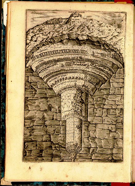
But then I found loads of other images, including this skewed and unattributed manuscript scan, showing another mine-like Hell, or Hell as an extraction complex–
—complete with interesting subsurface faults and fractured bedrock, in section. One could easily imagine an obscure branch of the Renaissance academy in Rome publishing tract after tract on the exact geotechnical nature of the Inferno. Is it made of granite? Is it kiln-like? Is it slate? Is it ringed by rivers of uranium tailings?
It’s the literary-cosmological subgenre of Hell descriptions.
In any case, making a much less explicit visual or even Dantean connection here, there’s also Bartolomeo’s Hell.
And, finally, making no attempt at all to sustain the visual thread, there’s William Blake–
—a perennial favorite of mine, which shows us Dante and Virgil both, walking hand-in-hand through a shimmering geomagnetic curtain, a Northern Lights inside the earth. The gates of hell redesigned as a crackling, prehistoric, residual electricity that blasts in vaulted arcs from the faulted walls of granitic stratigraphy, prehuman, technicolor, properly infernal. Hell, as industrially re-designed by Nikola Tesla.
William Blake meets Jules Verne, who has become a mining engineer and is working on his own translation of Dante. They load-up on blank notebooks and descend together toward the vast, gyroscopic rotations of an electrical hell, taking notes on geology, mapping the stratigraphy of torture machines, where solid rocks mutate and minerals bleed. An epic poem starring geotechnical engineers, and rogue electricians. A hell-mapping expedition.
The climactic scene is a dialogue between Blake and Tesla, who argue, in front of huge glowing domes of black electricity, above vast canals of uranium, that there is an energetic basis for eternal life – or damnation…
Or perhaps the British Museum sends its imperial topographical unit deep into Siberia, where a giant hole has been discovered… Electrical storms form in its overgrown mouth and screams can be heard…
Anyway – Happy Halloween. Don’t forget your hell map.
The idea of listening to a landscape – how to podcast a landscape, for instance – tends to be literally overlooked in favor of a site’s visual impact or even its smell. When I was in Greece a few years ago, for instance, hiking toward an abandoned village on Tilos, every step I took crushed wild onions, herbs, and different flowers, and a temporary envelope of scent, picked up by breezes, floated all around me as I walked uphill. I may not remember every single detail of what that path *looked* like – but I do remember how it *smelled*. It was like hiking through salad. In any case, you don’t often see people packing up the family car, or hopping onto a train, to tour Wales or the Green Mountains of Vermont so that they can listen to the hills – they’ll go out to look at autumn leaf colors, sure, or take photographs of spring wildflowers. But to go all the way to Wales so they can hear a particular autumn wind storm howling through the gorges, a storm that only lasts two days of every year? Specifically going somewhere to *listen to the landscape*. Seasonal weather events and their sonic after-effects. The Great November Moan. All of which brings me to the idea of sound mirrors.
Musicalizing a weather system through landscape architecture. BLDGBLOG here proposes a series of sound mirrors to be built in a landscape with regular, annual wind phenomena. A distant gully, moaning at 2am every second week in October due to northern winds from Canada, has its low, droning, cliff-created reverb carefully echoed back up a chain of sound mirrors to supply natural soundscapes for the sleeping residents of nearby towns. Or a crevasse that actually makes no sound at all has a sound mirror built nearby, which then amplifies and redirects the ambient air movements, coaxing out a tone – but only for the first week of March. Annually. Landscape as saxophone.
It’s a question of interacting with the earth’s atmosphere through human geotechnical constructions. Through sound mirrors. What you’d need: 1) Detailed meteorological charts of a region’s annual wind-flow patterns. 2) Sound mirrors. 3) A very large arts grant. You could then musicalize the climate. With exactly placed and arranged sound mirrors atop a mesa, for instance, deep inside a system of canyons – whether that’s in the Peak District or Utah’s Canyonlands National Park – or even in Rajasthan, or western Afghanistan – you could interact with the earth’s atmosphere to create music for two weeks every year, amplifying the natural sounds of seasonal air patterns. People would come, camp out, check into hotels, open all their windows – and just listen to the landscaped echoes.
A few questions arise: in this context, does Stonehenge make any sounds? What if – and this is just a question – it was built not as a prehistoric astronomical device but as a *landscape wind instrument*? You’d be out there wandering around the Cotswolds, thinking oh – christ, it’s 5000 years ago and we’re lost, but: what’s that? I hear Stonehenge… And then you locate yourself. Sonic landmark. This raises the possibility of building smaller versions of these sound mirrors in urban neighborhoods so that, for instance, Berlin’s Prenzlauer Berg sounds different than Mitte, which sounds different than Kreuzberg – which sounds different than South Kensington, which is different than Gramercy Park… Etc. You’d always know which district of the city you were in – even which city you were in, full stop – based on what the wind sounded like. (Which reminds me of another idea: that, to attract people to a city without much going for it, you could *flavor the water supply*: make it taste like Doritos, for instance, and then sell that on huge billboards: buy your new home in Detroit, the water tastes like Doritos… the water tastes like tofurky…). Second: is there a sonic signature to the US occupation of Baghdad? And I don’t mean rumbling Hummers and airplane engines, I mean what if all those Bremer walls –
– generate sounds during passing wind storms? All the American military bases of Iraq moaning at 3am as desert breezes pass by. What does the occupation *sound like*? A sonic taxonomy of architectural forms could begin…
 [Image: Nickel-rich sap; photo by Antony van der Ent, courtesy New York Times.]

 [Images: Photos by BLDGBLOG.]
 [Image: R. Fu, via
  [Image: Cover from An Incomplete Atlas of Stones by
  [Image: From An Incomplete Atlas of Stones by


 [Images: Spreads from An Incomplete Atlas of Stones by


 [Images: Spreads from An Incomplete Atlas of Stones by


 [Images: Spreads from An Incomplete Atlas of Stones by


 [Images: Spreads from An Incomplete Atlas of Stones by
  [Image: Alice Aycock, “Project for Elevation with Obstructed Sight Lines” (1972)].
 [Image: Alice Aycock, “Project for Elevation with Obstructed Sight Lines” (1972), courtesy
 [Image: From “
 [Image: From “
 [Image: From “
 [Image: From “
 [Image: From “
 [Image: From “
 [Image: From “
 [Image: Photo by Martin Siegel/Society of Maritime Archaeology, via
  [Image: Photo by Martin Siegel/Society of Maritime Archaeology, via
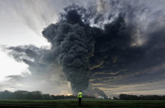 [Image: The Buncefield explosion, via the
 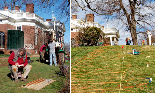 [Images: (left) An archaeologist examines soil cores. (right) Researchers plot lost roads across the grounds of Monticello. Courtesy of the
 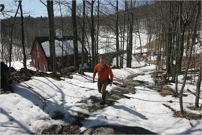 [Image: Walking an “ancient road” in Vermont; photo by
 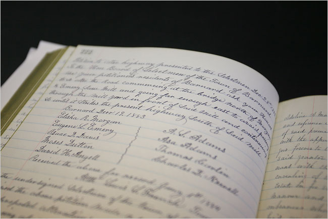 [Image: A hand-written inventory of Vermont’s ancient routes; photo by
 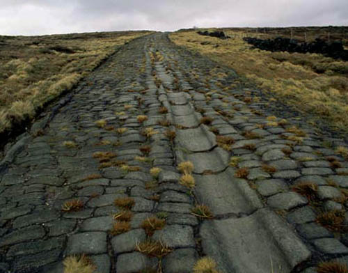 [Image: An old Roman road in Britain; photo via
 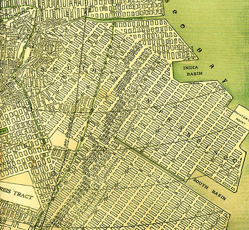 [Image: A map of San Francisco, including many “ghost streets,” courtesy of
 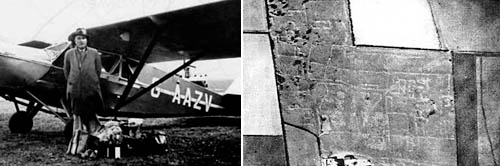 [Image: O.G.S. Crawford and his archaeological airplane; via Kitty Hauser’s
 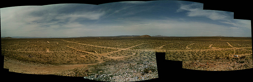 [Image: California City, CA; view
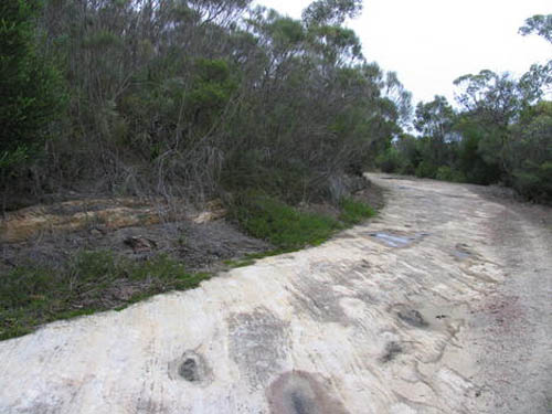
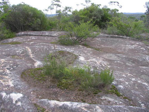
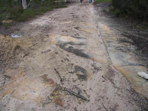 [Image: Three views of Australia’s lost
 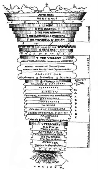 [Image: Dante’s Inferno, as imagined by

 —complete with interesting subsurface faults and fractured bedrock, in section. One could easily imagine an obscure branch of the Renaissance academy in Rome publishing tract after tract on the exact geotechnical nature of the Inferno. Is it made of granite? Is it kiln-like? Is it slate? Is it ringed by rivers of
  And, finally, making no attempt at all to sustain the visual thread, there’s William Blake–
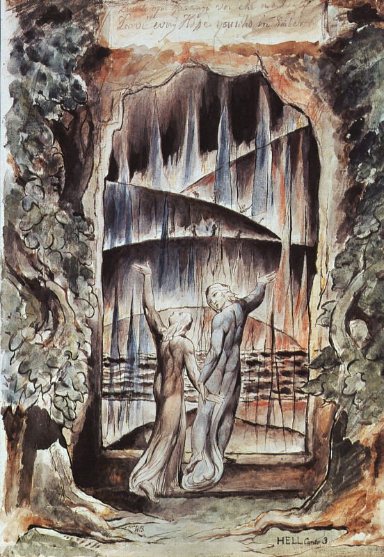 —a perennial favorite of mine, which shows us Dante and Virgil both, walking hand-in-hand through a shimmering geomagnetic curtain, a