Geomedia, or What Lies Below

[Image: Courtesy USGS.]

I love the fact that the U.S. Geological Survey had to put out a press release explaining what some people in rural Wisconsin might see in the first few weeks of January: a government helicopter flying “in a grid pattern relatively low to the ground, hundreds of feet above the surface. A sensor that resembles a large hula-hoop will be towed beneath the helicopter,” the USGS explains—but it’s not some conspiratorial super-tool, silently flipping the results of voting machines. It’s simply measuring “tiny electromagnetic signals that can be used to map features below Earth’s surface,” including “shallow bedrock and glacial sediments” in the region.

Of course, the fictional possibilities are nevertheless intriguing: government geologists looking for something buried in the agricultural muds of eastern Wisconsin, part Michael Crichton, part Stephen King; or CIA contractors, masquerading as geologists, mapping unexplained radio signals emanating from a grid of points somewhere inland from Lake Michigan; or a rogue team of federal archaeologists searching for some Lovecraftian ruin, a lost city scraped down to its foundations by the last Ice Age, etc. etc.

In any case, the use of remote-sensing tools such as these—scanning the Earth to reveal electromagnetic, gravitational, and chemical signatures indicative of mineral deposits or, as it happens, architectural ruins—is the subject of a Graham Foundation grant I received earlier this autumn. That’s a project I will be exploring and updating over the next 10 months, combining lifelong obsessions with archaeology and ruins (specifically, in this case, the art history of how we depict destroyed works of architecture) with an interest in geophysical prospecting tools borrowed from the extraction industry.

In other words, the same remote-sensing tools that allow geological prospecting crews to locate subterranean mineral deposits are increasingly being used by archaeologists today to map underground architectural ruins. Empty fields mask otherwise invisible cities. How will these technologies change the way we define and represent architectural history?

[Image: Collage, Geoff Manaugh, for “Invisible Cities: Architecture’s Geophysical Turn,” Graham Foundation 2020/2021; based on “Forum Romano, Rome, Italy,” photochrom print, courtesy U.S. Library of Congress.]

For now, I’ll just note another recent USGS press release, this one touting the agency’s year-end “Mineral Resources Program Highlights.”

Included in the tally is the “Earth MRI” initiative—which, despite the apt medical-imaging metaphor, actually stands for the “Earth Mapping Resource Initiative.” From the USGS: “When learning more about ancient rocks buried deep beneath the surface of the Earth, it may seem surprising to use futuristic technologies flown hundreds of feet in the air, but that has been central to the USGS Earth Mapping Resource Initiative.”

[Image: A geophysical survey of northwestern Arkansas, courtesy USGS.]

What lies below, whether it is mineral or architectural, is becoming accessible to surface view through advanced technical means. These new tools often reveal that, beneath even the most featureless landscapes, immensely interesting forms and structures can be hidden. Ostensibly boring mud plains can hide the eroded roots of ancient mountain chains, just as endless fields of wheat or barley can stand atop forgotten towns or lost cities without any hint of the walls and streets beneath.

The surface of the Earth is an intermediary—it is media—between us and what it disguises.

(See also, Detection Landscapes and Lost Roads of Monticello.)

Forest Accumulator

Ten years ago, this would have been a speculative design project by Sascha Pohflepp: “hyper-accumulating” plants are being used to concentrate, and thus “mine,” valuable metals from soil.

[Image: Nickel-rich sap; photo by Antony van der Ent, courtesy New York Times.]

“With roots that act practically like magnets, these organisms—about 700 are known—flourish in metal-rich soils that make hundreds of thousands of other plant species flee or die,” the New York Times reported last week. “Slicing open one of these trees or running the leaves of its bush cousin through a peanut press produces a sap that oozes a neon blue-green. This ‘juice’ is actually one-quarter nickel, far more concentrated than the ore feeding the world’s nickel smelters.”

A while back, I went on a road-trip with Edible Geography to visit some maple syrup farms north of where we lived at the time, in New York City. The woods all around us were tubed together in a huge, tree-spanning network—“forest hydraulics,” as Edible Geography phrased it at the time—as the trees’ valuable liquid slowly flowed toward a pumping station in the center of the forest.

It was part labyrinth, part spiderweb, a kind of semi-automated tree-machine at odds with the image of nature with which most maple syrup is sold.

[Images: Photos by BLDGBLOG.]

Imagining a similar landscape, but one designed as a kind of botanical mine—a forest accumulator, metallurgical druidry—is incredible.

And it’s not even a modern idea, as the New York Times points out. For all its apparent, 21st-century sci-fi, the idea of harvesting metal from plants is at least half a millennium old: “The father of modern mineral smelting, Georgius Agricola, saw this potential 500 years ago. He smelted plants in his free time. If you knew what to look for in a leaf, he wrote in the 16th century, you could deduce which metals lay in the ground below.”

This brings to mind an older post here about detection landscapes, or landscapes—yards, meadows, gardens, forests—deliberately planted with species that can indicate what is in the soil beneath them.

In the specific case of that post, this had archaeological value, allowing researchers to find abandoned Viking settlements in Greenland based on slight chemical changes that have affected which plants are able to thrive. Certain patches of flower, for example, act as archaeological indicator species, marking the locations of lost settlements.

In any case, my point is simply that vegetation can be read, or treated as a sign to be interpreted, whether by indicating the presence of archaeological ruins or by revealing the potential market-value of a site’s subterranean metal content.

Indeed, we read, “This vegetation could be the world’s most efficient, solar-powered mineral smelters,” with “the additional value of enabling areas with toxic soils to be made productive. Smallholding farmers could grow on metal-rich soils, and mining companies might use these plants to clean up their former mines and waste and even collect some revenue.” That is, you could filter and clean contaminated soils by drawing heavy-metal pollutants out of the ground, producing saps that are later harvested.

Fast-forward ten years: it’s 2030 and landscape architecture studios around the world are filled with speculative metal-harvesting plant designs—contaminated landscapes laced with gardens of hardy, sap-producing trees—even as industrial behemoths, like Rio Tinto and Barrick Gold, are breeding proprietary tree species in top-secret labs, genetically modifying them to maximize metal uptake.

Weird saps accumulate in iridescent lagoons. Autumn leaves glint, literally metallic, in the sun. Tiny metal capillaries weave up the trunks of black-wooded trees, in filigrees of gold and silver. The occasional forest fire smells not of smoke, but of copper and tin. Reclaimed timber, with knots and veins partially metallized, is used as luxury flooring in suburban homes.

Read more at the New York Times.

(Thanks to Wayne Chambliss for the tip!)

Magnetic Landscape Architecture

[Image: R. Fu, via ScienceNews].

Although I seem to be on a roll with linking to ScienceNews stories, this is too amazing to pass up: “People living at least 2,000 years ago near the Pacific Coast of what’s now Guatemala crafted massive human sculptures with magnetized foreheads, cheeks and navels. New research provides the first detailed look at how these sculpted body parts were intentionally placed within magnetic fields on large rocks.”

The magnetic fields were likely created by lightning strikes.

This is incredible: “Artisans may have held naturally magnetized mineral chunks near iron-rich, basalt boulders to find areas in the rock where magnetic forces pushed back, the scientists say in the June Journal of Archaeological Science. Predesignated parts of potbelly figures—which can stand more than 2 meters tall and weigh 10,000 kilograms or more—were then carved at those spots.”

It’s like a geological farm for the secondary effects of lightning. A lightning farm for real!

The mind boggles at the thought of magnetic landscape architecture, or magnetic masonry in ancient stonework, or even huge sculptures invisibly adhering to one another through magnetic forces, giving the appearance of magic.

Imagine a valley of exposed bedrock and boulders, its unusually high iron content making the rocks there attractive to lightning. Over tens of thousands of lightning strikes, the valley becomes partially magnetized, resulting in bizarre geological anomalies mistaken for the actions of a spirit world: small pebbles roll uphill, for example, or larger rocks inexplicably clump together in structurally precarious agglomerations. Stones perhaps hover an inch or two off the ground, pulled upward toward magnetic overhangs, or rocks visibly assemble themselves into small cairns, clicking into place one atop the other.

As you step into the valley, the only sound you hear is a trembling in the gravel ahead, as if the rocks are jostling for position. Your jewelry begins to float, pulling away from your wrists and chest.

Anyway, read more at ScienceNews.

(Also, watch for my friend Eva Barbarossa’s book on magnets coming out this fall.)

Dark Matter Mineralogy and Future Computers of Induced Crystal Flaws

[Image: Mexico’s “Cave of the Crystals,” via Wikipedia].

I guess I’ve got minerals on the brain.

Anyway, there was an amazing story last week suggesting that, deep inside the planet, minerals might exhibit flaws associated with “collisions with dark matter.” In a sense, this would make the entire interior of the earth a de facto dark matter detector—or, according to researchers at the University of Michigan, “minerals such as halite (sodium chloride) and zabuyelite (lithium carbonate), can act as ready-made detectors.”

Proving this hypothesis sounds like the opening scene of a blockbuster science fiction film: “An experiment could extract the minerals—which can be around 500 million years old—from kilometres-deep boreholes that already exist for geological research and oil prospecting. Physicists would need to crack open the extracted minerals and scan the exposed surfaces under an electron or atomic force microscope for the tracks made by recoiling nuclei. They could also use X-ray or ultraviolet 3D scanners to study bigger chunks of minerals faster, but with lower resolution.”

Either way, it’s incredible to imagine that slightly altered mineral structures deep inside the planet might reveal the presence of dark matter washing through the cosmos. After all, the Earth is allegedly “constantly crashing through huge walls of dark matter,” so the idea that some rocks might be glitched and scratched by these impacts isn’t that hard to believe. In fact, this brings to mind another hypothesis, that the GPS satellite network is, in fact, a huge, accidental dark matter detector.

Read more at Nature.

Meanwhile, ScienceDaily reported earlier this month that flaws deliberately introduced into the crystal forms of diamonds could be structured such that they improve those diamonds’ capacity for quantum computation. Apparently, a team at Princeton has designed new kinds of diamonds “that contain defects capable of storing and transmitting quantum information for use in a future ‘quantum internet.’”

There is obviously no connection between these two stories, but that won’t stop me from imagining some vast new quantum computer network, coextensive with the Earth’s interior, performing prime-number calculations along dark matter-induced crystal flaws, crooked mineral veins flashing in the darkness with data, like some buried circuitboard throbbing beneath the continents and seas.

Read more at ScienceDaily.

(Related: Planet Harddrive.)

Speculative Mineralogy

[Image: An otherwise unrelated image of crystal twinning, via Geology IN].

It’s hard to resist a headline like this: writing for Nature, Shannon Hall takes us inside “the labs that forge distant planets here on Earth.”

This is the world of exogeology—the geology of other planets—“a research area that is bringing astronomers, planetary scientists and geologists together to explore what exoplanets might look like, geologically speaking. For many scientists, exogeology is a natural extension of the quest to identify worlds that could support life.”

To understand how other planets are made, exogeologists are synthesizing those planets in miniature in the earthbound equipment in their labs. Think of it as an extreme example of landscape modeling. “To gather information to feed these models,” Hall writes, “geologists are starting to subject synthetic rocks to high temperatures and pressures to replicate an exoplanet’s innards.”

Briefly, it’s easy to imagine an interesting jewelry line—or architectural materials firm—using fragments of exoplanets in their work, crystals grown as representations of other worlds embedded in your garden pavement. Or fuse the ashes of your loved ones with fragments of hypothetical exoplanets. “Infinite memorialization,” indeed.

In any case, recall that, back in 2015, geologist Robert Hazen “predict[ed] that Earth has more than 1,500 undiscovered minerals and that the exact mineral diversity of our planet is unique and could not be duplicated anywhere in the cosmos.” As Hazen claimed, “Earth’s mineralogy is unique in the cosmos.” If we are, indeed, living in mineralogically unique circumstances, then this would put an end to the fantasy of finding a geologically “Earth-like” planet. But the search goes on.

This is not the only example of producing hypothetical mineral models of other worlds. In 2014, for example, ScienceDaily reported that “scientists for the first time have experimentally re-created the conditions that exist deep inside giant planets, such as Jupiter, Uranus and many of the planets recently discovered outside our solar system.” Incredibly, this included compressing diamond to a concentration denser than lead, using a giant laser.

Other worlds, produced here on Earth. Exoplanetary superdiamonds.

Read more over at Nature.

(Nature article spotted via Nathalia Holt).

The Snow Mine

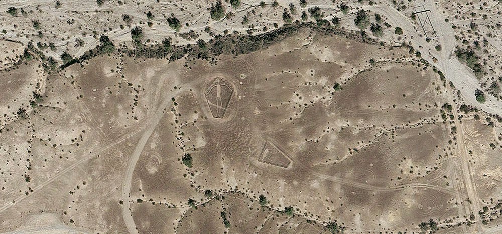
[Image: The “Blythe Intaglios,” via Google Maps].

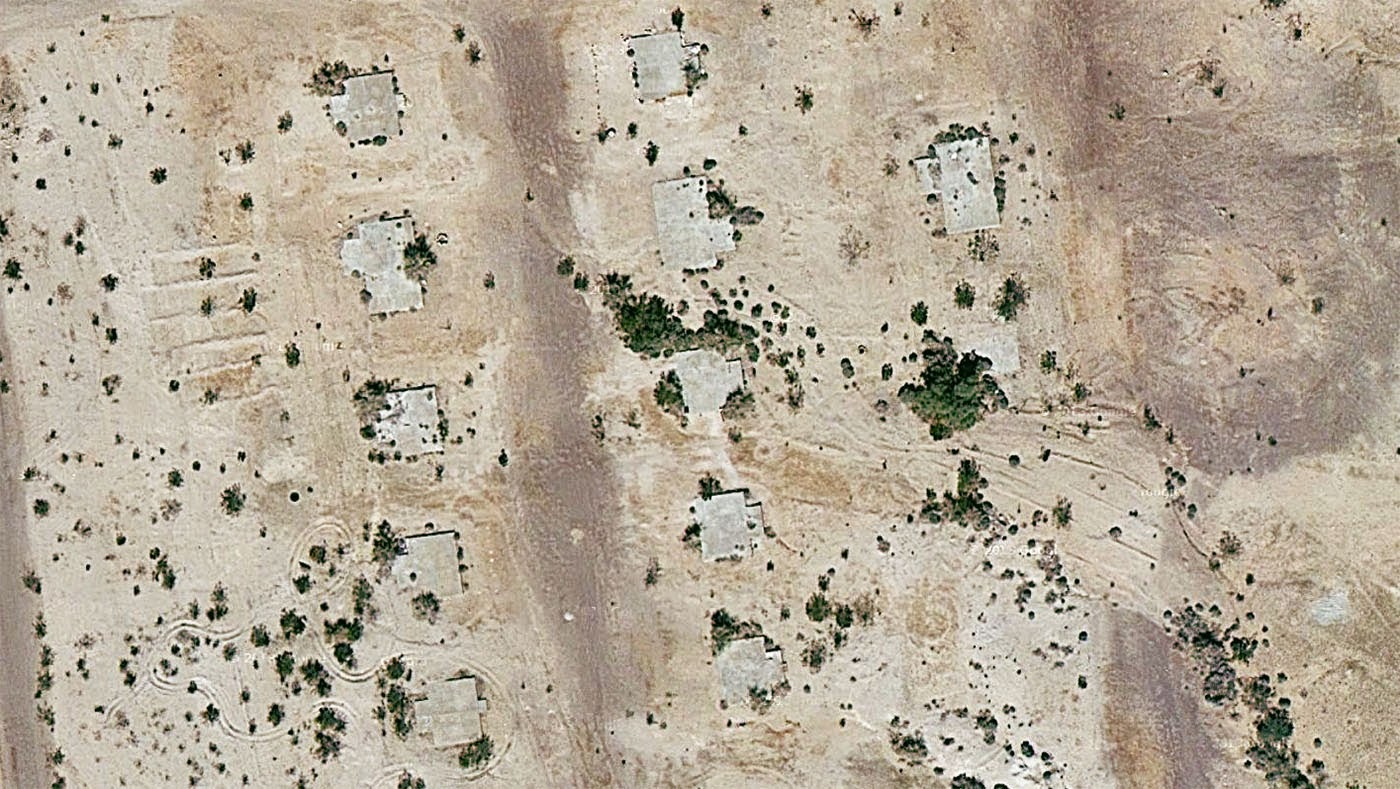
After reading an article about the “Blythe geoglyphs”—huge, 1,000-year old images carved into the California desert north of Blythe, near the border with Arizona—I got to looking around on Google Maps more or less at random and found what looked like a ghost town in the middle of nowhere, close to an old mine.

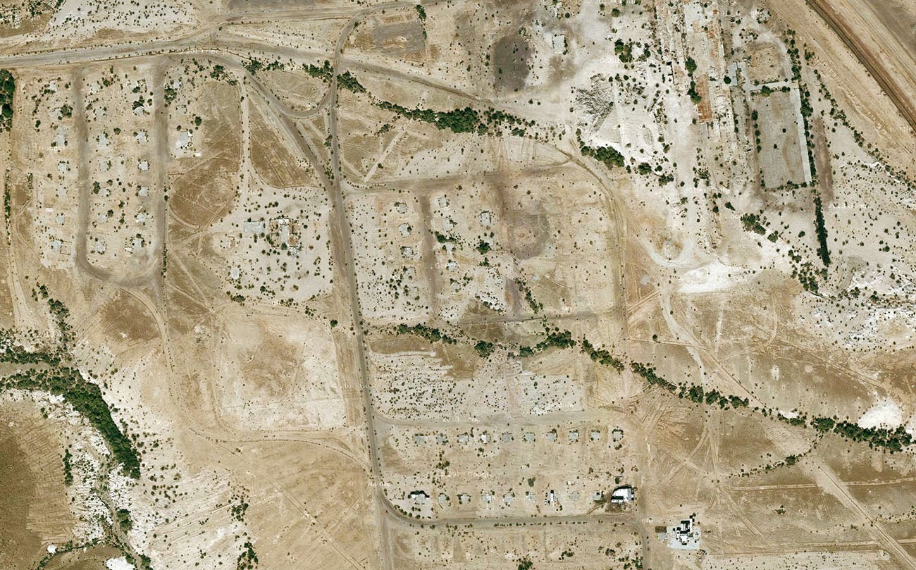
Turns out, it was the abandoned industrial settlement of Midland, California—and it’s been empty for nearly half a century, deliberately burned to the ground in 1966 when the nearby mine was closed.

[Image: Midland, California, via Google Maps].

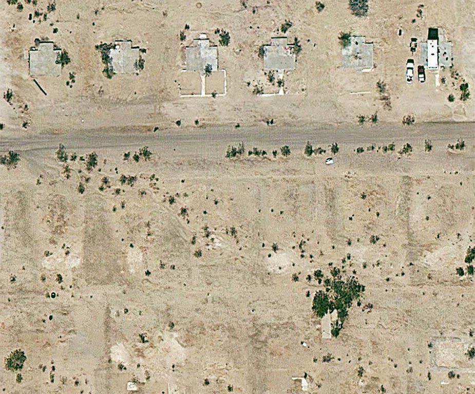
What’s so interesting about this place—aside from the exposed concrete foundation pads now reused as platforms for RVs, or the empty streets forming an altogether different kind of geoglyph, or even the obvious ease with which one can get there, simply following the aptly named Midland Road northeast from Blythe—is the fact that the town was built for workers at the gypsum mine, and that the gypsum extracted from the ground in Midland was then used as artificial snow in many Hollywood productions.

[Image: Midland, California, via Google Maps].

As the L.A. Times reported back in 1970—warning its readers, “Don’t Go To Midland—It’s Gone”—the town served as the mineral origin for Hollywood’s simulated weather effects.

“Midland was started in 1925 as a tent city,” the paper explained, “with miners in the middle of the Mojave Desert digging gypsum out of the Little Marias to meet the demands of movie studios. All the winter scenes during the golden age of Hollywood were filmed with ‘snowflakes’ from Midland.”

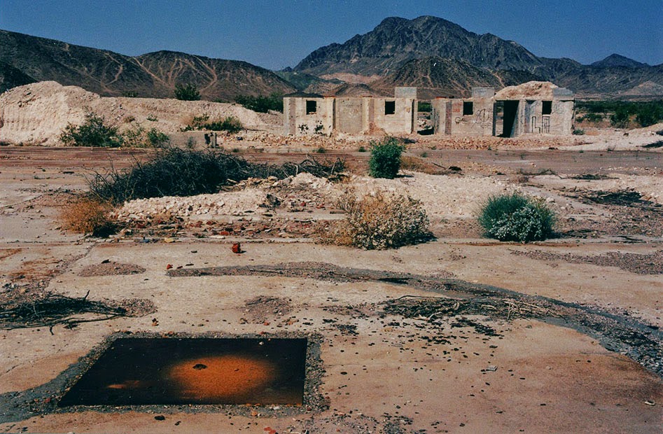
[Image: The abandoned streets of Midland, former origin of Hollywood’s artificial snow; photo via CLUI].

Like some strange, artificial winter being mined from the earth and scattered all over the dreams of cinemagoers around the world, Midland’s mineral snow had all the right qualities without any of the perishability or cold.

See, for example, this patent for artificial snow, filed in 1927 and approved in 1930, in which it is explained how gypsum can be dissolved by a specific acid mix to produce light, fluffy flakes perfect for the purposes of winter simulation. Easy to produce, with no risk of melting.

[Image: Midland, California, via Google Maps].

I’ve long been fascinated by the artificial snow industry—the notion of an industrially controlled climate-on-demand, spraying out snowflakes as if from a 3D printer, is just amazing to me—as well as with the unearthly world of mines, caves, and all things underground, but I had not really ever imagined that these interests might somehow come together someday, wherein fake glaciers and peaceful drifts of pure white snow were actually something scraped out of the planet by the extraction industry.

As if suggesting the plot of a deranged, Dr. Seussian children’s book, the idea that winter is something we pull from a mine in the middle of the California desert and then scatter over the warm Mediterranean cities of the coast is perhaps all the evidence you need that life is always already more dreamlike than you had previously believed possible.

(Very vaguely related: See also BLDGBLOG’s earlier coverage of California City).

Forensic Geology

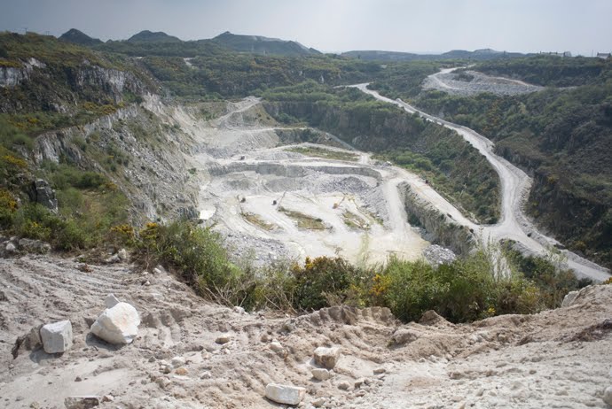
[Image: The “Trevisco pit,” Cornwall, from which the kaolinite used in space shuttle tiles comes from; photo by Hugh Symonds].

Photographer Hugh Symonds recently got in touch with a series of images called Terra Amamus, or “dirt we like,” in his translation, exploring mining operations in Cornwall.

“The granite moors of Cornwall,” Symonds explains, “were formed around 300 million years ago. Geological and climatic evolution have created a soft, white, earthy mineral called kaolinite. The name is thought to be derived from China, Kao-Ling (High-Hill) in Jingdezhen, where pottery has been made for more than 1700 years. Study of the Chinese model in the late 18th century led to the discovery and establishment of a flourishing industry in Cornwall.”

You could perhaps think of the resulting mines and quarries as a landscape falling somewhere between an act of industrial replication and 18th-century geological espionage.

[Image: Photo by Hugh Symonds].

As Symonds points out, kaolinite is actually “omni-present throughout our daily lives; in paper, cosmetics, pharmaceuticals, paints, kitchens, bathrooms, light bulbs, food additives, cars, roads and buildings. In an extraterrestrial, ‘Icarian’ twist, it is even present in the tiles made for the Space Shuttle.”

Indeed, the photograph that opens this post shows us the so-called Trevisco pit. Its kaolinite is not only “particularly pure,” Symonds notes; it is also “the oldest excavation in the Cornish complex.”

Even better, it is the “quarry from which the clay used for the Space Shuttle tiles came from.” This pit, then, is a negative space—a pockmark, a dent—in the Earth’s surface out of which emerged—at least in part—a system of objects and trajectories known as NASA.

Of course, the idea that we could trace the geological origins of an object as complex as the Space Shuttle brings to mind Mammoth‘s earlier stab at what could be called a provisional geology of the iPhone. As Mammoth wrote, “Until we see that the iPhone is as thoroughly entangled into a network of landscapes as any more obviously geological infrastructure (the highway, both imposing carefully limited slopes across every topography it encounters and grinding/crushing/re-laying igneous material onto those slopes) or industrial product (the car, fueled by condensed and liquefied geology), we will consistently misunderstand it.” These and other products—even Space Shuttles—are terrestrial objects. That is, they emerge from infrastructurally networked points of geological extraction.

[Images: Photos by Hugh Symonds].

In John McPhee’s unfortunately titled book Encounters with the Archdruid, there is a memorable scene about precisely this idea: a provisional geology out of which our industrial system of objects has arisen.

“Most people don’t think about pigments in paint,” one of McPhee’s interview subjects opines. “Most white-paint pigment now is titanium. Red is hematite. Black is often magnetite. There’s chrome yellow, molybdenum orange. Metallic paints are a little more permanent. The pigments come from rocks in the ground. Dave’s electrical system is copper, probably from Bingham Canyon. He couldn’t turn on a light or make ice without it.” And then the real forensic geology begins:

The nails that hold the place together come from the Mesabi Range. His downspouts are covered with zinc that was probably taken out of the ground in Canada. The tungsten in his light bulbs may have been mined in Bishop, California. The chrome on his refrigerator door probably came from Rhodesia or Turkey. His television set almost certainly contains cobalt from the Congo. He uses aluminum from Jamaica, maybe Surinam; silver from Mexico or Peru; tin—it’s still in tin cans—from Bolivia, Malaya, Nigeria. People seldom stop to think that all these things—planes in the air, cars on the road, Sierra Club cups—once, somewhere, were rock. Our whole economy—our way of doing things. Oh, gad! I haven’t even mentioned minerals like manganese and sulphur. You won’t make steel without them. You can’t make paper without sulphur…

We have rearranged the planet to form TVs and tin cans, producing objects from refined geology.

[Image: Photo by Hugh Symonds].

What’s fascinating here, however, is something I touched upon in my earlier reference to geological espionage. In other words, we take for granted the idea that we can know what minerals go into these everyday products—and, more specifically, that we can thus locate those minerals’ earthly origins and, sooner or later, enter into commerce with them, producing our own counter-products, our own rival gizmos and competitive replacements.

I was thus astonished to read that, in fact, specifically in the case of silicon, this is not actually the case.

In geologist Michael Welland‘s excellent book Sand, often cited here, Welland explains that “electronics-grade silicon has to be at least 99.99999 percent pure—referred to in the trade as the ‘seven nines’—and often it’s more nines than that. In general, we are talking of one lonely atom of something that is not silicon among billions of silicon companions.”

Here, a detective story begins—it’s top secret geology!

A small number of companies around the world dominate the [microprocessor chip] technology and the [silicon] market, and while their literature and websites go into considerable and helpful detail on their products, the location and nature of the raw materials seem to be of “strategic value,” and thus an industrial secret. I sought the help of the U.S. Geological Survey, which produces comprehensive annual reports on silica and silicon (as well as all other industrial minerals), noting that statistics pertaining to semiconductor-grade silicon were often excluded or “withheld to avoid disclosing company proprietary data.”

Welland thus embarks upon an admittedly short but nonetheless fascinating investigation, hoping to de-cloud the proprietary geography of these mineral transnationals and find where this ultra-pure silicon really comes from. To make a long story short, he quickly narrows the search down to quartzite (which “can be well over 99 percent pure silica”) mined specifically from a few river valleys in the Appalachians.

[Image: Photo by Hugh Symonds].

As it happens, though, we needn’t go much further than the BBC to read about a town called Spruce Pine, “a modest, charmingly low-key town in the Blue Ridge mountains of North Carolina, [that] is at the heart of a global billion-dollar industry… The jewellery shops, highlighting local emeralds, sapphires and amethysts, hint at the riches. The mountains, however, contain something far more precious than gemstones: they are a source of high-purity quartz.” And Spruce Pine is but one of many locations from which globally strategic flows of electronics-grade silicon are first mined and purified.

In any case, the geological origin of even Space Shuttle tiles is always fascinating to think about; but when you start adding things like industrial espionage, proprietary corporate landscapes, unmarked quarries in remote mountain valleys, classified mineral reserves, supercomputers, a roving photographer in the right place at the right time, an inquisitive geologist, and so on, you rapidly escalate from a sort of Economist-Lite blog post to the skeleton of an international thriller that would be a dream to read (and write—editors get in touch!).

And, of course, if you like the images seen here, check out the rest of Symond’s Terra Amamus series.

Glass is the ice of sand

As a continuation of the previous post, imagine a house whose plans are based upon a photomicrograph of glass. The house’s actual lay-out and external appearance are exact translations of the mineral structure and microtectonics of glass. The house itself, though, is also a glass house; that is, even as its layout and structure are based upon the mineral tectonics of glass itself, the house uses glass as its primary material.
Now imagine a Charles & Ray Eames-like film where we zoom-in at powers of 10 till we end up on the photomicrographic level, looking at the glass that the house is constructed from: the only problem is that it looks exactly like a full-scale photograph of the house. Have we zoomed all the way in, or did we zoom all the way back out?


MC Escher meets Mies van der Rohe, perhaps. Or Ouroborus as an architectural condition. And what happens if we keep zooming in?

Scalar interchangeability.