This Is Only A Test

[Image: From Ways of Knowing by Daniel Stier, on display at the kulturreich gallery].

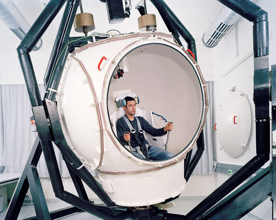
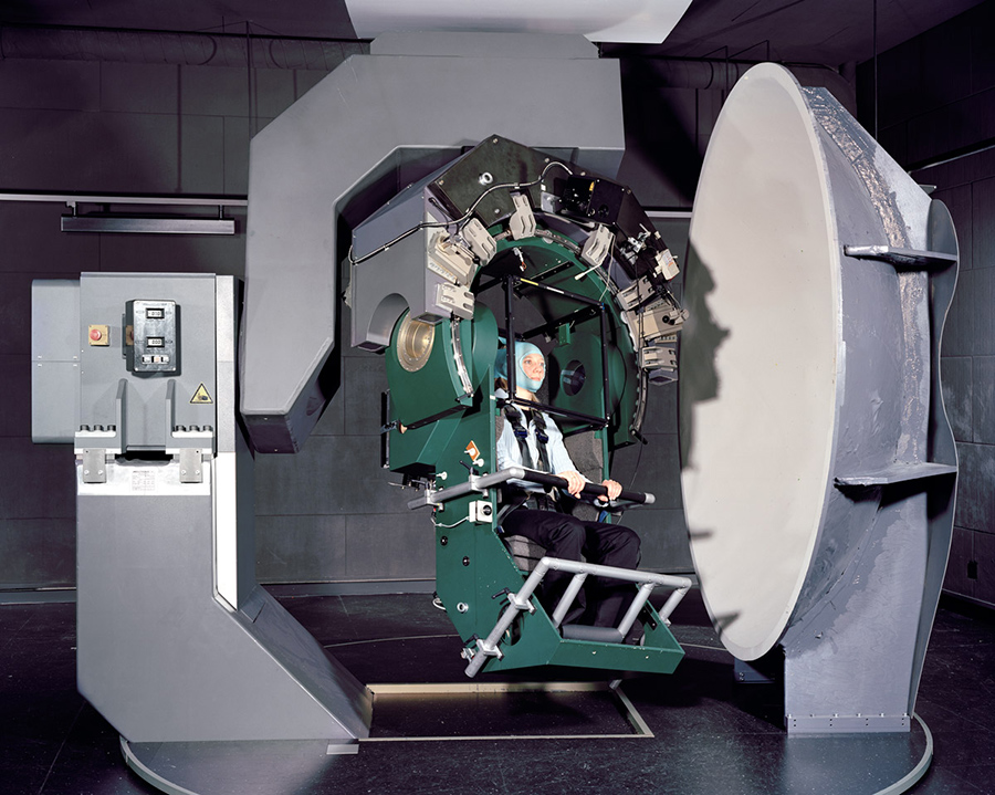
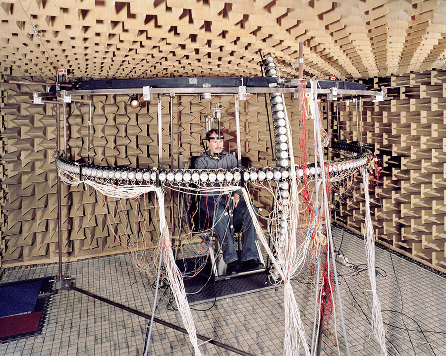
Photographer Daniel Stier has a new book out, and an accompanying exhibition on display at the kulturreich gallery, called Ways of Knowing.

Skier’s photos depict human subjects immersed in, or even at the mercy of, spatial instrumentation: strange devices conducting experiments that function at the scale of architecture but whose purpose remains unidentified.

[Image: From Ways of Knowing by Daniel Stier, on display at the kulturreich gallery].

In Stier’s words, the overall series is “a personal project exploring the real world of scientific research. Not the stainless steel surfaces bathed in purple light, but real people in their basements working on selfbuilt contraptions. All shot in state of the art research institutions across Europe and the US, showing experiments with human subjects. Portrayed are the people conducting the experiments—students, doctorands and professors.”

In recent interviews discussing the book, Stier has pointed out what he calls “similarities between artistic and scientific work,” with an emphasis on the craft that goes into designing and executing these devices.

However, there is also a performative or aesthetic aspect to many of these that hints at resonances beyond the world of applied science—a person staring into multicolored constellations painted on the inside of an inverted bowl, for example.

[Image: From Ways of Knowing by Daniel Stier, on display at the kulturreich gallery].

Ostensibly an ophthalmic device of some kind, it could just as easily be an amateur’s attempt at OpArt.

In a sense, these are not just one-off scientific experiments but spatial prototypes: rigorous attempts at building and establishing a very particular kind of environment—a carefully calibrated and tuned zone of parameters, forces, and influences—then exposing people to those worlds as a means of testing for their effects.

[Image: From Ways of Knowing by Daniel Stier, on display at the kulturreich gallery].

In any case, here are a few more images to pique your curiosity, but many, many more photos are available in Stier’s book, which just began shipping this month, and, of course, over at Stier’s website.

[Images: From Ways of Knowing by Daniel Stier, on display at the kulturreich gallery].

(Originally spotted via New Scientist).

Lost Highways

[Image: Reviewing old property deeds and land surveys; photo by Geoff Manaugh].

A story I’ve been obsessed with since first learning about it back in 2008 is the problem of “ancient roads” in Vermont.

Vermont is unusual in that, if a road has been officially surveyed and, thus, added to town record books—even if that road was never physically constructed—it will remain legally recognized unless it has been explicitly discontinued.

[Image: More Granville property deeds; photo by Geoff Manaugh].

This means that roads surveyed as far back as the 1790s remain present in the landscape as legal rights of way—with the effect that, even if you cannot see this ancient road cutting across your property, it nonetheless persists, undercutting your claims to private ownership (the public, after all, has the right to use the road) and making it difficult, if not impossible, to obtain title insurance.

Faced with a rising number of legal disputes from homeowners, Vermont passed Act 178 back in 2006. Act 178 was the state’s attempt to scrub Vermont’s geography of these dead roads.

[Image: Geographic coordinates for lost roadways; photo by Geoff Manaugh].

The Act’s immediate effects, however, were to kick off a rush of new research into the state’s lost roadways.

This meant going back through property deeds and mortgage records, dating back to the late 18th-century, deciphering old handwriting, making sense of otherwise location-less survey coordinates, and then reconciling all this with on-the-ground geologic features or local landmarks.

[Image: Zooming into survey descriptions of rods and chains; photo by Geoff Manaugh].

Not every town was enthusiastic about finding them, hoping instead that the old roads would simply disappear.

Other towns—and specific townspeople—responded with far more enthusiasm, as if finding an excuse to rediscover their own histories, the region’s past, and the lives of the other families or settlers who once lived there.

Anything they found and officially submitted for inclusion on Vermont’s state highway map would continue to exist as a state-recognized throughway; anything left undocumented, or specifically called out for discontinuance, would disappear, losings its status as a road and becoming mere landscape.

July 1, 2015, was the deadline, after which anything left undiscovered is meant to remain undiscovered.

[Image: Ancient road descriptions; photo by Geoff Manaugh].

I had an amazing opportunity to visit the tiny town of Granville, Vermont, ten days ago, where I met with a retired forester and self-enlisted local historian named Norman Arseneault.

Arseneault became so involved in the search for Granville’s ancient roads that he is not only self-publishing an entire book documenting his quest, but he was also pointed out to me as an exemplar of rigor and organization by Johnathan Croft, chief of the Mapping Section at the Vermont Agency of Transportation (where there is an entire page dedicated to “Ancient Roads“).

His hunt for old roads seems to fall somewhere between Robert Macfarlane’s recent work and the old Western trail research of Glenn R. Scott.

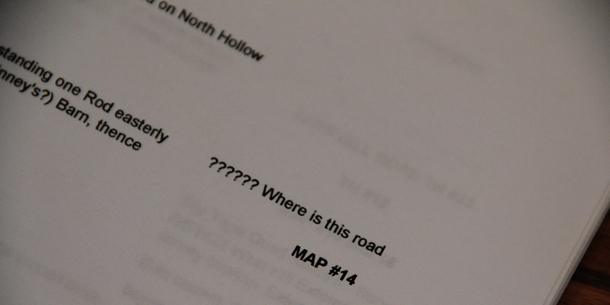
[Image: “?????? Where is this road”; photo by Geoff Manaugh].

While I was there in Granville, Arseneault took me into the town vault, flipping back through nearly 225 years of local property deeds. We then hit the old forest roads in his pick-up truck, to hike many of the “ancient roads” his research had uncovered.

I wrote up the whole experience for The New Yorker, and I have to say it was one of the more interesting article research processes I’ve ever been involved with; check it out, if any of this sounds of interest.

It’s worth pointing out, meanwhile, that the problem of “ancient roads” is not, in fact, likely to go away; the recent introduction of LiDAR data, on top of some confusingly written legal addenda, make it all but certain that other property owners will yet find long-forgotten public routes crossing their land, or that a future private development count still find its unbuilt plots placed squarely atop invisible roads made newly available to town use.

The hows and whys of this are, I hope, explained a bit more over at The New Yorker.

Composite Archaeology

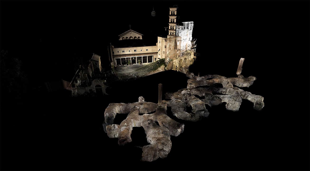
[Image: A laser scan of the Pantheon, courtesy ScanLAB Projects and the BBC; view larger!].

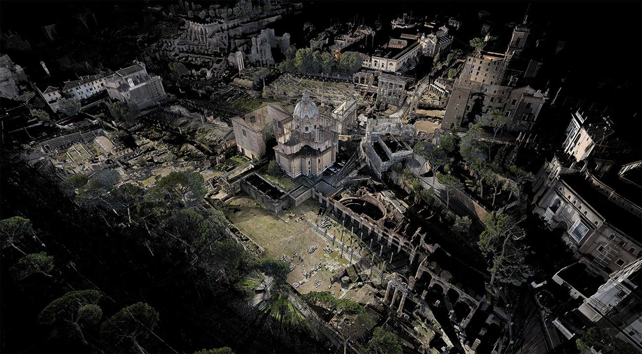
ScanLAB Projects, focus of a long article on Wired last month, are back in the news with a BBC documentary exploring the infrastructure of ancient Rome.

The show “explores Roman infrastructure and ingenuity, all below ground level”:

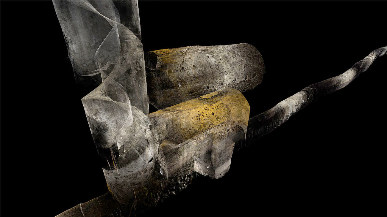
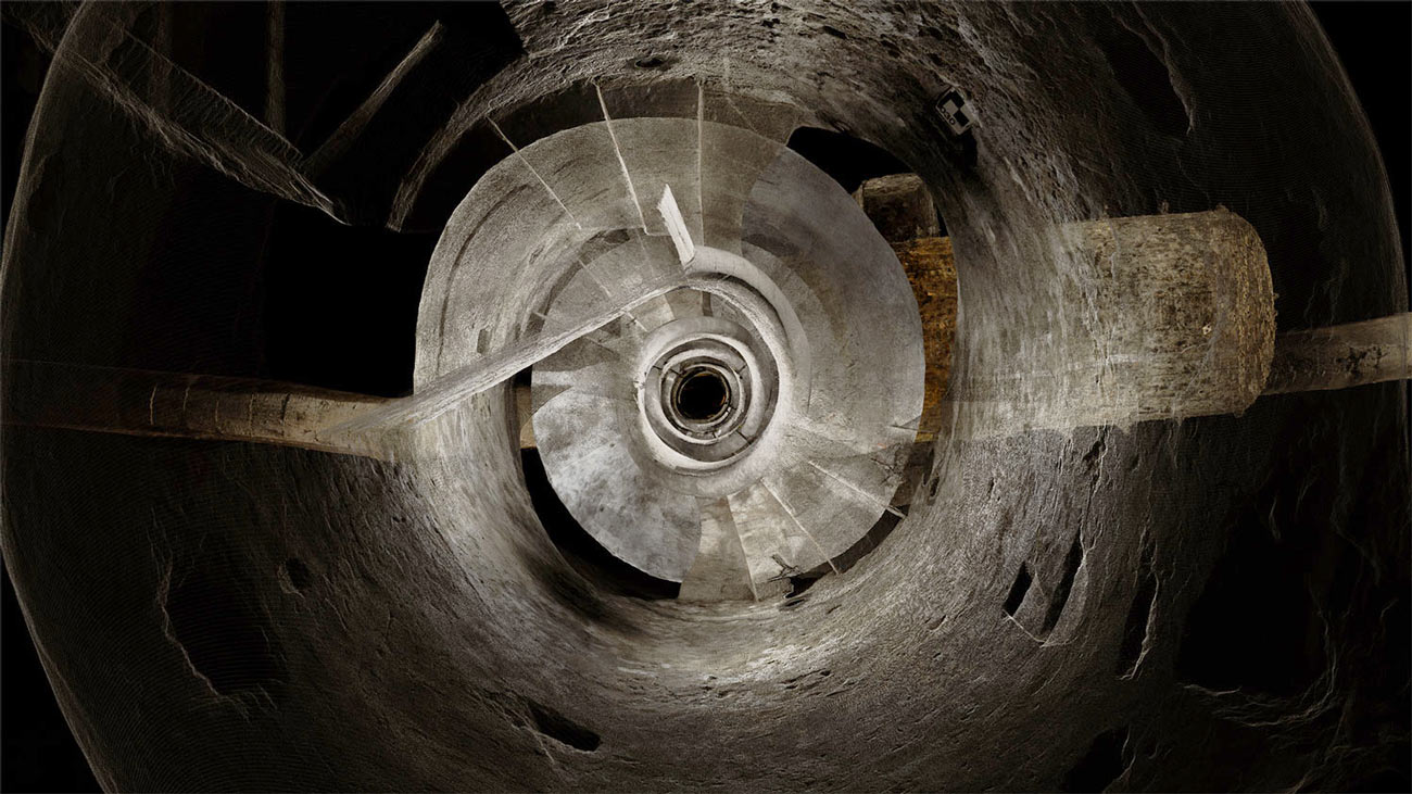
We journeyed via the icy, crystal clear waters of subterranean aqueducts that feed the Trevi fountain and two thousand year old sewers which still function beneath the Roman Forum today, to decadent, labyrinthine catacombs. Our laser scans map these hidden treasures, revealing for the first time the complex network of tunnels, chambers and passageways without which Rome could not have survived as a city of a million people.

The results, as usual, are both breathtaking and bizarre.

[Image: Courtesy ScanLAB Projects and the BBC].

The surface of the city is scraped away, a kind of archaeological dermabrasion, to reveal sprawling networks of knotted masonry and old corridors spliced together in a translucent labyrinth less below than somehow in the city.

[Image: Courtesy ScanLAB Projects and the BBC].

One of the most interesting points made in Mary-Ann Ray’s excellent Pamphlet Architecture installment—1997’s Seven Partly Underground Rooms and Buildings for Water, Ice, and Midgets—is when she describes her use of composite photography as a way to experiment with new forms of archaeological documentation.

Indeed, the pamphlet itself is as much architecture as it is archaeology—perhaps even suggesting a new series of historical site documents someone should produce called Pamphlet Archaeology—looking at wells, baths, cisterns, and spherical refrigeration chambers, in various states of ruin.

All of these are representationally difficult spaces, Ray explains, either curving away from the viewer in a manner that is nearly impossible to photograph or presenting constrictions of perspective that make even wide-angle photographs inadequate.

[Image: Courtesy ScanLAB Projects and the BBC].

Ray writes that the spatial complexity of the buildings, quarries, basements, and other excavations that she explores are, in a sense, an entirely different kind of space: knotty, interconnected, unstable. “They were also spaces,” she writes, “which seemed to have the ability to ‘flip-flop’ in and out of multiple spatial or constructional readings.”

What appears to be near is revealed to be far; what seems far away is suddenly adjacent.

[Image: Courtesy ScanLAB Projects and the BBC; view larger!].

Ray uses the metaphor of a “hyper-camera” here in order to draw comparisons between her composite photography and what she calls “a kind of cubist multiple view,” one where “the frame might succumb to the taper of perspective into deep space, or it may counter it, or build it into something else altogether.”

“In these composite views,” she adds, “the photograph can record the enactment of space as one maneuvers or roams through it with the eye or body.”

While Ray’s photographic approach is technologically, materially, and even visually very different from the work of ScanLAB, the two projects share a great deal, conceptually and methodologically. In fact, if many of the above quotations were applied, instead, to the images seen in the present post, they would seem to be the appropriate descriptions.

[Image: In the ruined basements of architectural simultaneity; ScanLAB Projects and the BBC].

ScanLAB’s laser work seems to fulfill many of the promises of Ray’s composite photography, offering multiple, overlapping perspectives simultaneously whilst also eliminating the problem of the horizon or ground plane: you can thus look straight-on into the basement of an ancient structure without losing sight of the upper floors or chambers.

The city is split in two, made into an architectural section of itself that is then animated, made volumetric, turned into Ray’s “enactment of space as one maneuvers or roams through it with the eye or body.”

The show airs tonight on the BBC. Check out ScanLAB’s website for more info, and definitely consider picking up a copy of Mary-Ann Ray’s book; it remains one of my favorites and has actually become more, not less, topical since its original publication.

Urban CAT Scan

[Image: By ScanLab Projects, with permission from the British Postal Museum & Archive].

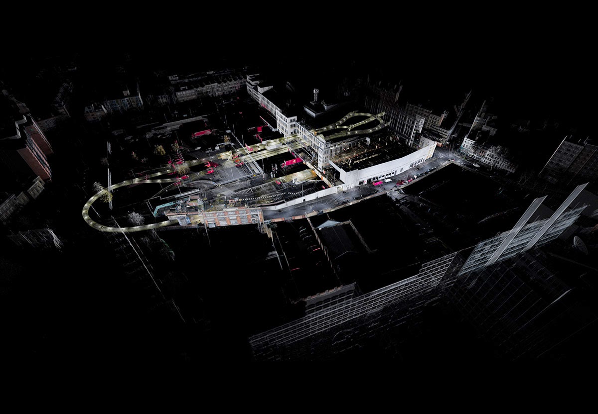
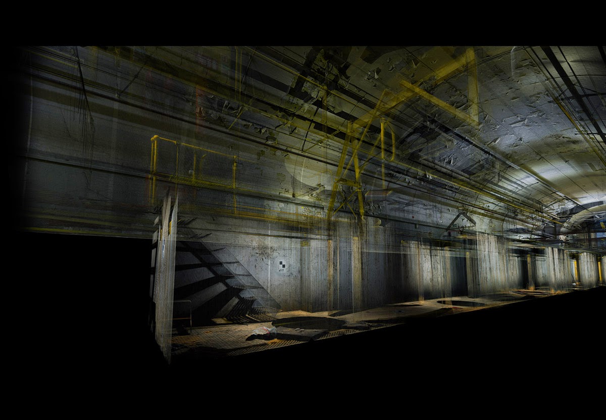
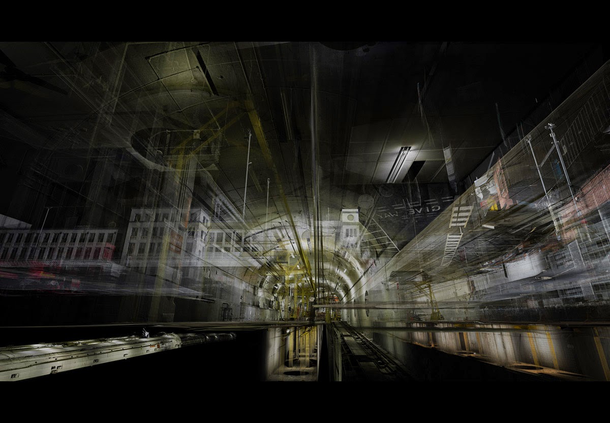
The London-based ScanLab Projects, featured here many times before, have completed a new commission, this time from the British Postal Museum & Archive, to document the so-called “Mail Rail,” a network of underground tunnels that opened back in 1927.

As Subterranea Britannica explains, the tunnels were initially conceived as a system of pneumatic package-delivery tubes, an “atmospheric railway,” as it was rather fantastically described at the time, “by which a stationary steam engine would drive a large fan which could suck air out of an air tight tube and draw the vehicle towards it or blow air to push them away.”

That “vehicle” would have been a semi-autonomous wheeled cart bearing parcels for residents of Greater London.

[Image: By ScanLab Projects, with permission from the British Postal Museum & Archive].

Alas, but unsurprisingly, this vision of an air-powered subterranean communication system for a vast metropolis of many millions of residents was replaced by a rail-based one, with narrow, packed-heavy cars running a system of tracks beneath the London streets.

Thus the Mail Rail system was born.

[Image: By ScanLab Projects, with permission from the British Postal Museum & Archive].

While the story of the system itself is fascinating, it has also been told elsewhere.

The aforementioned Subterranea Britannica is a perfect place to start, but urban explorers have also gained entrance for narrative purposes of their own, including the long write-up over at Placehacking.

That link includes the incredible detail that, “on Halloween night 2010, ravers took over a massive derelict Post Office building in the city and threw an illegal party of epic proportions. When pictures from the party emerged, we were astonished to find that a few of them looked to be of a tiny rail system somehow accessed from the building.”

Surely, this should be the setting for a new novel: some huge and illegal party in an abandoned building at an otherwise undisclosed location in the city results in people breaking into or discovering an otherwise forgotten, literally underground network, alcohol-blurred photographs of which are later recognized as having unique urban importance.

Something is down there, the hungover viewers of these photographs quickly realize, something vague and hazily glimpsed in the unlit background of some selfies snapped at a rave.

[Image: By ScanLab Projects, with permission from the British Postal Museum & Archive].

This would all be part of the general mysticism of infrastructure that I hinted at in an earlier post, the idea that the peripheral networks through which the city actually functions lie in wait, secretly connecting things from below or wrapping, Ouroborus-like, around us on the edges of things.

These systems are the Matrix, we might say in modern mythological terms, or the room where Zeus moves statues of us all around on chessboards: an invisible realm of tacit control and influence that we’ve come to know unimaginatively as nothing but infrastructure. But infrastructure is now the backstage pass, the esoteric world behind the curtain.

In any case, with this handful of party pictures in hand, a group of London explorers tried to infiltrate the system.

After hours of exploration, we finally found what we thought might be a freshly bricked up wall into the mythical Mail Rail the partygoers had inadvertently found… We went back to the car and discussed the possibility of chiselling the brick out. We decided that, given how soon it was after the party, the place was too hot to do that just now and we walked away, vowing to try again in a couple of months.

It took some time—but, eventually, it worked.

They found the tunnels.

[Image: By ScanLab Projects, with permission from the British Postal Museum & Archive].

The complete write-up over at Placehacking is worth the read for the rest of that particular story.

But ScanLab now enter the frame as documentarians of a different sort, with a laser-assisted glimpse of this underground space down to millimetric details.

Their 3D point clouds afford a whole new form of representation, a kind of volumetric photography that cuts through streets and walls to reveal the full spatial nature of the places on display.

The incredible teaser video, pieced together from 223 different laser scanning sessions, reveals this with dramatic effect, featuring a virtual camera that smoothly passes beneath the street like a swimmer through the waves of the ocean.


As the British Postal Museum & Archive explains, the goal of getting ScanLab Projects down into their tunnels was “to form a digital model from which any number of future interactive, visual, animated and immersive experiences can be created.”

In other words, it was a museological project: the digital preservation of an urban underworld that few people—Placehacking‘s write-up aside—have actually seen.

For example, the Museum writes, the resulting laser-generated 3D point clouds might “enable a full 3D walkthrough of hidden parts of the network or an app that enables layers to be peeled away to see the original industrial detail beneath.”

[Image: By ScanLab Projects, with permission from the British Postal Museum & Archive].

Unpeeling the urban onion has never been so gorgeous as we leap through walls, peer upward through semi-transparent streets, and see signs hanging in mid-air from both sides simultaneously.

[Image: By ScanLab Projects, with permission from the British Postal Museum & Archive].

Tunnels become weird ropey knots like smoke rings looped beneath the city as the facades of houses take on the appearance of old ghosts, remnants of another era gazing down at the flickering of other dimensions previously lost in the darkness below.

(Thanks again to the British Postal Museum & Archive for permission to post the images).

In a Pinch

[Image: A staircase in the Grands Magasins Dufayel; view larger].

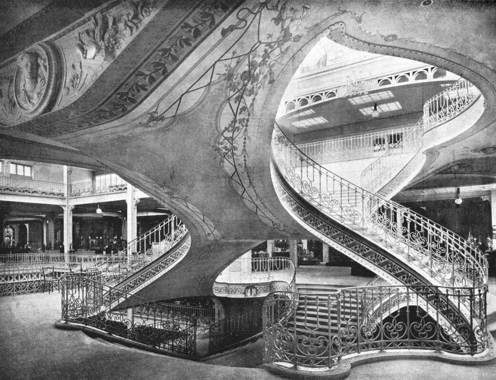
The second staircase I wanted to post today—here’s the first—is from the Grands Magasins Dufayel, a vast, 19th-century department store in Paris. View it larger.

Aside from the obvious grandeur of the structure, what makes this spatially noteworthy is the fact that one floor is pinched together with the next, and that the self-supporting “pinch” that results then becomes formalized as a stairway, a hyperbolic object in space that allows passage from one level to the next.

It’s as if a loop has been pulled or extracted from each level and then woven together—in effect, using a self-intersecting geometric pattern as the basis of a floorplan.

In any case, what I like in both examples (this one and the previous staircase), is that you have two floors or levels, obviously, but then there is the emptiness that separates them, a gap buzzing with unrealized forms of connection, and that you can fill that gap with pinches, spirals, knots, and loops, and that the magic of a well-designed staircase is precisely in giving material form to the invisible math that hovers in the space between floors.

(Originally spotted via ARCHI/MAPS).

Solved by Knots

[Image: Stairs inside the New York Life Insurance building, Minneapolis, by Babb, Cook and Willard; view larger].

There are two stairways I wanted to post, as they each solve the problem of getting from one floor to another in a particularly interesting way. The first example, seen above, is from the New York Life Insurance building in Minneapolis, Minnesota, designed by Babb, Cook and Willard.

View it larger.

What I love about this is incredibly simple, and it’s nothing more than the fact that a constrained approach from one floor to the next—with the far wall serving almost more like a cliff face—gave the architects no real room to operate. So they put in two, mirror-image spiral stairways, which kept the center of the room clear while dramatically increasing its available circulation space.

Today, of course, we’d probably just stick an elevator there and be done with it—but the compression of space made possible by spiral staircases is amazing. They are elegant prosthetics, connecting two levels like a casual afterthought with their efficient knots and coils.

Here’s the second staircase.

(Spotted via the always interesting ARCHI/MAPS).

The Moving Mountain, or Terrain as Spectacle

[Image: Courtesy of the Los Angeles Times Photographic Archive, Department of Special Collections, Charles E. Young Research Library, UCLA, via KCET].

Nathan Masters remains one of the more interesting chroniclers of life and landscape in Southern California, as evidenced by his “L.A. as Subject” blog for KCET. I could (and should) just link to all his posts, to be honest—lost hills! buried rivers! conflicting grids!—but last week’s installment, albeit short, was particularly interesting.

“For a few days in late November 1937,” Masters writes, “it was the Southland’s greatest attraction—a landslide in slow motion, 1.5 million tons of an Elysian Park hillside creeping toward the Los Angeles River bed.”

Sensational news reports, printed in papers and broadcast on radio nationwide, described it as a “moving mountain,” and tourists came from afar to witness the geologic curiosity. One Oklahoma City police officer took a leave of absence to watch the slide. Two boys hopped freight trains from New York to see it. Some 10,000 sightseers came by the hour. Spectators pressed against police barricades along Riverside Drive, and enterprising vendors worked the throng like a baseball game, hawking peanuts, popcorn, and soda. Some even sold field glasses.

Even local astronomers showed up, telescopes in tow, in order to study the mobile mass, this blob of geology suddenly making a move into town.

After a catastrophic lurching of the slow-motion mountain, the terrain appeared to come to a standstill. “The next day, an estimated crowd of 500,000 converged on the site, munching on popcorn and hoping the mountain would move again.”

This pent-up dramaturgy of the landscape—the possibility that its newfound agency would continue—crawling, oozing, rolling, forcing its way into public consciousness—remains strong today, even if subsumed into other contexts.

In other words, I’d suggest that many Angelenos are still, in a sense, “munching on popcorn and hoping the [landscape] would move again,” and that this is the dark fascination of seismic instability, of what it means to live in an earthquake zone: that the land itself is active, motivated from within by a kind of a slow-motion sentience, a mineral energy that is as much an invigorating spectacle as it is an existential threat.

Read the rest of Masters’s post over at “L.A. as Subject.”

A Cenotaph for Tailings

[Image: From “Mining Cenotaph” by Alexis Quinteros Salazar; courtesy of the RIBA President’s Medals].

Here’s another project from the RIBA President’s Medals, this one by Alexis Quinteros Salazar, a student at the University of Chile in Santiago.

Called “Mining Cenotaph,” it imagines an “occupation” of the tailings piles that have become a toxic urban landmark and a spatial reminder of the region’s economic exploitation.

[Image: From “Mining Cenotaph” by Alexis Quinteros Salazar; courtesy of the RIBA President’s Medals].

A museum would be carved into the tailings; in Salazar’s words, this would be a “building that captures the history and symbolism behind mining, enhancing and revitalizing a memory that is currently disaggregated and ignored and has a very high touristic potential.”

[Image: From “Mining Cenotaph” by Alexis Quinteros Salazar; courtesy of the RIBA President’s Medals].

In an architectural context such as this, the use of the word “cenotaph” is a pretty clear reference to Étienne-Louis Boullée’s classic speculative project, the “Cenotaph for Newton.” Over multiple generations, that has become something of a prime mover in the history of experimental architectural design.

Punctured walls and ceilings bring light into the interior—

[Image: From “Mining Cenotaph” by Alexis Quinteros Salazar; courtesy of the RIBA President’s Medals].

—while the roof is a recreational space for visitors.

Of course, there are a lot of unanswered questions here—including the control of aerosol pollution from the tailings pile itself and that pile’s own long-term structural stability—but the poetic gesture of a public museum grafted into a pile of waste material is worth commending.

[Image: From “Mining Cenotaph” by Alexis Quinteros Salazar; courtesy of the RIBA President’s Medals].

The detail I might like this most is where the structure becomes a kind of inversion of Boullée’s dome, which was pierced to make its huge interior space appear illuminated from above by constellations. Here, instead, it is the perforations in the the rooftop that would glow upward from below, as if in resonance with the night skies high above.

[Image: From “Mining Cenotaph” by Alexis Quinteros Salazar; courtesy of the RIBA President’s Medals].

Salazar’s project brings to mind a few other proposals seen here over the years, including the extraordinary “Memorial to a Buried Village” by Bo Li and Ge Men, as well as Brandon Mosley’s “Mine Plug” (which actually took its name retroactively from that BLDGBLOG post).

Click through to see slightly larger versions of the images over at the RIBA President’s Medals website.

[Image: From “Mining Cenotaph” by Alexis Quinteros Salazar; courtesy of the RIBA President’s Medals].

Finally, don’t miss the Brooklyn food co-op posted earlier, also a recent President’s Medal featured project.

Immaculate Ecologies

[Image: Via the Midway Atoll National Wildlife Refuge].

“We will put up the mountains. We will lay out the prairie. We will cut rivers to join the lakes.” So says the narrator of a nice piece of ecosystem fiction by my friend Scott Geiger published over at Nautilus.

This corporate spokesperson is building virgin terrain: “all-new country, elevated and secured from downstairs, with a growing complement of landforms, clean waters, ecologies, wilderness.”

I was reminded of Geiger’s work when I came across an old bookmark here on my computer, with a story that reads like something straight out of the golden age of science fiction: a corporate conglomerate, intent on spanning vast gulfs of space, finds itself engineering an entire ecosystem into existence on a remote stopping-off point, turning bare rocks into an oasis, in order to ensure that its empire can expand.

This could be the premise of a Hugo Award-winning interplanetary space opera—or it could be the real-life history of the Commercial Pacific Cable Company.

[Image: Via the Midway Atoll National Wildlife Refuge].

The Company was the first to lay a direct submarine cable from the United States to East Asia, but this required the use of a remote atoll, 1,300 miles northwest of Honolulu, called Midway, not yet famous for its role in World War II.

At the time, however, there was barely anything more there than “low, sandy island[s] with little vegetation,” considered by the firm’s operations manager to be “unfit for human habitation.” The tiny islands—some stretches no more than sandbars—would have been impossible to use, let alone to settle.

Like Geiger’s plucky terraforming super-company, putting up the mountains and laying out the prairie, the Cable Company and its island operations manager “initiated the long process of introducing hundreds of new species of flora and fauna to Midway.”

During this period, the superintendent imported soil from Honolulu and Guam to make a fresh vegetable garden and decorate the grounds. By 1921, approximately 9,000 tons of imported soil changed the sandy landscape forever. Today, the last living descendants of the Cable Company’s legacy still flutter about: their pet canaries. The cycad palm, Norfolk Island Pine, ironwood, coconut, the deciduous trees, everything seen around the cable compound is alien. Since Midway lacked both trees and herbivorous animals, the ironwood trees spread unchecked throughout the Atoll. What else came in with the soil? Ants, cockroaches, termites, centipedes; millions of insects which never could have made the journey on their own.

Strangely, the evolved remnants of this corporate ecosystem are now an international bird refuge, as if saving space for the feral pets of long-dead submarine cable operators.
[Image: Via the Midway Atoll National Wildlife Refuge].

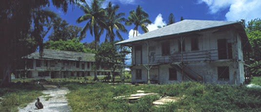
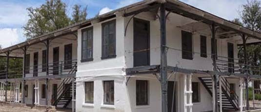
The preserved ruins of old Cable Company buildings stand amidst the trees, surely now home to many of those “millions of insects which never could have made the journey on their own.” Indeed, “the four main Cable Company buildings, constructed of steel beams and concrete with twelve-inch thick first-story walls, have fought a tough battle with termites, corrosion, and shifting sands for nearly a century.”

It is a built environment even down to the biological scale—a kind of time-release landscape now firmly established and legally protected.

It’s worth pointing out, however, that the constructed frontier lands of Scott Geiger’s fictions and the national park of curated species still fluttering their wings at Midway share much with the even stranger story of terraforming performed by none other than Charles Darwin on Ascension Island.

This is, in the BBC’s words, “the amazing story of how the architect of evolution, Kew Gardens and the Royal Navy conspired to build a fully functioning, but totally artificial ecosystem.” It’s worth quoting at length:

Ascension was an arid island, buffeted by dry trade winds from southern Africa. Devoid of trees at the time of Darwin and [his friend, the botanist Joseph] Hooker’s visits, the little rain that did fall quickly evaporated away.

Egged on by Darwin, in 1847 Hooker advised the Royal Navy to set in motion an elaborate plan. With the help of Kew Gardens—where Hooker’s father was director—shipments of trees were to be sent to Ascension.

The idea was breathtakingly simple. Trees would capture more rain, reduce evaporation and create rich, loamy soils. The “cinder” would become a garden.

So, beginning in 1850 and continuing year after year, ships started to come. Each deposited a motley assortment of plants from botanical gardens in Europe, South Africa and Argentina.

Soon, on the highest peak at 859m (2,817ft), great changes were afoot. By the late 1870s, eucalyptus, Norfolk Island pine, bamboo, and banana had all run riot.

It’s not a wilderness forest, then, but a feral garden “run riot” on the slopes of a remote, militarized island outpost (one photographed, I should add, by photographer Simon Norfolk, as discussed in this earlier interview on BLDGBLOG).
[Image: The introduced forestry of Ascension Island, via Google Maps].

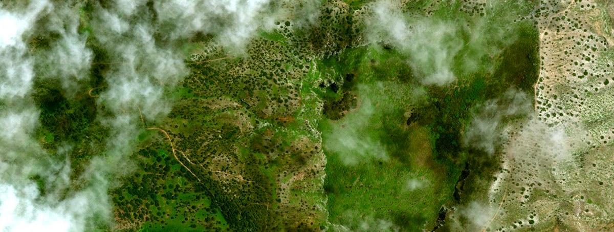
In a sense, Ascension’s fog-capturing forests are like the “destiny trees” from Scott Geiger’s story in Nautilus—where “there are trees now that allow you to select pretty much what form you want ten, fifteen, twenty years down the road”—only these are entire destiny landscapes, pieced together for their useful climatic side-effects.

For anyone who happened to catch my lecture at Penn this past March, the story of Ascension bears at least casual comparison to the research of Christine Hastorf at UC Berkeley. Hastorf has written about the “feral gardens” of the Maya, or abandoned landscapes once deeply cultivated but now shaggy and overgrown, all but indistinguishable from nature. For Hastorf, many of the environments we currently think of as Central American rain forest are, in fact, a kind of indirect landscape architecture, a terrain planted and pruned long ago and thus not wilderness at all.

Awesomely, the alien qualities of this cloud forest can be detected. As one ecologist remarked to the BBC after visiting the island, “I remember thinking, this is really weird… There were all kinds of plants that don’t belong together in nature, growing side by side. I only later found out about Darwin, Hooker and everything that had happened.” It was like stumbling upon a glitch in the matrix.

In the case of these islands, I love the fact that historically real human behavior competes, on every level, for sheer outlandishness with the best of science fiction for its creation of entire ecosystems in remote, otherwise inhospitable environments; advanced landscaping has become indistinguishable from planetology. And, in Scott Geiger’s case, I love the fact that the perceived weirdness of his story comes simply from the scale at which he describes these landscape activities being performed.

In other words, Geiger is describing something that actually happens all the time; we just refer to it as the suburbs, or even simply as landscaping, a near-ubiquitous spatial practice that is no less other-worldly for taking place one half-acre at a time.
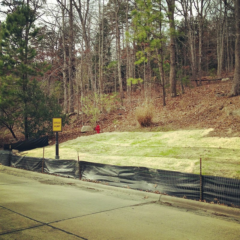
[Image: A suburban landscape being rolled out into the forest like carpet; photo by BLDGBLOG].

Soon, even the discordant squares of grass seen in the above photograph will seem as if they’ve always been there: a terrain-like skin graft thriving under unlikely circumstances.

Think of a short piece in New Scientist earlier this year: “All this is forcing enthusiasts to reconsider what ‘nature’ really is. In many places, true wilderness vanished thousands of years ago, and the landscapes we think of as natural are largely artificial.”

Indeed, like something straight out of a Geiger short story, “thousands of years from now our descendants may think of African lions roaming American plains as ‘natural’ too.”
NATO’s Underground Roman Super-Quarry

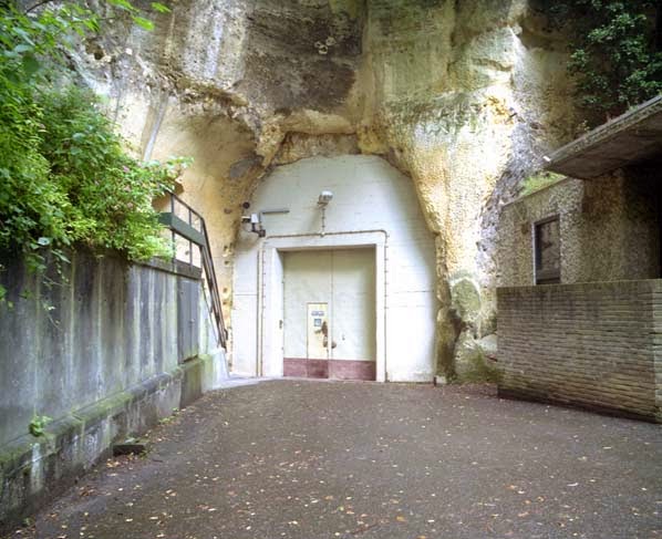
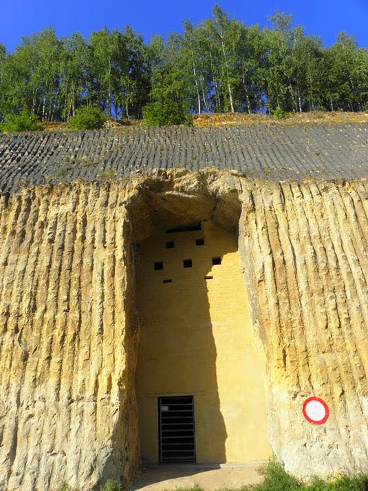
[Image: An entrance to the quarry in Kanne; photo by Nick Catford via Subterranean Britannica].

There is an underground Roman-era quarry in The Netherlands that, when you exit, you will find that you have crossed an invisible international border somewhere down there in the darkness, and that you are now stepping out into Belgium; or perhaps it’s the other way around, that there is an underground Roman-era quarry in Belgium that, when you exit, you will find that you have crossed an invisible international border somewhere down there in the darkness, and that you are now stepping out into The Netherlands.

However, this is not just a disused quarry—not just an archaeological site on the fringes of the Roman empire that was once mined for blocks of limestone. Its afterlife is by far the most interesting part of the story.

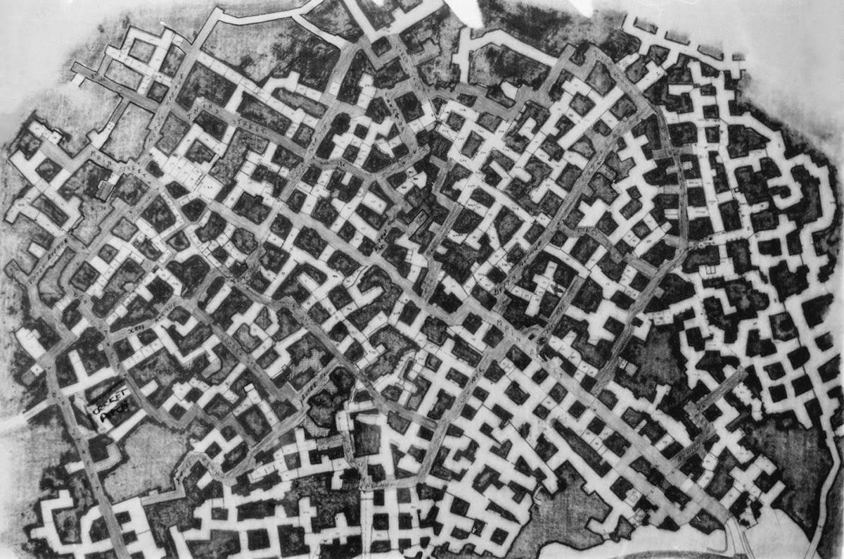
For nearly a century, beginning in the 1800s, these underground hollows were used by Jesuit monks as a secluded place for prayer, study, and meditation, and even for the carving of elaborate and impressive forms into the soft rock walls; then the Nazis took over, transforming this weird underworld into a subterranean factory for World War II airplane parts; then, finally, pushing the stakes yet higher, the whole complex of former Roman limestone mines, straddling an international border underground between two modern European nations, was turned into a doomsday bunker for NATO, a dark and mold-prone labyrinth within which military commanders constructed a Joint Operations Center for responding to the end of the world (whenever the time finally came).

[Images: Monks underground; via De Limburgse Mergelgrotten].

“There was even a 3-hole golf course complete with artificial turf,” Subterranean Britannica reports in a recent issue of their excellent magazine, Subterranea.

“The complex was on average 50 meters below ground covering an area of approximately 6750 acres with eight miles of corridors, 400 branches and 399 individual offices,” SubBrit explains. There were escape tunnels, as well, “one going out to the banks of the Albert Canal in Belgium, and one which came out in a farmer’s potato store in the village of Kanne.” It had its own water supply and even a dedicated wine cellar for NATO officers, who might need a glass of Europe’s finest chardonnay to help feel calm enough to launch those missiles.

Just look at this thing’s mind-boggling floor plan.

The “streets” were named, but not always easy to follow; however, this didn’t stop officers stationed there from occasionally going out to explore the older tunnels at night. A former employee named Bob Hankinson describes how he used to navigate:
Most corners were roughly 90 degrees, but only roughly. Going through the caves was an exercise in left and right turns every 50 feet or so. Navigation was helped by street names. Unlike in the USA, where streets are numbered on a sort of grid pattern, these were zigzag streets. My office on Main Street and J Street, so if I got lost I would just keep walking until I came to either Main or J, and join it. If I went the wrong way, eventually the street would peter out either at the perimeter or a T-junction, and you would just turn round and go back the other way.

As another former employee—a man named Alan Francis—explains, “If I did have spare time, I would wander through the dark tunnels where there were very few lights on at night, thinking how strange it was to be working in a Roman stone quarry.”

Writing in Subterranea, SubBrit explains that “nothing ever came out.” This was “a strict rule: apart from people, anything that went in never came out. All waste material ranging from redundant furniture to foot waste was dumped in one of the sixteen underground landfill sites” designated within this sprawling whorl of rooms and passages. Shredded documents were even mixed with water and applied directly to the walls as a kind of fibrous paste, used for insulation.

Such was the secrecy surrounding this place that it was officially classified as “a ‘forbidden place’ under the Protection of State Secrets Act which forbade people to even talk about it.”

One reason why the underground galleries are so vast, meanwhile, is apparently because of the character of the limestone they were carved through; in fact, “the limestone was so soft that the workers used a chainsaw to cut it.”

The notion that I could just cut myself a whole new room with a chainsaw—just revving this thing up and carving an entire new hallway or corridor, pushing relentlessly forward into what looks like solid earth, possibly even sawing my way into the roots of another country—is so awesome an architectural condition that I would move there tomorrow if I could.

Just imagine building this titanic doorway into the earth with a small group of friends, a case of beer, and a few chainsaws. It’s like Cappadocia by way of the Cold War. By way of Husqvarna.

[Image: An entrance into the NATO complex; via this thread].

Sadly, the whole place is contaminated with asbestos and has been badly saturated with diesel fuel. At least one environmental analysis of the underground maze found that “diesel fuel from the [copious emergency fuel] tanks had leaked into the porous limestone over a long period and had penetrated to a depth of about forty feet into the rock.”

You can imagine the weird bonfires that could have resulted should someone have been stupid enough to light a match, but “this area had to be removed and disposed of,” we read—presumably by chainsaw.

Nonetheless, today you can actually take a tour of this place—this now-derelict doomsday logistics hub that straddles international borders underground—courtesy of the Limburg Landscape Foundation.

If you can take the tour, let me know how it goes; I’d love to visit this place in person someday and would be thrilled to see any photographs.

(If you like the sound of underground NATO quarries and want to see more, don’t miss these vaguely related photo sets: NATO Quarry, N.A.T.O. Quarry, N.A.T.O. Quarry, France, Urban Explorers Discover Corroding Military Vehicles in Abandoned Subterranean Bunker, and Nato Quarry, Paris Suburbs May 2011).