Floating Cities and Site Surveys

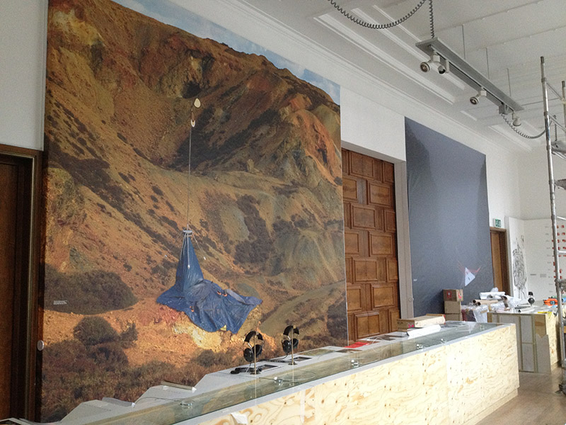
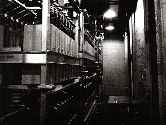
[Image: Photo by Mark Smout of a photo by Mark Smout, for the British Exploratory Land Archive].

I’m delighted to say that work originally produced for the British Pavilion at last summer’s Venice Biennale will go on display this week at the Royal Institute of British Architects in London, beginning tomorrow, 26 February.

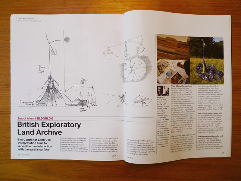
This will include, among many other projects, from studies of so-called “new socialist villages” in China to floating buildings in Amsterdam, to name but a few, the British Exploratory Land Archive (BELA) for which BLDGBLOG collaborated with architects Smout Allen in proposing a British version of the Center for Land Use Interpretation in Los Angeles. BELA would thus survey, catalog, explore, tour, document, and archive in one location the huge variety of sites in Britain altered by and used by human beings, from industrial sites to deserted medieval villages, slag heaps to submarine bases, smuggler’s hideouts to traffic-simulation grounds. A few of these sites have already been documented in massive photographs now mounted at the RIBA, also featuring architectural instruments designed specifically for the BELA project and assembled over the summer in Hackney.

[Image: From the British Exploratory Land Archive].

However, if you’re curious to know more and you happen to be in London on Thursday, 28 February, consider stopping by the Architectural Association to hear Smout Allen and I speak in more detail about the project. That talk is free and open the public, and it kicks off at 6pm; I believe architect Liam Young will be introducing things. Meanwhile, the aforementioned study of floating architecture in Amsterdam will be presented by its collaborative team—dRMM—at the RIBA on Tuesday night, 26 February, so make your calendars for that, as well (and check out the full calendar of related talks here).

The RIBA is at 66 Portland Place and the AA is in Bedford Square.

Operation Deep Sleep: or, dormant robots at the bottom of the sea

[Image: An otherwise unrelated photo of lift bags being used in underwater archaeology; via NOAA].

The Defense Advanced Research Projects Agency, or DARPA, is hoping to implement a global infrastructure for storing mission-critical objects and payloads at the “bottom of the sea”—a kind of stationary, underwater FedEx that will release mission-critical packages for rendezvous with passing U.S. warships and UAVs.

It’s called the Upward Falling Payloads program.

The “concept,” according to DARPA, “centers on developing deployable, unmanned, distributed systems that lie on the deep-ocean floor in special containers for years at a time. These deep-sea nodes would then be woken up remotely when needed and recalled to the surface. In other words, they ‘fall upward.'” This requires innovative new technologies for “extended survival of nodes under extreme ocean pressure, communications to wake-up the nodes after years of sleep, and efficient launch of payloads to the surface.”

As Popular Science describes it, it’s a sleeping archive of “‘upward falling’ robots that can hide on the seafloor for years [and] launch on demand.”

And you can even get involved: DARPA is currently seeking proposals for how to realize its vision for Upward Falling Payloads.

DARPA seeks proposals in three key areas for developing the program: Communications, deep ocean ‘risers’ to contain the payloads, and the actual payloads. DARPA hopes to reach technical communities that conduct deep-ocean engineering from the telecom and oil-exploration industry to the scientific community with insights into signal propagation in the water and on the seafloor.

An informative “proposer’s day” will be held on January 25, 2013, where you can learn more about the program. It seems that, just a few years from now, storing objects for at-sea retrieval will be as ordinary as receiving an email.

Briefly, it seems worth mentioning that this vision of waking things up from slumber at the bottom of the sea reads like a subplot from Pacific Rim, or like some militarized remake of the works of H.P. Lovecraft—wherein Lovecraft’s fictional Cthulhu, a monstrous and alien god, is described (by Wikipedia) as “a huge aquatic creature sleeping for eternity at the bottom of the ocean and destined to emerge from his slumber in an apocalyptic age.”

Only, here, it is a gigantic system of military jewelry laced across the seafloor, locked in robotic sleep until the day of its electromagnetic reawakening.

(Thanks to Brian Romans for the link!)

Fence Phone

[Image: Barbed wire, via Wikipedia].

One more radio-related link comes via @doingitwrong, who mentions the use of barbed-wire fences as a kind of primitive telephone network.

“Across much of the west,” C.F. Eckhardt explains, “…there was already a network of wire covering most of the country, in the form of barbed-wire fences. Some unknown genius discovered that if you hooked two Sears or Monkey Ward telephone sets to the top wire on a barbed-wire fence, you could talk between the telephones as easily as between two ‘town’ telephones connected by slick wire through an operator’s switchboard. A rural telephone system that had no operators, no bills—and no long-distance charges—was born.”

The system relied upon the creative use of everyday materials as insulators; in fact, according to Delbert Trew, “the most clever, most innovative cowboys used every conceivable type of device as insulators to suspend the wire. I have found leather straps folded around wire and nailed to the posts, whiskey bottle necks installed over big nails, snuff bottles, corn cobs, pieces of inner-tube wrapped around the wire and short straps of tire holding telephone wires to the post.”

[Image: From a June 1902 issue of The New York Times].

This ranchpunk system of interlinked fences led to the “big ranches” being “among the first to install barbed wire telephones in an effort to be alerted when prairie fires started”—an early-warning device for previously disconnected ranch owners, not a divisive symbol of modern property but a network, a transmitter, an oral internet of fences.

Project Sanguine and the Dead Hand

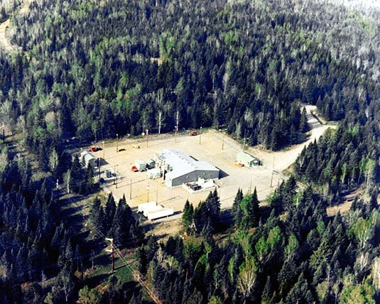
[Image: One of the stations of Project ELF, via Wikipedia].

Further exploring the radio-related theme of the last few posts, Rob Holmes—author and co-founder of mammoth—has pointed our attention to something called Project Sanguine, a U.S. Navy program from the 1980s that “would have involved 41 percent of Wisconsin,” turning that state into a giant “antenna farm” capable of communicating with what Wikipedia calls “deeply-submerged submarines.”

Each individual antenna would have been “buried five feet deep” in the fertile soil of the Cheese State, the New York Times explains, creating a networked system with nearly 6,000 miles’ worth of cables and receiving stations.

The Navy was hoping, we read, for a system “that could transmit tactical orders one-way to U.S. nuclear submarines anywhere in the world, and survive a direct nuclear attack.” This would “normally… require an antenna many hundreds of miles in length,” according to the NYT, but Naval strategists soon “realized that a comparable effect could be achieved by using a large volume of the earth’s interior”—that is, “looping currents deep in the Earth”—”as part of the antenna.” The hard and ancient rock of the Laurentian Shield was apparently perfect for this.

[Image: From Roy Johnson, “Project Sanguine,” originally published in The Wisconsin Engineer (November 1969)].

In other words, the bedrock of the Earth itself—not a mere island in the Antarctic—could be turned into a colossal radio station.

A similar system, installed for preliminary tests in North Carolina and Virginia, “apparently flickered lightbulbs in the area and caused spurious ringing of telephones,” like some regional poltergeist or a technical outtake from Cabin in the Woods.

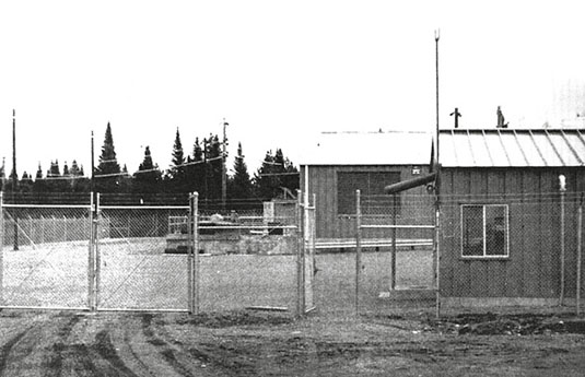
At least two things worth pointing out here are that a “scaled-down version” of Project Sanguine was, in fact, actually constructed, becoming operational in the northern forests of Michigan and Wisconsin from 1989-2004; called Project ELF (for Extremely Low Frequency), it arrived just in time for the Soviet Union to collapse…

[Image: Inside Project Sanguine; photo from Roy Johnson, The Wisconsin Engineer (November 1969)].

…which brings us to the second point worth mentioning: a strangely haunting program known as “The Dead Hand,” a doomsday device constructed by the Soviet Union.

In his Pulitzer Prize-winning book of that title, historian David Hoffman writes about a (still active) weapon of retaliation. The “Dead Hand” was built such that, if nuclear field commanders ever lost touch with military leaders back in Moscow during a time of war, a constellation of cruise missiles would automatically launch. This would happen not in spite of a lack of living military leaders, but precisely because everyone had been killed. That is, a machine would take over—thus the name “dead hand.”

Each cruise missile, however, flying over the lands of the USSR, would emit launch commands to all of the missile silos it passed over. Missile after missile would soon soar—thousands of them—arcing toward the United States, which would soon be obliterated, along with the rest of the world, in a nuclear holocaust controlled and commanded by nothing but preprogrammed machines.

In any case, Project Sanguine was its own version of an end-times radio, an “immense subterranean grid” transmitting to distant submarines by way of the Earth itself, humans using an entire planet as an apocalyptic radio device.

Books Received

[Image: The Wiederin bookshop in Innsbruck, Austria; photo by Lukas Schaller, courtesy of A10].

Barely in time for the holidays, here is a quick look at some of the many new or recent books that have passed through the home office here at BLDGBLOG.

As usual, I have not read all of the books listed here, but this will be pretty clear from the ensuing descriptions; those that I have read, and enjoyed, I will not hesitate to recommend.

And, as always, all of these books are included for the interest of their approach or subject matter as it relates to landscape, spatial sciences, and the built environment more generally.
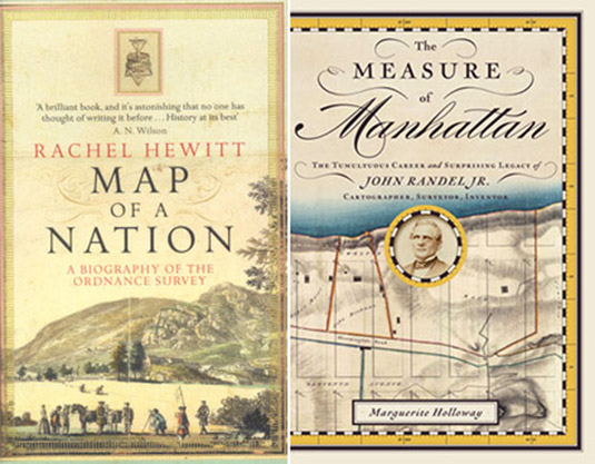
1) Map of a Nation: A Biography Of The Ordnance Survey by Rachel Hewitt (Granta).

2) The Measure of Manhattan: The Tumultuous Career and Surprising Legacy of John Randel, Jr., Cartographer, Surveyor, Inventor by Marguerite Holloway (W.W. Norton).

These two fantastic books form a nice, if coincidental, duo, looking at the early days of scientific cartography and the innovative devices and mathematical techniques that made modern mapping possible. In Rachel Hewitt’s case—a book I found very hard to put down, up reading it till nearly 2am several nights in a row—we trace the origins of the UK’s Ordnance Survey by way of the devices, tools, precision instruments, and imperialist geopolitical initiatives of the time.

Similarly, Marguerite Holloway introduces us to, among many other things, the first measured imposition of the Manhattan grid. I mentioned Holloway’s book the other day here on BLDGBLOG, and am also very happy to have been asked to blurb it. Here’s my description: “This outstanding history of the Manhattan grid offers us a strange archaeology: part spatial adventure, part technical expedition into the heart of measurement itself, starring teams of 19th-century gentlemen striding across the island’s eroded mountains and wild streams, implementing a grid that would soon enough sprout skyscrapers and flatirons, Central Park and 5th Avenue. Marguerite Holloway’s engaging survey takes us step by step through the challenges of obsolete land laws and outdated maps of an earlier metropolis, looking for—and finding—the future shape of this immeasurable city.”

For anyone at all interested in cartography, these make an excellent and intellectually stimulating pair.
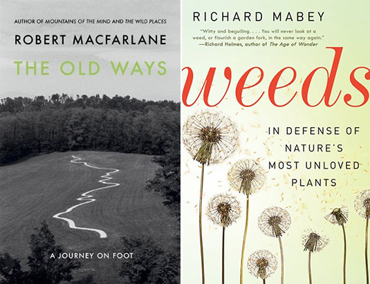
3) The Old Ways: A Journey on Foot by Robert Macfarlane (Viking).

4) Weeds: In Defense of Nature’s Most Unloved Plants by Richard Mabey (Ecco).

I’ve spoken highly of Robert Macfarlane’s writing before, and will continue to do so. His Wild Places remains one of my favorite books of the last few years, and I was thus thrilled to hear of his newest: a series of long walks (and a boat ride) through the British landscape, from coastal mudflats to chalk hills and peat bogs, following various kinds of well-worn routes and paths, the “old ways” of his book’s title. Macfarlane’s writing can occasionally strain for rapture when, in fact, it is precisely the mundane—nondescript earthen paths and overlooked back woods—that makes his “journeys on foot” so compelling; but this is an otherwise minor flaw in a highly readable and worthwhile new book.

Meanwhile, Richard Mabey has written an almost impossibly captivating history of weeds, “nature’s most unloved plants.” Covering invasive species, overgrown bomb sites in WWII London, and abandoned buildings, and relating stories from medieval poetry and 21st-century agribusiness to botanical science fiction, Mabey’s book is an awesome sweep through the world of out-of-place plant life.
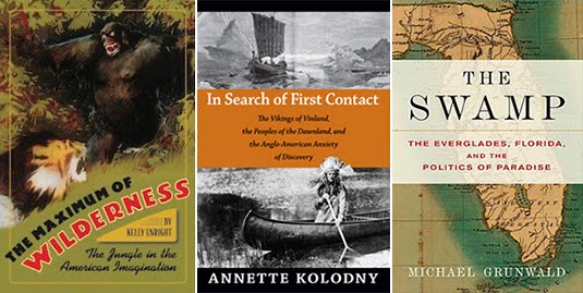
5) The Maximum of Wilderness: The Jungle in the American Imagination by Kelly Enright (University of Virginia Press).

6) In Search of First Contact: The Vikings of Vinland, the Peoples of the Dawnland, and the Anglo-American Anxiety of Discovery by Annette Kolodny (Duke University Press).

7) The Swamp: The Everglades, Florida, and the Politics of Paradise by Michael Grunwald (Simon & Schuster).

These three books variously describe encounters with the alien wilderness of a new world. Kelly Enright’s look at “the jungle in American imagination” reads a bit too much like a revised Ph.D. thesis, but its central premise is fascinating, looking not only at the complex differences between the meaning of a jungle and that of a rain forest, but exploring, as she phrases it, “some of the consequences of expanding an American image and ideology of wilderness beyond American shores,” from Theodore Roosevelt to the early days of tropical anthropology.

Annette Kolodny’s review of what can more or less be summarized as the Viking discovery of North America is incredibly rich. Quoting from the cover, Kolodny “offers a radically new interpretation of two medieval Icelandic tales, known as the Vinland Sagas. She contends that they are the first known European narratives about contact with North America.” However, in addition to these tales of “first contact,” Kolodny examines rock carvings in Maine and Canada, as well as Native American folktales, to try to geographically and historically locate the moment when Europeans first arrived in North America, sailing up the small coastal rivers and setting foot on foreign land. Kolodny convincingly demonstrates, in the process, that the Viking discovery of North America was more or less widely accepted by 19th-century historians, but that, she argues, following a large influx of Italian immigrants toward the end of that century and into the 20th, the national importance of Christopher Columbus—an Italian—began to grow. From this emerged, she shows, a kind of narrative contest in which rugged northerners from a stoic, military culture (the Norse) were pitted against royalist Catholic Mediterranean family men as the true cultural progenitors of the United States. It is also interesting here to note that Kolodny assigned these early Icelandic contact narratives to her English literature class, asking students “to consider the possibility that American literature really began in these early ‘contact’ narratives that constructed a so-called New World and its peoples through and for the contemporary cultural understandings of the European imagination.”

I read Michael Grunwald’s The Swamp under particular circumstances—traveling around Florida as part of Venue, along with Smout Allen and a group of students from the Bartlett School of Architecture (photos of that trip can be seen here and here)—which might have added to its appeal. But, either way, I was riveted. Grunwald’s book presents, in effect, all of Florida south of Orlando as a massive series of ecologically misguided—but, from an economic perspective, often highly successful—terraforming projects. Speaking only for myself, the book made it impossible not to notice waterworks everywhere, on all sides and at every scale: every canal, storm sewer, water retention basin, highway overpass, levee, reservoir, drainage ditch, coastal inlet, and flood gate, all parts of an artificially engineered peninsula that wants to—and should—be swamp. Environmentally sensitive without being a screed, and written at the pace of a good New Yorker article, The Swamp was easily one of my favorite discoveries this year, a book I’d place up there with Marc Reisner’s classic Cadillac Desert; it deserves the comparison for, if nothing else, its clear-eyed refocusing of attention onto a region’s hydrology and onto civilization’s larger attempts to manage wild lands (and waters), from the Seminole Wars to George W. Bush. Grunwald also makes clear something that I had barely even considered before, which is that south Florida is actually one of the most recently settled regions of the United States, far younger than the new states of the American West. South Florida, in many senses, is an event that only just recently happened—and Grunwald shows both how and why.
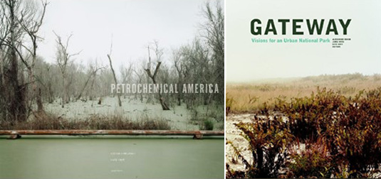
8) Petrochemical America by Richard Misrach and Kate Orff (Aperture Foundation).

9) Gateway: Visions for an Urban National Park edited by Alexander Brash, Jamie Hand, and Kate Orff (Princeton Architectural Press/Van Alen Institute).

Here are two new books, each connected to the work of landscape architect and Columbia GSAPP urban planner, Kate Orff.

The first is a split project with photographer Richard Misrach, looking both directly and indirectly at petrochemical infrastructure and the landscapes it passes through in the state of Louisiana. Misrach’s photos open the book with nearly 100 pages’ worth of views into the rapidly transforming nature of Louisiana’s so-called Cancer Alley, “showcasing the immediate plight of embattled local communities and surrounding industries.” Orff’s work follows in the second half of the book with what she calls an “Ecological Atlas” of the same region, mapping what currently exists, more thoroughly annotating Misrach’s photos, and proposing new interventions for ecologically remediating the spoiled landscapes of the region.

The second book is an edited collection of essays and proposals for New York’s Gateway National Recreational Area. Gateway is a strange combination of protected lands and artificial dredgescapes, at the border between ocean and land at the very edge of New York City. Photographs by Laura McPhee join essays by Ethan Carr, Christopher Hawthorne, and others to suggest a new role for parks in American urban life, and a new type of park in general, one that is distributed over discontinuous parcels of marginal land and includes large expanses of active waters.

10) Cities Without Ground: A Hong Kong Guidebook by Adam Frampton, Jonathan D. Solomon, and Clara Wong (ORO Editions).

11) Oblique Drawing: A History of Anti-Perspective by Massimo Scolari (MIT Press).

12) Bulwark & Bastion: A Look at Musket Era Fortifications with a Glance at Period Siegecraft by James R. Hinds and Edmund Fitzgerald (Pioneer Press).

13) On the Making of Islands by Nick Sowers (self-published).

Cities Without Ground: A Hong Kong Guidebook was inspired by the revelation that a person can navigate the city of Hong Kong over great distances without ever leaving architecture behind, meandering through complex networks of internal space, from walkways and shopping malls to escalators and covered footbridges. Indeed, one can explore Hong Kong without really setting foot on the surface of the earth at all, making it a “city without ground.” The resulting labyrinthine spatial condition—consisting of “seemingly inescapable and thoroughly disorienting sequences” that cut through, around, between, and under nominally separate megastructures—has led the book’s authors to produce a series of visually dense maps dissecting the various routes a pedestrian can take through the city. A particular highlight comes toward the end, where they focus solely on the city’s air-conditioning, suggesting a kind of thermal cartography of indoor space and implying that temperature control and even humidity are better metrics for evaluating the success of a given project than mere visual or aesthetic concerns.

Massimo Scolari’s Oblique Drawing also pursues the idea that there are other, less well-explored methods for representing the built environment. Although I was disappointed to find that the chapters are, in effect, separate, not always related papers that happen to share a common interest in architectural representation, the book manages to tie together everything from ancient Egyptian hieroglyphs to the military drawings of Leonardo da Vinci, from medieval Christian landscapes to Chinese painting techniques and the Tower of Babel. Scolari’s book was also mentioned here on the blog last week in the context of architectural espionage.

I was actually given a copy of Bulwark & Bastion while out at the surreal and extremely remote site of Fort Jefferson, in the Dry Tortugas of Florida, and I read it on the 2-hour boat ride back to Key West. No more than a stapled pamphlet, like something you’d make at Kinko’s, it is, nonetheless, an extremely interesting look at built landscapes of warfare and defense. Unsurprisingly, it includes a history of walled cities and forts from Europe; but—and this topic alone deserves a full-length book from a publisher like Princeton Architectural Press—it discusses in detail the landscape defenses of the American Civil War, including massive brick citadels in Alabama, Maryland, South Carolina, and New York City. Star forts, bastions, casements, field works, and other geometries of assault and counter-attack are all illustrated and diagrammed, and they’re followed by a glossary of architectural defensive terms. Thoroughly enjoyable, in particular for anyone interested in military history.

Many of you will know Nick Sowers from his blogging at Archinect, where he explored the niche field of military landscapes and sound recordings. Nick was a deserving recipient of UC-Berkeley’s generous Branner Fellowship, which gave him the resources to travel the world for nearly a year, visiting overseas military bases, old battlefields, and urban fortresses from Japan and the South Pacific to Western Europe, including even the legendary Maunsell Towers in London’s Thames Estuary. At all of these sites, he made field recordings. Nick and I first met, in fact, down in Sydney, Australia, as part of Urban Islands back in 2009. This self-published book tells the story of those travels, including sketches and models from Nick’s own final thesis project at Berkeley, black & white photos from his long circumambulations of closed U.S. bases overseas, and a consistently interesting series of observations on the spatial implications of sound in landscape design. Weird visions of limestone caves being vibrated into existence by the tropical sonic booms of military aircraft give the book a dream-like feel as it comes to a close. Congrats to Nick not only for putting this book together, but for organizing such an interesting, planet-spanning trip in the first place.

14) Architecture for Astronauts: An Activity-based Approach by Sandra Häuplik-Meusburger (Springer Praxis).

15) The Textual Life of Airports: Reading the Culture of Flight by Christopher Schaberg (Continuum).

16) Urban Maps: Instruments of Narrative and Interpretation in the City by Richard Brook and Nick Dunn (Ashgate).

Sandra Häuplik-Meusburger’s Architecture for Astronauts has an accompanying website where we read that a “number of extra-terrestrial habitats have been occupied over the last 40 years of space exploration by varied users over long periods of time. This experience offers a fascinating field to investigate the relationship between the built environment and its users.” Häuplik-Meusburger goes on to definite extra-terrestrial habitat as “the ‘houses and vehicles’ where people live and work beyond Earth: non-planetary habitats such as a spacecraft or space station; and planetary habitats such as a base or vehicle on the Moon or Mars. These building types are set up in environments different from the one on Earth and can be characterized as ‘extreme environments.’ Multiple requirements arise for the architecture and design of such a habitat.” These requirements include different lines of sight, a shifted posture for humans in low-gravity, and different needs for visual clarity and even thermal insulation—a very different architecture, indeed. Her book is thus organized as an activity guide for thinking through things like sleep, food, and hygiene, and how architects can reimagine the spatial requirements of each for the “extreme environments” into which these houses and vehicles might go.

Christopher Schaberg’s Textual Life of Airports looks at the airport as a new kind of cultural space, one with its own emerging literature and its own untold stories, including what he calls “the secret stories of airports—the disturbing, uncomfortable, or smoothed over tales that lie just beneath the surface of these sites.” Citing Marc Augé and ambient music, the “airport screening complex” and Steven Spielberg, his book tries to clarify some of the “spatial ambivalence” travelers feel in an airport’s interconnected spaces. In the context of Häuplik-Meusburger’s book, one wonders what future literatures will emerge for the transitional sites of offworld infrastructure, the spaceports and gravity-free hotels that may or may not be forthcoming for the human future.

For Urban Maps, Richard Brook and Nick Dunn “use the term ‘map’ loosely to describe any form of representation that reveals unseen space, latent conditions or narratives in and of the city.” Their examples come from Google Street View, the photographs of urban explorers, advertisements, contemporary film, surveillance, and the art world, to name but a few.
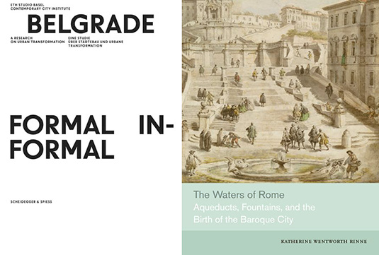
17) Belgrade, Formal/Informal: A Research on Urban Transformation by ETH Studio Basel Contemporary City Institute (Scheidegger & Spiess).

18) The Waters of Rome: Aqueducts, Fountains, and the Birth of the Baroque City by Katherine Wentworth Rinne (Yale University Press).

Using an awesome font called Warsaw Book/Poster, Belgrade, Formal/Informal zeroes in on “a city that was isolated on the European periphery, a city a long history that was as significant as it was turbulent,” to find what parts of a metropolis with such locally specific circumstances have managed to stay more or less the same, through both war and economic estrangement, and what parts were fundamentally transformed by larger, pan-European events and processes. Further, within this, and as the book’s title suggests, they break the city into formal and informal sectors, the generic and the specific. The book is extensively illustrated, and attractively designed by Ludovic Balland.

Katherine Rinne teaches architecture at the CCA in Oakland, though her online project on the waters of Rome is hosted by the University of Virginia. Her book, The Waters of Rome, coalesces much of that work into a detailed study of the city’s hydrological infrastructures, from the ancient to the nearly modern, with a particular emphasis on the city in its Baroque age. Her approach is “largely topographic,” she explains in the book’s introduction, tying even the innermost fountains and waterworks to the landscapes of hills and rivers outside the city. As she writes, “Rome’s fountains are so dazzling that it is easy for even dedicated to overlook the profound changes that their construction initiated in the social, cultural, and physical life of the city. The transformation was systematic and structural, reaching from ancient springs outside the city walls to include aqueducts, fountains, conduits, drains, sewers, streets, and the Tiber. Because of gravity, which dictated distribution, the water’s flow was constrained or encouraged by the existing topography, which influenced in part how the water was displayed or made available for use, who controlled it and who was served by it, what it cost, and obligations that attached to the people who were allowed to access it.” The book is a vital addition to any syllabus or library on hydraulic urbanism.

19) Foodprint Papers, Volume 1 by Nicola Twilley & Sarah Rich (Foodprint Project).

Last not but least, the Foodprint Papers, Volume 1 have been released, edited by Nicola Twilley (my wife) and Sarah Rich, documenting Foodprint NYC from back in 2010, “the first in [a] series of international conversations about food and the city.”

From a cluster analysis of bodega inventories to the cultural impact of the ice-box, and from food deserts to peak phosphorus, panelists examined the hidden corsetry that gives shape to urban foodscapes, and collaboratively speculated on how to feed New York in the future. The free afternoon program included designers, policy-makers, flavor scientists, culinary historians, food retailers, and others, for a wide-ranging discussion of New York’s food systems, past and present, as well as opportunities to transform our edible landscape through technology, architecture, legislation, and education.

The pamphlet is self-published through Lulu, and all purchases help Nicola & Sarah throw more such events in the future. And, while we’re on the subject of food, don’t miss Sarah’s own recent book, Urban Farms.

Happy reading!

* * *

All Books Received: August 2015, September 2013, December 2012, June 2012, December 2010 (“Climate Futures List”), May 2010, May 2009, and March 2009.

Caves of Nottingham

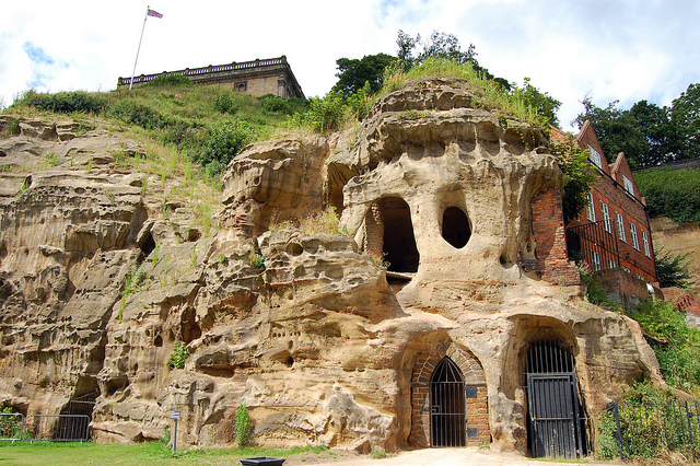
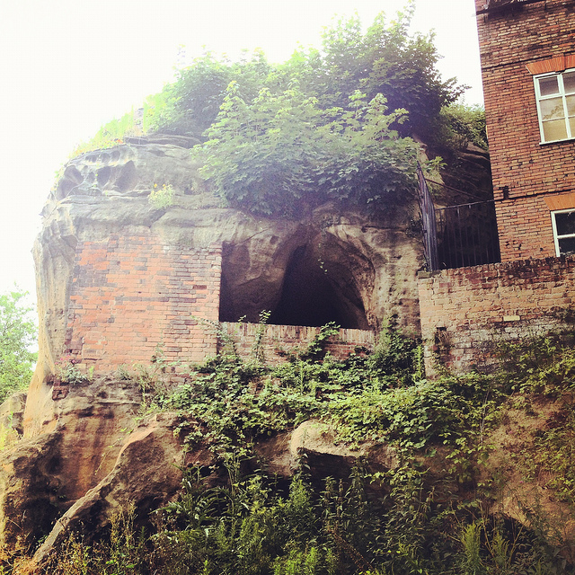
[Image: Cliffs and caves of Nottingham; photo by Nicola Twilley].
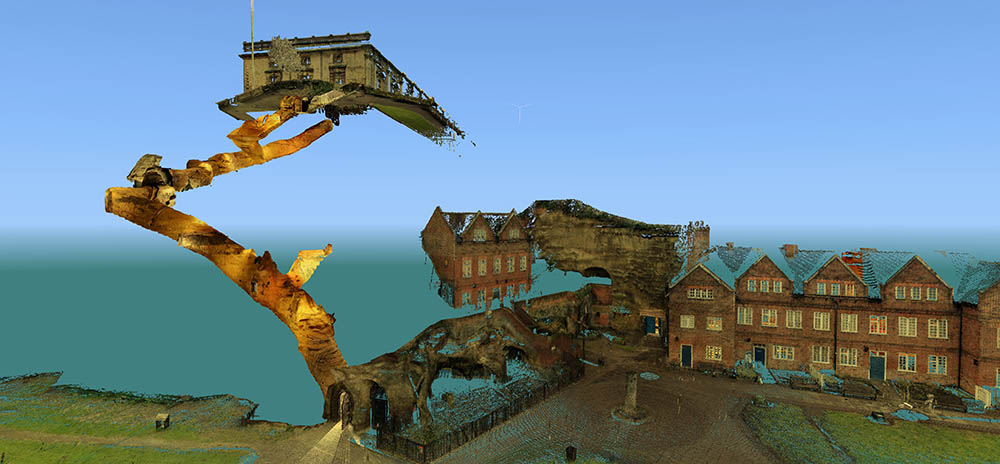
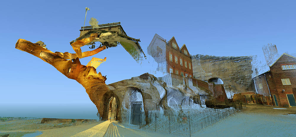
For several years now, I’ve admired from afar the ambitious laser-scanning subterranean archaeological project of the Nottingham Caves Survey.

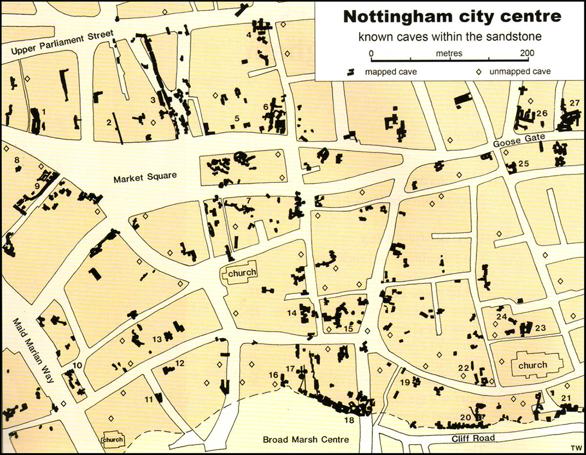
Incredibly, there are more than 450 artificial caves excavated from the sandstone beneath the streets and buildings of Nottingham, England—including, legendarily, the old dungeon that once held Robin Hood—and not all of them are known even today, let alone mapped or studied. The city sits atop a labyrinth of human-carved spaces—some of them huge—and it will quite simply never be certain if archaeologists and historians have found them all.

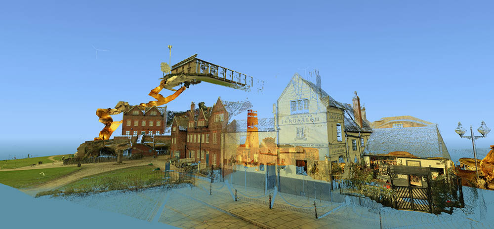
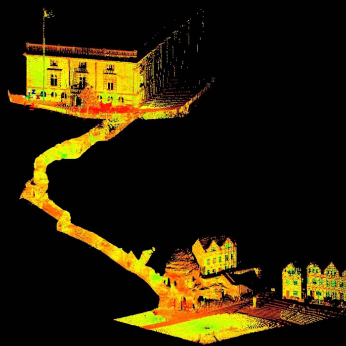
[Images: Laser scans from the Nottingham Caves Survey show Castle Rock and the Mortimer’s Hole tunnel, including, in the bottom image, the Trip to Jerusalem Pub where we met archaeologist David Strange-Walker; images like this imply an exhilarating and almost psychedelic portrait of the city as invisibly connected behind the scenes by an umbilical network of caves and tunnels. Scans courtesy of the Nottingham Caves Survey].

“Even back in Saxon times, Nottingham was known for its caves,” local historian Tony Waltham writes in his helpful guide Sandstone Caves of Nottingham, “though the great majority of those which survive today were cut much more recently.” From malt kilns to pub cellars, “gentlemen’s lounges” to jails, and wells to cisterns, these caves form an almost entirely privately-owned lacework of voids beneath the city.

[Image: Map of only the known caves in Nottingham, and only in Nottingham’s city center; map by Tony Waltham, from Sandstone Caves of Nottingham].

As Waltham explains, “Nottingham has so many caves quite simply because the physical properties of the bedrock sandstone are ideal for its excavation.” The sandstone “is easily excavated with only hand tools, yet will safely stand as an unsupported arch of low profile.”

In a sense, Nottingham is the Cappadocia of the British Isles.

[Image: The extraordinary caves at 8 Castle Gate; scan courtesy of the Nottingham Caves Survey].

The purpose of the Nottingham Caves Survey, as their website explains, is “to assess the archaeological importance of Nottingham’s caves. Some are currently scheduled monuments and are of great local and national importance. Some are pub cellars and may seem less vital to the history of the City.”

Others, I was soon to learn, have been bricked off, taken apart, filled in, or forgotten.

“All caves that can be physically accessed will be surveyed with a 3D laser scanner,” the Survey adds, “producing a full measured record of the caves in three dimensions. This ‘point cloud’ of millions of individual survey points can be cut and sliced into plans and sections, ‘flown through’ in short videos, and examined in great detail on the web.”


[Video: One of very many laser-scan animations from the Nottingham Caves Survey].

While over in England a few weeks ago, I got in touch with archaeologist David Strange-Walker, the project’s manager, and arranged for a visit up to Nottingham to learn more about the project. Best of all, David very generously organized an entire day’s worth of explorations, going down into many of the city’s underground spaces in person with David himself as our guide. Joining me on the trip north from London was Nicola Twilley of Edible Geography; architect Mark Smout of Smout Allen and co-author of the fantastic Pamphlet Architecture installment, Augmented Landscapes; and Mark’s young son, Ellis.

[Image: Artificially enlarged pores in the sandstone; photo by BLDGBLOG].
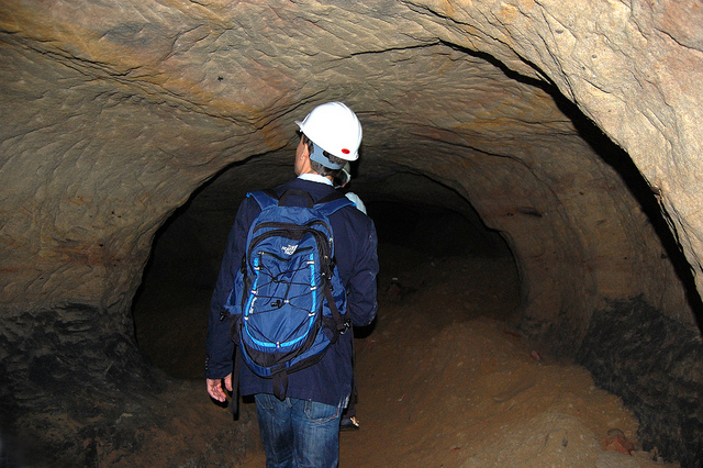
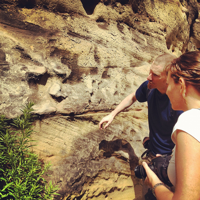
We met the very likable and energetic David—who was dressed for a full day of activity, complete with a well-weathered backpack that we’d later learn contained hard hats and floodlights for each of us—outside Nottingham’s Trip to Jerusalem pub.

Rather than kicking off our visit with a pint, however, we simply walked inside to see how the pub had been partially built—that is, expanded through deliberate excavation—into the sandstone cliffside.

The building is thus more like a facade wrapped around and disguising the artificial caves behind it; walking in past the bar, for instance, you soon notice ventilation shafts and strange half-stairways, curved walls and unpredictable acoustics, as the “network of caves” that actually constitutes the pub interior begins to reveal itself.

[Image: A laser scan showing the umbilical connection of Mortimer’s Hole, courtesy of the Nottingham Caves Survey].
My mind was already somewhat blown by this, though it was just the barest indication of extraordinary spatial experiences yet to come.

[Image: Examining sandstone with Dr. David Strange-Walker; photo by BLDGBLOG].
Wasting no time, we headed back outside, where afternoon rain showers had begun to blow in, and David introduced us to the sandstone cliff itself, pointing out both natural and artificially enlarged pores pockmarking the outside.

The sandstone formations or “rock units” beneath the city, as Tony Waltham explains, “were formed as flash flood sediments in desert basins during Triassic times, about 240 million years ago, when Britain was part of a hot and dry continental interior close to the equator. Subsequent eons of plate tectonic movements have brought Britain to its present position; and during the same time, the desert sediments have been buried, compressed and cemented to form moderately strong sedimentary rocks.”

The city is thus built atop a kind of frozen Sahara, deep into which we were about to go walking.

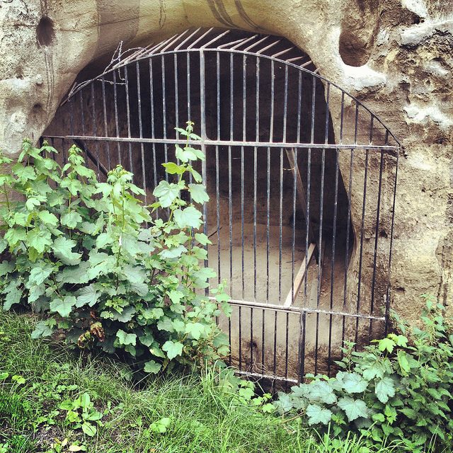
[Image: A gate in the cliff; photo by BLDGBLOG].
Outside here in the cliff face, small openings led within to medieval tunnels and stairs—including the infamous Mortimer’s Hole—that themselves curled up to the top of the plateau; doors in the rock further up from the Trip to Jerusalem opened onto what were now private shooting ranges, of all things; and, with a laugh, David pointed out shotcrete cosmetic work that had been applied to the outer stone surface.

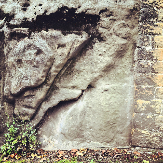
[Image: Artificial shotcrete geology; photo by BLDGBLOG].
We headed from there—walking a brisk pace uphill into the town center—with David casually narrating the various basements, cellars, tunnels, and other urban perforations that lay under the buildings around us, as if we were traveling through town with a human x-ray machine for whom the city was an archaeologically rich cobweb of underground loops and dead-ends.

We soon ended up at the old jails of the Galleries of Justice. A well-known tourist destination, complete with costumed re-enactors, the building sits atop several levels of artificial caves that are well worth exploring.

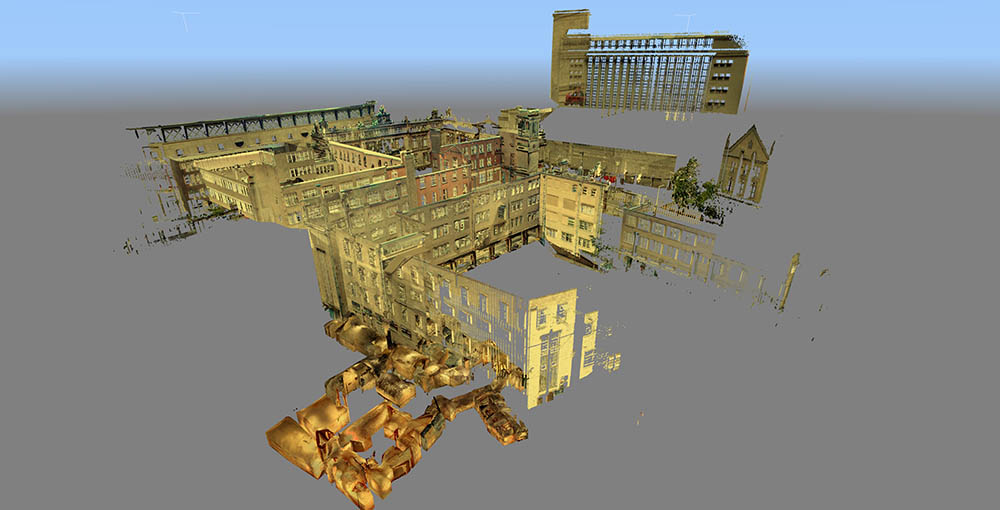
[Image: Scan of the Guildhall caves, courtesy of the Nottingham Caves Survey].
We were joined at this point by the site’s director, who generously took time out of his schedule to lead us down into parts of the underground complex that are not normally open to the general public.

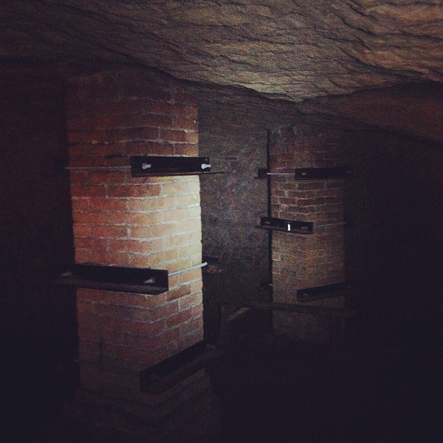
Heading downward—at first by elevator—we eventually unlocked a door, stepped into a tiny room beneath even the jail cells, crouching over so as not to bang our heads on the low ceiling, and we leaned against banded brick pillars that had been added to help support all the architecture groaning above us.

Avoiding each other’s flashlight beams, we listened as our two guides talked about the discovery—and, sadly, the willful reburial—of caves throughout central Nottingham.

[Image: Brick pillars below Nottingham; photo by BLDGBLOG].
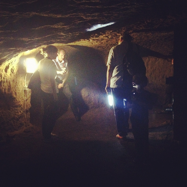
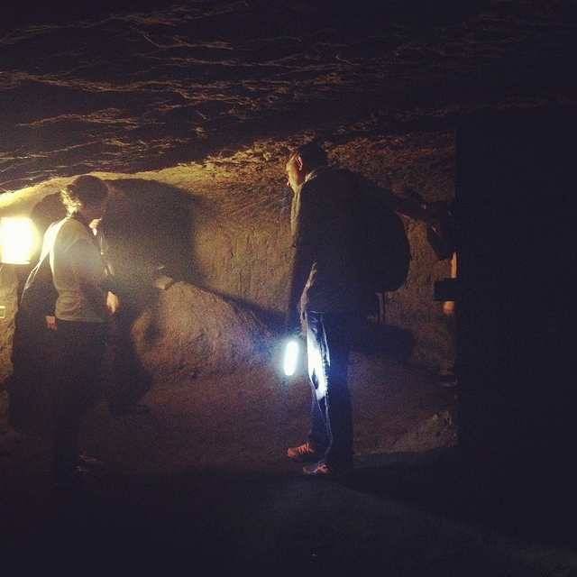
We learned, for instance, that, elsewhere in the city, there had once been a vacuum shop with a cave beneath it; if I remember this story correctly, the shop’s owners had the habit of simply discarding broken and unsold vacuum cleaners into the cave, inadvertently creating a kind of museum of obsolete vacuum parts. Discontinued models sat in the darkness—a void full of vacuums—as the shop went out of business.

We heard, as well, about a nearby site where caves had been discovered beneath a bank during a recent process of renovation and expansion—but, fearing discovery of anything that might slow down the bank’s architectural plans, the caves were simply walled up and left unexplored. They’re thus still down there, underneath and behind the bank, their contents unknown, their extent unmapped—a fate, it seems, shared by many of the caves of Nottingham.

Rather than being greeted by the subterranean and historical wonder that such structures deserve—and I would argue that essentially all of subterranean Nottingham should be declared a UNESCO World Heritage Site—the caves are too often treated as little more than annoying construction setbacks or anomalous ground conditions, suitable only for bricking up, filling with concrete, or forgetting. If the public thinks about them at all, in seems, it is only long enough to consider them threats to building safety or negative influences on property value.

[Images: Learning about caves; photos by BLDGBLOG].
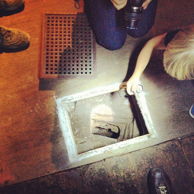
In any case, on our way out of the Galleries of Justice, we lifted up a ventilation grill in the floor and looked down into a small vertical shaft, too narrow and contorted even for Ellis to navigate, and we learned that there are urban legends that this particular shaft leads down to a larger room in which Robin Hood himself was once held… But we had only enough time to shine our flashlights down and wonder.

[Images: Ellis Smout looks for Robin Hood below; photos by BLDGBLOG].
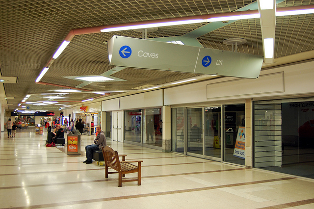
From here, we headed over to our final tourist-y site of the day, which is the awesomely surreal City of Caves exhibition, located in Nottingham’s Broad Marsh shopping mall.

You literally take an escalator down into an indoor mall, where, amidst clothing outlets and food courts, there is an otherwise totally mundane sign pointing simply to “Caves.”

If you didn’t know about Nottingham’s extensive sub-city, this would surely be one of the most inexplicable way-finding messages in mall history.

[Image: Caves; photo by Nicola Twilley].

Here, where we picked our copy of Tony Waltham’s Sandstone Caves of Nottingham pamphlet, from which I’ve been quoting, we learned quite a bit more about how the city has grown, how the caves themselves have often been uncovered (for example, during building expansions and renovations), and what role Nottingham’s underground spaces served during the Nazi bombings of WWII.

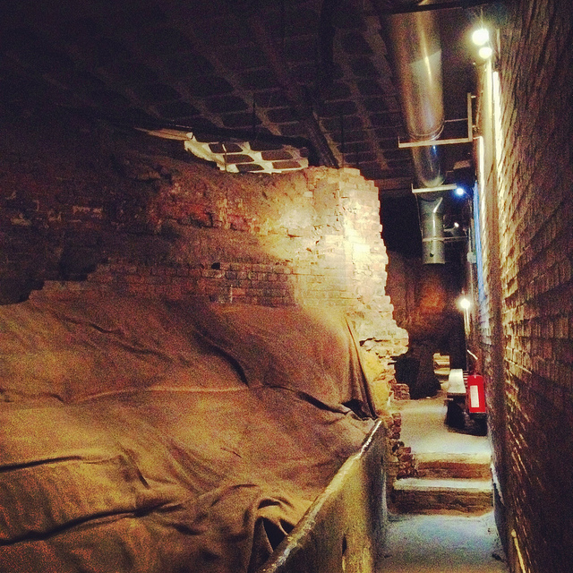
[Image: Beneath Broad Marsh shopping mall; photo by BLDGBLOG].
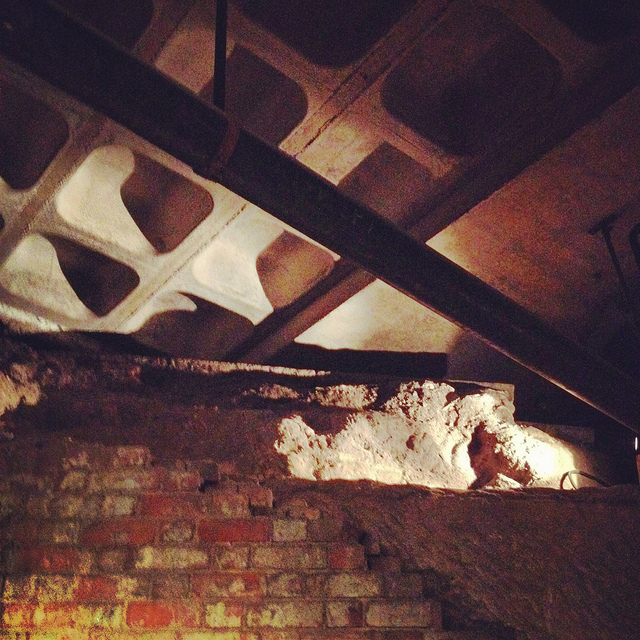
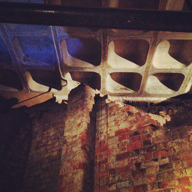
The specific underground complex beneath the shopping mall offers an interesting mix of old tanning operations and other semi-industrial, pre-modern work rooms, now overlapping with 20th-century living and basement spaces that were sliced open during the construction of the Broad Marsh mall.

[Images: Cave spaces beneath the Superstudio-like concrete grid of Nottingham’s Broad Marsh shopping Mall].
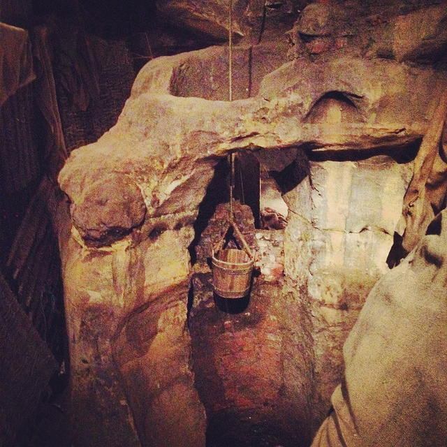
That these caves were preserved at all is testament to the power of local conservationists, as the historically rich and spatially intricate rooms and corridors would have been gutted and erased entirely during post-War reconstruction without their intervention.

As it now stands, the mall is perched above the caves on concrete pillars, with the effect that curious shoppers can wander down into the caves through an entrance that could just as easily lead to a local branch of Accessorize.

[Image: A well bucket in the caves beneath Broad Marsh; photo by BLDGBLOG].
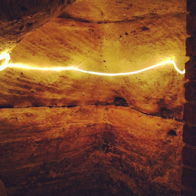
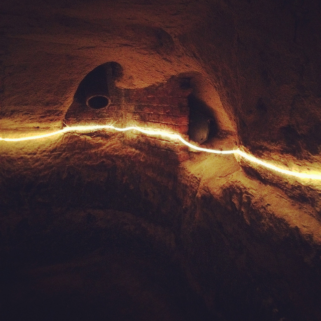
Again, we were fortunate to be taken down into some off-limits areas, stepping over lights and electric wires and peering ahead into larger rooms not on the tourist route.

[Images: Lines of lights we switched on in one of the off-limits rooms below Broad Marsh; photo by BLDGBLOG].
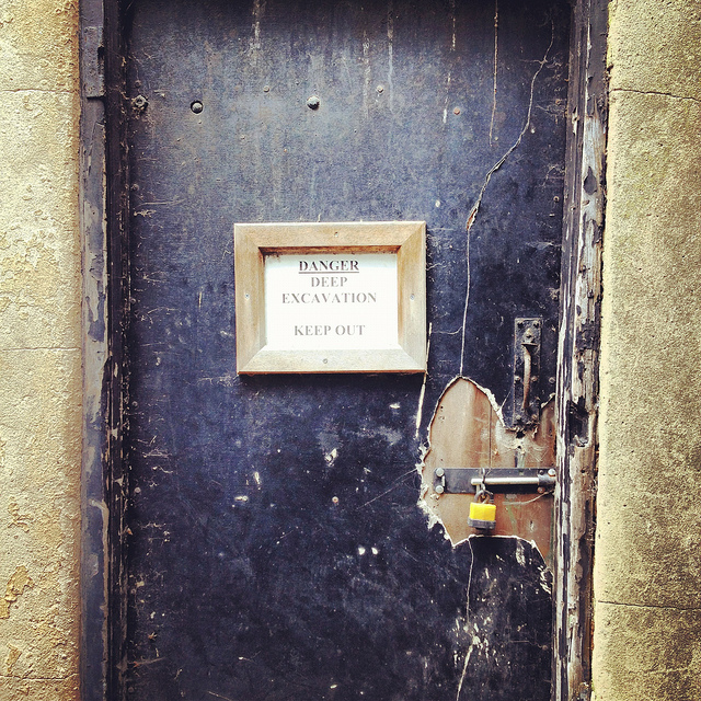
This included stepping outside at one point to wander through an overgrown alleyway behind the mall. Small openings even back here stretched beneath and seemingly into the backs of shops; one doorway, a short scramble up a hill of weed-covered rubble, appeared to contain a half-collapsed spiral staircase installed inside a brick-lined sandstone opening.

[Image: A doorway to voids behind Broad Marsh Centre; photo by BLDGBLOG].
At this point, we began to joke about the ease with which it seemed you could plan a sort of speleological super-heist, breaking into shops from below, as an entire dimension of the city seemed to lie unwatched and unprotected.

Nottingham, it appeared, is a city of nothing but doors and openings, holes, pores, and connections, complexly layered knots of space coiling beneath one building after another, sometimes cutting all the way down to the water table.

Incredibly, the day only continued to build in interest, reaching near-impossible urban sights, from catacombs in the local graveyard to a mind-bending sand mine that whirled and looped around like smoke rings beneath an otherwise quiet residential neighborhood.

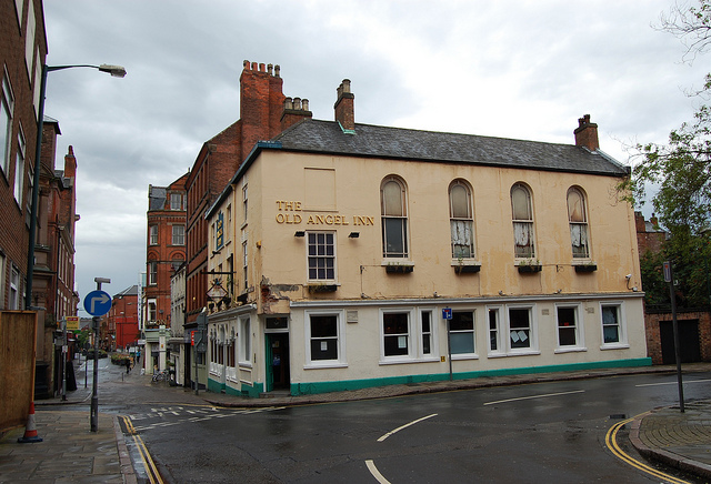
Leaving the mall behind, and maintaining a brisk pace, David took us further into the city, where our next stop was the Old Angel Inn, another pub with an extensive cellar of caves, in this case accessed through a deceptively workaday door next to an arcade game.

[Images: The Old Angel Inn (top), including the door inside the pub that leads down to the caves below; photos by Nicola Twilley].

Once again, it can hardly be exaggerated how easy it would be to visit or even live in Nottingham and have absolutely no idea that underground spaces such as this can be found almost anywhere. As Tony Waltham points out, “It would be a fair assumption that every building or site within the old city limits either has or had some form of cave beneath it. About 500 caves are now known, and this may be only half the total number that have been excavated under Nottingham.”

[Images: The caves of the Old Angel Inn, courtesy of the Nottingham Caves Survey].
In any case, “Although the Old Angel is a ‘modern’ brick building,” as the Nottingham Caves Survey describes the pub on its website, “an investigation of the caves below reveals stone walls belonging to an earlier incarnation. It is likely that there were buildings on this site as far back as the Anglo-Saxon period. Whether the caves beneath are also this old cannot be demonstrated definitively.”

Typical, as well, for these types of pub caves, we found ventilation and delivery tunnels leading back up to the surface, and the walls themselves are lined with long benches, perfect for sitting below ground and, provided you have candles or a flashlight along with you, enjoying a smoke and a pint of beer. As Tony Waltham explains, pub cellars often include “perimeter thralls,” or “low ledges cut in the rock,” normally used for storing kegs and barrels of beer but quite easily repurposed for a quick sit-down.

But I sense I’m going on way too long about all this, especially because the two most memorable details of the entire day were yet to come.

Jumping forward a bit, we left the Old Angel and followed some twists and turns in the street to find ourselves standing outside a nightclub called Propaganda.

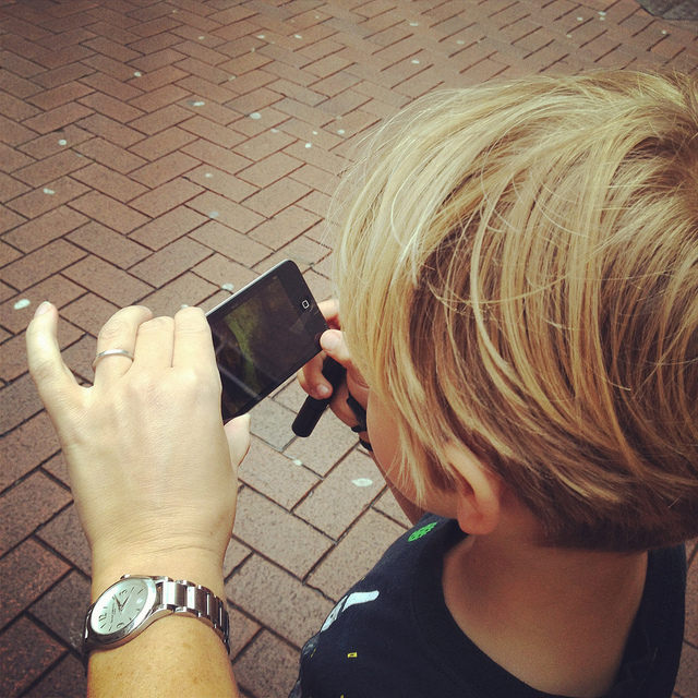
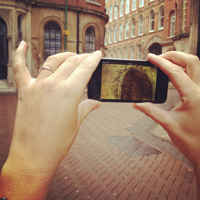
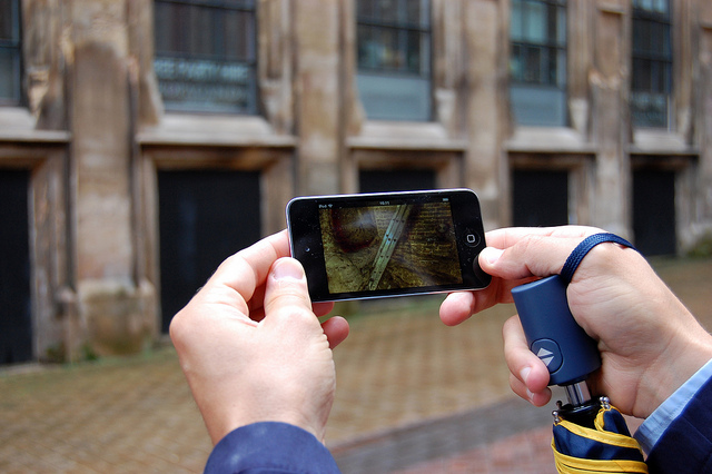
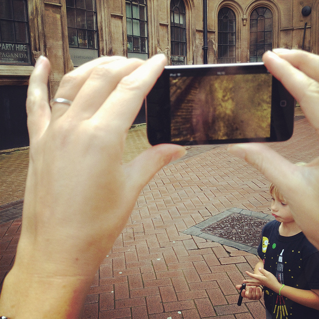
Here, David revealed that he has been working on what, in my opinion, will easily be one of the must-have apps of the year. In a nutshell, David has managed to make the subterranean 3D laser-scans of the Nottingham Caves Survey accessible by location, such that, holding up his iPod Touch, he demonstrated that you could, in effect, scan the courtyard we were standing in to see the caves, tunnels, stairways, cellars, vents, storage rooms, and more that lay hidden in the ground around us.

[Images: We test-drive the cave-spotting app; bottom photo by Nicola Twilley].
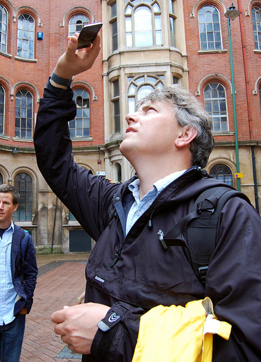
Ideally, once the Survey’s extensive catalog of 3D visualizations and laser point-clouds has been made available and the app is ready for public download, you will be able to walk through the city of Nottingham, smartphone in hand, revealing in all of their serpentine complexity the underground spaces of the city core.

For anyone who has ever dreamt of putting on x-ray glasses and using them to explore architectural space, this app promises to be a thrilling and vertiginous way to experience exactly that—peering right through the city to see its most ancient foundations.


[Video: A fly-through of the Propaganda Nightclub malting caves].

I, for one, can’t wait to see what David and the Nottingham Caves Survey do with the finished application and I eagerly await its public availability.

[Image: Mark Smout looks for caves in the sky; photo by Nicola Twilley].
I’ll wind up this already quite long post with just a few more highlights.

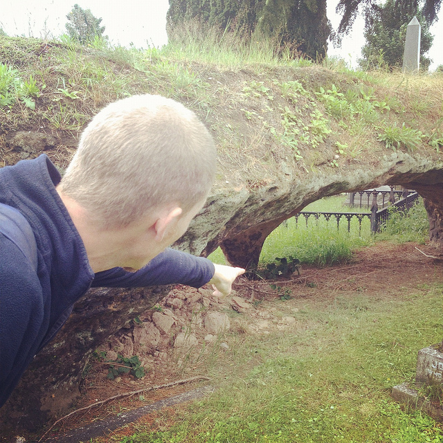
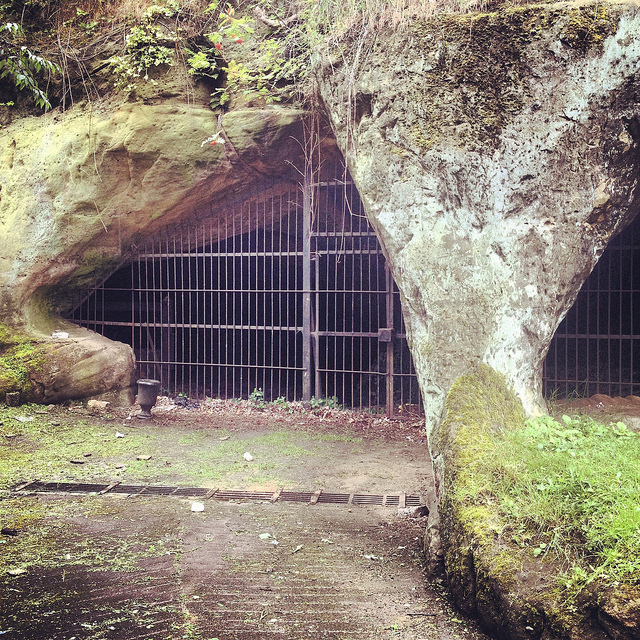
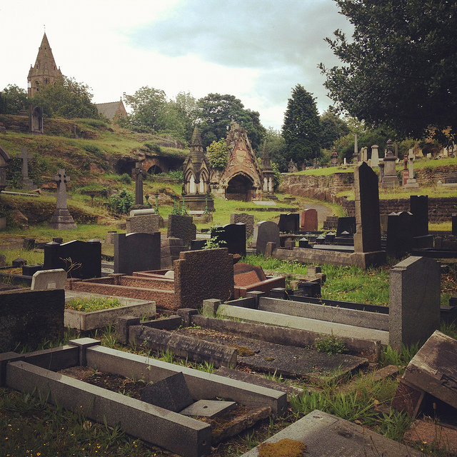
Nottingham’s Rock Cemetery, north from the center of town along the Mansfield Road, contains, among other things, the collapsed remains of a sand mine. Three of the mine’s old entrances are now gated alcoves surrounded by graves, like something out of Dante. They “are the only surviving remnants of the mine,” Waltham writes in his pamphlet.

[Images: Nottingham’s Rock Cemetery, where archaeologist David Strange-Walker explained the history of the local landscape].
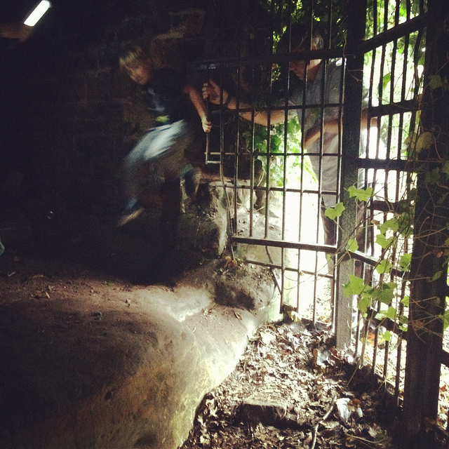
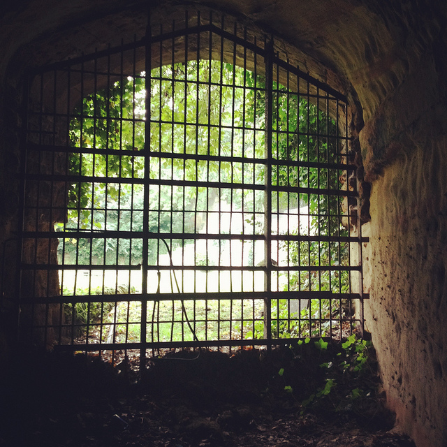
However, an ambitious plan to carve sizable catacombs, inspired by Paris and Rome, through the sandstone beds of the ancient desert here resulted in the never-completed Catacomb Caves, “probably done in 1859-63,” Waltham suggests. These long arched tunnels, accessible through one of the gates described above, eventually lead to a radial terminus from which branch the unused proto-catacombs.

The air there is cloudy with sand—leading me, several days later, to experience a brief attack of hypochondria, worried about developing silicosis—the walls are graffiti’d, and years of trash are piled on the sides of the sandy floor (which has since taken on the characteristics of a dune sea in places, as 150 years of footfall and a collapsing ceiling have led to the appearance of drifts).

[Images: The Rock Cemetery catacomb gates].
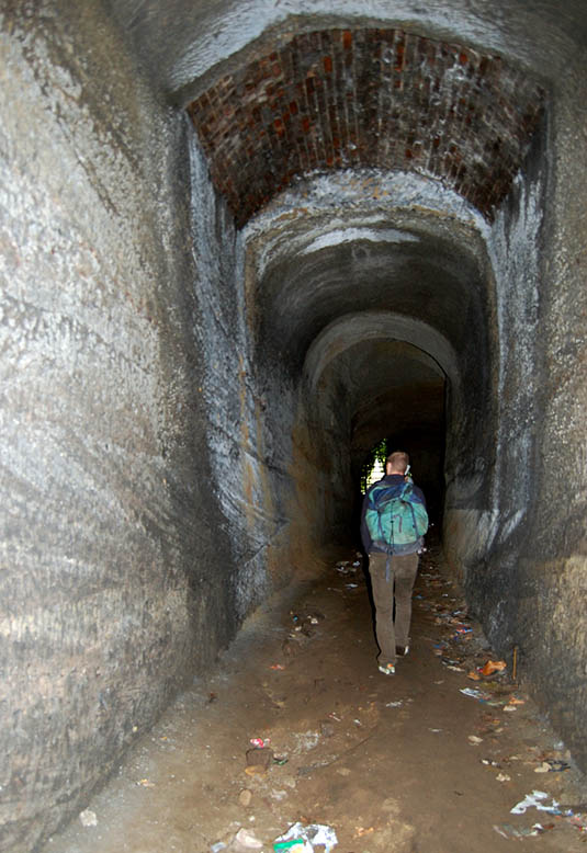
What was so extraordinary here, among many other things, was that, for most of this walk through the catacombs, we were actually walking below the graves, meaning that people were buried above us in the earth. At the risk of overdoing it, this felt not unlike becoming aware of an altogether different type of constellation, with bodies and all the stories their lives could tell held above us in a terrestrial sky like legends and heroes, like Orion and Cassiopeia, as we looked up at the vaulted ceiling, flashlights in hand.

[Image: Inside the catacombs; photo by Nicola Twilley].
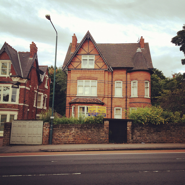
But the best site of all was next.

[Image: A door on the street—the black door with bars—leading down into a sand mine; photo by BLDGBLOG].

Serving as something of the ultimate proof that Nottingham is a city of overlooked doors that lead into the underworld, there were two locked doors—one of which (the black door, near the sidewalk) appears in the photo, above, another of which, on a street nearby, leads down into the Peel Street Caves—simply sitting there on the sidewalk that, if opened, will take you down into extensive and now defunct sand mines. David’s laser-scans of these for the Nottingham Caves Survey are absolutely gorgeous, as you can see, below.

[Image: The Peel Street Caves sand mine, courtesy of the Nottingham Caves Survey].

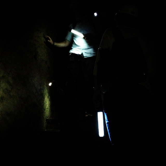
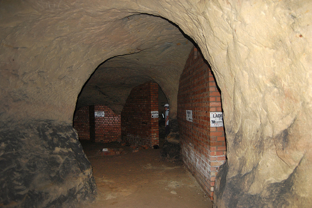
For a variety of reasons, I am going to avoid being too specific about some of the details here, but, aside from that, I can only enthuse about the experience of donning our hard hats and heading down several flights of comparatively new concrete steps into a coiling and vast artificial cavern from the 19th century, one we spent nearly an hour exploring.

[Image: Nicola Twilley and Mark Smout head down into the sand mine; photo by BLDGBLOG].
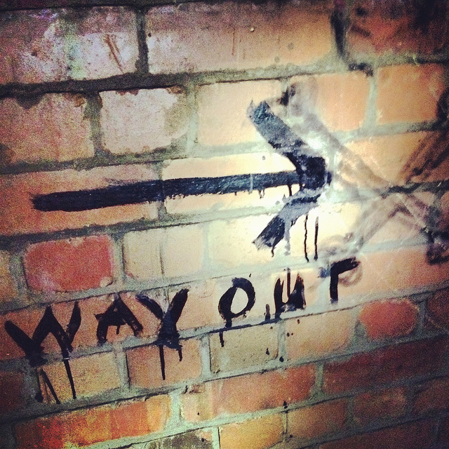
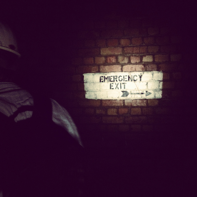
Getting lost down there would be so absurdly easy that it is frightening even to contemplate, and, in case the group of us somehow got split up or our batteries ran out of juice, we joked about—if only we could remember them—the easy techniques for navigating a labyrinth offered in Umberto Eco’s novel The Name of the Rose.

[Image: Many of these way-finding signs are actually incorrect, David explained, and seem to have been painted as a kind of sick joke by someone several years ago; photos by BLDGBLOG].
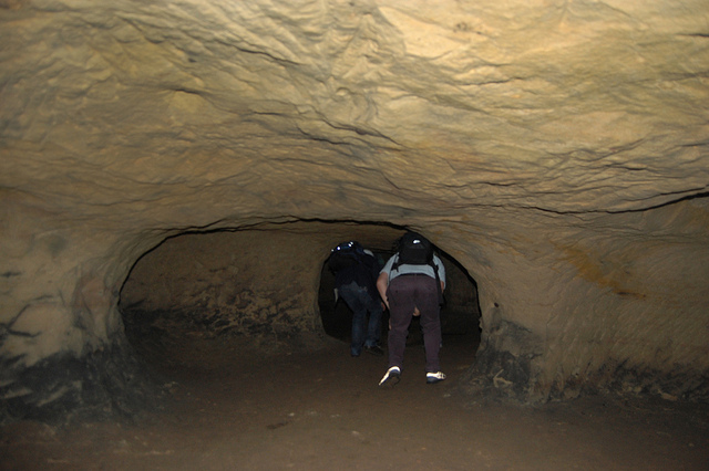
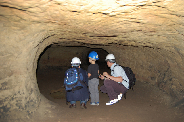
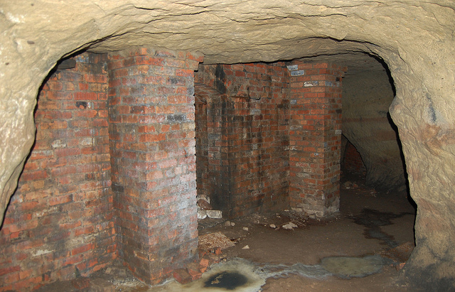
Avoiding such a fate, however, we found graffiti and men’s and women’s latrines; we popped our heads through holes allowing glimpse of other levels; and we cracked our helmets loudly against the low and rough roof more times than I could count.

[Images: Inside the sand mine; all photos by Nicola Twilley].
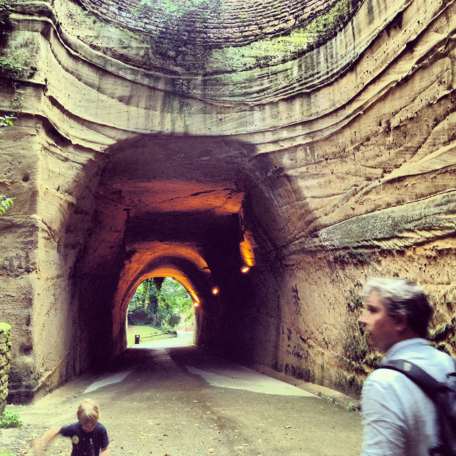
And even that doesn’t complete the day. From here, heading back out onto the street through a nondescript steel door, as if we had been doing nothing more than watching football in someone’s basement, we went on to eat pie and chips in a restaurant built partially into a cave; we walked back across town, returning to where we started, talking about the future and seemingly obvious possibility of Nottingham’s caves being declared a UNESCO World Heritage Site and thus saved from their all but inevitable destruction (it’s easy to imagine a future in which a tour like the one David gave us will be impossible for lack of caves to see); and we all said goodbye beneath an evening sky cleared of clouds as a late-day breeze began to cut through town.

[Image: Mark & Ellis Smout explore our final “underground” space of the day, the magnificent Park Tunnel; the banded strata clearly visible in the walls show how the tunnel was carved through the dunes of an ancient desert. Photo by BLDGBLOG].

David proved to be a heroic guide that day. His energy never flagged throughout the tour, and he never once appeared impatient with or exhausted by any of our often ridiculous questions—not to mention our tourists’ insistence on pausing every three or four steps to take photographs—and he remained always willing to stay underground far longer than he had originally planned, all this despite having never met any of us before in person and only communicating with me briefly via a flurry of emails the week before.

Meeting David left me far more convinced than I already was that the Nottingham Caves Survey fully deserves the financial support of individuals and institutions, so that it can complete its ambitious and historically valuable work of cataloging Nottingham’s underground spaces and making that knowledge freely accessible to the general public.

Weirdly, England has within its very heart a region deserving comparison to Turkish Cappadocia—yet very few people even seem to know that this subterranean world exists. There very well could be more than 1,000 artificial caves beneath the city, many of them fantastically elaborate, complete with fine carvings of lions and ornate stairwells, and it is actually somewhat disconcerting to think that people remain so globally unaware of Nottingham’s underground heritage.

With any luck, the work of David Strange-Walker, Trent & Peak Archaeology, and the Nottingham Caves Survey will help bring this extraordinary region of the earth the attention—and, importantly, the focused conservation—it is due.

(For further reading, don’t miss Nicola Twilley’s write-up of the tour on her own blog, Edible Geography; and Tony Waltham’s Sandstone Caves of Nottingham, cited extensively in this post, is worth a read if you can find a copy).

Striper

Speaking of the accidental artistry of colorful street markings, artist Simon Rouby became fascinated by the ongoing painting and repainting of traffic lines on the freeways and streets of Los Angeles, like some vast and unacknowledged readymade art project.

[Images: Photos by Simon Rouby for “Yellow Line“].

Could this huge urban painting apparatus be temporarily repurposed, Rouby wondered—leading him to contact Caltrans directly and embark upon a project with the rather straightforward name of “Yellow Line.”

That project, Rouby explains, introduced him “to the California Transportation ‘Striping Crew.’ I followed them while they poured miles of yellow paint onto the concrete of Los Angeles. With them I got to know the biggest and most congested network of freeways in the United States, and built my understanding of Los Angeles, a gigantic city where people meet everyday, but at 60 miles per hour on the freeways. Millions of cars per day, from which 75% drive alone, despite traffic and smog.”

“We also did canvases,” Rouby adds, “painted directly with their trucks.”

[Image: From “Yellow Line” by Simon Rouby].

Nonetheless, it’s not those canvases but the project’s most basic conceptual move—putting the Caltrans striping crews into the same context as, say, Jackson Pollack or Marcel Duchamp—that interests me the most here, implying new possibilities for interpretation, even whole new futures for art history and landscape criticism, with this recognition of avant-garde projects going on disguised as the everyday environment.

[Image: From “Yellow Line” by Simon Rouby].

Pushing this further, the transportation system itself becomes an earthworks project that dwarfs the—by contrast—embarrassingly unambitious Michael Heizer or Robert Smithson, revealing Caltrans, not Field Operations or any other white-collar design firm, as one of the most high-stakes landscape practitioners—a parallel civilization of mound builders hidden in plain sight—at work in the world today.

In any case, Simon Rouby’s “Yellow Line” is on display at the Caltrans District 7 Building—100 South Main Street, Los Angeles—until 28 September 2012.

Buncefield Bomb Garden

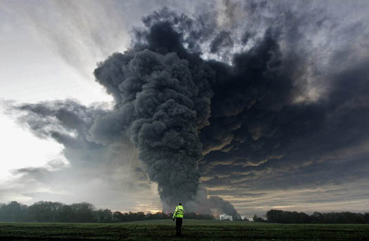
[Image: The Buncefield explosion, via the BBC].

In one of the more interesting landscape design stories I’ve read this year, New Scientist reported back in March that the massive, December 2005 explosion at a fuel-storage depot called Buncefield in England, might have been strongly assisted by the site’s landscaping.

“A few years ago no one would have predicted that a row of trees and shrubs could make the difference between a serious fire and a catastrophic explosion,” the magazine suggests. But now, it’s becoming a reasonably accepted notion that the physical layout of the Buncefield site’s plantlife—from the “shrubs and small trees” down to their individual “twigs and branches”—can work to contain and concentrate, and, worse, add explosive surface area to what would otherwise have simply been a gas leak.

Indeed, the ongoing investigation at Buncefield “might change the way storage depots, refineries and pipelines are designed, and how the sites are landscaped [emphasis added]. Along with conventional safety features like sensors and alarms, site operators may have to rethink the way that trees, hedges and shrubs are positioned.” Investigators have concluded that “even structures on nearby commercial developments could help to accelerate a flame,” meaning that, in the design of any landscape, from industrial parks to corporate lawns, there is a previously unknown capacity for detonation.

What’s incredible about this—if proven true—is that the potentially explosive landscaping of sites such as Buncefield might suggest, according to New Scientist, new geometries or diagrammatic possibilities for the design of jet engines, in particular “a novel aircraft propulsion system called a pulse detonation engine.” The garden as jet engine!

Putting this into the context of other landscape typologies, such as ritual gardens or sacred groves—as if we might someday have orchards that churn and pulse with controlled coils of fire, like the engine of some vast arboreal machine—makes this terrifying topographical phenomenon seem all the more mythic and extraordinary.

(Previously on BLDGBLOG: Star Garden).

Books Received

[Image: A riverboat library in Bangladesh; image courtesy of the Gates Foundation].

Many, many books have arrived at the home office here, and I’m thus once again woefully behind in tallying up all the titles that have come my way. Accordingly, there are still many more write-ups to come, but it will be next month, after some upcoming travels, before I get to those other books.

Meanwhile, as has always been the case with Books Received posts, I have not read all of the books linked here and not all of them are necessarily new. However, in all cases, these are included for the interest of their approach or subject matter, and the following list should easily give just about anyone at least one good book to read over the coming summer.


1) City: A Guidebook for the Urban Age by P.D. Smith (Bloomsbury) — P.D. Smith’s voluminous look at the history of urbanism stretches from the Sumerians to the 2012 London Olympics, from Tenochtitlán to Dubai, from the Code of Hammurabi to J.G. Ballard, and from the Italian Renaissance to the urban ruins of nuclear war. Smith has organized his book like a travel guide, albeit not for a particular metropolis but for the city in and of itself. Chapters are thus divided into overarching categories such as “arrival,” “where to stay,” “getting around,” and more, and while the result can sometimes conflate otherwise quite different urban phenomena found in disparate cities around the world, that slight sense that things are starting to blur is evened out by Smith’s eye for detail in the stories and anecdotes he relates, particularly in the book’s many boxed texts and sidebars. Migration, food security, global tourism, natural disasters, economic expansion, and war: these are all perennial influences on urban form—and urban futures—and Smith works hard to show their role in shaping the life of what he calls “the ape that shapes [its] environment, the city builders.” City comes out in the United States in June 2012.

2) Tubes: A Journey to the Center of the Internet by Andrew Blum (Ecco) — I had the pleasure of receiving periodic email updates from author Andrew Blum as he traveled to the unmarked buildings and coastal warehouses—amongst many other sites—that enable, store, and protect what we broadly refer to as the internet. The resulting book, released earlier this week, tells the story of those travels: it is Blum’s field guide to the physical infrastructure of contemporary data, tracking the internet’s actual geography, the sites where the switches are kept and the servers are cooled, where the cables come out of the sea and relay onward, deeper into cities and suburbs, into office and apartments like the one from which I’m posting this. “The Internet couldn’t just be everywhere,” Blum writes, questioning ethereal metaphors like “the cloud” or the abstract “tubes” of the book’s title. “But then where was it? If I followed the wire, where would it lead? What would that place look like? Why were they there? I decided to visit the Internet.” In one particularly memorable description, Blum quips that he “had begun to notice that the Internet had a smell, an odd but distinctive mix of industrial-strength air conditioners and the ozone released by capacitors,” as if even the most amorphous realms of data have their own peculiar body odor. This body—the “tubes” of the internet—leads Blum from underground London to the middle of nowhere in central Oregon, from downtown Milwaukee to locked rooms in Amsterdam, on the trail of the “pulses of light” that give the internet physical and geographic form.

3) The Appian Way: Ghost Road, Queen of Roads by Robert A. Kaster (University of Chicago Press) — As Kaster’s book claims on its opening page, “No road in Europe has been so heavily traveled, by so many different people, with so many different aims, over so many generations.” The Appian Way, which cuts broadly southeast from the old city walls of Rome, gives Kaster—a Classicist at Princeton—a long and meandering geography on which to base this otherwise concise, almost pamphlet-length look at the Italian landscape and how it has evolved over the past two millennia. From marshes and town centers to incongruously 21st-century wind farms where the ancient road all but disappears into gravel-strewn ruins, by way of endless crumbling tombs that will be familiar to any fan of Piranesi, Kaster’s book describes the sites, monuments, churches, cemeteries, and more that give readers an opportunity to explore the historical—usually archaeological—context for this legendary piece of transportation infrastructure. The Appian Way is part of the “Culture Trails” series from the University of Chicago Press.


4) Ghetto at the Center of the World: Chungking Mansions, Hong Kong by Gordon Mathews (University of Chicago Press) — Mathews offers a kind of anthropological critique of globalization in the guise of architectural reportage, telling the story of Chungking Mansions, “a dilapidated seventeen-story commercial and residential structure in the heart of Hong Kong’s tourist district,” and using close descriptions of everyday life in the complex to build a cross-section of the global economy. “A remarkably motley group of people call the building home,” we read in the book’s own description: “Pakistani phone stall operators, Chinese guesthouse workers, Nepalese heroin addicts, Indonesian sex workers, and traders and asylum seekers from all over Asia and Africa live and work there—even backpacking tourists rent rooms. In short, it is possibly the most globalized spot on the planet.”

5) Great American City: Chicago and the Enduring Neighborhood Effect by Robert J. Sampson (University of Chicago Press) — Sampson’s very academic book—less narrative than statistical and analytic, and keenly based in empirical research—weighs the importance of community in defining, empowering, and uniting the city of Chicago, neighborhood by neighborhood.

6) New York at War: Four Centuries of Combat, Fear, and Intrigue in Gotham by Steven H. Jaffe (Basic Books) — Jaffe has written an incredibly interesting military history of New York City, beginning well before it was either New York or a city. Jaffe’s detailed accounts of early colonial battles and Revolutionary battlegrounds reveal the, to me, surprising number and topographic diversity of combat sites that dot the greater New York landscape. In the process, he offers little-known historical anecdotes—for instance, not only that Wall Street is so named after the defensive wall once constructed there, from one side of the island to the other, but that the wall was the first example of debt-financed urban infrastructure in what were then Dutch colonies. Jaffe’s look at a military urbanism peculiar to New York, from the 1600s to WWII to the security bollards of post-9/11 NYC, has proven hard to put down.

7) The Insurgent Barricade by Mark Traugott (University of California Press) — Traugott’s history of the barricade as a uniquely successful “technique of insurrection” is, first and foremost, a look at the spatial politics of the built environment. These politics operate in at least two primary, and clearly oppositional, ways, Traugott suggests. The first is the deliberate mis-use or counter-use of the city, transforming it into something that, through improvisatory re-design, can be express the political demands of an otherwise overlooked constituency. This is the production of barricades, which interfere with and strategically realign the internal movements of the city. The other side of this story, however, is the purposeful and systematic alteration of a city’s fabric precisely so that its everyday spaces cannot be used as outlets for political expression. In the latter example, streets can be widened or public spaces closely surveilled; in the former, makeshift tools and ad hoc materials, from cobblestones to wheelbarrows, can be transformed at a moment’s notice into walls that clog the city’s arteries and bring its streets to a halt. Traugott shows how all this has played out over more than four centuries of European urban history, also looking at what future spatial possibilities exist, on both sides of the barricade, for the political life of the metropolis.


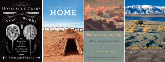
8) Horseshoe Crabs and Velvet Worms: The Story of the Animals and Plants That Time Has Left Behind by Richard Fortey (Alfred A. Knopf) — Fortey is easily one of my favorite natural history writers, and his Earth: An Intimate History remains high on my list of recommended books. With this new book, Fortey takes on the question of survival—or super-survival—in creatures whose wildly successful evolutionary paths mean they have had a disproportionately deep effect on whole ecosystems still thriving today. This is “life’s history told not through the fossil record but through the stories of organisms that have survived, almost unchanged, throughout time,” in the book’s own words. The horseshoe crabs and velvet worms of the title are only two of the most-cited creatures in Fortey’s unsurprisingly enjoyable book.

9) The Prehistory of Home by Jerry D. Moore (University of California Press) — Moore starts things off with the unfortunate claim that “various animals build shelters, but only humans build homes,” an unprovable statement that belongs on the sadly endless pile of false comparisons made about humans and animals. Indeed, only four pages later, Moore himself writes that “we [humans] have been building homes longer than we have been Homo sapiens,” which can literally only be true if animals—that is, non-humans or non-Homo sapiens—can, after all, build homes, not just shelters, and have been doing so all along. In any case, this minor but by no means inconsequential quibble shouldn’t hold you back from enjoying Moore’s engaging history of the home—that is, the symbolically rich personal shelter—which he takes on a wide and exciting run from hand-woven walls and mud floors on the coast of Peru all the way to maximum security prisons, from Mesopotamian walled cities to gated suburbs, and from bachelor pads to underground “dwellings” built for the recently deceased in globally diverse burial practices. Part archaeological survey dating back, as Moore explains, to before humans were Human, and part speculative treatise as to why humans have an emotional need for homes at all, Moore’s book spans hundreds of thousands of years and nearly every continent.

10) The Last Imaginary Place: A Human History of the Arctic World by Robert McGhee (Oxford University Press) — McGhee, an archaeologist at the Canadian Museum of Civilization, “paints a vivid portrait of Viking farmers, entrepreneurial Inuit, and Western explorers” in their encounter with, and long-term settling of, the Arctic. Though the book has been out for several years, it just crossed my desk and I look forward to jumping in over the summer.

11) Rough-Hewn Land: A Geologic Journey from California to the Rocky Mountains by Keith Heyer Meldahl (University of California Press) — Meldahl’s book is, in its own words, “a 1000-mile-long field trip back through more than 100 million years of deep time to explore America’s most spectacular and scientifically intriguing landscapes.” Those landscapes are the western plateaus, mountains, and deserts of the southwestern United States, a region whose terrain now verges on the over-exposed—hardly a season goes by without a new book on the subject—but, as Meldahl suggests, “geology is stranger than fiction,” and the book he’s built around that statement is a worthwhile read.


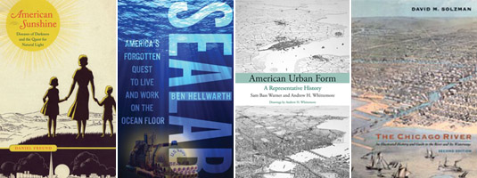
12) American Sunshine: Diseases of Darkness and the Quest for Natural Light by Daniel Freund (University of Chicago Press) — Freund’s book is a delightfully idiosyncratic look at the “quest for natural light” in American culture, from the earliest use of tanning beds as a kind of surrogate sun to the mainstream acceptance of “light therapy” as a cure for Seasonal-Affective Disorder, and from the marketing of climate tourism to the development of specialty lighting rigs for use in industrial food preparation. Freund explains in his introduction that the book was motivated by three otherwise unrelated historical figures—Akhenatan, Vitruvius, and Linnaeus—all of whom represent for Freund “the universality of sunlight as a subject for consideration.” The results are this unique look at the confluence of personal health, urban design, and near-religious popular beliefs about the purifying power of sunlight over roughly 150 years of American culture.

13) Sealab: America’s Forgotten Quest to Live and Work on the Ocean Floor by Ben Hellwarth (Simon & Schuster) — Hellwarth relates the surprisingly overlooked story of U.S. Navy “saturation divers” and the international oceanographers whose research helped to pioneer the construction of deepsea equipment and large-scale architectural environments that almost made living on the ocean floor an everyday reality. Equal parts tropical retro-futurism, complete with scenes of Jacques Cousteau assembling his Conshelf habitats in the Mediterranean Sea, and high-tech adventure story populated by military super-athletes and entrepreneurial gear manufacturers few of us even knew existed—including surreal high-pressure diving experiments involving presumably quite bewildered farm animals—Hellwarth’s book tells the true history of what have been (and what might still be) for human inhabitation of the oceans. Best of all, it’s almost entirely set in a quasi-utopian underwater world, like Archigram crossed with The Abyss.

14) American Urban Form: A Representative History by Sam Bass Warner and Andrew H. Whittemore (MIT Press) — Warner and Whittemore have produced an illustrated historical survey of U.S. urbanism, with short chapters ranging from “the city’s seventeenth-century beginnings” on the Atlantic coast to “the federally supported city” of the 1950s, ending with a somewhat obligatory overview of the “global city” and its suburban fringe. The book is a great introduction to the processes that have influenced and restrained urban development in the United States for more than three centuries, but it focuses more on presenting a coherent narrative—often reading more like a special issue of The Economist—as opposed to developing an original or otherwise surprising new interpretation of American urban form.

15) The Chicago River: An Illustrated History and Guide to the River and Its Waterways by David M. Solzman (University of Chicago Press) — Re-released in its current, second edition back in 2006, Solzman’s book will no doubt already be familiar to many readers of BLDGBLOG, but his history of the Chicago River, its ecological context and industrial re-engineering, complete with a hands-on guide for anyone who might want to explore it, was new to me.


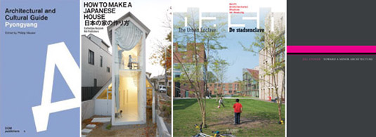
16) Pyongyang: Architectural and Cultural Guide edited by Philipp Meuser (DOM Publishers) — In print for less than three months, Meuser’s guide is already something of a cult classic in architectural circles, offering as it does a photographic and textual survey of the gonzo dictatorial postmodernism of Pyongyang, North Korea. A genuinely fascinating look at the political symbology of a capital city—Stefano Boeri’s memorable description of Pyongyang as a “rogue city” comes to mind—this slipcased, two-volume set offers “photographs and descriptions” in one book, including brief lessons on Pyongyang’s overall urban organization, and, in the other, what Meuser calls “background and comments.” These latter categories include—incredibly—excerpts from an architectural pamphlet written by the late Kim Jong-Il, who explains to his readers that, among other things, “architects are creative workers and operations officers,” spatially gifted functionaries of the State. Many of the photographs found in each volume can unfortunately resemble washed-out tourist postcards, and the buildings themselves are often striking for their super-ornamental, propagandistic absurdity—in a city whose natural setting makes it look oddly like Memphis, Tennessee—but to mock the city so easily and dismissively would be to miss the guide’s more interesting insight, which is that Pyongyang is, in fact, a remarkably assembled collection of processional spaces and monumental object-buildings, aesthetically arranged in a kind of 3-dimensional essay extolling the wonders of uncontested state power.

17) How to Make a Japanese House by Catherine Nuijsink (NAi Publishers) — Although architecture blogs have perfected the art of Japanese house fatigue over the past few years—in which it seems like a central server somewhere has been auto-feeding photos of small Japanese houses to the same design blogs over and over again every week—Nuijsink’s book is, refreshingly, a more substantive exploration of 21st-century domestic space in Japan, complete with one-on-one architectural interviews and occasional floor plans. Many of the projects you will already have seen online, but, given the breadth of context here, some great photographs, and three framing “monologues” written by architects Yoshiharu Tsukamoto, Taro Igarashi, and Jun Aoki, it more than justifies its publication.

18) Dash 5: The Urban Enclave edited and produced by Delft Architectural Studies on Housing (NAi Publishers) — Dash—not quite a magazine, more of a subscription book series—continued last autumn with this look at the “urban enclave,” which the editors have framed as an often progressively intended urban mega-project. These developments, both privately and publicly funded, can create what one of the book’s essays calls “a city-within-the-city” or a city “made up of miniature utopias”: social developments and architectural forms that appear, at first glance, to be entirely disconnected from one another but that, the authors argue, actually invigorate the city through these clear and obvious contrasts. The enclave offers—in fact, it does not let you avoid—”the proximity and the accessibility of ‘the other.'” Agree or disagree, it’s another well-produced issue in the ongoing Dash series, including an interesting look at Oswald Mathias Ungers’s notion of Grossform by historian Lara Schrijver, author of Radical Games.

19) Toward A Minor Architecture by Jill Stoner (MIT Press) — Stoner’s book looks to “dissect and dismantle prevalent architectural mythologies,” and to do so through a turn toward fiction—but the result is an often somewhat timid and unnecessarily academic entry in what should be a very rich conversation. Stoner relies too much on citations from the usual suspects found in your, mine, and everyone else’s thesis papers from the 1990s (Deleuze & Guattari, Walter Benjamin, Leibniz, Sigmund Freud, Italo Calvino, and even the now sadly over-exposed J.G. Ballard). But, having said that, it’s hard not to find pleasure in a book that takes, well, J.G. Ballard, Walter Benjamin, Sigmund Freud, Franz Kafka, James Joyce, and more—even the Berlin Wall—as fuel for a descriptive expansion of architecture into various other genres and media.


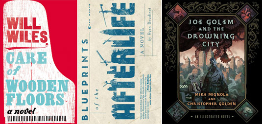
20) Care of Wooden Floors by Will Wiles (Amazon) — Many of you will recognize Will Wiles from his work as deputy editor of ICON magazine or his excellent though infrequent blog Spillway, but here he turns to fiction in a debut novel that tells the story of a man slowly going mad whilst house-sitting for a friend in Eastern Europe. From the book’s own description: “A British copywriter house-sits at his composer friend Oskar’s ultra-modern apartment in a glum Eastern European city. The instructions are simple: Feed the cats, don’t touch the piano, and make sure nothing damages the priceless wooden floors. Content for the first time in ages, he accidentally spills some wine. The apartment and the narrator’s sanity gradually fall apart in this unusual and satisfying novel.” The book has already been released in the UK, where it’s been receiving good reviews as a dark-humored “disaster novel,” but it’s not due out in the States until later this year, when it will become part of the first crop of books published directly and exclusively by Amazon.com.

21) Blueprints of the Afterlife by Ryan Boudinet (Grove Press) — Boudinet’s “bracingly weird new novel” has been receiving high praise and enviable comparisons for the author’s style, including to such writers as Philip K. Dick, William Burroughs, and Neal Stephenson, as Blueprints of the Afterlife picks up considerable buzz in the scifi/speculative fiction world. Fans of odd settings and spatial details will presumably appreciate the book’s “sentient glacier” or its “full-scale replica of Manhattan under construction in Puget Sound.” I’m looking forward to reading this while traveling over the next few weeks.

22) Joe Golem and the Drowning City by Mike Mignola and Christopher Golden (St. Martin’s Press) — It’s no secret that I’m a huge fan of Mike Mignola’s work, and his novelistic collaborations with Christopher Golden have so far been great, if not quite as gripping as Mignola’s own early Hellboy tales. Joe Golem tells the story of a flooded Manhattan, or, in the book’s own words: “In 1925, earthquakes and a rising sea level left Lower Manhattan submerged under more than thirty feet of water, so that its residents began to call it the Drowning City. Those unwilling to abandon their homes created a new life on streets turned to canals and in buildings whose first three stories were underwater.” The results, set 50 years after the flooding, are somewhere between H.P. Lovecraft and Central European urban folklore, featuring occasional black and white drawings by Mignola.

* * *

All Books Received: August 2015, September 2013, December 2012, June 2012, December 2010 (“Climate Futures List”), May 2010, May 2009, and March 2009.

Perhaps it is not a city

[Image: Michael Maltzan’s Inner City Arts building, Los Angeles; photo by Iwan Baan].

I’ll be speaking tonight, May 17th, at Van Alen Books with architect Michael Maltzan about his book No More Play: Conversations on Urban Speculation in Los Angeles and Beyond, edited by Jessica Varner, previously discussed on BLDGBLOG here. The book includes interviews with Matthew Coolidge of the Center for Land Use Interpretation, Charles Waldheim, Qingyun Ma, Catherine Opie, Edward Soja (who quips that “architects should think more like good geographers”), and many more, and will be available for sale this evening, if you can stop by.

Things kick off at 7pm at 30 W. 22nd Street, near the Flatiron Building; here’s a map.

[Image: Los Angeles; photo by Iwan Baan, from No More Play].

As Maltzan writes in the book, “we have reached a point where past vocabularies of the city and of urbanism are no longer adequate, and at this moment, the very word city no longer applies” to Greater Los Angeles. “Perhaps it is not a city” at all, he suggests, but something altogether different and more formally interesting than that (see a slightly longer discussion of this earlier on BLDGBLOG).

When discussing this resistant, indefinable character of Los Angeles, I’m always reminded of a description from the beautifully written but, sadly, now scientifically out of date 2-part book The Music of the Spheres by Guy Murchie. At one point, Murchie describes the surprising lack of density in certain stars, even when those stars, nonetheless, seem structurally coherent to an outside observer.

He explains, for instance, that the surface of the sun “is really a thousand times more vacuous than a candle-flame on Earth, and even the concentrated moiling gases hidden a thousand miles below it are a hundred times thinner than earthly air.” In fact, other stars—such as E Aurigae I, so huge it could “contain most of our solar system, including the 5.5-billion-mile circumference of Saturn’s orbit”—are often “described as ‘red-hot vacuums,'” Murchie writes, “because their material, though hot, averages thousands of times thinner than earthly air and is normally invisible, so that you might fly through them for days in your insulated space ship without even realizing you were inside a star.”

You might fly through them for days without even realizing you are inside a star.

[Image: Los Angeles; photo by Iwan Baan, from No More Play].

Applying this to the urban condition of Los Angeles—a kind of sidereal city, measured by different stars, able to make you feel as if you will never really arrive—it becomes an oddly apt analogy for that region, with its loose outer edges and unclear points of entry into an often off-kilter system of road grids.

In any case, stop by Van Alen Books tonight at 7pm, where we’ll be discussing Los Angeles, density, crime, and, who knows, even my own willful misunderstanding of astrophysics—or, as Van Alen Books puts it, topics such as “real-estate speculation and future urban development, infrastructure, resources, site density, urban experience, political structure, commerce, and community, attempting to transform our understanding of how each affects present-day Los Angeles.”

Lost Lakes of the Empire State Building

[Image: Sunfish Pond].

Something I’ve meant to post about for awhile—and that isn’t news at all—is the fact that there is a lost lake in the basement of the Empire State Building. Or a pond, more accurately speaking.

After following a series of links leading off from Steve Duncan’s ongoing exploration of New York’s “lost streams, kills, rivers, brooks, ponds, lakes, burns, brakes, and springs,” I found the fascinating story of Sunfish Pond, a “lovely little body of water” at the corner of what is now 31st Street and Fourth Avenue. “The pond was fed both by springs and by a brook which also carried its overflow down to the East River at Kip’s Bay.”

Interestingly, although the pond proper would miss the foundations of the Empire State Building, its feeder streams nonetheless pose a flood risk to the building: the now-buried waterway “leading from Sunfish Pond still floods the deep basement of the Empire State Building today.”

To a certain extent, this reminds me of a line from the recent book Alphaville: “Heat lightning cackles above the Brooklyn skyline and her message is clear: ‘You may have it paved over, but it’s still a swamp.'” That is, the city can’t escape its hydrology.

But perhaps this makes the Empire State Building as good a place as any for us to test out the possibility of fishing in the basements of Manhattan: break in, air-hammer some holes through the concrete, bust out fishing rods, and spend the night hauling inexplicable marine life out of the deep and gurgling darkness below.