Lost Animals

I don’t normally link to my short stories here, but I’m proud of a new one called “Lost Animals” that went up earlier this week. It’s about a man hired by private clients to clear houses of ghosts, not using supernatural equipment but a baseball bat.

He’s been storming into abandoned homes, haunted offices, auto-repair yards, and even millionaires’ yachts all over the country, using aggression to overcome his own fears and maintain the upper hand.

The times ghosts truly scare me aren’t from the shock of a dead face staring up from the bottom of a basement staircase; I’m usually too drunk or high for that, too hyped up on aggression. I’ll simply charge at the thing, running after it into a root cellar or climbing a wooden ladder into an unlit barn attic to chase it away. The sights that genuinely unsettle me, that keep me awake at night, are the weird, demented loops I sometimes catch them in, the bleakness of a ghost’s new existence, the never-ending isolation of the afterlife, empty versions of ourselves stuck in routines that have lost all meaning.

After nearly two decades of this—scaring dead people out of their comfort zones—he experiences a slow change of attitude that affects his ability to do the job.

It’s only loosely architectural, but I thought I’d link it here anyway, as the story explores a wide range of spatial situations amenable to hauntings. Check it out, if you’re in the mood for an autumnal read at the height of summer.

[Photo in top image courtesy of U.S. Library of Congress.]

The Terrestrial Status of Boston

The terrestrial status of Boston is an unexpectedly fascinating topic. A city built on land rescued from the sea, it is not only unusually at risk from sea-level rise; it also hides parts of its marshy past beneath its streets and buildings.

As a project by the Norman B. Leventhal Map & Education Center recently wrote, “No city in the U.S. has a more striking history of landmaking than Boston, with about a sixth of its present land area sitting on estuaries, mudflats, coves, and tidal basins that would have been submerged at high tide prior to the seventeenth century. Mapping the growth of the city into the surrounding ocean has been an interest of Boston’s geographers for centuries, and our modern maps of shoreline change are some of the most popular objects in our digital collections.”

[Image: Boston, courtesy of the Norman B. Leventhal Map & Education Center.]

Indeed, the Wall Street Journal explained last year, some of Boston’s most expensive houses are more like docks or wharves, sitting atop wooden pilings driven deep into flooded ground. In one specific case, “the underground wooden pilings supporting the foundation had been rotting for years, to the point where the building’s walls were ‘almost floating,’ [the home’s owner] recalled.”

Recall the the incredible story of William Walker, a diver who “saved” Winchester Cathedral in England by diving beneath it for a period of six years, repairing its aquatic foundations from below. “When huge cracks started to appear in the early 1900s,” we read, “the Cathedral seemed in danger of complete collapse. Early efforts to underpin its waterlogged foundations failed until William Walker, a deep-sea diver, worked under water every day for six years placing bags of concrete.”

Ben Affleck’s next movie, perhaps—scuba diving beneath the streets of Boston and saving the city from below…

While the bulk of the Leventhal Center’s project focuses on the economic value of reclaimed land in the Boston area—what they call “the ultimate financial asset: brand-new urban land, ready for development”—there is at least one amazing detail I wanted to post here.

Like buried ships in New York City and San Francisco, Boston has its own maritime archaeology: “Sophisticated networks of fish weirs can still be found buried beneath the streets of the [Back Bay] neighborhood, which were laid out in a tidily gridded pattern in the nineteenth century to facilitate the engrossment and sale of property.” Indigenous hydrological infrastructure, hiding in plain sight.

Writing just today, meanwhile, in an op-ed for WBUR, Courtney Humphries suggests that, ironically, Boston’s future survival might depend on doing more of what got it into trouble with the sea in the first place: building more land and further modifying the shoreline.

What future weirs and dams and levees and pilings, architectural anchorages all, might we see beneath the streets of Boston, a city halfway between terrestrial and maritime, ground and ocean, bedrock and marsh, in the years to come?

Architecture of the In-Between

“The city owns some of the narrowest, most unusual lots in New York,” we read, but these odd lots might soon host affordable housing. A new competition called Big Ideas for Small Lots NYC is looking for architectural proposals for how these awkwardly sized spaces might be used.

Although these overlooked lots exist all over New York—“The city became the owner of thousands of properties beginning in the 1960s and ’70s,” The New York Times explains, “many in the Bronx and Brooklyn, where properties were seized from delinquent landlords and urban blight was rampant”—the competition is focused on one particular location:

Entrants will be asked to focus on a property on West 136th Street in Harlem, a 17-foot-wide, 1,665-square-foot mid-block lot that is overgrown with weeds and home to a number of feral cats. It was chosen because many of its challenges, including narrow frontage and limited sunlight, are present at other lots on the list, according to a spokesman for the project.

Read more at the project website or at The New York Times.

(Very, very vaguely related: Buy a Los Angeles Sidewalk Corner).

Hospital Interiors / Dolby Suburbs

[Image: “Mix House” by Joel Sanders Architect, Karen Van Lengen/KVL, and Ben Rubin/Ear Studio].

Between cross-country moves, book projects, wild changes in the online media landscape over the past few years, and needless self-competition through social media, my laptop has accumulated hundreds and hundreds, arguably thousands, of bookmarks for things I wanted to write about and never did. Going back through them all feels like staring into a gravesite at the end of a life I didn’t realize was mortal.

For example, the fact that the scent of one of Saturn’s moons was created in a NASA lab in Maryland—speculative offworld perfumery—and that, who knows, it could even someday be trademarked. Or that mountain-front suburban homes in Colorado were unwittingly constructed over mines designed to collapse—and that of the mines have already begun to do so, taking surface roads along with them. Or the sand mines of central Wisconsin. Or the rise of robot-plant hybrids. Or the British home built around a preserved railway carriage “because bizarre planning regulations meant the train could not be moved”—a vehicle frozen into place through architecture.

In any case, another link I wanted to write about many eons ago explained that legendary producer and ambient musician Brian Eno had been hired to design new acoustics for London’s Chelsea and Westminster hospital, part of an overall rethinking of their patient-wellness plan. Healing through sound. “The aim,” the Evening Standard explained, “is to replicate techniques in use in the hospital’s paediatric burns unit, where ‘distraction therapy’ such as projecting moving images on to walls can avoid the need to administer drugs such as morphine.”

This is already interesting—if perhaps also a bit alarming, in that staring at images projected onto blank walls can apparently have the same effect as taking morphine. Or perhaps that’s beautiful, a chemical testament to the mind-altering potential of art amplified by modern electrical technology.

Either way, Eno was brought on board to “refine” the hospital’s acoustics, much as one would do for the interior of a luxury vehicle, and even to “provide soothing music” for the building’s patients, i.e. to write a soundtrack for architecture.

We are already in an era where the interiors of luxury cars are designed with the help of high-end acoustic consultants, where luxury apartments are built using products such as “acoustic plaster,” and where critical governmental facilities are constructed with acoustic security in mind—a silence impenetrable to eavesdroppers—but I remain convinced that middle-budget home developers all over the world are sleeping on an opportunity for distinguishing themselves. That is, why not bring Brian Eno in to design soothing acoustics for an entire village or residential tower?

Imagine a whole new neighborhood in Los Angeles designed in partnership with Dolby Laboratories or Bang & Olufsen, down to the use of acoustic-deflection walls and carefully chosen, sound-absorbing plants, or an apartment complex near London’s Royal Academy of Music with interiors acoustically shaped by Charcoalblue. SilentHomes™ constructed near freeways in New York City—or, for that matter, in the middle of nowhere, for sonically sensitive clients. Demonstration suburbs for unusual acoustic phenomena—like Joel Sanders et al.’s “Mix House” scaled up to suit modern real-estate marketers.

At the very least, consider it a design challenge. It’s 2020. KB Home has teamed up with Dolby Labs to construct a new housing complex covering three city blocks near a freeway in Los Angeles. What does it look—and, more to the point, what does it sound—like?

Buy a Border Patrol Station

[Image: Courtesy U.S. Government Services Administration].

Somewhat amazingly, a former U.S. Border Patrol station is for sale outside the town of Gila Bend, Arizona.

The minimum bid is only $8,000—but the property doesn’t look too good and is “not warranted,” so buyer beware.

[Image: Courtesy U.S. Government Services Administration].

Structural conditions notwithstanding, this could be an amazing opportunity to create a Border Museum, a desert arts center, a writers’ retreat, an urban explorers’ redoubt, a remote branch of the Center for Land Use Interpretation, a field school for an avant-garde university geography program, a pop-up site for an architecture school to host student installations, a future restaurant, a weird Father’s Day gift, a place to store your favorite Paul Manafort trial memorabilia, an asbestos-exposure demonstration facility, or just a roadside site to park your pick-up truck.

Here is the facility on Google Maps.

[Image: Courtesy U.S. Government Services Administration].

Bidding begins on August 28th.

[Image: Courtesy U.S. Government Services Administration].

Note that there is an open house on Friday morning, August 17th, 2018, at 9am, for those of you near Gila Bend.

(Previously on BLDGBLOG: Buy a Los Angeles Sidewalk Corner, Buy a Complex of Submarine Pits, Buy a Skyway, Buy a Fort, Buy a Lighthouse, Buy an Underground Kingdom, Buy a Prison, Buy a Tube Station, Buy an Archipelago, Buy a Map, Buy a Torpedo-Testing Facility, Buy a Silk Mill, Buy a Fort, Buy a Church).

No Wall Is Ever Silent

Amidst a huge number of novels I’ve been reading lately for a variety of reasons is the book Nineveh by Henrietta Rose-Innes.

The book is set in Ninevah, a luxurious, new, South African real estate development that has been temporarily abandoned before its official opening due to an unspecified infestation; the action centers on an “ethical pest removal specialist” named Katya Grubbs. Katya has been hired by Mr. Brand, a swaggering, whiskey-fueled golfer and property developer, to clear Nineveh’s looming and empty buildings of whatever it is that has hatched there.

While I will confess that there were several scenes in which Katya’s actions seemed inexplicable to me, Rose-Innes’s descriptions of Nineveh and of the looming presence of infesting insects squirming just beneath the surface are nonetheless both beautifully written and resolutely Ballardian in tone.

For example, the land that Nineveh was built on “was reclaimed,” we read. “Katya wonders how much of the wetlands they had to drain, how many thousands of vertebrate or invertebrate souls were displaced or destroyed to make this place. In her experience, a poorly drained property is a magnet for all kinds of damp-loving pests: water-snakes, slugs and especially mosquitoes. The rising water and its travelers always find a way back in.”

“Indeed,” the narrative continues, “beyond Nineveh’s perimeter, everything is insistently alive and pushing to enter.”

This older, overlooked ecosystem, dismissed as a nuisance, now threatens literally to come back up through the floorboards.

Wandering around amidst the huge buildings, a J. G. Ballard among the insects, Katya discovers ruined rooms and even a rain-soaked smuggling tunnel used to strip the uninhabited suites of their woodwork, pipes, and copper.

Katya soon suspects that she is not, in fact, alone. She puts her ear to the wall one night, convinced she hears someone on the other side: “No wall is ever silent; always there is a subdued orchestra of knocks and sighs and oceanic rushing. The hum of pipes, the creaks of bricks and mortar settling. Or unsettling: such sounds are the minute harbingers of future destruction, the first tiny tremors of a very, very slow collapse that will end, decades or centuries from now, in a pile of rubble.”

Without, I hope, giving away much of the plot, there is a confrontation later in the book, deep in the interior of one of these buildings, in a scene where everyone realizes how flimsy the construction around them really is. The buildings are just masks on empty space. Katya’s temperament is such that she has already realized this, suspecting all along that the apparent paradise of Nineveh was all just wishful projection; other, less cynical characters fare poorly.

What follows is an insight about architecture’s false reliability—that we are, in fact, deluded to take our buildings at face-value—that I also try to make in my book, A Burglar’s Guide to the City. This excerpt thus particularly stood out to me:

One thing about having a belief in the fixed nature of things, in walls and floors: it gives you a certain disadvantage. Mr. Brand, for all his solid confidence, in fact because of it, cannot look beyond the obvious, cannot see past the evidence of the concrete world. He can’t consider that perhaps the walls are false, or that the floorboards might conceal strange depths. Despite his rage, he would not think to punch through a wall: it would not occur to him that walls are breachable. In Mr. Brand’s world of certainties, such an in-between place is hardly possible; it barely exists.

The collapsing world of Nineveh, with its hollow walls, smugglers’ tunnels, and rising tides of storm-borne insects, twinned with Katya’s own house that is literally splitting in two from seismic disturbances caused by the heavy machinery of gentrification across the street, presents us with a precariously inhabited world barely standing still on its foundations. Yet within those foundations are the bugs and worms, beetles and snakes, temporarily beaten back by humans but on the verge of retaking the scene.

In any case, you can read reviews at Kirkus or the Guardian.

Zone for Game

[Image: Via TechCrunch].

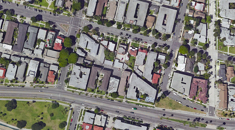
There was finally something interesting to read about Pokémon Go. The game—which involves overlaying the physical world with a grab-bag of exotic creatures that players attempt to capture for points—might help catalyze a new form of virtual urban zoning.

In England, BuzzFeed reported earlier this week, “one person has been so unsettled by strangers turning up at their house that they’ve been forced to ask their member of parliament to intervene.” Apparently, the game’s virtual characters have been showing up within this person’s property lines, which has been “attracting people from far and wide to come and do battle.”

The peeved constituent presumably wants to establish some sort of legal mechanism for preventing uninvited virtual inhabitants from popping up on his or her private property.

[Image: Altered photo of an American front lawn, via Wikipedia].

In the U.S., meanwhile, a New Jersey man has also had enough of these sorts of pixellated guests.

As Kashmir Hill writes for Fusion, “So many people started showing up around [the New Jersey man’s] house, smartphones in hand, hunting Pokémon that he is now suing the makers of the game for creating a nuisance and unjustly enriching themselves by using his backyard as a virtual home for the game’s cartoon creatures.”

In a sense, the game’s designers are operating an illegal—albeit virtual—business on his property.

The New Jersey man’s legal complaint alleges that he “became aware that strangers were gathering outside of his home, holding up their mobile phones as if they were taking pictures. At least five individuals knocked on Plaintiff’s door, informed Plaintiff that there was a Pokémon in his backyard, and asked for access to Plaintiff’s backyard in order to ‘catch’ the Pokémon.”

Trespassing, unlicensed business activity, illegal occupancy, even burglary—as Hill points out, this has led to a rather fascinating challenge to the limits of personal property rights.

It is “quite a novel lawsuit,” she writes, referring specifically to the New Jersey case. “It is laughable, on the one hand, yet it does raise interesting questions around who owns the augmented reality space overlaid on people’s real world properties. When you own land, there are limits to how far above and below your house you own. A new question would be the extent of your rights to the new dimension on top of your property that is augmented reality.”

For Hill, this goes on to raise a series of related questions, including, “if augmented reality really catches on, and an internet environment overlaid on our real world surroundings becomes common, what will be the rules around using that augmented space? Could anyone put a virtual billboard on the front of your house or would they need your permission?”

Could you sell, lease, or subdivide the digital rights to your own home, yard, or lobby?

Could you extract a toll, tax, or commission from virtual usage?

[Image: “With the success of Pokémon Go, we set out to discover if any of the little monsters were hiding within the walls of our own L.A. Times newsroom.” Were those little monsters digitally trespassing? Photo via the L.A. Times].

A while back, we looked at zoning rules in the U.K., hoping to learn what those rules might reveal about the extent to which everyday citizens can use, or even fundamentally transform, personal real estate. What can the state regulate—what can zoning rules control—versus what a private property owner commands? What about digitally?

These Pokémon Go examples suggest something altogether more ominous, I might suggest, wherein a digital entertainment company could prove to have de facto access to your yard, your car, your front stoop, your place of business, using any one of those merely as a stage or platform for passive economic activity.

How much would I love to read a Supreme Court decision—and its dissent!—about these very questions, posing an absolute outside limit to personal digital property rights, where virtual homesteads begin and end, or the extent to which we have the right to populate other people’s space with augmentations and intrusions.

[Image: Skid Row, Los Angeles, via Wikipedia].

Briefly, it’s worth adding that this could also have urban-scale implications.

As Curbed L.A. pointed out this week, Los Angeles “is a veritable menagerie of diverse and unusual Poké-creatures,” which means that “the city may soon be overrun with Poké-tourists,” people from diverse geographic backgrounds hoping to capture high-value targets.

Pokémon Go will disappear from public memory relatively soon, of course, yet it is all but guaranteed to be replaced by other augmented-reality games that also rely on a quote-unquote real, physical location to determine the strategic value of player actions.

To what extent, then, will entire urban entities such as Los Angeles seek to collaborate with, or even directly fund, virtual inhabitants—virtual landmarks, virtual historic sites, virtual destinations—and what are the rules or regulations that might apply to them?

Finally—as anyone who has read Delirious New York or is familiar with the work of Hugh Ferriss knows—cities are fundamentally shaped by zoning laws, literally down to the shadows cast by individual buildings. What, then, might digital or virtual zoning actually look like? How might it shape urban environments to come?

What, as Kashmir Hill asked, is “the extent of your rights to the new dimension on top of your property that is augmented reality”?

*Update* In a slightly expanded version of this post syndicated by Motherboard, I point out that Thailand is already looking “to restrict zoning for the Pokémon Go game after receiving several complaints from people who are disturbed by the trainers, or players, of the game.”

The proposed blocklist would begin with sites of national security, removing them from the field of potential gameplay. However, it is not hard to imagine private citizens using their own political influence to help determine which homes—let alone which streets or entire neighborhoods—would be added to the no-game zone. Think of it as geofencing as a form of urban design.

More over at Motherboard.

(Thanks to @AnthonyAdler for tweeting about “virtual environment policy” a few days ago).

Ghost Streets of Los Angeles

[Image: Via Google Maps; view larger].

In a short story called “Reports of Certain Events in London” by China Miéville—a text often cited here on BLDGBLOG—we read about a spectral network of streets that appear and disappear around London like the static of a radio tuned between stations, old roadways that are neither here nor there, flickering on and off in the dead hours of the night.

For reasons mostly related to a bank heist described in my book, A Burglar’s Guide to the City, I found myself looking at a lot of aerial shots of Los Angeles—specifically the area between West Hollywood and Sunset Boulevard—when I noticed this weird diagonal line cutting through the neighborhood.

[Image: Via Google Maps; view larger].

It is not a street—although it obviously started off as a street. In fact, parts of it today are still called Marshfield Way.

At times, however, it’s just an alleyway behind other buildings, or even just a narrow parking lot tucked in at the edge of someone else’s property line.

[Image: Via Google Maps; view larger].

Other times, it actually takes on solidity and mass in the form of oddly skewed, diagonal slashes of houses.

The buildings that fill it look more like scar tissue, bubbling up to cover a void left behind by something else’s absence.

[Image: Via Google Maps; view larger].

First of all, I love the idea that the buildings seen here take their form from a lost street—that an old throughway since scrubbed from the surface of Los Angeles has reappeared in the form of contemporary architectural space.

That is, someone’s living room is actually shaped the way it is not because of something peculiar to architectural history, but because of a ghost street, or the wall of perhaps your very own bedroom takes its angle from a right of way that, for whatever reason, long ago disappeared.

[Image: Via Google Maps; view larger].

If you follow this thing from roughly the intersection of Hollywood & La Brea to the strangely cleaved back of an apartment building on Ogden Drive—the void left by this lost street, incredibly, now takes the form of a private swimming pool—these buildings seem to plow through the neighborhood like train cars.

Which could also be quite appropriate, as this superficial wound on the skin of the city is most likely a former streetcar route.

But who knows: my own research went no deeper than an abandoned Google search, and I was actually more curious what other people thought this might be or what they’ve experienced here, assuming at least someone in the world reading this post someday might live or work in one of these buildings.

[Image: Via Google Maps; view larger].

And perhaps this is just the exact same point, repeated, but the notion that every city has these deeper wounds and removals that nonetheless never disappear is just incredible to me. You cut something out—and it becomes a building a generation later. You remove an entire street—and it becomes someone’s living room.

I remember first learning that one of the auditoriums at the Barbican Art Centre in London is shaped the way it is because it was built inside a former WWII bomb crater, and simply reeling at the notion that all of these negative spaces left scattered and invisible around the city could take on architectural form.

Like ghosts appearing out of nowhere—or like China Miéville’s fluttering half-streets, conjured out of the urban injuries we all live within and too easily mistake for property lines and real estate, amidst architectural incisions that someday become swimming pools and parking lots.

*Update* Some further “ghost streets” have popped up in the comments here, and the images are worth posting.

[Image: Via Google Maps; view larger].

The one seen above, for example, is “another ghost diagonal that begins on 8th St. at Hobart, and ends at Pico and Rimpau,” an anonymous commenter explains.

Another example, seen below—

[Image: Via Google Maps; view larger].

—is “a block in the Pico-Robertson area,” a commenter writes:

I lived there as a teenager, but never noticed the two diagonals until I looked at it with google maps. There are some lots on the west side of the next two blocks north which also have diagonals. And if you continue north across Pico Blvd, you can see diagonal property lines around St. Mary Magdalene Catholic School and the church.

Thanks for all the tips, and by all means keep them coming, if you are aware of other sites like this, whether in Los Angeles or further afield; and be sure to read through the comments for more.

*Second Update* The examples keep coming. A commenter named Lance Morris explains that he did an MFA project “about this very thing, but in Long Beach. There’s a long diagonal scar running from Long Beach Blvd and Willow all the way down to Belmont Shore. I tried walking as closely to the line as I could and GPS tracked the results. There are even 2 areas where you can still see tracks!”

This inspired me to look around the area a little bit on Google Maps, which led to another place nearby, as seen below.

[Image: Via Google Maps; view larger].

Again, seeing how these local building forms have been generated by the outlines of a missing street or streetcar line is pretty astonishing.

Further, the tiniest indicators of these lost throughways remain visible from above, usually in the form of triangular building cuts or geometrically odd storage yards and parking lots. Because they all align—like some strange industrial ley line—you can deduce that an older piece of transportation infrastructure is now missing.

[Image: Via Google Maps; view a bit larger].

Indeed, if you zoom out from there in the map, you’ll see that the subtle diagonal line cutting across the above image (from the lower left to the upper right) is, in fact, an old rail right of way that leads from the shore further inland.

To give a sense of how incredibly subtle some of these signs can be, the diagonal fence seen in the below screen grab—

[Image: Via Google Maps; view larger].

—is actually shaped that way not because of some quirk of the local storage lot manager, but because it follows this lost right of way.

*Third Update* There are yet more interesting examples popping up now over in a thread on Metafilter.

There, among other notable comments, someone called univac points out that the streetcar scar that “begins on 8th St. at Hobart, and ends at Pico and Rimpau”—quoting an earlier commenter here on BLDGBLOG—”actually has one echo in the diagonally-stepped building here, and picks up again in the block bounded by Wilton, Westchester, 9th and San Marino, and ends at a crooked building just north of 4th and Olympic.”

[Image: Via Google Maps; view larger].

You can see the middle stretch of that route in the image, above. For more, check out the thread on Metafilter.

Not only this, however, but the old right of way followed by that commenter actually extends much further than that, all the way southwest to a small park at approximately Pico and Queen Anne Place.

[Image: Via Google Maps; view larger].

In the above image, you can see a small structure—a garage or a house—turned slightly off-axis in the northeast corner, indicating the line of the old streetcar line, with some open lawns and small paved areas revealing its obscured geometry as you look down to the southwest.

Buy a Los Angeles Sidewalk Corner

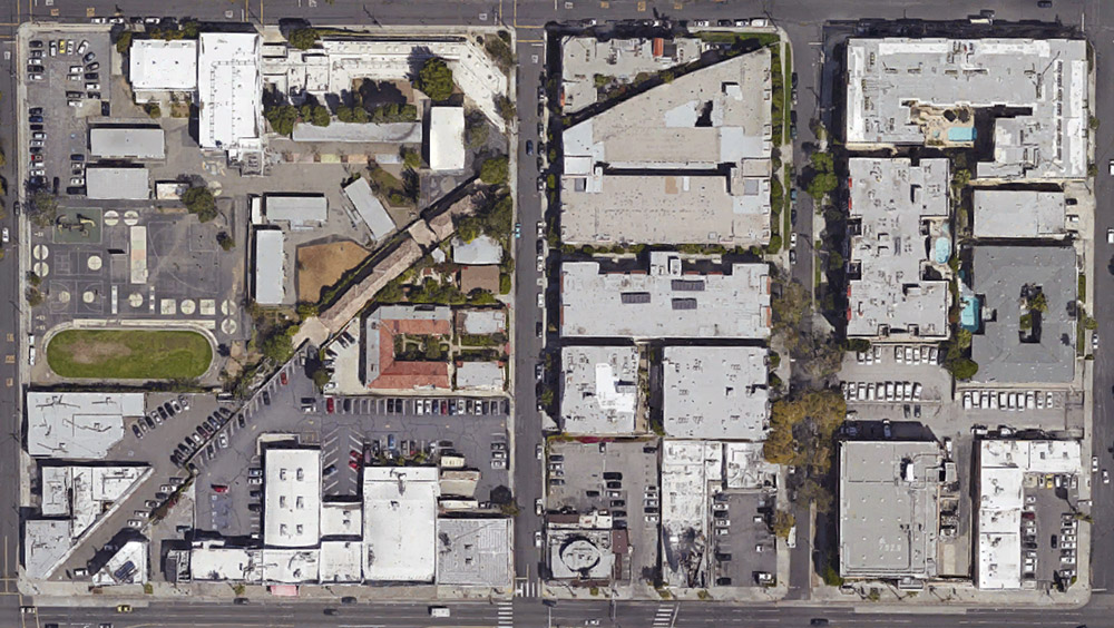
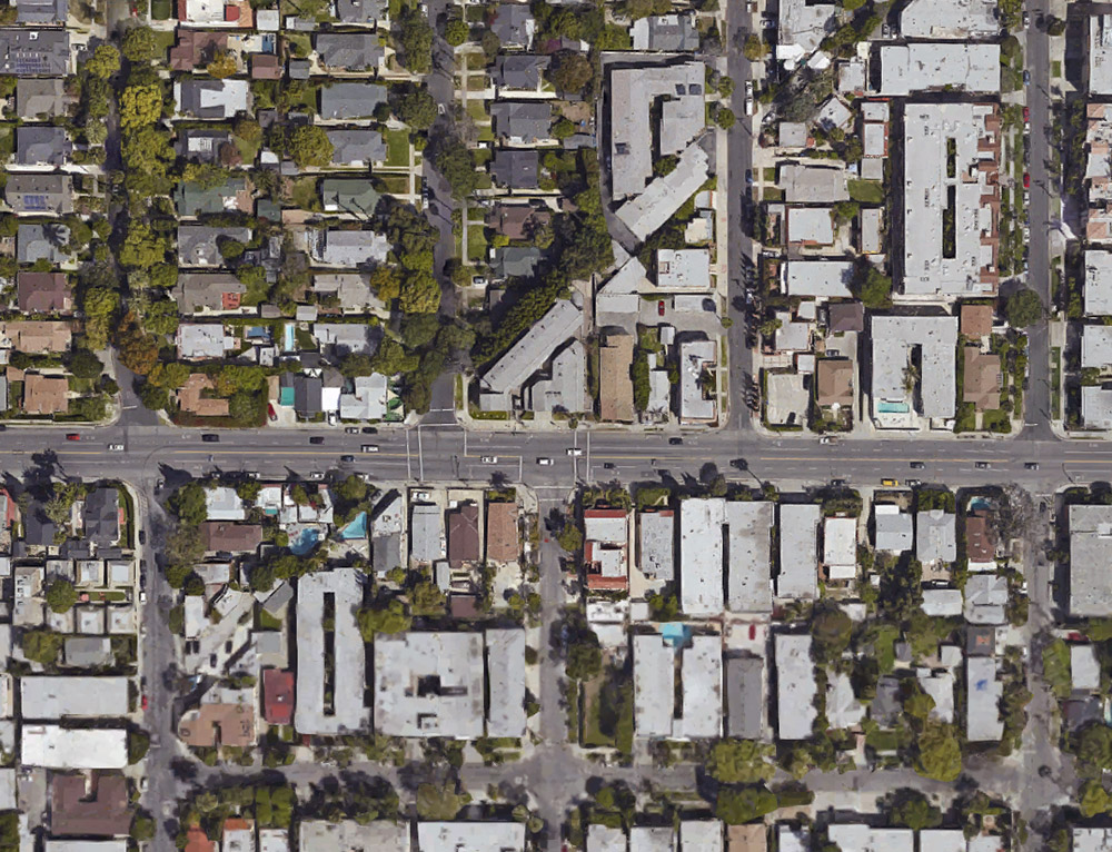
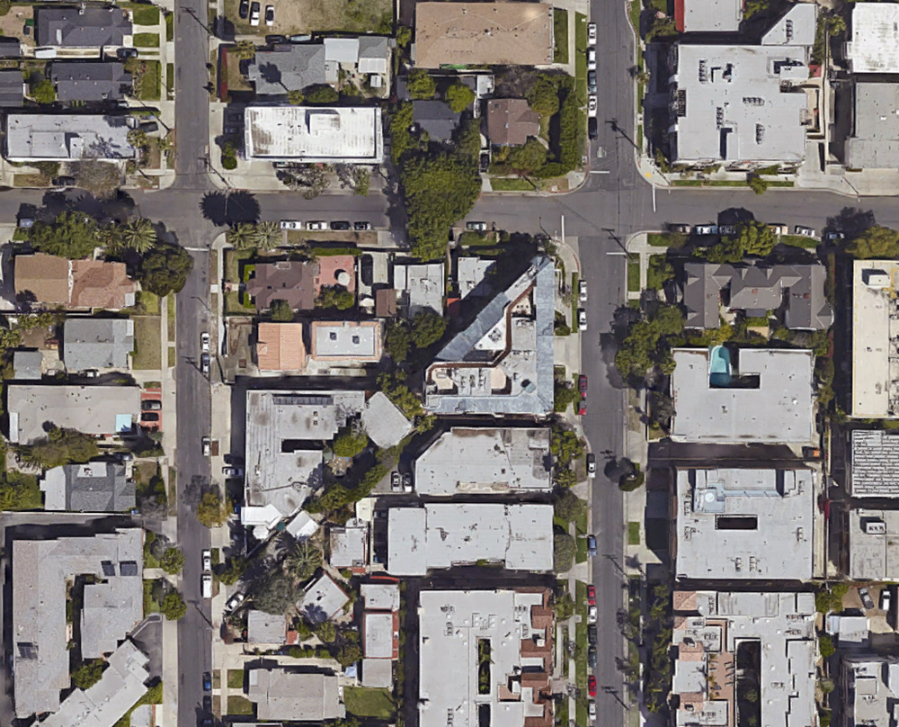
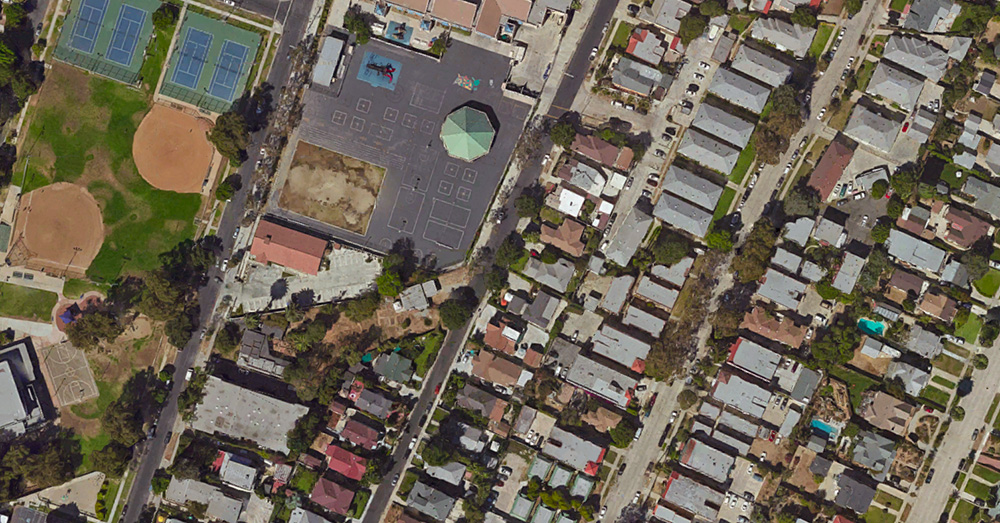
[Image: A sidewalk corner in Los Angeles, albeit not the one for sale; via Google Street View].

If you’ve been longing for a way to satisfy your inner Gordon Matta-Clark—the artist who, among many other things, once purchased an interstitial empire of “odd lots” throughout New York City, including the spaces between buildings and other “unusably small slivers of land sliced from the city grid through anomalies in surveying, zoning, and public-works expansion”—then now might be your chance.

Los Angeles is auctioning off a chunk of odd lots: “Offerings include transferable ‘air rights’ and, in one case, the corner of a sidewalk,” the Los Angeles Times reports, among what they describe as “tiny bits of land that were left over from big real estate developments, set aside like scraps of cloth cut from a garment.”

The properties for sale include a collection of oddly shaped and awkwardly encumbered lots acquired during decades of efforts to help developers build in blighted neighborhoods. A few of the parcels, though, are under name-brand Los Angeles institutions, such as the ground under the historic Angels Flight funicular railway on Bunker Hill and the land occupied by the Dolby Theatre in Hollywood, site of the Academy Awards.

You can peruse the full list of sites here. In all honesty, they are not immediately compelling. However, they do include an archipelago of air rights throughout the city; one property is only 26 square feet; and another appears to be the small strip of land located outside 1013 E. Adams Boulevard.

Purchase wisely.

(Previously on BLDGBLOG: Buy a Complex of Submarine Pits, Buy a Skyway, Buy a Fort, Buy a Lighthouse, Buy an Underground Kingdom, Buy a Prison, Buy a Tube Station, Buy an Archipelago, Buy a Map, Buy a Torpedo-Testing Facility, Buy a Silk Mill, Buy a Fort, Buy a Church).

City of Buried Machines

[Image: Courtesy of London Basement].

A story of buried digging machines made something of an unexpected splash over at New Statesman this week, quickly becoming their weekend’s most-read article.

It turns out that all those elaborate basements and artificial show caves built for Londons’ nouveau riche have led to an interesting spatial dilemma: contractors are unable to retrieve the excavation equipment they used to produce all those huge underground extensions in the first place, and they have thus developed a technique for simply abandoning their machines underground and burying them in place.

London is thus becoming a machine cemetery, with upwards of £5 million worth of excavators now lying in state beneath the houses of the 1%. Like tools invented by M.C. Escher, these sacrificial JCBs have excavated the very holes they are then ritually entombed within, turning the city into a Celtic barrow for an age of heroic machinery.

What will future archaeologists make of these interred devices, densely packed in earth and left behind in unmarked graves?

[Image: Courtesy of London Basement].

As we explored here on BLDGBLOG six years ago, deep below the mansions and row houses of the city’s wealthiest residents, colossal cave adventures are taking shape: massive swimming pools, TV rooms, personal gymnasia, full-scale cinemas, and whole subterranean flats are being constructed in order to side-step strict historic preservation laws on the earth’s surface.

Pioneered by firms such as the appropriately named London Basement, these massively expanded homes now feature “playrooms and cinemas, bowling alleys and spas, wine cellars and gun rooms—and even a two-storey climbing wall,” the Guardian reported in 2012. “It is leading to a kind of iceberg architecture, a humble mansion on the surface just the visible peak of a gargantuan underworld, with subterranean possibilities only limited by the client’s imagination.”

As the architect of one such mega-basement explained, “We analyzed the planning laws and realized that they cover everything about the surface of the ground, but nothing beneath it. There was nothing whatsoever that could stop us from drilling all the way down to the south pole.”

[Image: Courtesy of London Basement].

Those grand old piles you see lining the streets of Belgravia thus might hide vertically sprawling domestic labyrinths and basement mazes down in the soil and clay beneath their ever-growing foundations, as home ownership fractally expands downward into the planet by way of waterproof geotextiles and carefully buttressed retaining walls.

However, these vast catacombs are by no means uncontroversial and might yet see their era come to an end due to local frustration with the disruption caused by construction crews and because of ever-growing municipal fees and penalties.

Until then, though, this abyssal impulse is surely approaching the inevitable point where we will see a private home legally redefined as a mine, a site of excavation closer in spirit to the extraction industry than private housing.

(Thanks to Martin John Callanan, Peter Flint, Paul Black, and Nicola Twilley! Meanwhile, if you like this, you might also like Subterranean Machine Resurrections)

A Building For Measuring Borders

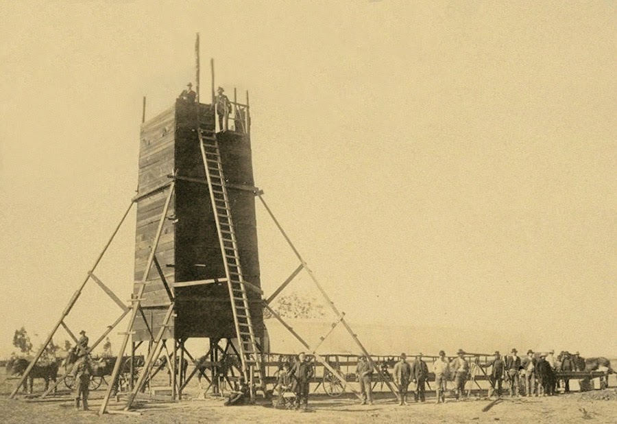
The so-called “Yolo Buggy” was not a 19th-century adventure tourism vehicle for those of us who only live once; it was a mobile building, field shelter, and geopolitical laboratory for measuring the borders of an American county. Yolo County, California.

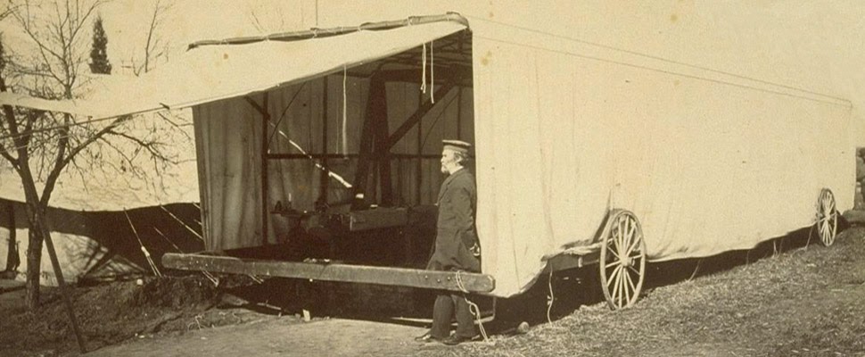
The “moveable tent or ‘Yolo Buggy,'” as the libraries at UC Berkeley describe it, helped teams of state surveyors perform acts of measurement across the landscape in order to mathematically understand—and, thus, to tax, police, and regulate—the western terrain of the United States. It was a kind of Borgesian parade, a carnival of instruments on the move.

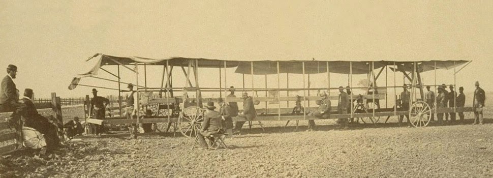
The resulting “Yolo Baseline” and the geometries that emerged from it allowed these teams to establish a constant point of cartographic reference for future mapping expeditions and charts. In effect, it was an invisible line across the landscape that they tried to make governmentally real by leaving small markers in their wake. (Read more about meridians and baselines over at the Center for Land Use Interpretation).

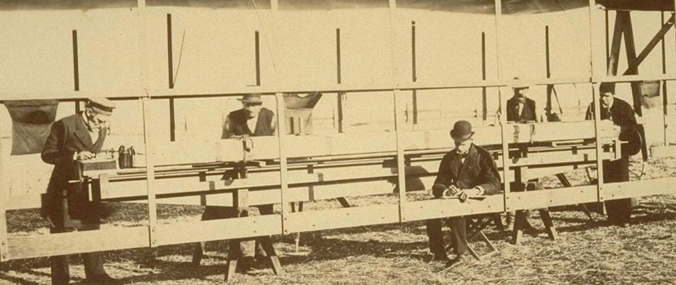
In the process, these teams carried architecture along with them in the form of the “moveable tent” seen here—which was simultaneously a room in which they could stay out of the sun and a pop-up work station for making sense of the earth’s surface—and the related tower visible in the opening image.

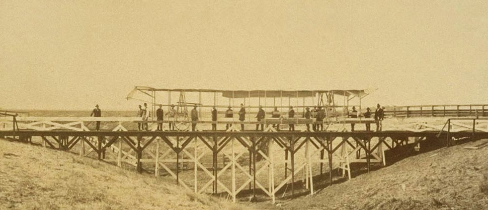
That control tower allowed the teams’ literal supervisors to look back at where they’d come from and to scan much further ahead, at whatever future calculations of the grid they might be able to map in the days to come. You could say that it was mobile optical infrastructure for gaining administrative control of new land.

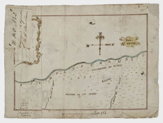
Like a dust-covered Tron of the desert, surrounded by the invisible mathematics of a grid that had yet to be realized, these over-dressed gentlemen of another century helped give rise to an abstract model of the state. Their comparatively minor work thus contributed to a virtual database of points and coordinates, something immaterial and totally out of scale with the bruised shins and splintered fingers associated with moving this wooden behemoth across the California hills.
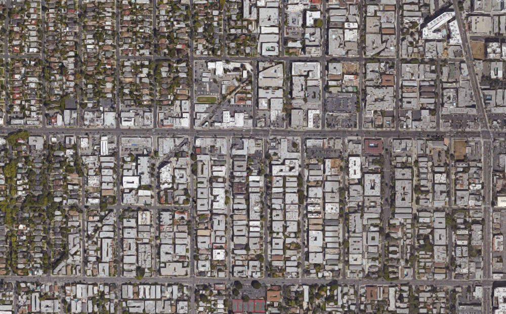
(All images courtesy UC Berkeley/Calisphere).