Geologist Michael Welland has an interesting post up about the “first detailed examination of extra-terrestrial sand dunes” on Mars, coming later this year. His post also briefly discusses the life and career of Ralph Bagnold, after whom the Martian dunes are named, as well as the granular physics of a remote landscape that, in Welland’s words, “just seems, instinctively, to be unearthly.”
Tag: Geology
Rings
In the forests of northern Ontario, a “strange phenomenon” of large natural rings occurs, where thousands of circles, as large as two kilometers in diameter, appear in the remote landscape.
 [Image: From the thesis “Geochemistry of Forest Rings in Northern Ontario: Identification of Ring Edge Processes in Peat and Soil” (PDF) by Kerstin M. Brauneder, University of Ottawa].
“From the air, these mysterious light-coloured rings of stunted tree growth are clearly visible,” the CBC explained back in 2008, “but on the ground, you could walk right through them without noticing them.”
Since they were discovered on aerial photos about 50 years ago, the rings have baffled biologists, geologists and foresters… Astronomers suggest the rings might be the result of meteor strikes. Prospectors wonder whether the formations signal diamond-bearing kimberlites, a type of igneous rock.
While it’s easy to get carried away with visions of supernatural tree rings growing of their own accord in the boreal forest, this is actually an example of where the likely scientific explanation is significantly more interesting than something explicitly otherworldly.
 [Image: From the thesis “Geochemistry of Forest Rings in Northern Ontario: Identification of Ring Edge Processes in Peat and Soil” (PDF) by Kerstin M. Brander, University of Ottawa].
As geochemist Stew Hamilton suggested in 1998, the rings are most likely to be surface features caused by “reduced chimneys,” or “big centres of negative charge that frequently occur over metal deposits,” where a forest ring is simply “a special case of a reduced chimney.”
Reduced chimneys, meanwhile, are “giant electrochemical cells” in the ground that, as seen through the example of forest rings, can affect the way vegetation grows there.
 [Image: Screen-grab from Google Maps].
One of many things worth highlighting here is this suggestion that the trees are being influenced from below by ambient electrochemical processes in the soil, set into motion by the region’s deep geology:
Hamilton was testing an analytical technique over a Matheson gold deposit to determine if there was any kind of geochemical surface signal. To his surprise, there were signals coming through 30 to 40 metres of glacial clay.
“We’re thinking there’s no way metals can move through clay 10,000 years after glaciation.”
After ruling out transport by ground water, diffusion and gas, he theorized it had to have been lifted to surface on electrical fields.
He applied the same theory to forest rings and discovered that they were also giant negatively charged cells.
Any source of negative charge will create a forest ring.
In landscape architecture terms, a forest ring—which Hamilton describes [PDF] as “a plant assemblage that is different from the surrounding forest making the features visible from the air”—could be seen as a kind of indirect electrochemical garden taking on a recognizably geometrical form without human intervention.
In effect, their shape is expressed from below. For ambitious future landscape designers, note that this implies a potential use of plantlife as a means for revealing naturally occurring electrical networks in the ground, where soil batteries and other forms of terrestrial electronics could articulate themselves through botanical side-effects.
That is, plant a forest; come back after twenty years; discover vast rings of negative electrochemical charge like smoke rings pushing upward from inside the earth.
Or, of course, you could reverse this: design for future landscape-architectural effects by formatting the deep soil of a given site, thus catalyzing subterranean electrochemical activity that, years if not generations later, would begin to have aesthetic effects.
 [Image: From the paper “Spontaneous potential and redox responses over a forest ring” (PDF) by Stewart M. Hamilton and Keiko H. Hattori].
But it gets weirder: as Hamilton’s fieldwork also revealed, there is a measurable “bulge in the water table that occurs over the entire length of the forest ring with a profound dip on the ring’s outer edge.” For Hamilton, this effect was “beyond science fiction,” he remarked to the trade journal Northern Ontario Business, “it’s unbelievable.”
What this means, he explained, is that “the water is being held up against gravity” by naturally occurring electrical fields.
 [Image: From the paper “Spontaneous potential and redox responses over a forest ring” (PDF) by Stewart M. Hamilton and Keiko H. Hattori].
Subsequent and still-ongoing research by other geologists and geochemists has shown that forest rings are also marked by the elevated presence of methane (which explains the “stunted tree growth”), caused by natural gas leaking up from geological structures beneath the forest.
Hamilton himself wrote, in a short report for the Ontario Geological Survey [PDF], that forest ring formation “may be due to upward methane seepage along geological structures from deeper sources,” and that this “may indicate deeper sources of natural gas in the James Bay Lowlands.”
Other hypotheses suggest that these forest rings could instead be surface indicators of diamond pipes and coal deposits—meaning that, given access to an aerial view, you can, in effect, “read” the earth’s biosphere as a living tissue of signs or symptoms through which deeper, non-biological phenomena (coal, diamonds, metals) are revealed.
 [Image: Forest ring at N 49° 16′ 05″, W 83° 45′ 01″, via Google Maps].
Even better, these electrochemical effects stop on a macro-scale where the subsurface geology changes; as Hamilton points out [PDF], the “eastward disappearance of rings in Quebec occurs at the north-south Haricanna Moraine, which coincides with a sudden drop in the carbonate content of soils.”
If you recall that there were once naturally-occurring nuclear reactors burning away in the rocks below Gabon, then the implication here would be that large-scale geological formations, given the right slurry of carbonates, metals, and clays, can also form naturally-occurring super-batteries during particular phases of their existence.
To put this another way, through an accident of geology, what we refer to as “ground” in northern Ontario could actually be thought of a vast circuitboard of electrochemically active geological deposits, where an ambient negative charge in the soil has given rise to geometric shapes in the forest.
 [Image: Forest rings at N 49° 29′ 48″, W 80° 05′ 40″, via Google Maps].
In any case, there is something incredible about the idea that you could be hiking through the forests of northern Ontario without ever knowing you’re surrounded by huge, invisible, negatively charged megastructures exhibiting geometric effects on the plantlife all around you.
Several years ago, I wrote a post about the future of the “sacred grove” for the Canadian Centre for Architecture, based on a paper called “The sacred groves of ancient Greece” by art historian Patrick Bowe. I mention this because it’s interesting to consider the forest rings of northern Ontario in the larger interpretive context of Bowe’s paper, not because there is any historical or empirical connection between the two, of course; but, rather, for the speculative value of questioning whether these types of anomalous forest-effects could, under certain cultural circumstances, carry symbolic weight. If they could, that is, become “sacred groves.”
Indeed, it is both thrilling and strange to imagine some future cult of electrical activity whose spaces of worship and gathering are remote boreal rings, circular phenomena in the far north where water moves against gravity and chemical reactions crackle outward through the soil, forcing forests to take symmetrical forms only visible from high above.
For more on forest rings, check out the CBC or Northern Ontario Business or check out any of the PDFs linked in this post.
Sulphur Bricks and Super-Arches
 [Image: Mars architecture concept by ZA Architects, via The Verge].
Without water or traditional building materials, what will hypothetical Martian settlers use to build their future homes? Worry no more: materials scientists at Northwestern University have developed “Martian concrete” using sulphur, which is abundant on our neighboring planet.
The key material in a Martian construction boom will be sulphur, says the Northwestern team. The basic idea is to heat sulphur to about 240°C [464°F] so that it becomes liquid, mix it with Martian soil, which acts as an aggregate, and then let it cool. The sulphur solidifies, binding the aggregate and creating concrete. Voila—Martian concrete.
The resulting bricks are apparently quite strong and readily recyclable. As the MIT Technology Review points out, “Martian concrete can be recycled by heating it, so that the sulphur melts. So it can be re-used repeatedly. It is also fast-setting, relatively easy to handle and extremely cheap compared to materials brought from Earth.”
Briefly, it’s worth noting that sulphur-based brick mixes were previously explored at McGill University in Montréal by a team of environmentally minded designers, including architect Vikram Bhatt. As I got to learn from Bhatt himself during a summer at the Canadian Centre for Architecture back in 2010, that group sought to reuse waste sulfur as a building material.
One of the more interesting and, if I remember correctly, totally unexpected side-effects was the discovery that full-color images could be transferred to the bricks with a startling degree of verisimilitude, as the following two photos make clear.

 [Images: Photos by Geoff Manaugh, originally published here].
Of course, this feature is presumably rather low on the list of details future astronaut-architects will be hoping for as they build their first encampments on Mars.
More practically, one thing I’d love to learn more about would be the possibility of novel architectural structures constructed using sulfurous concrete in the lower-gravity environment of Mars. Would the planet’s weaker gravity augment an architect’s ability to construct ambitious spans and arches, for example, because the materials themselves would be substantially lighter? Or, conversely, would the planet’s gravitational strength already be accounted for by a reduced density of the material, negating gravity’s diminished pull?
Put another way, the idea of ultra-light sulphur-concrete vaults and arches covering distances and spans that would be terrestrially impossible is quite a beautiful thing to imagine—and, coupled with those image-transfer techniques seen by Bhatt and his team at McGill, could result in vast new galleries and chapels illustrated with Martian frescoes, a high-tech return to older representational techniques from art history.
A Model Descent
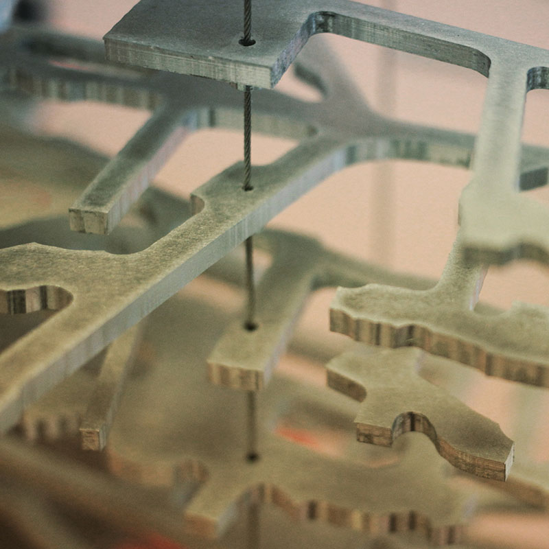 [Image: Model by SITU Studio with C&G Partners; Instagram by BLDGBLOG].
The Homestake Mine in Lead, South Dakota, was once “the largest, deepest and most productive gold mine in North America,” featuring nearly 370 miles’ worth of tunnels.
Although active mining operations ceased there more than a decade ago, the vast subterranean labyrinth not only remains intact, it has also found a second life as host for a number of underground physics experiments.
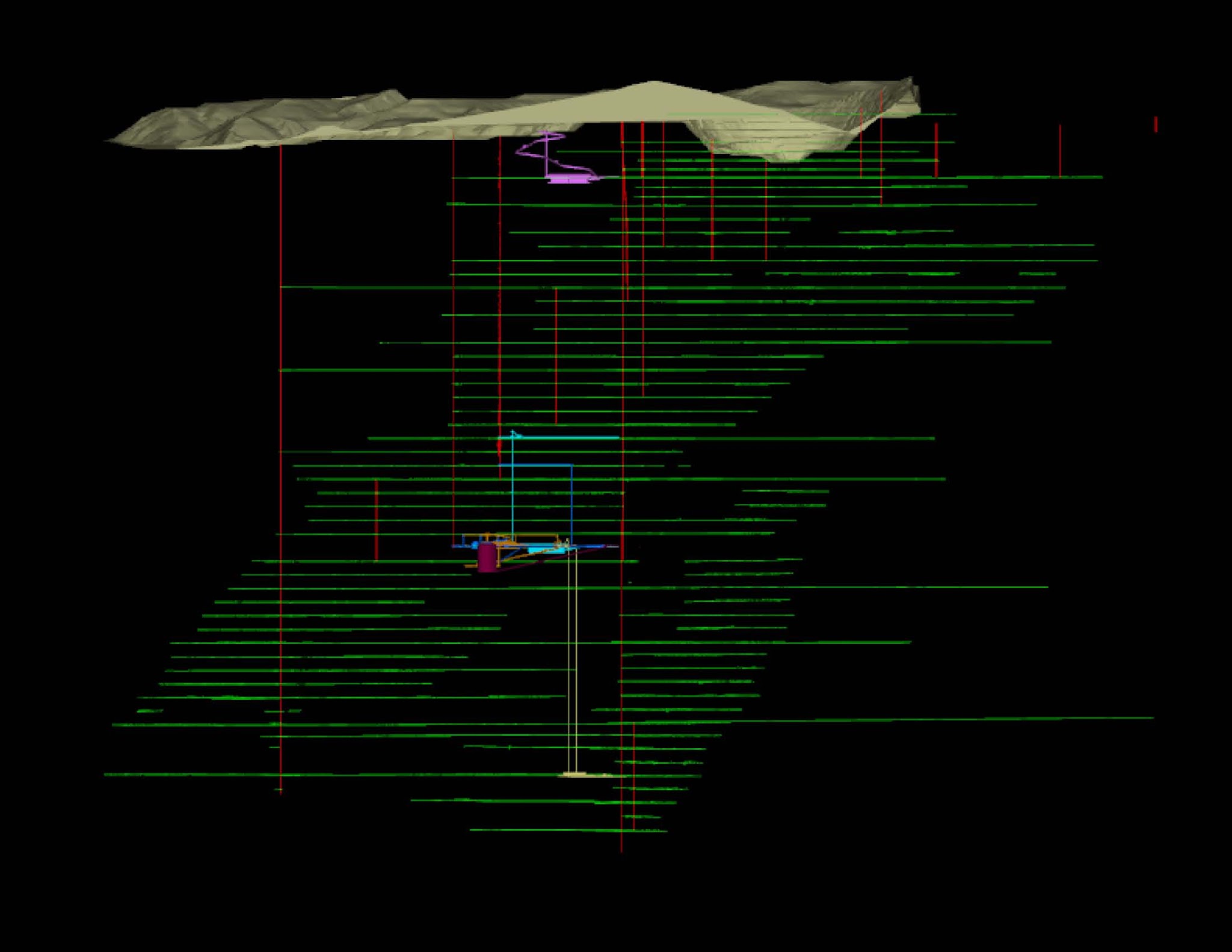 [Image: Digital model of the old mine tunnels beneath Lead, South Dakota; via SITU Fabrication].
These include a lab known as the Sanford Underground Research Facility, as well as a related project, the Deep Underground Science and Engineering Laboratory (or DUSEL).
Had DUSEL not recently run into some potentially fatal funding problems, it “would have been the deepest underground science facility in the world.” For now, it is on hold.
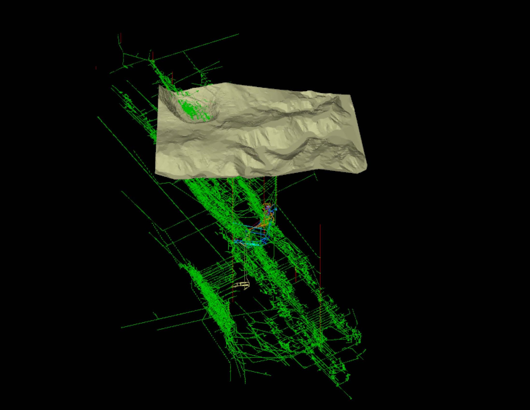 [Image: Digital model of the old mine tunnels beneath Lead, South Dakota; via SITU Fabrication].
There is already much to read about the experiments going on there, but one of the key projects underway is a search for dark matter. As Popular Science explained back in 2010:
Now a team of physicists and former miners has converted Homestake’s shipping warehouse into a new surface-level laboratory at the Sanford Underground Laboratory. They’ve painted the walls and baseboards white and added yellow floor lines to steer visitors around giant nitrogen tanks, locker-size computers and plastic-shrouded machine parts. Soon they will gather many of these components into the lab’s clean room and combine them into LUX, the Large Underground Xenon dark-matter detector, which they will then lower halfway down the mine, where—if all goes well—it will eventually detect the presence of a few particles of dark matter, the as-yet-undetected invisible substance that may well be what holds the universe together.
Earlier this year, I was scrolling through my Instagram feed when I noticed some cool photos popping up from a Brooklyn-based firm called SITU Fabrication. The images showed what appeared to be a maze of strangely angled metal parts and wires, hanging from one another in space.
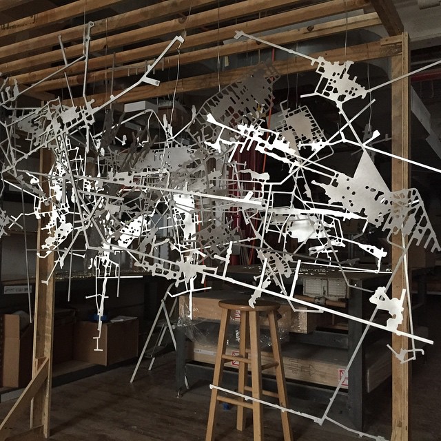 [Image: Model by SITU Studio with C&G Partners; Instagram by SITU Fabrication].
One of them—seen above, and resembling some sort of exploded psychogeographic map of Dante’s Inferno—was simply captioned, “#CNC milled aluminum plates for model of underground tunnel network in #SouthDakota.”
Living within walking distance of the company’s DUMBO fabrication facility, I quickly got in touch and, a few days later, stopped by to learn more.
 [Image: Model by SITU Studio with C&G Partners; Instagram by BLDGBLOG].
SITU’s Wes Rozen met me for a tour of the workshop and a firsthand introduction to the Homestake project.
The firm, he explained, already widely known for its work on complex fabrication jobs for architects and artists alike, had recently been hired to produce a 3D model of the complete Homestake tunnel network, a model that would later be installed in a visitors’ center for the mine itself.
Visitors would thus encounter this microcosm of the old mine, in lieu of physically entering the deep tunnels beneath their feet.
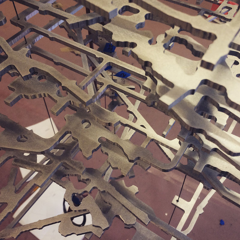 [Image: Model by SITU Studio with C&G Partners; Instagram by BLDGBLOG].
Individual levels of the mine, Rozen pointed out, had been milled from aluminum sheets to a high degree of accuracy; even small side-bays and dead ends were included in the metalwork.
Negative space became positive, and the effect was like looking through lace.
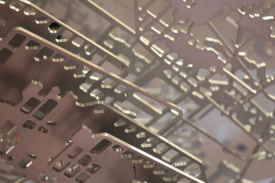 [Image: Model by SITU Studio with C&G Partners; photo by BLDGBLOG].
Further, tiny 3D-printed parts—visible in some photographs, further below—had also been made to connect each level to the next, forming arabesques and curlicues that spiraled out and back again, representing truck ramps.
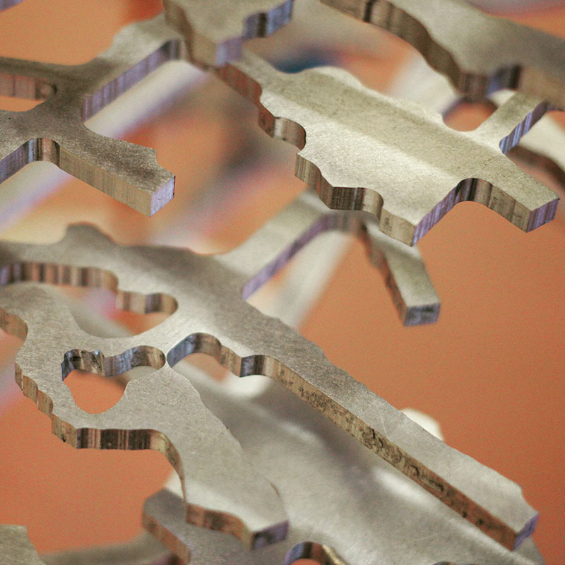 [Image: Model by SITU Studio with C&G Partners; Instagram by BLDGBLOG].
The whole thing was then suspended on wires, hanging like a chandelier from the underworld, to form a cloud or curtain of subtly reflective metal.
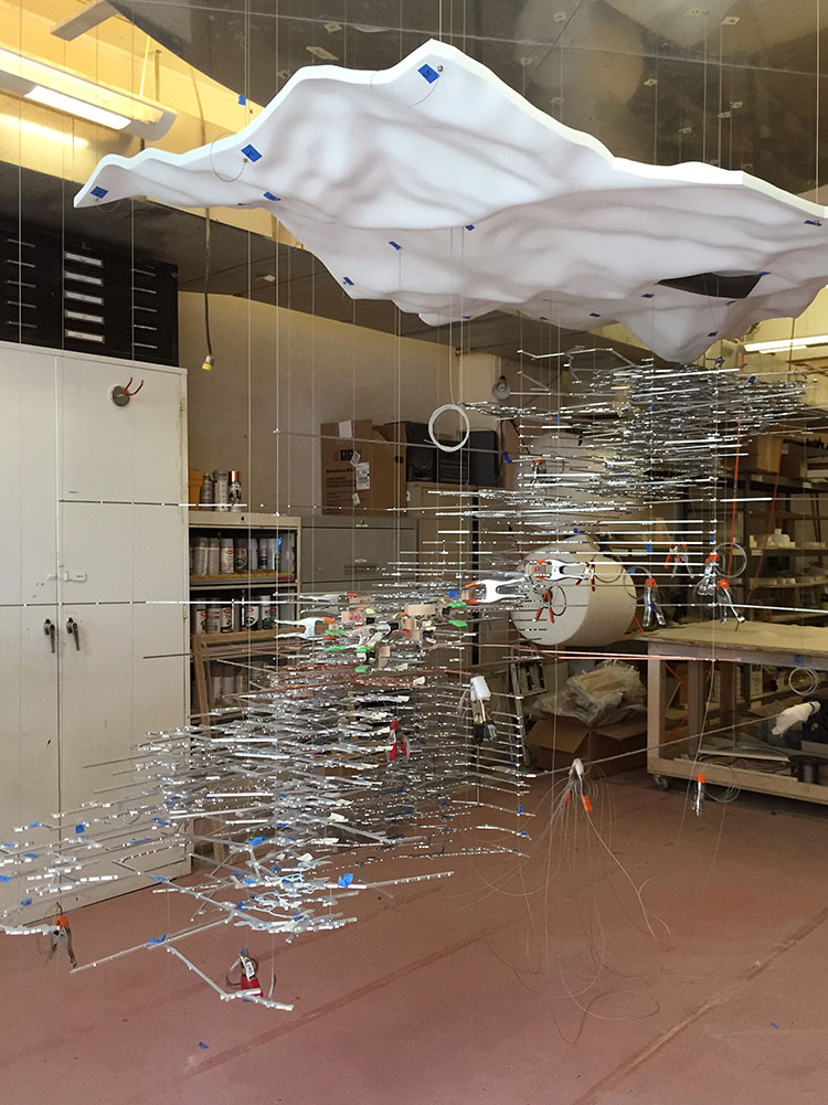 [Image: Assembly of the model by SITU Studio with C&G Partners; photo courtesy of SITU Fabrication].
When I showed up that day, the pieces were still being assembled; small knots of orange ribbon and pieces of blue painter’s tape marked spots that required further polish or balancing, and metal clamps held many of the wires in place.
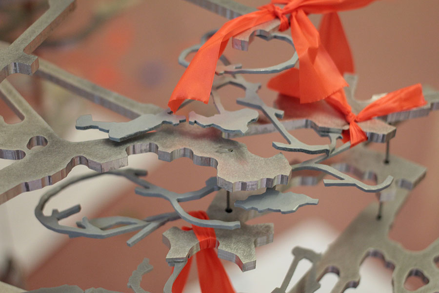
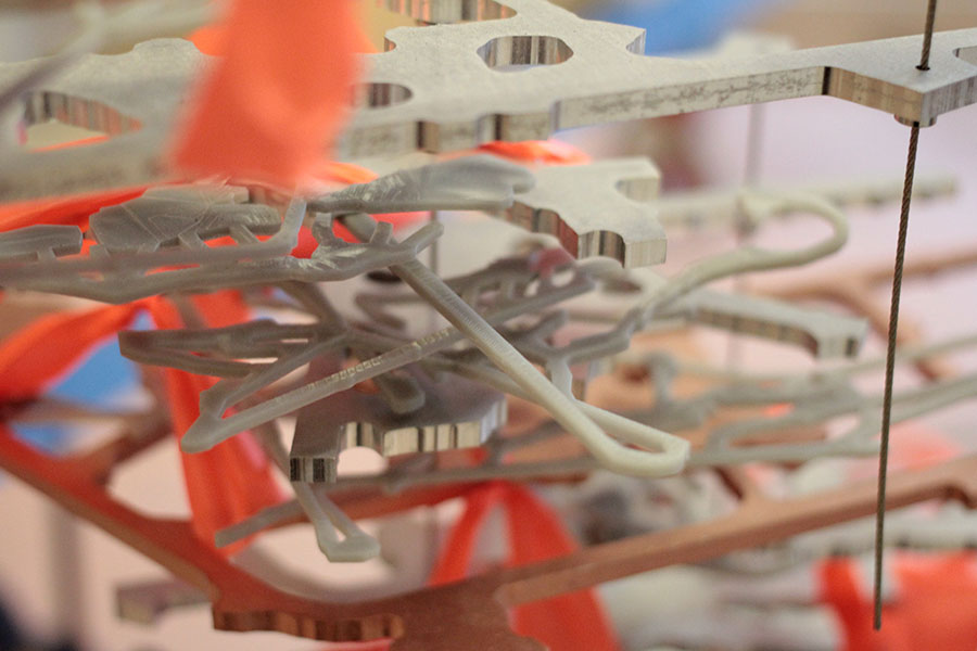 [Images: Model by SITU Studio with C&G Partners; photos by BLDGBLOG].
Seen in person, the piece is astonishingly complex, as well as physically imposing—in photographs, unfortunately, this can be difficult to capture.
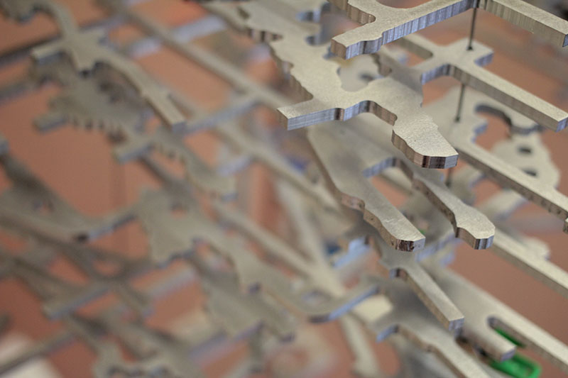 [Image: Model by SITU Studio with C&G Partners; photo by BLDGBLOG].
However, the sheer density of the metalwork and the often impossibly minute differences from one level of the mine to the next—not to mention, at the other extreme, the sudden outward spikes of one-off, exploratory mine shafts, shooting away from the model like blades—can still be seen here, especially in photos supplied by SITU themselves.
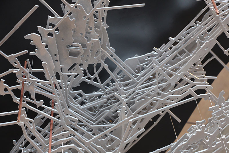 [Image: Assembly of the model by SITU Studio with C&G Partners; photo courtesy of SITU Fabrication].
A few of the photos look more like humans tinkering in the undercarriage of some insectile aluminum engine, a machine from a David Cronenberg movie.
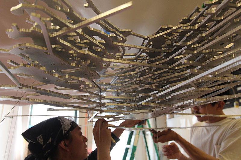 [Image: Assembling the model by SITU Studio with C&G Partners; photo courtesy of SITU Fabrication].
Which seems fitting, I suppose, as the other appropriate analogy to make here would be to the metal skeleton of a previously unknown creature, pinned up and put together again by the staff of an unnatural history museum.
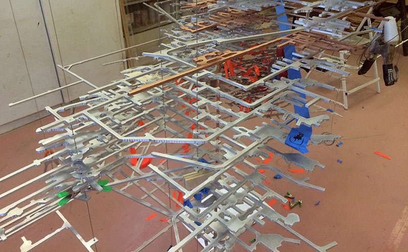 [Image: Model by SITU Studio with C&G Partners; photo by BLDGBLOG].
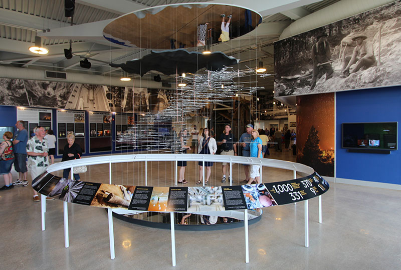
The model is now complete and no longer in Brooklyn: it is instead on display at the Homestake visitors’ center in South Dakota, where it greets the general public from its perch above a mirror. As above, so below.
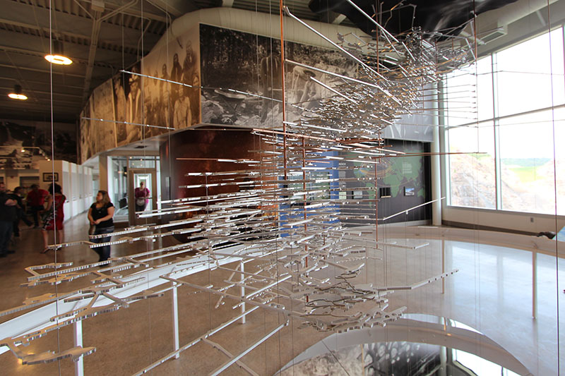
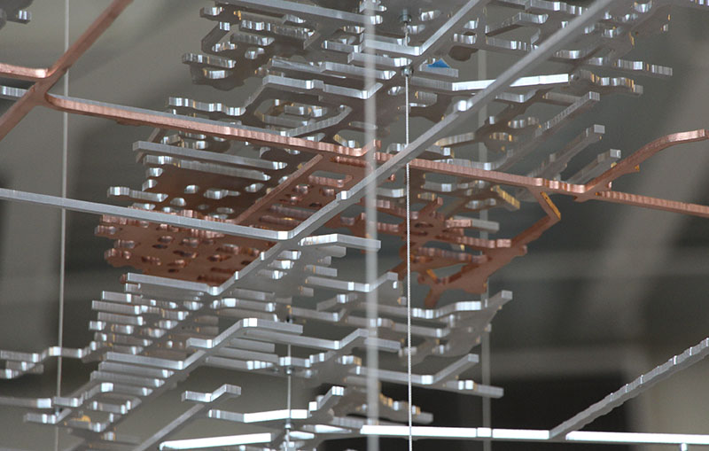
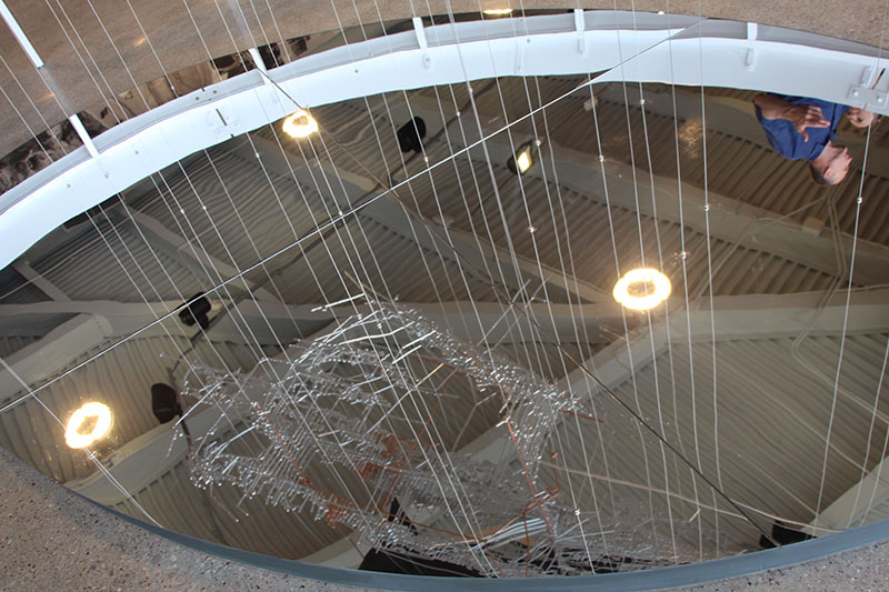 [Images: The model seen in situ, by SITU Studio with C&G Partners; photos courtesy of SITU Fabrication].
Again, it’s funny how hard the piece can be to photograph in full, and how quick it is to blend into its background.
This is a shame, as the intricacies of the model are both stunning and worth one’s patient attention; perhaps it would be better served hanging against a solid white background, or even just more strategically lit.
 [Image: The model by SITU Studio with C&G Partners; photo courtesy of SITU Fabrication].
Or, as the case may be, perhaps it’s just worth going out of your way to see the model in person.
Indeed, following the milled aluminum of one level, then down the ramps to the next, heading further out along the honeycomb of secondary shafts and galleries, and down again to the next level, and so on, ad infinitum, was an awesome and semi-hypnotic way to engage with the piece when I was able to see it up close in SITU’s Brooklyn facility.
I imagine that seeing it in its complete state in South Dakota would be no less stimulating.
(Vaguely related: Mine Machine).
Shell
 [Image: “Vaulted Chamber” by Matthew Simmonds].
While writing the previous post, I remembered the work of Matthew Simmonds, a British stonemason turned sculptor who carves beautifully finished, miniature architectural scenes into otherwise rough chunks of rock.
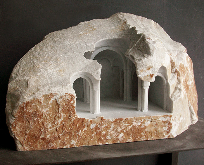 [Image: “Sinan: Study” by Matthew Simmonds].
Simmonds seems primarily to use sandstone, marble, and limestone in his work, and focuses on producing architectural forms either reminiscent of the ancient world or of a broadly “sacred” character, including temples, church naves, and basilicas.
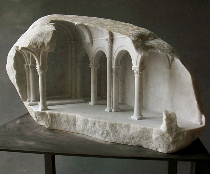 [Image: “Basilica III” by Matthew Simmonds].
You can see many more photos on his own website or over at Yatzer, where you, too, might very well have seen these last year.
 [Image: “Fragment IV” by Matthew Simmonds].
Someone should commission Simmonds someday soon to carve, in effect, a reverse architectural Mt. Rushmore: an entire hard rock mountain somewhere sculpted over decades into a warren of semi-exposed rooms, cracked open like a skylight looking down into a deeper world, where Simmonds’s skills can be revealed at a truly inhabitable spatial scale.
(Previously: Emerge).
Then we descend
 [Image: Descending into Mammoth Cave, from Beneath the surface; or, the wonders of the underground world by W.H. Davenport Adams].
By way of JF Ptak Science Books, I found myself reading through an old book called Beneath the surface; or, the wonders of the underground world by W.H. Davenport Adams this weekend, a travelogue from 1876 exploring subterranean landscapes around the world, including what is now Mammoth Cave National Park.
“Then we descend,” Adams writes upon his arrival at the cave, “by a small pathway excavated among the rocks, until we discover, in the sides of the mountain, and at the bottom of a funnel-shaped cavity, overgrown with verdure, an opening so low and narrow that two people can with difficulty enter at once.”
Slipping through, they pass into “a labyrinth of caves” consisting of seemingly endless sloping rooms, shafts, and corridors.
As my own phrasing there indicates, these spaces are described by way of architectural analogy: as naves and vestibules, chambers and rotundas. In fact, their perceived architectural characteristics are highlighted even on the acoustic level. One cave, for example, is a place “where the voice resounds and, lingering, reverberates, like the strain of an organ through dim cathedral aisles.”
 [Image: A room in Mammoth Cave known as “The Maelstrom,” from Beneath the surface; or, the wonders of the underground world by W.H. Davenport Adams].
Continuing on their downward trek, Adams & Co. soon wander into “a chamber nearly 320 feet in circuit, whose roof rises like the stand of an immense nave. Its form, its grandeur, its magnitude (it could accommodate five thousand persons), and the strange architectural-like stalactites which embellish it, have procured it the name of the Gothic Church.”
Indeed, standing amidst this ersatz cathedral, and “thanks to the power of imagination, and the varying influence of the light, we here distinguish all the details of a medieval nave, pillars, and columns, and corbels and ogives.”
Among many things, what interests me here is how the interior of the earth is seen as if through the haze of a projection, with architectural forms emerging where, in fact, only inhuman geological processes at work—but also, in the opposite direction, the implied observation here that, in an age of masonry construction, architecture and geology were, in effect, natural cousins, lending themselves to mutual comparison far more easily than in today’s time of glass and steel construction.
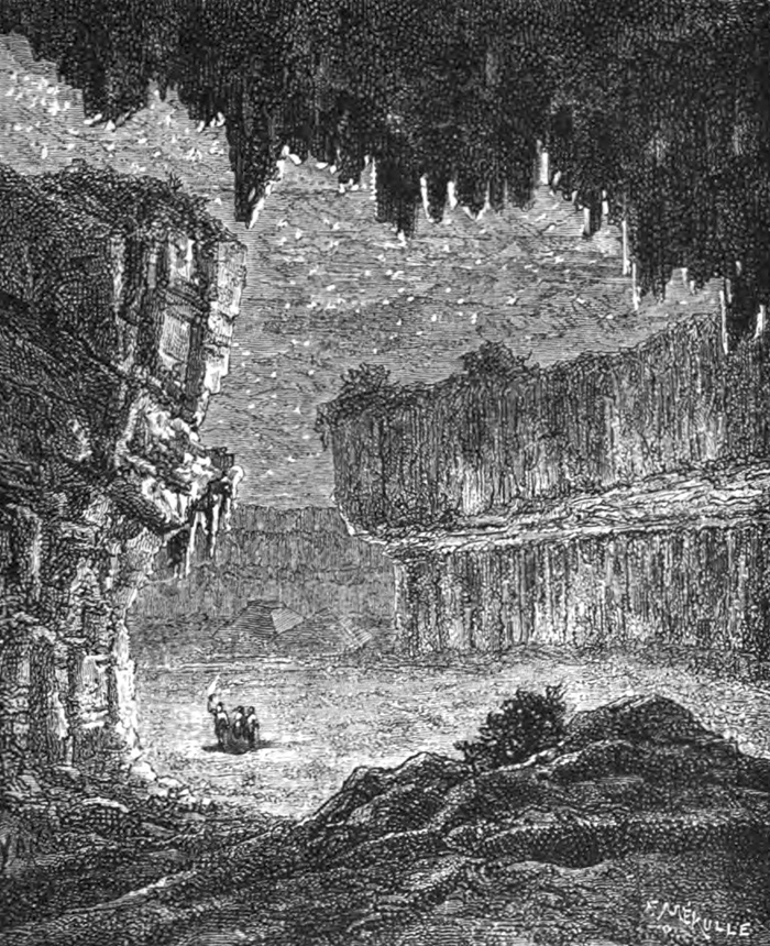 [Image: A vast underground room filled with “a silent, terrible solitude,” from Beneath the surface; or, the wonders of the underground world by W.H. Davenport Adams].
To put this another way, many streets in Manhattan are often quite appropriately described as “canyons,” not only due to their perceived depth—that is, given the towering buildings on either side, as if pedestrians merely wander at the bottom of artificial slot canyons—but also due to the geological materials those buildings were made from.
However, following widespread transformations in global building construction, our buildings today are now more likely to be reflective—even dangerously so—or partially transparent, whether this is due to the use of glass curtain walls or shadow-annihilating polished titanium, with the effect that our urban environment is no longer particularly well-served by geological analogy.
In any case, the book’s flirtation with an architectural vocabulary is gradually abandoned as Adams and his colleagues venture deeper into the planet. They eventually find themselves standing somewhat uncomfortably surrounded by a “phantasmagoria” of black gypsum walls, all “covered with sparkling crystallizations,” in a vast room whose belittling proportions inspire feelings not of grandeur and religiosity but a kind of exhausted desolation.
Here, Adams writes, “you think yourself on one of those dead and naked planets, where mineral nature reigns in the bosom of a silent, terrible solitude; on some earth never warmed by the sun, and which is animated by no kind of life.”
 [Image: An unfortunately rather low-res image from Beneath the surface; or, the wonders of the underground world by W.H. Davenport Adams].
The rest of the book—including the image seen immediately above this sentence—ventures elsewhere, into silver mines and glacial caves, even briefly passing by way of underground “artificial ice caves” for the premodern production and storage of ice.
I’m just a sucker for subterranea. Check it out if any of this sounds up your alley, and click through the archives of JF Ptak Science Books while you’re at it.
Subterranean Lightning Brigade
 [Image: “Riggers install a lightning rod” atop the Empire State Building “in preparation for an investigation into lightning by scientists of the General Electric Company” (1947), via the Library of Congress].
This is hardly news, but I wanted to post about the use of artificial lightning as a navigational aid for subterranean military operations.
This was reported at the time as a project whose goal was “to let troops navigate about inside huge underground enemy tunnel complexes by measuring energy pulses given off by lightning bolts,” where those lightning bolts could potentially be generated on-demand by aboveground tactical strike teams.
Such a system would replace the use of GPS—whose signals cannot penetrate into deep subterranean spaces—and it would operate by way of sferics, or radio atmospheric signals generated by electrical activity in the sky.
The proposed underground navigational system—known as “Sferics-Based Underground Geolocation” or S-BUG—would be capable of picking up these signals even from “hundreds of miles away. Receiving signals from lighting strikes in multiple directions, along with minimal information from a surface base station also at a distance, could allow operators to accurately pinpoint their position.” They could thus maneuver underground, even in hundreds—thousands—of feet below the earth’s surface in enemy caves or bunkers.
Hundreds of miles is a very wide range, of course—but what if there is no natural lightning in the area?
Enter artificial military storm generators, or the charge of the lightning brigade.
Back in 2009, DARPA also put out of a request for proposals as part of something called Project Nimbus. NIMBUS is “a fundamental science program focused on obtaining a comprehensive understanding of the lightning process.” However, it included a specific interest in developing machines for “triggering lightning”:
Experimental Set-up for Triggering Lightning: Bidders should fully describe how they would attempt to trigger lightning and list all potential pieces of equipment necessary to trigger lightning, as well as the equipment necessary to measure and characterize the processes governing lightning initiation, propagation, and attachment.
While it’s easy enough to wax conspiratorial here about future lightning weapons or militarized storm cells—after all, DARPA themselves write that they want to understand “how [lightning] ties into the global charging circuit,” as if “the global charging circuit” is something that could be instrumentalized or controlled—I actually find it more interesting to speculate that generating lightning would be not for offensive purposes at all, but for guiding underground navigation.
 [Image: Lightning storm over Boston; via Wikimedia/NOAA].
Something akin to a strobe light begins pulsing atop a small camp of unmarked military vehicles parked far outside a desert city known for its insurgent activities. These flashes gradual lengthen, both temporally and physically, lasting longer and stretching upward into the sky; the clouds above are beginning to thicken, grumbling with quiet rolls of thunder.
Then the lightning strikes begin—but they’re unlike any natural lightning you’ve ever seen. They’re more like pops of static electricity—a pulsing halo or toroidal crown of light centered on the caravan of trucks below—and they seem carefully timed.
To defensive spotters watching them through binoculars in the city, it’s obvious what this means: there must be a team of soldiers underground somewhere, using artificial sferics to navigate. They must be pushing forward relentlessly through the sewers and smuggling tunnels, crawling around the roots of buildings and maneuvering through the mazework of infrastructure that constitutes the city’s underside, locating themselves by way of these rhythmic flashes of false lightning.
Of course, this equipment would eventually be de-militarized and handed down to the civilian sector, in which case you can imagine four friends leaving REI on a Friday afternoon after work with an artificial lightning generator split between them; no larger than a camp stove, it would eventually be set up with their other weekend caving equipment, used to help navigate through deep, stream-slick caves an hour and a half outside town, beneath tall mountains where GPS can’t always be trusted.
Or, perhaps fifty years from now, salvage teams are sent deep into the flooded cities of the eastern seaboard to look for and retrieve valuable industrial equipment. They install an artificial lightning unit on the salt-bleached roof of a crumbling Brooklyn warehouse before heading off in a small armada of marsh boats, looking for entrances to old maintenance facilities whose basement storage rooms might have survived rapid sea-level rise.
Disappearing down into these lost rooms—like explorers of Egyptian tombs—they are guided by bolts of artificial lightning that spark upward above the ruins, reflected by tides.
 [Image: Lightning via NOAA].
Or—why not?—perhaps we’ll send a DARPA-funded lightning unit to one of the moons of Jupiter and let it flash and strobe there for as long as it needs. Called Project Miller-Urey, its aim is to catalyze life from the prebiotic, primordial soup of chemistry swirling around there in the Cthulhoid shadow of eternal ice mountains.
Millions and millions of years hence, proto-intelligent lifeforms emerge, never once guessing that they are, in fact, indirect descendants of artificial lightning technology. Their spark is not divine but military, the electrical equipment that sparked their ancestral line long since fallen into oblivion.
In any case, keep your eyes—and cameras—posted for artificial lightning strikes coming to a future military theater near you…
Landscapes of Inevitable Catastrophe
 [Image: Illustration by David McConochie, courtesy of The Art Market, via The Guardian].
Last month, The Economist reported on the widespread presence of radioactive tailings piles—waste rock left over from Soviet mining operations—in southern Kyrgyzstan. Many of the country’s huge, unmonitored mountains of hazardous materials are currently leaching into the local water supply.
In a particularly alarming detail, even if you wanted to avoid the danger, you might not necessarily know where to find it: “Fences and warning signs have been looted for scrap metal,” we read.
Frequent landslides and seasonal floods also mean that the tailings are at risk of washing downriver into neighboring countries, including into “Central Asia’s breadbasket, the Fergana Valley, which is home to over 10m people… A European aid official warns of a ‘creeping environmental disaster.'”
Attempts at moving the piles have potentially made things worse, releasing “radioactive dust” that might be behind a spike in local cancers.
In addition to the sheer aesthetic horror of the landscape—a partially radioactive series of river valleys, lacking in warning signs, that writer Robert Macfarlane would perhaps call “eerie,” a place where “suppressed forces pulse and flicker beneath the ground and within the air… waiting to erupt or to condense”—it’s worth noting at least two things:
One, there appears to be no end in sight; as The Economist points out, the neighboring countries “are hardly on speaking terms, so cross-border co-operation is non-existent,” and the costs of moving highly contaminated mine waste are well out of reach for the respective governments.
This means we can more or less confidently predict that, over the coming decades, many of these tailings piles will wash away, slowly but relentlessly, fanning out into the region’s agricultural landscape.
Once these heavy metals and flecks of uranium have dispersed into the soil, silt, and even plantlife, they will be nearly impossible to re-contain; this will have effects not just over the span of human lifetimes but on a geological timescale.
Second, most of these piles are unguarded: unwatched, unmonitored, unsecured. They contain radioactive materials. They are in a region known for rising religious extremism.
Given all this, surely finding a solution here is rather urgent, before these loose mountains of geological toxins assume an altogether more terrifying new role in some future news cycle—at which point, in retrospect, articles like The Economist‘s will seem oddly understated.
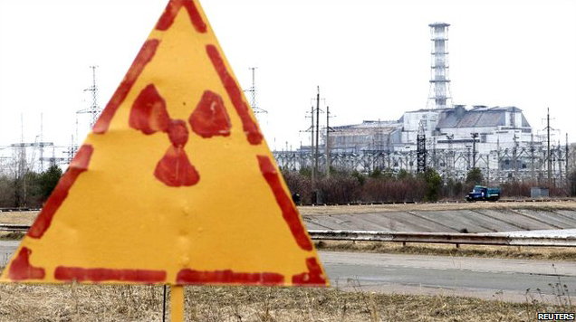 [Image: Hand-painted radiation sign at Chernobyl, via the BBC].
Indeed, our ability even to comprehend threats posed on a geologic timescale—let alone to act on those threats politically—is clearly not up to the task of grappling with events or landscapes such as these.
To go back to Robert Macfarlane, he wrote another article earlier this year about the specialized vocabulary that has evolved for naming, describing, or cataloging terrestrial phenomena. By contrast, he suggests, we now speak with “an impoverished language for landscape” in an era during when “a place literacy is leaving us.”
As Macfarlane writes, “we lack a Terra Britannica, as it were: a gathering of terms for the land and its weathers—terms used by crofters, fishermen, farmers, sailors, scientists, miners, climbers, soldiers, shepherds, poets, walkers and unrecorded others for whom particularised ways of describing place have been vital to everyday practice and perception.”
Channeling Macfarlane, where is the vocabulary—where are our cognitive templates—for describing and understanding these landscapes of long-term danger and slow catastrophe?
It often seems that we can stare directly into the wasteland without fear, not because there is nothing of risk there, but because our own words simply cannot communicate the inevitability of doom.
Horizon Line
 [Image: Here’s another image from the same French rare-book seller seen in an earlier post; this one comes from Thomas Alcock’s Travels in Russia, Persia, Turkey and Greece, printed in 1831. The scene depicted here equally resembles some strange act of theatrical scenography—a geologic backdrop shaded to resemble urban space—and a horizon-spanning speculative megastructure by Étienne Louis-Boullée (previously)].
A Well-Tailored Landscape
 [Image: Sewn geology; photo by Matthew Cox of Kit Up!].
Earlier this summer, packaging and apparel manufacturing firm ReadyOne Industries debuted a new line of products: “moldable camouflage kits that can be customized to mimic virtually any type of rock formation or similar type of terrain.”
The sewn geological forms seen here—in photos taken by Matthew Cox of Kit Up!—use a multi-spectral concealment system called “VATEC,” further described by ReadyOne as a “Portable Battlefield Cryptic Signature and Concealment” system.
In the process, they give the word “geotextile” a new level of literality.
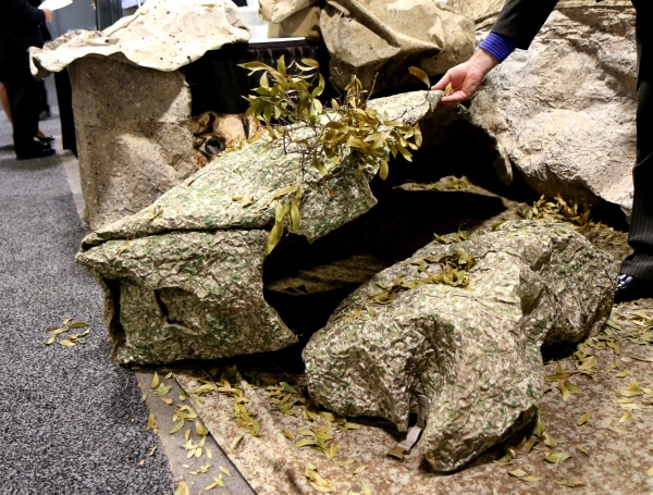 [Image: Lifting up fake rocks; photo by Matthew Cox of Kit Up!].
While you can read a tiny bit more about the product over at both Kit Up! and ReadyOne, what interests me here is the sheer surreality of portable artificial geology made by a garment manufacturing firm, or pieces of clothing blown up to the scale of landscape.
The unexpected implication is that those rocks you see all around you might not only be fake—they might also be pieces of clothing: camouflage garments that already mimicked natural forms simply taken to their obvious end point in the form of pop-up rocks and well-tailored geology.
Village Design as Magnetic Storage Media
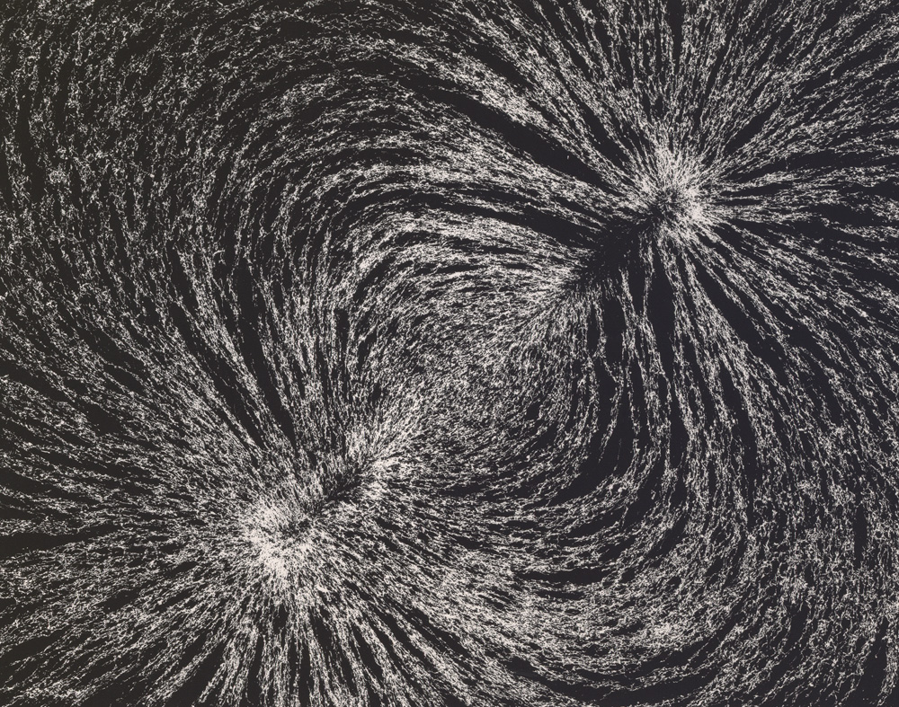 [Image: “Magnetic Field” by Berenice Abbott, from The Science Pictures (1958-1961)].
An interesting new paper suggests that the ritual practice of burning parts of villages to the ground in southern Africa had an unanticipated side-effect: resetting the ground’s magnetic data storage potential.
As a University of Rochester press release explains, the “villages were cleansed by burning down huts and grain bins. The burning clay floors reached a temperature in excess of 1000ºC, hot enough to erase the magnetic information stored in the magnetite and create a new record of the magnetic field strength and direction at the time of the burning.”
What this meant was that scientists could then study how the Earth’s magnetic field had changed over centuries by comparing more recent, post-fire alignments of magnetite in the ground beneath these charred building sites with older, pre-fire clay surrounding the villages.
The ground, then, is actually an archive of the Earth’s magnetic field.
If you picture this from above—perhaps illustrated as a map or floor plan—you can imagine seeing the footprint of the village itself, with little huts, buildings, and grain bins appearing simply as the outlines of open shapes.
However, within these shapes, like little windows in the surface of the planet, new magnetic alignments would begin to appear over decades as minerals in the ground slowly re-orient themselves with longterm shifts in the Earth’s magnetic field, like differently tiled geometries contrasting with the ground around them.
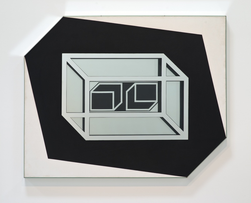 [Image: “Untitled” by Larry Bell (1962), via the L.A. Times].
What really blows me away here, though, is the much more abstract idea that the ground itself is a kind of reformattable magnetic data storage system. It can be reformatted and overwritten, its data wiped like a terrestrial harddrive.
While this obviously brings to mind the notion of the planetary harddrive we explored a few years ago—for what it’s worth, one of my favorite posts here—it also suggests something quite strange, which is that landscape architecture (that is, the tactical and aesthetic redesign of terrain) and strategies of data management (archiving, cryptography, inscription) might someday go hand in hand.
(Via Archaeology).


