PoMo- Mytho- Geo-

[Image: “Model of an Earth Fastener on the Delphi Fault (Temple of Apollo)” (2019) by Kylie White; photo courtesy Moskowitz Bayse.]

Artist Kylie White has two new pieces up in a group show here in Los Angeles, called Grammars of Creation, on display at Moskowitz Bayse till March 16th, which I will return to in a second.

White had a great solo show at the same gallery almost exactly a year ago, featuring a series of geological faults modeled in richly veined, colored marble Most also incorporated brass details, acting as so-called “Earth fasteners.”

[Images: From Six Significant Landscapes by Kylie White; photos courtesy Moskowitz Bayse.]

Gallery text explained at the time that White’s works “are at once sculptures, scale models, geologic diagrams, and proposals; each depicts an active fault line, a place of displaced terrain due to tectonic movement.”

The “proposal” in each work, of course, would be the fasteners: metal implants of a sort meant to span the rift of an open fault.

[Image: “Model of Earth Fastener on a Transform Fault; 1”=10” (2017) by Kylie White; note that this piece was not featured in Six Significant Landscapes. Photo courtesy Moskowitz Bayse.]

White’s fasteners seemed to suggest at least two things simultaneously: that perhaps we could fix the Earth’s surface in place, if only we had the means to stop faults from breaking open, but also that human interventions such as these, in otherwise colossal planetary landscapes, would be trivial at best, more sculptural than scientific, just temporary installations not permanent features of a changing continent.

[Image: From Six Significant Landscapes by Kylie White; photo courtesy Moskowitz Bayse.]

As I struggled to explain to my friends, however, while describing White’s work, the visual effect was strangely postmodern, almost tongue-in-cheek, as if her sculptures—all green marble blocks and inlaid brass—could have passed for avant-garde luxury furniture items from the 1980s (and, to be clear, I mean this in a good way: imagine scientific models masquerading as luxury goods).

[Images: Details from Six Significant Landscapes by Kylie White; photos by BLDGBLOG.]

All of which means I sort of laughed when I saw these more recent works that seem to take this postmodern aesthetic to a new height, complete with two fault models mounted atop faux-Greek columns.

[Image: “Model of an Earth Fastener on the Hierapolis Fault (Plutonion)” (2019) by Kylie White; photo courtesy Moskowitz Bayse.]

It’s like plate tectonics meets Learning From Las Vegas, by way of Greek mythology.

Because the columns are also a fitting reference to the pieces’ own subject matter: one, seen at the top of this post, is called “Model of an Earth Fastener on the Delphi Fault (Temple of Apollo)” and the other, immediately above, is “Model of an Earth Fastener on the Hierapolis Fault (Plutonion).” They perhaps suggest an entirely new approach to natural history museum displays—boldly gridded rooms filled with heroic blocks of the Earth’s surface, bathed in neon. Pomotectonics.

In any case, more information about the show is available at Moskowitz Bayse. It closes on March 16th, 2020, although White apparently has another, currently untitled solo show coming up in 2021.

Walker Lane

[Image: The shadow of the San Andreas Fault emerges near sunset at Wallace Creek; photo by BLDGBLOG].

All four long-term readers of BLDGBLOG will know that I am obsessed with the San Andreas Fault, teaching an entire class about it at Columbia and visiting it whenever possible as a hiking destination.

The San Andreas is often a naturally stunning landscape—particularly in places like Wallace Creek, Tomales Bay, or even the area near Devil’s Punchbowl—but the fault’s symbolism, as the grinding edge of two vast tectonic plates, where worlds slide past one another toward an unimaginable planetary future, adds a somewhat mystical element to each visit. It’s like hiking along a gap through which a new version of the world will emerge.

I was thus instantly fascinated several years ago when I read about something called the Walker Lane, a huge region of land stretching roughly the entire length of the Eastern Sierra, out near the California/Nevada border, which some geologists now believe is the actual future edge of the North American continent—not the San Andreas. It is an “incipient” continental margin, in the language of structural geology.

[Image: My own sketch of the Walker Lane, based on Google Maps imagery].

In fact, the Walker Lane idea suggests, the San Andreas is so dramatically torqued out of alignment at a place northwest of Los Angeles known as the “Big Bend” that the San Andreas might be doomed to go dormant over the course of several million years.

That’s good news for San Franciscans of the far future, but it means that a world-shattering amount of seismic strain will need to go somewhere, and that somewhere is a straight shot up the Eastern Sierra along the Walker Lane: a future mega-fault, like today’s San Andreas, that would stretch from the Gulf of California, up through the Mojave Desert, past Reno, and eventually back out again to the waters of the Pacific Ocean (most likely via southwest Oregon).

Much of this route, coincidentally, is followed closely by Route 395, which brings travelers past extinct volcanoes, over an active caldera, within a short drive of spectacular hot springs, and near the sites of several large earthquakes that have struck the region over the past 150 years.

That region—again, not the San Andreas—is where the true tectonic action is taking place, if the Walker Lane hypothesis is to be believed.

[Image: The gorgeous Hot Creek Geologic Site, along the Walker Lane; photo by BLDGBLOG].

In an absolute dream come true, I was able to turn this armchair obsession of mine into a new feature for Wired, and it went online this morning as part of their May 2019 issue.

For it, I spend some time out in the field with Nevada State Geologist James Faulds, a major proponent of the Walker Lane hypothesis. We visited a fault trench, we hiked along a growing rift southeast of Pyramid Lake, and we met several of his colleagues from the University of Nevada, Reno, including geodesist Bill Hammond and paleoseismologist Rich Koehler.

I also spoke with early advocates of the Walker Lane hypothesis, particularly Amos Nur and Tanya Atwater, both of whom have been suggesting, since at least the early 1990s, that something major might be in store for this under-studied region.

[Image: Coso Volcanic Field, near where the Eastern California Shear Zone meets the Walker Lane; photo by BLDGBLOG].

The Wired story is almost entirely focused on the science behind discovering the Walker Lane, from GPS geodesy to LiDAR, but there are also a few scattered thoughts on deep time and the vast imaginative horizon within which geologists operate. This comes mostly by way of Marcia Bjornerud’s new book Timefulness. There is also a brief look at indigenous seismic experience as allegedly recorded in Native American petroglyphs along the Walker Lane, via an interesting paper by Susan Hough.

But, on a more symbolic level, the Walker Lane totally captivates me, including how vertiginous and exciting it is to think about—let alone to hike along!—a new edge to the known world, a linear abyss emerging in the desert outside Los Angeles, slowly rifting north through hundreds of miles of dead volcanoes and disorganized fault lines, gradually pulling all of it together into one clear super-system, flooding with the waters of the Gulf of California, bringing a new version of the Earth’s surface into being in real-time.

In any case, check out the piece over at Wired if any of this sounds up your alley. The piece includes some great photos by Tabitha Soren.

The Wreckage, The Collapse

I’ve been thinking about two art installations lately—one from the 1980s, the other from 2008—that remain interesting beyond their admittedly obvious metaphoric value.

The first is the aptly named Samson by Chris Burden, an installation piece from 1985.

[Image: An installation view of Samson (1985) by Chris Burden, courtesy Zwirner & Worth].

Samson was “a museum installation consisting of a 100-ton jack connected to a gear box and a turnstile. The 100-ton jack pushes two large timbers against the bearing walls of the museum. Each visitor to the museum must pass through the turnstile in order to see the exhibition. Each input on the turnstile ever so slightly expands the jack, and ultimately if enough people visit the exhibition, Samson could theoretically destroy the building.”

The idea that attendees might not know this—that they could continue to visit the gallery unaware of the purpose or function of this massive device sitting there in the middle of the room, disastrously expanding millimeter by millimeter with every click of the turnstile—haunted me for days after first studying this back in college. Perhaps the artist gets drunk on the night of the opening and doesn’t fully explain what the piece does, or perhaps far more people show up than anyone had expected, the wall-text is obscured by human bodies, and the outward pressure of the machine relentlessly builds. And builds.

The end is built into the very working of the machinery, even while the moment of its long-promised collapse remains impossible to anticipate.

The other is the technically and aesthetically fascinating slow-motion car crash of Jonathan Schipper’s “Slow Inevitable Death of American Muscle.”

The “sculpture is a machine that advances two full sized automobiles slowly into one another over a period of 6 days, simulating a head on automobile collision. Each car moves about three feet into the other. The movement is so slow as to be invisible.”

The tectonic effects of the ensuing collision are incredible to watch; this would be hugely useful, it seems, in a geology lab, for demonstrating the movement of faults. Slow it down even more—not days, but weeks, months—and you could watch whole mountain ranges, basins, folds, and troughs form in stressed and crumpling landscapes of different materials over the course of an entire semester.

Two forces, oppositely oriented, appear at first glance to be still, their mutual ruination—gorgeous, unstoppable—already underway.

Atlas of the Underworld

[Image: Via Science].

A “complete x-ray of Earth’s interior is coming into focus,” Science reported last week. Using computerized tomography, or CT scanning—the same technology used to visualize the interior of the human body for various medical diagnoses—Dutch Earth scientists are piecing together what they call an “Atlas of the Underworld.” They are documenting invisible landscape features—the ghostly remains of entire continents—hidden inside the planet, locked beneath the surface we dwell upon everyday.

Awesomely, these features include “oceans and mountains lost to Earth’s history,” we read, an Earth’s surface within the Earth’s surface:

The reconstructions are also resurrecting mountains that had been lost to time. For example, in a study published several months ago, [tectonicists Jonny Wu and John Suppe] reconstructed the travels of 28 slabs to recreate the Philippine Sea as it was more than 50 million years ago. Beyond identifying what appears to be a previously unknown piece of ocean crust, they predicted that as one of their paleoplates plunged into the mantle, it threw up a large chain of volcanoes that eventually collided with Asia. That convulsive process could explain mysterious folded rocks in Japan and beneath the East China Sea.

For now, however, these “lost mountains” remain digital projections based on available data, not real, physical discoveries. They are, we might say, tectonic fictions, unverified models of past Earths inside our own.

A researcher at the University of Oslo named Grace Shephard points out, for example, that she will soon “publish a comparison of 14 different models that will assess which slabs seem most likely to be real” (emphasis added).

[Image: The long-buried Farallon Plate, visible nowhere on the Earth’s surface—or, rather, only visible through its indirect, mountain-building effects; courtesy Karin Sigloch].

Twenty years ago, poet Gary Snyder published a book called Mountains and Rivers Without End. As the Freer and Sackler Galleries describe it, the book is an “epic celebration of nature and humanity that encompasses Asian artistic traditions, Native American storytelling, and Zen Buddhist philosophy,” all in the guise of a book of landscape poetry.

I mention this not because Snyder’s book is the only example of such a thing, but because it’s interesting to imagine a tomographic expansion of Snyder’s “mountains and rivers without end”—adding revelatory geophysics and otherworldly Earth-scanning technology to the book’s already eclectic mix of myths and texts.

In other words, where is the poetry of lost ghost continents, buried mountain ranges, drowned ocean basins, landlocked archipelagoes, melting thousands of miles beneath our feet, swirling slowly below us in the Earth’s deep interior?

(Thanks to Wayne Chambliss for the tip!)

“Today’s world has no equivalent”

[Image: Tromsø, Norway; photo by BLDGBLOG].

Ted Nield’s book Supercontinent: Ten Billion Years in the Life of Our Planet—previously discussed back in 2012—is an exercise in what has long been referred to here as landscape futures.

In Nield’s case, this means literally imagining what the surface of the Earth might look like after hundreds of millions of years’ worth of tectonic transformations have deformed it beyond all recognition. Supercontinent could thus be read alongside Jan Zalasiewiez’s The Earth After Us as a useful guide for thinking about radical landscape change on a truly inhuman timescale.

Nield writes, for example, that, “even if some civilization of 200 million years ago had completely covered [the Earth] in cities and then wiped itself out in some gigantic global nuclear holocaust, nothing—not even the faintest trace of some unnatural radioisotope—would now remain on the surface.” Some of us might think that writing books, for example, is a way to achieve immortality—or winning an Oscar or becoming a national leader—yet covering the entire planet with roads and buildings is still not enough to guarantee a place in any sort of collective future memory. Everything will be erased.

The book goes from a speculative, but apparently realistic, scenario in which subduction zones might open in the Caribbean—thus dragging North America back toward a seemingly inexorable collision with Eurasia—to the future implications of past tectonic activity. Supercontinents have come and gone, Nield reminds us, and the cycle of these mega-islands is “the grandest of all the patterns in nature.” “750 million years before Pangaea formed,” he writes, “yet another [supercontinent] broke up; and before that another, and so on and on, back into the almost indecipherable past.”

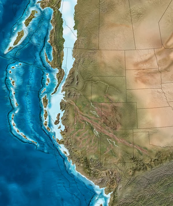
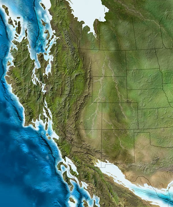
At one point, Nield asks, “what of older supercontinents? What of the supercontinent that broke up to give us Pangaea? And the one before that? Compared with Pangaea, those lost worlds seem truly lost. As with all geological evidence, the older it is, the less of it survives, the more mangled it has become and the harder it is to interpret.”

It is all but impossible to picture them—to see oneself standing on them—as you can with Pangaea. They have their magical names, which lend them reality of a sort despite the fact that, for some, even their very existence remains controversial. About Rodinia, Pannotia, Columbia, Atlantica, Nena, Arctica or distant Ur, the mists of time gather ever more thickly.

The amazing thing is that this cycle will continue: long after North America is expected to reunite with Eurasia, which itself will have collided with North Africa, there will be yet another splintering, following more rifts, more bays and inland seas, in ever-more complicated rearrangements of the Earth’s surface, breeding mountain ranges and exotic island chains. And so on and so on, for billions of years. Bizarre new animals will evolve and bacteria will continue to inter-speciate—and humans will long since have disappeared from the world, unable to experience or see any of these future transformations.

While describing some of the potential ecosystems and landscapes that might result from these tectonic shifts, Nield writes that “our knowledge of what is normal behavior for the Earth is extremely limited.”

Indeed, he suggests, the present is not a key to the past: geologists have found “that there were things in the deepest places of Earth history for the unlocking of whose secrets the present no longer provided the key.” These are known as “no-analog” landscapes.

That is, what we’re experiencing right now on Earth potentially bears little or no resemblance to the planet’s deep past or far future. The Earth itself has been, and will be again, unearthly.

[Image: Oulanka National Park, Finland; photo by Peter Essick, courtesy of the University of Missouri].

In any case, I mention all this because of a quick description found roughly two-fifths of the way through Nield’s book where he discusses lost ecosystems—landscapes that once existed here but that no longer have the conditions to survive.

Those included strange forests that, because of the inclination of the Earth’s axis, grew in almost permanent darkness at the south pole. “These forests of the polar night,” Nield explains, describing an ancient landscape in the present tense, “withstand two seasons: one of feeble light and one of unremitting dark. Today’s world has no equivalent of this eerie ecosystem. Their growth rings show that each summer these trees grow frenetically. Those nearer the coast are lashed by megamonsoon rains roaring in from [the lost continent] of Tethys, the thick cloud further weakening the feeble sunshine raking the latitudes at the bottom of the world.”

There is something so incredibly haunting in this image, of thick forests growing at the bottom of the world in a state of “unremitting” darkness, often lit only by the frozen light of stars, swaying now and again with hurricane-force winds that have blown in from an island-continent that, today, no longer exists.

Whatever “novel climates” and unimaginable geographies lie ahead for the Earth, it will be a shame not to see them.

(Related: Ghosts of Planets Past: An Interview with Ron Blakey).

The Labyrinth of Night, The Polar Gothic, and a Golden Age for Landscape Studies

It’s hard to resist a place called the Noctis Labyrinthus, or “the Labyrinth of Night,” especially when it’s on Mars.

NoctisLabyrinthus[Image: Courtesy ESA/DLR/FU Berlin].

“This block of martian terrain, etched with an intricate pattern of landslides and wind-blown dunes, is a small segment of a vast labyrinth of valleys, fractures and plateaus,” the European Space Agency reported earlier this week.

“As the crust bulged in the Tharsis province it stretched apart the surrounding terrain, ripping fractures several kilometres deep and leaving blocks—graben—stranded within the resulting trenches,” the ESA adds. “The entire network of graben and fractures spans some 1200 km, about the equivalent length of the river Rhine from the Alps to the North Sea.”

In other words, it’s an absolutely massive expanse of desert canyons and landslides, stretching roughly the distance from Switzerland to Rotterdam—a “700-mile labyrinth of fractures and landslides,” in the words of the reliably interesting Corey Powell on Twitter.

Imagine hiking there.

NoctisLabyrinthusAerial[Image: Courtesy ESA/DLR/FU Berlin].

We are living in something of a golden age for landscape studies. Over a remarkably short span of time, for example, we’ve learned that there are sinkholes on comets—that is, that comets have undergrounds. They have pores, caves, and tunnels, with sinkholes explosively airing this subterranean world into outer space. These “mysterious, steep-sided pits—one up to 600 feet wide and 600 feet deep,” as National Geographic described them, indicate that “there must be gaps inside.” Picture caves and tunnels evaporating in the darkness, before collapsing in on themselves in a crystalline flash.

Meanwhile, I have always loved the fact that there is a mountain range on Mars named after dead American astronauts, as if the Red Planet is somehow haunted in advance of human arrival by the mythological figures of explorers who never made it there. But this is just one small example of how a radically unfamiliar environment can gradually become known through the process of naming.

2016-01-01 22.59.25[Image: From India’s Mars Orbiter, via @coreyspowell].

My wife, Nicola Twilley, was actually at the Johns Hopkins Applied Physics Laboratory for the recent Pluto flyby, covering it for The New Yorker; she wrote a great description of how the former planet became a true landscape:

As the scientists traced tendrils of reddish brown and speculated as to the rate of melt at the edge of a two-toned ice patch near Pluto’s equator, the impossibly distant world came to life. Fed up with referring to features as, for instance, “the black circle at two o’clock” and “the big white patch,” the team had started to give them names—first nicknames, such as “the heart” and “the whale,” and then unofficial but more formal names drawn from the mythology of the underworld. The whale became Lovecraft’s Cthulhu, and a nearby dark smudge was christened Balrog, after the demons of Tolkien’s Middle-earth. An alien landscape had started to become a collection of places: knowable, if not yet known.

Interestingly, it seems that names come first, algorithms later.

In any case, while naming, of course, lends an air of familiarity to alien terrains—or knowability, we might say—the utterly bonkers nature of these landscapes remains extraordinary.

Nicky later revisited the subject, for example, writing that “the reddish patches” seen on Pluto might actually be “the organic material nicknamed ‘star tar,’ a precursor to life”—sludge awaiting sentience—and that “cryovolcanoes—volcanoes that spew slushy methane and nitrogen ice rather than molten rock,” might exist at the planet’s south pole.

There, this slow-moving matrix of frozen elements would circulate amongst other “exotic ices” in the distant cold, surely another kind of “labyrinth of night,” if there ever was one.

Think of what writer Victoria Nelson has called the “polar Gothic,” referring to an era of science-fictional representations of the Earth’s own polar regions as places of psychological menace and theological mystery; now picture weird slurries of nitrogen and star-tar sinkholes in a region named after Cthulhu, and it seems that perhaps the great age of landscape exploration has only now truly begun.

Consider, for example, this tweet by Rob Minchin, referring to the latest geological revelations coming from Pluto, a world of nitrogen glaciers and ice tectonics. “Water ice floats on nitrogen or CO ice,” he explains. This means, unbelievably, that “numerous mountains on Pluto appear to be floating.”

pluto[Image: Pluto, via @CoreySPowell].

Even within our own solar system, it seems, if you have an idea for a landscape so unreal it borders on pure fantasy, there is a planet, comet, or asteroid already exceeding it.

(In addition to @CoreySPowell, another good Twitter account for offworld landscape studies is @LoriKFenton, as the images seen at the link make clear).

L.A.T.B.D.

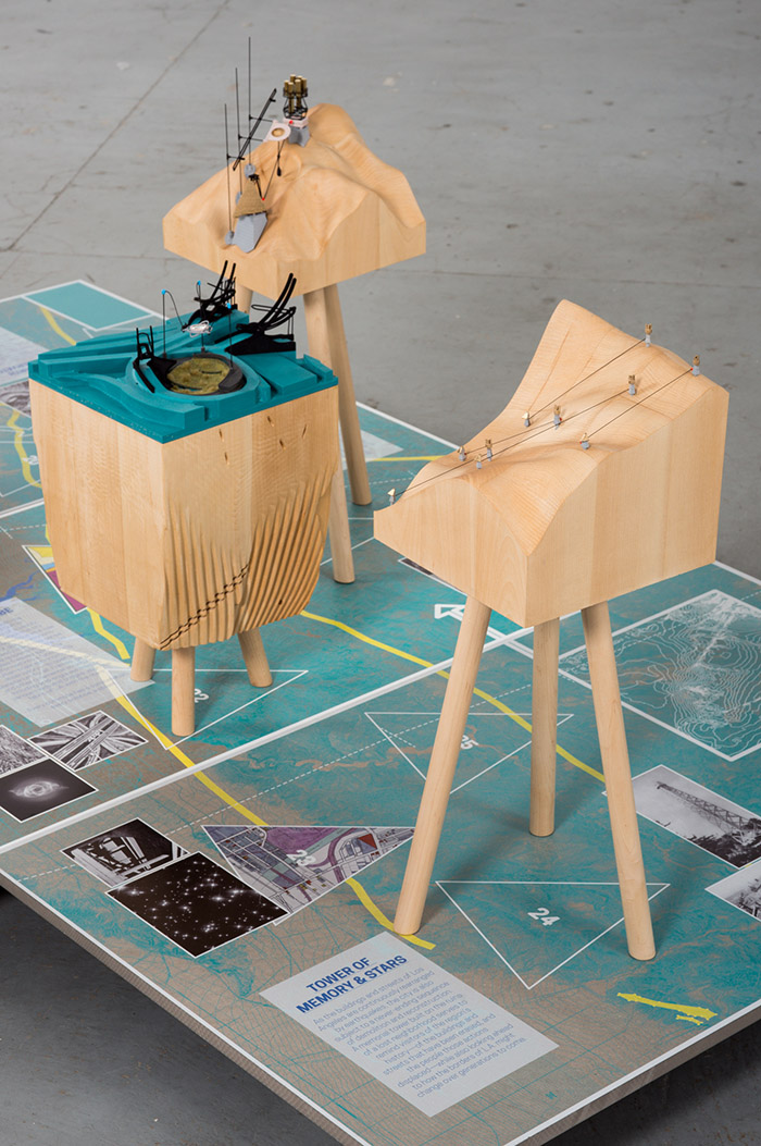
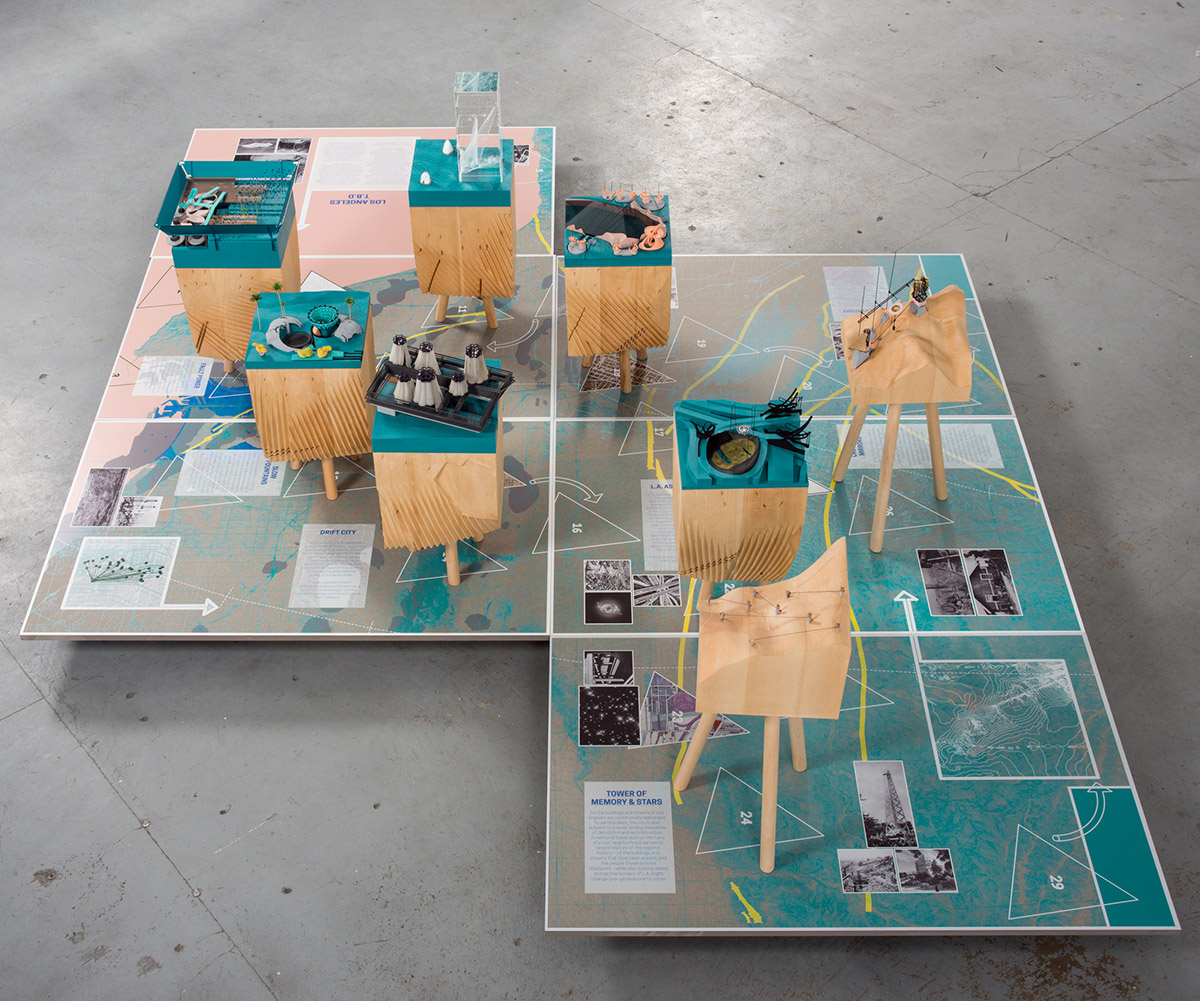
[Image: L.A.T.B.D. by Smout Allen for USC Libraries; photo by Stonehouse Photographic].

I wanted to give a quick heads up that a new collaborative exhibition will be opening to the public later today in the Doheny Memorial Library at USC here in Los Angeles, featuring work by myself and Smout Allen.

Called L.A.T.B.D., the project looks at diverse narrative, scientific, architectural, and landscape futures of Los Angeles. It is a city always yet to be determined—or L.A., T.B.D.

The exhibition actually comes at the very end of the 2015 USC Libraries Discovery Fellowship, which I’ve had the honor of holding this year, the challenge of which was to use the archival holdings of USC as a springboard for looking forward toward whatever Los Angeles might become.

Like plotting a ballistic trajectory, if we know where L.A. has been—if we can see the ingredients of its past, from its prehuman landscapes to the 2012 procession of the Space Shuttle—can we determine where the city might be, 10, 20, 100 years from now?

[Image: L.A.T.B.D. by Smout Allen for USC Libraries; photo by Stonehouse Photographic].

The overall curatorial idea was that, hidden within USC’s impressive and seemingly endless archival holdings, there might be glimpses of an L.A. yet to come, and that a project such as this should find a way of bringing that future version of the city into focus.

However, not one for prediction or prescriptive visions of tomorrow, I wanted this to be far more open-ended than that. We thus developed several parallel lines of materials for the show.

[Image: L.A.T.B.D. by Smout Allen for USC Libraries; photo by Stonehouse Photographic].

One, of course, are a series of gorgeous models designed and fabricated by Smout Allen, showing various hypothetical scenarios for the future city. In one, huge pendulums have been installed beneath the streets to act as seismic counterweights, protecting the city from earthquakes.

In another, the titanic forces released by plate tectonics can be captured by a new kind of power station, converting those otherwise threatening movements of the earth into a source of renewable energy.

In yet another, the city’s freeway system has been converted into a kind of immersive astronomical device, to help train the eyes of this city of stars on an older and more important firmament above.

This work also served as a direct source for the related project we did for this year’s inaugural Chicago Architecture Biennial.

[Image: L.A.T.B.D. by Smout Allen for USC Libraries; photo by Stonehouse Photographic].

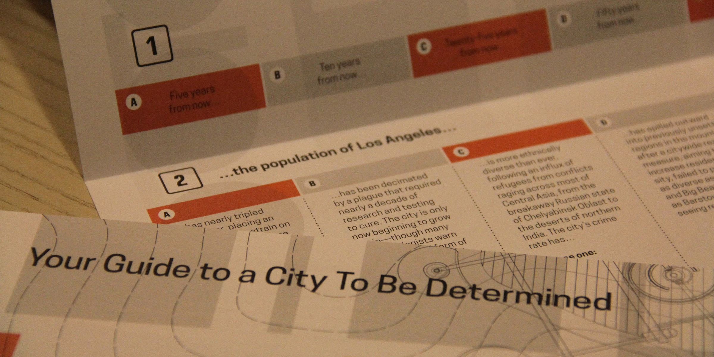
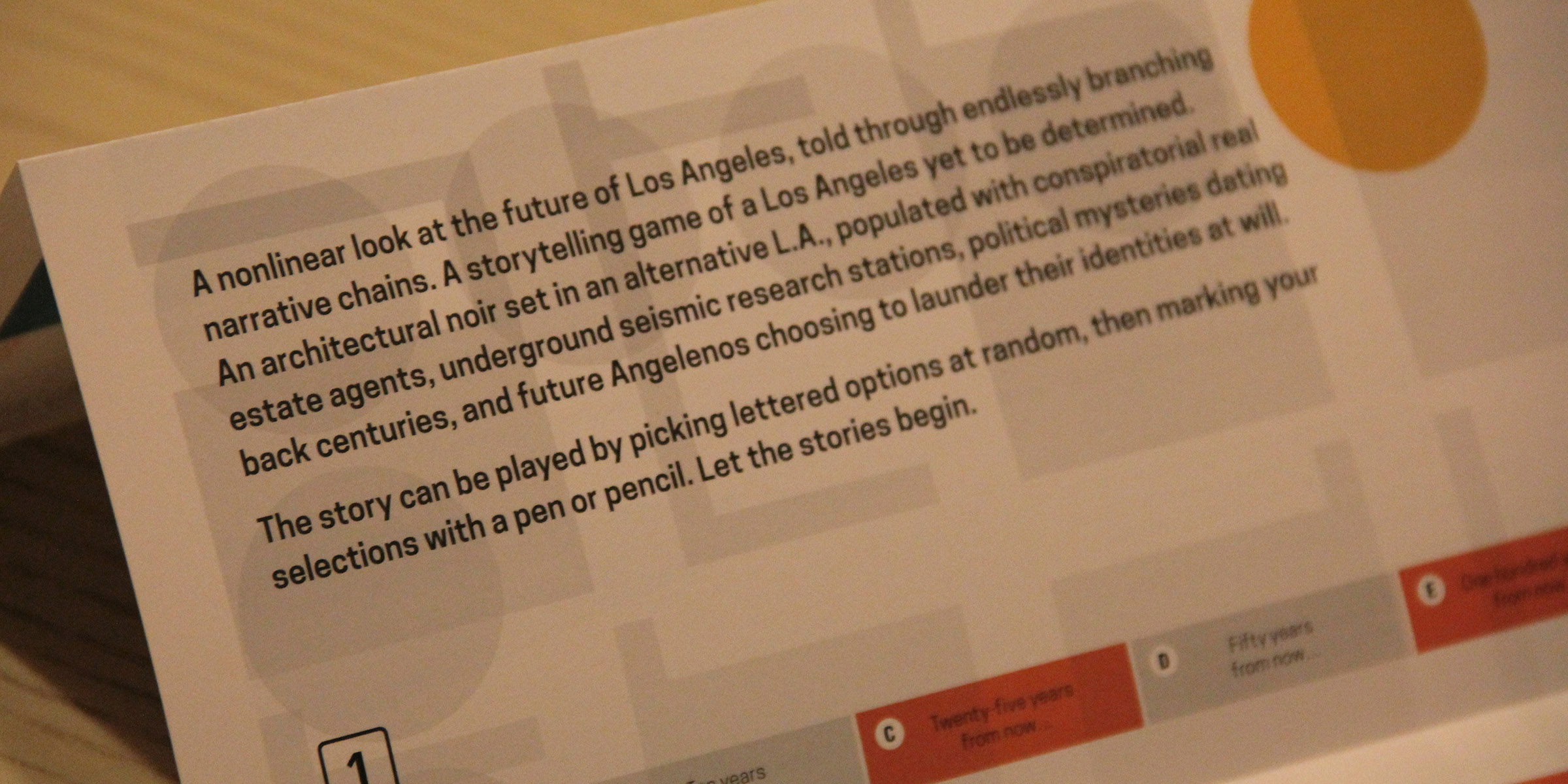
Another key part of the L.A.T.B.D. exhibition is an interactive text that allows visitors to, in a sense, choose their own future for the metropolis. This text combines a small-scale look at what sort of Los Angeles might yet greet our unborn descendants—complete with neighborhoods flooded by sea-level rise, widespread demographic shifts, and corrupt political machinations—with a subtext of noir or urban mystery.

Put another way, if this is a city known for its conspiracies and crimes—whether it’s Chinatown, O.J. Simpson, bank heists, or the novels of James Ellroy—can we use that same narrative register to explore the city’s future infrastructure?

[Images: L.A.T.B.D.‘s accompanying exhibition text, designed by David Mellen Design; terrible photos by Geoff Manaugh].

I started referring to this as a kind of architectural or infrastructural noir, and I’ve come to really like the phrase: the accompanying exhibition text is thus not at all what you’d expect to see in a typical gallery setting, but instead tells an endlessly branching “noir” about the next Los Angeles—by, in some ways, revealing what Los Angeles really was, all along.

[Image: L.A.T.B.D.‘s accompanying exhibition text, designed by David Mellen Design; terrible photo by Geoff Manaugh].

Finally, the exhibition includes a series of historical artifacts from the USC Libraries holdings, from old scientific reports to transportation policy papers, from obsolete urban predictions from the 1980s to board games set in a premodern L.A.

Here, working with designer David Mellen, we had a lot of fun, deliberately crossing and recrossing the line between fiction and reality: that is, not every artifact you see in the exhibition should be trusted, and things might not always be what they seem.

There’s much more to say about the exhibition, but I wanted to get a quick post up before the show opens later this afternoon. There is a reception tonight at 5:30pm in the library, or consider stopping by on Saturday, October 17, from noon to 1pm, to talk to myself and Smout Allen about the project. Saturday’s event is part of the “Archives Bazaar.”

L.A.T.B.D. was made possible by support from the USC Libraries Discovery Fellowship, the Bartlett School of Architecture, UCL, and the British Council. Special thanks are owed to Dean Catherine Quinlan; to Jeff Watson; to the USC Libraries staff; and to Harry Grocott, Doug Miller, and Sandra Youkhana.

The Town That Creep Built

[Image: A curb in Hayward reveals how much the ground is drifting due to “fault creep”: the red-painted part is slowly, but relentlessly, moving north. Photo by Geoff Manaugh].

South of San Francisco, a whole town is being deformed by plate tectonics. These are the slow but relentless landscape effects known as “fault creep.”

An earlier version of this post was first published on The Daily Beast.

The signs that something’s not right aren’t immediately obvious, but, once you see them, they’re hard to tune out.

Curbs at nearly the exact same spot on opposite sides of the street are popped out of alignment. Houses too young to show this level of wear stand oddly warped, torqued out of synch with their own foundations, their once strong frames off-kilter. The double yellow lines guiding traffic down a busy street suddenly bulge northward—as if the printing crew came to work drunk that day—before snapping back to their proper place a few feet later.

This is Hollister, California, a town being broken in two slowly, relentlessly, and in real time by an effect known as “fault creep.” A surreal tide of deformation has appeared throughout the city.

[Image: “Fault creep” bends the curbs in Hollister; photo by Geoff Manaugh].

As if its grid of streets and single-family homes was actually built on an ice floe, the entire west half of Hollister is moving north along the Calaveras Fault, leaving its eastern streets behind.

In some cases, doors no longer fully close and many windows now open only at the risk of getting stuck (some no longer really close at all).

Walking through the center of town near Dunne Park offers keen observers a hidden funfair of skewed geometry.

[Image: 359 Locust Avenue, Hollister; photo by Geoff Manaugh].

For example, go to the house at 359 Locust Avenue.

The house itself stands on a different side of the Calaveras Fault than its own front walkway. As if trapped on a slow conveyor built sliding beneath the street, the walk is being pulled inexorably north, with the effect that the path is now nearly two feet off-center from the porch it still (for the time being) leads to.

[Image: The walkway is slowly creeping north, no longer centered with the house it leads to; photo by Geoff Manaugh].

In another generation, if it’s not fixed, this front path will be utterly useless, leading visitors straight into a pillar.

Or walk past the cute Victorian on 5th Street. Strangely askew, it seems frozen at the start of an unexpected metamorphosis.

[Image: Photo by Geoff Manaugh].

Geometrically, it’s a cube being forced to become a rhomboid by the movements of the fault it was unknowingly built upon, an architectural dervish interrupted before it could complete its first whirl.

Now look down at your feet at the ridged crack spreading through the asphalt behind you, perfectly aligned with the broken curbs and twisted homes on either side.

This is the actual Calaveras Fault, a slow shockwave of distortion forcing its way through town, bringing architectural mutation along with it.

[Images: The Calaveras Fault pushes its way through Hollister; photos by Geoff Manaugh].

The ceaseless geometric tumult roiling just beneath the surface of Hollister brings to mind the New Orleans of John McPhee, as described in his legendary piece for The New Yorker, “Atchafalaya.”

There, too, the ground is active and constantly shifting—only, in New Orleans, it’s not north or south. It’s up or down. The ground, McPhee explains, is subsiding.

“Many houses are built on slabs that firmly rest on pilings,” he writes. “As the turf around a house gradually subsides, the slab seems to rise.” This leads to the surreal appearance of carnivalesque spatial side-effects, with houses entirely detached from their own front porches and stairways now leading to nowhere:

Where the driveway was once flush with the floor of the carport, a bump appears. The front walk sags like a hammock. The sidewalk sags. The bump up to the carport, growing, becomes high enough to knock the front wheels out of alignment. Sakrete appears, like putty beside a windowpane, to ease the bump. The property sinks another foot. The house stays where it is, on its slab and pilings. A ramp is built to get the car into the carport. The ramp rises three feet. But the yard, before long, has subsided four. The carport becomes a porch, with hanging plants and steep wooden steps. A carport that is not firmly anchored may dangle from the side of a house like a third of a drop-leaf table. Under the house, daylight appears. You can see under the slab and out the other side. More landfill or more concrete is packed around the edges to hide the ugly scene.

Like McPhee’s New Orleans, Hollister is an inhabitable catalog of misalignment and disorientation, bulging, bending, and blistering as it splits right down the middle.

And there’s more. Stop at the north end of 6th Street, for example, just across from Dunne Park, and look back at the half-collapsed retaining wall hanging on for dear life in front of number 558.

It looks like someone once backed a truck into it—but it’s just evidence of plate tectonics, the ground bulging northward without regard for bricks or concrete.

[Images: A fault-buckled wall and sidewalk bearing traces of planetary forces below; photos by Geoff Manaugh].

In fact, follow this north on Google Maps and you’ll find a clean line connecting this broken wall to the jagged rupture crossing the street in the photographs above, to the paper-thin fault dividing the house from its own front walk on Locust Avenue.

So what’s happening to Hollister?

“Fault creep” is a condition that results when the underlying geology is too soft to get stuck or to accumulate tectonic stress: in other words, the deep rocks beneath Hollister are slippery, more pliable, and behave a bit like talc. Wonderfully but unsurprisingly, the mechanism used to study creep is called a creepmeter.

The ground sort of oozes past itself, in other words, a slow-motion landslide at a pace that would be all but imperceptible if it weren’t for the gridded streets and property lines being bent out of shape above it.

[Image: A curb and street drain popped far out of alignment in Hollister; photo by Geoff Manaugh].

In a sense, Hollister is an urban-scale device for tracking tectonic deformation: attach rulers to its porches and curbs, and you could even take measurements.

The good news is that the large and damaging earthquakes otherwise associated with fault movement—when the ground suddenly breaks free every hundred years or so in a catastrophic surge—are not nearly as common here.

Instead, half a town can move north by more than an inch every five years and all that most residents will ever feel is an occasional flutter.

[Images: Crossing onto the Pacific Plate (heading west) in Parkfield; photo by Geoff Manaugh].

I spoke with Andy Snyder from the U.S. Geological Survey about the phenomenon.

Snyder works on an experiment known as the San Andreas Fault Observatory at Depth, or SAFOD, which has actually drilled down through the San Andreas Fault to monitor what’s really happening down there, studying the landscape from below through sensitive probes installed deep in the active scar tissue between tectonic plates.

On Snyder’s advice, I made my way out to one of the greatest but most thoroughly mundane monuments to fault creep in the state of California. This was in Parkfield, a remote town with a stated population of 18 where Snyder and SAFOD are both based, and where fault creep is particularly active.

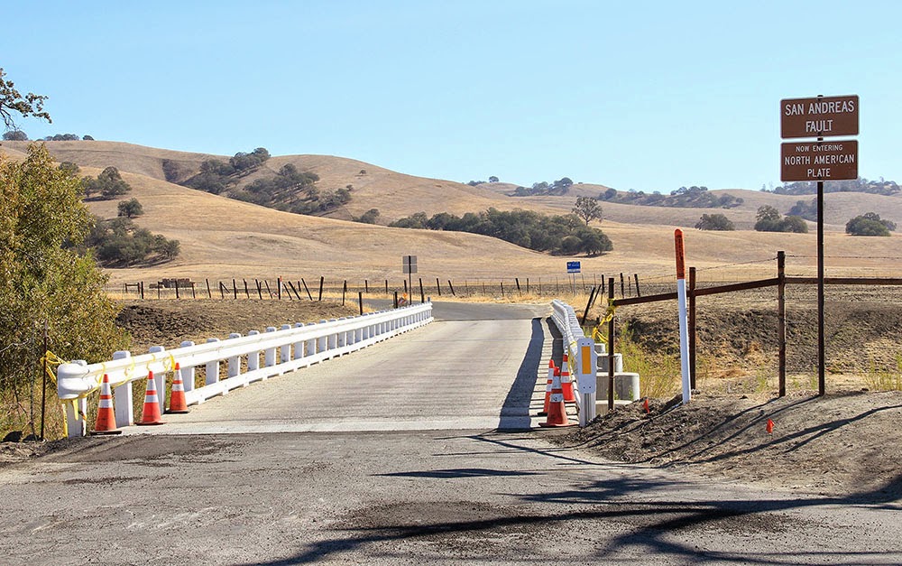
In Parkfield there is a remarkable road bridge: a steel structure that has been anchored to either side of the San Andreas Fault like a giant, doomed staple. Anyone who crosses it in either direction is welcomed onto a new tectonic plate by friendly road signs—but the bridge itself is curiously bent, warped like a bow as its western anchorage moves north toward San Francisco.

It distorts more and more every day of the month, every year, due to the slow effects of fault creep. Built straight, it is already becoming a graceful curve.

[Image: Looking east at the North American Plate in Parkfield; photos by Geoff Manaugh].

Parkfield is also approximately where fault creep begins in the state, Snyder explained, marking the southern edge of a zone of tectonic mobility that extends up roughly to Hollister and then begins again on a brief stretch of the Hayward Fault in the East Bay.

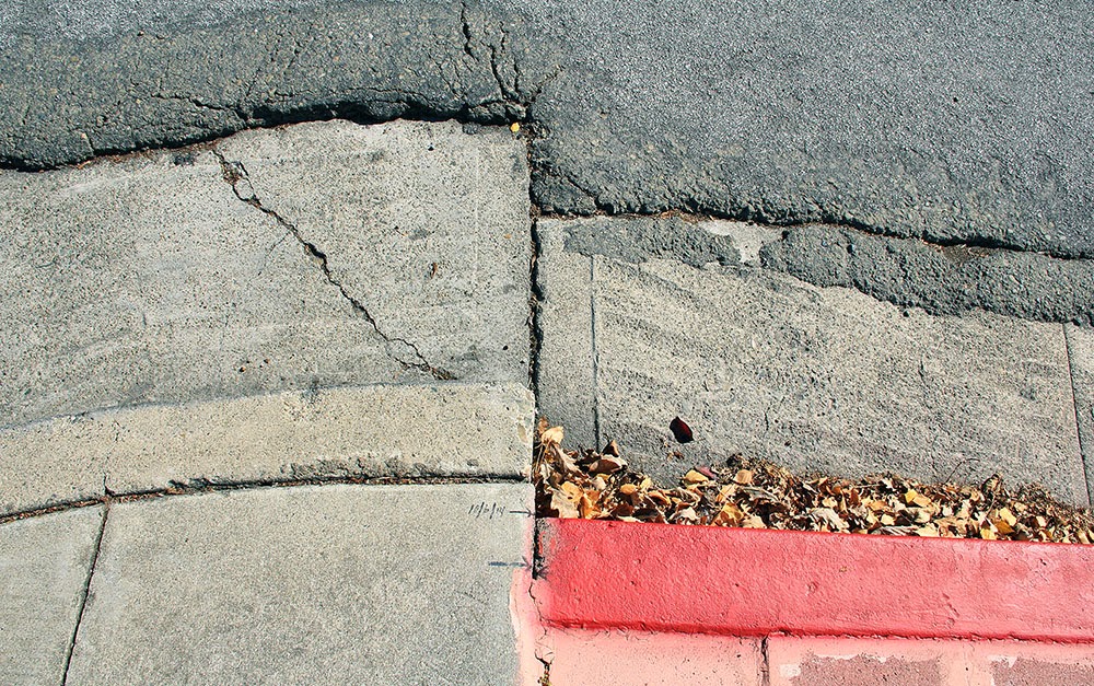
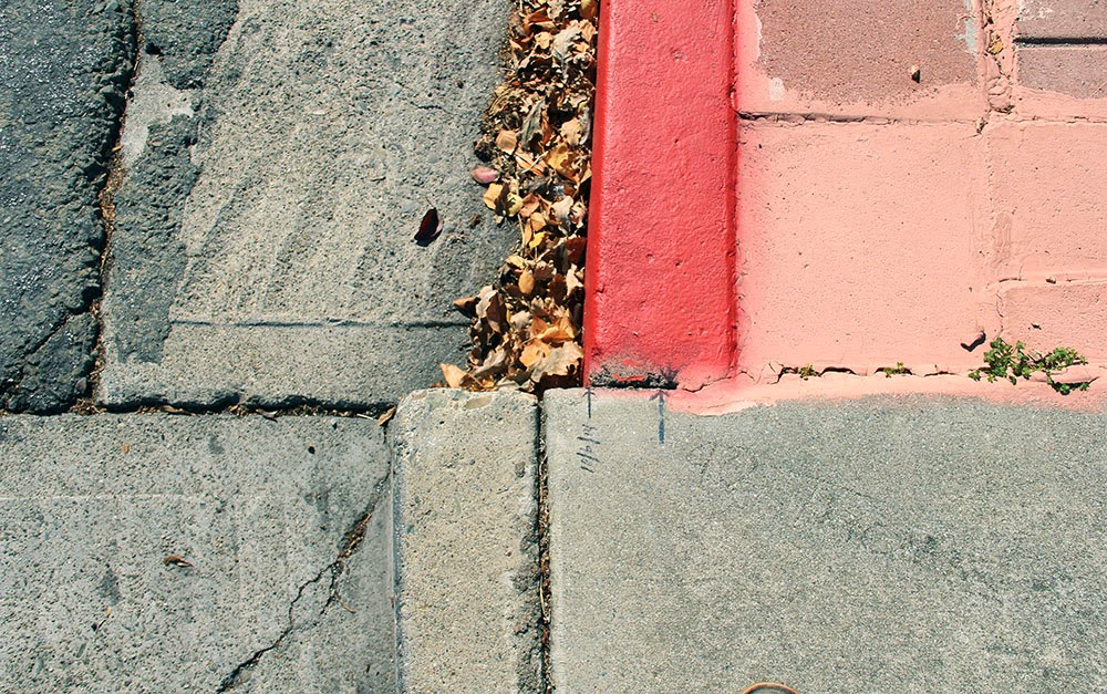
Indeed, another suggestion of Snyder’s was that I go up to visit a very specific corner in the city of Hayward, where the curb at the intersection of Rose and Prospect Streets has long since been shifted out of alignment.

Over the past decade—most recently, in 2011—someone has actually been drawing little black arrows on the concrete to help visualize how far the city has drifted in that time.

The result is something like an alternative orientation point for the city, a kind of seismic meridian—or perhaps doomsday clock—by which Hayward’s ceaseless cleaving can be measured.

[Images: A moving curb becomes an inadvertent compass for measuring seismic energy in Hayward; photos by Geoff Manaugh].

Attempting to visualize earthquakes on a thousand-year time span, or to imagine the pure abstraction of seismic energy, can be rather daunting; this makes it all the more surprising to realize that even the tiniest details hidden in plain sight, such as cracks in the sidewalk, black sharpie marks on curbs, or lazily tilting front porches, can actually be real-time evidence that California is on the move.

But it is exactly these types of signs that function as minor landmarks for the seismic tourist—and, for all their near-invisibility, visiting them can still provide a mind-altering experience.

Back in Hollister, Snyder warned, many of these already easily missed signs through which fault creep is made visible are becoming more and more hard to find.

The town is rapidly gentrifying, he pointed out, and Hollister’s population is beginning to grow as its quiet and leafy streets fill up with commuters who can no longer afford to live closer to Silicon Valley or the Bay. This means that the city’s residents are now just a bit faster to repair things, just a bit quicker to tear down structurally unsound houses.

One of the most famous examples of fault creep, for example—a twisted and misshapen home formerly leaning every which way at a bend in Locust Avenue—is gone. But whatever replaces it will face the same fate.

After all, the creep is still there, like a poltergeist disfiguring things from below, a malign spirit struggling to make itself visible.

Beneath the painted eaves and the wheels of new BMWs, the landscape is still on the move; the deformation is just well hidden, a denied monstrosity reappearing millimeter by millimeter despite the quick satisfaction of weekend repair jobs. Tumid and unstoppable, there is little that new wallpaper or re-poured driveways can do to disguise it.

[Image: Haphazard concrete patchwork in a formerly straight sidewalk betrays the slow action of fault creep; photo by Geoff Manaugh].

Snyder remembered one more site in Hollister that he urged me to visit on my way out of town.

In the very center of Hollister’s Dunne Park, a nice and gentle swale “like a chaise longue,” in his words, has been developing.

Expecting to find just a small bump running through the park, I was instead surprised to see that there is actually a rather large grassy knoll forming there, a rolling and bucolic hill that few people would otherwise realize is an active tectonic fault.

[Image: A fault-caused grassy knoll rises in the center of Dunne Park in Hollister; photo by Geoff Manaugh].

In fact, he said, residents have been entirely unperturbed by this mysterious appearance of a brand new landform in the middle of their city, seeing it instead as an opportunity for better sunbathing. Fault creep is not without its benefits, he joked.

Snyder laughed as he described the sight of a dozen people and their beach towels, all angling themselves upward toward the sun, getting tan in a mobile city with the help of plate tectonics.

[Note: An earlier version of this piece was first published on The Daily Beast (where I did not choose the original headline). I owe a huge thanks to Andy Snyder for the phone conversation in which we discussed fault creep; and the book Finding Fault in California: An Earthquake Tourist’s Guide by Susan Elizabeth Hough was also extremely useful. Finally, please also note that, if you do go to Hollister or Hayward to photograph these sites, be mindful of the people who actually live there, as they do not necessarily want crowds of strangers gathering outside their homes].

It Came From Below

Formless and ancient things from the depths of our planet move beneath Los Angeles, unexpectedly setting fire to sidewalks and burning whole businesses to the ground. Welcome to urban life atop a still-active oil field.

This post was originally published on The Daily Beast.

Sliding around beneath the surface of Los Angeles is something dark, primordial, and without clear form. It seeps up into the city from below through even the smallest cracks and drains. Infernal, it can cause fires and explosions; toxic, it can debilitate, poison, and kill.

Near downtown Los Angeles, at 14th Place and Hill Street, a small extraction firm called the St. James Oil Corporation runs an active oil well. In 2006, the firm presided over a routine steam-injection procedure known as “well stimulation.” The purpose was simple: a careful and sustained application of steam would heat up, liquefy, and thus make available for easier harvesting some of the thick petroleum deposits, or heavy oil, beneath the neighborhood.

But things didn’t quite go as planned. As explained by the Center for Land Use Interpretation—a local non-profit group dedicated to documenting and analyzing land usage throughout the United States—“the subterranean pressure forced oily ooze and smells out of the ground,” causing a nauseating “goo” to bubble over “into storm drains, streets, and basements” as far as two blocks away.

The sudden appearance of this black tide beneath the neighborhood even destabilized the nearby road surface, leading to its emergency closure, and 130 people had to be evacuated. It took weeks to pump these toxic petroleum byproducts out of the basements and to resurface the street; the firm itself was later sued by the city.

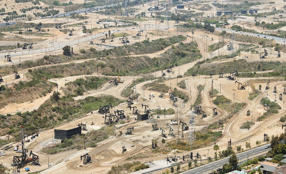
While this was an industrial accident, hydrocarbons are, in fact, almost constantly breaking through the surface of Los Angeles, both in liquid and gaseous form. These are commonly known as seeps, and the most famous example is also an international tourist attraction: the La Brea Tar Pits, with its family-friendly museum on Wilshire Boulevard.

The “tar” here is actually liquid asphalt or pitch, and it is one of many reasons why humans settled the region in the first place. Useful both for waterproofing and for its flammability, this sticky substance has been exploited by humans in the region for literally thousands of years—and it has also given L.A. some of its most impressive paleontological finds.

[Image: Tar pushes up through cracks in the sidewalk on Wilshire Boulevard, near the La Brea Tar Pits; photo by Geoff Manaugh].

In other words, precisely because they are so dangerous, the tar pits are a veritable archive of extinct species; these include mastodons, saber-toothed tigers, and dire wolves, examples of which have been found fatally mired in the black mess seeping up from the deep. Groups of these now long-dead creatures once wandered across an otherworldly landscape of earthquakes and extinct volcanoes, an active terrain pockmarked with eerie bubbling cauldrons of flammable liquid asphalt.

What’s so interesting about contemporary life in Southern California is that this surreal, prehistoric landscape never really went anywhere: it’s simply been relegated to the background, invisibly buried beneath strip malls, car dealerships, and sushi restaurants. Every natural tar seep and artificial oil well here can be seen as an encounter with this older, stranger world trying to break back through into our present experience.

What humans choose to do with this primordial stuff leaking through the cracks can often be almost comical. Architect Ben Loescher, who has given tours of the region’s oil infrastructure for the Center for Land Use Interpretation, points out that many buildings near Lafayette Park must contend with a constant upwelling of asphalt. He sent me a photograph showing a line of orange utility buckets arranged as an ingenious but absurd stopgap measure against the endless and unstoppable goo.

[Image: A makeshift system for capturing the near-constant tar and liquid asphalt leaking up from below a building near Lafayette Park; photo by Ben Loescher].

Nearby, Loescher added, parking lots are a great place to see the onslaught. Many are constantly but slowly flooding with tar and asphalt, to the point that one lot—run by a karaoke club—is struck so badly that the tar is actually visible on Google Maps. “That parking lot is riddled with seeps, as well. When it gets hot, the parking lot sort of re-asphalts itself,” Loescher explains, “and they have to put down tarps on top of it so the cars don’t get stuck.” A much larger gravel lot across the street also exhibits multiple sites of seepage, as if pixelating from below with black matter.

Loescher emphasized that these sites are by no means limited to the La Brea Tar Pits. They can be found throughout the Los Angeles basin, beneath sidewalks, yard, parking lots, and even in people’s basements. To exaggerate for dramatic effect, it’s as if the premise of The Blob was at least partially inspired by a true story—one that has been taking place for hundreds of thousands of years throughout Southern California, and that involves, instead of a visitor from space, something ancient and pre-human forcing its way up from below.

[Image: Liquid asphalt leaking upward into the parking lot of a Los Angeles karaoke club; photo by Geoff Manaugh].

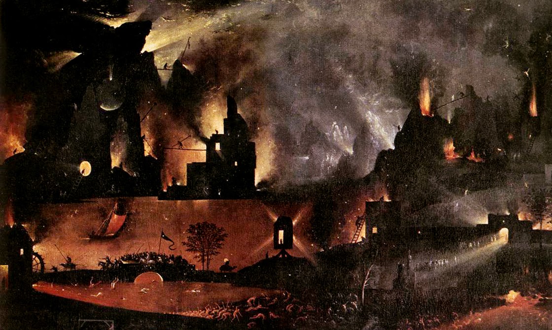
In a short book called Making Time: Essays on the Nature of Los Angeles, writer William L. Fox explores the remnant gas leaks and oil seeps of the city. At times, it reads as if he is describing the backdrop of a Hieronymus Bosch painting. Such is the strange and permanent apocalypse of 21st-century L.A.

Fox writes, for example, that “a methane vent opened up in the middle of Fairfax Street” back in 1985, and that it “burned uncontrollably for days before it could be put out.” At night, it was a world lit by flames. Astonishingly, he adds, in 1962 “a Hawthorne woman had a fire under her house—a house with no basement. She located the source of the problem when she went outside and touched a match to a crack in the sidewalk: A flame ran down to it.”

This city where sidewalks burn and sewers fill with oily ooze is a city built here almost specifically for that very reason; Los Angeles, in many ways, is a settlement founded on petroleum byproducts, and the oil industry for which the city was once known never actually left. It just got better at hiding itself.

It is already well known that there are oilrigs disguised in plain sight all over the city. The odd-looking tower behind Beverly Hills High School, for example, is actually a camouflaged oilrig; an active oil field runs beneath the classrooms and athletic fields. Even stranger, the enormous synagogue at Pico and Doheny is not a synagogue at all, but a movable drilling tower designed to look like a house of worship, as if bizarre ceremonies for conjuring a literal black mass out of the bowels of the Earth take place here, hidden from view. If you zoom in on Google Maps, you can just make out the jumbles of industrial machinery tucked away inside.

However, amidst all of this still-functional oil infrastructure, there are ruins: abandoned wells, capped drill sites, and derelict pumping stations that have effectively been erased from public awareness. These, too, play a role in the city’s subterranean fires and its poisonous breakouts of black ooze.

As Fox explains in Making Time, a labyrinth of aging pipelines and forgotten wells crisscrosses the city. He explains that the Salt Lake Oil Field—which underlies the La Brea Tar Pits, sprawls below an outdoor shopping center known as The Grove, and continues deep into the surrounding neighborhoods—once contained as many as 1,500 operative oil wells. However, most of these “have long since been abandoned and are virtually invisible,” he writes, and, alarmingly, “roughly 300 are unaccounted for.”

These “unaccounted for” oil wells are out of sight and out of mind—but it should not be assumed that they are safely or permanently capped. Indeed, the Salt Lake Oil Field actually “appears to be repressurizing with oil and water,” like an underground blister come back to life, Fox writes. This only raises the stakes of “a hazard already complicated by the lack of knowledge about the exact location of all the wells on the property.” Only 10 years ago, for example, “an orphaned well in Huntington Beach blew out in a gusher forty feet high, spraying oil and methane over one-half square mile, a hazardous-waste problem that will become more common.”

[Image: The Baldwin Hills old field; photo by Geoff Manaugh].

Due to its centrality, the Salt Lake field plays an outsized role in terms of strange petroleum events in the city. The Salt Lake was behind the multiday methane fire in the middle of Fairfax Avenue, for example, and behind arguably the most well known and certainly most destructive reminder of the city’s subterranean presence.

In 1989, in a busy strip mall at Fairfax and 3rd Street, a Ross Dress for Less began to fill with methane gas leaking up from a large pocket connected to the oil field below. Somehow, it had broken through the natural clay boundary that should have held it in place, and the methane thus easily seeped up into the storage rooms, closets, and retail galleries of the discount clothing giant.

Before long, the methane ignited and the entire store blew up.

[Image: Screen grab from YouTube].

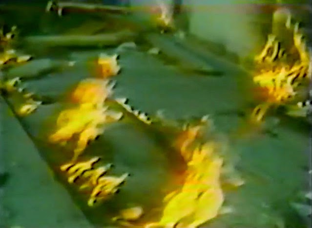
This was by no means an insubstantial explosion—you should watch the aftermath on YouTube—as the entire façade of the building was blown to pieces, the roof collapsed, and dozens of people were disfigured by the detonation.

The resulting fires burned for hours. Small fires roared out of nearby sewer grates, and red and orange flames flickered out of even the tiniest cracks in the sidewalk, like some weird vision of Hell burning through the discount blouses and cheap drywall of this obliterated shopping center.

[Image: Flames burn through cracks in the sidewalk; screen grab from YouTube].

While reporting the tragedy, a local newscaster worryingly informed his viewers that it was simply “too early to tell where or when [the methane] might surface again”—in other words, that there could very well be further explosions. This paranoia—that there is something down there, some inhuman Leviathan stirring beneath the city, and that no one really knows when and where it will strike next—continues to this day.

Even at the time of the explosion, the possibility that city workers might inadvertently drill into a methane pocket beneath the neighborhood became one of the chief reasons for blocking the construction of a new subway line in the area. This same fear has recently resurfaced as the number one excuse for blocking a proposed subway through Beverly Hills.

Back in 2012, local parents released a video urging the city to stop the expansion of subterranean public transit through their neighborhood, concerned that it would cause Beverly Hills High School to explode. (The fact that stopping the subway would also keep certain economic undesirables out of their streets and shopping districts was just a fringe benefit.)

In any case, the narrative resonance of all this is impossible to deny. Formless and ancient things from the depths of our planet move beneath the city, unexpectedly setting fire to sidewalks and burning whole businesses to the ground. Taken out of context, this could be the plot of a new horror film—but it’s just urban life atop a still-active oil field.

As Matthew Coolidge, director of the Center for Land Use Interpretation, explained it to me, the city “is really just a giant scab of petroleum-fueled activities,” an impermanently sealed cap atop this buried monstrosity.

It is worth considering, then, next time you step over a patch of tar on the sidewalk, that the black gloom still bubbling up into people’s yards and basements, still re-asphalting empty gravel parking lots, is actually an encounter with something undeniably old and elementally powerful.

In this sense, Los Angeles is more than just a city; it is a kind of interface between a petrochemical lifestyle of cars and freeways and the dark force that literally fuels it, a subterranean presence that predates us all by millions of years and that continues to wander freely beneath L.A.’s tangled streets and buildings.

(Note: This piece was originally published on The Daily Beast. I have also written about the La Brea Tar Pits and William L. Fox’s book in Landscape Futures. Opening image: a close-up of Hell, from “The Garden of Earthly Delights” by Hieronymous Bosch, Museo del Prado, Madrid, Spain).

Life on the Subsurface: An Interview with Penelope Boston

A landscape painting above Penny Boston’s living room entryway depicts astronauts exploring Mars.

Penelope Boston is a speleo-biologist at New Mexico Tech, where she is also Director of Cave and Karst Science. Her work examines subterranean lifeforms, often found very deep within cave systems, including the larger subterranean ecosystems those creatures are connected to. Her research focuses primarily on what are known as extremophiles for their ability to survive in seemingly inhospitable micro-environments here on Earth; these bizarre forms of life, thriving in acidic, anoxic, or highly pressurized situations, offer compelling analogies for the sorts of lifeforms and ecosystems that might exist, undetected, on other planets.

But the flip side of her research are those environments themselves: the caves, tunnels, and other underground spaces inside of which unearthly life might thrive. As you’ll see, this is an interview obsessed with space: how to define space, how space is formed geologically, and what sorts of speculative underground spaces and structures can form under radically different gravitational regimes, deep inside the polar glaciers of distant moons, or even in the turbulent skies of gas giants.

Boston has worked with the NASA Innovative Advanced Concepts program (NIAC) to develop protocols for both human extraterrestrial cave habitation and for subterranean life-detection missions on Mars, life which she believes is highly likely to exist.

On a hot summer afternoon, she graciously welcomed me and Nicola Twilley, traveling for our Venue project, into her home in Los Lunas, New Mexico, where we arrived with design futurist Stuart Candy in tow, en route to dropping him off at the Very Large Array later that day.

Over the course of our conversation, Boston told us about her experiences working at Mars analog sites; she explained why she believes there is a strong possibility for life below the surface of the Red Planet, perhaps inside billion-year-old networks of lava tubes; she detailed her own ongoing cave explorations beneath the U.S. Southwest; and we touched on some mind-blowing ideas seemingly straight out of science fiction, including extreme forms of extraterrestrial life (such as dormant life on comets, thawed and reawakened with every passage close to the sun) and the extraordinary potential for developing new pharmaceuticals out of cave microorganisms.

An edited transcript of our conversation appears below.

• • •
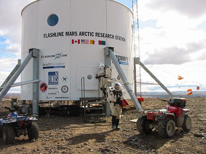
The Flashline Mars Arctic Research Station (FMARS) on Devon Island, courtesy of the Mars Society.

Geoff Manaugh: As a graduate student, you co-founded the Mars Underground and then the Mars Society. You’re a past President of the Association of Mars Explorers, and you’re also now a member of the science team taking part in Mars Arctic 365, a new one-year Mars surface simulation mission set to start in summer 2014 on Devon Island. How does this long-term interest in Mars exploration tie into your Earth-based research in speleobiology and subterranean microbial ecosystems?

Penelope Boston: Even though I do study surface things that have a microbial component, like desert varnish and travertines and so forth, I really think that it’s the subsurface of Mars where the greatest chance of extant life, or even preservation of extinct life, would be found.

Nicola Twilley: Is it part of NASA’s strategy to go subsurface at any point, to explore caves on Mars or the moon?

Boston: Well, yes and no. The “Strategy” and the strategy are two different things.

The Mars Curiosity rover is a very capable chemistry and physics machine and I am, of course, dying to hear the details of the geochemistry it samples. A friend of mine, for instance, with whom I’m also a collaborator, is the principal investigator of the SAM instrument. Friends of mine are also on the CheMin instrument. So I have a vested interest, both professionally and personally, in the Curiosity mission.

On the other hand, you know: here we go again with yet another mission on the surface. It’s fascinating, and we still have a lot to learn there, but I hope I will live long enough to see us do subsurface missions on Mars and even on other bodies in the solar system.

Unfortunately, right now, we are sort of in limbo. The downturn in the global economy and our national economy has essentially kicked NASA in the head. It’s very unclear where we are going, at this point. This is having profound, negative effects on the Agency itself and everyone associated with it, including those of us who are external fundees and sort of circum-NASA.

On the other hand, although we don’t have a clear plan, we do have clear interests, and we have been pursuing preliminary studies. NASA has sponsored a number of studies on deep drilling, for example. One of the most famous was probably about 15 years ago, and it really kicked things off. That was up in Santa Fe, and we were looking at different methodologies for getting into the subsurface.

I have done a lot of work, some of which has been NASA-funded, on the whole issue of lava tubes—that is, caves associated with volcanism on the surface. Now, Glenn Cushing and Tim Titus at the USGS facility in Flagstaff have done quite a bit of serious work on the high-res images coming back from Mars, and they have identified lava tubes much more clearly than we ever did in our earlier work over the past decade.
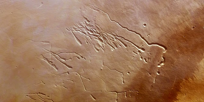
Surface features created by lava tubes on Mars; image via ESA

Twilley: Is it the expectation that caves as common on Mars as they are on Earth?

Boston: I’d say that lava tubes are large, prominent, and liberally distributed everywhere on Mars. I would guess that there are probably more lava tubes on Mars than there are here on Earth—because here they get destroyed. We have such a geologically and hydro-dynamically active planet that the weathering rates here are enormous.

But on Mars we have a lot of factors that push in the other direction. I’d expect to find tubes of exceeding antiquity—I suspect that billions-of-year-old tubes are quite liberally sprinkled over the planet. That’s because the tectonic regime on Mars is quiescent. There is probably low-level tectonism—there are, undoubtedly, Marsquakes and things like that—but it’s not a rock’n’roll plate tectonics like ours, with continents galloping all over the place, and giant oceans opening up across the planet.

That means the forces that break down lava tubes are probably at least an order of magnitude or more—maybe two, maybe three—less likely to destroy lava tubes over geological time. You will have a lot of caves on Mars, and a lot of those caves will be very old.

Plus, remember that you also have .38 G. The intrinsic tensile strength of the lava itself, or whatever the bedrock is, is also going to allow those tubes to be much more resistant to the weaker gravity there.
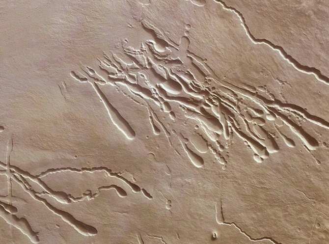
Surface features of lava tubes on Mars; images via ESA

Manaugh: I’d imagine that, because the gravity is so much lower, the rocks might also behave differently, forming different types of arches, domes, and other formations underground. For instance, large spans and open spaces would be shaped according to different gravitational strains. Would that be a fair expectation?

Boston: Well, it’s harder to speculate on that because we don’t know what the exact composition of the lava is—which is why, someday, we would love to get a Mars sample-return mission, which is no longer on the books right now. [sighs] It’s been pushed off.

In fact, I just finished, for the seventh time in my career, working on a panel on that whole issue. This was the E2E—or End-to-End—group convened by Dave Beatty, who is head of the Mars Program at the Jet Propulsion Laboratory [PDF].

About a year ago, we finished doing some intensive international work with our European Space Agency partners on Mars sample-return—but now it’s all been pushed off again. The first one of those that I worked on was when I was an undergraduate, almost ready to graduate at Boulder, and that was 1979. It just keeps getting pushed off.

I’d say that we are very frustrated within the planetary and astrobiology communities. We can use all these wonderful instruments that we load onto vehicles like Curiosity and we can send them there. We can do all this fabulous orbital stuff. But, frankly speaking, as a person with at least one foot in Earth science, until you’ve got the stuff in your hands—actual physical samples returned from Mars—there is a lot you can’t do.
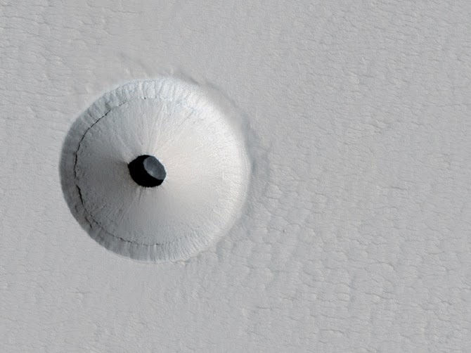
Looking down through a “skylight” on Mars and into a Martian sinkhole; images via NASA/JPL/University of Arizona

Twilley: Could you talk a bit about your work with exoplanetary research, including what you’re looking for and how you might find it?

Boston: [laughs] The two big questions!

But, yes. We are working on a project at Socorro now to atmospherically characterize exoplanets. It’s called NESSI, the New Mexico Exoplanet Spectroscopic Survey Instrument. Our partner is Mark Swain, over at JPL. They are doing it using things like Kepler, and they have a new mission they’re proposing, called FINESSE. FINESSE will be a dedicated exoplanet atmospheric characterizer.

We are also trying to do that, in conjunction with them, but from a ground-based instrument, in order to make it more publicly accessible to students and even to amateur astronomers.

That reminds me—one of the other people you might be interested in talking to is a young woman named Lisa Messeri, who just recently finished her PhD in Anthropology at MIT. She’s at the University of Pennsylvania now. Her focus is on how scientists like me to think about other planets as other worlds, rather than as mere scientific targets—how we bring an abstract scientific goal into the familiar mental space where we also have recognizable concepts of landscape.

I’ve been obsessed with that my entire life: the concept of space, and the human scaling of these vastly scaled phenomena, is central, I think, to my emotional core, not just the intellectual core.
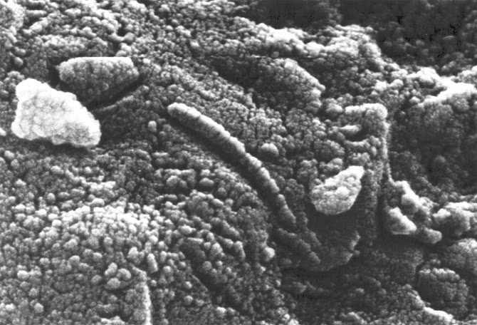
The Allan Hills Meteorite (ALH84001); courtesy of NASA.

Manaugh: While we’re on the topic of scale, I’m curious about the idea of astrobiological life inhabiting a radically, undetectably nonhuman scale. For example, one of the things you’ve written and lectured about is the incredible slowness it takes for some organisms to form, metabolize, and articulate themselves in the underground environments you study. Could there be forms of astrobiological life that exist on an unbelievably different timescale, whether it’s a billion-year hibernation cycle that we might discover at just the wrong time and mistake, say, for a mineral? Or might we find something on a very different spatial scale—for example, a species that is more like a network, like an aspen tree or a fungus?

Boston: You know, Paul Davies is very interested in this idea—the concept of a shadow biosphere. Of course, I had also thought about this question for many years, long before I read about Davies or before he gave it a name.

The conundrum you face is: how would you know—how you would study or even conceptualize—these other biospheres? It’s outside of your normal spatial and temporal comfort zone, in which all of your training and experience has guided you to look, and inside of which all of your instruments are designed to function. If it’s outside all of that, how will you know it when you see it?

Imagine comets. With every perihelion passage, volatile gases escape. You are whipping around the solar system. Your body comes to life for that brief period of time only. Now apply that to icy bodies in very elliptical orbits in other solar systems, hosting life with very long periods of dormancy.

There are actually some wonderful early episodes of The Twilight Zone that tap into that theme, in a very poetic and literary way. [laughs] Of course, it’s also the central idea of some of the earliest science fiction; I suppose Gulliver’s Travels is probably the earliest exploration of that concept.

In the microbial realm—to stick with what we do know, and what we can study—we are already dealing with itsy-bitsy, teeny-weeny things that are devilishly difficult to understand. We have a lot of tools now that enable us to approach those, but, very regularly, we’ll see things in electron microscopy that we simply can’t identify and they are very clearly structured. And I don’t think that they are all artifacts of the preparation—things that get put there accidentally during prep.

A lot of the organisms that we actually grow, and with which we work, are clearly nanobacteria. I don’t know how familiar you are with that concept, but it has been extremely controversial. There are many artifacts out there that can mislead us, but we do regularly see organisms that are very small. So how small can they be—what’s the limit?

A few of the early attempts at figuring this out were just childish. That’s a mean thing to say, because a lot of my former mentors have written some of those papers, but they would say things like: “Well, we need to conduct X, Y, and Z metabolic pathways, so, of course, we need all this genetic machinery.” I mean, come on, you know that early cells weren’t like that! The early cells—who knows what they were or what they required?

To take the famous case of the ALH84001 meteorite: are all those little doobobs that you can see in the images actually critters? I don’t know. I think we’ll never know, at least until we go to Mars and bring back stuff.

I have relatively big microbes in my lab that regularly feature little knobs and bobs and little furry things, that I am actually convinced are probably either viruses or prions or something similar. I can’t get a virologist to tell me yes. They are used to looking at viruses that they can isolate in some fashion. I don’t know how to get these little knobby bobs off my guys for them to look at.

The Allan Hills Meteorite (ALH84001); courtesy of NASA.

Twilley: In your paper on the human utilization of subsurface extraterrestrial environments [PDF], you discuss the idea of a “Field Guide to Unknown Organisms,” and how to plan to find life when you don’t necessarily know what it looks like. What might go into such a guide?

Boston: The analogy I often use with graduate students when I teach astrobiology is that, in some ways, it’s as if we are scientists on a planet orbiting Alpha Centauri and we are trying to write a field guide to the birds of Earth. Where do you start? Well, you start with whatever template you have. Then you have to deeply analyze every feature of that template and ask whether each feature is really necessary and which are just a happenstance of what can occur.

I think there are fundamental principles. You can’t beat thermodynamics. The need for input and outgoing energy is critical. You have to be delicately poised, so that the chemistry is active enough to produce something that would be a life-like process, but not so active that it outstrips any ability to have cohesion, to actually keep the life process together. Water is great as a solvent for that. It’s probably not the only solvent, but it’s a good one. So you can look for water—but do you really need to look for water?

I think you have to pick apart the fundamental assumptions. I suspect that predation is a relatively universal process. I suspect that parasitism is a universal process. I think that, with the mathematical work being done on complex, evolving systems, you see all these emerging properties.

Now, with all of that said, the details—the sizes, the scale, the pace, getting back to what we were just talking about—I think there is huge variability in there.
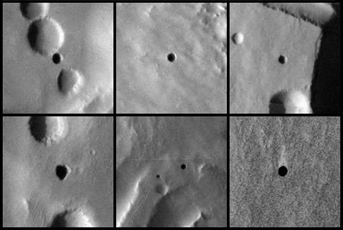
Caves on Mars; images courtesy of NASA/JPL-Caltech/ASU/USGS.

Twilley: How do you train people to look for unrecognizable life?

Boston: I think everybody—all biologists—should take astrobiology. It would smack you on the side of the head and say, “You have to rethink some of these fundamental assumptions! You can’t just coast on them.”

The organisms that we study in the subsurface are so different from the microbes that we have on the surface. They don’t have any predators—so, ecologically, they don’t have to outgrow any predators—and they live in an environment where energy is exceedingly scarce. In that context, why would you bother having a metabolic rate that is as high as some of your compatriots on the surface? You can afford to just hang out for a really long time.

We have recently isolated a lot of strains from these fluid inclusions in the Naica caves—the one with those gigantic crystals. It’s pretty clear that these guys have been trapped in these bubbles between 10,000 and 15,000 years. We’ve got fluid inclusions in even older materials—in materials that are a few million years old, even, in a case we just got some dates for, as much as 40 million years.
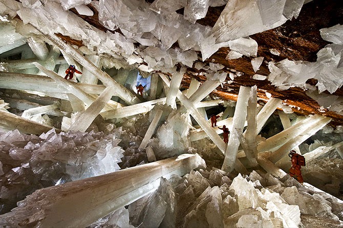
Naica Caves, image from the official website. The caves are so hot that explorers have to wear special ice-jackets to survive.

One of the caveats, of course, is that, when you go down some distance, the overlying lithostatic pressure of all of that rock makes space impossible. Microbes can’t live in zero space. Further, they have to have at least inter-grain spaces or microporosity—there has to be some kind of interconnectivity. If you have organisms completely trapped in tiny pockets, and they never interact, then that doesn’t constitute a biosphere. At some point, you also reach temperatures that are incompatible with life, because of the geothermal gradient. Where exactly that spot is, I don’t know, but I’m actually working on a lot of theoretical ideas to do with that.

In fact, I’m starting a book for MIT Press that will explore some of these ideas. They wanted me to write a book on the cool, weird, difficult, dangerous places I go to and the cool, weird, difficult bugs I find. That’s fine—I’m going to do that. But, really, what I want to do is put what we have been working on for the last thirty years into a theoretical context that doesn’t just apply to Earth but can apply broadly, not only to other planets in our solar system, but to one my other great passions, of course, which is exoplanets—planets outside the solar system.

One of the central questions that I want to explore further in my book, and that I have been writing and talking about a lot, is: what is the long-term geological persistence of organisms and geological materials? I think this is another long-term, evolutionary repository for living organisms—not just fossils—that we have not tapped into before. I think that life gets recycled over significant geological periods of time, even on Earth.

That’s a powerful concept if we then apply it to somewhere like Mars, for example, because Mars does these obliquity swings. It has super-seasonal cycles. It has these little dimpled moons that don’t stabilize it, whereas our moon stabilizes the Earth’s obliquity level. That means that Mars is going through these super cold and dry periods of time, followed by periods of time where it’s probably more clement.

Now, clearly, if organisms can persist for tens of thousands of years—let alone hundreds of thousands of years, and possibly even millions of years—then maybe they are reawakenable. Maybe you have this very different biosphere.

Manaugh: Like a biosphere in waiting.

Boston: Yes—a biosphere in waiting, at a much lower level.

Recently, I have started writing a conceptual paper that really tries to explore those ideas. The genome that we see active on the surface of any planet might be of two types. If you have a planet like Earth, which is photosynthetically driven, you’re going to have a planet that is much more biological in terms of the total amount of biomass and the rates at which this can be produced. But that might not be the only way to run a biosphere.

You might also have a much more low-key biosphere that could actually be driven by geochemical and thermal energy from the inside of the planet. This was the model that we—myself, Chris McKay, and Michael Ivanoff, one of our colleagues from what was the Soviet Union at the time—published more than twenty years ago for Mars. We suggested that there would be chemically reduced gases coming from the interior of the planet.

That 1992 paper was what got us started on caves. I had never been in a wild cave in my life before. We were looking for a way to get into that subsurface space. The Department of Energy was supporting a few investigators, but they weren’t about to share their resources. Drilling is expensive. But caves are just there; you can go inside them.
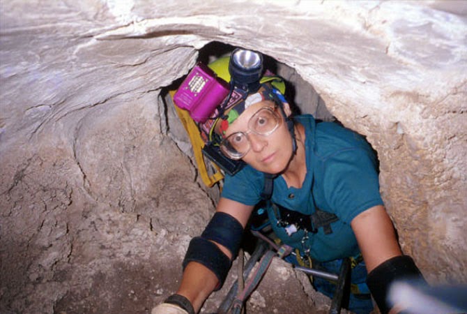
Penelope Boston caving, image courtesy of V. Hildreth-Werker, from “Extraterrestrial Caves: Science, Habitat, Resources,” NIAC Phase I Study Final Report, 2001.

So that’s really what got us into caving. It was at that point where I discovered caves are so variable and fascinating, and I really refocused my career on that for the last 20 years.

The first time I did any serious caving was actually in Lechuguilla Cave. It was completely nuts to make that one’s first wild cave. We trained for about three hours, then we launched into a five-day expedition into Lechuguilla that nearly killed us! Chris McKay came out with a terrible infection. I had a blob of gypsum in my eye and an infection that swelled it shut. I twisted my ankle. I popped a rib. Larry Lemke had a massive migraine. We were not prepared for this. The people taking us in should have known better. But one of them is a USGS guide and a super caving jock, so it didn’t even occur to him—it didn’t occur to him that we were learning instantaneously to operate in a completely alien landscape with totally inadequate skills.
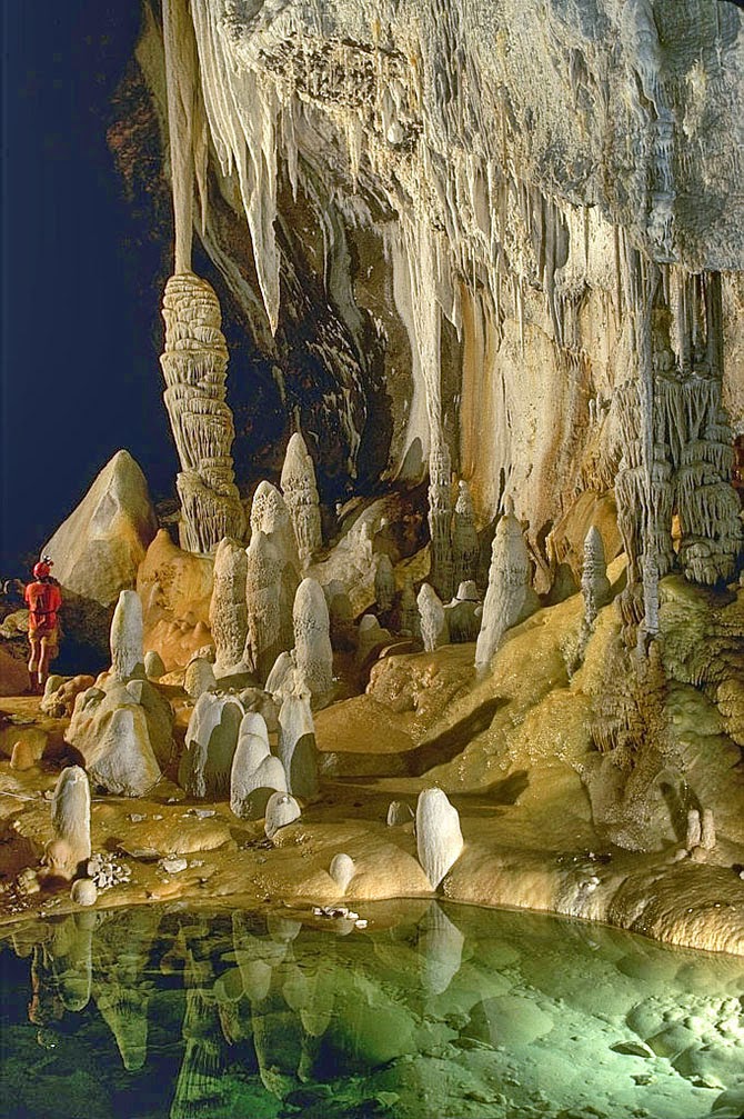
Lechuguilla Cave, photograph by Dave Bunnell.

All I knew was that I was beaten to a pulp. I could almost not get across these chasms. I’m a short person. Everybody else was six feet tall. I felt like I was just hanging on long enough so I could get out and live. I’ve been in jams before, including in Antarctica, but that’s all I thought of the whole five days: I just have to live through this.

But, when I got out, I realized that what the other part of my brain had retained was everything I had seen. The bruises faded. My eye stopped being infected. In fact, I got the infection from looking up at the ceiling and having some of those gooey blobs drip down into my eye—but, I was like, “Oh my God. This is biological. I just know it is.” So it was a clue. And, when, I got out, I knew I had to learn how to do this. I wanted to get back in there.

ESA astronauts on a “cave spacewalk” during a 2011 training mission in the caves of Sardinia; image courtesy of the ESA.

Manaugh: You have spoken about the possibility of entire new types of caves that are not possible on Earth but that might be present elsewhere. What are some of these other cave types you think might exist, and what sort of conditions would be required to form them? You’ve used some great phrases to describe those processes—things like “volatile labyrinths” and “ice volcanism” that create strange cave types that aren’t possible on Earth.

Boston: Well, in terms of ice, I’ll bet there are all sorts of Lake Vostok-like things out there on other moons and planets.

The thing with Lake Vostok is that it’s not a “lake.” It’s a cave: a cave in ice. The ice, in this case, acts as bedrock, so it’s not a lake at all. It’s a closed system.

Manaugh: It’s more like a blister: an enclosed space full of fluid.

Boston: Exactly. In terms of speculating on the kinds of caves that might exist elsewhere in the universe, we are actually working on a special issue for the Journal of Astrobiology right now, based on the extraterrestrial planetary caves meeting that we did last October. We brought people from all over the place. This is a collaboration between my Institute—the National Cave and Karst Research Institute in Carlsbad, where we have our headquarters—and the Lunar and Planetary Institute.

The meeting was an attempt to explore these ideas. Karl Mitchell from JPL, who I had not met previously, works on Titan; he’s on the Cassini Huygens mission. He thinks he is seeing karst-like features on Titan. Just imagine that! Hydrocarbon fluids producing karst-like features in water-ice bedrock—what could be more exotic than that?

That also shows that the planetary physics dominates in creating these environments. I used to think that the chemistry dominated. I don’t think so anymore. I think that the physics dominates. You have to step away from the chemistry at first and ask: what are the fundamental physics that govern the system? Then you can ask: what are the fundamental chemical potentials that govern the system that could produce life? It’s the same exercise with imagining what kind of caves you can get—and I have a lurid imagination.
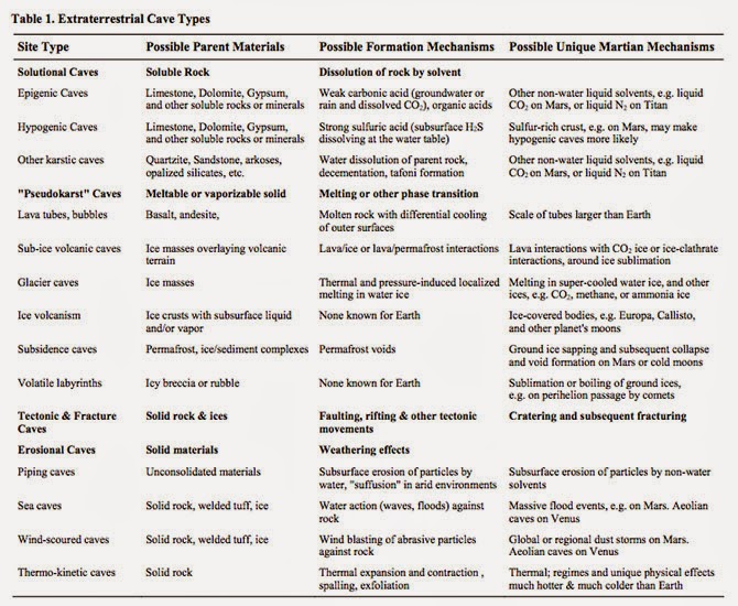
From “Human Utilization of Subsurface Extraterrestrial Environments,” P. J. Boston, R. D. Frederick, S. M. Welch, J. Werker, T. R. Meyer, B. Sprungman, V. Hildreth-Werker, S. L. Thompson, and D. L. Murphy, Gravitational and Space Biology Bulletin 16(2), June 2003.

One of the fun things I do in my astrobiology class every couple of years is the capstone project. The students break down into groups of four or five, hopefully well-mixed in terms of biologists, engineers, chemists, geologists, physicists, and other backgrounds.

Then they have to design their own solar system, including the fundamental, broad-scale properties of its star. They have to invent a bunch of planets to go around it. And they have to inhabit at least one of those planets with some form of life. Then they have to design a mission—either telescopic or landed—that could study it. They work on this all semester, and they are so creative. It’s wonderful. There is so much value in imagining the biospheres of other planetary bodies.

You just have to think: “What are the governing equations that you have on this planet or in this system?” You look at the gravitational value of a particular body, its temperature regime, and the dominant geochemistry. Does it have an atmosphere? Is it tectonic? One of the very first papers I did—it appeared in one of these obscure NASA special publications, of which they print about 100 and nobody can ever find a copy—was called “Bubbles in the Rocks.” It was entirely devoted to speculation about the properties of natural and artificial caves as life-support structures. A few years later, I published a little encyclopedia article, expanding on it, and I’m now working on another expansion, actually.

I think that, either internally, externally, or both, planetary bodies that form cracks are great places to start. If you have some sort of fluid—even episodically—within that system, then you have a whole new set of cave-forming processes. Then, if you have a material that can exist not only in a solid phase, but also as a liquid or, in some cases, even in a vapor phase on the same planetary body, then you have two more sets of potential cave-forming processes. You just pick it apart from those fundamentals, and keep building things up as you think about these other cave-forming systems and landscapes.
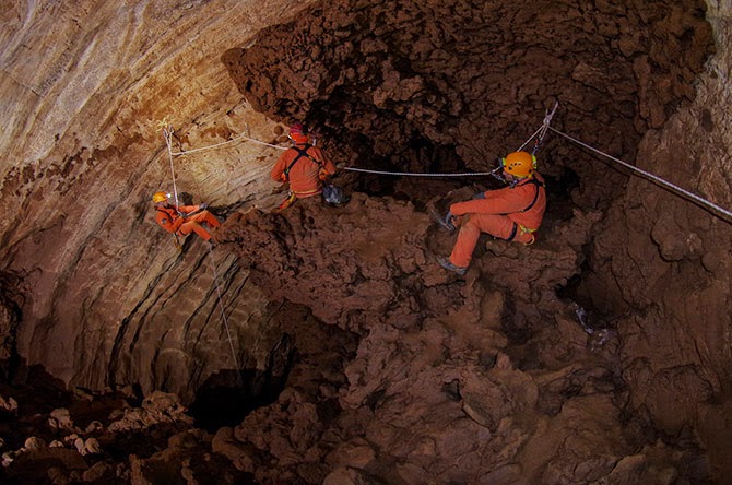
ESA astronauts practice “cavewalking”; image courtesy ESA-V. Corbu.

Manaugh: One of my favorite quotations is from a William S. Burroughs novel, where he describes what he calls “a vast mineral consciousness at absolute zero, thinking in slow formations of crystal.”

Boston: Oh, wow.

Manaugh: I mention that because I’m curious about how the search for “extraterrestrial life” always tends to be terrestrial, in the sense that it’s geological and it involves solid planetary formations. But what about the search for life on a gaseous planet, for example—would life be utterly different there, chemically speaking, or would it simply be sort of dispersed, or even aerosolized? I suppose I’m also curious if there could be a “cave” on a gaseous planet and, if so, would it really just be a weather system? Is a “cave” on a gaseous planet actually just a storm? Or, to put it more abstractly, can there be caves without geology?

Boston: Hmm. Yes, I think there could be. If it was enclosed or self-perpetuating.

Manaugh: Like a self-perpetuating thermal condition in the sky. It would be a sort of atmospheric “cave.”

Twilley: It would be a bubble.
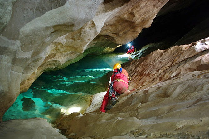
ESA astronauts explore caves in Sardinia; image courtesy ESA–R. Bresnik.

Boston: In terms of life that could exist in a permanent, fluid medium that was gaseous—rather than a compressed fluid, like water—Carl Sagan and Edwin Salpeter made an attempt at that, back in 1975. In fact, I use their “Jovian Gasbags” paper as a foundational text in my astrobiology classes.

But an atmospheric system like Jupiter is dominated—just like an ocean is—by currents. It’s driven by thermal convection cells, which are the weather system, but it’s at a density that gives it more in common with our oceans than with our sky. And we are already familiar with the fact that our oceans, even though they are a big blob of water, are spatially organized into currents, and they are controlled by density, temperature, and salinity. The ocean has a massively complex three-dimensional structure; so, too, does the Jovian atmosphere. So a gas giant is really more like a gaseous ocean I think.

Now, the interior machinations that go on in inside a planet like Jupiter are driving these gas motions. There is a direct analogy here to the fact that, on our rocky terrestrial planet, which we think of as a solid Earth, the truth is that the mantle is plastic—in fact, the Earth’s lower crust is a very different substance from what we experience up here on this crusty, crunchy top, this thing that we consider solid geology. Whether we’re talking about a gas giant like Jupiter or the mantle of a rocky planet like Earth, we are really just dealing with different regimes of density—and, here again, it’s driven by the physics.

ESA astronauts set up an experimental wind-speed monitoring station in the caves of Sardinia; image courtesy ESA/V. Crobu.

A couple of years ago, I sat in on a tectonics class that one of my colleagues at New Mexico Tech was giving, which was a lot of fun for me. Everybody else was thinking about Earth, and I was thinking about everything but Earth. For my little presentation in class, what I tried to do was think about analogies to things on icy bodies: to look at Europa, Titan, Enceledus, Ganymede, and so forth, and to see how they are being driven by the same tectonic processes, producing the same kind of brittle-to-ductile mantle transition, but in ice rather than rock.

I think that, as we go further and further in the direction of having to explain what we think is going on in exoplanets, it’s going to push some of the geophysics in that direction, as well. There is amazingly little out there. I was stunned, because I know a lot of planetary scientists who are thinking about this kind of stuff, but there is a big gulf between Earth geophysics and applying those lessons to exoplanets.
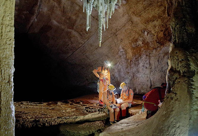
ESA astronauts prepare for their 2013 training mission in the caves of Sardinia; image courtesy ESA-V. Crobu.

Manaugh: We need classes in speculative geophysics.

Boston: Yeah—come on, geophysicists! [laughs] Why shouldn’t they get in the game? We’ve been doing it in astrobiology for a long time.

In fact, when I’ve asked my colleagues certain questions like, “Would we even get orogeny on a three Earth-mass planet?” They are like, “Um… We don’t know.” But you know what? I bet we have the equations to figure that out.

It starts with something as simple as that: in different or more extreme gravitational regimes, could you have mountains? Could you have caves? How could you calculate that? I don’t know the answer to that—but you have to ask it.

ESA astronauts take microbiological samples during a 2011 training mission in the caves of Sardinia; image courtesy of the ESA.

Twilley: You’re a member of NASA’s Planetary Protection Subcommittee. Could you talk a little about what that means? I’m curious whether the same sorts of planetary protection protocols we might use on other planets, like Mars, should also be applied to the Earth’s subsurface. How do we protect these deeper ecosystems? How do we protect deeper ecosystems on Mars, assuming there are any?

Boston: That’s a great question. We are working extremely hard to do that, actually.

Planetary protection is the idea that we must protect Earth from off-world contaminants. And, of course, vice versa: we don’t want to contaminate other planets—both for scientific reasons and, at least in my case, for ethical reasons—with biological material from Earth.

In other words, I think we owe it to our fellow bodies in the solar system to give them a chance to prove their biogenicity or not, before humans start casually shedding our skin cells or transporting microbes there.

That’s planetary protection, and it works both ways.

One thing I have used as a sales pitch in some of my proposals is the idea that we are attempting to become more and more noninvasive in our cave exploration, which is very hard to do. For example, we have pushed all of our methods in the direction of using miniscule quantities of sample. Most Earth scientists can just go out and collect huge chunks of rock. Most biologists do that, too. You grow E. coli in the lab and you harvest tons of it. But I have to take just a couple grams of material—on a lucky day—sometimes even just milligrams of material, with very sparse bio density in there. I have to work with that.

What this means is that the work we are doing also lends itself really well to developing methods that would be useful on extraterrestrial missions.

In fact, we are pushing in the direction of not sampling at all, if we can. We are trying to see what we can learn about something before we even poke it. So, in our terrestrial caving work, we are actually living the planetary protection protocol.

We are also working in tremendously sensitive wilderness areas and we are often privileged enough to be the only people to get in there. We want to minimize the potential contamination.

That said, of course, we are contaminant sources. We risk changing the environment we’re trying to study. We struggle with this. I struggle with it physically and methodologically. I struggle with it ethically. You don’t want to screw up your science and inadvertently test your own skin bugs.

I’d say this is one of those cases where it’s not unacceptable to have a nonzero risk—to use a double negative again. There are few things in life that I would say that about. Even in our ridiculous risk-averse culture, we understand that for most things, there is a nonzero risk of basically anything. There is a nonzero risk that we’ll be hit by a meteorite now, before we are even done with this interview. But it’s pretty unlikely.

In this case, I think it’s completely unacceptable to run much of a risk at all.

That said, the truth is that pathogens co-evolve with their hosts. Pathogenesis is a very delicately poised ecological relationship, much more so than predation. If you are made out of the same biochemistry I’m made of, the chances are good that I can probably eat you, assuming that I have the capability of doing that. But the chances that I, as a pathogen, could infect you are miniscule. So there are different degrees of danger.

There is also the alien effect, which is well known in microbiology. That is that there is a certain dose of microbes that you typically need to get in order for them to take hold, because they are coming into an area where there’s not much ecological space. They either have to be highly pre-adapted for whatever the environment is that they land in, or they have to be sufficiently numerous so that, when they do get introduced, they can actually get a toehold.

We don’t really understand some of the fine points of how that occurs. Maybe it’s quorum sensing. Maybe it’s because organisms don’t really exist as single strains at the microbial level and they really have to be in consortia—in communities—to take care of all of the functions of the whole community.

We have a very skewed view of microbiology, because our knowledge comes from a medical and pathogenesis history, where we focus on single strains. But nobody lives like that. There are no organisms that do that. The complexity of the communal nature of microorganisms may be responsible for the alien effect.

So, given all of that, do I think that we are likely to be able to contaminate Mars? Honestly, no. On the surface, no. Do I act as if we can? Yes—absolutely, because the stakes are too high.

Now, do I think we could contaminate the subsurface? Yes. You are out of the high ultraviolet light and out of the ionizing radiation zone. You would be in an environment much more likely to have liquid water, and much more likely to be in a thermal regime that was compatible with Earth life.

So you also have to ask what part of Mars you are worried about contaminating.
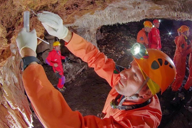
ESA teams perform bacterial sampling and examine a freshwater supply; top photo courtesy ESA–V. Crobu; bottom courtesy ESA/T. Peake.

Manaugh: There’s been some interesting research into the possibility of developing new pharmaceuticals from these subterranean biospheres—or even developing new industrial materials, like new adhesives. I’d love to know more about your research into speleo-pharmacology or speleo-antibiotics—drugs developed from underground microbes.

Boston: It’s just waiting to be exploited. The reasons that it has not yet been done have nothing to do with science and nothing to do with the tremendous potential of these ecosystems, and everything to do with the bizarre and not very healthy economics of the global drug industry. In fact, I just heard that someone I know is leaving the pharmaceutical industry, because he can’t stand it anymore, and he’s actually going in the direction of astrobiology.

Really, there is a de-emphasis on drug discovery today and more of an emphasis on drug packaging. It is entirely profit-driven motive, which is distasteful, I think, and extremely sad. I see a real niche here for someone who doesn’t want to become just a cog in a giant pharmaceutical company, someone who wants to do a small start-up and actually do drug discovery in an environment that is astonishingly promising.

It’s not my bag; I don’t want to develop drugs. But I see our organisms producing antibiotics all the time. When we grow them in culture, I can see where some of them are oozing stuff—pink stuff and yellow stuff and clear stuff. And you can see it in nature. If you go to a lava tube cave, here in New Mexico, you see they are doing it all the time.

A lot of these chemistry tests screen for mutagenic activity, chemogenic activity, and all of the other things that are indications of cancer-fighting drugs and so on, and we have orders of magnitude more hits from cave stuff than we do from soils. So where is everybody looking? In soils. Dudes! I’ve got whole ecosystems in one pool that are different from an ecosystem in another pool that are less than a hundred feet apart in Lechuguilla Cave! The variability—the non-homogeneity of the subsurface—vastly exceeds the surface, because it’s not well mixed.
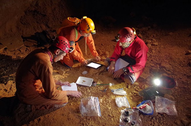
ESA astronauts prepare their experiments and gear for a 2013 CAVES (“Cooperative Adventure for Valuing and Exercising human behaviour and performance Skills”) mission in Sardinia; image courtesy ESA–V. Crobu

Twilley: In your TED talk, you actually say that the biodiversity in caves on Earth may well exceed the entire terrestrial biosphere.

Boston: Oh, yes—certainly the subsurface. There is a heck of a lot of real estate down there, when you add all those rock-fracture surface areas up. And each one of these little pockets is going off on its own evolutionary track. So the total diversity scales with that. It’s astonishing to me that speleo-bioprospecting hasn’t taken off already. I keep writing about it, because I can’t believe that there aren’t twenty-somethings out there who don’t want to go work for big pharma, who are fascinated by this potential for human use.

There is a young faculty member at the University of New Mexico in Albuquerque, whose graduate student is one of our friends and cavers, and they are starting to look at some of these. I’m like, “Go for it! I can supply you with endless cultures.”

Twilley: In your “Human Mission to Inner Space” experiment, you trialed several possible Martian cave habitat technologies in a one-week mission to a closed cave with a poisonous atmosphere in Arizona. As part of that, you looked into Martian agriculture, and grew what you called “flat crops.” What were they?

Boston: We grew great duckweed and waterfern. We made duckweed cookies. Gus made a rice and duckweed dish. It was quite tasty. [laughs] We actually fed two mice on it exclusively for a trial period, but although duckweed has more protein than soybeans, there weren’t enough carbohydrates to sustain them calorically.

But the duckweed idea was really just to prove a point. A great deal of NASA’s agricultural research has been devoted to trying to grow things for astronauts to make them happier on the long, outbound trips—which is very important. It is a very alien environment and I think people underestimate that. People who have not been in really difficult field circumstances have no apparent understanding of the profound impact of habitat on the human psyche and our ability to perform. Those of us who have lived in mock Mars habitats, or who have gone into places like caves, or even just people who have traveled a lot, outside of their comfort zone, know that. Your circumstances affect you.

One of the things we designed, for example, was a way to illuminate an interior subsurface space by projecting a light through fluid systems—because you’d do two things. You’d get photosynthetic activity of these crops, but you’d also get a significant amount of very soothing light into the interior space.

We had such a fabulous time doing that project. We just ran with the idea of: what you can do to make the space that a planet has provided for you into actual, livable space.

From Boston’s presentation report on the Human Utilization of Subsurface Extraterrestrial Environments, NIAC Phase II study (PDF).

Twilley: Earlier on our Venue travels, we actually drove through Hanksville, Utah, where many of the Mars analog environment studies are done.

Boston: I’ve actually done two crews there. It’s incredibly effective, considering how low-fidelity it is.

Twilley: What makes it so effective?

Boston: Simple things are the most critical. The fact that you have to don a spacesuit and the incredible cumbersomeness of that—how it restricts your physical space in everything from how you turn your head to how your visual field is limited. Turning your head doesn’t work anymore, because you just look inside your helmet; your whole body has to turn, and it can feel very claustrophobic.

Then there are the gloves, where you’ve got your astronaut gloves on and you’re trying to manipulate the external environment without your normal dexterity. And there’s the cumbersomeness and, really, the psychological burden of having to simulate going through an airlock cycle. It’s tremendously effective. Being constrained with the same group of people, it is surprisingly easy to buy into the simulation. It’s not as if you don’t know you’re not on Mars, but it doesn’t take much to make a convincing simulation if you get those details right.
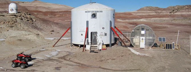
The Mars Desert Research Station, Hanksville, Utah; image courtesy of bandgirl807/Wikipedia.

I guess that’s what was really surprising to me, the first time I did it: how little it took to be transform your human experience and to really cause you to rethink what you have to do. Because everything is a gigantic pain in the butt. Everything you know is wrong. Everything you think in advance that you can cope with fails in the field. It is a humbling experience, and an antidote to hubris. I would like to take every engineer I know that works on space stuff—

Twilley: —and put them in Hanksville! [laughter]

Boston: Yes—seriously! I have sort of done that, by taking these loafer-wearing engineers—most of whom are not outdoorsy people in any way, who haunt the halls of MIT and have absorbed the universe as a built environment—out to something as simple as the lava tubes. I could not believe how hard it was for them. Lava tubes are not exactly rigorous caving. Most of these are walk-in, with only a little bit of scrambling, but you would have thought we’d just landed on Mars. It was amazing for some of them, how totally urban they are and how little experience they have of coping with a natural space. I was amazed.

I actually took a journalist out to a lava tube one time. I think this lady had never left her house before! There’s a little bit of a rigorous walk over the rocks—but it was as if she had never walked on anything that was not flat before.
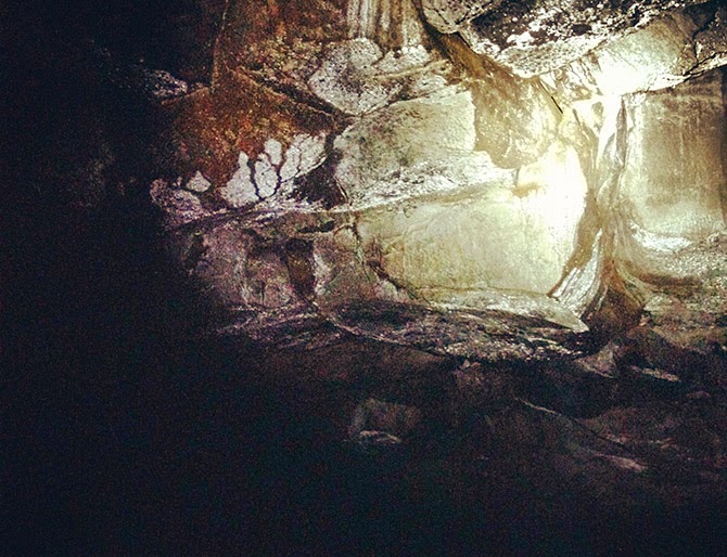
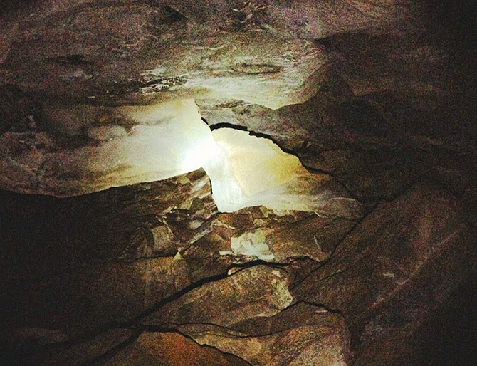
From Venue’s own visit to a lava tube outside Flagstaff, AZ.

It’s just amazing what one’s human experience does. This is why I think engineers should be forced to go out into nature and see if the systems they are designing can actually work. It’s one of the best ways for them to challenge their assumptions, and even to change the types of questions they might be asking in the first place.

(This interview was previously published on Venue).

Ghosts of Planets Past: An Interview with Ron Blakey

[Image: The west coast of North America as it appeared roughly 215 million years ago; map by Ron Blakey].
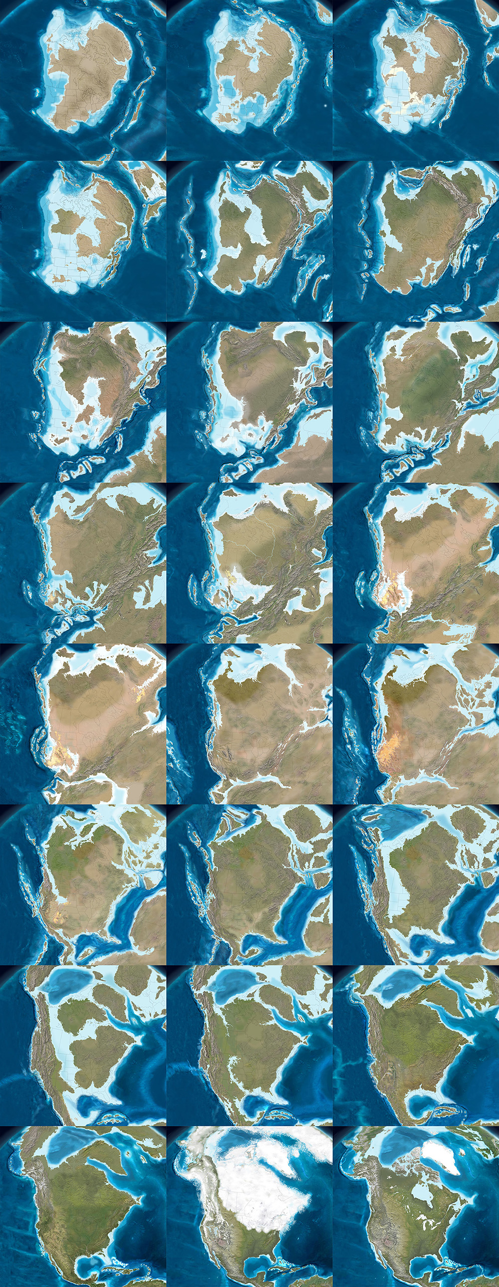
The paleo-tectonic maps of retired geologist Ronald Blakey are mesmerizing and impossible to forget once you’ve seen them. Catalogued on his website Colorado Plateau Geosystems, these maps show the world adrift, its landscapes breaking apart and reconnecting again in entirely new forms, where continents are as temporary as the island chains that regularly smash together to create them, on a timescale where even oceans that exist for tens of millions of years can disappear leaving only the subtlest of geological traces.

With a particular emphasis on North America and the U.S. Southwest—where Blakey still lives, in Flagstaff, Arizona—these visually engaging reconstructions of the Earth’s distant past show how dynamic a planet we live on, and imply yet more, unrecognizable changes ahead.

The following images come from Ron Blakey‘s maps of the paleotectonic evolution of North America. The first map shows the land 510 million years ago, progressing from there—reading left to right, top to bottom—through the accretion and dissolution of Pangaea into the most recent Ice Age and, in the final image, North America in its present-day configuration.


As part of BLDGBLOG’s collaborative side-project, Venue, Nicola Twilley and I met with Blakey in his Flagstaff home to talk about the tectonic processes that make and remake the surface of the Earth, the difficulty in representing these changes with both scientific accuracy and visual panache, and the specific satellite images and software tools he uses to create his unique brand of deep-time cartography.

Like film stills from a 600-million year-old blockbuster, Blakey’s maps take us back to the Precambrian—but there are much older eras still, stretching unmapped into far earlier continents and seas, and there are many more billions of years of continental evolution to come. Blakey talked us through some of the most complex changes in recent geological history, including the opening of the North Atlantic Ocean, and he allowed himself to speculate, albeit briefly, about where Earth’s continental crust might yet be headed (including a possible supercontinent in the Antarctic).

Many of Blakey’s maps are collected in the book Ancient Landscapes of the Colorado Plateau, written with Wayne Ranney, where Blakey also describes some of the research and methods that went into producing them. Blakey also contributed to the recent, new edition of a textbook by Wolfgang Frisch and Martin Meschede, Plate Tectonics: Continental Drift and Mountain Building, a thorough exploration of landscapes disassembling and colliding over vast spans of time.

• • •

[Image: The west coast of North America, depicted as it would have been 130 million years ago; the coast is a labyrinth of islands, lagoons, and peninsulas slowly colliding with the mainland to form the mountains and valleys we know today. Map by Ron Blakey].
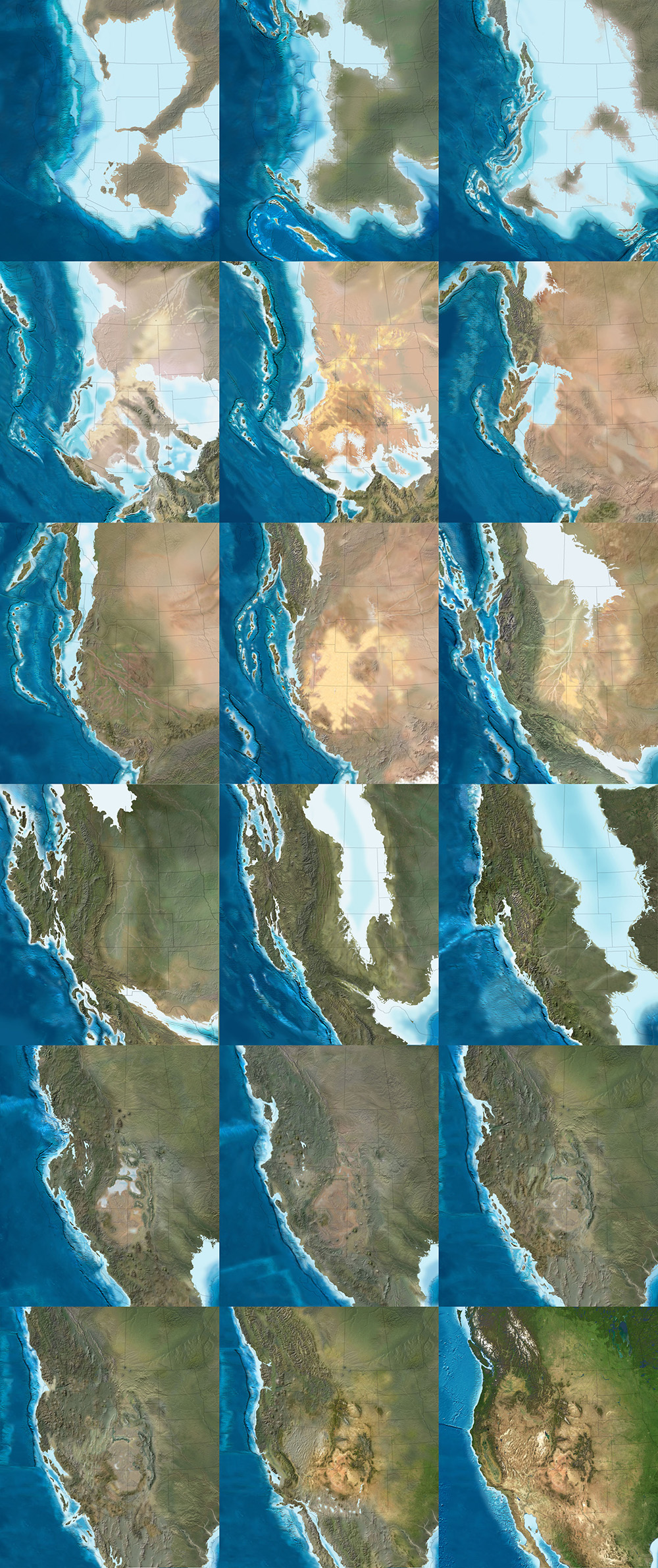
Geoff Manaugh: When I first discovered your maps showing the gradual tectonic re-location of the continents over hundreds of millions of years, I thought this was exactly what geologists should be doing: offering clear, step-by-step visual narratives of the evolution of the earth’s surface so that people can better understand the planet we live on. What inspired you to make the maps, and how did you first got started with them?

Ronald Blakey: Well, the very first maps I made were in conjunction with my doctoral thesis, back in the early 1970s. Those were made with pen and ink. I made sketches to show what the paleogeography would have looked like for the specific formation I was studying with my doctorate. Three or four of those maps went into the thesis, which was then published by the Utah Geologic Survey. I’ve also done a number of papers over the years where I’ve made sketches.

But I was late getting into the computer. Basically, during my graduate work I never used a computer for anything. I kind of resisted it, because, for the kind of work I was doing, I just didn’t see a need for it—I didn’t do quantifiable kinds of things. Then, of course, along comes email and the Internet. I actually forget when I first started with Photoshop—probably in the mid-1990s. When I found that, I just thought, wow: the power of this is incredible. I quickly learned how to use the cloning tool, so that I could clone modern topography onto ancient maps, and that made things even simpler yet.

Another thing I started doing was putting these maps into presentations. There were something like five different programs back there, in the late 90s, but the only one that survived was PowerPoint—which is too bad, because it was far from the best of the programs. I was using a program called Astound, which was far superior, particularly in the transitions between screens. I could do simple animations. I could make the tectonic plates move, create mountain belts, and so forth.

I retired in May of 2009, but all of my early maps are now online. With each generation of maps that I’ve done, there has been a noted improvement over earlier maps. I find new techniques and, when you work with Photoshop as much as I do, you learn new ideas and you find ways to make things that were a little clumsy look more smooth.

Manaugh: Where does the data come from?

Blakey: It comes from various publications. You can get a publication and have that PDF open, showing what something looked like in the past, and work from that. Usually, what I’m working from are fairly simple sketches published in the literature. They’ll show a subduction zone and a series of violent arcs, or a collision zone. What I do is take this information and make it more pictorial.

If you create a series of maps in sequence, you can create them in such a way that certain geologic events, from one time slice to the next, to the next, to the next, will blend. It depends a lot on the scale of what you’re trying to show—the whole world versus just four or five states in the West.

Now, throughout the years from, let’s say, 2004 until I retired in 2009, I kept improving the website. I envisioned most of this as educational material, and I didn’t pay much attention to who used it, how they used it, and so forth. But, then, shortly before I retired, various book companies and museums—and, most recently, oil companies—have approached me. So I started selling these and I tried very diligently not to allow this to overlap with what I was doing for my teaching and my research at the University.

In the following long sequence of images, we see the evolution of the west coast of North America, its state boundaries ghosted in for reference. Sea levels rise and fall; island chains emerge and collide; mountains form; inland seas proliferate and drain; and, eventually, modern day California, Vancouver Island, and the Baja peninsula take shape, among other recognizable features. The time frame represented by these images is approximately 500 million years. All maps by Ron Blakey.


Nicola Twilley: What do the oil companies want them for?

Blakey: They’re my biggest customers now. Usually, the geologists at oil companies are working with people who know either much less geology than they do or, in some cases, almost no geology at all, yet they’re trying to convince these people that this is where they need to explore, or this is what they need to do next.

They find these maps very useful to show what the Devonian of North Dakota looked like, for example, which is a hot spot right now with all the shales that they’re developing in the Williston Basin. What they like is that I show what the area might have really looked like. This helps, particularly with people who have only a modest understanding of geology, particularly the geologic past.

Manaugh: What have been some of the most difficult regions or geological eras to map?

Blakey: The most difficult thing to depict is back in the Paleozoic and the Mesozoic. Large areas of the continent were flooded, deep into the interior.

During certain periods, like the Ordovician, the Devonian, and parts of the Jurassic—especially the Cretaceous—as much as two-thirds of the continents were underwater. But they’re still continents; they’re still continental crusts. They’re not oceans. The sea level was just high enough, with respect to where the landscape was at the time, that the area was flooded. Of course, this is a concept that non-geologists really have problems with, because they don’t understand the processes of how continents get uplifted and subside and erode and so forth, but this is one of the concepts that my maps show quite nicely: the seas coming in and retreating.

But it’s very difficult—I mean, there is no modern analog for a seaway that stretched from the Mackenzie River Delta in Canada to the Gulf of Mexico and that was 400 miles wide. There’s nothing like that on Earth today. But the styles of mountains have not dramatically changed over the last probably two billion years—maybe even longer than that. I don’t go back that far—I tend to stick with the last 600 million years or so—but the styles of mountains haven’t changed. The nature of island arcs hasn’t changed, as far as we know.

What has changed is the amount of vegetation on the landscape. My maps that are in the early part of the Paleozoic—the Cambrian and the Ordovician early part of the Silurian—tend to be drab-colored. Then, in the late Silurian and in the Devonian, when the land plants developed, I start bringing vegetation colors in. I try to show the broad patterns of climate. Not in detail, of course—there’s a lot of controversy about certain paleoclimates. But, basically, paleoclimates follow the same kinds of regimens that the modern climates are following: where the oceans are, where the equator is, where the mountain ranges are, and so forth.

That means you can make broad predictions about what a paleoclimate would have been based on its relationship to the equator or based on the presence or absence of nearby mountains. I use these kinds of principles to show more arid areas versus more humid areas.

The next three sequences show the evolution of the Earth’s surface in reverse, from the present day to, at the very bottom, 600 million years ago, when nearly all of the planet’s landmasses were joined together in the Antarctic. The first sequence shows roughly 90 million years of backward evolution, the continents pulling apart from one another and beginning a slow drift south. They were mapped using the Mollweide projection, and, in all cases, are by Ron Blakey.


Twilley: And you paint the arid area based on a contemporary analog?

Blakey: Right. I know the modern world reasonably well and I’ll choose something today that might have matched the texture and aridity of that older landscape.

I use a program called GeoMapApp that gives me digital elevation maps for anywhere in the world. Most recently, they have coupled it with what they call the “Blue Marble.” NASA has stitched together a bunch of satellite photos of the world in such a way that you can’t tell where one series of photos come in or another. It’s a fairly true-color representation of what Earth would look like from space. So this Blue Marble is coupled with the GeoMapApp’s digital elevation topography; you put the Blue Marble over it, and you use a little slider to let the topography show through, and it gives you a fairly realistic looking picture of what you’re looking for.

For example, if I’m working with a mountain range in the southern Appalachians for a Devonian map—well, the southern Appalachians, during the Devonian, were probably far enough away from the equator that it was in the arid belt. There are some indications of that, as well—salt deposits in the Michigan Basin and in parts of New York and so forth. Plus, there are red-colored sediments, which don’t prove but tend to indicate arid environments. This combination tells me that this part of the world was fairly arid. So I’m going to places like modern Afghanistan, extreme western China, northern Turkey, or other places where there are somewhat arid climates with mountain belts today. Then I clone the mountains from there and put them in the map.

But you have to know the geologic background. You have to know how the mountains were formed, what the grain of the mountains was. That’s not always easy, although there are ways of doing it. To know the grain of the mountains, you need to know where the hinterland and the center of the mountains were. You need to know where the foreland area is, so that you can show the different styles of mountains. You have to move from foreland areas—which tends to be a series of parallel ridges, usually much lower than the hinterlands—to the center and beyond.

I use this kind of information to pick the right kind of modern mountain to put back in the Devonian, based on what that Devonian landscape probably had a good chance of looking like. Do we know for certain? Of course not. We weren’t around in the Devonian. But we have a good rock record and we have a lot of information; so we use that information and, then, voilà.

To give another example, let’s look at the Devonian period of the east coast. The big European continent that we call Baltica collided with Greenland and a series of micro-continents collided further south, all the way down at least as far as New Jersey, if not down as far the Carolinas. We know that there are places on Earth today where these same kinds of collisions are taking place—in the Alps and Mediterranean region, and the Caucasus region, and so forth.

We can use the concept that, if two plates are colliding today to produce the Caucasus mountains, and if we look at the style of mountains that the Caucasus are, then it’s reasonable to think that, where Greenland and Baltica collided in the Silurian and the Devonian, the mountains would have had a similar style. So we can map that.

This second sequence shows the continents drifting apart, in reverse, from 105 million years ago to 240 million years ago. They were mapped using the Mollweide projection, and, in all cases, are by Ron Blakey.


Manaugh: That collision alone—Baltica and Greenland—sounds like something that would be extremely difficult to map.

Blakey: Absolutely. And it’s not a one-to-one relationship. You have to look at the whole pattern of how the plates collided, how big the plates were, and so forth.

Then there’s the question of the different histories of particular plates. So, for example, most of Scotland started out as North America. Then, when all the continents collided to form Pangaea, the first collisions took place in the Silurian-Devonian and the final collisions took place in the Pennsylvanian-Permian. By, say, 250 million years ago, most of the continents were together. Then, when they started to split apart in the Triassic and Jurassic—especially in the Triassic and Cretaceous—the split occurred in such a way that what had been part of North America was actually captured, if you will, by Europe and taken over to become the British Isles.

Scotland and at least the northern half of Ireland were captured and began to drift with Europe. On the other hand, North America picked up Florida—which used to be part of Gondwana—and so forth.

One of the things that is interesting is the way that, when mountains come together and then finally break up, they usually don’t break up the same way that they came together. Sometimes they do, but it has to do with weaknesses, stress patterns, and things like this. Obviously, all time is extremely relative, but mountains don’t last that long. A given mountain range that’s been formed by a simple collision—not that there’s any such thing as a simple collision—once that collision is over with, 40 or 50 million years after that event, there is only low-lying landscape. It may have even have split apart already into a new ocean basin.

But here’s the important part: the structure that was created by that collision is still there, even though the mountains have been worn down. It’s like when you cut a piece of wood: the grain is still inherited from when that tree grew. The pattern of the grain still shows where the branches were, and the direction of the tree’s growth in response to wind and sun and its neighbors. You can’t reconstruct the tree exactly from its grain, but, if you’re an expert with wood, you should be able to look and say: here are the tree rings, and here’s a year where the tree grew fast, here’s a year where the tree grew slow, here’s where the tree grew branches, etc.

In a sense, as geologists, we’re doing the same things with rock structure. We can tell by the pattern of how the rocks are deformed which direction the forces came from. With mountains, you can tell the angle at which the plates collided. It’s usually very oblique. What that tends to do is complicate the geologic structure, because you not only get things moving one way, but you get things dragging the other way, as well. But we can usually tell the angle at which the plates hit.

Then, in many cases, based upon the nature of how the crust has been deformed and stacked up, we can tell the severity of the mountain range. It doesn’t necessarily mean that we can say: oh, this structure would have been a twenty-thousand-foot high mountain range. It’s not that simple at all, not least of which because rocks can deform pretty severely without making towering mountains.

This final of the three global sequences shows the continents drifting apart, in reverse, from 260 million years ago to 600 million years ago. There was still nearly 4 billion years of tectonic evolution prior to where these maps begin. They were mapped using the Mollweide projection, and, in all cases, are by Ron Blakey.


Manaugh: Are you able to project these same tectonic movements and geological processes into the future and show what the earth might look like in, say, 250 million years?

Blakey: I’ve had a number of people ask me about that, so I did make some global maps. I think I made six of them at about 50-million-year intervals. For the fifteen to 100-million-year range, I think you can say they are fairly realistic. But, once you get much past 75 to 100 million years, it starts to get really, really speculative. The plates do strange things. I’ll give you just a couple of quick examples.

The Atlantic Ocean opened in the beginning of the Jurassic. The actual opening probably started off the coasts of roughly what is now Connecticut down to the Carolinas. That’s where the first opening started. So the central part of the Atlantic was the first part to open up. It opened up reasonably simply—but, again, I’m using the word simple with caution here.

The north Atlantic, meanwhile, didn’t open up until about 60 to 50 million years ago. When it opened up, it did a bunch of strange things. The first opening took place between Britain and an offshore bank that’s mostly submerged, called Rockall. Rockall is out in the Atlantic Ocean, northwest of Ireland—near Iceland—but it’s continental crust. That splitting process went on for, let’s say, ten million years or so—I’m just going to talk in broad terms—as the ocean started opening up.

Then the whole thing jumped. A second opening began over between Greenland and North America, as Greenland and North America began to separate off. That lasted for a good 40 or 50 million years. That’s where you now get the Labrador Sea; that is actual ocean crust. So that was the Atlantic Ocean for thirty or forty million years—but then it jumped again, this time over between Greenland and what is now the west coast of Europe. It started opening up over there, before it jumped yet again. There’s an island in the middle of the North Atlantic, way the heck up there, called Jan Mayen. At one time, it was actually part of Greenland. The Atlantic opened between it and Greenland and then shifted to the other side and made its final opening.

The following two sequences show the evolution of Europe from an Antarctic archipelago to a tropical island chain to the present day Europe we know and recognize. The first sequence starts roughly 450 million years ago and continues to the Jurassic, 200 million years ago. All maps by Ron Blakey.


So it’s very complicated. And that’s just the Atlantic Ocean.

The Northern Atlantic took at least five different paths before the final path was established, and it’s all still changing. In fact, the south Atlantic is actually even worse; it’s an even bigger mess. You’ve got multiple openings between southwest Africa and Argentina, plus Antarctica was up in there before it pulled away to the south.

These complications are what makes this stuff so interesting. If we look at events that we can understand pretty well over the last, let’s say, 150 or 200 million years of time—where we have a good indication of where the oceans were because we still have ocean crusts of that age—then we can extrapolate from that back to past times when oceans were created and destroyed. We can follow the rules that are going on today to see all of the oddities and the exceptions and so forth.

These are the kinds of things I try to keep track of when I’m making these maps. I’m always asking: what do we know? Was it a simple pull-apart process? There are examples where continents started to split across from one another, then came back together, then re-split in a different spot later on. That’s not just speculation—there is geologic evidence for this in the rock record.

So, when it comes to extrapolating future geologies, things become very complicated very quickly. If you start thinking about the behavior of the north Atlantic, creating a projection based on what’s going on today seems, at first, like a fairly simple chore. North America is going on a northwesterly path at only one or two centimeters a year. Europe is moving away, at almost a right angle, at about another centimeter a year. So the Atlantic is only opening at three centimeters a year; it’s one of the slowest-opening oceans right now.

OK, fine—but what else is happening? The Caribbean is pushing up into the Atlantic and, off South America, there is the Scotia Arc. Both of those are growing. They’ve also identified what looks like a new island arc off the western Mediterranean region; that eventually would start to close the Atlantic in that area. Now you start to speculate: well, these arcs will start to grow, and they’ll start to eat into the oceans, and subduct the crusts, and so forth.

Again, for the first 50, 75, or even 100 million years, you can say that these particular movements are fairly likely. But, once you get past that, you can still use geologic principles, but you’re just speculating as to which way the continents are going to go.

For instance, the one continent that does not seem to be moving at all right now, relative to anything else, is Antarctica. It seems to be really fixed on the South Pole. That’s why some people think that everything will actually coagulate back towards the South Pole. However, there are also a bunch of subduction zones today along southern Asia, and those are pretty strong subduction zones. Those are the ones that created the big tsunami, and all the earthquakes off of Indonesia and so forth. Eventually, those could pull either parts of Antarctica or all of Antarctica up toward them.

But I’m more interested in reconstructing the past than I am the future, so I’ve only played around with those five or six maps.

This second sequence, showing the next phase in the evolution of Europe, begins approximately 150 million years ago and extends to the present day. All maps by Ron Blakey.


Manaugh: To ground things a bit, we’re having this conversation in Flagstaff, on the Colorado Plateau, which seems like a great place to teach geology. I wonder whether there might be another Colorado Plateau, so to speak, elsewhere in the world—something geologically similar to the extraordinary landscapes we see here that just hasn’t had the chance to emerge. Maybe the tectonics aren’t right, and it’s still just a crack, rather than a canyon, or maybe it’s covered in vegetation or ice so we can’t see it yet. Conversely, I’m curious if you might have found evidence of other great geological districts in the earth’s past—lost Grand Canyons, other Arches National Parks—that have been lost to time. How could we detect those, and where are they?

Blakey: This is indeed a great place to teach geology. It’s a great place to live.

As for Colorado Plateau analogs—it’s an interesting question. There’s an area in South America that I’d say is fairly similar. It’s got a couple of famous national parks that I can’t remember the name of. It’s a smaller version, but it’s very similar to the Colorado Plateau. It’s between the Andes and the Amazon basin, part of the general pampas region there of South America. It even has similarly aged rocks. Parts of northern Africa would also be similar.

But you have to look at all the characteristics of the Plateau. Number one: the rocks are flat. Number two: the rocks have been uplifted. Number three: the rocks are dissected by a major river system. Number four: it’s a semi-arid climate. There are probably five or six defining characteristics in total, and I’ve heard many people say that there is no other place else on Earth that has all those characteristics in exactly the same way. But I went to an area in eastern Mauritania many years ago, where, for all the world, it looked like the Grand Canyon. It wasn’t as colorful, but it was a big, deep canyon.

In fact, the Appalachian Plateau would be somewhat similar, except it’s in a humid climate, which means the land has been shaped and formed differently. But the Appalachian plateau has flat-lying rocks; it’s dissected by some major rivers; it’s experienced uplift; and so forth.

The next two sequences of images, followed from left to right, top to bottom, illustrate the gradual evolution of the Colorado Plateau, where, in its modern day incarnation, this interview with Ron Blakey took place (specifically, in Flagstaff, Arizona. The earliest map included here depicts the Proterozoic; the first sequence ends in the Triassic. All maps by Ron Blakey.


Twilley: I’m interested in the representational challenges you face when you decide to make a map, and, specifically, when you’re in Photoshop, what your most-used tools might be. I thought it was fascinating when you said that the cloning tool really changed how you make geological maps. What other techniques are important to you, in order to represent geological histories?

Blakey: Oh, the cloning tool is the most important, by far—at least when I’m actually painting. Of course, I use the outline tool to select areas, but, when I’m actually painting, it would be impossible to paint these different maps pixel by pixel. I couldn’t do it. Occasionally, I will actually hand-draw some things in the flatlands, where I want to put a river system, for example, but, at least for mountains and rugged terrain, I clone everything.

Some times, I’ll cut and paste. I’ll select an area in the GeoMapApp, I save it as a JPEG, and then I can select it and copy it and paste it in, and I can rotate and deform it a little bit. Are you familiar with the warp tool in Photoshop? I use that a lot, because you can change the shape of mountains a little. If you do it too dramatically, it really looks flaky. But, if you do it right, it still looks pretty realistic.

This second sequence, also showing the evolution of the Colorado Plateau, begins with the Triassic and ends roughly 5 million years ago—basically the present day, in geological terms. All maps by Ron Blakey.


Twilley: And do you have certain filters you rely on for particular geological effects?

Blakey: A little bit. I like to use the craquelure filter. It actually gives you little bumps and valleys and so forth. I use that especially for continental margins. Continental margins are anything but regular slopes, going down to the abyssal depths. They’re very irregular. There are landslides and all kinds of things going on there at the margins, so I add a little texture with craquelure.

It can be difficult to use, though, and it doesn’t work at really high resolutions—so, what I actually have to do some times, is that I will actually copy a part of my map, take it out, make it smaller, do the craquelure on it, and then blow it back up and paste it in again.

[Image: A painting by Ron Blakey depicts a geological landscape near Sedona, Arizona].

Dee Blakey, Ron’s Wife: I think the other reason that he can do what he does is that he paints. That’s one of his paintings over there. [gestures above fireplace]

Blakey: Well, I guess I should have said that right away, when you asked me why I got interested in this, because I am interested in the artistic aspect of geology. The artistic aspect of science, in general, but especially geology. Astronomy, for example, would be another field where artistic visualizations are useful—any time you’re trying to show things that can’t easily be visualized with something comparable here on present-day planet Earth, you have to use an artistic interpretation.

Anyway, I can’t explain it, but I understand color pretty well. I use the hue saturation tool a lot. I’ll select an area and then I’ll feather it, let’s say, because you don’t want the edges to be sharp. I’ll feather it by thirty, forty, fifty pixels. Then I’ll take the slider for hue saturation, where, if you go to the left, you make things redder and, if you go to the right, you make things greener. If I’ve got a landscape that looks a little too humid, I’ll just slide it slightly to the left to make it a bit redder. You can also change the lightness and darkness when you do that. There’s also regular saturation. By killing the saturation, you can really kill the nature of a landscape quite a bit.

And I use hue saturation a lot. That took me a long time to master, because it’s really easy to screw things up with that tool. You start sliding things a little too far and, whoa—wait a minute! All of a sudden, you’ve got purple mountains.

• • •

For more Venue interviews, be sure to stop by the Venue website.