Potsdamer Sea

[Image: From Kiessling’s Grosser Verkehrs-Plan von Berlin (1920).]

It’s funny to be back in Berlin, a city where I once thought I’d spend the rest of my life, first arriving here as a backpacker in 1998 and temporarily moving in with a woman 14 years older than me, who practiced Kabbalah and had twin dogs and who, when seeing that I had bought myself a portable typewriter because I was going through a William Burroughs phase, blessed it one night in her apartment near the synagogue in a ceremony with some sort of bronze sword. It’s almost literally unbelievable how long ago that was. More years have passed since I spent time in Berlin—supposedly to study German for grad school, but in reality organized entirely around going to Tresor—than I had been alive at the time.

Because I’m here again on a reporting trip, I was speaking yesterday evening with a former geophysicist who, when the Berlin Wall came down, found work doing site-remediation studies and heritage-mapping projects on land beneath the old path of the Wall. He was tasked with looking for environmental damage and unexploded ordnance, but also for older foundations and lost buildings, earlier versions of Berlin that might pose a structural threat to the city’s future or that needed to be recorded for cultural posterity.

Ironically, in a phase of my life I rarely think about, I wrote my graduate thesis on almost exactly this topic, focused specifically on Potsdamer Platz—once divided by the Wall—and the role of architectural drawings in communicating historical context. When I was first here, in 1998 into early 1999, Potsdamer Platz was still a titanic hole in the ground, an abyss flooded with groundwater, melted snow, and rain, a kind of maelström you could walk over on pedestrian bridges, where engineering firms were busy stabilizing the earth for what would become today’s corporate office parks.

As I told the former geophysicist last night, I remember hearing at the time that there were people down there, SCUBA diving in the floodwaters, performing geotechnical studies or welding rebar or looking for WWII bombs, I had no idea, but, whatever it was, their very existence took on an outsized imaginative role in my experience of the city. Berlin, destroyed by war, divided by architecture, where people SCUBA dive through an artificial sea at its broken center. It felt like a mandala, a cosmic diagram, with this inverted Mt. Meru at its heart, not an infinite mountain but a bottomless pit.

What was so interesting to me about Berlin at the time was that it felt like a triple-exposure photograph, the city’s future overlaid atop everything else in a Piranesian haze of unbuilt architecture, whole neighborhoods yet to be constructed, everything still possible, out of focus somehow. It was incoherent in an exhilaratingly literal sense. In Potsdamer Platz, what you thought was the surface of the Earth was actually a bridge; you were not standing on the Earth at all, or at least not on earth. It was the Anthropocene in miniature, a kind of masquerade, architecture pretending to be geology.

The more that was built, however, the more Berlin seemed to lose this inchoate appeal. The only people with the power to control the rebuilding process seemed to be automobile consortiums and international hotel groups, office-strategy consultants not wizards and ghosts or backpacking writers. Perhaps the city still feels like that to other people now—unfinished, splintered, jagged in a temporal sense, excitingly so, a city with its future still taking shape in the waves of an underground sea—but it seems to me that Berlin’s blur has been misfocused.

In any case, with the caveat that I am in Berlin this week for a very specific research project, so many people I’ve met have pointed to the fall of the Wall as an explosive moment for geophysical surveys in the East. Engineers were hired by the dozen to map, scan, and survey damaged ground left behind by a collapsed imperialist Empire, and the residues of history, its chemical spills and lost foundations, its military bunkers and archaeological remains, needed to be recorded. The ground itself was a subject of study, an historical medium. On top of that, new freeways were being built and expanded, heading east into Poland—and this, too, required geophysical surveys. The future of the region was, briefly, accessible only after looking down. The gateway to the future was terrestrial, a question of gravel and sand, forgotten basements and fallen walls.

The SCUBA divers of the Potsdamer Sea now feel like mascots of that time, dream figures submerged in the waves of a future their work enabled, swimming through historical murk with limited visibility and, air tanks draining, limited time. Their pit was soon filled, the hole annihilated, and the surface of the Earth—which was actually architecture—returned with amnesia.

The Surface of a Terrestrial Sea

[Image: A sinkhole in Wink, Texas, surrounded by oil extraction and wastewater injection infrastructure].

A story I meant to include in my link round-up yesterday is this news item about a “large swath” of active oil well sites in Texas “heaving and sinking at alarming rates.”

In other words, previously solid ground has been turned into a slow-moving terrestrial sea.

“Radar satellite images show significant movement of the ground across a 4000-square-mile area—in one place as much as 40 inches over the past two-and-a-half years,” Phys.org reports. The land is tidal, surging and rolling with artificially induced deformation.

“This region of Texas has been punctured like a pin cushion with oil wells and injection wells since the 1940s and our findings associate that activity with ground movement,” one of the researchers explains.

[Image: Infrastructure near Wink, Texas].

What’s particularly fascinating about this is why it’s alleged to be happening in the first place: a jumbled, chaotic, quasi-architectural mess of boreholes, abandoned pipework, and other artificial pores has begun churning beneath the surface of things and causing slow-motion land collapse.

For example, “The rapid sinking is most likely caused by water leaking through abandoned wells into the Salado formation and dissolving salt layers, threatening possible ground collapse.” Or a nearby region “where significant subsidence from fresh water flowing through cracked well casings, corroded steel pipes and unplugged abandoned wells has been widely reported.”

This utterly weird, anthropocenic assemblage—or should I say anthroposcenic—has also changed the terrain in other ways. Water leaking into an underground salt formation has “created voids,” for example, which have “caused the ground to sink and water to rise from the subsurface, including creating Boehmer Lake, which didn’t exist before 2003.” It’s like upward-falling rain.

The site brings to mind the work of Lebbeus Woods: jammed-up subterranean infrastructure, in a sprawling knot of abandoned and semi-functional machinery, causing the solid earth to behave more like the sea.

Read more at Phys.org.

Logan

[Image: Philadelphia’s Logan neighborhood, via Google Maps].

On a work trip to Philadelphia last week, I learned about the city’s semi-evacuated Logan neighborhood. As you can see in the satellite view, above, a huge swath of the neighborhood was emptied of its residents, their buildings torn down—because the ground there is not really ground at all, but “an unstable foundation of cinder and ash on a creek bed.”

As the New York Times reported back in 1989, “row houses listed at angry angles, sidewalks were crumbled and the ground seemed no more steady than the nerves of the residents… The houses are sinking, officials say, because the soil is shifting.”

“Some parts of vacant houses, like front porches or walls, have collapsed on their own,” we read, as if the neighborhood had become a slow, gridded sea of unspectacular but relentless subterranean motion. Some houses took on the form of scuttled ships: “Some sag. Some list. Some lean into each other, Corinthian columns askew. One front porch juts upward, like the prow of a galleon. In some homes, the tilt is so bad it looks as if dishes would slide off the dinner table.”

[Image: The empty streets of Logan, via Google Street View].

Unsurprisingly, the results were often nightmarish. Houses were “constantly flooded by raw sewage” from leaking pipes. Gas lines exploded. Or this, also from the New York Times:

Elizabeth Stone, a secretary who has lived in Logan for 15 years with her husband and three children, said she moved her washing machine from the basement to her kitchen because the basement floor was caving in. Her dryer is still down there, but she will not go in the basement because she is afraid the floor will collapse. Besides, she said, there are rats down there and there seem to be more of them in the neighborhood because of shifting foundations.

Perhaps the most evocative description, however, comes from a 2010 entry on the blog Philadelphia Neighborhoods.

A lone medical facility, run by Dr. Donald Turner, was never moved, receiving no help or financial aid from the city, which claimed it was somehow more stable than literally every other building around it. This, despite the fact that the ground has visibly buckled and the evacuated neighborhood around it became a magnet for crime.

In the late 1980s, when the removal of the houses commenced, [Dr. Turner’s] building was spared. “My building should have been one of the first to go,” he says. Houses sat directly next to and across the street from his office. “This whole street was houses!” he exclaims, pointing to a cement path that now sinks into an empty field.

As residents were moved out, the houses were left vacant and became hot spots for criminal mischief. When they were eventually torn down, things got even worse. Turner’s office fell victim to numerous crimes. “People have drilled through the ceiling and climbed in through the back window,” he explains, “they want pills, once one of them had a gun.”

Dr. Turner thus put up a rather apocalyptic sign proclaiming, “Mayor Goode Thought My White Friends Would Help Me.”

The real kicker, however, is this: “‘One time a cancer patient fell in a sinkhole,’ says Turner, ‘I thought they’d shut me down for sure.’”

They did not. The building, incredibly, is apparently still there.

Shocked to discover “they were living in ‘hill country’”

MysteriousUpswelling[Image: “Mysterious upswelling of Opp street above curb, Wilmington (1946),” courtesy USC Libraries].

In 1946, a “mysterious upswelling” occurred in a street in the neighborhood of Wilmington, California, near Long Beach. The photograph above, courtesy of the USC Libraries, pictures a young boy who went outside to measure it.

As part of an irregular series of short posts for KCET’s Lost L.A.—about things like Los Angeles partially illuminated by the light of an atomic bomb—I wrote a quick piece, inspired both by the photo itself and by its caption. “Surprising uprising,” it begins. “George Applegate measures mysterious swelling of Opp Street in Wilmington. Residents were shocked yesterday morning to discover they were living in ‘hill country.’ Street is seven inches above the curbing. Officials are investigating.”

Although I don’t mention this in the KCET post, I was instantly reminded of terrain deformation grenades and the instant, pop-up landforms of an old LucasArts game called Fracture. There, specialized weapons are put to use, tactically reshaping the earth’s surface, resulting in “mysterious upswellings” such as these.

There could be hills anywhere in Los Angeles, we might infer from this, lying in wait beneath our streets and sidewalks, prepping themselves for imminent exposure,” I write over at KCET. “A street today is a mountain tomorrow.”

(Also related: The previous post, Inland Sea).

Rootstocks and Rhizotrons

Edible Geography explores the exhumation of whole trees in a new post called “Rootstock Archaeology.” Don’t miss the incredible rhizotron, “an underground corridor whose walls consist of forty-eight shuttered windows, which researchers can open to peer out onto the root systems of adjacent trees and plants.”

Village Design as Magnetic Storage Media

[Image: “Magnetic Field” by Berenice Abbott, from The Science Pictures (1958-1961)].

An interesting new paper suggests that the ritual practice of burning parts of villages to the ground in southern Africa had an unanticipated side-effect: resetting the ground’s magnetic data storage potential.

As a University of Rochester press release explains, the “villages were cleansed by burning down huts and grain bins. The burning clay floors reached a temperature in excess of 1000ºC, hot enough to erase the magnetic information stored in the magnetite and create a new record of the magnetic field strength and direction at the time of the burning.”

What this meant was that scientists could then study how the Earth’s magnetic field had changed over centuries by comparing more recent, post-fire alignments of magnetite in the ground beneath these charred building sites with older, pre-fire clay surrounding the villages.

The ground, then, is actually an archive of the Earth’s magnetic field.

If you picture this from above—perhaps illustrated as a map or floor plan—you can imagine seeing the footprint of the village itself, with little huts, buildings, and grain bins appearing simply as the outlines of open shapes.

However, within these shapes, like little windows in the surface of the planet, new magnetic alignments would begin to appear over decades as minerals in the ground slowly re-orient themselves with longterm shifts in the Earth’s magnetic field, like differently tiled geometries contrasting with the ground around them.

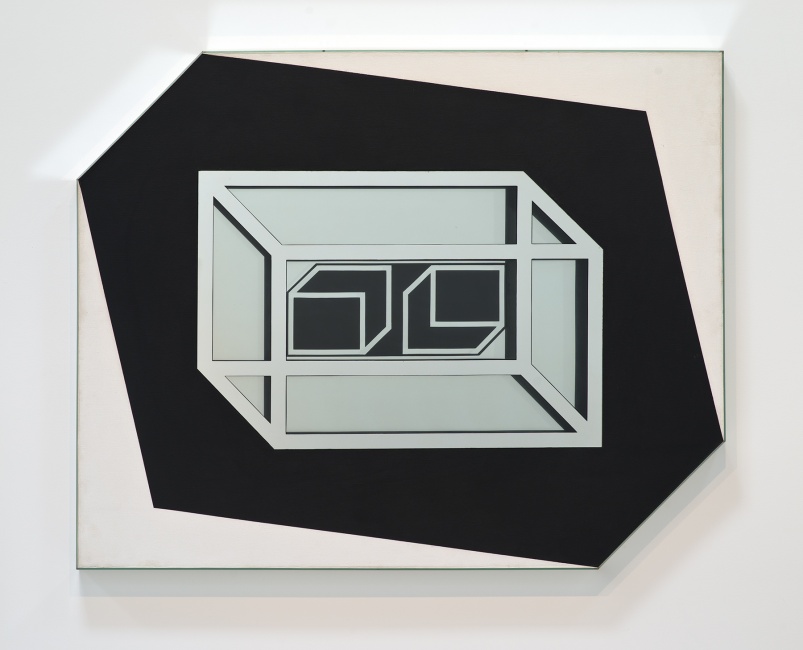
[Image: “Untitled” by Larry Bell (1962), via the L.A. Times].

What really blows me away here, though, is the much more abstract idea that the ground itself is a kind of reformattable magnetic data storage system. It can be reformatted and overwritten, its data wiped like a terrestrial harddrive.

While this obviously brings to mind the notion of the planetary harddrive we explored a few years ago—for what it’s worth, one of my favorite posts here—it also suggests something quite strange, which is that landscape architecture (that is, the tactical and aesthetic redesign of terrain) and strategies of data management (archiving, cryptography, inscription) might someday go hand in hand.

(Via Archaeology).

Extreme agricultural statuary

[Image: “Endothelium” by Philip Beesley & Hayley Isaacs].

I mentioned a recent issue of Mark Magazine the other day, but I deliberately saved one of the articles for a stand-alone post later on. That article was a long profile of the work of Philip Beesley, a Toronto-based architect and sculptor, whose project the “Implant Matrix” BLDGBLOG covered several years ago.

In issue #21 of Mark, author Terri Peters describes several of Beesley’s projects, but it’s the “Endothelium” that really stood out (and that you see pictured here).

[Image: “Endothelium” by Philip Beesley & Hayley Isaacs].

Peters refers to Beesley’s work as a “lightweight landscape of moving, licking, breathing and swallowing geotextile mesh” – a kind of pornography of ornament, or the Baroque by way of David Cronenberg. “Inspired by coral reefs,” she continues, “with their cycles of opening, clamping, filtering and digesting,” Beesley’s biomechanical sculpture-spaces are “immersive theatre environments” in which “wheezing air pumps create an environment with no clear beginning or end.”

I’m reminded of the penultimate scene in James Cameron’s film Aliens, when Ripley (Sigourney Weaver) meets the alien “queen.” The queen is laying eggs, we see, through a gigantic, semi-prosthetic, peristaltically-powered external ovarian sac – and the scene exemplifies the encounter with the grotesque in all its H.R. Giger-influenced, sci-fi extremes. Put another way, if organisms, too – not just buildings – can reach a point of ornamental excess, then James Cameron’s aliens are perhaps exhibit number one.

[Images: Screen grabs from James Cameron’s Aliens].

In any case, Beesley’s work is a fascinating hybrid of advanced textile design, geostructural modeling, and rogue biology experiment. Peters’s descriptions of the “Endothelium” are worth quoting at length:

[The structure consists of] a field of organic “bladders” that are self-powered and that move very slowly, self-burrowing, self-fertilizing and are linked by 3D printed joints and thin bamboo scaffolding. The bladders are powered using mobile phone vibrators and have LED lights. It works by using tiny gel packs of yeast which burst and fertilize the geotextile.

This latter detail – “using tiny gel packs of yeast which burst and fertilize the geotextile” – brings to mind something at the intersection of an improvised explosive device (or IED) and a green roof: you hire Philip Beesley to design a landscape-machine for installation atop a new building downtown, and, over the course of many decades, it vibrates, yeast-bursts, rotates, crawls, and grows through extraordinary cycles of grotesque architectural fertility. A solar-powered landscape of mold and microroots, generating its own soil. Within a few years, the original sculpture it all came from is gone, archaeologically undetectable beneath the vitality of the forms that have consumed it.

One wonders what Philip Beesley would think of the mushroom tunnel of Mittagong.

[Images: “Endothelium” by Philip Beesley & Hayley Isaacs].

Elsewhere in the article, Peters writes:

Endothelium is an automated geotextile, a lightweight and sculptural field housing arrays of organic batteries within a lattice system that might reinforce new growth. It uses a dense series of thin “whiskers” and burrowing leg mechanisms to support low-power miniature lights, pulsing and shifting in slight increments. Within this distributed matrix, microbial growth is fostered by enriched seed-patches housed within nest-like forms, sheltered beneath the main lattice units.

I’m a bit rhetorically stuck on “between” statements, I’m afraid, but it’s as if Beesley’s work falls somewhere between a loaf of sourdough bread and a sculpture by Jean Tinguely.

[Image: “Endothelium” by Philip Beesley & Hayley Isaacs].

I’m curious, meanwhile, if you could bury a Philip Beesley sculpture in the woods of rural England somewhere, and allowed it to articulate new ecosystems slowly, over the cyclic course of generations. In fact, I’m reminded of an article in the New York Times last week, spotted via mammoth, in which we learn that two abandoned landfills in Brooklyn have since been used as unlikely foundations for new ecosystems:

In a $200 million project, the city’s Department of Environmental Protection covered the Fountain Avenue Landfill and the neighboring Pennsylvania Avenue Landfill with a layer of plastic, then put down clean soil and planted 33,000 trees and shrubs at the two sites. The result is 400 acres of nature preserve, restoring native habitats that disappeared from New York City long ago.

“Once the plants take hold,” the article adds, “nature will be allowed to take its course, evolving the land into microclimates.” But what if those weren’t landfills down there but sculptures by Philip Beesley? Strategically sown seed-patches and gel packs of yeast wait underground for new roots to rediscover them.

It’s living geostatuary, buried beneath the surface of the earth – a kind of extreme agriculture, with soil-preparation by Philip Beesley.

[Images: “Endothelium” by Philip Beesley & Hayley Isaacs].

I’d genuinely like to see what Beesley might do if he was hired by, say, a NASA R&D program dedicated to terraforming other planets. Could you fly a modular, self-unfolding Philip Beesley sculpture into the depths of radiative space, land it on a planet somewhere, and watch as revolting pools of bacteriological mucus begin to coagulate and form new fungi?

Beesley’s whiskered vibrators begin to shiver with signs of piezoelectric life, as small crystals surrounded by radio transmitters and genetically engineerined space-seed-patches imperceptibly tremble, evolving into mutation-prone “organic batteries” unprotected beneath starlight. Give it a thousand years, and vast infected forests, the width of continents, take hold.

You’ve colonized a distant planet through architecture and yeast.

For more, check out Mark Magazine‘s issue #21. Beesley’s also got a book out, called Hylozoic Soil, that I would love to read.

Planet Harddrive

[Image: “Conceptual diagram of satellite triangulation,” courtesy of the Office of NOAA Corps Operations (ONCO)].

I’ve long been fascinated by what I might call the geological nature of harddrives – how certain mineral arrangements of metal and ferromagnetism result in our technological ability to store memories, save information, and leave previous versions of the present behind.

A harddrive would thus be a geological object as much as it is a technical one: a content-rich, heavily processed re-configuration of the earth’s surface.

[Image: Geometry in the sky. “Diagram showing conceptual photographs of how satellite versus star background would appear from three different locations on the surface of the earth,” courtesy of the Office of NOAA Corps Operations (ONCO)].

Perhaps someday we won’t need harddrives at all: we’ll simply use geology itself. In other words, what if we could manipulate the earth’s own magnetic field and thus program data into the natural energy curtains of the planet?

The earth would become a kind of spherical harddrive, with information stored in those moving webs of magnetic energy that both surround and penetrate its surface.

This extends yet further into an idea that perhaps whole planets out there, turning in space, are actually the harddrives of an intelligent species we otherwise have yet to encounter – like mnemonic Death Stars, they are spherical data-storage facilities made of content-rich bedrock – or, perhaps more interestingly, we might even yet discover, in some weird version of the future directed by James Cameron from a screenplay by Jules Verne, that the earth itself is already encoded with someone else’s data, and that, down there in crustal formations of rock, crystalline archives shimmer.

I’m reminded of a line from William S. Burroughs’s novel The Ticket That Exploded, in which we read that beneath all of this, hidden in the surface of the earth, is “a vast mineral consciousness near absolute zero thinking in slow formations of crystal.”

[Image: “An IBM HDD head resting on a disk platter,” courtesy of Wikipedia].

In any case, this all came to mind again last night when I saw an article in New Scientist about how 3D holograms might revolutionize data storage. One hologram-encoded DVD, for instance, could hold an incredible 1000GB of information.

So how would these 3D holograms be formed?

“A pair of laser beams is used to write data into discs of light-sensitive plastic, with both aiming at the same spot,” the article explains. “One beam shines continuously, while the other pulses on and off to encode patches that represent digital 0s and 1s.”

The question, then, would be whether or not you could build a geotechnical version of this, some vast and slow-moving machine – manufactured by Komatsu – that moves over exposed faces of bedrock and “encodes” that geological formation with data. You would use it to inscribe information into the planet.

To use a cheap pun, you could store terrabytes of information.

But it’d be like some new form of plowing in which the furrows you produce are not for seeds but for data. An entirely new landscape design process results: a fragment of the earth formatted to store encrypted files.

Data gardens.

They can even be read by satellite.

[Image: The “worldwide satellite triangulation camera station network,” courtesy of NOAA’s Geodesy Collection].

Like something out of H.P. Lovecraft – or the most unhinged imaginations of early European explorers – future humans will look down uneasily at the earth they walk upon, knowing that vast holograms span that rocky darkness, spun like inexplicable cobwebs through the planet.

Beneath a massive stretch of rock in the remotest state-owned corner of Nevada, top secret government holograms await their future decryption.

The planet thus becomes an archive.

(Earlier on BLDGBLOG: Geomagnetic Harddrive).

Geotechnics

Direct intervention into the earth’s surface through technology – the coupling of the planet with technological objects – could be phrased as ‘geotechnical,’ a word I thought I invented – until I discovered that ‘geotechnics’ is already a long-standing professional concern of engineers and architects. Gone was the whiz-bang neologism, but born was an intense curiosity in what ‘geotechnical engineers’ actually do.
Unforeseen ground conditions. Reuse of old foundations. Ground investigation. Geological voids. Borehole geophysics. ‘Geo Frontiers 2005’. Ground engineering, which includes ‘international geotechnical events’ and ‘covers all aspects of the engineering of the ground’.
The vocabulary alone justifies awe. Where else can you read: ‘Sui Field compression project: the tectonic structure of Northern Pakistan’, and take it seriously?
Geosynthetics!
Ground improvement!
‘The geotechnics of contaminated land’!
Applied geology.
My enthusiasm coming here not from some pre-adolescent obsession with digging machines, but from the black-out inducing intellectual high of outright planetary engineering, a geosynthetic *Wunderproject*, where remote-sensing meets hydrological engineering, geotextiles, ground improvement, and mega-scale, antigravitational, interstellar industrial machines hovering 350 miles above the dark, unfinished surface of a geoengineered planet.
‘The engineering of the ground’!
After geotechnics, the whole planet could be already artificial, bearing marks of human intervention. To find in a moment of ultra-fast zoom-out cello-soundtracked awe that the earth you’re standing on is always, already, everywhere a huge Mt. Rushmore, a man-made, artificial, technological, geotechnic project.
A hollow earth, a geosynthetic planet. Sculpted from geotextiles.
Landscape architecture taken to the megalomaniacal extreme. And funded by multinational petroleum companies.