Fault Lines/Point Clouds

[Image: Otherwise unrelated satellite view of the Pyramid Lake Fault (diagonal line from top left to bottom right), via Google Maps].

As a quick update to the Walker Lane post, there are some Walker Lane fault system LiDAR data sets available for download, if you’re able to play around with that sort of thing.

Geofencing and Investigatory Datasheds

There’s a lot to write about “geofencing” as a law enforcement practice, but, for now, I’ll just link to this piece in the New York Times about the use of device-tracking in criminal investigations.

There, we read about something called Sensorvault: “Sensorvault, according to Google employees, includes detailed location records involving at least hundreds of millions of devices worldwide and dating back nearly a decade.”

To access Sensorvault, members of law enforcement can use a “geofence warrant.” This is a hybrid digital/geographic search warrant that will “specify an area and a time period” for which “Google gathers information from Sensorvault about the devices that were there. It labels them with anonymous ID numbers, and detectives look at locations and movement patterns to see if any appear relevant to the crime. Once they narrow the field to a few devices they think belong to suspects or witnesses, Google reveals the users’ names and other information.”

In other words, you can isolate a specific private yard, public park, city street, or even several residential blocks during a particular period of time, then—with the right warrant—every device found within or crossing through that window can be revealed.

To a certain extent, the notion of a “crime scene” has thus been digitally expanded, taking on a kind of data shadow, as someone simply driving down a street or sitting in a park one day with their phone out is now within the official dataprint of an investigation. Or perhaps datashed—as in watershed—is a better metaphor.

But this, of course, is where things get strange, from both a political and a narrative point of view. Political, because why not just issue a permanent, standing geofence warrant for certain parts of the city in order to track entire targeted populations, whether they’re a demographic group or members of a political opposition? And narrative, because how does this change what it means to witness something, to overhear something, to be privy to something, to be an accomplice or unwilling participant? And is it you or your device that will be able to recount what really occurred?

From a narrative point of view, in other words, anyone whose phone was within the datashed of an event becomes a witness or participant, a character, someone who an author—let alone an authority—now needs to track.

(For more thoughts on witnessing, narrative, and authors/authorities, I wrote a piece for The Atlantic last year that might be of interest.)

Computational Landscape Architecture

[Image: An otherwise unrelated photo, via FNN/Colossal].

In 2017, researchers attending the annual Cable-Tec Expo presented a paper looking at the effect certain trees can have on wireless-signal propagation in the landscape.

In “North America in general,” the researchers wrote, “large swathes of geography are dominated by trees and other foliage which, depending on seasonal growth and longitude, can interrupt a good many LOS [line of sight] apertures between BS [a base station] and client and present performance challenges.”

That is to say, parts of North America are heavily forested enough that the landscape itself has a negative effect on signal performance, including domestic and regional WiFi.

Their presentation included a graph analyzing the effects that particular tree species—pine, spruce, maple—can have on wireless signals. “The impact of deciduous and conifer trees (under gusty wind conditions) suggest that the leaf density from the conifer more frequently produces heavy link losses and these,” they explain.

In other words, for the sake of signals, plant deciduous.

[Image: From “Can a Fixed Wireless Last 100m Connection Really Compete with a Wired Connection and Will 5G Really Enable this Opportunity?”]

What interests me here is the possibility that we might someday begin landscaping our suburbs, our corporate campuses, our urban business parks, according to which species of vegetation are less likely to block WiFi.

There is already a move toward xeriscaping, for example—or planting indigenous species tolerant of arid climates in cities such as Phoenix and Los Angeles—but what about WiFi-scaping, landscapes sown specifically for their electromagnetic-propagation effects?

One of my favorite studies of the last decade looked at whether trees planted around a fuel-storage depot in England known as Buncefield might have inadvertently caused a massive gas explosion. In this case, though, a site’s landscaping might instead cause data-propagation errors.

You can imagine, for example, vindictive foreign governments purposefully surrounding an American embassy with trees unpermissive of signal propagation, even deliberately donating specific indoor plant species known for their negative effects on electromagnetic signals. A kind of living, vegetative Faraday cage.

Hostile houseplant-gifting networks. Like the plot of some future David Cronenberg film.

[Image: Lucian Freud, “Interior in Paddington” (1951), via Tate Britain].

In any case, this brings to mind many things.

A recent study published in the MIT Technology Review, for example, suggested that WiFi could be used to spy on human movements inside architecture. The paper documents how researchers used WiFi “to work out the position, actions, and movement of individuals” inside otherwise sealed rooms.

It’s worth recalling the use of WiFi as a burglar alarm, whereby unexpected human intruders can be detected when their bodies perturb the local WiFi field. Is that someone walking toward you in the dark…? Your router might see them before you do, as their movement cause bulges and malformations in your home’s WiFi.

The more relevant implication, however, is that you could potentially use WiFi to spy on movements in the broader landscape. Deciduous forests would be easier than coniferous, it seems.

You could soak a forest in electromagnetic signals—yes, I know this is not the greatest idea—and measure those signals’ reflection to count, say, active birds, beetles, badgers, or other participants in the wilderness. It’s WiFi as a tool for ecological analysis: you set up a router and watch as its signals reverberate through the forests and fields. Animal radar.

Finally, consider a study published last year that suggested WiFi signals could be turned into a computational device. According to researchers Philipp del Hougne and Geoffroy Lerose, you can “perform analog computation with Wi-Fi waves reverberating in a room.”

Read their paper to find out more, but what seems so interesting in the present context is the idea that forested landscapes could be grown to cultivate their WiFi computational ability. Like botanical pinball machines, you could design, plant, and grow entire forests based on their ability to reflect future WiFi signals in very specific ways, artificial landscapes destined to perform computational tasks.

A bitcoin forest. WiFi forestry.

Or forest supercomputers, pruned for their ability to plumb the mathematical sublime.

(Thanks to Jameson Zimmer for the tip re: WiFI and trees. Earlier on BLDGBLOG: The Design Forest of the Sacred Grove, Forest Tone, and many others.)

Hard Drives, Not Telescopes

[Image: Via @CrookedCosmos].

More or less following on from the previous post, @CrookedCosmos is a Twitter bot programed by Zach Whalen, based on an idea by Adam Ferriss, that digitally manipulates astronomical photography.

It describes itself as “pixel sorting the cosmos”: skipping image by image through the heavens and leaving behind its own idiosyncratic scratches, context-aware blurs, stutters, and displacements.

[Image: Via @CrookedCosmos].

While the results are frequently quite gorgeous, suggesting some sort of strange, machine-filtered view of the cosmos, the irony is that, in many ways, @CrookedCosmos is simply returning to an earlier state in the data.

After all, so-called “images” of exotic celestial phenomena often come to Earth not in the form of polished, full-color imagery, ready for framing, but as low-res numerical sets that require often quite drastic cosmetic manipulation. Only then, after extensive processing, do they become legible—or, we might say, art-historically recognizable as “photography.”

Consider, for example, what the data really look like when astronomers discover an exoplanet: an almost Cubist-level of abstraction, constructed from rough areas of light and shadow, has to be dramatically cleaned up to yield any evidence that a “planet” might really be depicted. Prior to that act of visual interpretation, these alien worlds “only show up in data as tiny blips.”

In fact, it seems somewhat justifiable to say that exoplanets are not discovered by astronomers at all; they are discovered by computer scientists peering deep into data, not into space.

[Image: Via @CrookedCosmos].

Deliberately or not, then, @CrookedCosmos seems to take us back one step, to when the data are still incompletely sorted. In producing artistically manipulated images, it implies a more accurate glimpse of how machines truly see.

(Spotted via Martin Isaac. Earlier on BLDGBLOG: We don’t have an algorithm for this.”)

Landscapes of Data Infection

seeds[Image: An otherwise unrelated seed x-ray from the Bulkley Valley Research Centre].

There’s a fascinating Q&A in a recent issue of New Scientist with doctor and genetic researcher Karin Ljubic Fister.

Fister studies “plant-based data storage,” which relies on a combination of artificially modified genes, bacteria, and “infected” tobacco plants.

Comparing genetic programming with binary code, Fister explains that, “First you need a coding system. A computer program is basically a sequence of 0s and 1s, so we transformed this into the four DNA ‘letters’—A, G, C and T—by turning 00 into A, 10 into C, 01 into G and 11 into T. Then we synthesised the resulting DNA sequence. We transferred this artificial DNA into a bacterium and infected the leaf of a tobacco plant with it. The bacterium transfers this artificial DNA into the plant.”

Even better, the resulting “infection” is heritable: “We took a cutting of the infected leaf, planted it, and grew a full tobacco plant from it. This is essentially cloning, so all the leaves of this new plant, and its seeds, contained the ‘Hello World’ program encoded in their DNA.” The plants thus constitute an archive of data.

In fact, Fister points out that “all of the archives in the world could be stored in one box of seeds.” Now put that box of seeds in the Svalbard Global Seed Vault, she suggests, and you could store all the world’s information for thousands of years. Seed drives, not hard drives.

It’s worth reading the Q&A in full, but she really goes for it at the end, pointing out at least two things worth highlighting here.

saguaros[Image: “Higashiyama III” (1989) by Kozo Miyoshi, courtesy University of Arizona Center for Creative Photography; via but does it float].

One is that specialized botanical equipment could be used as a technical interface to “read” the data stored in plants. The design possibilities here are mind-boggling—and, in fact, are reminiscent of the Landscape Futures exhibition—and they lead directly to Fister’s final, amazing point, which is that this would, of course, have landscape-scale implications.

After all, you could still actually sow these seeds, populating an entire ecosystem with data plants: archives in the form of forests.

“Imagine walking through a park that is actually a library,” she says, “every plant, flower and shrub full of archived information. You sit down on a bench, touch your handheld DNA reader to a leaf and listen to the Rolling Stones directly from it, or choose a novel or watch a documentary amid the greenery.” Information ecosystems, hiding in plain sight.

Just-in-Case Informatics

[Image: A screen grab from the homepage of Orbital Insight].
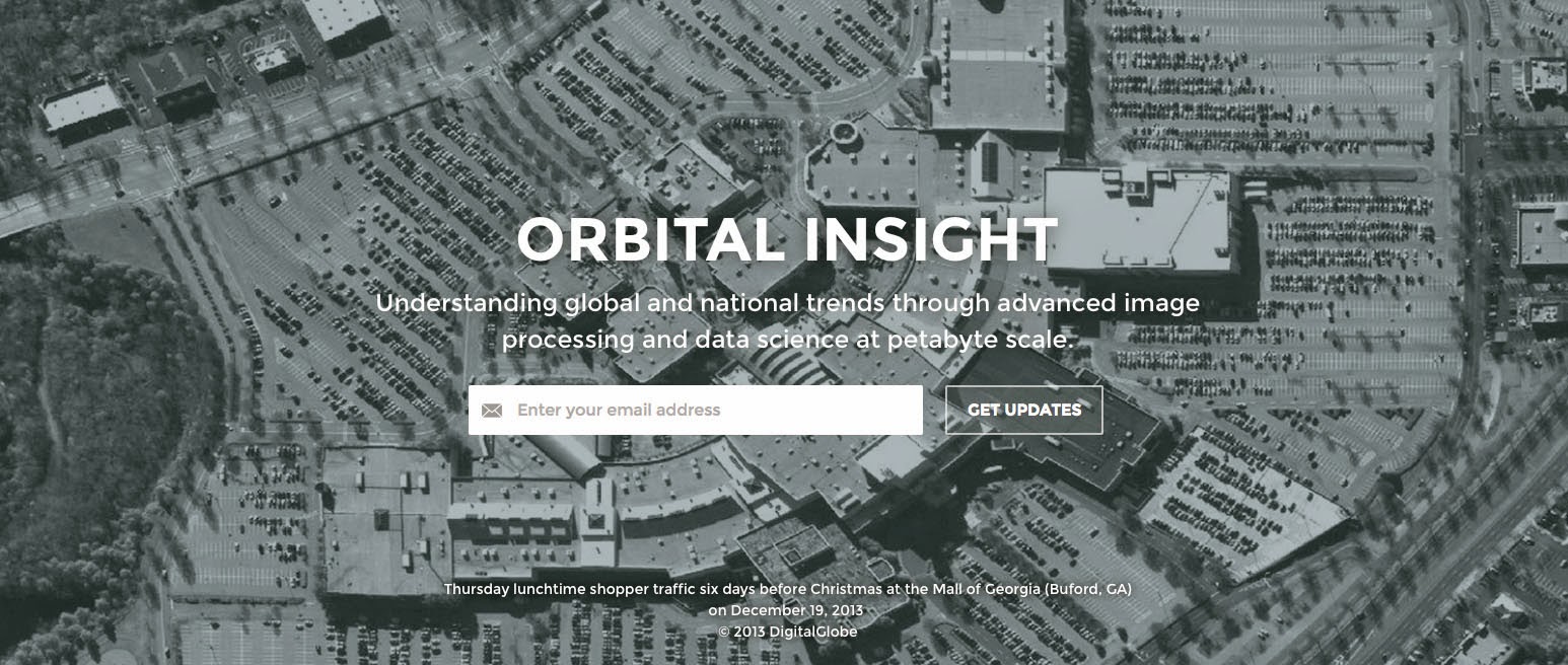
Proving that some market somewhere will find a value for anything, a company called Orbital Insight is now tracking “the shadows cast by half-finished Chinese buildings” as a possible indicator for where the country’s economy might be headed.

As the Wall Street Journal explains, Orbital Insight is part of a new “coterie of entrepreneurs selling analysis of obscure data sets to traders in search of even the smallest edges.” In many cases, these “obscure data sets” are explicitly spatial:

Take the changing shadows of Chinese buildings, which Mr. Crawford [of Orbital Insight] says can provide a glimpse into whether that country’s construction boom is speeding up or slowing down. Mr. Crawford’s company, Orbital Insight Inc., is analyzing satellite images of construction sites in 30 Chinese cities, with the goal of giving traders independent data so they don’t need to rely on government statistics.

If watching the shadows of Chinese cities from space isn’t quite your cup of tea, then consider that the company “is also selling analysis of satellite imagery of cornfields to predict how crops will shape up and studies of parking lots that could provide an early indicator of retail sales and quarterly earnings of companies such as Wal-Mart Stores Inc. and Home Depot Inc.”

[Image: A screen grab from the homepage of Orbital Insight].

The resulting data might not even prove useful; but, in a great example of what we might call just-in-case informatics, it’s scooped up and packaged anyway.

The notion that there are fortunes to be made given advance notice of even the tiniest spatial details of the world is both astonishing and sadly predictable—that something as intangible as the slowly elongating shadows of construction sites in China could be turned into a proprietary data point, an informational product sold to insatiable investors.

Everything has a price—including the knowledge of how many cars are currently parked outside Home Depot.

Read more at the Wall Street Journal.

Planet Harddrive

[Image: “Conceptual diagram of satellite triangulation,” courtesy of the Office of NOAA Corps Operations (ONCO)].

I’ve long been fascinated by what I might call the geological nature of harddrives – how certain mineral arrangements of metal and ferromagnetism result in our technological ability to store memories, save information, and leave previous versions of the present behind.

A harddrive would thus be a geological object as much as it is a technical one: a content-rich, heavily processed re-configuration of the earth’s surface.

[Image: Geometry in the sky. “Diagram showing conceptual photographs of how satellite versus star background would appear from three different locations on the surface of the earth,” courtesy of the Office of NOAA Corps Operations (ONCO)].

Perhaps someday we won’t need harddrives at all: we’ll simply use geology itself. In other words, what if we could manipulate the earth’s own magnetic field and thus program data into the natural energy curtains of the planet?

The earth would become a kind of spherical harddrive, with information stored in those moving webs of magnetic energy that both surround and penetrate its surface.

This extends yet further into an idea that perhaps whole planets out there, turning in space, are actually the harddrives of an intelligent species we otherwise have yet to encounter – like mnemonic Death Stars, they are spherical data-storage facilities made of content-rich bedrock – or, perhaps more interestingly, we might even yet discover, in some weird version of the future directed by James Cameron from a screenplay by Jules Verne, that the earth itself is already encoded with someone else’s data, and that, down there in crustal formations of rock, crystalline archives shimmer.

I’m reminded of a line from William S. Burroughs’s novel The Ticket That Exploded, in which we read that beneath all of this, hidden in the surface of the earth, is “a vast mineral consciousness near absolute zero thinking in slow formations of crystal.”

[Image: “An IBM HDD head resting on a disk platter,” courtesy of Wikipedia].

In any case, this all came to mind again last night when I saw an article in New Scientist about how 3D holograms might revolutionize data storage. One hologram-encoded DVD, for instance, could hold an incredible 1000GB of information.

So how would these 3D holograms be formed?

“A pair of laser beams is used to write data into discs of light-sensitive plastic, with both aiming at the same spot,” the article explains. “One beam shines continuously, while the other pulses on and off to encode patches that represent digital 0s and 1s.”

The question, then, would be whether or not you could build a geotechnical version of this, some vast and slow-moving machine – manufactured by Komatsu – that moves over exposed faces of bedrock and “encodes” that geological formation with data. You would use it to inscribe information into the planet.

To use a cheap pun, you could store terrabytes of information.

But it’d be like some new form of plowing in which the furrows you produce are not for seeds but for data. An entirely new landscape design process results: a fragment of the earth formatted to store encrypted files.

Data gardens.

They can even be read by satellite.

[Image: The “worldwide satellite triangulation camera station network,” courtesy of NOAA’s Geodesy Collection].

Like something out of H.P. Lovecraft – or the most unhinged imaginations of early European explorers – future humans will look down uneasily at the earth they walk upon, knowing that vast holograms span that rocky darkness, spun like inexplicable cobwebs through the planet.

Beneath a massive stretch of rock in the remotest state-owned corner of Nevada, top secret government holograms await their future decryption.

The planet thus becomes an archive.

(Earlier on BLDGBLOG: Geomagnetic Harddrive).