Secret British Caving Teams and the Mineralogy of Nuclear War

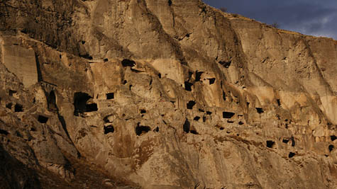
[Image: An otherwise unrelated photo of a cave in China, taken by @PhailMachine, via wallhere].

An interesting story that re-emerged during recent coverage of the Thai cave rescue is that a team of British cavers trapped underground in central Mexico for “more than a week” back in 2004 had been accused of having an ulterior motive.

Of the six men, five were British soldiers, and the crew was rescued not by local emergency crews but by a team flown in from Britain. Nothing about either alleged fact is even remotely suspicious, of course, but, according to local press at the time, “the men had been looking for materials that could be used to make nuclear weapons.”

This was apparently more than just a bar-room rumor: Mexico’s energy minister “waded into the row by saying he would send members of the country’s nuclear research institute into the caves because of rumours the British potholers were looking for uranium deposits.” Things “descended into farce,” according to the Guardian, “amid claims the MoD-sponsored expedition was a secret uranium prospecting exercise and that precise details of the trip were not forwarded to the relevant authorities.”

The conspiracy seems to have begun when someone noticed a particular piece of equipment in a photo of the caving team: “someone spotted radon dosimeters being used. This wasn’t a military training exercise; it was a bunch of guys on holiday, some of whom happened to be in the armed services.”

What the British team would even have done with such materials, if they had found them, including how they would have safely transported uranium out of the underworld in their caving gear—not to mention how they would have exploited this knowledge later, perhaps by developing a vast, illegal, underground mine in the middle of central Mexico?—is difficult to imagine, but, wow, would I like to read that novella.

Six British soldiers descend into the Earth beneath Mexico looking for the infernal materials of war, part of a much larger, secret global mission for subterranean weapons-prospecting, slipping into caves in Central America, the U.S. Southwest, the Namibian desert, and beyond, combining raw international espionage, classified satellite reports, weaponized mineralogy, advanced underground mapping techniques, and every gear-head’s camping equipment fantasy turned up to 11.

Then we descend

[Image: Descending into Mammoth Cave, from Beneath the surface; or, the wonders of the underground world by W.H. Davenport Adams].

By way of JF Ptak Science Books, I found myself reading through an old book called Beneath the surface; or, the wonders of the underground world by W.H. Davenport Adams this weekend, a travelogue from 1876 exploring subterranean landscapes around the world, including what is now Mammoth Cave National Park.

“Then we descend,” Adams writes upon his arrival at the cave, “by a small pathway excavated among the rocks, until we discover, in the sides of the mountain, and at the bottom of a funnel-shaped cavity, overgrown with verdure, an opening so low and narrow that two people can with difficulty enter at once.”

Slipping through, they pass into “a labyrinth of caves” consisting of seemingly endless sloping rooms, shafts, and corridors.

As my own phrasing there indicates, these spaces are described by way of architectural analogy: as naves and vestibules, chambers and rotundas. In fact, their perceived architectural characteristics are highlighted even on the acoustic level. One cave, for example, is a place “where the voice resounds and, lingering, reverberates, like the strain of an organ through dim cathedral aisles.”

[Image: A room in Mammoth Cave known as “The Maelstrom,” from Beneath the surface; or, the wonders of the underground world by W.H. Davenport Adams].
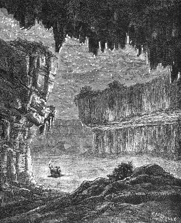
Continuing on their downward trek, Adams & Co. soon wander into “a chamber nearly 320 feet in circuit, whose roof rises like the stand of an immense nave. Its form, its grandeur, its magnitude (it could accommodate five thousand persons), and the strange architectural-like stalactites which embellish it, have procured it the name of the Gothic Church.”

Indeed, standing amidst this ersatz cathedral, and “thanks to the power of imagination, and the varying influence of the light, we here distinguish all the details of a medieval nave, pillars, and columns, and corbels and ogives.”

Among many things, what interests me here is how the interior of the earth is seen as if through the haze of a projection, with architectural forms emerging where, in fact, only inhuman geological processes at work—but also, in the opposite direction, the implied observation here that, in an age of masonry construction, architecture and geology were, in effect, natural cousins, lending themselves to mutual comparison far more easily than in today’s time of glass and steel construction.

[Image: A vast underground room filled with “a silent, terrible solitude,” from Beneath the surface; or, the wonders of the underground world by W.H. Davenport Adams].

To put this another way, many streets in Manhattan are often quite appropriately described as “canyons,” not only due to their perceived depth—that is, given the towering buildings on either side, as if pedestrians merely wander at the bottom of artificial slot canyons—but also due to the geological materials those buildings were made from.

However, following widespread transformations in global building construction, our buildings today are now more likely to be reflective—even dangerously so—or partially transparent, whether this is due to the use of glass curtain walls or shadow-annihilating polished titanium, with the effect that our urban environment is no longer particularly well-served by geological analogy.

In any case, the book’s flirtation with an architectural vocabulary is gradually abandoned as Adams and his colleagues venture deeper into the planet. They eventually find themselves standing somewhat uncomfortably surrounded by a “phantasmagoria” of black gypsum walls, all “covered with sparkling crystallizations,” in a vast room whose belittling proportions inspire feelings not of grandeur and religiosity but a kind of exhausted desolation.

Here, Adams writes, “you think yourself on one of those dead and naked planets, where mineral nature reigns in the bosom of a silent, terrible solitude; on some earth never warmed by the sun, and which is animated by no kind of life.”

[Image: An unfortunately rather low-res image from Beneath the surface; or, the wonders of the underground world by W.H. Davenport Adams].
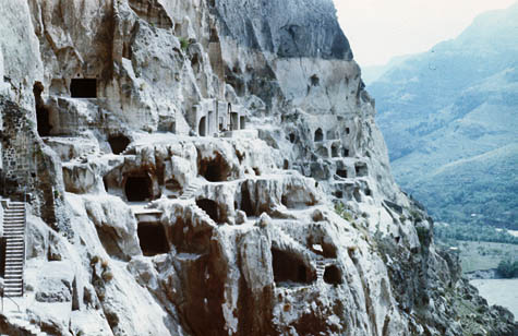
The rest of the book—including the image seen immediately above this sentence—ventures elsewhere, into silver mines and glacial caves, even briefly passing by way of underground “artificial ice caves” for the premodern production and storage of ice.

I’m just a sucker for subterranea. Check it out if any of this sounds up your alley, and click through the archives of JF Ptak Science Books while you’re at it.

Vardzia

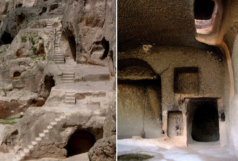
[Image: The Georgian cave monastery of Vardzia, via Wikipedia].
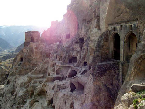
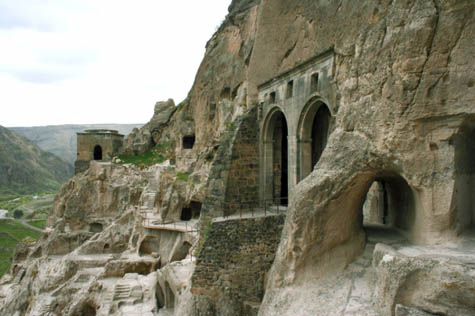
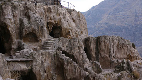
Vardzia is a ruined honeycomb of arched passageways and artificially enlarged caves on a steep mountainside in Georgia. It is on a “tentative list” for UNESCO World Heritage status.

[Image: Vardzia, via Wikipedia].

Quoting from Wikipedia:

The monastery was constructed as protection from the Mongols, and consisted of over six thousand apartments in a thirteen-story complex. The city included a church, a throne room, and a complex irrigation system watering terraced farmlands. The only access to the complex was through some well hidden tunnels near the Mtkvari river.

Nearby are the ruins of another cave monastery, called Vanis Kvabebi.

[Images: Vardzia, via Wikipedia].

In the formal application sent to UNESCO for consideration of the site, we read that the architecture of this region can be seen as spatially punctuating the landscape, supplying moments of almost grammatical emphasis:

Fortresses and churches erected on high mountains and hills are perceived as distinguished vertical accents in such a horizontally developed setting. They terminate and emphasise natural verticals, being in perfect harmony with the latter. They introduce great emotional impulse imparting specific grandeur to the whole environment. The same artistic affect is created by rock-cut monasteries and villages arranged in several tiers on high rocky mountain slopes.

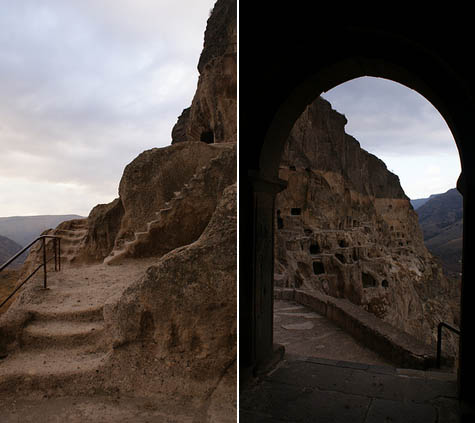
Originally constructed in the 12th century—in a region inhabited by humans since at least neolithic times—and very much resembling one of the cave-cities of Cappadocia, Vardzia is a spatially fantastic site (and, I’d assume, a videogame level waiting to happen).

[Images: Vardzia, via Wikipedia].

It is also located in one of the most geologically interesting places on earth—at least from a subterranean standpoint—as the nation of Georgia also contains the world’s deepest known cave.

As National Geographic explained in an article several years ago, Krubera Cave—also known as Voronya—is still incompletely explored, despite its record-breaking, abyssal depths; expeditions have spent more than three weeks underground there, mapping windows and chambers, sleeping in tents, and using colored dyes to trace rivers and streams locked in the rock walls around them.

Check out this sequence of images, for instance, documenting an organized descent into the planet—or this article about caving in Abkhazia, or even this summary of the “Call of the Abyss” exploration project that sought to find the true depths of Voronya Cave.

[Images: Vardzia, as seen in some stunning photos by cosh_to_jest].

In any case, there’s absolutely no geological connection between Vardzia and Krubera Cave—there is no secret tunnel system linking the two across the vast Georgian landscape (after all, they are extremely far apart)—but how exciting would it be to discover that Vardzia had, in fact, been constructed as a kind of architectural filter above the stovepipe-like opening of a titanic cave system, and that, 800 years ago, monks alone in the mountains reading books about the end of the world might have sat there, surrounded by fading frescoes of saints and dragons, looking into the mouth of the abyss, perhaps even in their own local twist on millennial Christianity standing guard over something they believed to be hiding far below.

[Images: Vardzia, via Wikipedia].

In fact, I don’t mean to belabor the point here, but I’ve always been fascinated by the fact that the CIA has satellite photos that have been used as scouting documents for the rumored location of Noah’s Ark—it is “satellite archaeology,” one researcher claims. That is, there being quite a few religious members of the U.S. government, things like Noah’s Ark are considered more objective and archaeological than they are superstitious or theological.

But how absolutely mind-boggling would it be to find out someday that there is, operating within the U.S. intelligence services, a small group of especially religious analysts who have been scouring the Caucausus region, funded by tax dollars, and armed with geoscanning equipment and several miles of rope, looking for the entrance to Hell?

You can see further images of Vardzia here.