Conic Sections: An Interview with Sol Yurick

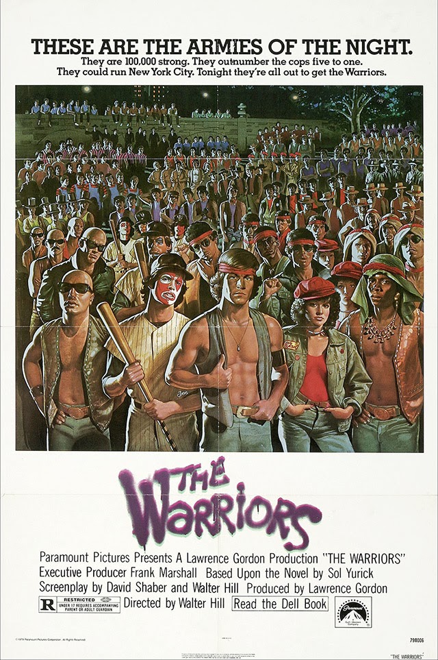
I interviewed novelist Sol Yurick back in March 2009. Rather than publish the interview on BLDGBLOG as I should have, however, I thought I’d try to find a place for it elsewhere, and began pitching it to a few design magazines. Yurick, after all, was the author of The Warriors—later turned into the cult classic film of the same name, in which New York City is transformed into a ruined staging ground for elaborately costumed gangs—and he was a familiar enough figure amidst a particular crowd of underground readers and independent press aficionados, those of us who might gravitate more toward Autonomedia pamphlets, for example, where you’d find Yurick’s strange and prescient Metatron: The Recording Angel, than anything on the bestseller list.

Looked at one way, The Warriors tells the story of a city gone out of control, become feral, taken over by criminal gangs and faceless police organizations, its infrastructure half-abandoned or, at the very least, fallen into a state of Piranesian decay. The everyday lives of its residents whirl on, while these cartoon-like groups of armed militants spiral toward violence and disaster. Yurick was thus an urban author, I thought, suitable for urban and architectural publications, his insights on cities far more useful than your average TED Talk and about one ten-thousandth as exposed.

In the interview, published for the first time below, Yurick freely discussed the back-story for The Warriors, which was the question that had motivated me to contact him in the first place. But he also drifted into his interests in the global financial system, which, at that point in time, was melting down through a domino game of bad mortgages and Ponzi schemes, and he went on to offer an even more dizzying perspective on Dante’s The Divine Comedy. Dante, in Yurick’s unexpected retelling, had actually written a series of concentric financial allegories, tales of monetary wizardry starring lost, beautiful souls searching for one another amongst the impenetrable mathematics of paradise.

Along the way, we touched on Mexican drug cartels, the Trojan War, the United Nations, and a handful of forthcoming books that Yurick was still, he claimed, energetically working on at the time. 

Image from Paper Tiger, via Sheepshead Bites

Alas, I pitched the wrong magazines and, soon thereafter, hit the road for a long period of travel and work; the interview simply disappeared into my hard drive and years went by. Then, worst of all, Yurick passed away in January of this year

The New York Times described him as “a writer whose best-known work, the 1965 novel The Warriors, recast an ancient Greek battle as a tale of warring New York street gangs and earned a cult following in print, on film and eventually in a video game.” Writing for The Nation, Samuel Fromartz specifically referred to several “out-of-the-blue interview requests” that had popped up in Yurick’s latter years, asking him about, yes, The Warriors. As Fromartz writes, “despite the delight he got in its cult status, it did not mean a lot more to him” than his other books, The Warriors being simply one project among many. 

And so this interview sat, unpublished, till I came across it again in my files recently and I thought I’d give it a second life online. It’s a fascinating discussion with an aging writer who unhesitatingly looked back at a long career of writing both fiction and political analysis, a life of deep reading and even a few eye-poppingly abstract interpretations of Dante.

What follows is the final edit of our conversation. Yurick was an engaged and pointed conversationalist, and, while I was obviously just another out-of-the-blue interviewer curious about the broken city of The Warriors, I hope this text does justice to his creative and sharp vision of the world. 

So this is for Sol Yurick, 1925-2013.

* * *

BLDGBLOG: I’d love to start with the most basic question of all, which is to ask about the back-story behind The Warriors. What motivated you to write it when you did?

Sol Yurick: Well, initially it started off when I was talking about some ideas with a friend in college. I’d just finished reading Xenophon and the concept popped into my head. This was the early 1940s.

Then, later, maybe in the 1950s, I read Outlaws of the Marsh, and the combination of ritual and violence in Outlaws of the Marsh just took my breath away. Those things mixed—Xenophon, ritual violence, Outlaws of the Marsh—and, on top of all that, I had already been working on a novel of my own. I was trying to get it published and it kept getting rejected—maybe 37 times?

BLDGBLOG: Wow.

Yurick: To move on to the next step, I wrote The Warriors. I did it in about three weeks. By this time, a lot of these ideas had matured. I’d been thinking about the whole question of gangs. First of all, the youth gangs at that point in time, running into the 1950s and ’60s, had no economic basis whatsoever. They mostly came from poverty-stricken families. You remember the film Rebel Without a Cause, right? That kind of stuff. It was viewed as kind of a national problem.

However, there were also gangs that came out of the suburbs—gangs nobody had ever heard about. No sociologist had wrote about this. In fact, I was big on sociology at the time, especially the works of Émile Durkheim and Max Weber, the founders of modern sociology. I wanted to write about stuff that approached reality—that was based in social reality—and that was not bound by a lot of the clichés or conventions of fiction as I knew it. I wanted to deal with a different stratum of society, something that wasn’t getting the attention it deserved in fiction at the time.

By the time I was actually writing the book, though, the whole 1960s had already started, and I eventually had a different take on it. In the book, it’s really about making a revolution, not just a criminal gang taking over the city. After all, it takes place on July 4th! But, in the book, that holiday is like a slap in the face for my characters—at least that’s the vision of the gang leader, looking at all the things that keep these people down. It’s Independence Day—but independence for whom? Independence from what?

Since that time, I’ve thought an awful lot about gangs and I began to see them in a very different way, as almost a biological formation. People make gangs—men and women, what have you. Cliques, clans, whatever you want to call it. There seems to be a big impulse there, something deeply social and political, but also maybe something biological.

I’d been thinking and meditating on this whole thing—this whole problem of the gang and what makes it. The interesting thing about gangs, as I wrote about them at that point in time, and as I mentioned, is that they had no economic basis. That all began to change during the period of the late 1950s and early 1960s, especially in relation to Vietnam, when more and more heroin began to be imported into the United States—a chunk of that coming through the good offices of the CIA. So, especially looking at the drug cartels in Mexico today, but also looking at this phenomenon of organized crime all over the world, the more you see that gangs are essentially capitalists. Within that system, they organize themselves: they have hierarchical principles and their leadership gets the best of everything. The lower strata are just the soldiers who risk their lives and don’t make out too well.

Look at the other gangs and mafia in ‘Ndrangheta, Calabria, the Camorra, the Japanese gangs, the Chinese triads, the Bulgarian gangs, the Russian gangs, all of that. It’s a business. Essentially, there are connections between these phenomena and corporate capitalism and politics, one way or another. On some level, there are always connections to something else—some other group, level, or economic phenomenon. In fact, no phenomenon, whether we’re talking physics or chemistry or what have you is totally isolated. Total isolation, or the making of discrete sets, is really an intellectual concept. No social formation is isolated in and of itself. It just isn’t.

What’s interesting is that, wherever you go, the gangs develop their own cultures. What makes them alike is generally their structures—their hierarchical structures—and the necessity for their leadership, whether it’s male or female, to exhibit charisma, machismo or machisma. And I don’t care whether you see this in corporations, which are supposedly rational entities but that, really, are not—because, otherwise, why would people talk about the “culture” of a corporation as something that can drive it into bankruptcy or make it successful? And how is that culture different from another corporation? So, in gangs and corporations both, we’re seeing a kind of driven necessity—maybe biological—to make and sustain a culture. But each culture is different.

Structurally, things look the same, but, culturally, things look different. That fascinates me.

Also, I grew up in a Communist household. Starting in the 1960s, I went back to reading Marx. In the back of my mind, though, there were aspects of Marx that seemed inadequate as a theory. It was very Western-centered; the number of classical and historical references in all of Marx’s work was just overwhelming to me. For all of his references, it felt limited. Then, as well, I began to think more in terms of neo-Darwinism. I don’t mean social Darwinism. Leftists and liberals deny the question of human nature, but what if it’s true? So that also became a consideration in my thinking—mixing the two: Marx and Darwin. 

All of that was part of the back-story for The Warriors.

BLDGBLOG: Before we move on to other topics, I think it’s interesting how much the built landscape of New York has changed since you wrote The Warriors. I’m curious, if you were to update the story of Xenophon again and rewrite The Warriors today, if there is a different location you might choose, whether that’s a different city or a different part of New York.

Yurick: Well, I would make it global, for one thing. And I would try to bring into it questions of finance—things like that. I’m not sure, though; I haven’t thought of that. Yes, there was a political and economic connection to Xenophon, and to Xenophon’s story—essentially, these gang members were mercenaries, and they were also a surplus population pushed to the edge of society. They were, after all, kids. And they were revolutionaries, not just street criminals. But I don’t know exactly how I’d handle it today.

Again, the whole question of making a revolution in the old way—it’s a tricky one. From my way of thinking, what happened in the Russian Revolution is: you had an uprising. People were discontented and what have you. Then a moment of opportunity came along, when it was a complete breakdown, and, at that point, Lenin stepped in. It was purely opportunistic. There was nothing decent in his move. There it was. It happened. Boom. He took advantage.

BLDGBLOG: In your book-length essay Metatron: The Recording Angel, you combine so many of these interests—everything from finance to electronic writing, looking ahead to what we now call the internet, and so on. I’m curious if we could talk a little bit about how Metatron came about, what you were seeking to do with that book, and where you might take its research today?

Yurick: When I wrote that, it was still early on. Computers were not universally around. I had a friend who was a computer expert—he had become an expert in the 1950s—so I was introduced to computers and the idea long before there were PCs or anything like that. I knew, when I saw stuff that would later become the internet—exchanges between scientists who had access to this kind of stuff—I knew I was looking at a different world. I began to see signs that this was going to become a big phenomenon, one of information and the effects of information. And again, this was before anybody had home computers.

Then computers began to come in, bit by bit. We’re talking maybe 1979. What happened then was that I got tied up with an organization trying to promote the use of satellites for global education. By this time, though, having been through the 1960s and 70s, I was telling them that this was just not going to happen. You’re not going to get money for this kind of thing; they’re going to use satellites for any other purpose for the most part, maybe military purposes, maybe propagandistic purposes, certainly for telecommunications.

But I went down to Washington with these people a couple of times, and we sat in on the committee hearings. Then I wrote a piece—an essay—to sort of introduce our organization. I forget when it was—maybe 1979 or 1978—but Jimmy Carter was coming to the UN and, because of the connections of several people in this organization, somebody got my essay to Jimmy Carter’s people. He almost incorporated a piece of it into his speech at the UN!

That didn’t happen, of course, so I decided I would submit it to this little publishing house, and they asked me to expand on it. I did that, and that was Metatron.

So my mind was ranging over all these things. I was trying to think of what the effect was going to be of computers and networks and satellites, trying to anticipate a lot of side effects. There was a lot I didn’t foresee, but there were some things I saw beginning to happen—that then, in fact, did happen maybe ten years later. Things like running factory farm machines by satellite and, now, running drones over Afghanistan from a place in Nevada. Things like that.

Anyway, having been getting more and more involved in many areas, while at the same time trying to find a basis for writing my fiction from new perspectives, became very destabilizing. Because most writers—most people—just stop growing at a certain point. They stop taking in more stuff because it gets in the way of their writing. But the opposite was happening. For instance, with The Warriors, I was able to make an outline chart of how the themes would develop. I could coordinate everything: what happened to the clothing, what happened at a certain time of day, and so forth and so on. Interestingly, the form of the chart I borrowed from a business model called program evaluation. It was a review technique. So I could do this thing and it came easy.

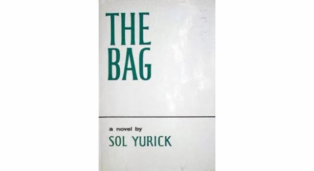
But when I tried to do it with The Bag, it didn’t work. I had such a hard time doing The Bag. The chart began to expand and expand till it was about ten feet long; I had different colors on it; it just didn’t work right. But I was learning so much.

Anyway, at certain points you’ve got to say enough. I forget which writer said this: “You don’t finish the work you abandon.”

BLDGBLOG: The financial aspects of your work are very interesting here, as well.

Yurick: Do you mean the economic?

BLDGBLOG: Well, I mean “financial” more specifically to refer to the system of writings, agreements, valuations, and so forth that constitute the world of international finance—which, if you take a very basic, material view of things, is just people writing. It’s numbers and spreadsheets, stock prices, contracts, and slips of paper, licenses and patents—its own sort of literature. You imply as much, in Metatron, with its titular reference to the archangel of writing.

Yurick: OK, yes. You know, I’ve been saying for years to people that this is coming, this moment [the financial crisis of 2007-2009], and it’s happening now. I read the newspaper and I see it: these people manufacturing money out of their imaginations. Sooner or later the bubble has got to burst, and it’s bursting.

In a certain sense, what’s taken place—what’s taking place now—is a series of mistakes. In other words, you don’t hire the people who caused the problem in the first place to try to rectify it, yet that’s what’s happening. It’s very interesting, I think, to look at this in terms of the criminal elements that we discussed—the gangs—and to see that what they do is done through extortion, prostitution, the selling of illegal things, illegal commodities, and what have you. They accumulate money and they launder it. But this also happens at the very top levels of finance: they imagine money and then they objectify it in terms of mansions and things like that.

When you’re dealing with this kind of stuff, you’re dealing with fiction—and when you’re dealing with fiction, you’re in my realm.

BLDGBLOG: The financial world that’s been created in the last decade or so often just seems like a dream world of overlapping fictions—of Ponzi schemes and collateralized agreements that no one can follow. It’s as is people are just telling each other stories, but the characters are mutual funds, and, rather than words, they’re written in numbers. To paraphrase Arthur C. Clarke, it’s as if sufficiently advanced financial transactions have become indistinguishable from magic.

Yurick: A long time ago, I started to write a book in which I invented a planet, and the planet was ultimately nothing but finance. I called it Malaputa. Do you know Jonathan Swift’s work at all? One of the trips Gulliver takes is to an island called Laputa, which really means, in Latin, the whore or the hole. There he encounters nothing but intellectuals building the most astonishing mental structures and doing the stupidest things imaginable. Now, Malaputa would be the evil whore.

So the planet I began to invent was a world that interpenetrates ours and it works by the rules of our world, but it’s not visible. Ultimately, it resides in the financial system in which, as you get to the center of it, its mass and velocity keep on increasing potentially. It’s the movement, ultimately, of symbols.

I realized, at a certain point, that what I was also talking about was, in a sense, The Divine Comedy. The descent into the Inferno, if you remember, is in the form of a cone—the inside of a cone. The ascent to the top of Mount Purgatory is also a cone, but you climb on the outside. Then, to move on to heaven, you have a series of concentric circles, at the center of which is the ultimate paradise, which is where God resides. The circles are spinning, but they’re spinning in an odd way. If you’re at the center of a spinning circle, you’re barely moving around. If you’re on the outside, you’re moving with great velocity.

In this case, Dante tells us that the center of the circle spins with the greatest velocity, and the further out you get away from it, the slower it moves. What does finance have to do with this? The woman who Dante idolized—Beatrice—was a banker’s daughter. You could say his interest in her was partly financial, pursued through these circles and cones of symbols. Anyway, that’s the architecture of The Divine Comedy that I was getting at.

From this point—as all of this was going into the stuff I’m writing now—I began to meditate on the question of surplus labor value. Which, as Marx said, is the unpaid part of what a worker doesn’t get, the part that the owner—the owner of the means of production—expropriates.

BLDGBLOG: The Malaputa idea was for an entire standalone novel, or it’s something that you’re now including in your current work? 

Yurick: It was originally going to be its own book, but I’m going to change that. I’ll incorporate it; I’ll reinvent it. 

I wrote a piece a long time ago for—I forget the name of the magazine. It was on the question of the information revolution, the dimensions of which were not yet clear at that point. I think it was the mid-1980s. I was talking about, even at that point in time, the speed of the transactions, and the infinitesimally small space in which transactions occur—against the space that you have to traverse either by foot or other means, like to the market village or the shopping mall or the warehouse floor.

In other words, I’m saying that finance has a space—it has an architecture. You might want to transfer billions of dollars from one country to another, but both are accounts in one computer space. What you’re doing might have enormous effects on the real world—the world of humans and geography—but what you’ve done is move it a fraction of an inch, at an enormous speed, with an enormous velocity and mass. And that has real effects thousands of miles away.

BLDGBLOG: I’m curious if you see other future developments of these works, or if there’s something new you’re working on at the moment.

Yurick: Yes—I’m working on two things that may intersect. One is a kind of biography that I call Revenge. What I realized, in a certain way—partly because I grew up in the Depression under bad circumstances, and now I see those same circumstances coming back again—I realized at a certain point that my novels Fertig and The Bag were revenge novels. That was a theme that was not clearly in my mind at the time, but that came into my consciousness relatively recently. 

Revenge begins with trying to pick a starting point—to impose a starting point—because wherever you begin, there is no ultimate beginning. Someone did something to someone else, in reaction to something that came before that, and so on and so forth. You start in the middle of things, and choose a starting point. It’s like a lot of the things we say about The Iliad, for instance. They start in the middle of things, in medias res.

There was an essay I wrote for The Nation on Truman Capote’s In Cold Blood, in which I panned the novel. But what I realized, even at the time I was writing it, was that, in a certain way, the story in that book—the true story it was based on—wasn’t just a random killing. It was a revenge killing. It was about two people who are, in a sense, dispossessed. But the person who got killed—not the family so much, but the farmer himself, Clutter—was no ordinary guy. He was no ordinary farmer, but a well-to-do guy with 3,000 acres and some cattle and maybe an oil-pumping system. He was important. He’d worked in government and he’d worked as a county agent. I won’t go into the history of the county agents and their ultimate role in making agribusiness as we know it today. But he was important enough in 1954 to have been interviewed about a kind of global crisis in agriculture in the magazine section of the New York Times.

This wasn’t the story Truman Capote told. Capote was given an assignment by the New Yorker and he went and he did it. He didn’t know or understand any of this background. He didn’t talk about the role of this guy. Not that this guy was the ultimate villain—this Clutter person—but, the fact is, he had a very key role. If he was important enough to be interviewed in a section on changes in agricultural policy in the New York Times Magazine, that means he’s not just nobody. The fact that he conjoined the outlaws, the killers—the fact that they conjoin, in a sense, with the Clutters—I think is a piece of, you can almost say, Dickensian chance. It’s like how some novelists will start out with two or three random incidents that are not connected at all and then mold them together.

I don’t know if you’ve read The Bridge of San Luis Rey? It’s about six or seven people who are on a bridge that collapses; it falls and they’re killed. What it is is an exercise in what brought these people together: what did they have, or not have, in common? Why this moment and not another moment? That’s what I wanted to develop with this, to go a little into the background of how I came to this line of thinking.

Now, one of the killers: his mother was an Indian [sic] and his father was a cowboy. The other one’s parents were poor farmers. So, here, we have three social groups expressed in these people. In the long struggle between corporate agriculture and the individual farmer, this is what develops: they get pushed off the land, these social groups. In fact, this also connects back to the old story of Joseph, in Egypt. With Joseph in Egypt, yes, he predicts the coming famine—the good times and the coming famine. But, when the famine does come, first he takes the farmer’s money, then he takes their land, and he moves them all into the cities. What you’ve got there is kind of an algorithm for the way agriculture develops: we’re talking Russia, the Soviet Union, China. We’re talking the United States. It looks different in different places, but the structure remains the same. You urbanize the people and you consolidate the land.

Then, of course, with the book I go into my own reactions to all kinds of literature, and I stop to try to rewrite that literature. For instance, suppose we think of The Iliad as one big trade war. Troy, as you know, sat on the route into the Black Sea, which means it commanded the whole hinterland where people like the Greeks and the Trojans did trading. The Trojan War was a trade war.

BLDGBLOG: The mergers and acquisitions of the ancient world.

Yurick: So that’s the kind of stuff I’m working on.

In the end, of course, the smaller farmer fought agribusiness tooth and nail, and they lost. We see what agribusiness has done to food itself, creating all kinds of mutational changes in seeds and so forth. Again, I think of the collectivization period in the Soviet Union in which, in order to win, you had to starve the peasants. That’s what the intellectuals of the time wanted, without understanding the practicality of life on the ground, so to speak. It was a catastrophe.

On the other hand, one of the images I had when I was a kid, during the Depression, was: you’d go see a newsreel and you’d see farmers spilling milk and grain on the ground because they couldn’t get their price. People didn’t have enough food, but they were just dumping their milk in the mud. These were smaller farmers—agribusiness hadn’t happened yet. So you’ve got two greed systems going on here.

Anyway, I use all that as the novel’s jumping-off point. In a sense, I’m saying Clutter had it coming to him—or his class had it coming to him.

But I’m in the very early stages. It becomes like a little race between living and doing it, and ultimately dying. I’m not rushing myself, but I’m having fun.

* * *

This interview was recorded in March 2009. Thank you to Sol Yurick for the conversation.

Flywheel Landscapes, Energy Reserves, 3D-Printed Urban Caves, and the British Exploratory Land Archive

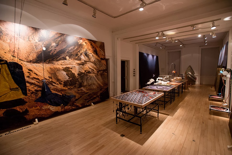
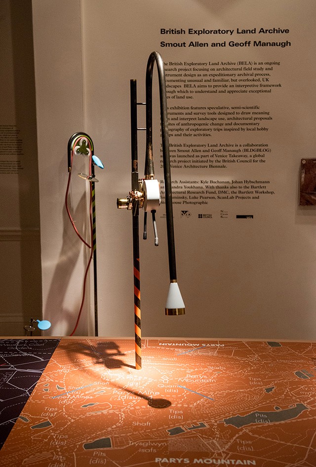
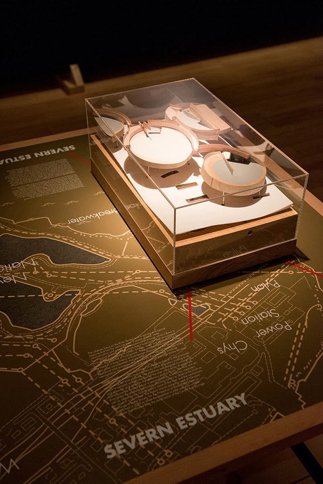
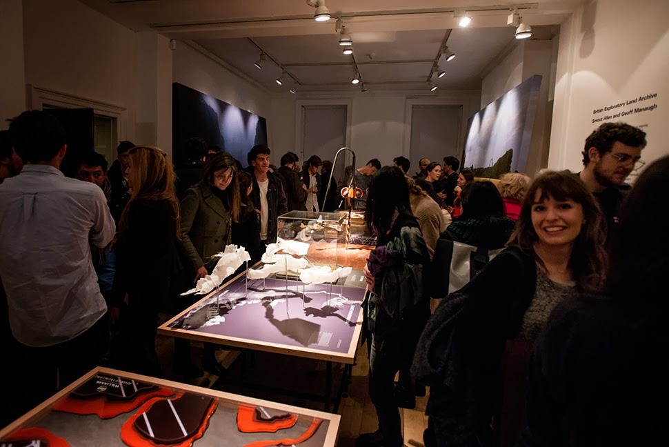
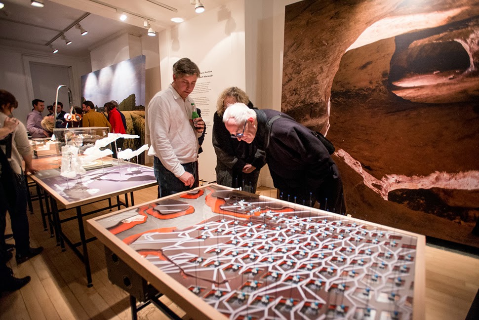
Last week, over at the Architectural Association in London, a new exhibition opened, continuing the work of the British Exploratory Land Archive, an ongoing collaboration between myself and architects Mark Smout & Laura Allen of Smout Allen.

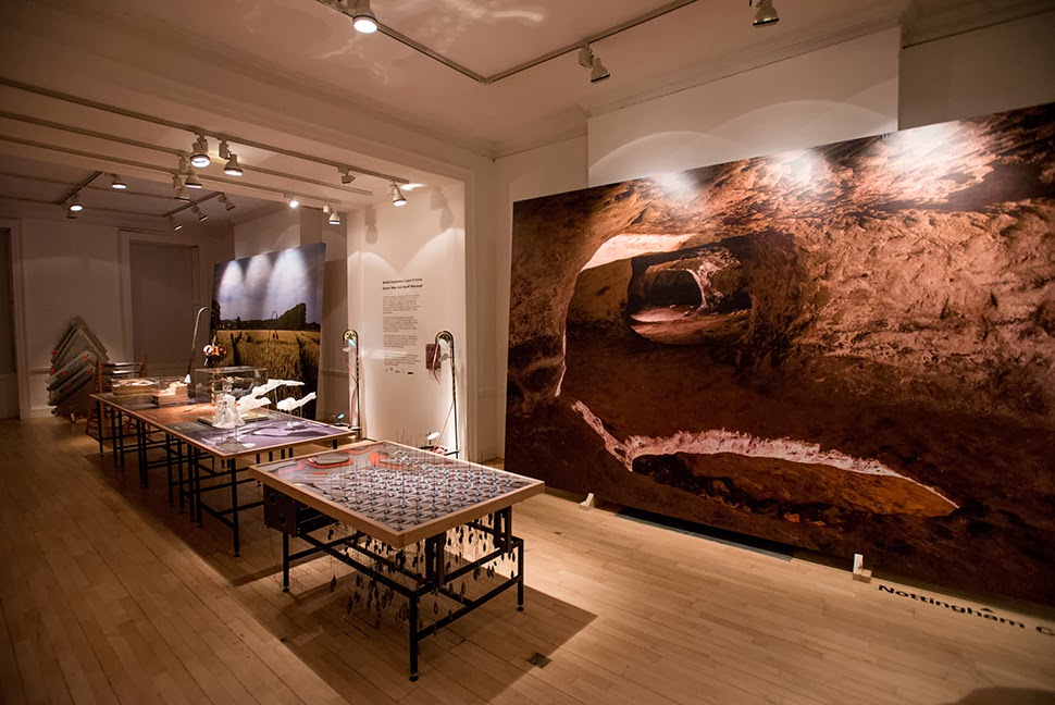
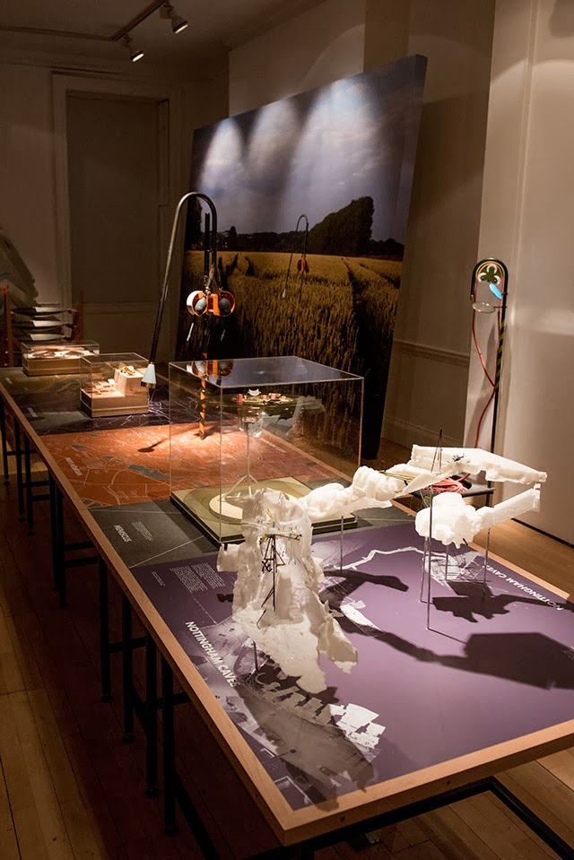
Although I was unfortunately not able to be in London to attend the opening party, I was absolutely over the moon to get all these photographs, taken by Stonehouse Photographic. These show not only the models, but also the show’s enormous wall-sized photographs and various explanatory texts.

The work on display ranged from cast models of underground sand mines in Nottingham, based on laser-scanning data donated by the Nottingham Caves Survey, to an architectural model the size and shape of a pool table, its part precision 3D-printed for us by Williams, of Formula 1 race car fame. Williams—awesomely and generously—also collaborated with us in helping come up with a new, speculative use of their hybrid flywheel technology (more on this, below).

From the bizarre environmental-sensing instruments first seen back at the Landscape Futures exhibition at the Nevada Museum of Art to landscape-scale devices printing new islands out of redistributed silt—a kind of dredge-jet printer spraying archipelagos along the length of the Severn—the scale and range of the objects on display is pretty thrilling to see.

I should quickly add that the exhibition is, by far and away, the work of Smout Allen, who burned candles at every end to get this all put together; despite being involved with the project, and working with the ideas all along, since last summer’s Venice Biennale, I am fundamentally an outside observer on all of this, simply admiring Smout Allen’s incredible tenacity and technical handiwork whilst throwing out the occasional idea for new projects and proposals.

In any case, a brief note on the collaboration with Williams: one of the proposed projects in the exhibition is a “flywheel reservoir” for the Isle of Sheppey.

This would be an energy-storage landscape—in effect, a giant, island-sized, semi-subterranean field of batteries—where excess electrical power generated by the gargantuan offshore field of wind turbines called the London Array would be held in reserve.

This island of half-buried spinning machines included tiny motor parts and models based on Williams’ own hybrid flywheel technology, normally used in Formula 1 race cars.

It was these little parts and models that were 3D-printed in alumide—a mix of nylon and aluminum dust—for us by engineers at Williams.

The very idea of a 3D-printed energy storage landscape on the British coast, disguised as an island, whirring inside with a garden of flywheels, makes my head spin, and a part of me would actually very much love to pursue feasibility studies to see if such a thing could potentially even be constructed someday: a back-up generator for the entire British electrical grid, saving up power from the London Array, brought to you by the same technology that helps power race cars.

Briefly, I was also interested to see that the little 3D-printed gears and pieces, when they first came out of the printer and had not yet been cleaned up or polished, looked remarkably—but inadvertently—like a project by the late Lebbeus Woods.

Finally, thanks not only to Williams, but to the Architectural Association for hosting the exhibition (in particular, Vanessa Norwood for so enthusiastically making it happen); to the small but highly motivated group of former students from the Bartlett School of Architecture, who helped to fabricate some of the exhibition’s other models and to organize some the British Exploratory Land Archive’s earlier projects; to the Nottingham Caves Survey for generously donating a trove of laser-scanning data for us to use in one of the models, and to ScanLAB Projects for helping convert that laser data into realizable 3D form; to UCL for the financial support and facilities; to Stonehouse Photographic, who not only was on hand to document the opening soirée but who also produced the massive photos you see leaning against the walls in the images reproduced here; and—why not?—to Sir Peter Cook, one of my own architectural heroes, for stopping by the exhibition on its opening night to say hello.

The exhibition is open until December 14 at the Architectural Association. Read more about the project here.

The Drowned

[Image: “Two Buildings Riverside Heights” by Louis Helbig].

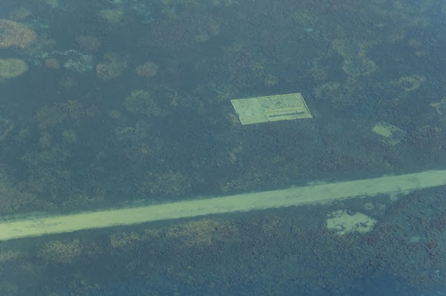
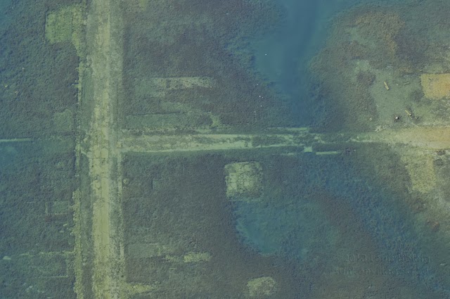
I posted these photos on Gizmodo the other week, but I wanted to throw them up here, as well: a series of wildly evocative aerial photographs by Louis Helbig, for a project called Sunken Villages.

Helbig has been documenting flooded villages and industrial structures losted to the water along the artificially engineered St. Lawrence Seaway, a borderland hydrological project smack in the international margin between Canada and the United States.

[Images: “Lot 3317 E. Campbell Property” (top) and “Downtown Aultsville” (bottom) by Louis Helbig].

As Helbig explains on the wonderfully organized and detailed project website:

July 1, 1958, is remembered as Inundation Day in the region near Cornwall, Ontario. At 08:00 a controlled explosion tore open a cofferdam and four days later an area that had been home to 7,500 people disappeared under the waves of Lake St. Lawrence, part of the newly created St. Lawrence Seaway.

On the Canadian side, twelve communities, some dating back to the 1700s, were affected. Following the old King’s Highway No. 2, upstream: Maple Grove, Mille Roches, Moulinette, Sheeks Island, Wales, Dickinson’s Landing, Farran’s Point and Aultsville were entirely destroyed; Iroquis was demolished and moved a mile to continue on in name; and, about half of Morrisburg–including its waterfront and most of its business district and main street–were levelled.

On the American side in St Lawrence County, the community of Croil’s Island disappeared and, along Highway 37B, Louisville Landing and Richards Landing ceased to exist, and parts of Waddington were dismantled.

On both sides, large rural tracts and property, farms, cottages, and entire islands were flooded. Sacred sites were obliterated and the historic battlefield of Crysler’s farm–where in November 1813 Redcoats, local militia and Mohawk warriors staved off a larger American force intent on sacking Montreal—disappeared.

With the communities went their infrastructure. Some buildings were moved and some graves exhumed. Roads, railways, and bridges were left to be buried along with the previous system of locks and canals. All else was levelled, razed to the foundations, cut to the stumps, burned and bulldozed.

But easily one of the most awesome moments in Helbig’s write-up is when he points out the inadvertent photographic side-effects of the zebra mussel: the “zebra mussel—an unintended consequence of the Seaway—has clarified the water making [the structures] visible once more.”

In other words, an aquatic infestation has allowed the ruins of old houses and towns to become visible in the murk, drawing back a silty curtain for aerial photographers and recreational boaters—as if we could reveal the presence of drowned things by seeding the waterways of the world with clarifying organisms, filtering water-logged sites of the past for future view.

[Image: “Downtown Altsville East to West” by Louis Helbig].

Old locks and canals rest below the surface of the riverway like dreams. Walls of lost houses are still legible in plan. Entire streets and town cores lie amidst the sediment, steadily fossilizing.

[Image: “Bar with Octagonal Silo” by Louis Helbig].

Click through to the Sunken Villages website for much more context and history, including interviews with local residents pushed out by the rising waters.

Meanwhile, the project was on display at the Marianne van Silfhout Gallery until November 2—but here’s to hoping Helbig’s project will travel, and find a gallery elsewhere interested in picking it up.

(Originally spotted via @urbanphoto_blog, easily one of the best architecture and urbanism feeds on Twitter. A different, earlier version of this appeared on Gizmodo).

(waves, says hello, disappears again)

[Image: Collage by Michael Hession, based on this image from the Library of Congress].

The last few weeks have been extremely busy, and there’s been no real time to post here on BLDGBLOG; so many interesting stories have come and gone, so many ideas to discuss and write about here, but I’ve primarily been working full-throttle in my new role as Editor-in-Chief of Gizmodo, where I’ve joined a team tasked with continuing the site’s transition away from pure tech news and gadget reviews to include the worlds of architecture, urbanism, and design. Any sufficiently large technology is indistinguishable from a landscape, we might say; any sufficiently ubiquitous machine indistinguishable from a city.

[Image: Inside a wind tunnel, courtesy of NASA, via Gizmodo].

In any case, I will be very busy for the foreseeable future in my new role—but we’ve published some really fantastic features there over the past few weeks alone, and I thought I’d throw up a quick post to give BLDGBLOG readers a taste of what’s to come. Here’s a solid list for a long day’s perusal:

Gizmodo was part of the first media tour since the 1980s of Hart Island, the largest mass grave site in the United States, run by the Department of Corrections on the outer maritime edge of New York City.

—”Capture houses” are entire decoy apartments and homes—furnished, lit, and run like actual residences—that, in reality, are elaborate traps for capturing burglars.

—The lost cow tunnels of New York City are no longer an urban myth: Nicola Twilley dug up blueprints for Gizmodo.

—The Los Angeles Aqueduct’s 100-year anniversary just rolled by and, with it, an historic reenactment of the moment the city’s floodgates were opened.

—New Yorkers receive junk mail from the future, thanks to designers Chris Woebken and Elliott P. Montgomery.

—”3D painting” creates working machine parts from directed aerosol layering—in effect, spray-painting objects into existence.

—A South Carolina archaeologist, citing Star Trek: The Next Generation as an influence, has scanned Linear B so that machines can help catalog the ancient past.

—The future of disaster recovery is a constellation of semi-autonomous robots swarming over avalanches and ruined cities to find survivors.

—An incredible “tangible interface” roils like the surface of a mechanical sea, reproducing any object you place within view of its sensors.

—We were on hand to see “Bertha,” the largest-diameter tunneling machine in the world, start spinning its way into the underworld of Seattle.

[Image: Bertha, a tunneling jaeger, undergoes assembly, courtesy of WSDOT, via Gizmodo].

—We learned what life is like on the job of a New York City archaeologist, digging up water mains, old bottles, and the foundation walls of lost prisons.

—Take a look at these chains 3D-printed from ice and igloos algorithmically constructed by architectural robots.

—This herky-jerky rock-climbing robot from NASA could someday conquer the glaciers, cliffs, caves, and mountains of alien worlds.

—Cheese made from human bacteria, cultivated into tomorrow’s sci-fi brie.

—Cold War weapons that terrified U.S. military intelligence.

—New techniques for turning nuclear waste into glass.

—And another tour of the Brooklyn super-factory producing modules for what will be the tallest prefab tower in the United States, right here in New York City.

Enjoy! Meanwhile, I’ll see you on the internet, here, there, and elsewhere, though the frequency of posting here will now be closer to just 2 or 3 times a month.

Hydrological Ceremonies Beneath the City

[Image: Valve chamber for City Water Tunnel No. 3; Instagram by BLDGBLOG].

I had the pleasure last week of visiting an enormous valve chamber 200′ beneath Central Park for the official opening of City Water Tunnel No. 3.

[Image: Mayor Bloomberg opens the tunnel; Instagram by BLDGBLOG].

New York City Mayor Michael Bloomberg was there to offer his own perspective on the value of urban infrastructure, and the colossal valves themselves were opened only a few hours later, bringing drinking water through the $5 billion tunnel, to residents of Lower Manhattan, for the very first time.

[Image: Waiting for the water to flow through Tunnel No. 3; Instagram by BLDGBLOG].

After no fewer than 43 years of construction, it was a pretty amazing ceremony to attend, sitting there at the end of Bloomberg’s reign, amidst security personnel, in a cathedral-like space beneath Central Park, reporters spread out across pews of blue plastic chairs arranged in what felt like a Romanesque side-chapel radiating off from the barrel vault of the central nave.

A manhole beneath our chairs was a surreal indication that, even here, 200′ beneath the city, much deeper levels lay hidden below (in fact, the actual water tunnel itself was another 400′ beneath us).

[Image: The labyrinth of smaller pipes that feed from and lead to Tunnel No. 3; Instagram by BLDGBLOG].

For many more photographs—that aren’t limited to Instagrams—and a much longer write-up, click through to Gizmodo.

(Vaguely related: Subterranean Machines Resurrections and The Windowless Hall of Tides).

Spatial Delirium: An Interview with Michael Light

Michael Light, Gated “Monaco” Lake Las Vegas Homesites Looking West on Grand Corniche Drive, Bankrupt MonteLago Village and Ponte Vecchio Bridge Beyond, Henderson, Nevada (2010)

Photographer Michael Light divides his time between San Francisco and a remote house near Mono Lake, in the Sierra Nevada. An artist widely known for his aerial work, Light flies the trip himself in a small airplane, usually departing very early in the morning, near dawn, before the turbulence builds up.

Michael Light preps his airplane for flight; photo by Venue.

Venue, BLDGBLOG’s collaborative project with Nicola Twilley of Edible Geography and the Nevada Museum of Art’s Center for Art + Environment, not only had the pleasure of flying with Light around Mono Lake, but of staying in his home for a few nights and learning more, over the course of many long conversations, about his work.
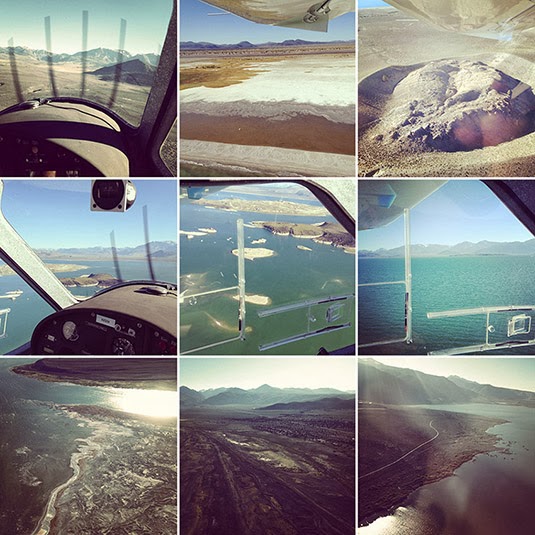
Flying with Michael Light over Mono Lake; photos by Venue.

We took a nighttime hike and hunted for scorpions in the underbrush; we looked at aerial maps of the surrounding area—in fact, most of the U.S. Southwest—to discuss the invisible marbling of military & civilian airspace in the region; and we asked Light about his many projects, their different landscape emphases, the future of photography as a pursuit and profession, and what he might work on next.

From SCUBA diving amidst the nuked ruins of WWII battleships in the most remote waters of the Pacific Ocean to spending years touching up and republishing photos of U.S. nuclear weapons tests for a spectacular and deeply unsettling book called 100 Suns, to his look at the Apollo program of the 1960s as an endeavor very much focused around the spatial experience of another landscape—the lunar surface—to his ongoing visual investigation of housing, urbanization, and rabid over-development in regions like Phoenix and Las Vegas, Light was never less than compelling.

With several great phrases—that “the mine is a city reversed,” or that the sunken ruins of WWII battleships “are dissolving like Alka-Seltzer” in the depths of the Pacific—and with an always caustic sense of humor, Light patiently answered our questions about his work both above the ground and below sea level, discussing what nuclear weapons have done the Western notion of the landscape sublime, what cameraphones have done to the professional photographer, and what it means to transgress today into the corporate-controlled air spaces of vast mining and extraction sites out west.

Michael Light, Shadow at 300’, 1300 hours, Deep Springs Valley, CA (2001)

• • •
Geoff Manaugh: I’d like to start by asking how the aerial view ties into the nature of your work in general. You’ve spoken to William L. Fox in an interview for the Some Dry Space exhibition about a feeling of spatial “delirium,” suggesting that the experience of moving through the sky is something viscerally attractive to you. I’m curious if you could talk about that, as a physical sensation, but also about the representational effects of the bird’s eye—or pilot’s eye—view and how it so thoroughly changes the appearance of a landscape.

Michael Light, Clouds Over the Jonah Natural Gas Field, Pinedale, WY (2007)

Michael Light: The short answer is that the aerial view affords a breadth of scale that offers direct access to many of the bigger, more “meta” themes that have always been of interest to me.

But let me take a few steps back and try to explain where all this came from. I got a B.A. in American Studies from Amherst many years ago, and I have since been an Americanist—not in the sense of being an apologist for America, but in the sense of someone trying to figure out what makes this country tick. It is a very, very vast country.

Michael Light, Sheep Hole Mountains at 400’, 0700 hours, Twentynine Palms, CA (2000)

I grew up on the end of Long Island, and I was always getting onto Highway 80 or onto more southerly interstates and heading west. The metaphor that always accompanied me, oddly enough, was one of falling into America rather than crossing it. I was falling into the vastness of America and the sheer scale of it.

Of course, after I moved to California in 1986, I caught myself coming back east quite a bit, for family or for work, and those commercial air flights across the nation, flying coast to coast, were formative and endlessly interesting to me. I don’t ever lower the window shade as requested. If the weather is clear, the odds are that what’s unfolding below, geologically, is the main attraction for me. I just found myself looking down—or looking into—America a lot, and that sense of falling into the country just grew and evolved.

I did a big piece back in the 1990s, when I was still in graduate school. It took a couple of years, but I figured out how to make pretty decent images from 30,000 feet, from the seat of a commercial airliner. For instance, you have to sit in front of the engine so that the heat doesn’t blow the picture; and it’s a contrast game, trying to get enough clarity through all the atmospheric haze and through two layers of plexiglass, and so on and so forth. That piece was based specifically on commercial flights and it was liberating for me in lots of ways.

While working on one of those images, in particular, I had something of an epiphany—I think it was somewhere over Arizona. It’s very spare, arid country, and the incursions of human settlement into it that you see from above look very much like a colony on Mars might look, or the proverbial lunar colony, and I thought “Ah ha! Look at that!” And I realized, at that moment, that maybe I could try to find or document something like a planetary landscape: the way humans live at a planetary scale and through planetary settlements.

Michael Light, Chidago Canyon at 500’, 1800 hours, Chalfant, CA (2001)

This was what got me, pretty soon thereafter, thinking above and beyond the earth: looking toward NASA, and their various programs over the past few decades, and that eventually became Full Moon.

FULL MOON: Composite of David Scott Seen Twice on Hadley Delta Mountain; Photographed by James Irwin, Apollo 15, 1971 (1999)

Manaugh: There’s an interesting book called Moondust by Andrew Smith, which began with Smith’s realization that we are soon approaching an historical moment when every human being who has walked on the moon will be dead. He set about trying to interview every living person—every American astronaut—who has set foot there. What makes it especially fascinating is that Smith portrays the entire Apollo program as a kind of vast landscape project, or act of landscape exploration, as if the whole thing had really just been at attempt at staging a real-life Caspar David Friedrich painting with seemingly endless Cold War funds to back it up. The place of Full Moon in your own work seems to echo that idea, of NASA lunar photography as something like the apotheosis of American natural landscape photography.

Light: The Apollo program was absolutely a landscape project—but also an extreme aerial project. And Full Moon, of course, was also driven by my own interest in the aerial view, or the aerial exterior. That project is nothing if not a really serious exploration of the aerial: that is, if you keep going up and up, the world becomes quite circular and alien. You see the world quite literally as a planet.

FULL MOON: The Ocean of Storms and the Known Sea; Photographed by Kenneth Mattingly, Apollo 16, April 16-27, 1972 (1999)

Anyway, for me, yes, the aerial view has an intense physicality. I’ve been flying planes since before I was driving. I soloed in gliders—engineless aircraft—by 14, and, by 16, I had a private pilot’s license. A glider offers a particularly intimate and very physical way of flying, because you have to work with thermals and updrafts. You don’t have an engine. You actually want it to be turbulent and bumpy up there, because that means that the air is unstable—that parts of the atmosphere are going up and other parts are going down—and, if you can stay in those up parts and find the updrafts, then you can ride it out for hours.

Also, I was lucky enough to start SCUBA diving at the age of 9.

Michael Light at 9 years old, Bimini, Bahamas (1972)

Flying and going underwater are completely connected, at least in my mind. The three-dimensionality of each of them is something I’ve experienced from a very early age, and it is one of my greatest ongoing pleasures. I would say that there’s a tremendous amount of physical pleasure in both—and that, occasionally, it would even be accurate to call it ecstasy.

It’s like skiing or long-distance running: everything’s in the groove, everything sort of falls into place, you’re flying really beautifully, or, oftentimes in my work, you’re transgressing over something, or you’ve got a very intense subject, and you are trying to figure something out as an artist or as a citizen.

Michael Light at 49 years old, Petaluma, CA (2012)

You mentioned delirium. There’s also a certain kind of delirium—a spatial delirium, sure—simply in the pleasure of learning something new and, for me, hopefully putting that 3-dimensional experience into 2-dimensional photographic form. And if it’s good—if the image is good—then hopefully other people can get some of what I got.

Manaugh: This reminds me of a conversation I had with a writer named Kitty Hauser about the history of aerial archaeology. To make a long story short, aerial archaeology, using photographs, was born from military reconnaissance flights over the European front in World War I. The pilots there began noticing that they could see features in the landscape—such as buried or ruined buildings—that were invisible from the ground. When that technique of viewing from above was later exported to England, particularly as the leisure classes and retired military types found the free time and the personal wealth to purchase private airplanes, aerial archaeology as a pursuit really took off, if you’ll excuse the pun. And these early pioneers began to realize that, for example, there are certain times of day when things are more clearly revealed by the angle of the sun, including shadows appearing in wheat and barley fields that, when seen from above, are revealed to be an archaeological site otherwise hidden beneath the plant life. I’m curious how coming back to the same locations at certain times of day, or in certain kinds of light, can make sites or landscapes into radically different photographic experiences—with different depths or different reliefs—and how you plan for that in your shots.

Light: If I go out on an expedition for weeks shooting with an assistant, I don’t immediately fall into that groove. A few days in, everything will align. It certainly is a kind of discipline. You’re flying and imaging and circling—again and again and again, around and around and around—because you can’t just move the camera two inches to the left, or wait 15 minutes. You’re moving along at 60 miles an hour through space. So you have to shoot it again and again and again, until, finally, you get to a point where your physical senses are moving faster than your mind, and you’ve made all the shots that you think you should make—which are generally the worst ones—and it’s at that point that you come up with something genuinely new.

Specifically, I tend to shoot early in the morning and then again in the evening, which is pretty much standard practice because, of course, the lower axial light gives that 3-dimensionality and creates a feeling of revelation. Every once in a while, though, I will shoot in the desert at midday, but it’s usually only when I’m specifically seeking a flat, blown out, almost stunning or hallucinatory light.

Michael Light, Deep Springs Valley at 500’, 1600 hours, Big Pine, CA (2001)

But, early in the morning, the sun seems to go off in the desert like a gun—and, of course, the sun is much softer in the evening, because there’s so much more dust in the air. You really have to get up early. I’ll shoot for an hour and a half, which is all I can really take with the doors off of the aircraft. It’s very windy. It’s very intense. The camera I use is about 20 pounds. So we’ll come back and we’ll have some breakfast—and I’m exhausted. I’ll probably nap around noon for an hour or two then, come 4:00pm or so, we gather our forces and go back up.

It’s always much more turbulent in the afternoon in summer. Summer is when I tend to fly, though, because, of course, in the colder months it’s just too cold. It’s also just a lot more dangerous to cross the mountains when there’s snow on them.

But, on summer afternoons, it can be a wild ride. You strap in there tight. My glider background is helpful here; I know the plane will continue to fly, for instance, and that there’s nothing to be super-scared of. I know I’m at the edges of my equipment’s performance. The specifications on the plane degrade measurably when you take the doors off, because you generate a tremendous amount of drag. In hot temperatures, the engine also tends to run hot and, the hotter the summer air is, the fewer molecules there are under the wings of the aircraft, the fewer molecules there are to combust with the engine fuel, the fewer molecules there are for the propeller to bite into, and you get much more turbulent air. Your aircraft performance falls off measurably.

Michael Light, Afternoon Thunderstorm Looking West, Near Rock Springs, WY (2007)

For example, I often fly from San Francisco over the Sierras to Mono Lake in the summer. The Sierras, on the west side, have a very gradual slope. But on the east side it’s a very dramatic, very steep escarpment. It’s a drop of 7,000 feet almost in a straight line. You have a very smooth, very fast trip up the western slope, but, when you get to the escarpment, you hit what’s called a “rotor.” That’s a very turbulent place where the usual land-to-airflow relationship completely falls apart, because the support has been taken away. For those five miles or so, going east, you’re in a tumbly, sometimes chaotic atmosphere and it can be extremely dangerous, depending on the speed of the wind.

When I hit the rotor, I just think of it in terms of river rafting: looking for eddies, back-flow currents, whirlpools, and so forth. Even though it’s invisible, I know where I’m going to hit turbulence. Even though I can’t see the air, I know, extrapolating from the way that water behaves, where the turbulence will be—like, beyond that rock mountain spire over there, it’s going to be gnarly.

Michael Light, City-Owned Motocross Park Looking North, I-70 Beyond, Lakewood, CO (2009)

To go back to your question: in the six, almost seven years I’ve been flying with engines, the landscape is so perceptually dependent on the type of light that’s illuminating it. You really do get radically different spaces in different kinds of light. A different kind of vibe. Seasons will also change the way a landscape looks—or, I should say, the light itself seasonally changes.

On an artistic level, the ever-changing nature of what I do and how I do it, and even the instability of my position in the sky over the landscape—it’s all part of my process and it’s something I enjoy.

Manaugh: Let’s go back to SCUBA diving. When we talked four or five years ago in Nevada, you were heading off to the Bikini Atoll, to dive amidst the ruins of U.S. warships, and I’d love to learn more about that project. How did it come about, what were you seeking to document, and what were the results? I’m also fascinated by analogy of being in the empty volume of the sky versus being buried in the very full volume of the ocean and how that affects the sense of space in your photography.

Light: The Bikini work grew out of my earlier involvement with imagery of nuclear detonations, which, as you know, was a project called 100 Suns. That was an archival endeavor that came out in 2003.

100 Suns (2003)

As a photographer or maker of images, I’m always as interested in trying to figure out the meaning of the trillions of photographs that have already been made as I am in making new ones of my own. And, culturally, I find it interesting to think about the meaning of photography, in the very large American contexts of Full Moon and 100 Suns. I think of both projects as landscape projects and, certainly, they are also investigations into American power and the peculiarities of American scale.

Nicola Twilley: As a side note, how does an archival project like 100 Suns work, technically, as far as reproducing the images goes?

Light: You scan them. You go in and you clean them up. You do whatever the approach of the hour is. You wind up almost lovingly inside each of the historical photographs. And you get very fond of them; you think of them almost as your own. Of course, they’re not—primarily because you haven’t had the experience of actually going to that space at that particular time and choosing how to make that image.

But I had a very strong desire to go—to make a pilgrimage—to, if not the Nevada Test Site, which I never could get into, then at least to the Pacific Proving Grounds, which I could get to. I tried to get into the Nevada Test Site. You can visit it, physically, but to get over it—in the air—and to make images is basically impossible. The last person to get permission to do that was Emmet Gowin, with his remarkable images. He got in in the 1990s. It took him a decade, and that was before 9/11. I tried again, and I was negotiating directly with the head of the site, but I just could never do it.

However, one can get out to Bikini, and the way one gets to Bikini hasn’t changed. At the time I went, there was a dive operation there run by the people of Bikini—who actually live 500 miles away, on a rather awful rock without a lagoon, in a place that they were moved to in 1945. They were basically booted off their atoll by the U.S. government. The people run this dive operation really for propaganda reasons, using it as a method to tell their story.

Michael Light, Bikini Island, Radioactively Uninhabitable Since 1954, Bikini Atoll (2003)

What one goes to dive for there are ships that were sunk in the Operation Crossroads tests of 1946.

At that point, the U.S. Navy—this was, of course, right after Hiroshima and Nagasaki—wanted to know if naval warfare was now utterly obsolete. Could a single bomb destroy an entire navy or a flotilla of ships?

100 SUNS: 058 BAKER/21 kilotons/Bikini Atoll/1946 (2003)

So they gathered almost 100 vessels for the tests, making all sorts of strange, mythic gestures. For instance, they brought the Nagato, which Admiral Yamamoto was on when he orchestrated the attack on Pearl Harbor. They brought that all the way from Tokyo. They brought out the Prinz Eugen from Germany, which was Germany’s most modern battleship. They brought the first American aircraft carrier, the U.S.S. Saratoga, out.

The ships they chose were these giant wartime icons, and they were bombed both from the air, with the Able test, and from 90 feet underwater, by the Baker test. The Baker test gave us the most spectacularly iconic images of Bikini: a water column being blasted up into the sky with the Wilson bell cloud around it that we all know so well.

100 SUNS: 059 BAKER/21 kilotons/Bikini Atoll/1946 (2003)

Those ships are 180 feet down at the bottom of Bikini Lagoon, to this day. They were functional at the time, and they were fully loaded with weaponry and fuel. They were unpopulated, although there were farm animals chained to the decks of the ships. So it’s creepy.

Diving there is pretty hairy. It’s way beyond recreational safety diving limits. 180 feet is dark. 180 feet is cold. You take on a tremendous amount of nitrogen down there. It’s pretty technical. You have to do decompression diving, which is inherently dangerous—you have to breathe helium trimix at about thirty feet below the boat for nearly an hour after twenty minutes at depth, hoping that no tiger shark comes along to eat you, as you adjust.

Michael Light, Shark, Bikini Lagoon (2007)

Once you’re down there, you can penetrate the ships, which are dissolving like Alka-Seltzer. It’s very entropic. You’re suffering, at that depth, from nitrogen narcosis. It’s like having three martinis. You’re pretty zonked out.

I went twice: in 2003 and, again, in 2007. During those trips, I made images from the air, on the surface, and underwater. I dove Bikini Lagoon, down to those ships on the bottom, twice.

Michael Light, Diver descending to 180 feet, Bikini Lagoon (2007)

It was one of the most challenging landscapes I have ever worked in, because almost inconceivable violence occurred to these places—both to Bikini Atoll and to Enewetak Atoll. I only physically went to Bikini Atoll, although I did fly over Enewetak. But both atolls were subjected to human gestures that are, as I said, almost inconceivably violent. To try to represent that photographically is very, very difficult.

In fact, the radiological disaster that occurred in 1954 happened simply because the winds changed direction at the wrong time, blowing back over the atoll at Bikini. During the largest nuclear detonation the United States ever did out there, which was 15 megatons, the winds shifted and everything blew back over the islands. It’s the worst radiological disaster in U.S. history.

Manaugh: I don’t want to sound naïve, but is it safe even to be there? Can you walk around and swim in the water and not get radiation poisoning?

Light: Bikini Atoll is still radioactive and still uninhabited to this day, but, yes, you can go there. As long as you don’t drink the water or eat the coconuts—anything that actually comes in contact with the soil, which has a layer of Cesium-137 in it—then you’re fine. The islands have healed. You know, it’s tropical. They’ve healed. There aren’t five-headed crabs walking around. The fish are fine; you can eat the fish. But it’s still pretty radioactive. I’m walking around in a Speedo bathing suit, thinking, “Wow, I’m glad I’m never having kids, ever!” You can’t feel radiation, but it’s there.

So there you are, having a tropical paradise moment, surrounded by tropical paradise visuals, yet you know, in your head, that this is one of the most violent landscapes on earth.

100 SUNS: 086 MOHAWK/360 kilotons/Enewetak Atoll/1956 (2003)

Two commercial aircraft fly the Marshall Islands. There is no access to private aircraft. The distances are too great. Bikini and Enewetak are in the middle of nowhere—that’s why they were used as test sites in the first place. To get aerial access to them was extremely difficult. I had to shoot from those two commercial air shuttles.

Over Enewetak I was able to get some pretty great images of the Mike crater. Mike was the first H-bomb test or, I should say, the first test of a “thermonuclear device.” It was not a bomb.

Michael Light, Mile-Wide, 200’ Deep 1952 MIKE Crater, 10.4 Megatons, Enewetak Atoll (2003)

That was Edward Teller’s baby, and one big-ass crater. That was 10.4 megatons. The scale of that kind of explosion dwarfs all of the ordinance detonated in both world wars combined. Five seconds after that detonation, the fireball alone was five miles wide. These were really, really big explosions. It’s hard to get your head around how big they were.

100 SUNS: 065 MIKE/10.4 megatons/Enewetak Atoll/1952 (2003)

Getting above and working with the Mike crater was terrific. I was able to get above Bikini, but not above the Bravo crater or out to the farthest edge of the atoll. Bravo was the 15-megaton test that left Bikini radioactive.

100 SUNS: 099 BRAVO/15 megatons/Bikini Atoll/1954 (2003)

However, I was able to dive in the Bravo crater while I was there, which was one of the creepiest experiences of my life. It’s still quite radioactive out on the edge of the crater. There’s a bunker right on the edge of Bravo Crater that’s sheared off at the top.

Michael Light, Radioactive Bunker Facing Mile-Wide, 200’ Deep 1954 BRAVO Crater, Bikini Atoll (2003)

Anyway, it’s obviously very deep and very rich territory. It was pretty amazing to be able to make the pilgrimage after having spent so much time with the archival material as I worked on 100 Suns. I have always felt ambivalent about the Bikini work. I’ve never known quite what to do with it. It is hard to work out there. I think that, ultimately, I will do a small book that will move between historical imagery of the ships and of the servicemen. There were 40,000 servicemen stationed there for several years while the Crossroads tests were happening.

I went back in 2007—I think that was right after you and I first talked about this. I got to do some aerial work and some more work on the ground, but, primarily, that trip was about bringing out a digital camera, which I did not have in 2003, and using it underwater. I had a housing and some lights, but I was not very successful in imaging those ships recognizably at those depths. It’s hard.

Michael Light, Ship Sunk by 1946 Crossroads Tests, Bikini Lagoon (2007)

There’s a lot of organic matter in the water. It’s incredibly dark. It’s very difficult to figure out, conceptually, a way to image the country’s first aircraft carrier. For example, I can’t back away from it enough, underwater, to get the whole thing. In theory, one could put together composite images, shot at a fairly close level, and then sort of stitch together what should look like a ship. But it’s a challenge.

Michael Light, Growth on Ship Sunk By 1946 Crossroads Tests, Bikini Lagoon (2007)

For me, throughout the Bikini work, both in 2003 and in 2007, I have taken the approach of reversing the positive as a conceit toward a sense of visually representing radiation and visually suggesting multiple energy sources other than the sun—multiple sources of light. There are also questions about narrative: about entropy, light, Hades, narcosis, dissolution.

You’ve got this kind of X-ray death trip, if you will.

Michael Light, Tower of the IJN Nagato Battleship, Sunk By 1946 Crossroads Tests, Bikini Lagoon (2007)

It’s a very, very strong feeling, diving amongst those ships, and the ghosts of all the people who died on those ships, and knowing what they were used for and how they were sunk. It almost feels like the last gasp of an industrial era that’s now long over and gone. It was really an age of iron. It’s as far from the digital world that we live in now that you can imagine. It’s a dead era, and the work is tough. It’s not warm and fuzzy, or nostalgic. None of that is what Bikini is about. It’s about as dark as you can get.

Michael Light, Along the USS Saratoga, Sunk By 1946 Crossroads Tests, Bikini Lagoon (2007)

Manaugh: In the context of 100 Suns and even hearing you say things like, “as dark as you can get,” it almost seems as though sites like the Mike crater and even these tropical ruins are like spatial byproducts of very large-scale light events. It’s as if the light of a counter-sun—the nuclear explosion—has created its own landscapes of extreme over-exposure and violence. The scenes you’re documenting, in a sense, are byproducts of light.

Light: Yes, some of this is important to me, and I do tend to think oppositionally, in rather binary terms.

Michael Light, Inside Radioactive Photographic Bunker Built In 1956, Aomon Island, Bikini Atoll (2003)

There are so many levels of meaning to the bomb. There are landscape meanings. There are political meanings. There are industrial meanings. There are scientific meanings. To me, as I mentioned, this is a landscape book at bottom.

I personally see the moment that the Mike device detonated in 1952 as the moment when the classical landscape sublime—which, of course, up to that point was the domain of either the divine or of massively powerful natural forces beyond human control—switched. In 1952, the landscape sublime shifted wholly over to humans as the architect.

I was interested in looking closer at that moment when humans became “the divine”—as powerful as, if not more powerful than, the natural forces that they’re subject to on the planet. What was the effect of that—what did that do to landscape representation—when the sublime became an architecture of ourselves?

100 SUNS: 081 TRUCKEE/210 kilotons/Christmas Island/1962 (2003)

With the attainment of a thermonuclear fusion device, humans are igniting their own stars. What does that mean in landscape terms? What does that mean in architectural terms? When you talk about light itself creating a landscape and leaving behind these giant craters, it’s very resonant territory.

Arguably, humans firing up their own stars could be seen as the absolute pinnacle of a tool-bearing civilization—although it’s equally fair to say that it could be seen as humanity’s greatest tragedy, because it came out of a cauldron of violence and was immediately put back into a cauldron of violence.

100 SUNS: 093 BRAVO/15 megatons/Bikini Atoll/1954 (2003)

To bring us back to ground a little bit here, I did 100 Suns, and I did Full Moon, and I continue to do my aerial forays into the American West, because these are things that I want to learn about and try to understand. I just truly didn’t understand fusion and fission; I really didn’t understand space. I think that, while I have a taste—and the human mind has a taste—for scale, there’s only so much scale that we can take. Even then, we need to have it served to us in smaller chunks.

I found that other books and investigations pertaining to outer space were just way too broad and, in the end, didn’t tell me anything. I don’t get much out of the Hubble images, for example. They’re too big. I have no entranceway into those to conceptualize or think about the subject, so I wind up with cotton candy or some nebula image that’s pretty, sure, but I can’t get any substance out of it.

100 Suns never would have happened without having spent five years on the surface of the moon, metaphorically. Studying the nature of light in a vacuum—that was really the primary interest of mine, artistically, in taking on that project.

FULL MOON: Astronaut’s Shadow; Photographed by Harrison Schmitt, Apollo 17, 1972 (1999)

How does light work without atmosphere to break it up? It’s sharper than anything our eyes have evolved to see, and it behaves very differently than it does when diffused by an atmosphere. What does that do to the physical act—the actual technology—of photography as it tries to capture that light? What does that light do to a landscape?

What does that landscape do to all the other landscapes we’ve already seen in the history of landscape photography?

FULL MOON: Morning Sun Near Surveyor Crater, With Blue Lens Flare; Photographed by Charles Conrad, Apollo 12, 1969 (1999)

I spent a lot of time looking at the sun’s effects on the surface of the moon, in near-vacuum conditions, and I thought, “Well, what’s the next logical step for this?”

FULL MOON: Solar Wind Collector; Photographed by Alan Bean, Apollo 12, 1969 (1999)

Certainly, it’s not Mars, as so many publishers would suggest. It seemed more logical to go look directly into that sun and, at least in terms of the 20th century, very clear that I should step back just two or three decades, and deal with the bomb. Of course, the Apollo program never would have happened without ICBMs.

On that level, it’s logical—but it also acts as a kind of psychological journey. In 100 Suns, there’s no handholding that occurs for the viewer to guide them between attraction and repulsion. You’re just thrown into it. There’s science afterward; there’s text afterward; there are explanations afterward; there are politics afterward. But that kind of frontal experience was what I wanted you to feel, as a viewer.

It was a very daunting subject. The scale of America, and the scale of its power, offers an infinite mountain of mystery.

Twilley: In terms of both the moon and some of these military ruins, like the Nevada Test Site, physical access for the photographer is all but impossible. Has this made you interested in remote-viewing, remotely controlled cameras, or even drone photography? What might those technologies do, not necessarily to the future of photography, but to the future of the photographer?

Light: Absolutely. I think it’s important to remember that the vast majority of the Apollo photographs were made without anyone looking through a viewfinder.

Those cameras were mounted on the surface of the moon or on the chest area of the spacesuit. With a proper wide-angle lens and an electric advance, the astronauts basically just pointed their bodies in 360-degree circles, at whatever area they were collecting the samples from, and that was the photograph. They were trained very carefully to make sure they could operate the cameras, and there are certainly examples of handheld camera images on the surface of the moon, but a lot of the images were these sort of automatic images you’re talking about—photography without a photographer.

FULL MOON: Alan Bean at Sharp Crater With the Handtool Carrier; Photographed by Charles Conrad, Apollo 12, 1969 (1999)

It’s one of those things that I find interesting about Full Moon, that what we consider to be interesting, photographically, can happen absent of a human set of eyes making the image. Today, as you mention, it’s only getting more extreme.

I should say, at this particular photographic moment, as a photographer myself, I feel overwhelmed. I have not figured out where photography is going. I don’t think anyone has. I certainly know that it’s changing, radically, and sometimes in ways that make me want to run back to the 19th century.

For one thing, everyone’s a photographer now, because everyone has a phone, and those cameras are getting very good. The cameras themselves are doing more and more of the work, as well, work that, traditionally, was the field of the photographer, so the quality of photographs—in the classic sense of things like quality of exposure, density, resolution, contrast, and so forth—is going up and up and up. And, of course, as you well know, there are now systems in place for total and instantaneous publishing of one’s work via the Internet. I think we are entering a world of total documentation.

Obviously, all of this visual information is going to continue to proliferate. I don’t know how to navigate my way through that. I tell myself—because I have my own methods, my own cameras, and my own crazy aerial platform—that my pictures have a view that you are not going to get from a drone.

Personal drones are going to proliferate, and our eyes, soon enough, are going to be able to go anywhere and everywhere without our bodies. Humans have a tremendous interest—they always have had—in extending themselves where they physically cannot go. That’s just picking up more speed now—it’s going faster and faster—and the density of the data is thickening, becoming smog.

I think that photography, or what we currently consider photography, will become more about the concept or the idea driving the picture than the actual picture itself. Maybe that has always been the case. Metaphors are obviously applicable to everything, and you can find them in everything, if you want to. It’s not so much the picture—or, it’s not so much the information in the picture—it’s the spin on it. Information does not equal meaning. Meaning is bigger than information.

I used to fly model aircraft as a kid. It’s a powerful fantasy: mounting a camera on a little electric helicopter and running it around the corner, lifting off over the fence, the hedgerow, the border, and seeing what you can see. I actually do it physically now, in airplanes, and I’m very invested in the physical experience of that. It’s a big part of my aerial work: the politics of transgressing private property in a capitalist society.

I may not be able to get into that gated community on the outskirts of Las Vegas—which is what I’m photographing now, a place called Lake Las Vegas—but, legally, I can get above it and I can make the stories and the images I want to make.

Michael Light, “Monaco” Lake Las Vegas Homes on Gated Grand Corniche Drive, Henderson, NV (2010)

That homeowners’ association, or that world created by developers, wants total control over its narrative, and, in general, they have it. They exclude anyone who wants to tell a different story. So far, with the exception of military air space and occasional prohibited air space around nuclear power plants and that sort of thing, I can still tell my own stories, and I do.

A couple of years ago I went out to Salt Lake City. I sold one of my big handmade books to the art museum there, and I also made an effort to see Kennecott Copper, which is owned by Rio Tinto. I thought they might be interested in buying some of the work—but, as it turned out, they were not at all interested, and, in fact, seemed to wish I didn’t exist.

I met with their PR person—a very nice, chatty PR kind of lady. I showed her this spectacular, 36-inch high and 44-inch wide book of photographs featuring this incredible, almost Wagnerian hole in the ground. And the only thing that she could say, upon seeing the book, was: “How on earth did you get permission?” Not: Wow, these are interesting pictures, or whatever. She instantly zoomed into the question of the legal permission to represent or tell the story of this site. I said: “Well, I didn’t get permission, actually, because I didn’t need permission.” And that was anathema to her; it was anathema to the whole corporate structure that wants to control the story of the Bingham Mine.

Michael Light, Earth’s Largest Excavation, 2.5 Miles Wide and .5 Miles Deep, Bingham Copper Mine, UT (2006)

Anyway, I think it’s through my own selfishness that I would not want to send a drone up to transgress over a site when I could do it, instead. I could just sit at my computer screen and kick back in my chair—but we spend enough time in chairs as it is. It’s more that I am putting my butt on the line; I’m breaking no laws, but there is the experience of physical exploration that I would be denied by using drones. Obviously, in areas where I truly cannot go—like the moon—or where I wouldn’t want to go—like on the edge of one of those nuclear detonations—then I’d be thrilled to have a remote.

Manaugh: You mentioned control over the narrative of the copper mine. It’s as if Kennecott has two-dimensional control over their narrative, through image rights, but they don’t have volumetric, or three-dimensional, control over the narrative, which you can enter into with an airplane and then relate to others in a totally different way.

Light: Of course.

My particular approach, aerially, is very different. The obvious answer is: why not just Google Map it, and zoom in, and then throw a little three-dimensionality on it by moving a little Google Earth lever? But the actual act of going in at the low altitudes that I do lets me make these particular images. I don’t do verticals; I do obliques, because they allow for a relational tableau to happen. To go in low—to make that physical transgression over Bingham or over Lake Las Vegas or over this or that development—is great, and I think it’s a viewpoint that is unique.

Michael Light, Looking East Over Unbuilt “Ascaya” Lots, Black Mountain Beyond, Henderson, NV (2010)

Manaugh: You’ve mentioned Las Vegas, but I’d also like to talk about your Los Angeles work. You basically have two oppositional series—L.A. Day and L.A. Night—which really makes explicit the role light plays in changing how we see a landscape. For instance, in L.A. Night, the city is represented as this William Blake-like microcosm of the universe, with the lights of the houses in the Hollywood hills, and the cars on the freeways, mimicking the stars above them. The city becomes a copy of the sky.

Michael Light, Untitled/Downtown Dusk, Los Angeles (2005)

Then there’s L.A. Day, which confronts the massive Ballardian geometry of the freeways themselves, baking under the sun.

Michael Light, Long Beach Freeway and Atlantic Boulevard Looking Southeast, L.A. River Beyond (2004)

I’m interested in what the city is doing for you in these photographs. Is it a representation of the end of civilization, or is it a strange depiction of new, golden dawn for urban form? What is your attraction to and metaphoric use of the city—of Los Angeles, in particular?

Light: Well, these are very interesting questions. One thing to bear in mind, first of all, is that the day work and the night work is now quite old work to me. The day work was shot in 2004 and the night work was shot in 2005 and it’s just a Los Angeles; it’s not the Los Angeles. It’s very much a particular spot in time that I found myself at that moment. I’ll get into that in a little more detail in a minute.

Back in 1986, when I moved to San Francisco, I wanted to come west for a lot of reasons, one of which was to work for the environment. I had worked for the Sierra Club doing political lobbying with their D.C. office for a couple of years right out of school in the late 1980s. I’ve remained a pretty strong environmentalist, although I try not to make my work tendentious or overtly activist in that sense. I want to be more complicated than that.

Michael Light, Looking Northwest, Somewhere Near Torrance (2004)

Anyway, in San Francisco, the default attitude is to look down your nose at the Southland—like, “Oh, yeah, Los Angeles. It’s everything that’s wrong with America.” The more I’ve lived in California, though, which is 26 years now, the more I have come to realize that this is an extraordinarily common, but very facile, view of Los Angeles. I hope I have grown in the depth of my views about L.A., I’d say, because, if there’s any one thing I’ve learned about photographing Los Angeles—like anywhere else, but particularly L.A.—it’s that, every time you shoot, it’s a different city. L.A. in the spring is one thing. L.A. in the dry summer is another. L.A. day. L.A. night. L.A. color. L.A. black and white. I have been humbled, I think, in a positive way in my views of Los Angeles. Of course, maybe I’ve just gotten more cynical or maybe I’ve gotten a little more complicatedly environmental. But I’m not condemnatory about that city the way I used to be.

L.A. is a massive thing. This is one of the reasons why I was drawn to it in the first place. It’s so big. It’s so complex. Is it apocalyptic? Well, yes; it has a certain apocalyptic quality to it. But, if I’m trying to understand America, or trying to understand the bomb, how could I not try to understand L.A.?

So L.A. Day came directly out of doing 100 Suns. 100 Suns came out in 2003 and I had been spending a tremendous amount of time metaphorically looking at “suns.” Obviously, in L.A. Day, one of the major tropes is that I am shooting directly into the sun, and I’m dealing with air, light, and atmosphere. In that regard, I’m also exploring many of the same things as Full Moon.

I was also just beginning to work with 4×5 negatives, and wanted to go as high-key as possible, to go back into that annihilating desert light. A lot of it was shot either early in the morning or very late in the day, but the whiteness of the light at midday is a very dry, Western, annihilating light that I was also interested in investigating. There’s an image that I’m particularly fond of: it’s downtown L.A. with the river in front, and the city is almost vaporizing. It’s almost just lifting up into the ether. I guess I wasn’t overtly looking for a nuclear moment, something coming so literally from 100 Suns, but, in my mind, that image really—at least, metaphorically—bridges those two projects.

Michael Light, Downtown Los Angeles Looking West, 1st Street Bridge and L.A. River in Foreground (2004)

The night work was kind of a binary reflex. I had been thinking about the old 19th-century blue-sensitive films, where the skies would go pure white, for a while. Full Moon, obviously, is the reversal of that, where the ground—the surface of the moon—is white with undiluted sunlight and the sky is endlessly black.

In the day in L.A. you get the obverse: a terrestrial sky, if you will. L.A. Night is another reversal and a kind of the binary analogue to the moon and its vacuum sky.

Michael Light, Untitled/River Stars, Los Angeles (2005)

Those things were operating in my mind, although the night work also came out of a technical challenge I wanted to face. I wanted to get this 4×5 camera to work from a helicopter. I can only go one-sixtieth of a second. Slower than that and I get a blur. The challenge was: can I actually get enough light on the film at one-sixtieth of a second, either at dusk or in pure dark? Can I even make this work?

I discovered very cheap—relatively speaking—Robinson R22 helicopters, operating out of Van Nuys, that I could get for something like $230 an hour with a pilot. The physical thrill of having your own private dragonfly, really, which is what these helicopters are, also drove my interest. I was doing all this day work and I thought, well: let’s try a night flight. Let’s actually drift over the vastness and the endlessness of the city, and all the light washing around in that basin. It is exquisitely sparkly. It’s delightful. It has some enchantment in a way that Los Angeles, in daylight, does not. It’s rife with metaphor with all the little lights standing in for all the little people.

Michael Light, Untitled/Hollywood, Los Angeles (2005)

I think that, in all of my work since the late 1980s, there has been a transposition between up and down, or a loss of gravitational pull, and that’s very important to me.

FULL MOON: Edward White at 17,500 mph Over the Gulf of Mexico; Photographed by James McDivitt, Gemini 4, 1965 (1999)

A sense of vertigo or spinning in space, the full 3-dimensionality of space—the spatial delirium we were talking about earlier. I’ve always been interested in imagery that gives me a sense of looking up when I am actually looking down. That reversal is something I try to look for.

Michael Light, Sawtooth Mountains Diptych, ID (2012)

But that night work was very much of a moment in time in my own production—meaning that I would not go back to L.A. and make pictures like that again.

The work I’m doing over Vegas couldn’t be more different. It’s color. It’s very much lower to the ground. It’s much more specific to its content. In aerial work for me, not only is there tremendous pleasure in moving through space, 3-dimensionally, there is also tremendous pleasure in moving over and around and amongst geology and amongst actual formations of the land. Much of the content of the western work is about that dialogue between geology and the built world.

Michael Light, Empty Lots in the “Marseilles” Lake Las Vegas Community, Henderson, NV (2011)

The subtitle of my larger project, Some Dry Space, is An Inhabited West. My point is that there is no place that’s untouched anymore. The west is a giant human park.

But, that said, there is still lot of space left and it’s really fun to move through that space. It’s fun to say, well, okay, here’s Phoenix or here’s Los Angeles, but how can I make images that actually show the power of the geology of a place? How do I represent two different time scales? How do I photograph the human one and the tectonic one? I find that dialogue, between a human time frame and the time frame of the land, to be an interesting one. I try to capture both when I can, preferably adjacent to each other in the same picture.

Michael Light, New Construction On East Porter Drive, Camelback Mountain Beyond, Scottsdale, AZ (2007)

Twilley: What have you been trying to capture or represent in your most recent trips out there?

Light: Every flight is different. Every mindset is different. I find that I take radically different pictures each time I go up. It’s an interesting thing. I’ve contained myself to two areas—Lake Las Vegas and the MacDonald Ranch, which is this whole side of a mountain that’s been completely sculpted into house pads. It is the most spectacular, simple engineering project I think I’ve ever seen. It’s very dramatic. Parts of it are built out; parts of it aren’t. I don’t know what the final awful sales name of the development will be, but these will be very high-end homes.

I’ve really taken on the domestic side of Las Vegas, where “California dreams” are to be had on the cheap—and then on the extraordinarily inflated side of things, the delusional, opulent side of things.

Vegas is a very easy target for the sophisticated East Coast cultural critic to come out and judge. But that line of critique is a dead end. It’s not new territory, and it also dismisses the people—the end-users—without asking any questions about how they got there. I’ll nail the developers any day of the week: this is a calculated, rationalized capitalist agenda for them. But the people at the end, on the receiving side of it, the people who are trying to build their lives and their dreams, on whatever unstable sands that they can or can’t afford out there—I would like to present them critically but without condemnation.

Michael Light, Halted “Bella Fiore” Houses and Bankrupt “Falls” Golf Course, Lake Las Vegas, Henderson, NV (2011)

The L.A. work was too high and atmospheric to get political. Now that I’m down, flying much lower and getting closer and closer to the material, I think the work can carry more of an agenda. It is a presentation with sophisticated layering, I hope, rather than a blanket condemnation. Otherwise, I’m looking down my nose, saying, “Oh, look at these poor fools living in Las Vegas, while I’m up in San Francisco living the way people should live.”

The more work I do in Las Vegas, the more I see parallels between the mining industry—and the extraction history of the west—and the inhabitation industry. They do the same sort of things to the land; they grade, flatten, and format the land in similar ways. It can be hard to tell the difference sometimes between a large-scale housing development being prepped for construction and a new strip mine where some multinational firm is prospecting for metals.

Michael Light, Unbuilt “Ascaya” Lots and Cul De Sac Looking West, Henderson, NV (2011)

In other words, the extraction industry and the inhabitation industry are two sides of the same coin. The terraforming that takes place to make a massive development on the outskirts of a city has the same order, and follows the same structure, as much of the terraforming done in the process of mining.

That was a revelation for me. The mine is a city reversed. It is its own architecture.

Michael Light, Hiking Trail and Unbuilt “Ascaya” Lots, Black Mountain Beyond, Henderson, NV (2010)

This latest shoot also resulted in some structural advances in the photographs, in the way that they are composed and the way that they are offset and fragmenting. I was pleased with it. I was also testing out a new camera I had rented.

Twilley: Are you shooting digital?

Light: I am beginning to. I’m trying. I’m renting all the Hasselblads—60 megapixels—that I can get my hands on.

Michael Light, Houses on the Edge of the Snake River Lava Plain, Jerome, ID (2009)

Anyway, the more I photograph, the more I have become attracted to architecture and the meanings of architecture. As it appears here and there out west in the landscape, architecture stands out so much. It’s just plunked down, naked and exposed. Whatever intentions it has, if there are any, are so apparent.

As I have come to photograph these inhabited landmarks, it’s more and more obvious how the affluent choose to manifest their affluence through architecture. They manifest it by getting or obtaining a certain piece of land—a spectacular piece of land in the spectacular west—and then by building some sort of structure there. They want to insert themselves into the most sublime location possible.

They take in the sublime, as we all would, and as I do, but then they try to project it back out again through a generally dirty and dark architectural mirror. You see it on the Snake River, with the potato barons. You see it in Colorado. You see it in ski towns. In my view, it’s just a re-projection of the American business ego—let’s just call it the American ego—back out into the landscape, via this or that villa. It’s an architectural version of wanting now to be the true authors of the landscape sublime, and part of this abrupt shift from classical, uninhabited landscapes to built landscapes of our own monumental and violent design. That’s all part of what I mean by “the inhabited west.”
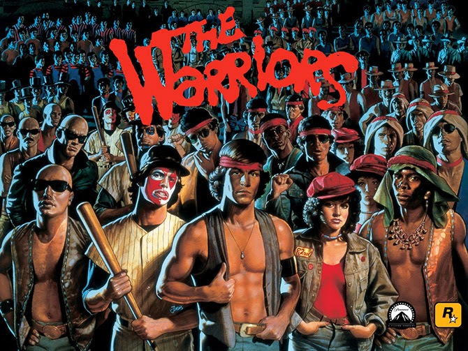
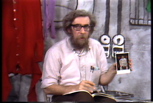
Buying, Selling, and Building Air

[Image: A “wind tunnel model of the New York Trade Center (study by Drs. J.E.Cermak and A.G. Davenport in the Colorado State University boundary layer wind tunnel for L.E. Robertson of Worthington, Skilling, Helle and Jackson (1964),” via Studio-X NYC].

Nicola Twilley of Edible Geography has put together an amazing event this coming Tuesday evening, October 8, at my former employer, Studio-X NYC, an event space run by the architecture department at Columbia University. Called “Air: Its Contents, Value, and Motion,” the event looks at air rights in New York, the challenge of structurally engineering against air, winds, and hurricanes in some of the world’s largest buildings, and a slightly more philosophical take on air’s contents—its pollen, pollution, and even aerosolized fats.

A pretty jaw-dropping cast of panelists—writer William Bryant Logan, air rights lawyer Robert Von Ancken, and legendary structural engineer Leslie Robertson—will discuss, as the event describes it, air, “the stuff between buildings.”

In the process, they “will share their perspective on the curious logic of the city’s air rights economy, how the wind has sculpted its facades, and how the content of its air differs by neighborhood.”

The event is free, kicks off at 7pm, and is at 180 Varick Street, Suite 1610, on the 16th floor. Here’s a map.

Out of the Mountains

[Image: David Kilcullen, from Out of the Mountains].

Military strategist David Kilcullen was in New York City earlier this week to talk about the future of urban warfare at the World Policy Institute. I tagged along to learn more about “future conflicts and future cities,” as Kilcullen describes it, and to see what really happens when urban environments fail: when cities fall apart or disintegrate into ungovernable canyons of semi-derelict buildings ruled by cartels, terrorist groups, and paramilitary gangs.

Kilcullen’s overall thesis is a compelling one: remote desert battlegrounds and impenetrable mountain tribal areas are not, in fact, where we will encounter the violence of tomorrow. For Kilcullen—indeed, for many military theorists writing today—the war in Afghanistan was not the new normal, but a kind of geographic fluke, an anomaly in the otherwise clear trend for conflicts of an increasingly urban nature.

The title of Kilcullen’s book—Out of the Mountains—suggests this. War is coming down from the wild edges of the world, driving back toward our lights and buildings from the unstructured void of the desert, and arriving, at full force, in the hearts of our cities, in our markets and streets. The recent siege in Nairobi and the Mumbai attacks, to name only two examples that came up in Kilcullen’s discussion, are evidence of the urbanization of violence and war. 

But if cities—particularly in the world’s coastal, developing regions—are a hotbed for future aggression, as Kilcullen and other military theorists suggest, then is it possible that we could somehow design away this growing problem? Kilcullen, a former soldier with the Australian military, said repeatedly that there is no military solution here. If we want to war-proof our cities, so to speak, then we’ll need more than guns and ammo.

So violence is coming down out of the mountains, Kilcullen explained, and it is taking root in the spaces of everyday life, in cities and suburbs where both infrastructure and governance have failed. This is the “future environment” or operational theater that military planners both fear and rigorously prepare for, one populated by feral cities—one of my favorite phrases of all time, coined in 2003 by Richard Norton—dystopian urban wastelands ruled over by loose constellations of gangs.

However, these same military planners are not the ones who should be most closely focused on the darkening horizon: rather, Kilcullen emphasized, we need to push civilian designers and professionals into thinking about “urban environments that are dramatically under stress,” as he phrased it during his talk. 

Kilcullen’s own professional role—a member of the executive team at Caerus Associates, a “strategy and design firm” working with architects and urban planners from its base in Washington D.C.—is, in and of itself, a vote of confidence in a non-military solution. “We help clients understand and thrive in complex, conflict-afflicted, and disaster-affected environments,” they write. 

[Image: David Kilcullen, from Out of the Mountains].

An articulate and precise speaker—his somewhat menacing message, of overpopulated cities trapped in death spirals, tempered only slightly by a soothing and intact Aussie accent—Kilcullen outlined where the cities of the world are going, how violence is following them, and where this conflict comes from in the first place. There were multiple take-aways. 

Crime is Warfare on Another Scale

There has been “a blurring of the distinction between crime and warfare” in urban environments, he pointed out. Armed gangs and paramilitary terrorist groups are blurring together. Look no further than cartel violence in northern Mexico and you can see that a sufficiently organized criminal is no different than a warlord.

We might say that a large enough crime spree is indistinguishable from an insurgency—a revolution against order in the city.

Feral Suburbs

It is not always correct to call these environments “cities,” on the other hand, nor to assume that all of the violence is, in fact, truly “urban”—rather, much of these conflicts are bred in what Kilcullen described as “diffuse” environments, or informal settlements on the “peri-urban” edge of the metropolis.

So, while we might say feral cities or cities gone wild, the problem is actually the violence of the diffuse and the decentered—the disorganized and the anti-urban—unexpectedly popping up in the city core.

Urban Embassies

We need to move beyond the nation-state and to think, instead, at the level of cities. Kilcullen here made the observation that, rather than having an India desk or an Egypt desk, for example, whether at a major newspaper or in the U.S. State Department, we should think much more specifically: assigning groups of analysts to particular conurbations for their unique urban needs. A Mumbai desk, a Nairobi desk.

As but one example, Kilcullen mentioned the NYPD has established what are, in effect, “New York embassies,” in Kilcullen’s words, in cities abroad. These overseas branches of the New York Police Department form a global circuit of city-to-city intelligence gathering operations; these are important sources of coordination and local expertise, both more subtle and far cheaper than a military operation.  

Even beyond this, Kilcullen emphasized the growing political importance of cities, as administrative units, and the urgency with which we need to understand their functioning. His analysis also suggests a new and surprising geopolitical actor in the world: the mayor. The mayor of a mega-city like New York can be far more important on the international stage than even the leader of a nation-state, and the city itself—whether it’s Lagos or Mexico City—can often punch far above the weight of the nation-state it’s found within. 

Failure From Above

During the Q&A, Kilcullen briefly mentioned the work of Crisis Mappers, who have developed tools for visually analyzing urban form using satellite photos. According to Kilcullen, they are able to do this with an astonishing degree of accuracy, diagnosing what parts of cities seem most prone to failure. Whether this is due to empty lots and abandoned buildings or to infrastructural isolation from the rest of the city, the factors that determine “ferality” in the built environment is a kind of aerial application of the Broken Windows theory.

The implication—conceptually fascinating, but by no means convincing, at least for me—was that we could, in theory, develop a visual algorithm for identifying environments tending toward failure, and thus find a way to intervene before things truly fall apart. Teams of architects with their own dedicated satellites could thus scan the cities of the world from above, algorithmically identifying urban regions prone to collapse, then intervening with a neighborhood redesign. It sounds great—it’s very high-tech and would make a great comic book—but it seems highly unlikely as the true way forward.  

In the end, then, it was this larger notion of “intervening” that became the elephant in the room. How is it to be done? What is intervention in the first place? How do we de-stress an urban landscape through design?

Again, this is something not achieved by blowing things up with cruise missiles, Kilcullen made clear, but by reorganizing the city, strengthening local lines of communication and governance, and treating urban planning as an alternative to war. 

In any case, Kilcullen himself is a better advocate of his ideas, and his book is a better place to start, delving into all of the above points in greater detail (and including further examples, such a series of drug raids in Kingston, Jamaica, and their spatial legacy in British colonialism).  

(This post originally appeared on Gizmodo; reproduced with permission.)

Books Received

[Image: Cincinnati Public Library, 1870s; photo via Steve Silberman].
It’s that time of the year again, to take a look at the many, many books that have passed through the halls of BLDGBLOG the past season or two, ranging, as usual, from popular science to fiction, landscape history to the urban future of the refugee camp.

There are some great books included in this round-up, ones I’d love to help find a wider audience—however, as will be clear from a handful of descriptions below, and as is always the case with book round-ups here on BLDGBLOG, I have not read every book included in the following list and not all of them are necessarily new.

However, in all cases, these books are included for the interest of their approach or for their general subject matter, and the wide range of themes present should give anyone at least a few interesting titles to seek out for autumn reading.


1) Exploding the Phone: The Untold Story of the Teenagers and Outlaws Who Hacked Ma Bell by Phil Lapsley (Grove Press)

One of the most enjoyable books of my summer was Exploding the Phone by Phil Lapsley. Lapsley’s history of “phone phreaks,” or people who successfully hacked the early phone networks into giving them free calls to one another and around the world, would read, in a different context, like some strange occult thriller featuring disaffected teenagers tapping into a supernatural world. Weird boxes, unexplained dial tones, and disembodied voices at the end of the line pop up throughout the book, as do surprise cameos from a pre-Apple Steve Wozniak and Steve Jobs.

Teenagers throwing frequencies and sounds at vast machines through telephone handsets managed to unlock another dimension of the phone network, Lapsley explains, a byzantine geography of remote switching centers and international operators. In the process, they helped pave the way for the hackers we know today. I have heard, anecdotally, from a few people who were around and part of these groups at the time, that Lapsley got some of his details wrong, but that didn’t take away from my enjoyment of—or inability to put down—his book. Recommended, and very fun.

2) Robot Futures by Illah Reza Nourbakhsh (MIT Press)

This pamphlet-length book by Carnegie Mellon University’s Illah Reza Nourbakhsh on the future of robotics pays admirable attention to the fundamental problem of even defining what “robotics” is. Better yet, Nourbakhsh prefaces each of his short chapters with fictional interludes exploring speculative scenarios of future robotics gone awry. There is a disturbing vignette in which flying robot toys programmed to recognize human eye contact swarm around and terrify anyone not hiding their gaze behind wearing sunglasses—something the toys’ manufacturer never predicted—as well as a memorable scenario in which new forms of robot-readable graffiti throw entire self-driving traffic systems into a tizzy, making car after car wrongly report that an impenetrable roadblock lies ahead. Call it traffic-hacking.

In the end, Nourbakhsh suggests, robots will prove to be fundamentally different from human beings, and we should be prepared for his. “A robot moving down the street will see in all directions, not simply in front of it like humans,” he writes. “If that robot is connected to a network of video cameras along the street, it will see everywhere on the street, from all angles, the entire time it walks. Imagine this scenario. A not-very-clever robot walking down the street will have access to entire synthesized views of the street—up and down, behind you, down the alley, around the corner—and be able to scroll back through time with perfect fidelity. As you approach this robot, it might be cognitively much dumber than you, but it knows far more about its surroundings than you do. It stops suddenly. What do you do? There is no common ground established between you and this robot, just the fact that you occupy the same sidewalk.”


3) Beyond The Blue Horizon: How The Earliest Mariners Unlocked The Secrets Of The Oceans by Brian Fagan (Bloomsbury Press)

Brian Fagan, an environmental historian known for his books on climate change and civilization, has written a great example of what might be called adventure-history. Beyond the Blue Horizon takes us through roughly twenty thousand—even potentially, depending on how you interpret the archaeological evidence, more than one hundred thousand—years of human seafaring. Every few pages, amidst tales of people sailing in small groups, even drifting, seemingly lost, for days at a time across vast expanses of open water, Fagan makes arresting observations, such as the fact that early Pacific navigators, laden down with seeds and plants, “literally carried their own landscape with them,” he writes.

The importance of the coast in supporting human settlement, and the absolute centrality of the sea—rather than continental interiors—in shaping human history, gives Fagan multiple opportunities to refocus our sense of our own remote past. We are not landed creatures of roads and automobiles, Fagan argues, but a maritime species whose entire childhood and adolescence was spent paddling past unknown coastlines, searching for freshwater rivers and streams—a “world of ceaseless movement,” as he calls it, including now lost islands, deltas, and coasts. Fagan’s brilliance at describing landscapes as they undergo both seasonal changes and variations in climate also applies to his depictions of Earthly geography when sea levels were, for most of the eras described in his book, more than 300 feet lower than it is today. It was another planet—a maritime world—one that humans seem to have lost sight of and forgotten.

4) The Human Shore: Seacoasts in History by John R. Gillis (University of Chicago Press)

John R. Gillis’s look at “seacoasts in history” proves to be compulsively readable, sustaining many long subway rides for me here in New York, although the final few chapters fall off into unnecessarily long quotations from what seems like any random academic source he could find that mentioned the sea. This is too bad, because a shorter, more tightly edited version of this book would be a dream. Gillis is not shy about making outsized claims for revising the history of human civilization. The shore is “the true home of humankind,” he writes, “the original Eden.” He wants Westerners to forget the “terracentric history” they’ve been taught, which is, he points out, simply a historical misunderstanding of where humans actually spent 95%—the number Gillis uses—of their development: on shorelines and coastal islands.

“The book of Genesis would have us believe that our beginnings were wholly landlocked,” he writes, “but it was written at the time that the Hebrews were settling down to an agrarian existence.” Gillis quotes the words of writer Steve Mentz here, who argued that we need “fewer gardens, and more shipwrecks” in our narrative understanding of human prehistory.

Gillis allows his book some intriguing political subthemes. He writes, for example, that “it would be a very long time, almost three hundred years, before Europeans realized the full extent of the Americas’ continental character and grasped the fact that they might have to abandon the ways of seaborne empires for those of territorial states.” He adds, “for the first century or more [of their habitation in the Americas], northern Europeans showed more interest in navigational rights to certain waterways and sea tenures than in territorial possession as such.” Rivers and lakes were the key to ruling North America, for a time; and, seemingly since the interior land rush of U.S. history, the “seaborne” ways of humans, with or without a state to back them, have been forgotten.

As a brief side note, it’s interesting here to look at the Somali pirates so often mythologized in Western media, including the forthcoming Paul Greengrass film Captain Phillips—that stateless, seaborne groups of humans still exist and are the rogue scourge of landed empires (see also The Enemy of All by Daniel Heller-Roazan, etc.).

5) The Great Ocean: Pacific Worlds from Captain Cook to the Gold Rush by Davig Igler (Oxford University Press)

David Igler’s own book on all things anthropologically oceanic focuses solely on the Pacific Ocean, from the first wave of European exploration to early-modern sea trade. Igler, too, finds the land-locked nature of traditional history both claustrophobic and incorrect. “The ‘places’ usually subjected to historical analysis—nations, regions, and localities—have fixed borders enclosing land and thus constitute terrestrial history,” he writes in the book’s introduction. “Historians have far less experience imagining the ways that oceanic space connects people and polities, rather than separating them.” Igler’s larger point—that tides, currents, and winds, even specific ships, are also, in a sense, “places” deserving of historical recognition—animates the rest of the book.

Mankind Beyond Earth: The History, Science, And Future Of Human Space Exploration by Claude A. Piantadosi (Columbia University Press)

6) This book is admittedly quite hampered by its extraordinary practicality: there is very little poetry here, mostly straight talk of musculoskeletal disorders in low gravity and heat-loss from warm bodies in space. We begin on the ground floor, not only with a short and perhaps unnecessary history of the U.S. space program, but with the very basics of human physiology and the mechanics of flight. I suspect, however, that most readers are perfectly willing to jump into the deep end and read what’s on offer in the book’s later chapters: human visits to Mars, to asteroids, to “big planets, dwarf planets, and small bodies,” in Piantadosi’s words, to the “moons of the ice giants” and beyond. Ultimately, though, the book is simply too dry to feel like these later glimpses of “mankind beyond Earth,” as the title teasingly—and, for the most part, misleadingly—promises, are a worthy reward. If you must, one to look for in the local library.


7) Scatter, Adapt, and Remember: How Humans Will Survive a Mass Extinction by Annalee Newitz (Doubleday)

Annalee Newitz, editor-in-chief of io9 and thus, now, a colleague of mine, has exceeded all expectations with the research, depth, and range of this quirkily enthusiastic look at planetary mass extinction. Her early chapters on dinosaurs, plagues, extremophiles, world-altering volcanic eruptions, long geological eras when the Earth was locked in ice, possible human/Neanderthal guerrilla warfare (not to mention inter-breeding), and much more, are like a New Scientist article you hope never ends. It’s an exciting read.

Oddly, though, the central premise of the book—that, through urbanization, human beings will find ways to avoid their own extinction—feels tacked on and unconvincingly developed. If I’m being honest, it feels like Newitz is trying to make more of an ideological point about the political value and cultural centrality of cities today, rather than actually arguing rationally for the possibility that cities will save the human species. This is especially the case if we’re talking about—as, in this book, we are—catastrophic asteroid impacts or the outbreak of a super-virus. This otherwise gripping book thus has a bit of an are-you-serious? feel as it wraps up its final fifty pages or so. While advancing a theory of safety achieved through collective living, urban farming, and social cooperation, Newitz also inadvertently seems to contradict the first command of her book’s title: to scatter. That is, to fling ourselves to the far edges of the universe—to explore, survive, and mutate with the cosmos—not to band together, urbanize, and cooperate.

As such, it seems possible to imagine an identical version of this book—identical, that is, for 200 pages or so—but with a radically differnet ending: one in which truly scattering, adapting ourselves, isolating ourselves, and differentiating our civilizational pursuits—even differentiating our very DNA through evolution in separation—would be the most effective way to avoid human extinction. But that argument, it seems, is ideologically impermissible; it makes you an anti-state survivalist, a cosmic redneck, building bunkers in the Utah desert or on the moons of another world, more Ted Nugent than Stewart Brand.

In any case, putting political arguments like these aside, the book ends with a mind-popper of a quotation. In a conversation with Randii Wessen at the Jet Propulsion Lab in Pasadena, California, Wessen tells Newitz: “Our kids are the last generation who will see no city lights on the Moon.” This is both wonderful and terrible, and as concise a statement as I’ve read anywhere to show the human future rolling on.

8) Five Billion Years of Solitude: The Search for Life Among the Stars by Lee Billings (Current)

Gifted science writer Lee Billings takes us on a search for other Earths—or, more accurately, for habitable “exoplanets” where life like us may or may not have a chance of existing. The book starts off with quite a coup. Billings treats us to a long, at-home visit with astronomer Frank Drake of Drake’s Equation fame: the abstract but reasonable calculation used for decades now to determine whether or not intelligent civilizations might exist elsewhere (and, by extension, how likely it is that humans will find them).

The book is not hard science, it is easy to follow, and Billings is a great writer; his tendency, however, veers toward the humanistic, following the life stories of individual astronomers or physicists here on Earth as they search the outer reaches of the detectable universe for signs of exoplanets.

A sizable diversion late in the book, for example, takes us on a canoe trip far into the Canadian north, past lakes and rivers, with a wary eye on approaching storms, to tell the story of how physicist Sara Seager met and fell in love with one of her colleagues. It is not a short diversion, and you’d be forgiven for thinking that Seager’s canoe trip has little to do with the search for “life among the stars,” as the book’s subtitle suggests. It is at moments like this, as Seager and her partner paddle from one portage to another, that I found myself wondering if the only stories to tell are of other human beings—whether scientists or NASA administrators—then why, in a sense, are we looking for exoplanets at all?

Of course, the book jacket never promised us surreal descriptions of other worlds. But it’s hard not to hope for exactly that: that Billings would focus his considerable rhetorical powers away from our world for a few more chapters and offer those evocative glimpses of Earth-like planets I suspect so many readers will come to his book to find—visions of worlds like ours but magically, cosmically different—and thus communicate the beautiful, poetically irresistible urge to discover them. His introductory descriptions of the formation of our solar system, for instance, are breathtaking, clear, and poetic, and similar passages elsewhere show the pull of the exoplanetary; the narrative structure of the scientist profile seems inadvertently to have focused the bulk of the book’s attention here on Earth, where we are already bound, rather than to let the strange light of the universe shine through more frequently.

But this is like complaining about dessert after a delicious meal. I’ll simply hope that Billings’s next book concentrates more on the inhuman allure so peculiar to astronomy, a field astonishingly rich with worlds mortal humans long to see.

9) Are We Being Watched?: The Search for Life in the Cosmos by Paul Murdin (Thames & Hudson)

The off-putting and sensationalistic title of Paul Murdin’s new book is, thankfully, not a sign of things to come in the text itself. Murdin’s sober yet thrilling look at the history and future of astrobiology is a bright spot in a recent spate of books about the possibility of extraterrestrial life. “The twenty-first century is the century of astrobiology,” he writes in the first sentence of chapter one; indeed, he adds with extraordinary confidence, “this is the era in which we will discover life on other worlds, and learn from it.”

Amidst many interesting tidbits, one worth repeating here actually comes from Murdin’s quotation of paleontologist Simon Conway-Morris. Conway-Morris, referring to the possibility of discovering truly alien life, rightly suggests that we could very well have no idea what we’re looking at. Indeed, he memorably says, these other life forms could be “constructions so unfamiliar that they are only brought home by accident and then inadvertently handed over for curation in a department of mineralogy.” The idea that rocks sitting quietly in a Natural History museum somewhere are actually alien life forms is mind-blowing and but one take-away from this thought-provoking book.

Over the course of Are We Being Watched?, Murdin enjoyably goes all over the place, from amino acids to plate tectonics, to radio-stimulated organic molecules in the atmosphere of Titan. As if channeling H.P. Lovecraft, Murdin at one point writes that, on Jupiter’s ice-covered moon Europa, scientists have seen the same churning processes as witnessed in Antarctica, but, on Europa, “we see the results of this churning as colored stains on ridges of ice at the boundaries of ice floes. Perhaps in these colored stains lie dead creatures, brought up from the depths of the ocean and exposed to view by orbiting spacecraft or landers that can rove over the surface.”

10) Frankenstein’s Cat: Cuddling Up to Biotech’s Brave New Beasts by Emily Anthes (FSG)

Frankenstein’s Cat follows the 21st-century quest to re-engineer biology, to design “the fauna of the future,” as the book promises, or “biotech’s brave new beasts,” where resurrected species, pets with prostheses, and militarized insects crawl through forests of genetically modified trees. At once terrifying and thrilling, and animated in all cases by the gonzo enthusiasm of any science operating at seemingly unstoppable speed, Emily Anthes’s book shows the weird biological breakthroughs that will ultimately create the landscapes of tomorrow: the cities, gardens, parks, oceans, and backyards our descendants will inevitably mistake for nature (and then, eventually, dismiss as mundane).


11) Sweet & Salt: Water And The Dutch by Tracy Metz and Maartje van den Heuvel (NAi Publishers)

Journalist Tracy Metz and art historian Maartje van den Heuvel have teamed up for this collaborative look at “environmental planning” in the Netherlands, with a focus on all things aquatic. While Metz visits the country’s numerous megaprojects and anti-flooding infrastructure to speak with water engineers, “dike wardens,” and other stewards of Holland’s relationship with rain and the sea, van den Heuvel assembles a spectacular catalog featuring visual depictions of waterworks throughout Dutch art history. This is “the visualization of water in art,” as she calls it, revealing “anxieties about flooding” and a deep-rooted infrastructural patriotism inspired by the technical means for controlling that flooding.

Ultimately, the book’s goal is to show how Dutch water management is changing in the face of rising sea levels and climate change, and how “water is coming back into the city,” as Metz writes, changing the nature of contemporary urban design.

12) Dutch New Worlds: Scenarios in Physical Planning and Design in the Netherlands, 1970-2000 by Christian Salewski (010 Publishers)

This well-illustrated history and catalog of large-scale hydrological projects in the Netherlands—and the “Dutch new worlds” those projects helped generate—offers a provocative look at the very idea of infrastructure. Salewski suggests that a nation’s infrastructure is like literature or mythology, a built narrative in which a much larger constellation of dreams and aspirations can be read. “There is no Dutch Hollywood,” Salewski writes, “no cinematic dream machine that constantly processes the current view of the future into easily digestible, mass-consumed science fiction movies. Dutch views into the future are probably best found not in cultural works of literature and art, but in physical planning designs.” That is, in the dams, dikes, levees, and polders the rest of the book goes on to so interestingly describe. Infrastructure, Salewski offers, is one of many ways in which a nation dreams.

13) Bird On Fire: Lessons From The World’s Least Sustainable City by Andrew Ross (Oxford University Press)

Andrew Ross takes a critical look at Phoenix, Arizona, a desert city “sprawling over a thousand square miles, with a population of four and a half million, minimal rainfall, scorching heat, and an insatiable appetite for unrestrained growth and unrestricted property rights.” As the city tries to “green” itself through boosts in public transportation and a more sensible water management strategy—among other things—Ross asks if an urban transformation, something that might save Phoenix from its current parched fate, is even possible.

14) Plutopia: Nuclear Families, Atomic Cities, and the Great Soviet and American Plutonium Disasters by Kate Brown (Oxford University Press)

Kate Brown’s Plutopia creates a horrifying set of conjoined urban twins, so to speak, by both comparing and contrasting the purpose-built plutonium production towns of Richland, Washington, and Ozersk, Russia. These were fully planned and state-supported facilities, yet both were also highly delicate, secret cities—in Ozersk’s case, literally off the map—constantly at risk of nuclear disaster. And disaster, of course, eventually comes.

Brown points out how, between the two of them, Richland and Ozersk released four times the amount of radiation into the environment as the meltdown at Chernobyl, and she tracks the disturbing long-term health and environmental effects in the surrounding regions. In both cases, perhaps cynically, perhaps inspiringly, these polluted regions have become nature reserves.

In a particularly troubling anecdote from the final chapter, referring to the experience of Richland, Brown points out that “periodically deer and rabbits wander from the preserve and leave radioactive droppings on Richland’s lawns,” but also, more seriously, that multiple wineries have sprung up perilously close to the hazard zone, “near the mothballed plutonium plant.” While sipping wine at one of those very vineyards, Brown tries to talk to the locals about the potential for radiation in the soil—and, thus, in the wine—but, unsurprisingly, they react to her questions “testily.”

These carefully manicured utopian towns, like scenes from The Truman Show crossed with Silkwood, with their dark role in the state production of plutonium, give us the “Plutopia” of the book’s title. Ozersk and Richland are “citadels of plutonium,” she writes, instant cities of the atomic age.


15) From Camp To City: Refugee Camps of the Western Sahara by Manuel Herz (Lars Müller Publishers)

Based on original research from a studio taught at the ETH in Zurich, architect Manuel Herz has assembled this fascinating and important guide to the urban and quasi-urban structures of refugee camps. Focusing specifically on camps in extreme southwest Algeria, populated by people fleeing from conflict in the Western Sahara, these camps are, Herz suggests, Western instant urbanism stripped bare, the city shown at its factory presets, revealing the infrastructural defaults and basic political conditions of the modern metropolis. They are “the spatial manifestation of the state of exception,” he writes, citing Giorgio Agamben, mere “holding areas” in which urban forms slowly take shape and crystallize. The camps are where, Herz writes, “Architecture and planning becomes [sic] a replacement for a political solution.”

From the architecture of the tents themselves to the delivery infrastructures that bring water, food, and other vital goods to their inhabitants, to culturally specific spatial accouterments, like carpets and curtains, Herz shows how the camps manage to become cities almost in spite of themselves, and how these cities then offer something like training grounds for future nations to come. In Herz’s own words, “the camps act also as a training phase, during which the Sahrawi society [of the Western Sahara] can develop ideas and concepts of what system of education they want to establish, and learn about public health and medical service provision. The camps become a space where nation-building can be learned and performed, to be later transferred to their original homeland, if it becomes available in the future.”

This idea of the state-in-waiting—and its ongoing spatial rehearsal in the form of emergency camps—runs throughout the book, which is also a detailed, full-color catalog of almost every conceivable spatial detail of life in these refugee camps. In the process, Herz and his team have assembled a highly readable and deeply fascinating look at urbanism in its most exposed or raw condition. “In the blazing sun of the Sahara Desert,” he concludes, “we can observe the birth of the urban condition with a clarity and crispness almost unlike anywhere else in the world.”

16) Roman Disasters by Jerry Toner (Polity)

Cambridge Classicist Jerry Toner had described his wide range of interests as being centered on the notion of “history from below.” He has written prolifically about ancient Rome, in particular, from several unexpected points of view, including popular culture in antiquity, the smellscape of early Christianity, and an currently in-progress work on crime in the ancient metropolis.

Roman Disasters looks specifically at imperial disaster-response, including earthquakes, volcanic eruptions, catastrophic fires, warfare, and disease. Toner describes how the abstract notion of risk was first formulated and understood; the role of religious prophecy in “imagining future disaster”; and halting, ultimately unsuccessful attempts to construct a fireproof metropolis, such as the widening of city streets and the creation of a semi-permanent Roman fire brigade.

Very much a history, rather than a page-turner directed at a popular audience, Roman Disasters nonetheless offers a compelling and unexpected look at the ancient world, one peppered with refugee camps, tent cities, and displaced populations all looking for—and not necessarily finding—imperial beneficence.

17) Picking Up: On the Streets and Behind the Trucks with the Sanitation Workers of New York City by Robin Nagle (FSG)

Robin Nagle is an “anthropologist-in-residence” at the NYC Department Sanitation. Picking Up is her document of that incredible—and strange—backstage pass to the afterlife of the city, where all that we discard or undervalue simply gets tossed to the curb. Nagle tags along with, interviews, and reveals the “garbage faeries” who rid our streets of the unwanted detritus of everyday life, whether trash or snow. In the process, she’s written a kind of narrative map or oral history of another New York, one with its own flows and infrastructure, and one that exists all but invisibly alongside the one we inhabit everyday.

18) Factory Towns of South China: An Illustrated Guidebook edited by Stefan Al (Hong Kong University Press)

Architect Stefan Al, currently teaching at the University of Pennsylvania, leads a team of researchers to the Pearl River Delta, the “factory of the world,” to explore how people live and—even more—how they work in the region. A fascinating glimpse at the “self-contained world” of what amounts to corporate-industrial urbanism, the book nonetheless feels very much like a book assembled by architects who had a grant for producing a publication: it is heavy on comparative infographics, layered images, pie charts, and small-print introductory essays, all on coated paper resistant to underlining. The subject matter is fascinating, but the book is ultimately of less use than, say, sending Robin Nagle to visit these “factory towns of south China,” reporting back about the complicated lives and material cultures found there.


19) Ruin Nation: Destruction And The American Civil War by Megan Kate Nelson (University of Georgia Press)

Megan Kate Nelson’s Ruin Nation is a kind of Piranesian guide to the Civil War ruins of American cities of the 19th century. The book is a bit slow and overly cautious in its descriptions, but it is remarkable for a specific focus on architectural ruins following the Civil War. “Architectural ruins—cities and houses—dominated the stories that soldiers and civilians told about the Civil War,” she writes in the book’s introduction, a time when whole cities were reduced to “lone chimneys” amidst the smoke and obliteration of urban warfare. We often hear—especially post-9/11—that Americans have never really experienced war and destruction on their own soil, but Nelson’s book convincingly and devastatingly shows how inaccurate a statement that is.

20) Line In The Sand: A History Of The U.S.-Mexico Border by Rachel St. John (Princeton University Press)

Heading west from the Gulf Coast, the U.S.-Mexico border takes an unexpected turn when you get past El Paso, Texas—that is, by not really turning at all. The border instead becomes a series of abnormally, mathematically straight lines, cutting, with only a few diversions north and south, all the way to the Pacific Ocean. It thus no longer follows any natural feature, such as the Rio Grande River.

But why is the border exactly here, and why the rigid, linear path that it takes? Rachel St. John’s “history of the western U.S.-Mexico border” looks at sovereignty, surveying, geography, diplomacy, war, conquest, and private property to piece together the tangled story of this “line in the sand” and the people (and economies) it has divided. Line in the Sand—which often has the ungainly feel of a Ph.D. thesis later edited into a book—ends with a critical look at the “operational security” falsely promised by a border fence, and a more hopeful look at mutations of the border region yet to come.

21) The Earthquake Observers: Disaster Science From Lisbon To Richter by Deborah R. Coen (University of Chicago Press)

Deborah Coen’s Earthquake Observers looks at the history of seismology—or the study of earthquakes—but, more specifically, seismology’s transition from something like a folk art of human observation to an instrumented science. It is a consistently interesting book, so much so that I invited Coen to speak to my class at Columbia last semester.

The book includes a great deal worth mentioning here, from the gender of early earthquake observers—writing, for example, specifically in reference to early-modern domesticity, that “a quiet, housebound lifestyle and close attention to the arrangement of domestic objects put many bourgeois women in an excellent position to detect tremors”—to the literally geopolitical effects of earthquakes. In the latter case, a state of emergency following catastrophic seismic events helped to influence 20th-century legal theory as well as to challenge accepted hierarchies of what it means for a state to respond. “Particularly in the Balkans,” she writes, “earthquakes called into question the political framework that tied the monarchy’s fringes to its two capitals: which level of the state’s intricate web of governance would respond?”

John Muir, the San Francisco earthquake of 1906, and the study of earthquake-related traumas, or “seismopathology,” all make their appearance in Coen’s study of how seismology became both modern and scientific.


22) From Roof To Table: Photographs By Rob Stephenson by Rob Stephenson (Design Trust for Public Space)

This magazine-style pamphlet of images by photographer Rob Stephenson documents urban farming efforts—not necessarily limited to roofs—across New York City. Plots of land beside empty brick warehouses, backyards, and even university labs bloom with fruits and vegetables in Stephenson’s full-color shots. “With the influx of people to cities and a continuing rise in the financial and environmental costs of shipping food, the widespread and large-scale adoption of urban agriculture seems inevitable,” Stephenson writes in an accompanying project description. “New York City, with its network of backyard vegetable plots, community gardens and rooftop farms, is at the forefront of this transformation.”

23) The Hermit in the Garden: From Imperial Rome to Ornamental Gnome by Gordon Campbell (Oxford University Press)

Gordon Campbell’s history of the garden hermit attempts to discover why the phenomenon of the live-in hermit—an actual human being, installed in a landscaped garden, acting as a form of living ornament—arose at all. Along the way, he explores what architectural structures these hermits required and the cultural motifs their strange roles kicked off. “Who were these people?” Campbell asks. “Why did landowners think it appropriate to have them in their gardens? What function did they serve?”


24) Out of the Mountains: The Coming Age of the Urban Guerrilla by David Killcullen (Oxford University Press)

Military strategist David Kilcullen takes on the urban future of war, arguing that armed conflict will occur more often, and with increasingly devastating effects, in cities. If the future is such that, in his words, “all aspects of human life—including, but not only, conflict, crime and violence—will be crowded, urban, networked and coastal,” then it only makes sense to attempt to make sense of this, both sociologically and from the perspective of the military.

Citing everything from Richard Norton’s revolutionary notion of the “feral city” to Mike Davis’s Planet of Slums—Davis, in fact, blurbs the book—Kilcullen has written a must-read for anyone unconvinced by the rosy take on cities and their triumphant future currently dominating the best-seller list.

25) Rise of the Warrior Cop: The Militarization of America’s Police Forces by Radley Balko (PublicAffairs)

Radley Blako’s libertarian take on the “militarization of America’s police forces” is more Rand Paul than ACLU, if you will, but it’s a worthy read for all sides of the political debate. It opens with the jarring rhetorical question, “Are cops constitutional?” And it goes on from there to discuss legal debates on federal power and the 3rd and 4th Amendments, a short history of military tactics creeping into the U.S. police arsenal following urban riots in Watts, the rise of reality TV shows seemingly encouraging police belligerence, the War on Drugs, the Occupy Movement, today’s all but ubiquitous Taser (and its abuse), no-knock raids, and more.

If you’re interested in cities, you should also be interested in how those cities are policed, and this is as interesting a place as any to start digging.

26) Manhunts: A Philosophical History by Grégoire Chamayou (Princeton University Press)

I picked up a copy of this book after an interesting, albeit brief, email exchange with L.A. Times architecture critic Christopher Hawthorne, who described a shift from the high-speed chase (that is, a large amount of space covered at high speed) to the manhunt (or a limited space studied with incredible intensity).

I’ve written about Hawthorne’s observation at greater length in my own forthcoming book about crime and architecture, and, while researching that book, I thought Grégoire Chamayou’s Manhunts would be a helpful reference. It was not, if I’m being honest, but it is, nonetheless, a striking work on its own terms: a history of what it means to hunt human beings, from runaway slaves and “illegal aliens” to Jews in World War II. He calls this an “anthropology of the predator”—“a history and a philosophy of hunting powers and their technologies of capture”—wherein the prey subject to destruction is a banished or shunned human being, terrifyingly relegated to the status of animal.

27) Rogue Male by Geoffrey Household (New York Review of Books Classics)

This strange, quite short, and very readable novel, recently brought back into print by the New York Review of Books, tells the story of a British political agent who fails in his attempt to assassinate an unnamed German political leader (who is, clearly, Adolf Hitler). The man flees Germany for the comparative safety of England, only to be relentlessly—and, as it happens, successfully—hunted by German agents intent on revenge.

It both does and does not spoil the rest of the book to reveal that the hunted man literally goes to ground, terrestrializing himself by digging a burrow in the Earth and hiding out there amidst the mud, the exposed tree roots, the darkness, and his own waste, sleeping unwashed in a humiliating cave of his own making, his clothes rotten, his feet swollen by rain, living underground at the side of a small lane in Britain’s agrarian hinterland. When he is found—and he is found—what could descend into a Rambo-like scene of violence and retaliation instead offers something that is still violent but far stranger, as this nearly worldchanging political actor, a failed assassin who could have changed the 20th century, finds a way to escape his grotesque and feral state.

Have a good autumn, and enjoy the books.

* * *

All Books Received: August 2015, September 2013, December 2012, June 2012, December 2010 (“Climate Futures List”), May 2010, May 2009, and March 2009.

(Thanks to Dan Bergevin for my copy of Out of the Mountains).

Ghosts of Planets Past: An Interview with Ron Blakey

[Image: The west coast of North America as it appeared roughly 215 million years ago; map by Ron Blakey].
The paleo-tectonic maps of retired geologist Ronald Blakey are mesmerizing and impossible to forget once you’ve seen them. Catalogued on his website Colorado Plateau Geosystems, these maps show the world adrift, its landscapes breaking apart and reconnecting again in entirely new forms, where continents are as temporary as the island chains that regularly smash together to create them, on a timescale where even oceans that exist for tens of millions of years can disappear leaving only the subtlest of geological traces.

With a particular emphasis on North America and the U.S. Southwest—where Blakey still lives, in Flagstaff, Arizona—these visually engaging reconstructions of the Earth’s distant past show how dynamic a planet we live on, and imply yet more, unrecognizable changes ahead.

The following images come from Ron Blakey‘s maps of the paleotectonic evolution of North America. The first map shows the land 510 million years ago, progressing from there—reading left to right, top to bottom—through the accretion and dissolution of Pangaea into the most recent Ice Age and, in the final image, North America in its present-day configuration.


As part of BLDGBLOG’s collaborative side-project, Venue, Nicola Twilley and I met with Blakey in his Flagstaff home to talk about the tectonic processes that make and remake the surface of the Earth, the difficulty in representing these changes with both scientific accuracy and visual panache, and the specific satellite images and software tools he uses to create his unique brand of deep-time cartography.

Like film stills from a 600-million year-old blockbuster, Blakey’s maps take us back to the Precambrian—but there are much older eras still, stretching unmapped into far earlier continents and seas, and there are many more billions of years of continental evolution to come. Blakey talked us through some of the most complex changes in recent geological history, including the opening of the North Atlantic Ocean, and he allowed himself to speculate, albeit briefly, about where Earth’s continental crust might yet be headed (including a possible supercontinent in the Antarctic).

Many of Blakey’s maps are collected in the book Ancient Landscapes of the Colorado Plateau, written with Wayne Ranney, where Blakey also describes some of the research and methods that went into producing them. Blakey also contributed to the recent, new edition of a textbook by Wolfgang Frisch and Martin Meschede, Plate Tectonics: Continental Drift and Mountain Building, a thorough exploration of landscapes disassembling and colliding over vast spans of time.

• • •

[Image: The west coast of North America, depicted as it would have been 130 million years ago; the coast is a labyrinth of islands, lagoons, and peninsulas slowly colliding with the mainland to form the mountains and valleys we know today. Map by Ron Blakey].
Geoff Manaugh: When I first discovered your maps showing the gradual tectonic re-location of the continents over hundreds of millions of years, I thought this was exactly what geologists should be doing: offering clear, step-by-step visual narratives of the evolution of the earth’s surface so that people can better understand the planet we live on. What inspired you to make the maps, and how did you first got started with them?

Ronald Blakey: Well, the very first maps I made were in conjunction with my doctoral thesis, back in the early 1970s. Those were made with pen and ink. I made sketches to show what the paleogeography would have looked like for the specific formation I was studying with my doctorate. Three or four of those maps went into the thesis, which was then published by the Utah Geologic Survey. I’ve also done a number of papers over the years where I’ve made sketches.

But I was late getting into the computer. Basically, during my graduate work I never used a computer for anything. I kind of resisted it, because, for the kind of work I was doing, I just didn’t see a need for it—I didn’t do quantifiable kinds of things. Then, of course, along comes email and the Internet. I actually forget when I first started with Photoshop—probably in the mid-1990s. When I found that, I just thought, wow: the power of this is incredible. I quickly learned how to use the cloning tool, so that I could clone modern topography onto ancient maps, and that made things even simpler yet.

Another thing I started doing was putting these maps into presentations. There were something like five different programs back there, in the late 90s, but the only one that survived was PowerPoint—which is too bad, because it was far from the best of the programs. I was using a program called Astound, which was far superior, particularly in the transitions between screens. I could do simple animations. I could make the tectonic plates move, create mountain belts, and so forth.

I retired in May of 2009, but all of my early maps are now online. With each generation of maps that I’ve done, there has been a noted improvement over earlier maps. I find new techniques and, when you work with Photoshop as much as I do, you learn new ideas and you find ways to make things that were a little clumsy look more smooth.

Manaugh: Where does the data come from?

Blakey: It comes from various publications. You can get a publication and have that PDF open, showing what something looked like in the past, and work from that. Usually, what I’m working from are fairly simple sketches published in the literature. They’ll show a subduction zone and a series of violent arcs, or a collision zone. What I do is take this information and make it more pictorial.

If you create a series of maps in sequence, you can create them in such a way that certain geologic events, from one time slice to the next, to the next, to the next, will blend. It depends a lot on the scale of what you’re trying to show—the whole world versus just four or five states in the West.

Now, throughout the years from, let’s say, 2004 until I retired in 2009, I kept improving the website. I envisioned most of this as educational material, and I didn’t pay much attention to who used it, how they used it, and so forth. But, then, shortly before I retired, various book companies and museums—and, most recently, oil companies—have approached me. So I started selling these and I tried very diligently not to allow this to overlap with what I was doing for my teaching and my research at the University.

In the following long sequence of images, we see the evolution of the west coast of North America, its state boundaries ghosted in for reference. Sea levels rise and fall; island chains emerge and collide; mountains form; inland seas proliferate and drain; and, eventually, modern day California, Vancouver Island, and the Baja peninsula take shape, among other recognizable features. The time frame represented by these images is approximately 500 million years. All maps by Ron Blakey.


Nicola Twilley: What do the oil companies want them for?

Blakey: They’re my biggest customers now. Usually, the geologists at oil companies are working with people who know either much less geology than they do or, in some cases, almost no geology at all, yet they’re trying to convince these people that this is where they need to explore, or this is what they need to do next.

They find these maps very useful to show what the Devonian of North Dakota looked like, for example, which is a hot spot right now with all the shales that they’re developing in the Williston Basin. What they like is that I show what the area might have really looked like. This helps, particularly with people who have only a modest understanding of geology, particularly the geologic past.

Manaugh: What have been some of the most difficult regions or geological eras to map?

Blakey: The most difficult thing to depict is back in the Paleozoic and the Mesozoic. Large areas of the continent were flooded, deep into the interior.

During certain periods, like the Ordovician, the Devonian, and parts of the Jurassic—especially the Cretaceous—as much as two-thirds of the continents were underwater. But they’re still continents; they’re still continental crusts. They’re not oceans. The sea level was just high enough, with respect to where the landscape was at the time, that the area was flooded. Of course, this is a concept that non-geologists really have problems with, because they don’t understand the processes of how continents get uplifted and subside and erode and so forth, but this is one of the concepts that my maps show quite nicely: the seas coming in and retreating.

But it’s very difficult—I mean, there is no modern analog for a seaway that stretched from the Mackenzie River Delta in Canada to the Gulf of Mexico and that was 400 miles wide. There’s nothing like that on Earth today. But the styles of mountains have not dramatically changed over the last probably two billion years—maybe even longer than that. I don’t go back that far—I tend to stick with the last 600 million years or so—but the styles of mountains haven’t changed. The nature of island arcs hasn’t changed, as far as we know.

What has changed is the amount of vegetation on the landscape. My maps that are in the early part of the Paleozoic—the Cambrian and the Ordovician early part of the Silurian—tend to be drab-colored. Then, in the late Silurian and in the Devonian, when the land plants developed, I start bringing vegetation colors in. I try to show the broad patterns of climate. Not in detail, of course—there’s a lot of controversy about certain paleoclimates. But, basically, paleoclimates follow the same kinds of regimens that the modern climates are following: where the oceans are, where the equator is, where the mountain ranges are, and so forth.

That means you can make broad predictions about what a paleoclimate would have been based on its relationship to the equator or based on the presence or absence of nearby mountains. I use these kinds of principles to show more arid areas versus more humid areas.

The next three sequences show the evolution of the Earth’s surface in reverse, from the present day to, at the very bottom, 600 million years ago, when nearly all of the planet’s landmasses were joined together in the Antarctic. The first sequence shows roughly 90 million years of backward evolution, the continents pulling apart from one another and beginning a slow drift south. They were mapped using the Mollweide projection, and, in all cases, are by Ron Blakey.


Twilley: And you paint the arid area based on a contemporary analog?

Blakey: Right. I know the modern world reasonably well and I’ll choose something today that might have matched the texture and aridity of that older landscape.

I use a program called GeoMapApp that gives me digital elevation maps for anywhere in the world. Most recently, they have coupled it with what they call the “Blue Marble.” NASA has stitched together a bunch of satellite photos of the world in such a way that you can’t tell where one series of photos come in or another. It’s a fairly true-color representation of what Earth would look like from space. So this Blue Marble is coupled with the GeoMapApp’s digital elevation topography; you put the Blue Marble over it, and you use a little slider to let the topography show through, and it gives you a fairly realistic looking picture of what you’re looking for.

For example, if I’m working with a mountain range in the southern Appalachians for a Devonian map—well, the southern Appalachians, during the Devonian, were probably far enough away from the equator that it was in the arid belt. There are some indications of that, as well—salt deposits in the Michigan Basin and in parts of New York and so forth. Plus, there are red-colored sediments, which don’t prove but tend to indicate arid environments. This combination tells me that this part of the world was fairly arid. So I’m going to places like modern Afghanistan, extreme western China, northern Turkey, or other places where there are somewhat arid climates with mountain belts today. Then I clone the mountains from there and put them in the map.

But you have to know the geologic background. You have to know how the mountains were formed, what the grain of the mountains was. That’s not always easy, although there are ways of doing it. To know the grain of the mountains, you need to know where the hinterland and the center of the mountains were. You need to know where the foreland area is, so that you can show the different styles of mountains. You have to move from foreland areas—which tends to be a series of parallel ridges, usually much lower than the hinterlands—to the center and beyond.

I use this kind of information to pick the right kind of modern mountain to put back in the Devonian, based on what that Devonian landscape probably had a good chance of looking like. Do we know for certain? Of course not. We weren’t around in the Devonian. But we have a good rock record and we have a lot of information; so we use that information and, then, voilà.

To give another example, let’s look at the Devonian period of the east coast. The big European continent that we call Baltica collided with Greenland and a series of micro-continents collided further south, all the way down at least as far as New Jersey, if not down as far the Carolinas. We know that there are places on Earth today where these same kinds of collisions are taking place—in the Alps and Mediterranean region, and the Caucasus region, and so forth.

We can use the concept that, if two plates are colliding today to produce the Caucasus mountains, and if we look at the style of mountains that the Caucasus are, then it’s reasonable to think that, where Greenland and Baltica collided in the Silurian and the Devonian, the mountains would have had a similar style. So we can map that.

This second sequence shows the continents drifting apart, in reverse, from 105 million years ago to 240 million years ago. They were mapped using the Mollweide projection, and, in all cases, are by Ron Blakey.


Manaugh: That collision alone—Baltica and Greenland—sounds like something that would be extremely difficult to map.

Blakey: Absolutely. And it’s not a one-to-one relationship. You have to look at the whole pattern of how the plates collided, how big the plates were, and so forth.

Then there’s the question of the different histories of particular plates. So, for example, most of Scotland started out as North America. Then, when all the continents collided to form Pangaea, the first collisions took place in the Silurian-Devonian and the final collisions took place in the Pennsylvanian-Permian. By, say, 250 million years ago, most of the continents were together. Then, when they started to split apart in the Triassic and Jurassic—especially in the Triassic and Cretaceous—the split occurred in such a way that what had been part of North America was actually captured, if you will, by Europe and taken over to become the British Isles.

Scotland and at least the northern half of Ireland were captured and began to drift with Europe. On the other hand, North America picked up Florida—which used to be part of Gondwana—and so forth.

One of the things that is interesting is the way that, when mountains come together and then finally break up, they usually don’t break up the same way that they came together. Sometimes they do, but it has to do with weaknesses, stress patterns, and things like this. Obviously, all time is extremely relative, but mountains don’t last that long. A given mountain range that’s been formed by a simple collision—not that there’s any such thing as a simple collision—once that collision is over with, 40 or 50 million years after that event, there is only low-lying landscape. It may have even have split apart already into a new ocean basin.

But here’s the important part: the structure that was created by that collision is still there, even though the mountains have been worn down. It’s like when you cut a piece of wood: the grain is still inherited from when that tree grew. The pattern of the grain still shows where the branches were, and the direction of the tree’s growth in response to wind and sun and its neighbors. You can’t reconstruct the tree exactly from its grain, but, if you’re an expert with wood, you should be able to look and say: here are the tree rings, and here’s a year where the tree grew fast, here’s a year where the tree grew slow, here’s where the tree grew branches, etc.

In a sense, as geologists, we’re doing the same things with rock structure. We can tell by the pattern of how the rocks are deformed which direction the forces came from. With mountains, you can tell the angle at which the plates collided. It’s usually very oblique. What that tends to do is complicate the geologic structure, because you not only get things moving one way, but you get things dragging the other way, as well. But we can usually tell the angle at which the plates hit.

Then, in many cases, based upon the nature of how the crust has been deformed and stacked up, we can tell the severity of the mountain range. It doesn’t necessarily mean that we can say: oh, this structure would have been a twenty-thousand-foot high mountain range. It’s not that simple at all, not least of which because rocks can deform pretty severely without making towering mountains.

This final of the three global sequences shows the continents drifting apart, in reverse, from 260 million years ago to 600 million years ago. There was still nearly 4 billion years of tectonic evolution prior to where these maps begin. They were mapped using the Mollweide projection, and, in all cases, are by Ron Blakey.


Manaugh: Are you able to project these same tectonic movements and geological processes into the future and show what the earth might look like in, say, 250 million years?

Blakey: I’ve had a number of people ask me about that, so I did make some global maps. I think I made six of them at about 50-million-year intervals. For the fifteen to 100-million-year range, I think you can say they are fairly realistic. But, once you get much past 75 to 100 million years, it starts to get really, really speculative. The plates do strange things. I’ll give you just a couple of quick examples.

The Atlantic Ocean opened in the beginning of the Jurassic. The actual opening probably started off the coasts of roughly what is now Connecticut down to the Carolinas. That’s where the first opening started. So the central part of the Atlantic was the first part to open up. It opened up reasonably simply—but, again, I’m using the word simple with caution here.

The north Atlantic, meanwhile, didn’t open up until about 60 to 50 million years ago. When it opened up, it did a bunch of strange things. The first opening took place between Britain and an offshore bank that’s mostly submerged, called Rockall. Rockall is out in the Atlantic Ocean, northwest of Ireland—near Iceland—but it’s continental crust. That splitting process went on for, let’s say, ten million years or so—I’m just going to talk in broad terms—as the ocean started opening up.

Then the whole thing jumped. A second opening began over between Greenland and North America, as Greenland and North America began to separate off. That lasted for a good 40 or 50 million years. That’s where you now get the Labrador Sea; that is actual ocean crust. So that was the Atlantic Ocean for thirty or forty million years—but then it jumped again, this time over between Greenland and what is now the west coast of Europe. It started opening up over there, before it jumped yet again. There’s an island in the middle of the North Atlantic, way the heck up there, called Jan Mayen. At one time, it was actually part of Greenland. The Atlantic opened between it and Greenland and then shifted to the other side and made its final opening.

The following two sequences show the evolution of Europe from an Antarctic archipelago to a tropical island chain to the present day Europe we know and recognize. The first sequence starts roughly 450 million years ago and continues to the Jurassic, 200 million years ago. All maps by Ron Blakey.


So it’s very complicated. And that’s just the Atlantic Ocean.

The Northern Atlantic took at least five different paths before the final path was established, and it’s all still changing. In fact, the south Atlantic is actually even worse; it’s an even bigger mess. You’ve got multiple openings between southwest Africa and Argentina, plus Antarctica was up in there before it pulled away to the south.

These complications are what makes this stuff so interesting. If we look at events that we can understand pretty well over the last, let’s say, 150 or 200 million years of time—where we have a good indication of where the oceans were because we still have ocean crusts of that age—then we can extrapolate from that back to past times when oceans were created and destroyed. We can follow the rules that are going on today to see all of the oddities and the exceptions and so forth.

These are the kinds of things I try to keep track of when I’m making these maps. I’m always asking: what do we know? Was it a simple pull-apart process? There are examples where continents started to split across from one another, then came back together, then re-split in a different spot later on. That’s not just speculation—there is geologic evidence for this in the rock record.

So, when it comes to extrapolating future geologies, things become very complicated very quickly. If you start thinking about the behavior of the north Atlantic, creating a projection based on what’s going on today seems, at first, like a fairly simple chore. North America is going on a northwesterly path at only one or two centimeters a year. Europe is moving away, at almost a right angle, at about another centimeter a year. So the Atlantic is only opening at three centimeters a year; it’s one of the slowest-opening oceans right now.

OK, fine—but what else is happening? The Caribbean is pushing up into the Atlantic and, off South America, there is the Scotia Arc. Both of those are growing. They’ve also identified what looks like a new island arc off the western Mediterranean region; that eventually would start to close the Atlantic in that area. Now you start to speculate: well, these arcs will start to grow, and they’ll start to eat into the oceans, and subduct the crusts, and so forth.

Again, for the first 50, 75, or even 100 million years, you can say that these particular movements are fairly likely. But, once you get past that, you can still use geologic principles, but you’re just speculating as to which way the continents are going to go.

For instance, the one continent that does not seem to be moving at all right now, relative to anything else, is Antarctica. It seems to be really fixed on the South Pole. That’s why some people think that everything will actually coagulate back towards the South Pole. However, there are also a bunch of subduction zones today along southern Asia, and those are pretty strong subduction zones. Those are the ones that created the big tsunami, and all the earthquakes off of Indonesia and so forth. Eventually, those could pull either parts of Antarctica or all of Antarctica up toward them.

But I’m more interested in reconstructing the past than I am the future, so I’ve only played around with those five or six maps.

This second sequence, showing the next phase in the evolution of Europe, begins approximately 150 million years ago and extends to the present day. All maps by Ron Blakey.


Manaugh: To ground things a bit, we’re having this conversation in Flagstaff, on the Colorado Plateau, which seems like a great place to teach geology. I wonder whether there might be another Colorado Plateau, so to speak, elsewhere in the world—something geologically similar to the extraordinary landscapes we see here that just hasn’t had the chance to emerge. Maybe the tectonics aren’t right, and it’s still just a crack, rather than a canyon, or maybe it’s covered in vegetation or ice so we can’t see it yet. Conversely, I’m curious if you might have found evidence of other great geological districts in the earth’s past—lost Grand Canyons, other Arches National Parks—that have been lost to time. How could we detect those, and where are they?

Blakey: This is indeed a great place to teach geology. It’s a great place to live.

As for Colorado Plateau analogs—it’s an interesting question. There’s an area in South America that I’d say is fairly similar. It’s got a couple of famous national parks that I can’t remember the name of. It’s a smaller version, but it’s very similar to the Colorado Plateau. It’s between the Andes and the Amazon basin, part of the general pampas region there of South America. It even has similarly aged rocks. Parts of northern Africa would also be similar.

But you have to look at all the characteristics of the Plateau. Number one: the rocks are flat. Number two: the rocks have been uplifted. Number three: the rocks are dissected by a major river system. Number four: it’s a semi-arid climate. There are probably five or six defining characteristics in total, and I’ve heard many people say that there is no other place else on Earth that has all those characteristics in exactly the same way. But I went to an area in eastern Mauritania many years ago, where, for all the world, it looked like the Grand Canyon. It wasn’t as colorful, but it was a big, deep canyon.

In fact, the Appalachian Plateau would be somewhat similar, except it’s in a humid climate, which means the land has been shaped and formed differently. But the Appalachian plateau has flat-lying rocks; it’s dissected by some major rivers; it’s experienced uplift; and so forth.

The next two sequences of images, followed from left to right, top to bottom, illustrate the gradual evolution of the Colorado Plateau, where, in its modern day incarnation, this interview with Ron Blakey took place (specifically, in Flagstaff, Arizona. The earliest map included here depicts the Proterozoic; the first sequence ends in the Triassic. All maps by Ron Blakey.


Twilley: I’m interested in the representational challenges you face when you decide to make a map, and, specifically, when you’re in Photoshop, what your most-used tools might be. I thought it was fascinating when you said that the cloning tool really changed how you make geological maps. What other techniques are important to you, in order to represent geological histories?

Blakey: Oh, the cloning tool is the most important, by far—at least when I’m actually painting. Of course, I use the outline tool to select areas, but, when I’m actually painting, it would be impossible to paint these different maps pixel by pixel. I couldn’t do it. Occasionally, I will actually hand-draw some things in the flatlands, where I want to put a river system, for example, but, at least for mountains and rugged terrain, I clone everything.

Some times, I’ll cut and paste. I’ll select an area in the GeoMapApp, I save it as a JPEG, and then I can select it and copy it and paste it in, and I can rotate and deform it a little bit. Are you familiar with the warp tool in Photoshop? I use that a lot, because you can change the shape of mountains a little. If you do it too dramatically, it really looks flaky. But, if you do it right, it still looks pretty realistic.

This second sequence, also showing the evolution of the Colorado Plateau, begins with the Triassic and ends roughly 5 million years ago—basically the present day, in geological terms. All maps by Ron Blakey.


Twilley: And do you have certain filters you rely on for particular geological effects?

Blakey: A little bit. I like to use the craquelure filter. It actually gives you little bumps and valleys and so forth. I use that especially for continental margins. Continental margins are anything but regular slopes, going down to the abyssal depths. They’re very irregular. There are landslides and all kinds of things going on there at the margins, so I add a little texture with craquelure.

It can be difficult to use, though, and it doesn’t work at really high resolutions—so, what I actually have to do some times, is that I will actually copy a part of my map, take it out, make it smaller, do the craquelure on it, and then blow it back up and paste it in again.

[Image: A painting by Ron Blakey depicts a geological landscape near Sedona, Arizona].

Dee Blakey, Ron’s Wife: I think the other reason that he can do what he does is that he paints. That’s one of his paintings over there. [gestures above fireplace]

Blakey: Well, I guess I should have said that right away, when you asked me why I got interested in this, because I am interested in the artistic aspect of geology. The artistic aspect of science, in general, but especially geology. Astronomy, for example, would be another field where artistic visualizations are useful—any time you’re trying to show things that can’t easily be visualized with something comparable here on present-day planet Earth, you have to use an artistic interpretation.

Anyway, I can’t explain it, but I understand color pretty well. I use the hue saturation tool a lot. I’ll select an area and then I’ll feather it, let’s say, because you don’t want the edges to be sharp. I’ll feather it by thirty, forty, fifty pixels. Then I’ll take the slider for hue saturation, where, if you go to the left, you make things redder and, if you go to the right, you make things greener. If I’ve got a landscape that looks a little too humid, I’ll just slide it slightly to the left to make it a bit redder. You can also change the lightness and darkness when you do that. There’s also regular saturation. By killing the saturation, you can really kill the nature of a landscape quite a bit.

And I use hue saturation a lot. That took me a long time to master, because it’s really easy to screw things up with that tool. You start sliding things a little too far and, whoa—wait a minute! All of a sudden, you’ve got purple mountains.

• • •

For more Venue interviews, be sure to stop by the Venue website.

Sukkah City

[Image: Sukkah City as it could be].

Joshua Foer, co-founder of Atlas Obscura and author of the forthcoming book Moonwalking with Einstein, has put together an awesome design competition called “Sukkah City.”

A sukkah is a temporary architectural structure with Biblical origins; it is “an ephemeral, elemental shelter, erected for one week each fall,” Foer writes, “in which it is customary to share meals, entertain, sleep, and rejoice. Ostensibly the sukkah’s religious function is to commemorate the temporary structures that the Israelites dwelled in during their exodus from Egypt, but it is also about universal ideas of transience and permanence as expressed in architecture.” The modern-day sukkah is thus both nostalgia and reenactment, substitution and performance (to put it in terms explored by the recent book Anachronic Renaissance).

With this historical background, you can imagine that the brief includes some very particular constraints, design limits that should prove oddly exhilarating to anyone willing to take them on:

The basic constraints seem simple: the structure must be temporary, have at least two and a half walls, be big enough to contain a table, and have a roof made of shade-providing organic materials through which one can see the stars. Yet a deep dialogue of historical texts intricately refines and interprets these constraints—arguing, for example, for a 27 x 27 x 38-inch minimum volume; for a maximum height of 30 feet; for walls that cannot sway more than one handbreadth; for a mineral and botanical menagerie of construction materials; and even, in one famous instance, whether it is kosher to adaptively reuse a recently deceased elephant as a wall. (It is.) The paradoxical effect of these constraints is to produce a building that is at once new and old, timely and timeless, mobile and stable, open and enclosed, homey and uncanny, comfortable and critical.

The idea of there being a long-running interpretive tradition associated with this specific but highly abstract architectural structure is amazing to me: an oral tradition, or architectural midrash, spanning centuries, through which even the most basic parameters—and thus the building’s most wild, soaring, and structurally unexpected instantiations, its walls made from dead elephants, its roof a meshed hole through which to spy on stars—can be determined.

More from the brief:

Sukkah City: New York City” will re-imagine this ancient phenomenon, develop new methods of material practice and parametric design, and propose radical possibilities for traditional design constraints in a contemporary urban site. Twelve finalists will be selected by a panel of celebrated architects, designers, and critics to be constructed in a visionary village in Union Square Park from September 19-21, 2010.
One structure will be chosen by New Yorkers to stand and delight throughout the week-long festival of Sukkot as the Official Sukkah of New York City. The process and results of the competition, along with construction documentation and critical essays, will be published in the forthcoming book Sukkah City: Radically Temporary Architecture for the Next Three Thousand Years.

You must register by July 1, and your design proposal will be due by August 1. I’m a bit biased here, but the jury includes some heavyweights, including Paul Goldberger, Ron Arad, Natalie Jeremijenko, Steven Heller, Maira Kalman, Thom Mayne, Ada Tolle, Thomas de Monchaux (co-coordinator of Sukkah City), and many others. I can’t wait to see what comes in, and I’d strongly encourage all sorts of approaches to this, from sprawling plastic plant forms to blocks of plug-in modularity, from a showerhead that 3D-prints the building below it to DIY assemblages of found materials. The collaged image, above, shows how formally interesting some of this could get.

And anyone is able to join in—as Foer writes, “If you’re an architect, designer, artist, engineer, backyard builder, or just someone with a clever idea, I hope you’ll consider entering.”