Books Received

[Image: Bookstore for Shibuya Publishing, Japan, designed by Hiroshi Nakamura].

Through a combination of publisher review copies and the slow-to-end fire sale at my favorite local bookstore, Stacey’s – they’ve gone out of business and are selling everything at 50% off, including now even the furniture – BLDGBLOG’s home office is awash in books. Since there literally is not enough time left in a person’s life to read all of these, I decided that I would instead start a new, regular series of posts on the blog called “Books Received” – these will be short descriptions of, and links to, interesting books that have crossed my desk.
Note that these lists will include books I have not read in full – but they will never include books that don’t deserve the attention.
Note, as well, that if you yourself have a book you’d like to see on BLDGBLOG, get in touch – send us a copy, and, if it fits the site, we’ll mention your title in a future Books Received.

1) Oase #75 and #76Oase is an excellent architecture and urban studies journal published by the Netherlands Architecture Institute and designed by Karel Martens of Werkplaats Typografie. Oase #75 is the 25th anniversary issue, and includes essays from Jurjen Zeinstra (“Houses of the Future”), René Boomkens (“Modernism, Catastrophe and the Public Realm”), and Frans Sturkenboom (“Come una ola de fuerza y luz: On Borromini’s Naturalism”), among many, many others. To be honest, there is so much interesting material in this issue that it’s hard to know where to start; look for this in specialty architecture bookstores and definitely consider picking up a copy. Meanwhile, Oase #76 arrived just in time for me to quote part of its interview with photographer Bas Princen in The BLDGBLOG Book – but the entire issue, bilingually printed in both English and Dutch and themed around what the editors call “ContextSpecificity,” is worth reading. There’s a whole section on “In-Between Buildings,” itself coming between long looks at context, tradition, and the generation of architectural form. #76 also includes virtuoso displays of how to push the typographic grid. A new favorite.

2) Blank Spots on the Map: The Dark Geography of the Pentagon’s Secret World by Trevor Paglen (Dutton) — Trevor Paglen is an “experimental geographer” at UC-Berkeley, well-known – perhaps infamous – for his successful efforts in tracking unmarked CIA rendition flights around the world. Using optical equipment normally associated with astronomy, Paglen has managed to photograph the goings-on of deep desert military bases and has even been able to follow US spy satellites through what he calls “the other night sky.” This book serves more or less as an introduction to Paglen’s work, from Afghanistan to Los Alamos.

3) The Thief at the End of the World: Rubber, Power, and the Seeds of Empire by Joe Jackson (Penguin) — Jackon’s book, new in paperback, explores the industrial implications of monopoly plantlife, telling the story of Henry Wickham, who “smuggled 70,000 rubber tree seeds out of the rainforests of Brazil and delivered them to Victorian England’s most prestigious scientists at Kew Gardens.” This led directly to the “great rubber boom of the early twentieth century,” we read – which itself resulted in such surreal sites as Henry Ford’s failed utopian-industrial instant city in the rain forest, Fordlandia. Here, Jackson describes that city, now in ruins and like something from a novel by Patrick McGrath:

The American Villa still stands on the hill. The green and white cottages line the shady lane, but the only residents now are fruit bats and trap-door tarantulas. The state-of-the-art hospital shipped from Michigan is deserted. Broken bottles and patient records litter the floor. A towering machine shop houses a 1940s-era ambulance, now on blocks. A riverside warehouse built to hold huge sheets of processed rubber holds six empty coffins arranged in a circle around the ashes of a small campfire.

Check out Jackson’s website for a bit more.

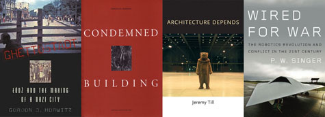
4) Ghettostadt: Łódź and the Making of a Nazi City by Gordon J. Horwitz (Harvard University Press) — By choosing the historical experience of Łódź, Poland, during its political assimilation and ethnic ghettoization by the Nazis, Gordon Horwitz shows how a long series of seemingly minor bureaucratic decisions can radically alter the normal urban order of things, paving the way for something as nightmarish as the Final Solution. This latter fact Horwitz memorably describes as “a phenomenon so unexpected and outrageous in design and execution as to exceed the then-understood limits of organized human cruelty.” About Łódź itself, he writes: “Secured by German arms, reshaped by German planning and technical expertise, the city was to be remade inside and out.” Horwitz shows how property confiscation, spatial rezoning, and literal new walls transformed Łódź into a Ghettostadt.

5) Condemned Building by Douglas Darden (Princeton Architectural Press) — The late Douglas Darden’s work seems both underknown and underexposed (perhaps because so little of it can be found online). This book, published in 1993, collects ten speculative projects, including the Museum of Impostors, the Clinic for Sleep Disorders, and the Oxygen House, complete with plans, models, elevations, and historical engravings. Darden’s work is an interesting hybrid of narrative fiction, visual storytelling, and architectural design – and so naturally of great interest to BLDGBLOG. For instance, his “Temple Forgetful” project weds amnesia, flooding, and the mythic origins of Rome. Good stuff.

6) Architecture Depends by Jeremy Till (MIT Press) — Architectural theory written with the rhetorical pitch of a blog, Architecture Depends is a kind of from-the-hip philosophy of “rogue objects,” construction waste, massive landfills, “lo-fi architecture,” and the fate of buildings over long periods of time. As Till states in the book’s preface, “Mess is the law.”

7) Wired for War: The Robotics Revolution and Conflict in the Twenty-first Century by P.W. Singer (Penguin) — An extremely provocative look at the future of war in an age of robot swarms and autonomous weaponry, Singer’s book is nonetheless a bit too casual for its own good (reading that Singer wrote the book because robots are “frakin’ cool” doesn’t help me trust the author’s sense of self-editing). Having said that, there is so much here to discuss and explore further that it’s impossible not to recommend the book – eyepopping micro-histories of individual war machines come together with Singer’s on-the-scene anthropological visits to robotics labs and military testing grounds, by way of Artificially Intelligent snipers, drone “motherships” forming militarized constellations in the sky, and even “mud batteries” and automated undersea warfare. Like Singer’s earlier Corporate Warriors – another book I would quite strongly recommend – the often terrifying implications of Wired for War nag at you long after you’ve stopped reading. For what it’s worth, by the way, this book seems almost perfectly timed for the release of Terminator Salvation.

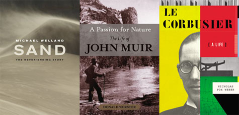
8) Sand: The Never-Ending Story by Michael Welland (University of California Press) — This book is awesome, and I hope to draw a much longer post out of it soon. Only slightly marred by an unfortunate subtitle, Welland’s book is disproportionately fascinating, considering its subject matter. On the other hand, “it has been estimated,” he writes, “that on the order of a billion sand grains are born around the world every second” (emphasis his) – so the sheer ubiquity of his referent makes the book worth reading. From the early history of sand studies to the aerial physics of dunes – by way of the United States’ little-known WWII-era Military Geology Unit – the interesting details of this book are inexhaustible.

9) A Passion for Nature: The Life of John Muir by Donald Worster (Oxford University Press) — Donald Worster has written a long biography of John Muir, the naturalist and writer who once famously climbed as high as he could into the canopy of a Californian forest during a lightning storm so that he could see what it was like to experience nature firsthand. At its most basic, Worster’s book explores the natural landscape of the American West as “a source of liberation.”

Going into wild country freed one from the repressive hand of authority. Social deferences faded in wild places. Economic rank ceased to matter so much. Bags of money were not needed for survival – only one’s wits and knowledge. Nature offered a home to the political maverick, the rebellious child, the outlaw or runaway slave, the soldier who refused to fight, and, by the late nineteenth century, the woman who climbed mountains to show her strength and independence.

Worster himself is an environmental historian at the University of Kansas.

10) Le Corbusier: A Life by Nicholas Fox Weber (Alfred A. Knopf) — I’m strangely excited to read this, actually – and I say “strangely” because I am not otherwise known for my interest in reading about Le Corbusier. But Nicholas Fox Weber’s approximately 765 pages of biographical reflection on Corbu’s life look both narratively satisfying, as a glimpse into the man’s daily ins and outs over eight decades, but also architecturally minded, contextualizing Le Corbusier’s spatial work within his other political (and libidinal) interests. I hope to dive into this one over the summer.

* * *

All Books Received: August 2015, September 2013, December 2012, June 2012, December 2010 (“Climate Futures List”), May 2010, May 2009, and March 2009.

Park’s Parks

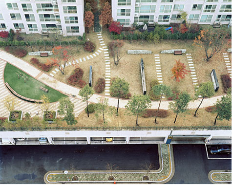
[Image: “Daechi Dong,” a photo by Hosang Park, from his series A Square].

Note: This is a guest post by Nicola Twilley.

Korean photographer Hosang Park‘s series A Square consists of bird’s-eye views of the small, over-landscaped parks that seem to accompany modern apartment towers all over the world. As Park explains, these “parks” are too small to serve their ostensible purpose: as open space for recreation and places “to make discussions or take a rest.” In the UK and US, they are included in new construction projects to fulfill the letter of planning regulations (if not the spirit) – a token band-aid of “nature” applied to high-density development. As Park points out, their presence in Korea is both a reassurance and an investment: the trees, paths, and water features, no matter how artificial, push up property prices by providing an implicit guarantee of “the environmental benefits of a place where they belong.”

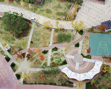
[Images: “Howon Dong” and “Sinbong Dong 2,” photos by Hosang Park, from his series A Square].

Park’s parks are photographed from above – which seems, in fact, to be the view for which they were designed. As two-dimensional compositions of curved paths, colored paving, and rhythmically spaced rocks or trees, they resemble pleasing, if sterile, designs for wrapping paper or Ikea rugs. Tellingly, they are also completely empty. Park explains that he took these photos while he was living on the 13th floor of Jugong Apartment in Chang-dong, Seoul. He and his hundreds of neighbors experienced their park as a a patch of eye candy – visual respite from the concrete and tarmac of their surroundings. Its cornucopia of amenities – climbing frames, fountains, seesaws and swing sets, pagodas, grass, ornamental rocks, meandering paths, trees and flower beds, benches, ponds, basketball courts… even public art – are crammed together as visual shorthand for endless leisure. They are landscape as signage, a placeholder for the possibilities of a park.

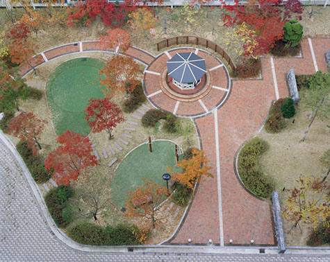
[Images: “Samsung Dong” and “Uman Dong,” photos by Hosang Park, from his series A Square].

But could we then imagine that Korea’s urban landscape subcontractors have been applying the lessons of graphic design to their creations, as if to a poster or magazine spread? The spaces between ornamental planters are carefully kerned, the edges of flower beds masterfully shaped through ragging to create an “organic” appearance – each element ordered and constrained by a Tschicholdian grid. Or perhaps these parks are the work of one visionary landscape designer, a passionate disciple of Edward Tufte. His goal is the ultimate park infographic, and he diligently recombines ponds, benches, and pagodas to achieve ever greater data density that allow for ever more sophisticated landscape analyses. The published results will become the canonical park design text for a generation, changing public policy as effectively as John Snow’s landmark cholera outbreak map of London once did.

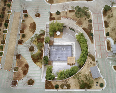
[Image: “Sindorim Dong” by Hosang Park, from his series A Square].

Finally, I’m reminded of the Royal Horticultural Society’s model gardens at Wisley. Wisley, an otherwise unremarkable village in Surrey, is home to an educational garden, meant to fulfill the Society’s remit “to show to the public the best kinds of plants to grow.” Behind the scenes at Wisley, fields are devoted to trialling difficult, delicate, or entirely new kinds of flowers, vegetables, and fruit for “garden or ornamental use.” Teams of horticulturists partner with botanists, entomologists, and pathologists to determine the correct details, cultivation, and advice for each group of plants, with high performing plants winning an Award of Garden Merit (AGM) – the gardening equivalent of a Good Housekeeping Seal.

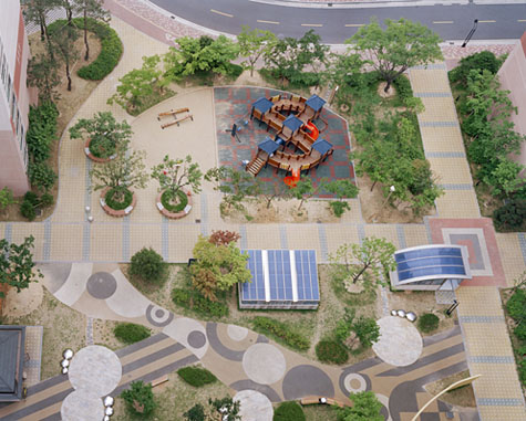
[Images: “Jangan Dong” and “Sinbong Dong,” photos by Hosang Park, from his series A Square].

AGM-winning plants are then arranged in model gardens at Wisley, to which the public is invited to learn the ideal varietals, patterns, and conditions for a garden on chalky soil, say, or a poorly drained lot. These model gardens are not actually intended to be the private back yards they resemble; instead they are part-instruction manual, part-shop window, part prototype of future, unrealized landscapes elsewhere. Like Park’s parks, they are primarily designed to be read, rather than sensed or experienced; and they are deliberately exhaustive in their approach, with each rather small plot landscaped to show all appropriate elements of, for instance, a sub-alpine rock garden. Which leads me to wonder if Park’s photos have inadvertently documented an experimental array of urban test gardens, new spatial formats for high-density leisure in their beta phase.

(Hosang Park’s work discovered via Flavorwire. Earlier posts by Nicola Twilley include Dark Sky Park and Zones of Exclusion).

Planet Harddrive

[Image: “Conceptual diagram of satellite triangulation,” courtesy of the Office of NOAA Corps Operations (ONCO)].

I’ve long been fascinated by what I might call the geological nature of harddrives – how certain mineral arrangements of metal and ferromagnetism result in our technological ability to store memories, save information, and leave previous versions of the present behind.

A harddrive would thus be a geological object as much as it is a technical one: a content-rich, heavily processed re-configuration of the earth’s surface.

[Image: Geometry in the sky. “Diagram showing conceptual photographs of how satellite versus star background would appear from three different locations on the surface of the earth,” courtesy of the Office of NOAA Corps Operations (ONCO)].

Perhaps someday we won’t need harddrives at all: we’ll simply use geology itself. In other words, what if we could manipulate the earth’s own magnetic field and thus program data into the natural energy curtains of the planet?

The earth would become a kind of spherical harddrive, with information stored in those moving webs of magnetic energy that both surround and penetrate its surface.

This extends yet further into an idea that perhaps whole planets out there, turning in space, are actually the harddrives of an intelligent species we otherwise have yet to encounter – like mnemonic Death Stars, they are spherical data-storage facilities made of content-rich bedrock – or, perhaps more interestingly, we might even yet discover, in some weird version of the future directed by James Cameron from a screenplay by Jules Verne, that the earth itself is already encoded with someone else’s data, and that, down there in crustal formations of rock, crystalline archives shimmer.

I’m reminded of a line from William S. Burroughs’s novel The Ticket That Exploded, in which we read that beneath all of this, hidden in the surface of the earth, is “a vast mineral consciousness near absolute zero thinking in slow formations of crystal.”

[Image: “An IBM HDD head resting on a disk platter,” courtesy of Wikipedia].

In any case, this all came to mind again last night when I saw an article in New Scientist about how 3D holograms might revolutionize data storage. One hologram-encoded DVD, for instance, could hold an incredible 1000GB of information.

So how would these 3D holograms be formed?

“A pair of laser beams is used to write data into discs of light-sensitive plastic, with both aiming at the same spot,” the article explains. “One beam shines continuously, while the other pulses on and off to encode patches that represent digital 0s and 1s.”

The question, then, would be whether or not you could build a geotechnical version of this, some vast and slow-moving machine – manufactured by Komatsu – that moves over exposed faces of bedrock and “encodes” that geological formation with data. You would use it to inscribe information into the planet.

To use a cheap pun, you could store terrabytes of information.

But it’d be like some new form of plowing in which the furrows you produce are not for seeds but for data. An entirely new landscape design process results: a fragment of the earth formatted to store encrypted files.

Data gardens.

They can even be read by satellite.

[Image: The “worldwide satellite triangulation camera station network,” courtesy of NOAA’s Geodesy Collection].

Like something out of H.P. Lovecraft – or the most unhinged imaginations of early European explorers – future humans will look down uneasily at the earth they walk upon, knowing that vast holograms span that rocky darkness, spun like inexplicable cobwebs through the planet.

Beneath a massive stretch of rock in the remotest state-owned corner of Nevada, top secret government holograms await their future decryption.

The planet thus becomes an archive.

(Earlier on BLDGBLOG: Geomagnetic Harddrive).

Of networks, grids, and infrastructures, or: How to make a planet

If I have several blogging resolutions for 2009 – and I do – one of them is definitely to read InfraNet Lab more often.

[Image: Offshore energy islands, via InfraNet Lab].

Easily one of the most interesting architecture blogs out there today – though it’s really an infrastructure blog, hopefully heralding a new focus for design writers in the next few years – and written by Toronto-based architects Mason White and Lola Sheppard, along with two contributors named Maya and Neeraj, it tracks massive infrastructure, waste, energy, and design projects across the global landscape, taking in geology, engineering, network economics, ecology, construction innovation, future fuels, and much more.

Read it and you’ll know how to “harvest energy from the earth’s rotation” using mega-gyroscopes, you’ll discover how a more efficient offshore seaweed industry might work, you’ll pick up clues for how to design a mountain and then how to connect that mountain to others using aerial tramways, you’ll get an architectural glimpse of habitat meshing, you’ll take an hallucinatory tour through Taiwanese mushroom farms, you’ll visit underground waste isolation sites in New Mexico, you’ll turn around and go the opposite vertical direction – into the sky – to farm water from the atmosphere, and you’ll even punt around the artificial inland waterways of Britain using strange mechanized structures and seeing that archipelago as hydrology first, geography later.

So go check it out – and make 2009 the year of networks, grids, and infrastructures.

Dark Sky Park

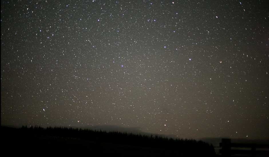
[Image: The dark skies above Galloway Forest Park, Scotland, via the Guardian].

Note: This is a guest post by Nicola Twilley.

2009 has been designated by the United Nations as the International Year of Astronomy (IYA), marking the 400th anniversary of Galileo’s telescope. The excitement is starting early, with Galloway Forest Park in Scotland announcing its plans to become Europe’s first “dark sky park.”

The forest, which covers 300 square miles and includes the foothills of the Awful Hand Range, rates as a 3 on the Bortle scale. The scale, created by John Bortle in 2001, measures night sky darkness based on the observability of astronomical objects. It ranges from Class 9 – Inner City Sky – where “the only celestial objects that really provide pleasing telescopic views are the Moon, the planets, and a few of the brightest star clusters (if you can find them),” to Class 1 – Excellent Dark-Sky Site – where “the galaxy M33 is an obvious naked-eye object” and “airglow… is readily apparent.” Class 3 is merely “Rural Sky,” meaning that while “the Milky Way still appears complex… M33 is only visible with averted vision.”

[Image: The Pleiades, photographed by Thackeray’s Globules, photographed by Hubble].

Nonetheless, Galloway Forest Park contains the darkest skies in Europe, and Steve Owens, co-coordinator of the IYA plans in the UK, is determined to gain recognition from the International Dark-Sky Association (IDA) as a lasting legacy for the 2009 celebrations.

The certification process is challenging. According to the Guardian, “to earn dark sky park status, officials in Galloway will submit digital photographs of the night sky taken through a fisheye lens. Their application must be supported by readings from light meters at different points in the park, and a list of measures that are being taken within the forest to prevent lights in and around the handful of farm buildings from spilling upwards into the sky and ruining the view.”

The IDA website itself contains everything that “locations with exceptional nightscapes” need to know to submit their application to be certified as “International Dark Sky Communities (IDSC), International Dark Sky Parks (IDSP), and International Dark Sky Reserves (IDSR).” Currently, there is only one dark-sky community in the world (Flagstaff, AZ), and just two dark-sky parks (the first, Natural Bridges National Monument in Utah, and the slightly less well-known Cherry Springs State Park in northern Pennsylvania). There are no actual reserves yet; indeed, the concept is still being thrashed out in partnership with UNESCO (who issued their own Starlight Reserve framework in 2007).

[Images: The “center of the Milky Way,” photographed by the European Southern Observatory at al.; the galaxy NGC 281, photographed by Ken Crawford of the Rancho Del Sol Observatory; and the Pleiades, photographed by Philip L. Jones].

The idea of a human-created dark sky park is fascinating, of course, as are the architectural and landscape modifications that must be undertaken by town councils and park management services in order to secure a qualifying Bortle score. For example, Observatory Park in Montville Township, Ohio, has been awarded provisional IDSP status (Silver Tier), contingent on “the completion of the park’s outdoor lighting scheme, visitor’s center, and enactment of outdoor lighting ordinances in surrounding townships.” The Geauga Park District submitted their 34-page Lighting Management Plan (read the PDF) in August 2008, detailing various proposals for the reduction of local skyglow (as opposed to natural airglow), light trespass, and glare. These include full shading for all light installations and lighting curfews, as well as strategic tree planting.

The concept of shaping the ground to frame and enhance the sky is not new (for instance, James Turrell’s Skyscapes are an architectural attempt to achieve “light effects and perceptual events” centered on a complex reframing of the sky). Nonetheless, the idea of rebuilding and landscaping an entire community specifically for the purposes of experiencing darkness is an exciting one – as is the idea of UNESCO, official protector of World Heritage Sites, attempting to safeguard dark skies as a “natural and cultural property.”

Scotland, with its northerly latitude and constant rain (which cleans the atmosphere of dust), has perhaps discovered its global tourist niche: A spokesman for VisitScotland, which is working closely with Dark Sky Scotland, ventured that “the night sky could be as important for tourism as the landscape.”

Fossil Cities

[Image: Art by Joe Alterio; view larger].

I’m thrilled to announce that BLDGBLOG and Wired Science have teamed up with Swissnex to host a live interview—free and open to the public—with University of Leicester geologist Jan Zalasiewicz, author of The Earth After Us: What Legacy Will Humans Leave in the Rocks?, from Oxford University Press.

The event will be from 7-9pm on Wednesday, December 17th, at Swissnex, 730 Montgomery Street, in San Francisco; here’s a map.

Zalasiewicz’s book offers a fascinating and sustained look at what will happen to the material artifacts of human civilization 100 million years from now, when cities like Manhattan are mere trace fossils in flooded submarinescapes, Amsterdam is an indecipherably fragmentary presence in the lithified mudflats of a new, future continent, and cities like Los Angeles and Zurich have been eroded away entirely by a hundred million years of rockslides and weather.

To quote an early chapter from Zalasiewicz’s book at length:

The surface of the Earth is no place to preserve deep history. This is in spite of – and in large part because of – the many events that have taken place on it. The surface of the future Earth, one hundred million years now, will not have preserved evidence of contemporary human activity. One can be quite categorical about this. Whatever arrangement of oceans and continents, or whatever state of cool or warmth will exist then, the Earth’s surface will have been wiped clean of human traces.
(…)
Thus, one hundred million years from now, nothing will be left of our contemporary human empire at the Earth’s surface. Our planet is too active, its surface too energetic, too abrasive, too corrosive, to allow even (say) the Egyptian Pyramids to exist for even a hundredth of that time. Leave a building carved out of solid diamond – were it even to be as big as the Ritz – exposed to the elements for that long and it would be worn away quite inexorably.
(…)
So there will be no corroded cities amid the jungle that will, then, cover most of the land surface, no skyscraper remains akin to some future Angkor Wat for future archaeologists to pore over. Structures such as those might survive at the surface for thousands of years, but not for many millions.

The book goes on to explore buried cities, flooded cities, and cities destroyed by erosion; the long-term traces of different materials, from concrete and steel to nuclear waste and industrial plastics; and the future magnetic presence of urban metals that have been compressed into the thinnest bands of underground strata. We’ll be talking about cities like New Orleans, London, Hanoi, and Shanghai; New York, Los Angeles, Cairo, and Geneva. What “signals” of their one-time existence will these cities offer in 100 million years’ time? About Mexico City, Zalasiewicz writes:

Mexico City has a good short-term chance of fossilization, being built on a former lake basin next to active, ash-generating volcanoes; but its long-term chances are poor, as that basin lies on a high plateau, some two kilometers above sea level. The only ultimate traces of the fine buildings of [Mexico City] will be as eroded sand- and mud-sized particles of brick or concrete, washed by rivers into the distant sea.

With visions of cities become not spectacular, vine-covered ruins but but vast deltaic fans of multi-colored sand, the book looks at the future geological destinies of everything from plastic cups to clothes.

Alexis Madrigal, from Wired Science, and I will also have five copies of Zalasiewicz’s book to give away to attendees, and there will be drinks and light food after the event, so it will be well worth coming out.

If you get a chance, please RSVP at the Swissnex site, so that they can keep track of expected visitors.

(With special thanks to Joe Alterio for the artwork!)

Code 46

On Monday, November 24, I’ll be hosting a live interview at the Barbican in London with director Michael Winterbottom, for a special screening of his film Code 46. You can read a bit more about the event – as well as buy tickets – here.
This is part of an ongoing series called Architecture on Film, curated by the Architecture Foundation.

[Image: From Michael Winterbottom’s Code 46, courtesy of United Artists].

The purpose of the event is to talk about film and architecture – or, in this case, cities, urban design, memory, science fiction, landscape, globalization, and the built environment. As you can see from the list of locations used for the film’s production, Code 46 is very well-traveled, stitching together urban – and exurban – environments from London, Shanghai, Dubai, Hong Kong, and even the deserts of Rajasthan.
That the film achieves the feel of science fiction simply through a well-edited depiction of existing landscapes says as much about the film as it does about the nature of city-building today; perhaps one might only half-jokingly suggest that people build cities today in order to live inside science fiction films.

[Image: Shanghai, from Code 46, directed by Michael Winterbottom, courtesy of United Artists].

As BLDGBLOG explored the other week in a long post, “cities today are well known for popping up in the middle of nowhere, history-less and incomprehensible.”

That’s what cities now do. If these cities are here today, they weren’t five years ago; if they’re not here now, they will be soon. Today’s cities are made up, viral, fungal, unexpected. Like well-lit film sets in the distance, staged amidst mudflats, reflecting themselves in the still waters of inland reservoirs, today’s cities simply arrive, without reservations; they are not so much invited as they are impossible to turn away. Cities now erupt and linger; they are both too early and far too late. Cities move in, take root and expand, whole neighborhoods throwing themselves together in convulsions of glass and steel.

What does it mean, then, to set a film inside a mix of such spaces? And as more and more instant cities appear in the world, built from zero in less than a decade, how can cinema capitalize on the lack of recognition these historically too-new and culturally all but anonymous environments inspire?
What does it mean, as well, that the depiction of the future in Code 46 – a depiction of the future through architecture – involves no U.S. cities at all and only very brief glimpses of urban infrastructure in Europe?

[Image: Shanghai, from Code 46, directed by Michael Winterbottom, courtesy of United Artists].

This brings up one of the more interesting aspects of the film – something not internal to it, but created by the current state of global urbanization. The film makes it deliberately unclear, in other words, that it was shot in multiple locations at all; the opening sequence blurs together landscapes, buildings, and infrastructures from very different cities – yet this unfamiliar new place to which we’re being introduced might very well exist.
For all many viewers know, perhaps Shanghai really is in the middle of a desert; perhaps Dubai really does look exactly like Hong Kong.
This confusion only seems possible, however, within a very narrow window of historical time. As the skylines and iconic hotel interiors of Dubai, Shanghai, Hong Kong, and elsewhere become visually familiar to many more people, it will become much harder to do what Code 46 has done – which is to edit them all up into a convincing pastiche. They are a spatial collage, an urban cut-up – William S. Burroughs as architectural director.
In ten years, then, would this be akin to cutting from a shot of the Empire State Building to a shot of the Eiffel Tower and pretending that these landmarks are in the same city – only to find that almost no one has been genuinely tricked?
In a funny but negative Amazon review of the film, a disappointed viewer actually mocks this very aspect: “If I have to keep seeing these movies with the I haven’t a clue which Metro I’m in look I’m going to scream.”
But what does it mean that Asian cities – cinematically depicted as a kind of monolithic urban Other – are, for the time being, so visually unfamiliar to Western audiences that they can be edited into a seamless Global Metropolis, a vast agglomeration of spatial alterity that we can cut-and-paste together on film?
Where might Code 46 have been made if it had been produced fifteen years from now? What explosive urban outgrowths between now and then will be sufficiently unfamiliar to literally hundreds of thousands of filmgoers that they could be combined into one convincing location?
Will the sci-fi films of tomorrow be set in Lagos, Delhi, Rabat, or Shenzhen? All of the above?
It’s the future science fiction of global third-tier urbanism.
For instance, one of the most striking aspects of the urban environment in The Matrix came simply from the fact that many – though not all – of the outdoor scenes were shot in Sydney, a city with which most American viewers are not visually familiar. The urban world of the Matrix thus took on an uncanny sense of near-resemblance, looking an awful lot like a city everyone has seen before – is that Houston? Tampa Bay? Fresno? – but not enough like any single one of them to be clear.
The film Primer, shot in Dallas, is an amazing example of this: the whole time you’re watching it you have no idea where you are… though absolutely everything about it looks familiar.
The effect, particularly in Code 46, is almost literally uncanny.

[Image: The Shanghai skyline, from Code 46, directed by Michael Winterbottom, courtesy of United Artists].

Briefly, I’m also reminded here of Tativille, the massive film-set city built by Jacques Tati to produce his own film Playtime. Constructed solely for the purpose of hosting camera crews – and later disassembled – Tativille was a city of the image, its design shaped only by how it would look on screen. With Tativille in mind, what might future audiences think if, say, Dubai really does run out of money in the global economic downturn, its towers abandoned and eroding back to sand? It will be visible in films like Code 46 – but nowhere else. It will have ceased to exist.
It will have been a kind of Tativille of the Emirates, built only to host film crews and car commercials.
In any case, the film’s visions of desert poverty – scenes in Rajasthan – and desert opulence – scenes in Dubai – bring up the topic of uneven development. If, as William Gibson‘s oft-quoted line goes, the future is already here, it’s just unevenly distributed, then this also appears to be true in the context of architectural form and urban landscapes.
But which one is the future: the nationless desert of rights-deprived exiles or the golf course-filled desert of the stateless business class?
Or are these perhaps one and the same, requiring each other as the flipsides of their own formation?

[Image: The opening titles of Michael Winterbottom’s Code 46, courtesy of United Artists].

None of these questions are new, of course, going back in some form or another to Sergei Eisenstein, Fredric Jameson, and many, many others; but the opportunity to discuss all this with Michael Winterbottom himself in reference to a specific – and, as it happens, visually stunning – film, in a monumental and legendary architectural complex like the Barbican, is something of which I’m genuinely excited to be a part.
So if you’re in London on Monday, November 24, consider stopping by. Tickets can be purchased directly through the Barbican’s website, and you can learn a bit more about the film here.

Zones of Exclusion

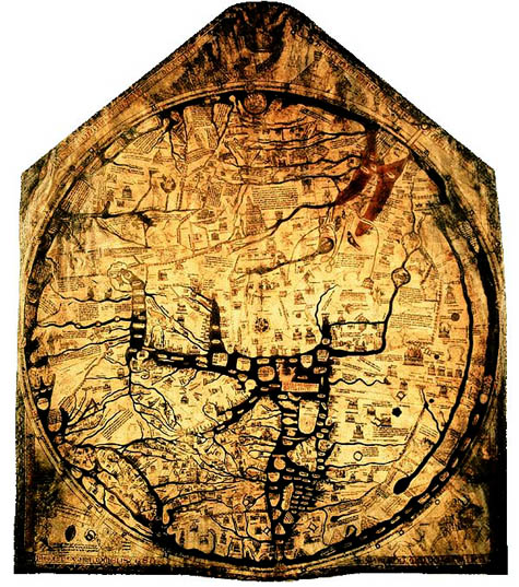
[Image: The charismatic boundaries of an earlier worldview – here, the Hereford
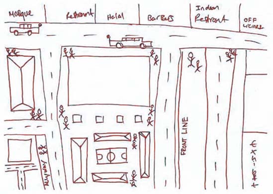
 Mappa Mundi].

Note: This is a guest post by Nicola Twilley.

Another question for the topic of whether or not a “dense assortment of buildings” can ever be a real city: What is London for an eighteen-year old whose entire urban experience is confined to 200-square meters and who has never seen the Thames?

Researchers at the University of Glasgow, sponsored by the Joseph Rowntree Foundation, have spent the past two years asking young residents of Bradford, Peterborough, London, Glasgow, Sunderland, and Bristol to draw maps of their own individual urban experience in order to explore micro-territoriality as both a cause and a symptom of social exclusion. You can read the full PDF of their report here.

“In Glasgow, Sunderland and Bradford,” they found, “a recognizable territory might be as small as a 200-meter block or segment.” In Tower Hamlets, London, fifteen and sixteen-year old boys mapped their world into three streets, a football pitch, a barber shop, mosque, Indian restaurant, and – just beyond the clearly marked “Front Line” – an off-license, or liquor store.

[Image: From the Joseph Rowntree Foundation report, “Young people and territoriality in British cities” (download the PDF)].

Some of the sketches even remind me of medieval maps: the known world is an island of familiarity, simultaneously shown much larger than scale but made tiny and precious by the monsters of “Terra Incognita” that surround it. In the case of a 15-year-old girl from Bradford, today’s dragons are “moshers,” “chavs,” “Asians,” and “posh people” – all “Enemys.” The researchers found that teenage boys display an even more complete ignorance of the world beyond their perceived boundaries: these two maps of the same area in Glasgow were drawn by young men in the same class at the same school, who live on different sides of the same road.

[Images: From the Joseph Rowntree Foundation report, “Young people and territoriality in British cities” (download the PDF)].

The report’s authors examined the causes, nature, and impact of micro-territorialization. Their research uncovered Bristol’s “postcode wars,” where gangs spray-paint their postcode in rival areas as a form of aggression, as well as descriptions of the maneuvers involved in going to school in one part of Bradford that match the Schlieffen Plan in strategic complexity. “In some places,” they note with reference to Glasgow and Sunderland, “territoriality was a leisure activity, a form of ‘recreational violence.’” In other words, bored and economically deprived teenagers are transforming 1960s council estates and Victorian terraces into a real-world, multiplayer World of Warcraft.

Of course, excessive loyalty to the local, and the resulting lack of mobility, has a significant and negative impact on access to education, services, and job opportunities. In the words of one interviewee from Glasgow:

If your horizons are limited to three streets, what is the point of you working really hard at school? What is the point of passing subjects that will allow you to go to college or university if you cannot travel beyond these streets? What’s the point of dreaming about being an artist, a doctor, etc., if you cannot get on a bus to get out of the area in which you live?

The report points out an interesting irony here: current policies in urban regeneration are dominated by strategies to increase “place attachment” as a means “to reinforce social networks and maintain the quality of an area through pride.” However, the areas that actually generate such loyalties are, in the authors’ words “often ones that have little that conventionally invokes pride.”

It was difficult to say which was more depressing – the relentless defense of a featureless piece of open space on the fringes of a Glasgow housing scheme where there is nothing whatsoever by way of amenities, or the confinement to a socially isolated but densely populated and built-up quarter-square-mile of London of young men for whom the culture and wealth of one of the world’s great cities might as well be on another continent.

The report goes on to identify 244 anti-territorial projects (ATPs) currently in progress across the UK. Most use sports or other “hook” activities to encourage association and to teach networking skills. Disappointingly, none tackle the issue in terms of the design of physical space.

So what does the anti-territorial city look like? Some things to consider: unsurprisingly, the report found that most conflicts “occurred on boundaries between residential areas, which were typically defined by roads, railways, vacant land or other physical features.” The city center also becomes a venue for bigger showdowns: a youth worker in Peterborough explains that “the flashpoints are in the city center, the ‘big stage,’ the one place they all, you know, congregate on a Saturday.” Finally, the researchers found that micro-territorialization took place across the spectrum of low-income housing stock, from “high-density, flatted, inner-city estates; traditional, pre-1914 areas of terraced housing; and suburban, often council-built environments.”

As the authors rightly point out, lack of jobs and economic hardship are key structural forces contributing to “problematic territoriality.” But what role does urban planning, landscape design and the built environment have to play?

Can the design of the city itself generate – or mitigate against – territoriality?

(Note: Read the Guardian‘s take on the Joseph Rowntree Foundation report here and here).

Tactical Landscaping and Terrain Deformation

[Image: A screenshot from Fracture by LucasArts. Via Wired].

Over on Wired this weekend I read about a game called Fracture, by LucasArts, which features “terrain deformation” as a central factor in gameplay.

Fracture is “a game centered on the wanton reformation of land masses,” Wired reports; the author then goes on to introduce us to the game’s “terrain deformation mechanics.”

“Every player is equipped with a tool called an Entrencher,” we read. The Entrencher “gives them the ability to raise or lower most surfaces at will,” including the surface of the earth itself:

Gone are the days of studying a level, and simply memorizing sniper positions and the fastest routes. Resourceful players will be digging trenches, raising their own cover and manipulating level elements to fortify their positions… fundamentally altering the way levels are played.

Which means what, exactly?

Can’t find a way across that slime pit? Raise the ground underneath it. You can also terrain-jump by leaping as you raise the ground beneath your feet, launching yourself into the air.

“The rule of thumb,” the article adds, “is that if you can walk on it, you can probably alter it.”

Using weapons like the Tectonic Grenade, you can reshape the planet. Quoting from the official Fracture website:

The ER23-N Tectonic Grenade sets off localized shockwaves when detonated, causing small, concentrated earthquakes that raise the immediate terrain around the point of impact. The weapon is extremely useful for shaping the terrain and providing cover.

There’s also a Spike Grenade. As LucasArts explains, “Tectonic scientists discovered that lava tubes lying dormant deep below the surface of the earth could be stimulated to eject a pyroclastic column.” These columns can “be used as a ‘natural elevator’ of sorts, allowing a soldier to access hard to reach high elevation areas.”

[Image: A screenshot from Fracture, by LucasArts, showing a pyroclastic elevator at work].

There are even Subterranean Torpedoes that burrow into the planet and create landforms on the surface far away.

[Image: A screenshot from Fracture by LucasArts].

Of course, the idea that an instantaneous and semi-magmatic reshaping of the earth’s surface might have military implications is an interesting one – and probably not far from technological realization. I’ve written about the weaponization of the earth’s surface before, but Fracture seems to illustrate the concept in a refreshingly accessible way.

However, there are many historical precedents for the idea of politicized terrain creation, and these deserve at least a passing mention here.

I’m thinking, in particular, of David Blackbourn’s recent book The Conquest of Nature: Water, Landscape, and the Making of Modern Germany. The “making” in Blackbourn’s subtitle is meant literally, as the book looks at coastal reshaping, bog- and marsh-draining, and other projects of imperial hydrology; these were the activities through which the territory of Germany itself was physically shaped.

It was terrain deformation: a militarized reshaping of the earth’s surface under orders from Frederick the Great. Frederick sought to transform the lands of northern Germany – then called Prussia – in order to create more space to rule.

In his book, Blackbourn describes what these imperial “hydro-technicians” actually did:

The task of filling in the squares on Frederick’s grids remained. That meant ditching and diking the future fields, constructing sluices, uprooting the old vegetation and planting willows by the new drainage canals, preparing the still heavy, intractable soil, building paths and bridges, houses, farms, and schools, all the while maintaining the new defenses against the water.

These “new defenses” have since been so naturalized that we mistake them for a pre-existing terrain upon which modern Germany was founded – but they were and are constructed landforms, a “brave new world of dikes, ditches, windmills, fields, and meadows.”

These were lands created through military intervention in order to host a particular form of political governance.

In this context, then, Fracture would seem to be simply an accelerated – or what Sanford Kwinter might call an “adrenalated” – version of this tactical landscaping.

[Image: Celestial Impact].

Meanwhile, a commenter over on Wired points out that there are conceptual similarities between Fracture and another game called Celestial Impact.

In Celestial Impact, “the landscape is fully deformable in all directions.”

“Build and dig your way around the landscape in various strategic ways,” we read, ways that are “not limited to destruction”:

[T]he players also have the ability to add terrain to the landscape in the middle of combat using a special tool called Dirtgun. With the Dirtgun, players can add or remove terrain during combat as they see fit, simply by aiming and firing the dirtgun. Depending on the chosen action, this will either add or remove a chunk of dirt from the landscape. So as the teams are battling, the landscape receives vast changes opening up for various tactical approaches each team can use.

When your weapons are set on build-mode, the game’s creators explain, “the Dirtgun adds terrain in the form of a pre-selected shape in front of the player. The shapes could be a simple cube, a part of a bridge or even a defensive wall.”

In many ways, this sounds like a weaponized version of Behrokh Khoshnevis‘s building-printer – subject of one of the earliest posts on BLDGBLOG – here remade as a kind of propulsive instant-concrete mixer retrofit for imperial military campaigns.

As Discover described Khoshnevis’s machine back in 2005, “a robotically controlled nozzle squeezes a ribbon of concrete onto a wooden plank. Every two minutes and 14 seconds, the nozzle completes a circuit, topping the previous ribbon with a fresh one. Thus a five-foot-long wall rises – a wall built without human intervention.”

Now make an accelerated, portable, and fully weaponized version of this thing, put it in a videogame, and you’ve got something a bit like Celestial Impact.

Here are some screenshots.

[Image: From The re-naturalization of territory by Vicente Guallart].

Finally, I couldn’t help but think here of architect Vicente Guallart. Guallart’s work consistently seeks to introduce new geological forms into the built infrastructure of the city – artificial mountains, for instance, and “new topographies” through which a city might expand.

[Image: From The re-naturalization of territory by Vicente Guallart].

I suppose one question here might be: what would a videogame look like as designed by Vicente Guallart? Would it look like Fracture? If Vicente Guallart and Behrokh Khoshnevis teamed up, would they have created Celestial Impact?

But a more interesting, and wide-ranging, question is whether designing videogame environments is not something of a missed opportunity for today’s architecture studios.

After all, how might architects relay complex ideas about space, landscape, and the design of new terrains if they were to stop using academic essays and even project renderings and turn instead to video games?

It seems like you can take your ideas about terrain deformation and instant landscapes and nomadic geology and you can license it to LucasArts, knowing that tens of thousands of people will soon be interacting with your ideas all over the world; or you can just pin some images up on the wall of an architecture class, make no money at all, and be forced to get a job rendering buildings for Frank Gehry.

So would more people understand Rem Koolhaas’s thoughts on cities if he stopped writing 1000-page books and started designing videogames – games set in some strange quasi-Asiatic desert world of Koolhaasian urbanism?

Or do all of these questions simply mistake popularity for engaged comprehension?

The larger issue, though, is whether or not architecture, increasingly popular as a kind of Dubai-inspired freakshow (rotating skyscrapers! solar-powered floating hotels!), is nonetheless not reaching the audience it needs.

[Image: From The re-naturalization of territory by Vicente Guallart].

If architects and architecture writers continue to use outmoded forms of publication, such as $25/copy university-sponsored magazines and huge books purchased by no one but college librarians, then surely they can expect only people currently enrolled in academic programs even to be aware of what they’re talking about, let alone to be enthusiastic about it or appreciative of the implications.

$100 hardcover books do absolutely nothing to increase architecture’s audience.

So what would happen if architects tried videogames?

[Image: The constructed geologies of Vicente Guallart, from How To Make a Mountain].

In any case, terrain deformation, dirtguns set on build-mode, and other forms of militarized landscape creation – these seem like good enough reasons to me to add gaming consoles to a design syllabus near you.

Mayan Muons and Unmapped Rooms

[Image: “Guatemala Tikal D8006” by youngrobv].

Easily one of the most interesting things I’ve read in quite a while is how a team of particle physicists from UT-Austin plan on using repurposed muon detectors to see inside Mayan archaeological ruins.
In the new issue of Archaeology, Samir S. Patel describes how “an almost featureless aluminum cylinder 5 feet in diameter” that spends its time “silently counting cosmic flotsam called muons” – “ghost particles” that ceaselessly rain down from space – will be installed in the jungles of Belize.
There, these machines will map the otherwise unexplored internal spaces of what the scientists call a “jungle-covered mound.”
In other words, an ancient building that now appears simply to be part of the natural landscape – a constructed terrain – will be opened up to viewing for the first time since it was reclaimed by rain forest.
It’s non-invasive archaeology by way of deep space.

[Images: The muon detector, courtesy of the UT-Austin Maya Muon Group].

From the UT-Austin Maya Muon Group website:

The first major experiment of the Maya Muon Group will bridge the disciplines of physics and archeology. The particle detectors and related systems are designed specifically to explore ruins of a Maya pyramid in collaboration with colleagues at the UT Mesoamerican Archaeological Laboratory. The Maya Muon Group will travel to La Milpa in northwest Belize to make discoveries about “Structure 1” – a jungle-covered mound covering an unexplored Maya ruin.

Pointing out that dense materials block more muons, Patel explains that a muon detector can actually detect rooms, spaces, and caves inside what seems to be solid:

A detector next to a Maya pyramid, for example, will see fewer particles coming from the direction of the structure than from other angles: a muon “shadow.” And if a part of that pyramid is less dense than expected – containing an open space for, say, a royal burial – it will have less of a shadow. Count enough muons that have passed through the pyramid over the course of several months, and they will form an image of its internal structure, just like light makes an image on film. Then combine the images from three or four devices and a 3-D reconstruction of the pyramid’s guts will take shape.

Referring to a muon detector already at work on the campus of UT-Austin, Patel writes: “The detector sees in every direction, so it also records muon shadows from the adjacent university buildings, and can even identify empty corridors. Silently, with little tending, it takes a monumental x-ray of the world around it.”
“The resulting image,” he adds, “will be almost directly analogous to a medical CAT-scan.”

[Image: The muon detector, courtesy of the UT-Austin Maya Muon Group].

Install one of these things in New York City and see what you find: moving blurs of elevators and passing trucks amidst the strange, skeletal frameworks of skyscrapers that stand behind it all in a labyrinthine mesh.

[Image: A diagram of how it all works; from this PDF by Roy Schwitters].

Patel goes on to relate the surreal story of physicist Luis Alvarez, who used muons “to scan the inside of an ancient structure” – in this case, Khafre’s pyramid at Giza. “Working with Egyptian scientists in the late 1960s,” we read, “he gained access to the Belzoni chamber, a humid vault deep under the pyramid.”
Like something out of an H.P. Lovecraft story, “Alvarez’s team set up a muon detector called a spark chamber, which included 30 tons of of iron sheeting, in the underground room.”
Foreign physicists building iron rooms beneath the pyramids! To search for secret chambers based on the evidence of cosmic particles.

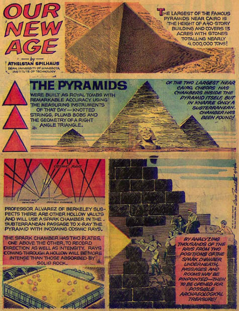
[Image: An illustrated depiction of Luis Alvarez’s feat; view larger!].

Indeed, we read:

Suspicion of the research team ran high – here was a group of Americans with high-tech electronics beneath one of Egypt’s most cherished monuments. “We had flashing lights behind panels – it looked like a sci-fi thing from Star Trek,” says Lauren Yazolino, the engineer who designed the detector’s electronics.

Alvarez’s iron room beneath the monolithic geometry of the pyramid – it’s like a project by Lebbeus Woods, by way of Boullée – apparently took one year to perform its muon-detection work.
One day, then, the team took a long look at the data – wherein Yazolino “spotted an anomaly, a region of the pyramid that stopped fewer muons than expected, suggesting a void.”
There were still undiscovered rooms inside the structure.

[Image: Wiring up the muon detector, courtesy of the UT-Austin Maya Muon Group].

Excitingly, when Roy Schwitters sets up his muon detector next to the tree-covered mounds of the Mayan city of La Milpa, he should get his results back in less than six months. Sitting there like a strange battery, the detector’s ultra-long-term abstract photography of the jungle hillsides vaguely reminds me of the technically avant-garde photographic work of Aaron Rose.
Rose has pioneered all sorts of strange lenses and unexpected chemical developers as he takes long-term exposures of Manhattan.
New York becomes less a city than a kind of impenetrable wall of built space.

[Images: Four photographs by Aaron Rose. View slightly larger].

Again, then, I’m curious what it’d be like to install one of these muon detectors in Manhattan: the shivering hives of space it might detect, as delivery trucks shake the bridges and elevators move up and down inside distant high-rises. What would someone like Aaron Rose be able to do with a muon detector?
Are muon detectors the future of urban art photography?
Perhaps it could even be a strange new piece of public art: a dozen muon detectors are installed in Union Square for six months. They’re behind fences, and look sinister; conspiratorialists leave long comments on architecture blogs suggesting that the muon detectors might not really be what they seem…
But the resulting images, after six months of Manhattan muon detection, are turned over as a gift to the city; they are hung in massive prints inside the Metropolitan Museum of Art, near the Egyptian wing, and Neil deGrasse Tyson delivers the keynote address.
Or perhaps a muon detector could be installed atop London’s fourth plinth:

The Fourth Plinth is in the north-west of Trafalgar Square, in central London. Built in 1841, it was originally intended for an equestrian statue but was empty for many years. It is now the location for specially commissioned art works.

For six months, a shadowy muon detector will stand there, above the heads of passing tourists, detecting strange and labyrinthine hollows beneath government buildings where sprawling complexes from WWII spiral out of sight below ground.
Or perhaps muon detectors could even be installed along the European coast to discover things like the buried neolithic village of Skara Brae or those infamous Nazi bunkers “that lay hidden for more than 50 years” before being uncovered by the sea. As the Daily Mail reported earlier this month:

Three Nazi bunkers on a beach have been uncovered by violent storms off the Danish coast, providing a store of material for history buffs and military archaeologists.

The bunkers were found in practically the same condition as they were on the day the last Nazi soldiers left them, down to the tobacco in one trooper’s pipe and a half-finished bottle of schnapps.

So what else might be down there under the soil and the sands…?
I’m imagining mobile teams of archaeologists sleeping in unnamed instant cities in the jungles and far deserts of the world, with storms swirling over their heads, running tests on gigantic black cylinders – muon detectors, all – that stand there like Kubrickian monoliths, recording invisible flashes of energy from space to find ancient burial sites and old buildings underground.

[Images: Tikal, photographed by n8agrin: top/bottom].

Perhaps all the forests and deserts of the world should be peppered with muon detectors – revealing archaeological anomalies and unexpected spaces in the ground all around us.
Architecture students could be involved: installing muon detectors outside Dubai high-rises and then competing to see who can most accurately interpret the floorplan data.

[Images: “Sobrevolando Tikal, Guatemala,” photographed by Eddie von der Becke].

Till one day, ten years from now, an astronaut crazed with emotional loneliness, riding through space with his muon detector, begins misinterpreting all of the data. He concludes – in a live radio transmission broadcast home to stunned mission control supervisors – that his space station has secret rooms – undiscovered rooms – that keep popping up somehow in the shadows…
More to the point, meanwhile, you can read a few more things about Roy Schwitters over at MSNBC – and, of course, at the UT-Austin Maya Muon Group homepage.

Deep in the basement of an ancient tenement on Second Avenue in the heart of midtown New York City, I was fishing

Last summer, on the extremely short-lived blog Urbablurb – which only managed five posts before dying, yet still remains interesting today – we read about the little-known phenomenon of people fishing in the basements of Manhattan.

[Image: A map of the lost rivers of Manhattan, via Urbablurb].

Urbablurb quotes from The New York Times:

We had a lantern to pierce the cellar darkness and fifteen feet below I clearly saw the stream bubbling and pushing about, five feet wide and upon its either side, dark green mossed rocks. This lively riverlet was revealed to us exactly as it must have appeared to a Manhattan Indian many years ago.
With plum-bob and line, I cast in and found the stream to be over six feet deep. The spray splashed upwards from time to time and standing on the basement floor, I felt its tingling coolness.
One day I was curious enough to try my hand at fishing. I had an old-fashioned dropline and baited a hook with a piece of sperm-candle. I jiggled the hook for about five minutes and then felt a teasing nibble. Deep in the basement of an ancient tenement on Second Avenue in the heart of midtown New York City, I was fishing.

The lost rivers of Manhattan are real; hundreds of streams and whole wetlands were paved over and filled so that the roots of buildings could safely grow. But whether or not you could ever fish in them – and this whole thing sounds like Dr. Seuss to me – is the subject of a post on the also now defunct blog, Empire Zone. There, a commenter informs us that fishing for eyeless carp in the underground cisterns of Istanbul is something of a national past-time.

Alas, we also learn that, as to the question of “whether any carp could be found swimming under Manhattan today,” the answer, sadly, is no.

But how much would I love to find myself in New York City for a weekend, perhaps sent there by work to cover a story – when the phone rings in my hotel room. It’s 11pm. I’m tired, but I answer. An old man is on the other end, and he clears his throat and he says: “I think this is something you’d like to see.” I doubt, I delay, I debate with myself – but I soon take a cab, and, as the clock strikes 12am, I’m led down into the basement of a red brick tenement building on E. 13th Street.

I step into a large room, that smells vaguely of water – and six men are sitting around an opening in the floor, holding fishing poles in the darkness.

(Also on Urbablurb: Who is Jack Gasnick?).