The Tree Museum

Note: This is a guest post by Nicola Twilley.

Every tree is a living archive, its rings a record of rainfall, temperature, atmosphere, fire, volcanic eruption, and even solar activity. These arboreal archives together reach back in time over centuries, sometimes millennia. We can even map human history through them—and onto them—tracing famines, plagues, and the passing of our own lives.

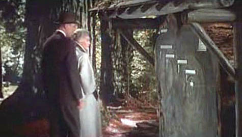
[Image: A scene from Alfred Hitchcock’s film Vertigo, with Jimmy Stewart and Kim Novak in Muir Woods, outside San Francisco, where Novak points to the concentric rings of the redwood trunk and says, “Here I was born… and here I died”].

For artist Katie Holten, trees were thus the natural starting point for an oral history of a city street in the Bronx. To mark the 100th anniversary of the Grand Concourse, a four-mile-long boulevard that connects Manhattan to the parks of the Northern Bronx, Holten has created the Tree Museum: 100 specially-chosen trees between 138th Street and Mosholu Parkway, each of which has a story to tell if you dial the number at its base.

The museum opens today, June 21, with a parade and street fair: for those of us not in New York, a podcast and brochure will be available for download, and you also can view each of the tree locations on Google Maps.

[Image: Trees in the museum each have their own sidewalk marker, which gives their name and extension number].

Only a handful of the one hundred “story-trees” date from the Concourse’s construction, when an avenue of Norwegian maples was planted to shade carriages and pedestrians strolling along the broad boulevard. In an email conversation, Holten explained to BLDGBLOG that most of these original trees were moved to Pelham Bay Park when the B/D subway line was built in the early ’30s. Twelve of the surviving maples are joined in the Tree Museum by representatives of fifty-nine other tree species, from an Amur Corktree in Joyce Kilmer park to a Kentucky Coffeetree just south of Tremont Avenue.

In fact, each tree is carefully identified by its species name, in Spanish, English, and Latin, to draw museum visitors’ attention to their variety. Holten told me that, early on in her community outreach, she realized how important naming the trees would be when a teacher in a local school confessed, incredibly, that it was only after he heard about the Tree Museum idea that “he noticed the next time he was walking that there were different kinds of trees. Before that he’d thought they were just ‘trees’.”

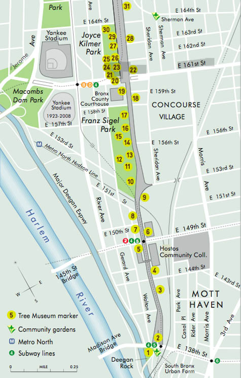
[Image: A section of the Tree Museum map; a much larger version can be seen here].

The trees were chosen for their variety, Holten says, but also for “location, age, and connection to a particular person or story.” Holten acted as matchmaker, pairing trees with former and current Bronx residents, as well as scientists, authors, and activists who have worked in the area. Among the 100 participants are well-known former Bronxites DJ Jazzy Jay and Daniel Libeskind, students at the Bronx Writing Academy, and Jonathan Pywell, Bronx Senior Forester, who helped Holten identify all the trees (not an easy task in mid-winter). Each has used their tree as the starting point for a personal anecdote, snippet of neighborhood history, song, or even a digital sound recording.

Taken together, the tree stories are part shared history, part personal memory, part science lesson—they form what Holten describes as “the whole ecosystem of the street.”

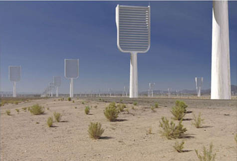
[Image: A computer-generated image of Klaus Lackner’s prototype “synthetic tree,” which would remove carbon dioxide directly from the air; image courtesy of Columbia University].

In her email, Holten went into some detail describing the range of stories you can hear as you dial each tree’s extension, from the sound of a Puerto Rican tree frog (No.73, a Gingko) to a local preservationist describing how he fought to turn an abandoned lot into the park that now surrounds No. 100, a Cottonwood. From her email:

Klaus Lackner (professor in the Department of Earth and Environmental Engineering at Columbia University and director of the Lenfest Center for Sustainable Energy) tells the story of the carbon cycle and his attempt to create a “fake plastic tree,” or air extractor, that would suck the CO2 out of the air and convert it into something we can put in a safe place. Eric Sanderson (a landscape ecologist based at the Bronx Zoo, and author of Mannahatta) needed a really old, native tree to talk about projecting the landscape backwards. I gave him No. 9, a beautiful American Elm outside Cardinal Hayes High School.

At the northern end of the Concourse, at 206th St, there’s a huge chunk of rock between two buildings; it’s like the side of a cliff. I had to give the tree there, No. 95, to Sid Horenstein, a geologist who recently retired from the American Museum of Natural History. He’s able to use the rock outcrop to explain the story of what the Concourse lies above—it was built on a ridge and that’s one of the main reasons the street was constructed here, because it was elevated and offered spectacular views of the countryside all around.

And Tree No. 45, a Little Leaf Linden, has a story told by Patricia Foody, a 95-year-old Bronxite. She remembers her dad bringing her for a walk to the Concourse to visit his brother’s tree in just this location—it was one of the original maples, and many of them had plaques for soldiers who had died in World War I.

Some of the stories come from people who work with the trees directly: Jennifer Greenfeld, director of Street Tree Planting for the Parks and Recreation department, uses No. 66, a Chinese Elm, to provide an overview of street trees throughout New York City and the policy battles they sometimes cause. Barbara Barnes, a landscape architect also with the Parks department, puts her tree in the context of the historic street tree canopy project she’s working on, to replant Joyce Kilmer and Franz Sigel parks as they were originally laid out.

[Image: Eric Sanderson pointing at a map of the Bronx; photo by Katie Holten].

For other participants, the trees function as more of a backdrop for personal history and community activism. Sabrina Cardenales is the real-life model for the character Mercedes in Adrian Nicole LeBlanc’s Random Family: Love, Drugs, Trouble, and Coming of Age in the Bronx, which documents extreme urban poverty in New York: both Sabrina and Adrian introduce themselves and read a passage from the book as part of the Tree Museum. Meanwhile, Majora Carter, an environmental justice activist and MacArthur fellow from the south Bronx, uses tree No. 6, a honey locust, to tell people: “You don’t have to leave your neighborhood to live in a better one, and trees are an important part of making that happen.”

The variety of voices and stories Holten describes accumulate into a sense that plenty of people really do care about these trees, this street, and the Bronx in general. They also act as a series of nudges to look at the urban landscape in a new light. The result is that the Tree Museum, at least in theory, will recreate some of the optimism of the Grand Concourse’s roots in the City Beautiful movement, while not glossing over the struggles and setbacks faced by the “Champs-Élysées of the Bronx” ever since.

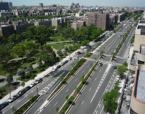
[Image: The Bronx Grand Concourse, looking north from 161st Street; photo by Katie Holten].

As part of the Concourse’s centenary celebrations, the Bronx Museum and New York’s Design Trust For Public Space are running a competition called Intersections: Grand Concourse Beyond 100, to gather new proposals for regenerating the street. Although the call for entries period is now closed, Katie Holten has set up a community forum for the Tree Museum, and clearly hopes the project will prompt action, as well as reflection.

Holten explains her most basic hope, which is that the Museum will encourage people to start using and enjoying their shared public space again:

One hundred years ago the Concourse was built for people to stroll along, under the shade of the trees, but in 2009 it takes quite an effort to get people out for a walk—hopefully we’ll get them strolling! There are a number of individuals who I met because they are interested in trees, or in “green” issues, and we’ve tried to use the momentum of the Tree Museum to help them make differences. For example, Fernando Tirado (tree No. 88) is district manager for Bronx Community Board #7 and he’s been prompted to establish a “Greening the Concourse” project. He’s organizing summer internships for youth in the area: giving them a job and training, and at the same time actually greening the street.

Perhaps more importantly, Holten’s Tree Museum (which she describes as “practically invisible—it’s part of the urban fabric”) demonstrates an intriguing way to re-imagine the landscape: finding ways to make the hidden layers and connections of a street’s story visible (or audible) might ultimately be as, if not more, important than installing a new swing set in the park.

[Previous guest posts by Nicola Twilley include Watershed Down, The Water Menu, Atmospheric Intoxication, and Park Stories].
London Yields, Harvested

Note: This is a guest post by Nicola Twilley.

As Geoff mentioned last month, London’s Building Center hosted a daylong seminar at the end of May called London Yields: Getting Urban Agriculture off the Ground.

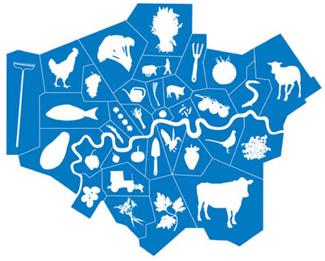
[Image: From London Yields: Urban Agriculture].

The speakers covered a lot of terrain—so, instead of a full recap of the event, the following list simply explores some of the broader ideas, responses, and questions about urban agriculture that stood out from the day’s presentations.

1. Becoming public policy
The event was introduced and moderated by David Barrie, a sustainable development consultant, who framed the day as a collective opportunity to brainstorm ways in which urban agriculture could be moved from mere “sustainable accessory” to become a standard practice of both everyday life and city design. Interestingly, Mark Brearley, Head of Design at Design for London (DfL) and the day’s first speaker, provided confirmation of Barrie’s diagnosis, confessing that food production was a recent add-on to many of their open space projects. Why? “Because people were asking us about it,” he said.

Brearley’s presentation was an overview of DfL’s hundreds of urban regeneration and infrastructure improvement projects; these are, in themselves, interesting but, in aggregate, somewhat exhausting. However, as an office of the London Development Agency, working on behalf of the Mayor of London, Brearley was able to provide a fascinating insight into some of the current institutional priorities that need to be satisfied before urban agriculture can become a standard part of London public policy. For example, DfL’s main interest in food production today is in terms of its “public engagement potential” and their primary stumbling block is how to measure the scaleability of local initiatives. Any London-based urban agriculture projects hoping for a mayoral blessing, take note!

2. Food is a design tool
The second speaker was Carolyn Steel, author of the excellent book Hungry City: How Food Shapes Our Lives. Hungry City traces how food has shaped both the city and its productive hinterland throughout history, from the Sumerian city of Ur to today’s London via the markets and gates of ancient Rome. Steel provides a wide-ranging historical look of food production, importation, regulation, and culture, before putting forward her own intriguing and potentially revolutionary proposition: what would happen if we consciously used food as a design tool to create a “sitopic” city? Steel’s coinage here, sitopia—from “sitos” (food) and “topos” (place)—is derived from her realization that “food shares with utopia the quality of being cross-disciplinary… capable of transforming not just landscapes, but political structures, public spaces, social relationships, [and] cities.” And because “food is necessary,” a sitopian city (unlike its utopian cousin) would remain tied to reality and of universal relevance.

The quotations above come from Steel’s book, however, rather than her lecture; twenty-five minutes was enough time to provide fascinating examples of food’s role in shaping cities and urban life, but, sadly, not enough to explain (let alone explore) further thoughts about food’s use as an urban planning tool. More to come soon, I hope, on this topic…

[Image: Ebenezer Howard’s original scheme for the Garden Cities of To-morrow shows a landscape reimagined in terms of food production and supply. As Carolyn Steel explains in her own book Hungry City, Howard’s plans relied on land reform that was never carried out, and the garden cities of today (Letchworth, Welwyn, etc.) are, as a result, little more than green dormitory suburbs].

3. Partnerships as infrastructure
Anna Terzi, who runs London Food Link’s small grants scheme for Sustain, was the day’s third speaker; she described one of their current projects, demonstrating how key insights from both Mark Brearley’s and Carolyn Steel’s talks might look in action.

Sustain (a nonprofit alliance for better food and farming) is currently poised to create borough-wide institutional change by partnering with Camden Council and Camden Primary Care Trust (part of the National Health Service). This alliance—with its intriguing implication that the National Health Service might be the one institution with the most to gain by promoting urban agriculture—speaks to the impact of creating new interest groups for locally grown food. By partnering with institutions responsible for dealing with established urban challenges—issues such as public health, economic growth, community engagement, waste, and environmental sustainability—groups like Sustain have the potential to take urban agriculture from decorative hobby to investment-worthy infrastructure.

The Camden partnership’s report (still in draft stage) aims to outline a relatively coherent and holistic food program for the borough—a plan that promises to use food to reshape at least this part of the city, in terms of promoting social enterprise, meeting infrastructure needs, and reducing health inequalities.

[Image: A lemon grown in Dulwich; photograph by Jonathan Gales (2008), ©Bohn & Viljoen Architects].

4. Mapping and visualization tools
The last two presentations of the day agreed that successfully producing food in the city requires a detailed resource inventory combined with effective promotion efforts. Mikey Tomkins, a PhD candidate at the University of Brighton, described systematically mapping the rooftops, grass patches, vertical faces, and vacant lots of Elephant & Castle—whereupon he discovered that 30% of the area’s food needs could be met through the cultivation of found space alone.

Architects Katrin Bohn and Andre Viljoen, creators of the uninspiringly named CPUL (Continuous Productive Urban Landscapes), emphasized the need to think about spare inventory in terms of population and three dimensionality (their Urban Agriculture Curtain filled a display window one floor above us). Their research techniques included the accumulation of census data and questionnaires combined with GPS mapping and site visits in order to analyze a landscape’s food production capacity.

Both Tomkins and Bohn & Viljoen also showed several projects intended to help people read the city in terms of food, using tools as diverse as “edible maps” of London and visual analyses of urban agriculture in Havana, to installations and public events, such as the Continuous Picnic. This was a day-long event, part of the 2008 London Festival of Architecture, that included an “Inverted Market” (bring your own locally grown fruit and vegetables to be admired, judged, and then prepared), as well lessons in “Community Composting”; a giant public picnic then spread throughout Russell Square and Montague Place, with connecting corridors between.

Meanwhile, for his Edible Maps series, an example of which appears below, Tomkins targets a new type of urban resident: the “food-flâneur,” who, map in hand, “could start to picture… the grassed areas around housing, the corners of parks, or the many flat rooftops of this quarter of Croydon spring into life with psychogeographic food.”

Another example of urban agriculture as an opportunity for community activation was Croydon Roof Divercity, Tomkins’s collaboration with AOC (previously discussed, along with other AOC projects, on BLDGBLOG here).

[Image: From Mikey Tomkins’s series of Edible Maps, this guide represents the area around Surrey Street car park, site of Croydon Roof Divercity, in terms of inventory and potential yield].
5. Easy, cheap, and somewhat under control
Both Anna Terzi and Bohn & Viljoen recognized the difficulty of maintaining urban agriculture projects, once the initial novelty has worn off. Bohn & Viljoen are currently working on a twelve-step program to prevent relapse, while Sustain are offering ongoing practical and financial support to new food growing spaces in London through their Capital Growth initiative.

Throughout the morning, David Barrie repeatedly registered his concern that urban agriculture needed to be economically viable, not just an upscale $64 Tomato lifestyle choice. Several of the presenters added a layer of nuance to Barrie’s formulation, noting that cheap food has simply had its costs externalized and hidden (Carolyn Steel) and that organizations like the New Economics Foundation are developing the much-needed tools to measure urban-agriculture-created value, such as increased community engagement and environmental sustainability, which is currently perceived as intangible and qualitative (Katrin Bohn). Mikey Tomkins argued against an economics-based one-size-fits-all approach to urban agriculture, explaining that the scale of a food growing project determines its possible benefits. Thus differentiated, food gardening generates educational and quality of life outcomes and should be measured accordingly, while market gardening creates recycling benefits, and urban agriculture can be evaluated in terms of yield.

Finally, the elephant in the room was the degree of coordination and regulation needed to transform London into a food-producing landscape. In an environment where, as Carolyn Steel said, the supermarkets where Londoners buy more than 80% of their groceries refused to participate in consultations with the Mayor’s London Food Strategy, it seems unlikely that sustainable food production and distribution will become the norm without legislative intervention.

In her book, Steel quotes Cassiodorus, a Roman statesman who wrote: “You who control the transportation of food supplies are in charge, so to speak, of the city’s lifeline, of its very throat.” At the moment, Steel tells us, roughly 30 agrifood conglomerates—unelected, and with no responsibility other than to their shareholders—have almost unfettered control over London’s food supply. Until that changes, urban agriculture can’t help but remain “at the artwork stage”—an inspiring, attractive, and completely optional extra.

[Other guest posts by Nicola Twilley include Watershed Down, The Water Menu, Atmospheric Intoxication, Park Stories, and Zones of Exclusion].

NYNEX, Embedded Angel of New York City

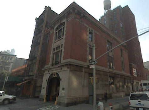
[Image: The original fire house from Ghostbusters, seen here via Google Street View].

Every once in a while it’s rumored that there will be a Ghostsbusters III – the current rumor being that Judd Apatow might produce – and so, today, while walking around the National Gallery of Modern Art here in Rome, in a state of 100º exhaustion, I got to thinking about what would make an interesting plot if BLDGBLOG were somehow hired to write the screenplay.
And this is what I came up with:
It’s 1997. NYNEX is on the verge of being purchased by Bell Atlantic, after which point it will be dissolved in all but name.
But all hell starts breaking loose. Pay phones ring for no reason, and they don’t stop. Dead relatives call their families in the middle of the night. People, horrifically, even call themselves – but it’s the person they used to be, phoning out of the blue, warning them about future misdirection.
Every once in a while, though, something genuinely bad happens: someone answers the phone… and they go a little crazy.
Thing is – spoiler alert – halfway through the film, the Ghostbusters realize that NYNEX isn’t a phone system at all: it’s the embedded nervous system of an angel – a fallen angel – and all those phone calls and dial-up modems in college dorm rooms and public pay phones are actually connected into the fiber-optic anatomy of a vast, ethereal organism that preceded the architectural build-up of Manhattan.
Manhattan came afterwards, that is: NYNEX was here first.
It’s worth recalling, in fact, that NYNEX – at least according to Wikipedia – actually stood for New York/New England, “with the X representing the unknown future (or ‘the uneXpected’).” It’s like Malcolm X’s telephonically inclined, wiry cousin.
So the phone system of Manhattan – all those voices! all those connections! leading one life to another – starts to act up, provoked by its dissolution into Bell Atlantic… and the Ghostbusters are called in to fix it.
Fixing it involves rapid drives from telephone substation to telephone substation, from library to library, all while Dan Ackroyd’s character keeps receiving phone calls about a family crisis… his ex-wife is calling… his dad is calling… they’re urging him to stop this whole, crazy Ghostbusters business… He starts acting funny. The voices on the phone say strange things. They call at strange hours. He feels kinship with public pay phones; they sometimes ring as he walks past. He tries to call his family back – but they’re not answering.
Harold Ramis starts to suspect something.
In the background there are shadowy figures called out to fix transmission lines – but they are actually wiring something up… something big…
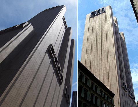
The whole movie then leads up to the granddaddy of them all: an electromagnetic confrontation inside the windowless, Brutalist telephone switching tower at 33 Thomas Street (rumored haunt of the ghost of Aleister Crowley).

[Image: 33 Thomas Street, via Wikipedia, “is a telephone exchange or wire center building which contains three major 4ESS switches used for interexchange (long distance) telephony…”].

The opening scene: a pay phone on a sun-splashed street near Washington Square Park. You can see the famous arch in the background.
A man is sitting nearby, outside a deli. He’s got a bagel and a coffee and he’s reading the New York Times.
The phone starts to ring. He looks at it. It rings and rings.
He gets up, finally, and approaches the phone – and he answers it.
It’s his dad.
But he thought his dad was dead.
Ghostbusters III.
The city’s telecommunications system is not some mere collection of copper wires and fiber optics, the film will suggest; it’s actually the subtle anatomy of a barely understood supernatural being, an angel of rare metals embedded in the streets of Manhattan.
Somewhere between AT&T and H.P. Lovecraft, by way of electromagnetized Egyptian mythology.
These metals, Harold Ramis will explain, pushing up his eyeglasses, also correspond to materials used in pre-Christian burial rituals throughout Mesopotamia. Copper coffins. Traces of selenium found in embalming tools. He refers to Tiamat, dragon of multiple heads, and he draws mind-bending parallels between Middle Eastern mythology and the origins of NYNEX. NYNEX/Tiamat. NYNEX/Michael. NYNEX/Metatron.
Certain members of the audience think the whole thing sounds like bullshit. But they like the special effects. And who cares, anyway.
So the movie will involve everyone from Guglielmo Marconi to Thomas Edison to Alexander Graham Bell (he’s the “ultimate sorcerer,” Dan Ackroyd exclaims, laughing along with the rest of us), and it will make reference to the hundreds of architecturally interesting telephone substations scattered throughout the greater New York region.
It’s voodoo meets urban infrastructure by way of Avital Ronell. Architecture students will flock to see it.
Having seen the film, people will long for the days of pay telephones – when, according to the film’s mythology, you were actually using the body of an angel to make local phone calls.
Within the film, then, there are also brief scenes of excavation – a kind of angelic archaeology wherein Bill Murray digs through the plaster of tenement walls in search of ancient trunk lines. But he accidentally breaks into the plumbing.
At one point, he and Ernie Hudson drive north along the Hudson, discussing Christian archangels, afraid to use the car phone, looking for some kind of old anchorage point for the phone system.
They think maybe they can just shut the whole thing off.
They are surrounded by dark trees and the scenography is breath-taking.
Harold Ramis then uncovers a diagram of city streets and the exact locations of NYNEX lines; these line up with other diagrams from some Central European grimoire that he finds down in the basement of the New York Public Library.
They’re getting close, in other words.
And that’s when they discover 33 Thomas Street.
In any case, the film is released in the summer of 2012 and it’s a runaway blockbuster. It’s “a return to American mythmaking,” A.O. Scott writes in the New York Times, and there’s immediate talk of a Ghostbusters IV.
Manhattan is the wired center of a vast, global haunting, a transmission point crisscrossed by whispers above a magical infrastructure no one fully understands.
Ghostbusters III: hire me, and I’ll write it! I don’t think it’d be a bad movie, actually.

A Parking Lot to Last 16,000 Years

Perhaps proof that J.G. Ballard didn’t really die, he simply took an engineering job at MIT, scientists at that venerable Massachusetts institution have designed a new concrete that will last 16,000 years.

Called ultra-high-density concrete, or UHD, the material has so far proven rather strikingly resistant to deformation on the nano-scale – to what is commonly referred to as “creep.”

This has the (under other circumstances, quite alarming) effect that “a containment vessel for nuclear waste built to last 100 years with today’s concrete could last up to 16,000 years if made with an ultra-high-density (UHD) concrete.” (Emphasis added).

So how long until we start building multistory car parks with this stuff? 16,000 years from now, architecture bloggers camped out for the summer in rented apartments in Houston – the new Rome – get to visit the still-standing remains of abandoned airfields, dead colosseums, and triumphal arches that once held highway flyovers?

16,000 years’ worth of parking lots. 16,000 years’ worth of building foundations. Perhaps this simply means that we’re one step closer to mastering urban fossilization.

(Thanks, Mike R.!)

Acqua Veritas

The city of Venice has begun to rebrand its tap water, calling it Acqua Veritas, in an attempt to woo both residents and tourists away from the environmental hazards (and waste collection nightmare) of bottled water.
After all, Italians are “the leading consumers of bottled water in the world,” the New York Times reports, “drinking more than 40 gallons per person annually.” Further, “Venice’s tap water comes from deep underground in the same region as one of Italy’s most popular bottled waters, San Benedetto” – so turning Venetians on to the miracles of the tap (and setting an example for cities elsewhere) is clearly overdue.
However, as we saw earlier on BLDGBLOG, in a guest post by Nicola Twilley, bottled water now sits on the cusp of becoming as pretentious as the wine industry, complete with a developing vocabulary for taste preferences and even an emerging geography of aquatic terroir. In other words, it will be hard to break the Duchampian habit of seeking water in a bottle. Why Duchampian?
Because bottled water is the ultimate readymade object; I’d even suggest that Marcel Duchamp very nearly discovered the bottled water industry when he first captured 50 cc of Paris Air, in an artwork of the same title, back in 1919.

[Image: Marcel Duchamp, 50 cc of Paris Air (1919), courtesy of the Philadelphia Museum of Art].

It’s hard not to wonder what might have happened had Marcel Duchamp been alive just slightly later, and able to exhibit his artwork alongside – or even simply to hang out with – Andy Warhol; combine the readymade object with Warholian mass reproduction, substitute pure glacial water for Paris air, and perhaps today we’d all be drinking L’Eau de Duchamp.
In any case, if cities around the world engaged in marketing campaigns similar to this one in Venice, however tongue-in-cheek it may be, might people finally regain interest in their own municipal water supplies?
Croton Silver: The Taste of Manhattan™.

(Vaguely related: The next bottled water industry? Chinese Air Bars).

Watershed Down

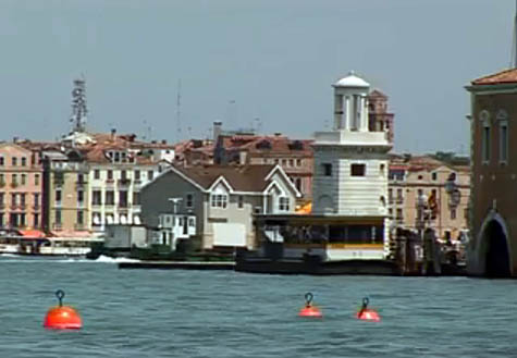
[Image: Mike Bouchet’s Watershed being towed through Venice towards the Arsenale basin, against a backdrop of Italian palazzi].
Note: This is a guest post by Nicola Twilley.

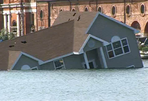
The 2009 Venice Biennale opened this week with an unexpected and quite beautiful piece of performance art. Artist Mike Bouchet had built a one-to-one scale replica of a typical American surburban home that he planned to install on floating pontoons in the Venice Arsenale basin. He called the project Watershed.

David Birnbaum, the Biennale’s curator, told camera crews filming the installation that he thought the project “sounded a bit megalomaniac,” but the sight of the oversized house, clad in beige vinyl, flimsily bobbing up and down against a backdrop of palazzi and piazzi as it was towed through Venice’s canals, was breathtaking. It was an architectural icon of the American Dream revealed in all its formulaic absurdity.

Amazingly, then, one of the pontoons capsized, and the entire house sank to the bottom of the canal—an unintentional yet utterly perfect coda to the house’s own built-in commentary. Now, a fake generic American suburban home will add its ruins to the underwater archaeology of Venice.

[Image: Mike Bouchet’s Watershed goes down].
A two-minute video of the house’s journey, and eventual fate, can be seen in full on YouTube.

(Originally spotted on Flavorwire).

Mobile Street Furniture

Note: This is a guest post by Nicola Twilley.

Over the past two weeks, in two separate cities, multiple sightings of IDEO-like user-generated adaptations have reframed the motorbike as an intriguing addition to the emerging category of street furniture.

[Image: Photo by Lucy Crosbie, used under a Creative Commons license].

The first example was spotted outside Richard Rogers’s Channel 4 building in London, where a cluster of bike couriers had put their feet up onto their bikes’ handlebars, tipping their helmets down over their faces, and allowing the seats to form a gently curved cradle for their spines. They thereby squeezed in a quick nap between jobs.

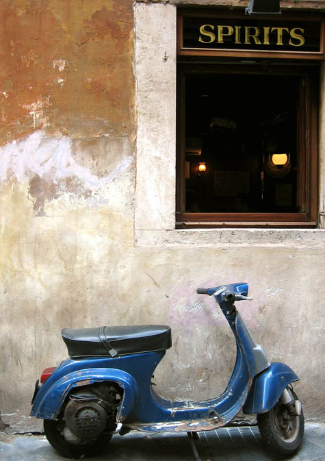
Then, last week, as the streets of Trastevere overflowed with Romans celebrating the Festa della Repubblica, an unlucky Vespa parked next to a bustling enoteca was claimed as a bar stool and drink stand by several different groups over the course of the evening.

In both cases, the bikes suddenly appeared remarkably well-designed for their off-menu functionality: the hammock-like seat cushion and broad, flat rear looked purpose-built for backs and beer, respectively. In fact, with just a few adaptations and some thoughtful urban planning, their potential as mobile street furniture could be taken to the next level.

Simple additions—such as a gently vibrating seat cushion to work out muscle knots while couriers are snoozing, or flip-out cup holders behind the seat of the Vespa—combined with reserved parking spots for motorbikes outside bars and popular brunch spots, would surely enhance city life.

Ambitious entrepreneurs could carve out a seasonal niche by deploying a fleet of specially customized motorbikes as on-demand mobile seating. Perhaps tourists visiting Rome for the day could even rent motorbikes in a shady side-street so as not to miss out on their expected siestas. And, particularly in London, where dedicated outdoor beer gardens—a losing proposition for at least three hundred days of the year, but the most desirable real-estate in the city on those few hot, sunny days—smart publicans would eagerly pay to rent a dozen Vespa bar stools for their clientele to enjoy.

In each case, the motorbikes would be gone by the time pedestrian and vehicle traffic started up again—their mobility ensuring that streets and sidewalks remain uncluttered at peak flow.

It would only be a matter of time before low-platform flat-bed trucks had rentable sofas installed in the back and were then parked at scenic overlooks, while empty lorries were re-purposed as hammock dormitories, circling airport terminals to snap up jet-lagged travelers intent on maximizing layover time. The first international Mobile Street Furniture Conference in Milan would be swiftly followed by the creation of an industry-sponsored urban planning lobbying arm, high-profile design contests, and premium membership schemes, allowing unlimited worldwide street furniture rental…

[Other guest posts by Nicola Twilley include Watershed Down, The Water Menu, Atmospheric Intoxication, Park Stories, and Zones of Exclusion].

Zone for Cloud

[Image: Detail of a zoning map for New York City].

Earlier this month, mammoth – just two months old, but already one of the more interesting architecture blogs out there – cited climatological research that certain land use patterns can dramatically affect the formation of clouds above.

In other words, pastures, forests, suburbs, cities, farms, and so on, all affect the skies in very particular spatial ways. Deforestation, for instance, has “substantially altered cloud patterns” in the Amazon; specifically, we read that “patches of trees behave as ‘green oceans’ while cleared pastures act like ‘continents’,” generating a new marbling of the local atmosphere.

The same thing can be found to happen above cities, of course. Instead of “being zoned ‘R-3 Residential Low Density’,” mammoth continued, “a block might be zoned ‘Cumulus H-2’.” Or Mammatus H-3. In this tongue-in-cheek vision of sky-centric urban development, all new buildings would have to be cleared with a Meteorological Bureau to ensure that they produce the right types of cloud. Atmospheric retrofitting comes to mean attaching bizarre cantilevers, ramps, and platforms to the roofs and walls of existing houses till the clouds above look just right.

Sky vandals are people who deliberately misengineer the weather through the use of inappropriate roof ornamentation.

Over generations, you and your friends and the descendants of your friends sculpt vast, urban-scale volumes of air, guiding seasonal rain events toward certain building types – where, as mammoth‘s own earlier paper about fog farming suggests, “fog nets” might capture a new water source for the city.

(Incidentally, there is a short vignette in The BLDGBLOG Book about bespoke, privatized, and extremely local weather control).

The Rentable Basement Maze

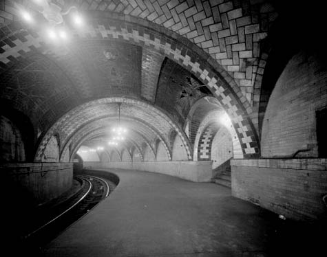
[Image: The subterranean vaults of Manhattan, seen here in City Hall station, which closed in December 1945; photo by David Sagarin (1978), via the Library of Congress, Prints and Photographs Division, Historic American Engineering Record of the Heritage Conservation and Recreation Service].
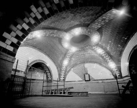
A city with an abandoned underground train line, one that cuts beneath some of the nicest townhouses in the city, develops an unexpected new real estate idea: renting out temporary basements in the form of repurposed subway cars.
Access stairs are cut down from each individual house till they connect up with the existing disused train tunnels below; each private residence thus becomes something like a subway station, with direct access, behind a locked door, to the subterranean infrastructure of the city far below.
Then, for a substantial fee – as much as $15,000 a month – you can rent a radically redesigned subway car, complete with closets, shelves, and in-floor storage cubes. The whole thing is parked beneath your house and braked in place; it has electricity and climate control, perhaps even WiFi. You can store summer clothes, golf equipment, tool boxes, children’s toys, and winter ski gear.
When you no longer need it, or can’t pay your bills, you simply take everything out of it and the subway car is returned to the local depot.
A veritable labyrinth of moving rooms soon takes shape beneath the city.

[Image: The great Manhattan underdome, photo by David Sagarin (1978), via the Library of Congress, Prints and Photographs Division, Historic American Engineering Record of the Heritage Conservation and Recreation Service (which includes many other incredible photographs of that subway line)].

Within a few years, the market matures.
You can then rent bar cars, home gyms, private restaurants, cheese caves, wine cellars, topless dancing clubs, recording studios, movie theaters, and even an aquarium. You can’t sleep in the middle of the night and so you wander downstairs to look at rare tropical fish, alone with fantastic webworks of coral beneath a slumbering metropolis.
Bespoke planetarium cars are soon developed; you step into your own personal history of the sky every night as the clanking metal of distant private rail switches echoes in the tunnels all around you, basements unlatching and moving on through urban darkness.
Shoe storage. Rare book libraries. Guest bedrooms. Growing operations. Swine flu quarantine facilities.
The catalog of newly mobile subterranean architectural typologies comes to include nearly anything the clients can imagine – or afford. Rumor has it, a particularly wealthy widower on the Upper West Side of Manhattan has whole exhibitions from the American Museum of Natural History parked beneath his house when the Museum closes at night; he goes down in his slippers, and he looks at dinosaur skeletons and gemstones as he thinks about his wife.
But then the economy crashes. The market in rentable basements dries up. The lovingly detailed personalized cars that once trolled around beneath the city are dismantled and sold for scrap.
Within a generation, the very idea that people once had personal access to a migratory maze of temporary rooms far below seems almost impossible to believe.

Nocturnal Projections

[Image: A dream of freeways above the city, at Postopolis! LA; I believe this was from Ted Kane‘s presentation. Photo by Dan Hill].

One Postopolis!, a minor car accident, and 500 miles later, I’m back in the rain of San Francisco. I owe a huge thanks to everyone who came out for the event last week, from my fellow bloggers (Bryan, Jace, David A./David B., Régine, and Dan) to Joseph Grima and the crew of Storefront for Art and Architecture, by way of ForYourArt, who found us the venue, organized several daytrips, and brought the whole thing into real time.
Thanks not only for coming along to see it unfold, but for sticking with us through microphone feedback, near-freezing rooftop temperatures, and the odd delay. If you get a chance, definitely visit the websites of the people who presented to learn more about their work; you can find links here.

The Lost Airfields of Greater Los Angeles

[Image: An airplane flies above Los Angeles, a landscape of now-forgotten airports].

Buried beneath the streets of Los Angeles are lost airfields, airports whose runways have long since disappeared, sealed beneath roads and residential housing blocks, landscaped into non-existence and forgotten. Under the building you’re now sitting in, somewhere in greater L.A., airplanes might once have taken flight.

[Image: The now-lost runways of L.A.’s Cecil B. De Mille Airfield; photo courtesy of UCLA’s Re-Mapping Hollywood archive].

The Cecil B. De Mille Airfield, for instance, described by the Re-Mapping Hollywood archive at UCLA as having once stood “on the northwest corner of Wilshire Boulevard and Crescent Avenue (now Fairfax),” would, today, be opposite The Grove; on the southwest corner of the same intersection was Charlie Chaplin Airfield. As their names would indicate, these private (and, by modern standards, extremely small) airports were used by movie studios both for transportation and filming sky scenes. They were aerial back-lots.

Other examples include Burdett Airport, located at the intersection of 94th Street and Western Avenue in what is now Inglewood; the fascinating history of Hughes Airport in Culver City; the evocatively named, and now erased, Puente Hills “Skyranch“; and at least a dozen others, all documented by Paul Freeman’s aero-archaeology site, Abandoned & Little-Known Airfields (four pages alone are dedicated to lost L.A. airfields).

[Image: Charlie Chaplin Airfield in 1920s Los Angeles; photo courtesy of UCLA’s Re-Mapping Hollywood archive].

In a way, though, these airports are like the Nazca Lines of Los Angeles – or perhaps they are even more like Ley lines beneath the city. Laminated beneath 20th century city growth, their forgotten geometries once diagrammed an anthropological experience of the sky, spatial evidence of human contact with the middle atmosphere. Perhaps we should build aerial cathedralry there, to mark these places where human beings once ascended. A winged Calvary.

The cast of minor characters who once crossed paths with those airfields is, itself, fascinating. A minor history of L.A. aviators would include men like Moye W. Stephens. Stephens’s charismatic globe-trotting adventures, flying over Mt. Everest in the early 1930s, visiting Timbuktu by air, and buzzing above the Taj Mahal, would not be out of place in a novel by Roberto Bolaño or an unpublished memoir by Antoine de Saint-Exupéry. And that’s before we really discuss Howard Hughes.

[Image: The Cecil B. De Mille Airfield, renamed Rogers Airport (or, possibly, Rogers Airport, which later became the Cecil B. De Mille Airfield); image via Paul Freeman’s Abandoned & Little-Known Airfields].

Of course, many of these aeroglyphs are now gone, but perhaps their remnants are still detectable – in obscure property law documents at City Hall, otherwise inexplicable detours taken by underground utility cables, or even in jurisdictional disputes at the L.A. fire department.

And they could even yet be excavated.

A new archaeology of airfields could be inaugurated at the corner of Wilshire and Fairfax, where a group of students from UCLA will brush aside modern concrete and gravel to find fading marks of airplanes that touched down 90 years ago, over-loaded with film equipment, in what was then a rural desert.

With trowels and Leica site-scanning equipment in hand, they look for the earthbound traces of aerial events, a kingdom of the sky that once existed here, anchored down at these and other points throughout the L.A. basin, cutting down into the earth to deduce what once might have happened high above.