
 [Image: By Andrew Winning, courtesy of Reuters, via National Geographic].
In her excellent and morbidly fascinating book Necropolis: London and Its Dead, Catharine Arnold describes in detail how parts of the London Underground were tunneled, blasted, picked, and drilled through a labyrinth of plague pits and cemeteries.
To no small extent, she makes clear, the subterranean presence of corpses can be found throughout the British capital. Dead bodies were basically buried everywhere, to the point that, as Arnold pithily states, “London is one giant grave.” The city is saturated from below with the dead.
In one of my favorite examples of this from the book, Arnold explains how the London Hospital maintained its own burial ground from 1849 to 1854. Somewhat astonishingly, however, we learn that housing projects for the medical staff were then built over these old graveyards—and the coffins were not very far below the surface.
As Arnold describes it, this led to some rather unsafe ground conditions:
The remaining part of the burial ground became a garden for nurses and medical students, complete with tennis court, “where they are in the habit of capering about in their short times off-duty, and where it sometimes happens that the grass gives way beneath them—an ordinary occurrence when the subsoil is inhabited by coffins!”
In other words, these tennis-playing nurses “capering about” on their grass tennis courts would occasionally and literally fall through the surface of the earth only to find themselves standing in a maze of rotting coffins hidden just beneath the soil, an infernal honeycomb of badly tended graves like something out of Dante.
This image—of young women frolicking in their 19th-century sports gear suddenly falling through the earth into coffins—is absolutely astonishing and surely belongs in a movie coming soon to a cinema near you, a London-based, hospital-themed remake of Poltergeist.
 [Image: An otherwise unrelated London cemetery, photographed by Louise McLaren/Creative Commons].
Of course, as London’s population exploded, so too did the number of its dead; and, thus, some local churches got in on the financial action of corpse disposal by accepting dead bodies (and the high fees associated with their interment) only to do nothing at all with the corpses but toss them down into the cellar.
One church was so bad, Arnold explains, that its parishioners would often become light-headed and even pass out from the horrible smell of rotting and partially liquified bodies wafting up from beneath the floorboards.
A particularly nightmarish location described by Arnold is Enon Chapel, a Baptist church founded “as a speculative venture.” That is, the minister—Mr. W. Howse—was in it purely for the money.
Arnold’s own description of what happened next says it best:
Worship there was a dangerous business; for members of the congregation frequently passed out—yet, because nobody guessed at the minister’s appalling secret, it never occurred to them that the cause of their sickness lay beneath a flimsy layer of floorboards, in the vault of the chapel.
In warm, damp weather, local residents were assaulted by a peculiarly disgusting smell. Occasionally, when a fire was lit in a nearby building, an intolerable stench arose, which did not originate from the drains. Vast numbers of rats infested the houses; and meat exposed to the atmosphere turned putrid after an hour or two.
The parishioners could even taste it, apparently: an acrid, oily slick on their tongues, resulting from the humid corpse-fog that filled the church, a kind of artificial weather system created by the dissolving bodies of the dead jumbled up in the darkness below them.
Mind-bogglingly, when all of this was finally discovered, how many corpses do you think London city authorities found down there? Several dozen? A few hundred, perhaps? They found twelve thousand corpses. 12,000 corpses all turning into jello and contaminating the local water supply.
 [Image: London’s Abney Park Cemetery, photo by BLDGBLOG].
Yet those churchgoers were lucky to escape with their own lives, we read. At times, London’s urban burial grounds simply exploded, their cheap coffins dangerously over-pressurized from within with corpse gas.
The resulting blasts and long-burning subterranean infernos, for the most part limited to the crypts and basements of churches, were physically repellent and not at all easy to extinguish. “In the 1800s,” Arnold writes, “fires beneath St. Clement Dane’s and [architect Christopher] Wren’s Church of St. James’s in Jermyn Street destroyed many bodies and burned for days.”
To help prevent these corpulent bombs from bursting, sextons of the churches were required to “tap” the coffins now and again; this tapping would jostle the bodies within and thus “facilitate the escape of gases which would otherwise detonate from their confinement.”
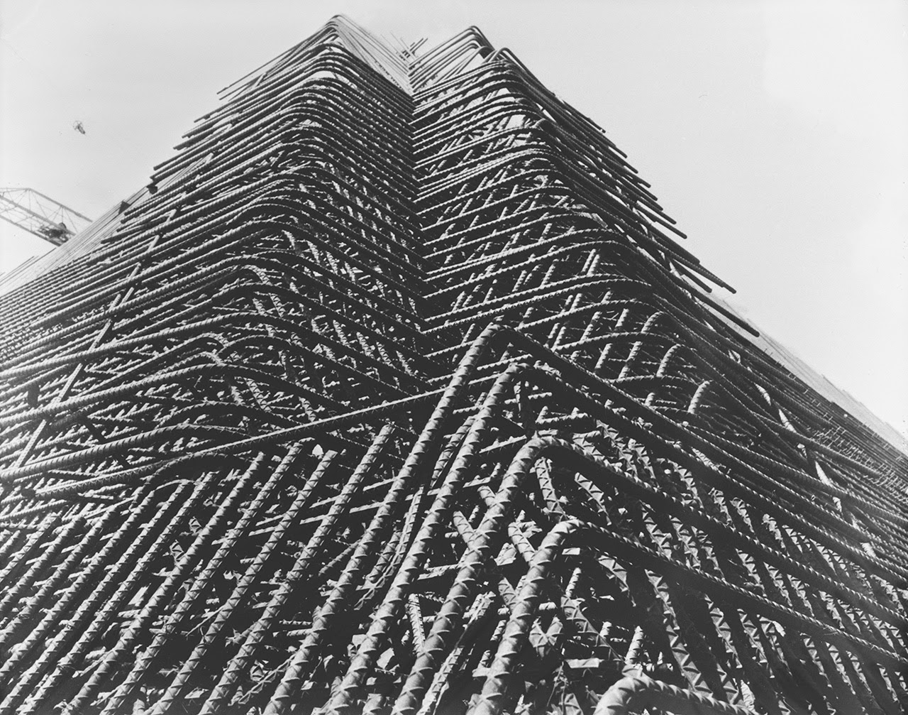
Entrepreneurial architects were not going to stand idly by, however, as a new market for spatial ideas took shape. Designers of speculative necropolises were beginning to ask: why bury when you can build?
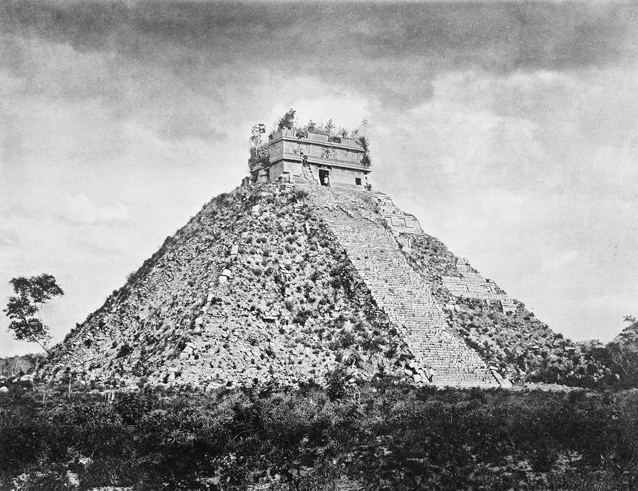
Specifically, Arnold explains, an architecturally inclined businessman named Thomas Willson “proposed a huge pyramid for Primrose Hill. At an estimated cost of £2,500, this massive mausoleum, higher than St. Paul’s, would contain five million Londoners.”
 [Image: The great London pyramid of the Pyramid General Cemetery Company, via Wonders & Marvels].
Intended to invoke solemnity, inspire awe, and earn lots of money, Willson’s colossal geometric structure was to be funded through subscription and run by a new corporation called the Pyramid General Cemetery Company:
Constructed from brick, with granite facing, the plans comprised a chapel, office, quarters for the Keeper, Clerk, Sexton and Superintendent, four entrances and a central ventilation shaft. A series of sloping paths would allow bodies to be moved. Each catacomb took up to twenty-four coffins and could be sealed up after all interments had been completed. Resembling a beehive, it would be a thing of awe and wonder to all who saw it.
The pyramid was never constructed, of course, but perhaps in our own era of London megaprojects, some brick and granite Giza might yet emerge on the marshy edges of town to support and protect the dead of southeast England.
All of which finally brings us back to the real reason I started writing this post, which was to tell the story of how these corpses—the city absolutely littered with burial grounds and plague pits—came to influence the construction of London’s Underground train system. It’s a brief anecdote, but it’s both ghoulish and interesting.
As Arnold points out, there is an otherwise inexplicable shift in direction in the Piccadilly line passing east out of South Kensington. “In fact,” she writes, “the tunnel curves between Knightsbridge and South Kensington stations because it was impossible to drill through the mass of skeletal remains buried in Hyde Park.” I will admit that I think she means “between Knightsbridge and Hyde Park Corner“—although there is apparently a “small plague pit dating from around 1664″ beneath Knightsbridge Green—but I will defer to Arnold’s research.
But to put that another way, the ground was so solidly packed with the interlocked skeletons of 17th-century victims of the Great Plague that the Tube’s 19th-century excavation teams couldn’t even hack their way through them all. The Tube thus had to swerve to the side along a subterranean detour in order to avoid this huge congested knot of skulls, ribs, legs, and arms tangled in the soil—an artificial geology made of people, caught in the throat of greater London.
London’s Tube thus sits atop, cuts around, and tunnels through a citywide charnel ground of corpses, its very routes and station locations haunted by this earlier presence in the ground below.
For much more info on the geography of London’s dead, check out a copy of Necropolis.
(An earlier version of this post was previously published on Gizmodo).

 [Image: Photo by Benjamin Halpern, courtesy of the
 [Images: Photos by Benjamin Halpern, courtesy of the
 [Images: Photos by Benjamin Halpern, courtesy of the
  [Image: Photo by Benjamin Halpern, courtesy of the
  [Image: The pyramid, seen somewhat jarringly in full color, via
 [Images: (top) Photo by Benjamin Halpern, courtesy of the
  [Image: Photo by Benjamin Halpern, courtesy of the


 [Images: Photos by Benjamin Halpern, courtesy of the
 [Images: Photos by Benjamin Halpern, courtesy of the
 [Image: From
  [Image: Due to glacial melt, Switzerland has actually grown in size since 1940; courtesy
 [Images: From
  [Image: From
 [Images: From

 [Images: From
 [Images: From
 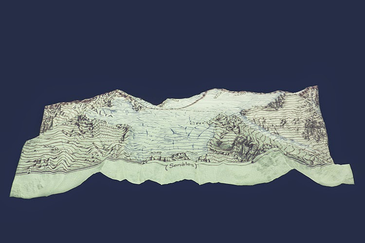 [Image: From
 [Image: A perspectival representation of the “ideal city,” artist unknown].
 [Image: Jeff Bezos as perspectival historian. Courtesy of
  [Image: Courtesy of
  [Image: One of several perspectival objects—contraptions for producing spatially accurate drawings—by Albrecht Dürer].
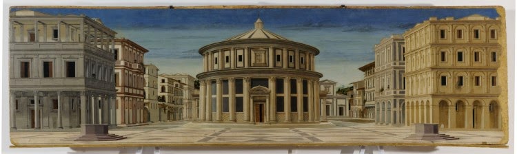 [Image: Another “ideal city,” artist unknown].

 [Image: From Etienne-Gaspard Robertson’s 1834 study of technical phantasmagoria, via
  [Image: A “moving face” transmitted by John Logie Baird at a public demonstration of TV in 1926 (photo
  [Image: Kristian Birkeland stares deeply into his universal simulator (
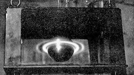 [Image: From Birkeland’s The Norwegian Aurora Polaris Expedition 1902-1903, Vol. 1: On the Cause of Magnetic Storms and The Origin of Terrestrial Magnetism (
 [Image: Cropping in on the pic seen above (
 [Image:
 [Image: The new plastic geology, photographed by
 [Image: Courtesy of
  [Image: Courtesy of
 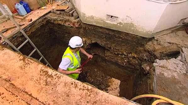 [Image: Courtesy of
 [Image: From the Ellensburg Daily Record, June 16, 1914].
 [Image: An otherwise irrelevant photo of people ballroom dancing, via
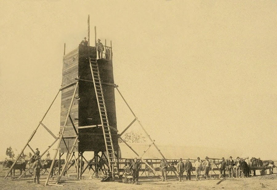 The so-called “Yolo Buggy” was not a 19th-century adventure tourism vehicle for those of us who only live once; it was a mobile building, field shelter, and geopolitical laboratory for measuring the borders of an American county.
 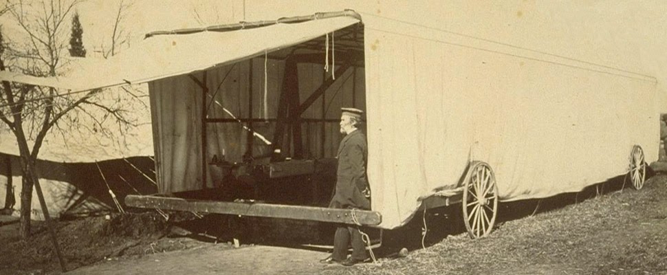 The “moveable tent or ‘
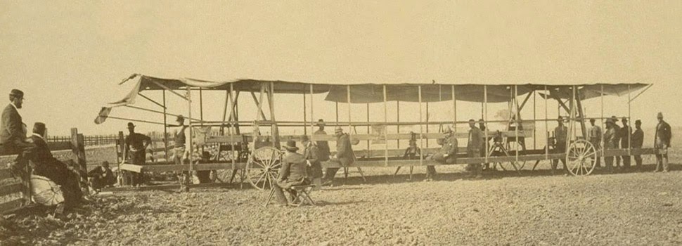 The resulting “Yolo Baseline” and the geometries that emerged from it allowed these teams to establish a constant point of cartographic reference for future mapping expeditions and charts. In effect, it was an invisible line across the landscape that they tried to make governmentally real by leaving small markers in their wake. (Read more about meridians and baselines over at the
 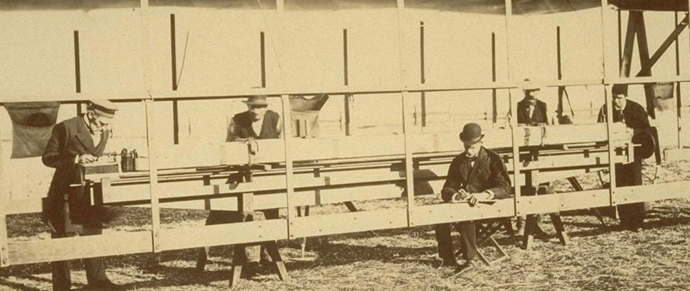 In the process, these teams carried architecture along with them in the form of the “moveable tent” seen here—which was simultaneously a room in which they could stay out of the sun and a pop-up work station for making sense of the earth’s surface—and the related tower visible in the opening image.
 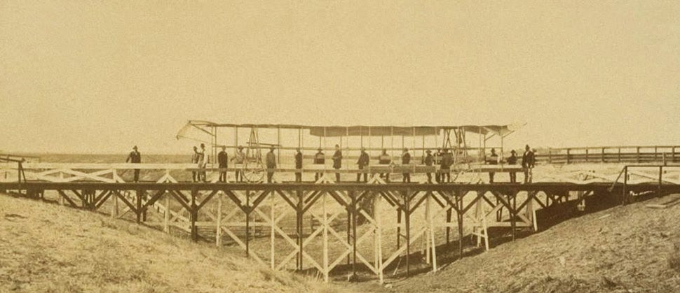 That control tower allowed the teams’ literal supervisors to look back at where they’d come from and to scan much further ahead, at whatever future calculations of the grid they might be able to map in the days to come. You could say that it was mobile optical infrastructure for gaining administrative control of new land.
 Like a dust-covered Tron of the desert, surrounded by the invisible mathematics of a grid that had yet to be realized, these over-dressed gentlemen of another century helped give rise to an abstract model of the state. Their comparatively minor work thus contributed to a virtual database of points and coordinates, something immaterial and totally out of scale with the bruised shins and splintered fingers associated with moving this wooden behemoth across the California hills.
 [Image: Kahn & Selesnick, courtesy
  [Image: Kahn & Selesnick, courtesy
  [Image: Kahn & Selesnick, courtesy
 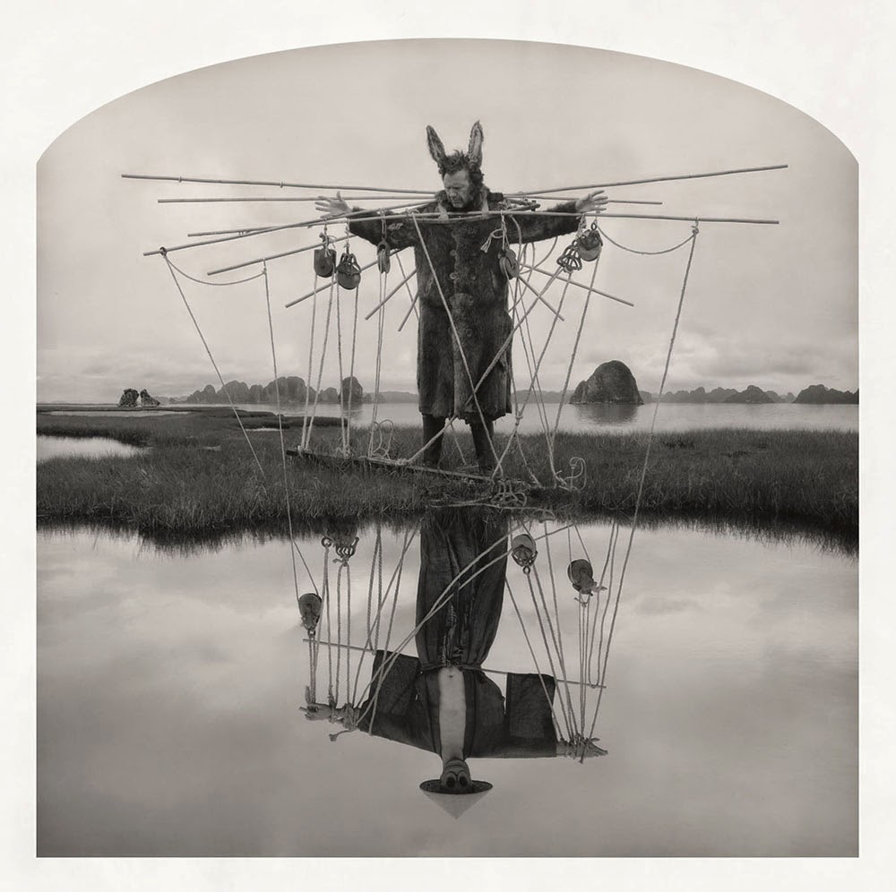 [Image: Kahn & Selesnick, courtesy
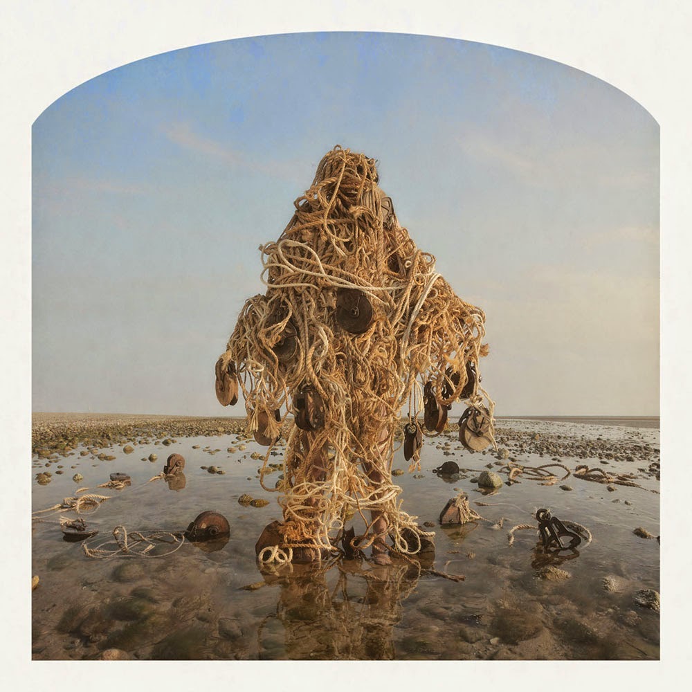
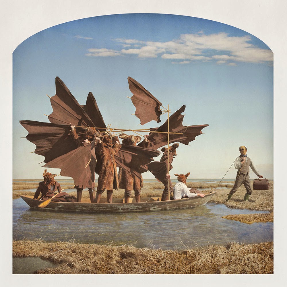
 [Image: Kahn & Selesnick, courtesy
 [Images: Kahn & Selesnick, courtesy
  [Image: Kahn & Selesnick, courtesy
 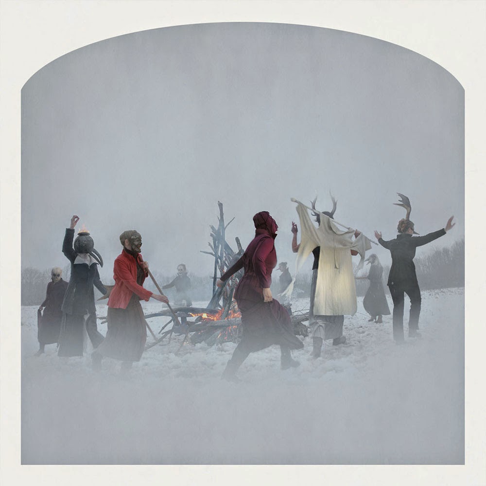 [Image: Kahn & Selesnick, courtesy