Heat Maps

[Image: From Heat Maps by Richard Mosse, courtesy Jack Shainman Gallery].

In a highly timely new show called Heat Maps, opening tonight, February 2, at Jack Shainman Gallery in New York City, photographer Richard Mosse “charts the refugee crisis unfolding across Europe, the Middle East and North Africa.”

Mosse has documented refugee camps and staging sites using an extreme telephoto military-grade camera that can detect thermal radiation, including body heat, at great distance. The camera is used against its intended purpose of border and combat surveillance to map landscapes of human displacement. Reading heat as both metaphor and index, these images reveal the harsh struggle for survival lived daily by millions of refugees and migrants, seen but overlooked, and ignored by many.

By attaching the camera to a robotic motion-control tripod, Mosse has scanned significant sites in the European refugee crisis from a high eye-level, creating densely detailed panoramic thermal images. Each artwork has been painstakingly constructed from a grid of almost a thousand smaller frames, each with its own vanishing point. Seamlessly blended into a single expansive thermal panorama, these images evoke certain kinds of classical painting, such as those by Pieter Bruegel or Hieronymus Bosch, in the way that they describe space and detail. They are documents disclosing the fences, security gates, loudspeakers, food queues, tents, and temporary shelters of camp architecture, as well as isolated disembodied traces of human and animal motion and other artifacts that disrupt each precarious composition and reveal its construction. Very large in scale, Heat Maps reveal intimate details of fragile human life in squalid, nearly unlivable conditions on the margins and in the gutters of first world economies.

An accompanying book, featuring brilliant silver metallic inks and a new essay by Italian philosopher Giorgio Agamben, is due out this spring, as well.

The exhibition opens today at 6pm; more info at Jack Shainman Gallery.

(Earlier: Saddam’s Palaces: An Interview with Richard Mosse).

Gold Standard

[Image: “Ringroad (Houston)” (2005) by Bas Princen].

Photographer Bas Princen has published a new book looking at the visual and personal backstory to one particular photograph, seen above, “Ringroad (Houston),” from 2005. Called The Construction of an Image, the book is also the final publication from Bedford Press.

It is, the book’s editor, Vanessa Norwood, writes, “an arresting image: an ordinary American office block transformed by Princen’s lens into a glowing golden cube cut by the horizon, acting as both mirror and container; the reflected landscape of trees confined within its gridded exterior.”

As part of his work process, Princen assembles small research notebooks of images he is thinking of or influenced by during the production of certain images; The Construction of an Image includes those along with other examples of Princen’s work created at the same time. As such, it offers a sustained glimpse of how Princen operates, how visual concepts are formed, and how analogies are identified and tracked from one building or landscape to another.

In the case of “Ringroad (Houston),” these precedent images range from engravings by Albrecht Dürer—fitting the world into a perspectival grid—to photographs taken inside geodesic domes, and from corporate lobbies to archaeological earthworks. These represent moments or sites where solitary structures, all-encompassing geometric frames or grids, and uneasy distinctions between foreground and background predominate.

I’m proud to have a short essay featured in the book, alongside texts by editor Vanessa Norwood, architect Kersten Geers, curator Moritz Küng, and a summary by Princen himself.

Geers, in particular, swings for the fences with his assessment of the photo, writing, “Bas Princen’s photograph Ringroad (Houston) encapsulates, through its simple presence and curious ambiguity, almost everything I feel we can ever say about architecture,” continuing over the rest of his essay to explain how the photo went on to influence Geers’s own architectural design work.

My own look at the image is in the context of Princen’s output, from Los Angeles to Dubai, focusing on his images in which “there is often an extraordinary, building-size geometric shape in the center of the frame, yet it is not always clear if it can be described as architecture. (…) Rather, these abstract objects—sometimes mirrored, sometimes with no visible points of entry—function more like undeclared monuments with no clear subject of commemoration. They are, in a sense, both unexplained and inexplicable.”

[Image: “Cooling Plant, Dubai” (2009) by Bas Princen; while this photograph does not appear in The Construction of the Image, I mention it in my essay as an inversion of “Ringroad (Houston)”].

If you’re curious to see a slightly different sort of approach, Princen’s photos are also—as of yesterday—on display at the Met Breuer museum in New York City.

In a show called Breuer Revisited, photographers Luisa Lambri and Princen both offer their own distinctive visual analyses of four buildings designed by Marcel Breuer.

“Evoking minimalism and abstraction,” the museum explains, “Lambri creates images that examine the dialogue between interior and exterior, and the interaction between surface and light. Princen investigates and reframes urban and rural spaces through documenting the concept of post-occupancy, or the evolution of a building and its enduring relevance.”

The show is open until May 21, 2017; The Construction of an Image is available through the Architectural Association.

(Earlier: Pieces of the city are forming, like islands).

Escaping from the Garden

[Image: An example of Periplaneta japonica, via New York Daily News].

Ornamental vegetation planted on New York City’s famed High Line park might have inadvertently brought an “invasive cockroach” to the United States. From the New York Daily News:

The High Line, a park that turned a dilapidated stretch of elevated railway on Manhattan’s West Side into one of New York’s newest tourist attractions, may have brought a different kind of visitor: a cockroach that can withstand harsh winter cold and never seen before in the U.S.

Rutgers University insect biologists Jessica Ware and Dominic Evangelista said the species Periplaneta japonica is well documented in Asia but was never confirmed in the United States until now. The scientists, whose findings were published in the Journal of Economic Entomology, say it is too soon to predict the impact but that there is probably little cause for concern.

“The scientists suspect the little critter was likely a stowaway in the soil of ornamental plants used to adorn the park,” the newspaper adds.

I’ve always been fascinated by how gardens—ostensibly well-controlled landscapes meant to reach maturity under the guise of human supervision—accidentally become beachheads for invasive species.

In the UK, for instance, and this is only one example among very many, it is estimated that nearly “one-quarter of plants sold to ornamental gardeners since the 1800s have escaped, and 30 per cent of these are firmly established in the English countryside.”

As naturalist Richard Mabey points out in his highly recommended book Weeds, sometimes these botanical escapees can even be tracked step by step—or rail line by rail line, as the case may be.

[Image: Buddleia; photo by Steven Mulvey via the BBC, who describe it as “the plant that dominates Britain’s railways”].

Consider buddleia, a popular plant described by writer Laura Spinney, in a great old article for New Scientist (that no longer appears to be archived on their website), as “one of the commonest destructive weeds in Britain.” Buddleia is “not a native of the island,” on the other hand, but rather was “brought from the Himalayas in Victorian times to offer a long flowering season and attract butterflies.”

Ironically, however, “buddleia grows fast and its many seeds are easily dispersed by the wind. It has powerful roots used to thin soil on rocky substrata, ideally suited to penetrating the bricks and mortar of modern buildings. In London and other urban centres it can be seen growing out of walls and eves.”

It is, Spinney suggests, a long-term vegetative threat to the masonry structure of the city itself, a demolition tool hiding in plain sight.

Even in the descriptions of this phenomenon there is such strange poetry to be found—phrases both ominous and inspiring, like, “a plant establishing itself outside the garden,” as if John Milton had somehow reinvented himself as a horticultural critic with a penchant for sci-fi.

In any case, read more about New York City’s newest inhabitant—another alleged escapee from a garden—over at the New York Daily News.

(Roach story spotted, like the previous post, via Chris Woebken).

Love Unlocked

I was interested to see that the NYC Department of Transportation has begun hanging new signs prohibiting, among other things, the attachment of “love locks” to the Brooklyn Bridge.

[Image: Banning love locks; photo courtesy of the NYC Department of Transportation].

Love locks, as I explored in a piece for the New Yorker a few summers ago—an article that was also later partially absorbed into the tools chapter of A Burglar’s Guide to the City—are “padlocks with names, initials, or messages of love written on them, clipped to pieces of urban infrastructure as a public sign of romantic commitment.”

In some cases, the locks have been expensively laser-etched; others are simply written on with Sharpie. “Carrina, will you marry me?” “Zach + Julie, Always + Forever.” They are poetic, forming quite beautiful, rose-like clusters—and they are doomed. In nearly all cases, they will be clipped by the city and disposed of, their magic and romance lost.

Love locks are a global phenomenon, and have been popping up in the news more and more recently, usually portrayed as “a scourge” or even “insipid.”

[Image: Love locks on the Brooklyn Bridge; photo by Nicola Twilley].

(Top photo spotted via Chris Woebken).

Local Code

[Image: Local Code by Nicholas de Monchaux].

Architect Nicholas de Monchaux—whom you might remember from, among other things, a long interview on BLDGBLOG a few years back—has a new book out this week.

[Image: Local Code by Nicholas de Monchaux].

Local Code is an exploration of design variants and latent possibilities in overlooked parcels of urban space. It is “as much design speculation as narrative (and as much obsession as exposition),” he explains.


[Images: Local Code by Nicholas de Monchaux].

The book includes no fewer than “3,659 drawings of designs (by me!) for vacant lots and spaces in New York City, Los Angeles, San Francisco, and the Venice Lagoon, highlighting how such spaces can play an essential and unique role in providing ecological, social, and cultural resilience. Inspired originally by Gordon Matta-Clark’s Fake Estates project, the book has become a graphic and intellectual meditation on cities, networks, data and resilience.”

[Image: Local Code by Nicholas de Monchaux].

The book’s thesis is that “vacant public land”—by which de Monchaux means everything from “land under billboards in Los Angeles, ­dead-end alleys in San Francisco, city-owned vacant lots in New York City, and abandoned islands in the Venetian lagoon”—actually contain “unrecognized potential as a social and ecological resource.” The accompanying explosion of drawings and diagrams is meant to tease out what some of these potentials might be.

Consider picking up a copy, check out the book’s introduction online, and don’t forget to click back to BLDGBLOG’s interview with de Monchaux about the design history of the Apollo spacesuit.

Sunken Cities

[Image: Raising a house to help survive future floods; photo by Eliot Dudik, courtesy The New York Times].

The climate change-induced flooding of coastal cities along the U.S. eastern seaboard has already begun, the New York Times suggests.

“For decades, as the global warming created by human emissions caused land ice to melt and ocean water to expand, scientists warned that the accelerating rise of the sea would eventually imperil the United States’ coastline,” we read. “Now, those warnings are no longer theoretical: The inundation of the coast has begun.” In many places, “the sea is now so near the brim in many places that [scientists] believe the problem is likely to worsen quickly.”

The article is full of specific details that would not be out of place in a well-constructed novel, including dead lawns killed by exposure to seawater, vacuum trucks sent out “to suck saltwater off the streets,” and “huge vertical rulers” installed along roads to help drivers judge if the floodwaters “are too deep to drive through.”

These are the new, everyday practices of life on a future seabed: preparatory behaviors as the waters rise and whole communities face permanent inundation.

What’s so interesting about this, in fact, is the apparent lack of panic and catastrophe. While this seeming calmness is no doubt based purely in denial—not just denial that excessive carbon dioxide in the atmosphere retains more heat, leading to warming, but denial of the fact that this is the new normal, that these floods are not flukes but early glimpses of a fundamentally transformed landscape to come—people are nonetheless simply getting on with their lives, even as radical change occurs around them at every scale.

I’m still haunted by a small detail from a similar story published a few years ago, following Hurricane Sandy, about a place called Broad Channel, an outer neighborhood of New York City. There, rising coastal waters have been causing more and more flooding, to the extent that it has become a regular occurrence—not something terrifying, just mildly irritating.

This is true to the extent that residents have now developed otherwise calm and perfectly rational ways of warning one another that the waters are back, that the streets are flooding, and—more to the point—that they should perhaps consider moving their cars.

Broad Channel is now “a place where residents cling to tide clocks and, some joke, every child gets wading boots for Christmas. Neighbors will honk a car horn in the middle of the night to warn others of an approaching tide, and some have made pencil markings on their homes to show water levels from storms past.”

If we ask ourselves what life will be like in the Anthropocene, after the ever-mounting effects of climate change become real, it’s worth remembering these people “honk[ing] a car horn in the middle of the night to warn others of an approaching tide.”

In other words, the Anthropocene will look perfectly normal: people will simply vacuum-pump seawater out of their carports and garages, scrub encrusted salt from the walls of the homes, give each other waterproof boots for Christmas, and otherwise go on as if the world hasn’t changed.

The secret of the Anthropocene is that it’s just another kind of everyday life.

“The entire city can be considered as one large house”

venice[Image: “St. Mark’s Place, with campanile, Venice, Italy,” via the Library of Congress].

Following a number of recent events for A Burglar’s Guide to the City—discussing, among other things, the often less than clear legal lines between interiors and exteriors, between public space and private—I’ve been asked about the Jewish practice of the eruv.

An eruv, in very broad strokes, is a clearly defined space outside the walls of the private home, often marked by something as thin as a wire, inside of which observant Jews are permitted to carry certain items on Shabbat, a day on which carrying objects is otherwise normally prohibited.

As Chabad describes the eruv, “Practically, it is forbidden to carry something, such as a tallit bag or a prayer book from one’s home along the street and to a synagogue or to push a baby carriage from home to a synagogue, or to another home, on Shabbat.”

However, “It became obvious even in ancient times, that on Shabbat, as on other days, there are certain things people wish to carry. People also want to get together with their friends after synagogue and take things with them—including their babies. They want to get together to learn, to socialize and to be a community.”

While, today, “it is an obvious impracticality to build walls throughout portions of cities, crossing over or through streets and walkways, in order to place one’s home and synagogue within the same ‘private’ domain,” you can instead institute an eruv: staking out a kind of shared private space, or a public “interior,” as it were. The eruv, Chabad continues, is “a technical enclosure which surrounds both private and hitherto public domains,” and it “is usually large enough to include entire neighborhoods with homes, apartments and synagogues, making it possible to carry on Shabbat, since one is never leaving one’s domain.”

In fact, the space of the eruv can absorb truly huge amounts of an existing city, despite the fact that many people will not even know it exists, let alone that they have crossed over into it, that they are “inside” something.

So the question I’ve been posed—although I will defer to more learned colleagues for an informed and accurate answer—is: what does the eruv do to concepts of burglary, if everything taking place inside it, even if technically “outside,” is considered an interior private space? In other words, can any crime committed inside an eruv be considered an act of burglary?

These questions reminded me, in fact, of a commenter named Federico Sanna, who recently pointed out here on the blog that the city of Venice has instituted a new regime for public space in the city by recognizing the entirety of Venice as an eruv.

Reading this with the messy help of Google Translate, the Venetian mayor has signed a law “attesting that the entire city can be considered as one large ‘house,’” or eruv, extending domesticity to the entire metropolis. This eruv will exist for five years, after which, presumably, it will be renewed.

As Sanna points out in his comment, “It must be said: Venice is the place that invented the Ghetto. And this is the 500th anniversary of that event. Venice is the first city to ever constrain Jews in one tiny portion of its urban space–another act that generated architecture, making buildings grow higher and higher to accomodate the growing Jewish population. It is significant, then, if not altogether timely, that it’s Venice that makes this symbolic move of inclusiveness for the first time.”

What effect—if any—this might have on the legal recognition of burglary remains, for me, an interesting question.

“This is how you can shape a metropolis for generations”

moses[Image: Robert Moses, via Wikipedia].

I’ve been meaning to post about this since I first heard about it: a competition to design a game based on Robert Caro’s book The Power Broker: Robert Moses and the Fall of New York.

As Tim Hwang of the Infrastructure Observatory writes, “we are launching a competition that challenges game designers to adapt The Power Broker into a playable, interactive form that preserves the flavor and themes of the written work, while leveraging the unique opportunities the game medium provides.” They are “seeking submissions both in a video game category, as well in a separate tabletop game category.”

Although I am obviously already biased toward game-creation as a form of urban analysis, the possibilities here are incredibly interesting. If you missed Gothamist’s great interview with Robert Caro, meanwhile, it’s well worth reading, serving as an engagingly free-wheeling introduction to Caro’s now-classic book, including several damning insights into how Moses abused infrastructural design as a new form of political power.

“Moses came along with his incredible vision,” Caro explains, for example, “and vision not in a good sense. It’s like how he built the bridges too low.”

I remember his aide, Sid Shapiro, who I spent a lot of time getting to talk to me, he finally talked to me. And he had this quote that I’ve never forgotten. He said Moses didn’t want poor people, particularly poor people of color, to use Jones Beach, so they had legislation passed forbidding the use of buses on parkways.
Then he had this quote, and I can still [hear] him saying it to me. “Legislation can always be changed. It’s very hard to tear down a bridge once it’s up.” So he built 180 or 170 bridges too low for buses.
We used Jones Beach a lot, because I used to work the night shift for the first couple of years, so I’d sleep til 12 and then we’d go down and spend a lot of afternoons at the beach. It never occurred to me that there weren’t any black people at the beach.
So [my wife] Ina and I went to the main parking lot, that huge 10,000-car lot. We stood there with steno pads, and we had three columns: Whites, Blacks, Others. And I still remember that first column—there were a few Others, and almost no Blacks. The Whites would go on to the next page. I said, God, this is what Robert Moses did. This is how you can shape a metropolis for generations.

You have until April 29th to register for the game-design competition; you can find more information on the competition website.

Infrastructure as Processional Space

[Image: A view of the Global Containers Terminal in Bayonne; Instagram by BLDGBLOG].

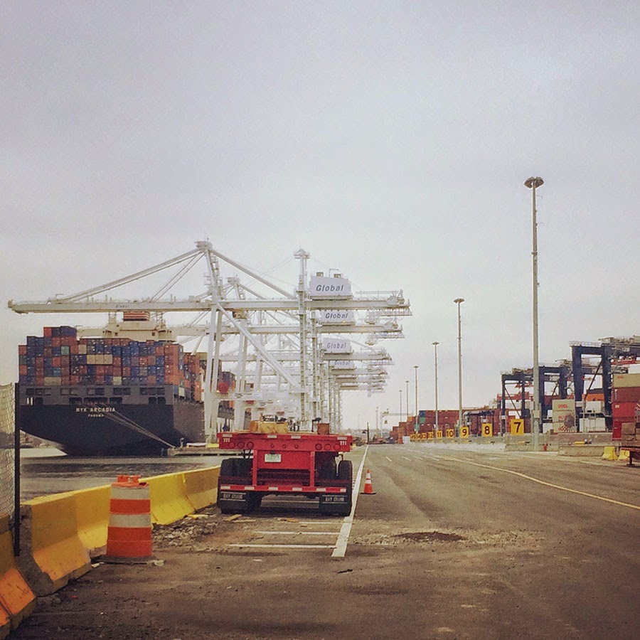
I just spent the bulk of the day out on a tour of the Global Containers Terminal in Bayonne, New Jersey, courtesy of the New York Infrastructure Observatory.

That’s a new branch of the institution previously known as the Bay Area Infrastructure Observatory, who hosted the MacroCity event out in San Francisco last May. They’re now leading occasional tours around NYC infrastructure (a link at the bottom of this post lets you join their mailing list).

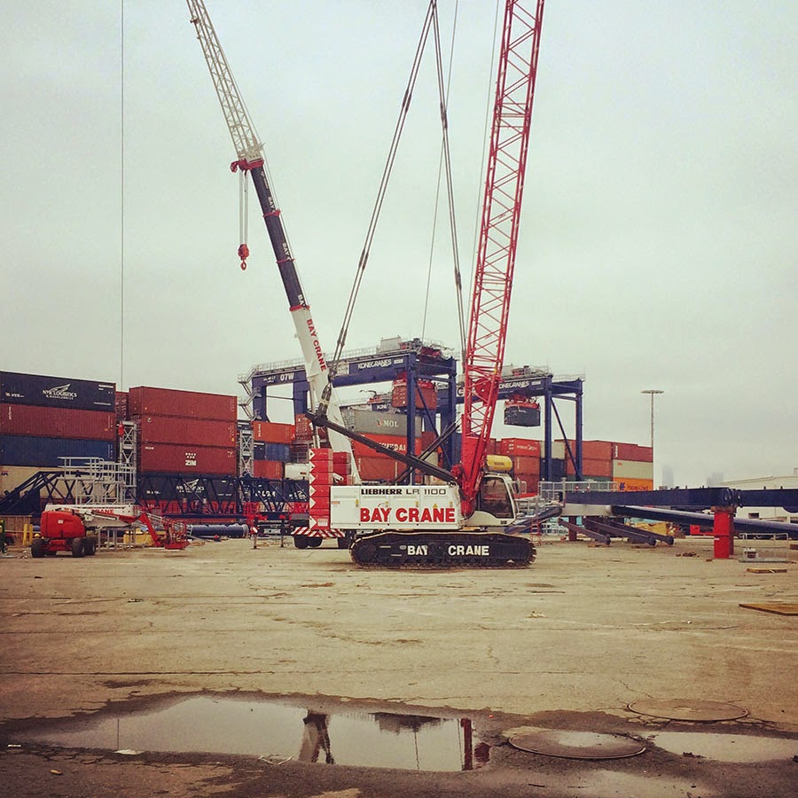
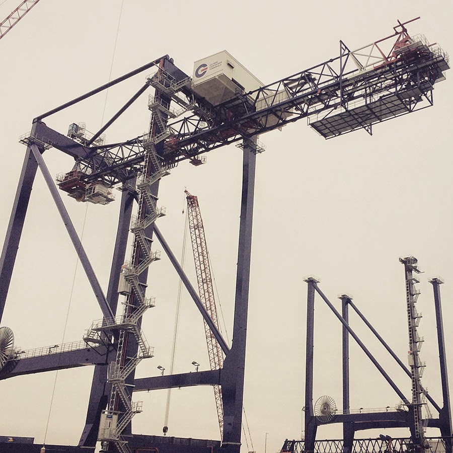
[Image: A crane so large my iPhone basically couldn’t take a picture of it; Instagram by BLDGBLOG].

There were a little more than two dozen of us, a mix of grad students, writers, and people whose work in some way connected them to logistics, software, or product development—which, unsurprisingly, meant that everyone had only a few degrees of separation from the otherworldly automation on display there on the peninsula, this open-air theater of mobile cranes and mounted gantries whirring away in the precise loading and unloading of international container ships.

The clothes we were wearing, the cameras we were using to photograph the place, even the pens and paper many of us were using to take notes, all had probably entered the United States through this very terminal, a kind of return of the repressed as we brought those orphaned goods back to their place of disembarkation.

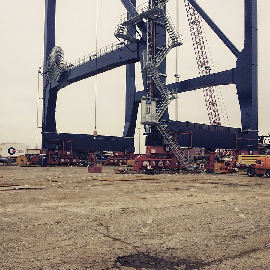
[Images: The bottom half of the same crane; Instagram by BLDGBLOG].

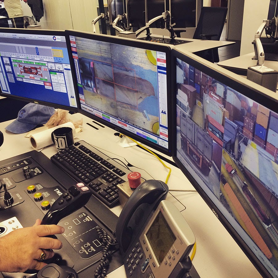
Along the way, we got to watch a room full of human controllers load, unload, and stack containers, with the interesting caveat that they—that is, humans—are only required when a crane comes within ten feet of an actual container. Beyond ten feet, automation sorts it out.

When the man I happened to be watching reached the critical point where his container effectively went on auto-pilot, not only did his monitor literally go blank, making it clear that he had seen enough and that the machines had now taken over, but he referred to this strong-armed virtual helper as “Auto Schwarzenegger.”

“Auto Schwarzenegger’s got it now,” he muttered, and the box then disappeared from the screen, making its invisible way to its proper location.

[Image: Waiting for the invisible hand of Auto Schwarzenegger; Instagram by BLDGBLOG].

Awesomely—in fact, almost unbelievably—when we entered the room, with this 90% automated landscape buzzing around us outside on hundreds of acres of mobile cargo in the wintry weather, they were listening to “Space Oddity” by David Bowie.

“Ground control to Major Tom…” the radio sang, as they toggled joysticks and waited for their monitors to light up with another container.

[Image: Out in the acreage; Instagram by BLDGBLOG].

The infinitely rearrangeable labyrinth of boxes outside was by no means easy to drive through, and we actually found ourselves temporarily walled in on the way out, just barely slipping between two containers that blocked off that part of the yard.

This was “Damage Land,” our guide from the port called it, referring to the place where all damaged containers came to be stored (and eventually sold).

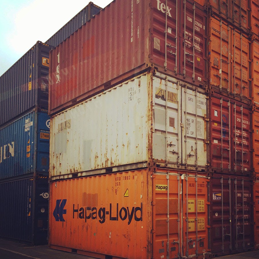
[Image: One of thousands of stacked walls in the infinite labyrinth of the Global Containers Terminal; Instagram by BLDGBLOG].

One of the most consistently interesting aspects of the visit was learning what was and was not automated, including where human beings were required to stand during some of the processes.

For example, at one of several loading/unloading stops, the human driver of each truck was required to get out of the vehicle and stand on a pressure-sensitive pad in the ground. If nothing corresponding to the driver’s weight was felt by sensors on the pad, the otherwise fully automated machines toiling above would not snap into action.

This idea—that a human being standing on a pressure-sensitive pad could activate a sequence of semi-autonomous machines and processes in the landscape around them—surely has all sorts of weird implications for everything from future art or museum installations to something far darker, including the fully automated prison yards of tomorrow.

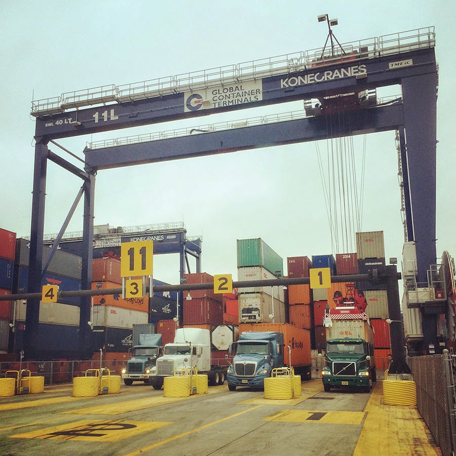
[Image: One of several semi-automated gate stations around the terminal; Instagram by BLDGBLOG].

This precise control of human circulation was also built into the landscape—or perhaps coded into the landscape—through the use of optical character recognition software (OCR) and radio-frequency ID chips. Tag-reading stations were located at various points throughout the yard, sending drivers either merrily on their exactly scripted way to a particular loading/unloading dock or sometimes actually barring that driver from entry. Indeed, bad behavior was punished, it was explained, by blocking a driver from the facility altogether for a certain amount of time, locking them out in a kind of reverse-quarantine.

Again, the implications here for other types of landscapes were both fascinating and somewhat ominous; but, more interestingly, as the trucks all dutifully lined-up to pass through the so-called “OCR building” on the far edge of the property, I was struck by how much it felt like watching a ceremonial gate at the outer edge of some partially sentient Forbidden City built specifically for machines.

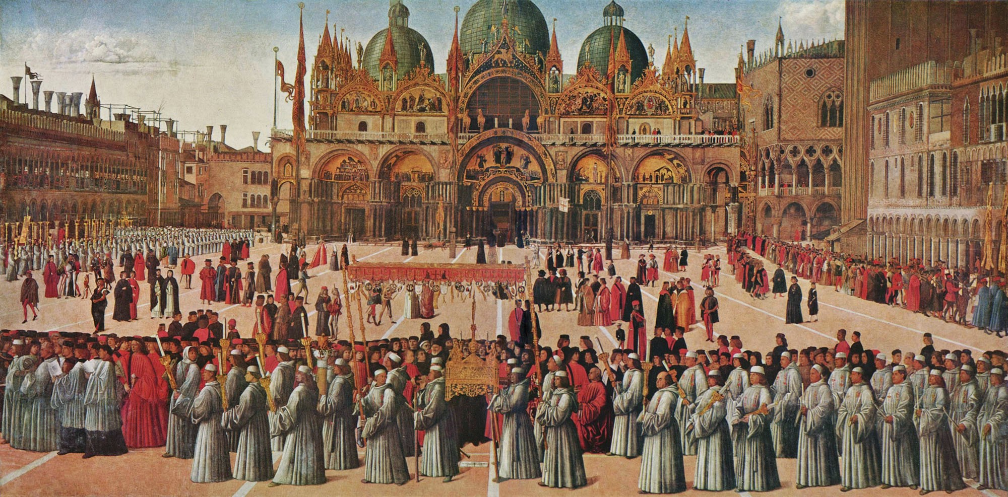
In other words, we often read about the ceremonial use of urban space in an art historical or urban planning context, whether that means Renaissance depictions of religious processions or it means the ritualized passage of courtiers through imperial capitals in the far east. However, the processional cities of tomorrow are being built right now, and they’re not for humans—they’re both run and populated by algorithmic traffic control systems and self-operating machine constellations, in a thoroughly secular kind of ritual space driven by automated protocols more than by democratic legislation.

These—ports and warehouses, not churches and squares—are the processional spaces of tomorrow.

[Image: Procession of the True Cross (1496) by Gentile Bellini, via Wikimedia].

It’s also worth noting that these spaces are trickling into our everyday landscape from the periphery—which is exactly where we are now most likely to find them, simply referred to or even dismissed as mere infrastructure. However, this overly simple word masks the often startlingly unfamiliar forms of spatial and temporal organization on display. This actually seems so much to be the case that infrastructural tourism (such as today’s trip to Bayonne) is now emerging as a way for people to demystify and understand this peripheral realm of inhuman sequences and machines.

In any case, as the day progressed we learned a tiny bit about the “Terminal Operating System”—the actual software that keeps the whole place humming—and it was then pointed out, rather astonishingly, that the actual owner of this facility is the Ontario Teachers’ Pension Plan, an almost Thomas Pynchonian level of financial weirdness that added a whole new level of narrative intricacy to the day.

If this piques your interest in the Infrastructure Observatory, consider following them on Twitter: @InfraObserve and @NYInfraObserve. And to join the NY branch’s mailing list, try this link, which should also let you read their past newsletters.

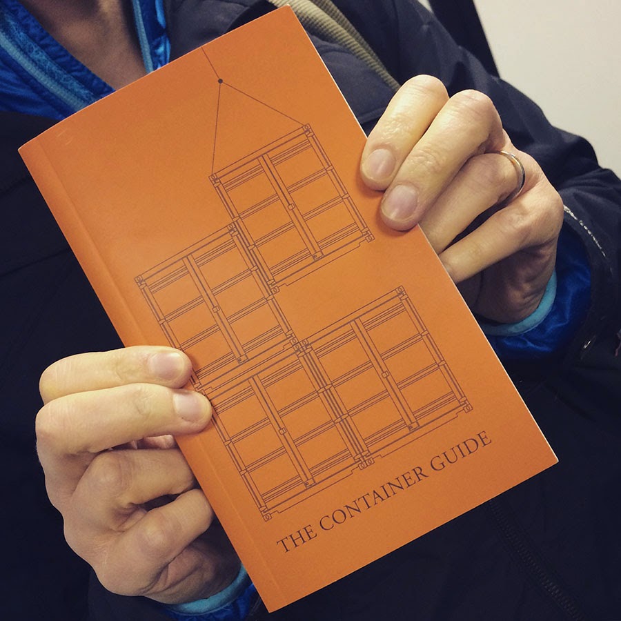
[Image: The Container Guide; Instagram by BLDGBLOG].

Finally, the Infrastructure Observatory’s first publication is also now out, and we got to see the very first copy. The Container Guide by Tim Hwang and Craig Cannon should be available for purchase soon through their website; check back there for details (and read a bit more about the guide over at Edible Geography).

(Thanks to Spencer Wright for the driving and details, and to the Global Containers Terminal Bayonne for their time and hospitality!)

Brooklyn Super Food

[Image: From “Brooklyn Co-operative” by Yannis Halkiopoulos, University of Westminster; courtesy RIBA President’s Medals].

I was clicking around on the RIBA President’s Medals website over the weekend and found a few projects that seemed worth posting here.

The one seen here is a beautifully illustrated proposal for an “alternative supermarket” in Brooklyn, New York, that would be located in the city’s old Navy Yard.

Note that, in all cases, larger images are available at the project website.

[Image: From “Brooklyn Co-operative” by Yannis Halkiopoulos, University of Westminster; courtesy RIBA President’s Medals].

Its designer—Yannis Halkiopoulos, a student from the University of Westminster—pitches it as a food-themed exploration of adaptive reuse, a mix of stabilized ruins, gut renovations, and wholly new structures.

He was inspired, he suggests, by the architecture of barns, market structures, and the possibility of an entire urban district becoming a “reinvented artefact” within the larger economy of the city.

The results would be a kind of post-industrial urban food campus on the waterfront in Brooklyn.

[Image: From “Brooklyn Co-operative” by Yannis Halkiopoulos, University of Westminster; courtesy RIBA President’s Medals].

From Halkiopoulos’s description of the project:

The project is a response to current plans which are to demolish the row of abandoned houses to build a suburban supermarket. Once home to high ranking naval officers the eleven structures have been left to decay since 1960. The response is an alternative food market which aims to incorporate the row of houses and re-kindle the consumer with the origin of the food produced and promote regional traditions, gastronomic pleasure and the slow pace of life which finds its roots in the Slow Food Movement NY.

It includes a slaughterhouse, a “slow fish market,” preservation facilities, a “raised tunnel network” linking the many buildings, and more.

[Image: From “Brooklyn Co-operative” by Yannis Halkiopoulos, University of Westminster; courtesy RIBA President’s Medals].

The buildings as a whole are broken down tectonically and typologically, then further analyzed in their own posters.

[Image: From “Brooklyn Co-operative” by Yannis Halkiopoulos, University of Westminster; courtesy RIBA President’s Medals].

There is, for example, the “slaughterhouse & eating quarters” building, complete with in-house “whole animal butcher shop,” seen here—

[Image: From “Brooklyn Co-operative” by Yannis Halkiopoulos, University of Westminster; courtesy RIBA President’s Medals].

—as well as the “slow fish market” mentioned earlier.

[Image: From “Brooklyn Co-operative” by Yannis Halkiopoulos, University of Westminster; courtesy RIBA President’s Medals].

Most of these use exposed timber framing to imply a kind of unfinished or incompletely renovated condition, but these skeletal grids also work to extend the building interiors out along walking paths and brise-soleils, partially outdoor spaces where food and drink could be consumed.

These next few images are absurdly tiny here but can be seen at a larger size over at the President’s Medals; they depict the stabilized facades of the homes on Admirals Row, including how they might change over time.

[Images: From “Brooklyn Co-operative” by Yannis Halkiopoulos, University of Westminster; courtesy RIBA President’s Medals].

Part of this would include the installation of a “raised tunnel network,” effectively just a series of covered walkways and pedestrian viaducts between buildings, offering a visual tour through unrenovated sections of the site but also knitting the overall market together as a whole.

[Images: From “Brooklyn Co-operative” by Yannis Halkiopoulos, University of Westminster; courtesy RIBA President’s Medals].

In any case, I really just think the images are awesome and wanted to post them; sure, the project uses a throwback, sepia-toned, posterization of what is basically just a shopping center to communicates its central point, but the visual style is actually an excellent fit for the proposal and it also seems perfectly pitched to catch the eye of historically minded developers.

You could imagine Anthony Bourdain, for example, enjoying the sight of this for his own forthcoming NY food market.

[Image: From “Brooklyn Co-operative” by Yannis Halkiopoulos, University of Westminster; courtesy RIBA President’s Medals].

In a sense, it’s actually too bad this didn’t cross their desks; personally, I wouldn’t mind hopping on the subway for a quick trip to the Navy Yard, to wander around the revitalized ruins, now filled with food stalls and fish mongers, walking through gardens or stumbling brewery to brewery on a Saturday night, hanging out with friends amidst a labyrinth of stabilized industrial buildings, eating fish tacos in the shadow of covered bridges and tunnels passing overhead.

More (and larger) images are available over at the President’s Medals.

Forward into the colossal yellow room taking shape beneath Manhattan

[Image: A Metropolitan Transportation Authority worker steps forward into the colossal yellow room taking shape beneath Manhattan, an astonishing and cavernous new part of the city’s East Side Access Project that will expand rail service for the Long Island Rail Road. Don’t miss the original shot and its related images, all taken by Rehema Trimiew for the MTA].