Christmas Tree Beach

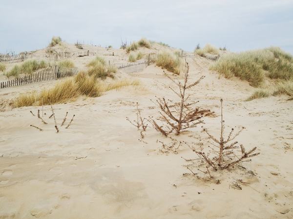
fionacroall1[Image: “Discarded Christmas trees were used to help rebuild the sand dunes around three years ago,” writes photographer Fiona Croall on her Instagram feed. “Now you can hardly see them!”].

While discarded Christmas trees here in New York City simply piled up on the sidewalks for more than two weeks after the holidays, forming strange—if still somewhat sadly picturesque—felled forests on the margins of the city, it turns out there’s an altogether more useful fate for those trees over in England.

There, the eroding beaches at Formby, just north of Liverpool, have been partially stabilized through Christmas tree donations.

formby[Image: The Christmas trees at Formby; photo courtesy National Trust/Robert Matthews].

“Our Rangers are asking people to bring their used real Christmas trees down to Formby so they can be used to help protect our internationally important sand dunes,” the National Trust explains.

The trees “help to mitigate [wind and erosion] by mimicking the action of the Marram grass, catching the sand blown on to the dunes from the beach and also dissipating the power of the wind as it blows across the surface of the dunes. Over time the trees become buried which helps to build up the dunes and they also help to partly stabilise the surface of the dunes which often allows the Marram grass to take hold again naturally.”

Below the beach, trees.

FionaCroall2[Image: The artificially stabilized beaches at Formby, with no sign of the displaced forest lurking below; photo by Fiona Croall].

Compare this approach, for example, to the widespread use of massive, industrially produced tetrapods for coastal erosion management—or even to the endless expense of so-called “beach nourishment”—and the idea of rebuilding the landscape using nothing more than linked chains of dead Christmas trees seems both tactically brilliant and cost-effective.

Not to mention archaeologically intriguing: it doesn’t take much to wonder how geotechnical assemblages such as these—huge arboreal lumps without a nearby forest to explain them—might appear to some distant researcher hoping to make sense of the stratigraphic record.

Like evidence of an ancient tsunami, the buried woods of Formby could surely sustain many a strange landscape theory to come.

(Huge thanks to photographer Fiona Croall who tweeted about the Christmas trees late last month).

The Sky Roads of Kauttua

AbrahamBosse[Image: A 17th-century engraving by Abraham Bosse, scanned from the excellent Architectural Representation and the Perspective Hinge by Alberto Pérez-Gómez and Louise Pelletier].

Thanks to airborne ice crystals reflecting street lights into the sky—an effect known as light pillars—the small Finnish village of Kauttua was greeted with an astral image of itself, as seen in a photo that made the rounds earlier this week. The town’s night-lit streets and buildings became uncanny constellations: the village as self-reflecting planetarium.

“How is that possible?” asks a helpful blog post by Fiona MacDonald. “When the temperature gets close to freezing,” she writes, “flat, hexagonal ice crystals can form in the air—not just up high, but also close to the ground. When this happens, these crystals essentially form a collective, giant mirror that can reflect a light source—such as a streetlight—back to the ground.” They are like ladders of light, or perhaps optical arrow chains, pulling images of our world up to space.

While the effect is already amazing, it’s worth noting that Kauttua is also the site of an ongoing search for an Iron Age village buried beneath the existing streets and property lines.

“The oldest archive source, a cadastral map from the year 1696, presents a homestead of 10 houses by the bridge leading across Eurajoki River,” we read over at Day of Archaeology. “A later cadastral map from 1790 presents large holdings of one farm at the same site and around it.” Today, however, there is little more than one surviving building, “an area of black soil” next to it, and “two light lines, presumably the earlier roads,” revealed in aerial photographs taken in 2008.

While there is obviously no connection between a lost Iron Age village and the ghostly street map that appeared in the sky over Kauttua last week, there is nonetheless something quite striking about the idea of a small village in the far north poised between two versions of itself: an underground web of old buildings and streets, now turned to black soil beneath the wheat fields, and this perfect, far more ethereal version, hovering there in a crystallography of light.

It’s almost as if a strange and other-worldly calendar exists, where, every summer, the town turns downward, scraping through soil and rock to uncover what it used to be, and then, each winter, it turns its eyes to the skies to see an inverted cartography, like some municipal zodiac, of its thriving streets.

(Thanks to Finnish novelist Hannu Rajaniemi, who first pointed this out to me on Twitter. “In Finland,” he wrote, “we make city maps in the sky out of light and snow crystals.”)

Village Design as Magnetic Storage Media

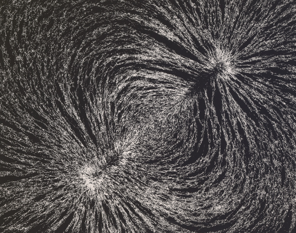
[Image: “Magnetic Field” by Berenice Abbott, from The Science Pictures (1958-1961)].

An interesting new paper suggests that the ritual practice of burning parts of villages to the ground in southern Africa had an unanticipated side-effect: resetting the ground’s magnetic data storage potential.

As a University of Rochester press release explains, the “villages were cleansed by burning down huts and grain bins. The burning clay floors reached a temperature in excess of 1000ºC, hot enough to erase the magnetic information stored in the magnetite and create a new record of the magnetic field strength and direction at the time of the burning.”

What this meant was that scientists could then study how the Earth’s magnetic field had changed over centuries by comparing more recent, post-fire alignments of magnetite in the ground beneath these charred building sites with older, pre-fire clay surrounding the villages.

The ground, then, is actually an archive of the Earth’s magnetic field.

If you picture this from above—perhaps illustrated as a map or floor plan—you can imagine seeing the footprint of the village itself, with little huts, buildings, and grain bins appearing simply as the outlines of open shapes.

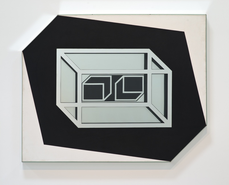
However, within these shapes, like little windows in the surface of the planet, new magnetic alignments would begin to appear over decades as minerals in the ground slowly re-orient themselves with longterm shifts in the Earth’s magnetic field, like differently tiled geometries contrasting with the ground around them.

[Image: “Untitled” by Larry Bell (1962), via the L.A. Times].

What really blows me away here, though, is the much more abstract idea that the ground itself is a kind of reformattable magnetic data storage system. It can be reformatted and overwritten, its data wiped like a terrestrial harddrive.

While this obviously brings to mind the notion of the planetary harddrive we explored a few years ago—for what it’s worth, one of my favorite posts here—it also suggests something quite strange, which is that landscape architecture (that is, the tactical and aesthetic redesign of terrain) and strategies of data management (archiving, cryptography, inscription) might someday go hand in hand.

(Via Archaeology).

Composite Archaeology

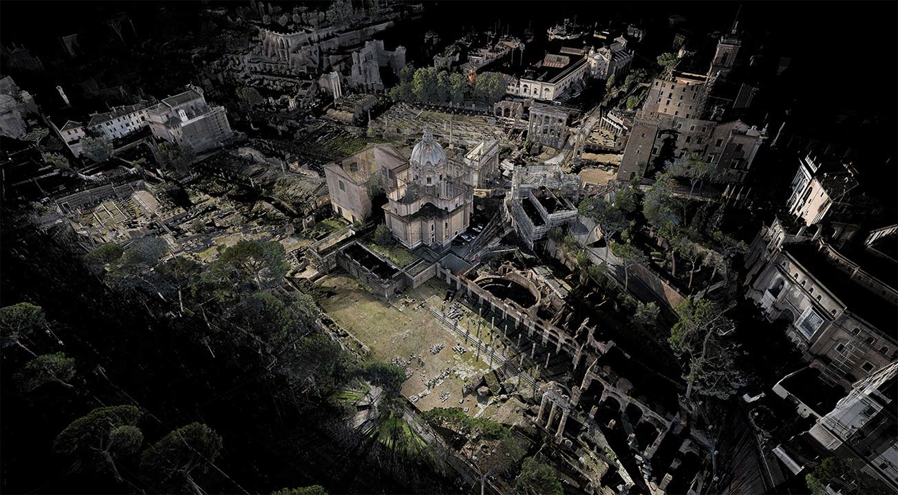
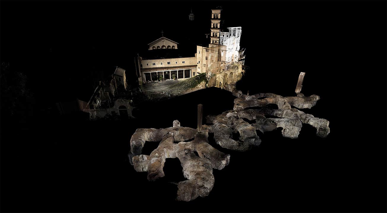
[Image: A laser scan of the Pantheon, courtesy ScanLAB Projects and the BBC; view larger!].

ScanLAB Projects, focus of a long article on Wired last month, are back in the news with a BBC documentary exploring the infrastructure of ancient Rome.

The show “explores Roman infrastructure and ingenuity, all below ground level”:

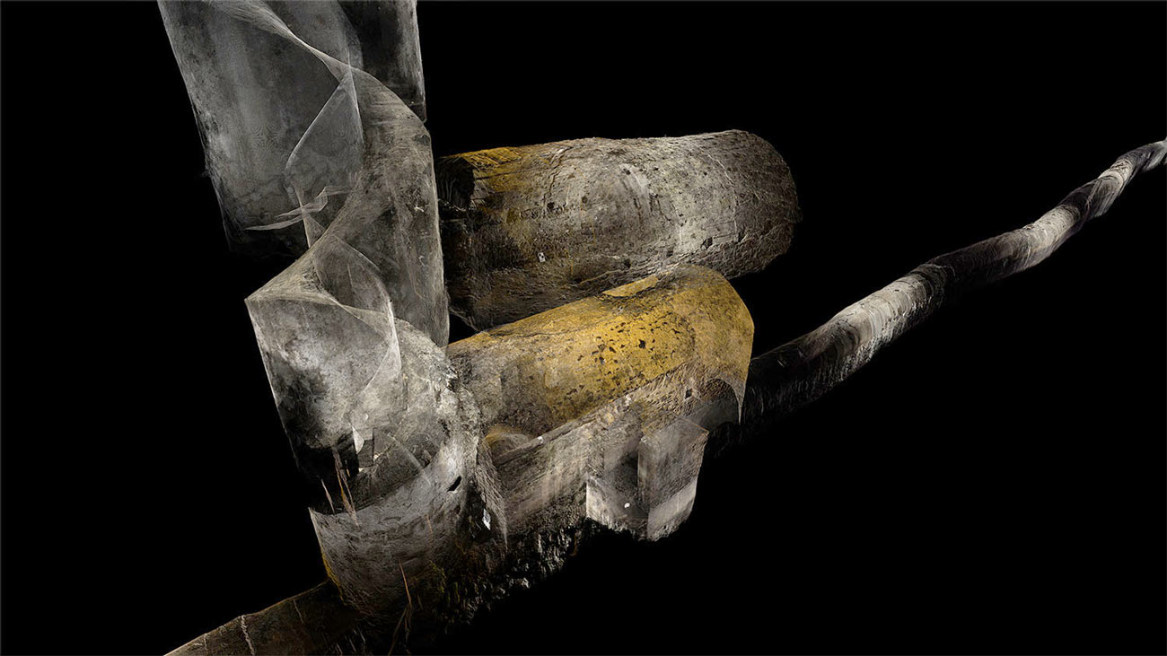
We journeyed via the icy, crystal clear waters of subterranean aqueducts that feed the Trevi fountain and two thousand year old sewers which still function beneath the Roman Forum today, to decadent, labyrinthine catacombs. Our laser scans map these hidden treasures, revealing for the first time the complex network of tunnels, chambers and passageways without which Rome could not have survived as a city of a million people.

The results, as usual, are both breathtaking and bizarre.

[Image: Courtesy ScanLAB Projects and the BBC].

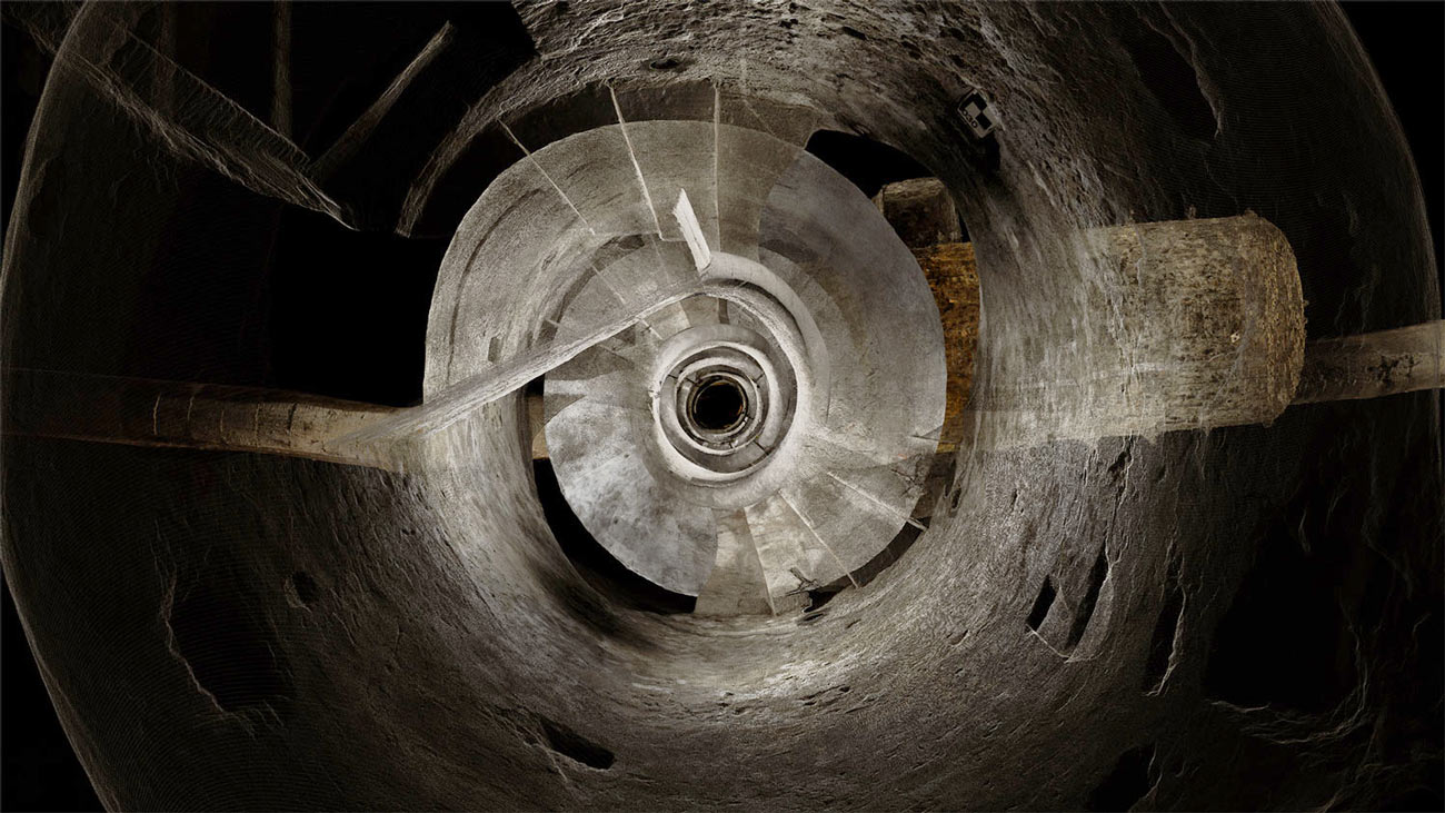
The surface of the city is scraped away, a kind of archaeological dermabrasion, to reveal sprawling networks of knotted masonry and old corridors spliced together in a translucent labyrinth less below than somehow in the city.

[Image: Courtesy ScanLAB Projects and the BBC].

One of the most interesting points made in Mary-Ann Ray’s excellent Pamphlet Architecture installment—1997’s Seven Partly Underground Rooms and Buildings for Water, Ice, and Midgets—is when she describes her use of composite photography as a way to experiment with new forms of archaeological documentation.

Indeed, the pamphlet itself is as much architecture as it is archaeology—perhaps even suggesting a new series of historical site documents someone should produce called Pamphlet Archaeology—looking at wells, baths, cisterns, and spherical refrigeration chambers, in various states of ruin.

All of these are representationally difficult spaces, Ray explains, either curving away from the viewer in a manner that is nearly impossible to photograph or presenting constrictions of perspective that make even wide-angle photographs inadequate.

[Image: Courtesy ScanLAB Projects and the BBC].

Ray writes that the spatial complexity of the buildings, quarries, basements, and other excavations that she explores are, in a sense, an entirely different kind of space: knotty, interconnected, unstable. “They were also spaces,” she writes, “which seemed to have the ability to ‘flip-flop’ in and out of multiple spatial or constructional readings.”

What appears to be near is revealed to be far; what seems far away is suddenly adjacent.

[Image: Courtesy ScanLAB Projects and the BBC; view larger!].

Ray uses the metaphor of a “hyper-camera” here in order to draw comparisons between her composite photography and what she calls “a kind of cubist multiple view,” one where “the frame might succumb to the taper of perspective into deep space, or it may counter it, or build it into something else altogether.”

“In these composite views,” she adds, “the photograph can record the enactment of space as one maneuvers or roams through it with the eye or body.”

While Ray’s photographic approach is technologically, materially, and even visually very different from the work of ScanLAB, the two projects share a great deal, conceptually and methodologically. In fact, if many of the above quotations were applied, instead, to the images seen in the present post, they would seem to be the appropriate descriptions.

[Image: In the ruined basements of architectural simultaneity; ScanLAB Projects and the BBC].

ScanLAB’s laser work seems to fulfill many of the promises of Ray’s composite photography, offering multiple, overlapping perspectives simultaneously whilst also eliminating the problem of the horizon or ground plane: you can thus look straight-on into the basement of an ancient structure without losing sight of the upper floors or chambers.

The city is split in two, made into an architectural section of itself that is then animated, made volumetric, turned into Ray’s “enactment of space as one maneuvers or roams through it with the eye or body.”

The show airs tonight on the BBC. Check out ScanLAB’s website for more info, and definitely consider picking up a copy of Mary-Ann Ray’s book; it remains one of my favorites and has actually become more, not less, topical since its original publication.

Bunker Simulations

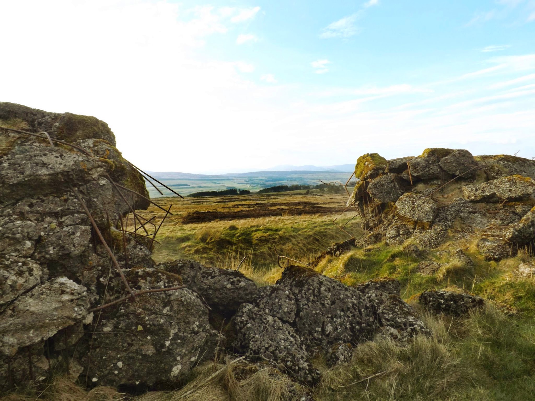
[Image: A replica of the Nazis’ Atlantic Wall defenses in Scotland; photo via Stirling 2014].

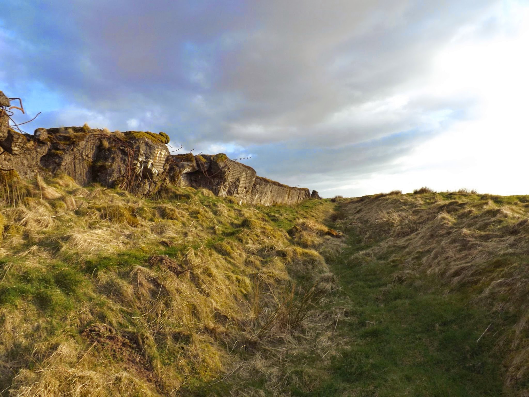
The continent-spanning line of concrete bunkers built by the Nazis during WWII, known as the “Atlantic Wall,” was partially recreated in the United Kingdom—in more than one location—to assist with military training.

These simulated Nazi bunkers now survive as largely overlooked ruins amidst the fields, disquieting yet picturesque earth forms covered in plants and lichen, their internal rebar exposed to the weather and twisted by explosives, serving as quiet reminders of the European battlefield.

The various wall sites even include trenches, anti-tank ditches, and other defensive works carved into the ground, forming a kind of landscape garden of simulated fortification.

[Image: A replica of the Atlantic Wall in Scotland; photo via Stirling 2014].

As the Herald Scotland reported the other day, one of these walls “was built at Sheriffmuir, in the hills above Dunblane, in 1943 as preparations were being made to invade Europe. The problem was the Nazis had built a formidable line of concrete defenses from Norway all the way to the Spanish border and if D-Day was to have any chance of success, the British and their allies would have to get over those defenses.”

This, of course, “is why the wall at Sheriffmuir was built: it was a way for the British forces to practise their plan of attack and understand what they would face. They shot at it, they smashed into it, and they blew it up as a way of testing the German defences ahead of D-Day.”

[Image: A replica of the Atlantic Wall in Scotland; photo via Stirling 2014].

It would certainly be difficult to guess what these structures are at first glance, or why such behemoth constructions would have been built in these locations; stumbling upon them with no knowledge of their history would suggest some dark alternative history of WWII in which the Nazis had managed to at least partially conquer Britain, leaving behind these half-buried fortresses in their wake.

Indeed, the history of the walls remains relatively under-exposed, even in Britain, and a new archaeological effort to scan all of the defenses and mount an exhibition about them in the Dunblane Museum is thus now underway.

[Image: A replica of the Atlantic Wall in Scotland; photo via Stirling 2014].

The story of the Scottish wall’s construction is also intriguingly odd. It revolves around an act of artistic espionage, courtesy of “a French painter and decorator called Rene Duchez.”

Duchez, the newspaper explains, “got his hands on the blueprints for the German defences while painting the offices of engineering group TODT, which [had been hired] to build the Atlantic walls. He hid the plans in a biscuit tin, which was smuggled to Britain and used as the blueprint for the wall at Sheriffmuir.”

But Scotland is not the only UK site of a simulated Nazi super-wall: there were also ersatz bunkers built in Surrey, Wales, and Suffolk. In fact, the one in Surrey, built on Hankley Common, is not all that far from my in-laws, so I’ll try to check it out in person next time I’m over in England.

[Images: An Atlantic Wall replica in Surrey; top photo by Shazz, bottom three photos via Wikipedia].

Attempts at archaeological preservation aside, these walls seem destined to fade into the landscape for the next several millennia, absorbed back into the forests and fields; along the way, they’ll join other ancient features like Hadrian’s Wall on the itinerary of future military history buffs, just another site to visit on a slow Sunday stroll, their original context all but forgotten.

(Spotted via Archaeology. Previously on BLDGBLOG: In the Box: A Tour Through The Simulated Battlefields of the U.S. National Training Center and Model Landscape].

Drive-By Archaeology

[Image: From a patent filed by MIT, courtesy U.S. Patent and Trademark Office].

The technical systems by which autonomous, self-driving vehicles will safely navigate city streets are usually presented as some combination of real-time scanning and detailed mnemonic map or virtual reference model created for that vehicle.

As Alexis Madrigal has written for The Atlantic, autonomous vehicles are, in essence, always driving within a virtual world—like Freudian machines, they are forever unable to venture outside a sphere of their own projections:

The key to Google’s success has been that these cars aren’t forced to process an entire scene from scratch. Instead, their teams travel and map each road that the car will travel. And these are not any old maps. They are not even the rich, road-logic-filled maps of consumer-grade Google Maps.
They’re probably best thought of as ultra-precise digitizations of the physical world, all the way down to tiny details like the position and height of every single curb. A normal digital map would show a road intersection; these maps would have a precision measured in inches.

The vehicle can thus respond to the city insofar as its own spatial expectations are never sufficiently contradicted by the evidence at hand: if the city, as scanned by the vehicle’s array of sensors and instruments, corresponds to the vehicle’s own internal expectations, then it can make the next rational decision (to turn a corner, stop at an intersection, wait for a passing train, etc.).

However, I was very interested to see that an MIT research team led by Byron Stanley had applied for a patent last autumn that would allow autonomous vehicles to guide themselves using ground-penetrating radar. It is the subterranean realm that they would thus be peering into, in addition to the plein air universe of curb heights and Yield signs, reading the underworld for its own peculiar landmarks.

[Image: From a patent filed by MIT, courtesy U.S. Patent and Trademark Office].

How would it work? Imagine, the MIT team suggests, that your autonomous vehicle is either in a landscape blanketed in snow. It is volumetrically deformed by all that extra mass and thus robbed not only of accurate points of measurement but also of any, if not all, computer-recognizable landmarks. Or, he adds, imagine that you have passed into a “GPS-denied area.”

In either case, you and your self-driving vehicle run the very real risk of falling off the map altogether, stuck in a machine that cannot find its way forward and, for all intents and purposes, can no longer even tell road from landscape.

[Image: From a patent filed by MIT, courtesy U.S. Patent and Trademark Office].

Stanley’s group has thus come up with the interesting suggestion that you could simply give autonomous vehicles the ability to see through the earth’s surface and scan for recognizable systems of pipework or other urban infrastructure down below. Your vehicle could then just follow those systems through the obscuring layers of rain, snow, or even tumbleweed to its eventual destination.

These would be cars attuned to the “subsurface region,” as the patent describes it, falling somewhere between urban archaeology and speleo-cartography.

In fact, with only the slightest tweaking of this technology and you could easily imagine a scenario in which your vehicle would more or less seek out and follow archaeological features in the ground. Picture something like an enormous basement in Rome or central London—or perhaps a strange variation on the city built entirely for autonomous vehicles at the University of Michigan. It is a vast expanse of concrete built—with great controversy—over an ancient site of incredible archaeological richness.

Climbing into a small autonomous vehicle, however, and avidly referring to the interactive menu presented on a touchscreen dashboard, you feel the vehicle begin to move, inching forward into the empty room. The trick is that it is navigating according to the remnant outlines of lost foundations and buried structures hidden in the ground around you, like a boat passing over shipwrecks hidden in the still but murky water.

The vehicle shifts and turns, hovers and circles back again, outlining where buildings once stood. It is acting out a kind of invisible architecture of the city, where its routes are not roads at all but the floor plans of old buildings and, rather than streets or parking lots, you circulate through and pause within forgotten rooms buried in the ground somewhere below.

In this “subsurface region” that only your vehicle’s radar eyes can see, your car finds navigational clarity, calmly poking along the secret forms of the city.

In any case, for more on the MIT patent, check out the U.S. Patent and Trademark Office.

(Via New Scientist).

Demolition Ground


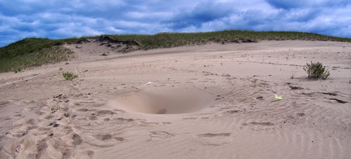
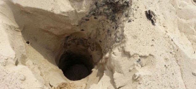
I love this story of the mysterious disappearing sinkholes of Indiana’s Mount Baldy, where deep pits in the sand dunes are opening and closing for reasons as yet to be determined. These “strange holes” have “appeared since last year, only to collapse and be filled in with sand a day later. Some of the holes were so deep they could not be measured with the researchers’ measuring tapes,” Livescience reports.

The area has thus been closed to the public while EPA scientists scan the site with ground-penetrating radar; this will help them to develop an “understanding of the overall internal architecture of the dune, using multispectral GPR and coring.”


After all, one of the leading theories is actually that buried structures, consumed by the dune’s migration over the past century, might have collapsed deep below the sand, creating these temporary sinkholes.

Imagine small buildings imploding under the weight of the landscape, like little cubic tombs held in place all this time by a dry glacier of sand and gravel, finally bursting inward as the strain becomes too much for them to carry—as if, beneath us in weird labyrinths of negative space, the invisible, slow-motion demolition of old buildings proceeds apace, detectable only as momentary pores and sinkholes breathing open and closed in the earth’s mobile surface.

(Images courtesy National Park Service).

Wire-Tapping the Ruins of Pompeii

[Image: Alexander Graham Bell, inventor of the telephone, steps forth into the ruins of the “extinct city” of Pompeii; courtesy U.S. Library of Congress].
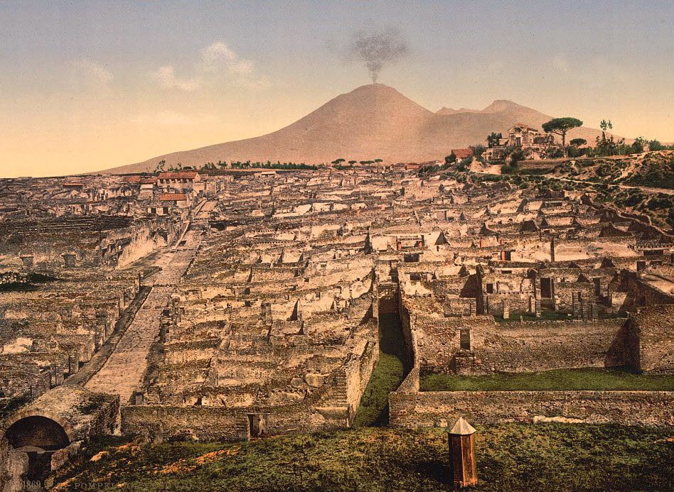
The ruins of Pompeii are being wired-up by a company otherwise known for its work as a manufacturer of military drones and “electronic warfare equipment,” Phys.org reports. Finmeccanica, the “Italian aerospace and defense giant,” has been contracted to install a high-tech sensor network amongst the barely stabilized walls and streets of this city once buried by a volcanic eruption nearly 2,000 years ago, in the hopes of monitoring unstable ground conditions on the sites.

Slippage and instability threaten to bring some of the buildings down, not just putting the site’s UNESCO-designated mansions at risk but potentially injuring (or worse) its annual hordes of international visitors.

[Image: General view of Pompeii and Mt. Vesuvius; courtesy U.S. Library of Congress].

In Phys.org’s words, the sensors are being installed “to assess ‘risks of hydrogeological instability’ at the sprawling site, boost security and test the solidity of structures, as well as set up an early warning system to flag up possible collapses.”

The results are a bit like electronic eavesdropping—a kind of NSA of the ruins—only, instead of wire-tapping a single phone line, the entire city of Pompeii will be listened to from within, hooked up from one side to the other with equipment so sensitive it is normally used in waging “electronic warfare.”

[Image: The Street of Tombs, Pompeii; courtesy U.S. Library of Congress].

The data will eventually be made available online for all to analyze, but it is interesting to read of a more immediate use of the sensors’ findings: Pompeii’s “security guards will be supplied with special radio equipment as well as smartphone apps to improve communication that can pinpoint their position and the type of intervention required.”

In other words, guards will receive electronic updates from the city itself while out on their daily rounds, including automated pings and alerts of impending structural failure or deformations of the ground, like some weird, semi-militarized version of ambient music, as if listening to the real-time groans of a settling city by radio.

Wire-tapping the ruins of a dead city, this mesh of electronic equipment—normally used in military surveillance operations—will thus help to preserve the archaeological site for future generations.

[Image: Fortuna Street, Pompeii; courtesy U.S. Library of Congress].

Like something out of Douglas Kahn’s recent book about the history of terrestrial electromagnetism and audio art, the old crumbling columns and shattered walls of Pompeii will soon find a new voice through repurposed military equipment, a weaponized seance performed on the empty streets of a place that’s more tomb than city.

[Image: The Forum, Pompeii; courtesy U.S. Library of Congress].

The possibilities for interactive apps and other touristic experiences are also mind-boggling here: imagine, at the very least, being able to walk into the center of Pompeii totally alone, with nothing but your phone and some earbuds, tuning into real-time broadcasts of the shuddering masonry all around you, a wireless archaeological orchestra of bleached monuments in the sun, listening from within to the sounds of the ancient city.

Distant HAM radio enthusiasts, tuning in from attics in Indiana, spin the dial every Saturday night hoping to find Pompeii, a destroyed city on the other side of the world with its own location in the ether, whistling and purring as its architecture falls apart, room by room, a catacomb of sound and destruction.

(An earlier, different version of this post first appeared on Gizmodo).

When Hills Hide Arches


Landforms masquerading as architecture and vice versa seem to dominate a few sets of older images hosted at the Library of Congress.

Photos taken between 1865 and 1872, these are—photographically speaking—almost impossibly ancient, approaching a point of chemical age as comparatively old to us today as the structures they depict were to the military expeditions that documented them in the first place.


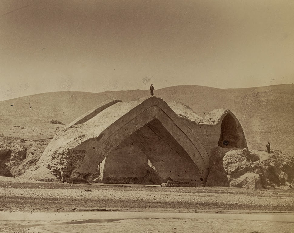
The first shot—depicting the “ruins of the Mulushki Mirza Rabat near Khodzhend,” as the Library of Congress explains it—establishes something of a theme here: works of architecture built from modules of fired clay, their wind-pocked brickwork extracted from the hills around them and transformed by kilns into something artificial, “manmade,” now more artifact than natural object.

Ironically, though, it is exactly their resemblance to the earth that sets the stage for these structures’ later decay, falling apart into mere dust and minerals, little pebbles and grains of sand, literally forming dunes, blending imperceptibly with the landscape. Once they’re gone, it’s as if they were never there.


Domes and extraordinary arches stand in the middle of nowhere, as if left behind by the receding tide of some alien civilization that once slid through, depositing works of architecture in its wake. Like the slime of a snail, these are just residue, empty proof that something much bigger once passed by.

What’s so amazing about these pictures, I’d suggest, is that, among other things, they come with the surreal implication that, beneath or somehow within all the rolling hills and dunes of the surrounding landscape, these sprawling bridges and spinal forms are actually hidden, just waiting there for hooded, 19th-century backpackers to rediscover.

These tiny figures are probably laughing in awe at the anti-gravitational urge that pushes these structures up above the sand line, into the photographs of these seemingly nameless expeditionary teams intent on cataloging every spatially exotic detail they find.


Here, in the ruins of Murza Rabat, seen below, natural hills are actually catacombs of architecture, buildings fooling us for their resemblance to caves, structurally camouflaged as the surface of the earth.

But it’s not the planet—it’s not geology—it’s just architecture: a shaped thing, an artifact, something plastic and formed by human hands. Not hills but abandoned buildings.


In the end, photographs of sand dunes might actually depict scenes of collapsed architecture; that landscape there in front of you might really be a city seen one thousand years after the fact, every wall cracked open and broken into pointless little mounds you’d probably stomp through without even thinking, the desert all around you giving no indication that this all used to be structure.

It used to be arches, bridges, vaults, and domes, huge mosques and cathedrals of human form before crumbling into mindless anthills of mud and clay.


It’s almost like these photographs exist to remind you that everything you now think of as a room—as space, as volume, as creation—will soon just be a suffocation of sand grains packed together in dense, amnesia-ridden hills, landscapes almost laughably quick to forget they once were architecture.

All photos courtesy of the Library of Congress.

The Peterborough Tunnels

A weird old story I came across in my bookmarks this morning tells a tale of tunnels under the town of Peterborough, England.

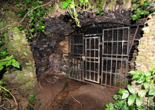
[Image: Gates in Holywell, Peterborough; photo by Rowland Hobson, courtesy of Peterborough Today].

The local newspaper, Peterborough Today, refers to a woman described simply as “a grandmother” who claims “that she crawled through a tunnel under Peterborough Cathedral as a schoolgirl.” That experience—organized as a school trip, of all things—was “terrifying”; in fact, it was “so scary that it gave her nightmares for weeks afterwards.”

About 25 of us went down into the tunnel, one at a time; none of the teachers came in. It was pitch black, had a stone floor and was about two feet high and three feet wide. We crawled along on our hands on knees. The girl in front of me stopped and started screaming, she was so scared. The tunnel started in the Cathedral and ended there too; we were down there for what seemed like ages. When I eventually got home I was in tears. Afterwards I had horrible nightmares for weeks about being buried alive underneath the Cathedral.

What’s fascinating about the story, though, is the fact that not everyone even agrees that these tunnels exist. A “city historian” quoted in the same article says that, while “there are small tunnels under the Cathedral,” they are most likely not tunnels at all, but simply “the ruins of foundations from earlier churches on the site, dating from Saxon times.” The girls would thus have been crawling around amongst the foundations of ruined churches, lost buildings that long predated the cathedral above them.

But local legends insist that the tunnels—or, perhaps, just one very large tunnel—might, in fact, be real. To this end, an amateur archaeologist named Jay Beecher, who works in a local bank by day, has “been intrigued by the legend of the tunnel ever since he was a young boy when he was regaled with tales that had been passed down the generations of a mysterious passageway under the city.” This “mysterious passageway under the city” would be nearly 800 years old, by his reckoning, and more than a mile in length. “Medieval monks may have used the tunnel as a safe route to visit a sacred spring at Holywell to bathe in its healing waters,” we read.

Although Beecher has found indications of the tunnel on city maps, not everyone is convinced, claiming the whole thing is just “folklore.” But it is oddly ubiquitous folklore. One former resident of town who contacted the newspaper “claimed that a series of tunnels ran between Peterborough and Thorney via a secret underground chapel.” Another “said that he recalled seeing part of a tunnel in the cellar at a home in Norfolk Street, Peterborough,” as if the tunnel flashes in and out of existence around town, from basement to basement, church cellar to pub storage room, more a portal or instance gate than an actual part of the built environment. And then, of course, there is the surreal childhood memory—or nightmare—recounted by the “grandmother” quoted above who once crawled beneath the town church with 25 of her schoolmates, worried that they’d all be buried alive in the center of town (surely the narrative premise of a childhood anxiety dream if there ever was one).

No word yet if Beecher has found his archaeological evidence, but the fact that this particular spatial feature makes an appearance in the dreams, memories, or confused geographic fantasies of the people who live there—as if their town can only be complete given this subterranean underside, a buried twin lost beneath churches—is in and of itself remarkable.

(If this interests you—or even if it doesn’t—take a quick look at BLDGBLOG’s tour through the tunnels and sand mines of Nottingham, or stop by this older post on the “undiscovered bedrooms of Manhattan“).

Geomedia

[Image: “Laser Cut Record” by Amanda Ghassaei].

An incredible example of what can be done with laser-cutting, Amanda Ghassaei’s project “Laser Cut Record” features music inscribed directly into cut discs of maple wood, acrylic, and paper, resulting in lo-fi but playable records.

For what they are, the otherwise scratchy and off-kilter audio quality is actually quite amazing, and the sounds themselves are made all the more haunting and strange by the crackling noise and resonance of the material that hosts them.

[Image: “Laser Cut Record” by Amanda Ghassaei].

Some technical details are available at Ghassaei’s Instructables page, and you can see the laser-cutting itself at work in the following video.


I’m reminded of a short letter called “Acoustic Recordings from Antiquity,” written to the Proceedings of the IEEE in August 1969 by a man named Richard G. Woodbridge III. The somewhat eccentric Mr. Woodbridge explains that he has been researching accidental recording of sounds found, after careful analysis, on the surfaces of physical objects rescued from antiquity—in particular, pieces of pottery originally shaped on potters’ wheels (seen here as a kind of primordial record platter).

Woodbridge even claims some sounds have been “recorded” as re-playable waves in the slowly drying shapes of oil paintings.

To listen to these lost recordings, the letter suggests, you simply hold a record cartridge near the work of pottery in question, such that the needle of the phonograph can “be positioned against a revolving pot mounted on a phono turntable (adjustable speed) ‘stroked’ along a paint stroke, etc.” When this was done properly, he claimed, a “low-frequency chatter sound could be heard in the earphones.”

That is, the voices of people present in the room during the making of the pot could be re-played from the surface of the pot itself.

[Image: “Laser Cut Record” by Amanda Ghassaei].

Woodbridge suggests that this might have alternative applications: “This is of particular interest as it introduces the possibility of actually recalling and hearing the voices and words of eminent personages as recorded in the paint of their portraits or of famous artists in their pictures.” So an experiment was orchestrated:

With an artist’s brush, paint strokes were applied to the surface of the canvas using “oil” paints involving a variety of plasticities, thicknesses, layers, etc., while martial music was played on the nearby phonograph. Visual examination at low magnification showed that certain strokes had the expected transverse striated appearance. When such strokes, after drying, were gently stroked by the “needle” (small, wooden, spade-like) of the crystal cartridge, at as close to the original stroke speed as possible, short snatches of the original music could be identified.

Through this technique, the overlooked—overlistened?—acoustic qualities of various objects, beyond high-brow pottery and oil paintings, can thus be revealed:

Many situations leading to the possibility of adventitious acoustic recording in past times have been given consideration. These, for example, might consist of scratches, markings, engravings, grooves, chasings, smears, etc., on or in “plastic” materials encompassing metal, wax, wood, bone, mud, paint, crystal, and many others. Artifacts could include objects of personal adornment, sword blades, arrow shafts, pots, engraving plates, paintings, and various items of calligraphic interest.

Woodbridge calls the pursuit and revelation of these sounds “acoustic archaeology.”

[Image: Like the rings of Saturn, from “Laser Cut Record” by Amanda Ghassaei; in fact, perhaps the rings of Saturn are an unread recording…].

But why stop at sounds?

Perhaps in two years’ time, we’ll watch as Amanda Ghassaei cuts DVDs—”the data on a DVD is encoded in the form of small pits and bumps in the track of the disc“—with a combined and simultaneous laser-cutter/3D printer ensemble, coating inscribed “small pits and bumps” with reflective metals.

Suddenly, wood, rock, metal, even exposed geology in situ can host visual content. Indeed, perhaps it already does, but we haven’t invented—or we simply haven’t applied—the right technologies for decoding it. In other words, we have DVD players; we just haven’t, learning from Richard G. Woodbridge III, used them to “read” other materials.

In August 2015, you and some friends hike up to a rock wall in the middle of Utah, and there are DVDs printed all over the surface of the hillside, full-length albums laser-burned into White Rim sandstone, and audio-visual pilgrims carrying deconstructed laser-lens systems, scanning for hidden film fests and warbling soundtracks, swarm every surface all around them.

It’s the rise of geomedia.