[Image: My own “crypto-forest of Utrecht,” via Google Maps].
While we’re on the subject of PrimatePoetics!, I’m intrigued by their “Crypto–ForestsofUtrecht” series, which kicked off back in October 2009. It’s an ongoing exploration of botanical landscapes in and around Utrecht, Netherlands, that have sprung back from aggressive anthropological intervention. Weed patches in which the earliest emergent traces of a thicket can be found; clusters of trees growing semi-feral on the edges of railroad yards; forgotten courtyards sprouting with random saplings unplanted by any hand: these are all crypto-forests.
Each example of this type of landscape, PrimatePoetics! explains, is “almost entirely hidden from view and very few people know about it.” Each is “a forest grown in the shadow of neglect, private ownership and municipal refusal.” Each is a landscape that has been “left to fallow” but then spurts back in spikes of weedy regrowth, becoming “unnoteworthy from all angles, but pretty large when you are inside it.”
All of them together would make an amazing travel guide or landscape pamphlet—a short tour through minor quasi-forests around the city of Utrecht (or elsewhere). I’m tempted to launch a global “crypto-forestry” group on Flickr for documenting exactly this sort of thing—in fact, I’ve gone ahead and done so. Feel free to contribute, if you’re in the mood, burgeoning scholars of urban weeds. Photographic documents of minor landscapes on the rebound; urban forests in their earliest, stunted stage; insurgent fringes of suburbia coming back to vitality; derelict groves extending underground roots. The return of the botanical repressed.
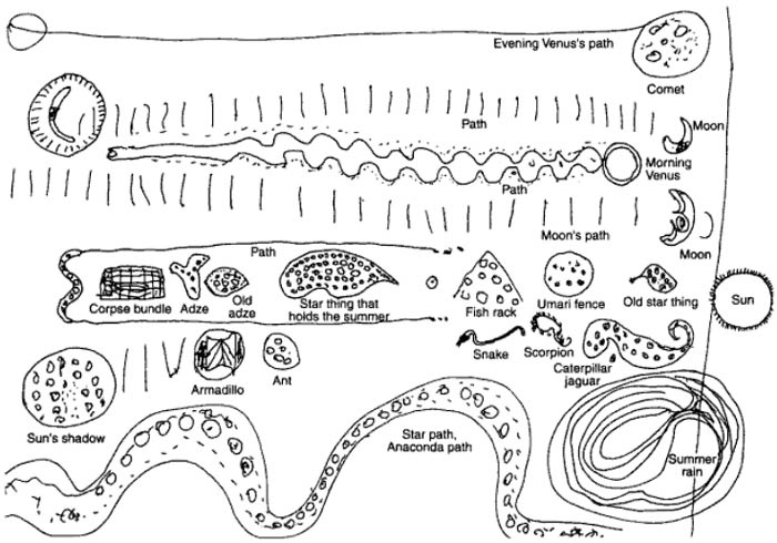
“Constellations are here mapped as identities from Barasana mythology,” we read. “The Pleiades, or Star Woman, is shown here as the ‘star thing that holds the summer.'” As a brief aside, the Pleiades are known in Japan as Subaru—which explains that carmaker’s astrally inflected logo. So, if you’re driving a Subaru, there’s a kind of ethno-astronomical star chart emblazoned on the front grill of your car.
In any case, the image seen above comes from a recent series of short posts, looking at hand-drawn cartographies from peripheral cultures around the world, posted on the excellent blog PrimatePoetics! (whose exhilarating manifesto reminds us that “we still have at least 30,000 years to go before our existence in history will be of equal duration to our existence in prehistory,” and whose blog thus hopes to document “the transmutation of the ape into a conversationalist”).
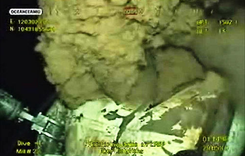
I think easily the most sobering thing I’ve read in a long time is that the BP Gulf oil spill might now be unstoppable.
It’s never the best editorial practice in a situation like this to laminate comments on top of comments on top of comments, but the internet is a-riot tonight with a chain of frankly terrifying speculation that boils down to one anonymous note posted on The Oil Drum earlier this week (which you can read in full through that link). In a nutshell, “the well bore structure is compromised ‘down hole’,” we read, leading to “one inescapable conclusion. The well pipes below the sea floor are broken and leaking.” This means that no surface capping will ever, at this point, work; the well is leaking in too many places, and the seabed itself is now beginning to show signs of collapse.
Indeed, the comment immediately following suggests that “a massive collapse of the Gulf floor itself is in the making,” and that “fracturing and a complete bleed-out are already underway”—meaning that no fewer than 2 billion barrels of oil could leak into the Gulf before the reservoir has fully depleted itself. That’s two billion.
Again: this is all rumors, anonymous comments, and geological speculation, but it’s also the most chilling scenario I’ve read yet for what is already an ecological disaster. The consequences of an unstoppable, multi-billion-barrel oil spill in the Gulf are truly unimaginable.
Read the Oil Drumcomment and feel free to join one of the numerous threads discussing it.
Atlas Obscura points our attention to a site in Oregon known as the “duplicative forest.”
[Image: The Duplicative Forest—17,000 acres of identical trees—awaits; photo courtesy of Atlas Obscura].
The poplar trees growing at this 17,000-acre farm are “all the same height and thickness,” we read, “and evenly spaced in all directions. The effect is compounded when blasting by at 75 mph. If you look for too long the strobe effect may induce seizures.”
While this latter comment is clearly a joke, it would actually be quite interesting to see if optical regulations are ever needed for the spacing of roadside objects. If, for instance, the Duplicative Forest really did induce seizures in motorists—but only those driving more than 90 mph, say—thus exhibiting neurological effects, what sorts of spatial rules might need to be implemented? Every sixth tree could be planted off-grid, for instance, in a slight stagger away from the otherwise mesmerizing patterns, or the speed limit could be rigorously enforced using bumps—in which case you would know that, just over the horizon of your car’s speedometer, a strange world of neurobiological self-interference looms, as the world around you threatens cognitive failure in those passing through it at a high enough speed or intensity.
On an only vaguely related note, meanwhile, fans of Fredric Jameson might recall his spatial analysis of Alfred Hitchcock’s absolutely excellent film North by Northwest—specifically Hitchcock’s use of rhythmically placed, identical trees.
[Image: Archaeologists work at Gobero, “the largest graveyard discovered to date in the Sahara.” Photo by Mike Hettwer, courtesy of National Geographic, otherwise unrelated to this post].
Archaeologist Sara Gonzalez, we read, courtesy of an older post on Middle Savagery, “practices what she calls ‘catch and release’ archaeology.” This means Gonzalez “plots all of the artifacts as they are excavated and then reburies the artifacts after analysis.”
While you can apparently read more about her method in this paper, I’m intrigued by the more general idea of systematically reburying things for their later, contrived rediscovery. This sort of behavior seems all but guaranteed to upset the existing stratigraphy of a site—and thus, in fact, be archaeologically usless—but it also sets up an interesting relationship with subterranean artifacts. That is, objects inside the earth enter into a kind of regulated hide-and-seek with surface dwellers.
Anthropologically speaking, I would love to learn more about cultures that have practiced this strangely squirrel-like behavior: burying perhaps quite large-scale things, in a loop bordering on repetition-compulsion, so that someone can unearth them later, thus deliberately leaving traces that future humans might not even know to look for.
[Image: From Stalker, directed by Andrei Tarkovsky].
[Note: This is a guest post by Jim Rossignol].
During the period in which 3D videogames began to use textures imported from photography, rather than hand-drawn pixel tiles, it became common to hear game developers discuss their photo references.
Drew Markham, director of Return To Castle Wolfenstein, spent the 2001 pre-release press tour for his game talking about the time he had spent in Europe, sourcing textures from “real” locations that had played host to the war. Crumbling French flagstones, Teutonic concretes, and other useful built surfaces: these details would add a certain level of authenticity that other games lacked. When the Wolfenstein sequel finally arrived, British gaming journalists were amused to see the ubiquitous British “H” fire hydrant signs scattered deep within the occult bunkers of Himmler’s SS Paranormal Division.
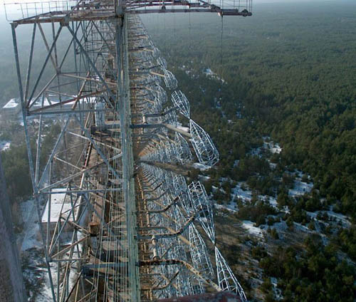
A few years later, another photo-reference tour was being cited for the gaming press, only this time it was not a cheery holiday in Europe, but a trip to the Zone Of Alienation. This 30km area of Ukraine and Belarus remains poisoned and largely off-limits to mankind, thanks to the radioactive caesium that dusted it after the explosion at the Chernobyl Nuclear Power Plant in 1986.
While it has remained quarantined and closed to (legal) habitation, it hasn’t kept out sight-seers. The production team at GSC Gameworld, a games studio based in nearby Kiev, intended to use the derelict zone as the basis for environments in their action shooter, STALKER: Shadow Of Chernobyl. The team went into the zone and photographed urban dereliction: a snapshot of an abandoned Soviet Union. They would go on to fill their game world with the zone’s rusting fences and collapsing grain silos, but that was not all that came with the material: the landscape and its decaying architecture was already charged with mythology—with narrative.
Creative director Anton Bolshakov explained this in an interview in 2007: “The Soviet system was sealed, many facts were kept secret. Even the most harmless objectives or events generated unbelievable rumours and legends.” One example, he says, is
an existing gigantic antenna located within the Chernobyl exclusion zone. On some of our photos taken during the trip to Chernobyl the body of the antenna is seen on the horizon spanning several hundred meters across. So some unofficial sources claim, the waves emitted by the antenna were psychoactive. The antenna was directed onto Western Europe and preoccupied with a long-lasting military experiment on psychotropic influence onto human psyche.
[Images: The “steel giant” near Chernobyl; all photos via English Russia].
The antenna wall—actually an early-warning radar system developed for Cold War defense, which has been preserved thanks to being inside the zone—made it into the game as “the brain scorcher,” a device that must be shut down before the player can progress into the abandoned city of Pripyat. The environment of Chernobyl not only provided the game with an authentic atmosphere, it was also to influence the events that players could experience.
However, the zone as an idea already existed before the explosion in 1986. It appeared, for instance, in a 1972 science fiction novel called Roadside Picnic. A mysterious, contaminated pocket of landscape, quarantined from the outside world, was the main theme of that book, which was written by two brothers, Boris and Arkady Strugatsky.
In the Strugatsky’s book, an alien visitation to the earth—an extra-terrestrial “roadside picnic”—has left dangerous and incomprehensible materials strewn across a zone of Northern Canada. Although sealed off for scientific research, this zone is raided by “Stalkers” who sell the unnatural trinkets for black-market cash. To do so, they brave bizarre dangers, because the zone has been transformed into a place that is utterly at odds with our own world. The alien is never seen or even described, and all the characters encounter is its terrible remainder: landscape made alien. Pools of jelly that will cripple a man lurk in basements, extra-terrestrial cobwebs that can stop a heart beating are strung across doorways, and gravitational mantraps will crush anyone who passes over the wrong patch of mud.
The zone of Roadside Picnic was seen by many as an allegory for the entire Soviet experiment: not simply in the literal sense of the poisoned landscapes created by the industrial excesses of the region, but the entire social order that was created by the Communist government. Polluted expanses, continually washed by acid rain, became shorthand for describing the bizarre political situation of a country in which Communism had failed, and yet robotically continued.
Russian film-maker Andrei Tarkovsky shot a movie, called Stalker, which told a story based on that of Roadside Picnic. A glacially slow, almost event-free film about landscape and longing, it’s a work that lingers for long minutes over broken wastelands of abandoned industry. It encapsulates Tarkovsky’s style, as well as his interest in dereliction and decay—themes that would be revisited by the STALKER videogame, thirty years on.
[Image: From Stalker, directed by Andrei Tarkovsky].
Tarkovsky’s film manages to imbue derelict industrial landscapes with a terrible sense of threat. Largely unable to realize the alien properties of artifacts in Roadside Picnic, Tarkovsky projected the danger into the architecture itself. Passive landscapes that could swallow a man. Tunnels which tear them to shreds. These effects were never demonstrated, but also never doubted, thanks to the tentative way the actors explored their surroundings.
In much the same way that the images of the real Chernobyl zone seem like lush vegetative scenes, despite being formidably radioactive, so Tarkovsky’s zone is calm and invisibly dangerous.
Cinematic legend had it that the power station shown in the final background scenes of the film was in fact Chernobyl NPP, although the truth is the entire film was shot in Estonia. That’s not to say that Stalker was without poisonous consequences of its own, however. The first version of the movie was shot entirely on corrupted film, which was unsalvageable when Tarkovsky’s production team returned to their Russian studios. Worse, the second shooting took place down stream from a poorly regulated chemical works. The effluent from the plant was responsible for many of the astonishing visuals in the river scenes from the movie, but team members came to suffer serious side-effects from this exposure, including cancer. They had, it seems, suffered side-effects from their time in the zone: just like the fate of the fictional Stalkers in the Strugatsky books. It was as if the fiction and reality were blurring back through each other. As if—to quote Alan Moore—the written page was too fragile a boundary.
Or perhaps, as Steven Shaviro suggests in his book Connected, Roadside Picnic, like all science fiction, actually exists to cast a shadow over the present. “It shows us how profoundly haunted we are by what has not yet happened,” says Shaviro of science fiction writing. In the specific case of Roadside Picnic and Tarkovsky’s film, what had not happened yet was the Chernobyl disaster.
After 1986, however, there were others for whom the ideas of Roadside Picnic were to be immediately accessible and useful in describing the world that they faced. People going into the Chernobyl exclusion zone, to loot buildings or show tourists around, began to call themselves “Stalkers.” For them, the zone of the Strugatsky’s vision was immediate and first-hand, a kind of fictional reference for the reality they were facing. They were living it—and it was strangely convenient to have the Stalker nomenclature to hand.
[Images: STALKER game images from this very extensive Flickr set].
As for Bolshakov and his creative team, borrowing from both the Strugatskys and the real world has proven fruitful. Real world ruins seem to connect with players far more readily than their fantasy counterparts. No one has been able to come away from STALKER without talking about the architectural waste that GSC borrowed from the zone. The game has now reached three iterations and supports an energetic fan community.
Bolshakov suggests that there is more to this than simply commerce or escapism, however: “The motif behind STALKER was to create a game which would remind people of the Chernobyl accident and at the same time warn mankind against any possible fatal mistakes in the future.” The warning seems likely to go unheard, but perhaps it has another message: to tell game developers that the architecture of the real world comes prefixed with meaning. Even now, when cities can be raised procedurally from the blank canvas of a game engine, perhaps it’s worth taking a look at the real world and the mythology that has been strewn around it. If borrowing architecture from the zone proves anything, it’s that simulation should not exist in a vacuum.
[Image: “Archive II” from the Archive Series by David Garcia Architect, Copenhagen].
When I started the “Books Received” series last year, I did so just in time to box all my books up, put them in storage for what was supposed to be a three-month trip—and then abandon the series with only two posts written. But now it’s May 2010, that “three-month” trip has still not ended (the one-year mark is in two weeks), my things are still out in an L.A. storage warehouse gathering dust, and I’ve managed to hoard a whole new collection of books and papers.
About to hit the road once again now, for a trip within the trip, heading north to spend the summer in Montreal, I thought I’d revive the “Books Received” posts with a look at some of the many, many pieces of reading material that have gathered in our apartment over the past half-year. As before, I have not read all of the following books, which means I cannot vouch for all of their quality (except in a few cases that I will note); also, as before, these are not all new books. They are newly purchased—or newly received as review copies—but they are not necessarily hot off the press.
And with that…
—Radical Games by Lara Schrijver (Netherlands Architecture Institute). Schrijver looks back at the “radical movements” of the 1960s, to “a moment in the history of architecture when revolutionary ideals were paramount and dreams became drawings.” Her goal, however, is to uncover how the ideals of three specific groups—Archigram, the Situationists, and Venturi & Scott Brown—maintained a confusing dependency on the very Modernist philosophies they were trying to dispute. This continues to have effects today, Schrijver argues, in muddying the waters of both theoretical debate and experimental practice.
—Provisional: Emerging Modes of Architectural Practice USA, edited by Elite Kedan, Jon Dreyfous, and Craig Mutter (Princeton Architectural Press). Speaking of architectural practice, this fantastically designed (by Project Projects) book shows how architects actually work and how their buildings come together, including nARCHITECTS’ extraordinary “Wind Shape.” A very useful and interesting look at the organizational innovations, technical breakthroughs, and work-flow challenges that architectural offices now face. In fact, if there are forthcoming titles, designed to the same fabulous standard, called Emerging Modes of Architectural Practice Europe, …Asia, …Africa, …South America, and so on, I would snap all of them up.
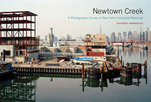
—Newtown Creek: A Photographic Survey of New York’s Industrial Waterway by Anthony Hamboussi (Princeton Architectural Press). From gargantuan salt piles to paving yards, UPS loading docks to derelict oil terminals and the sludge tanks of the NY Department of Sanitation, Hamboussi leads a photogeographic tour through the industrial landscapes of Newtown Creek, dividing Brooklyn and Queens. “Having worked along the creek for about a decade,” Paul Parkhill writes in the book’s afterword, on the other hand, “I can say with some conviction that any assumptions about abandonment are misplaced. Behind the street walls and cyclone fencing, inside the shuttered factories and warehouses, there exists a world hidden to the casual observer. Newtown Creeks reflects, in the words of one waterfront planning official, the ‘backyard’ of New York City. Desolate in spots, disgusting in others, it is far from abandoned.”
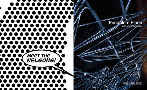
— Meet The Nelsons by Wes Jones and Pendulum Plane by the Oyler Wu Collaborative (Los Angeles Forum for Architecture and Urban Design). These two pamphlets from the LA Forum unfortunately suffer from bad production, with almost instantly cracking spines and pages falling loose within minutes of reading. No matter, the Oyler Wu pamphlet in particular has some fantastic details, including beautiful shots of their Lebbeus Woods-like sketchbooks and some backstage glimpses of the “Live Wire” installation they did for SCI-Arc.
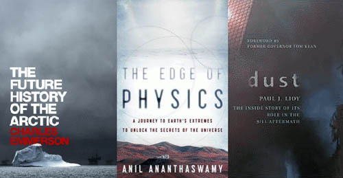
—The Future History of the Arctic by Charles Emmerson (PublicAffairs). Emmerson takes us through the now-rapidly shifting geography north of the Arctic Circle, where nation-state territorial ambitions and private-sector mineral & gas claims—not to mention thawing international shipping lanes, package tourism, and global climate change—are beginning to collide.
—The Edge of Physics: A Journey to Earth’s Extremes to Unlock the Secrets of the Universe by Anil Ananthaswamy (HMH). I’m halfway through this, and absolutely loving it. There are sensitive, remote, large-scale, and theoretically complex physics experiments going on all over the world, complete with massive pieces of infrastructure that such things require. So why not take a trip around the world and visit these extraordinary sites, as well as the unearthly landscapes in which they sit? Ananthaswamy does exactly that, taking us into an abandoned mine in Minnesota, to a neutrino detector deep beneath Russia’s Lake Baikal, up into the mountain deserts of South America, and past hulking telescopes in dark regions all over the world. All travel writing should be this interesting.
—Dust: The Inside Story of its Role in the September 11th Aftermath by Paul Lioy (Rowman & Littlefield). In the book’s Prologue, Lioy writes that, “Within twenty-four hours of the September 11 attack on the World Trade Center (WTC) in New York City, representatives from several governmental agencies asked me about the dust that was released during the collapse of each tower.”
The thick gray and fluffy dust seemed to be everywhere, settling on all of the animate and inanimate objects in its path. It covered the skin and clothes of many of those who had survived but who had been trapped in harm’s way. You could see it being resuspended in the air after official vehicles drove through Manhattan. What was in that dust and its companion plume of smoke that was moving across Brooklyn and out to sea? At that time, I didn’t know the answer to this question.
Lioy—a “specialist in exposure science”—has thus written this investigative chemical analysis of the cloud: what was in it, its basic morphology, how it interacted with human tissue, and how long its residue actually stuck around in New York City.
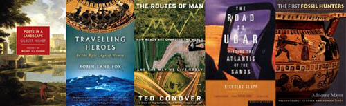
—Poets in a Landscape by Gilbert Highet (New York Review of Books). This brand new, NYRB edition revives Highet’s classic textual history of Roman poets, zooming in through the curtain of their words to focus on the background landscapes within which their poetic events took place—revealing a geography of lost place-names, gardens, villages, city fringes, and farms. An earlier edition of Highet’s book was praised in an old post on the excellent blog Some landscapes.
—Traveling Heroes: In the Epic Age of Homer by Robin Lane Fox (Vintage). This book has been greeted with mixed reviews, but the premise still thrills me: Fox has written a survey of “traveling heroes”: “particular Greeks at a particular phase in the ancient world who travelled with mythical stories of gods and heroes in their minds.” Or this, from the back cover description: Fox “explores how the intrepid Mediterranean seafarers of eight-century B.C. Greece encountered strange new sights—volcanic mountains, vaporous springs, huge prehistoric bones—and weaved them into the myths of gods, monsters, and heroes that would become the cornerstone of Western civilization.”
—The Routes of Man: How Roads Are Changing the World and the Way We Live Today by Ted Conover (Knopf). The premise of this book is fantastically simple: to travel the world’s roads, to ask how they have shaped human culture, and to reveal their literal resurfacing of the planet. After all, “Roads constitute the largest human-made artifact on earth,” Conover writes, so why not approach them as an anthropologist might? The execution so far, however, has left me underwhelmed. At the moment, Conover has just spent an awfully long time writing in a faux-naive voice about the South American jungle, telling us far less about roads, in any real sense, than about his own travels through this remote, intensely rural region that he can’t seem adequately to decipher. I’m finding myself wishing that Matthew Coolidge of the Center for Land Use Interpretation had written this book—or that a similarly themed book comes out soon, perhaps by the authors of mammoth—but I hope this sense of anticlimax dissipates as I continue reading.
—The Road to Ubar: Finding the Atlantis of the Sands by Nicholas Clapp (Mariner). I picked this up after seeing a brief reference to it in Michael Welland’s excellent book Sand. At first, it sounds like total b.s.—a lost city called the “Atlantis of the Sands,” known only through rumors and myth, like something published by Weiser. But it turns out to be true: there is a lost trading city beneath the sand dunes of Oman, and the whole thing disappeared when it collapsed into a sinkhole. Read this old New York Times review if you’re not convinced; there, we read that Clapp
assembled a group of collaborators that included a remote-imaging geologist from J.P.L.; an Arabic-speaking expedition wrangler with a knighthood; a fund-raiser; a cameraman (the personal quest having meanwhile become a film project); a sound man; Clapp’s wife, Kay; and Juris Zarins, an archeologist with a special interest in the Arabian incense trade. In 1990, Sultan Qaboos ibn Said granted them access not just to a remote zone of desert but also to one of his helicopters. After some reconnaissance flights, a more laborious search in Land Rovers led the team to a fruitful dig site in the Omani desert—though at an unexpected location, under an unexpected name. Over the next four years, Zarins, with a crew of helpers, would excavate that site tellingly.
To reveal here just what they found, and where they found it, would betray the suspense of Clapp’s narrative.
Think of it as Indiana Jones meets subterranean desert hydrology.
—The First Fossil Hunters: Paleontology in Greek and Roman Times by Adrienne Mayor. (Princeton University Press). What an amazing topic for a book: how did ancient cultures understand, collect, and eventually explain fossils from gigantic creatures that they had no scientific means of understanding? From myths of dragons to fossilized deities, what cultural reactions did these petrified remains inspire? Looking back at the fossil-hunting record of Mediterranean cultures 2000 years ago, Mayor attempts to answer those questions. On another note, Mayor’s most recent book, The Poison King, also looks great.
—Obelisk: A History by Brian A. Curran, Anthony Grafton, Pamela O. Long, and Benjamin Weiss (MIT). An illustrated, multiply-authored account of how massive stone plinths were quarried, transported, publicly erected, and culturally adored from Ancient Egypt to Paris in the 21st century.
—TV Towers by Friedrich von Borries, Matthias Böttger, and Florian Heilmeyer. This “architectural history of TV towers” tracks the political history and structural forms of television-broadcasting towers all over the world, primarily in Europe—yet, as the authors point out, “the most recent are being erected in up-and-coming Asian cities and in the Middle East.”
TV towers have been—and still are—the most visible symbols of an otherwise invisible technological revolution. The geographical spread of such towers traces twentieth century political history until this day: rivalry between political systems in East and West was followed by competition among global cities for touristic and economic appeal… TV towers are the cathedrals of a media society.
The book was published to coincide with an exhibition at the Deutsches Architekturmuseum that closed in March 2010.
—Other Space Odysseys, edited by Mirko Zardini and Giovanna Borasi (Canadian Centre for Architecture/Lars Müller). I’m looking forward to seeing this exhibition in person up in Montreal next month. This pamphlet-sized accompanying booklet does a great job in portraying the loopy design history of architects who have directly engaged with the space program (and, specifically, with human experience on the moon). The Alessandro Poli chapter is a highlight.
—Al Manakh 2 (Volume/Archis). A sober, recessionary note, kicked off right away by Rem Koolhaas’s introductory letter, haunts this sequel to Al-Manakh. Koolhaas sounds more like a defiant sports fan who knows his favorite team is having an off-season (but who has decided to cheer them on, nonetheless). “Dubai is an experiment that will never be repeated,” he writes; it is (was?) “an entirely different construct, the brainchild of a local minority that generously invited manpower and expertise from everywhere to assemble an artificial community, to test, explore and put into practice the relationship between Islam and modernity.” Whether or not this massive—and, physically, very nicely realized—book amplifies or eviscerates the “understandable Schadenfreude” Koolhaas mentions in his intro is something I will have to find out while reading it this summer.
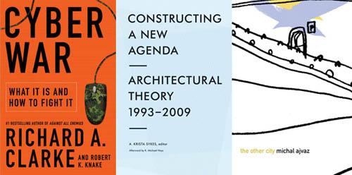
—Cyber War: The Next Threat to National Security and What to Do About It by Richard Clarke and Robert Knake (Ecco). This is another book I’m roughly halfway through (and enjoying, precisely because of its alarming nature). If Clarke and Knake are to be believed—and they seem like reliable narrators—the U.S. is wildly underprepared for any sort of concentrated, militarized cyber-attack, whether from another nation-state or from an organized network of criminal hackers. “The U.S. military is no more capable of operating without the Internet than Amazon.com would be,” the authors write, and the eye-popping infrastructural vulnerabilities that they point out here and there—such as counterfeit routers, manufactured in China and sold throughout the U.S. market, with security flaws suspiciously (and deliberately?) well-placed for later attacks, or the “logic bombs” that have been found “all over our [the U.S.’s] electric grid”—are worth the price of the book alone.
—Constructing a New Agenda for Architecture: 1993 to the Present, edited by A. Krista Sykes (Princeton Architectural Press). This is an historically valuable collection of essays commonly assigned by architecture professors over the past seventeen years—but, to be honest, if you want interesting ideas for future design projects, I think you’re better off reading even just a handful of the other titles mentioned above. This is not universally true for everyone reading this blog, of course, and I don’t mean to be idiotically dismissive of the past decade and a half of theoretical writing; after all, Sykes has put together an impressive survey. But, for my own needs, impulsive architectural speculation is a much more valuable, projective form of theorizing than the overly careful, citational micropolitics that too often passed for academic work in the 1990s.
—Finally, The Other City by Michal Ajvaz (Dalkey Archive). Ajvaz’s novel is a “strange and lovely hymn to Prague,” we read, falling somewhere between magic realism, Labyrinths, and perhaps Jeff VanderMeer. “Can there really exist a world in such close proximity to our own,” Ajvaz asks, “one that seethes with such strange life, one that was possibly here before our own city and yet we know absolutely nothing about it?” That is “indeed quite possible,” his narrator concludes, wandering through streets always on the verge of mutating into something else.
[Image: The Ladybower bellmouth at full drain, photographed by Flickr user Serigrapher].
Nearly half a year ago, a reader emailed with a link to a paper by Andrew Crompton, called “Three Doors to Other Worlds” (download the PDF). While the entirety of the paper is worth reading, I want to highlight a specific moment, wherein Crompton introduces us to the colossal western bellmouth drain of the Ladybower reservoir in Derbyshire, England.
His description of this “inverted infrastructural monument,” as InfraNet Lab described it in their own post about Crompton’s paper—adding that spillways like this “maintain two states: (1) in use they disappear and are minimally obscured by flowing water, (2) not in use they are sculptural oddities hovering ambiguously above the water line”—is spine-tingling.
[Image: The Ladybower bellmouth, photographed by John Fielding, via Geograph].
“What is down that hole is a deep mystery,” Crompton begins, and the ensuing passage deserves quoting in full:
Not even Google Earth can help you since its depths are in shadow when photographed from above. To see for yourself means going down the steps as far as you dare and then leaning out to take a look. Before attempting a descent, you might think it prudent to walk around the hole looking for the easiest way down. The search will reveal that the workmanship is superb and that there is no weakness to exploit, nowhere to tie a rope and not so much as a pebble to throw down the hole unless you brought it with you in the boat. The steps of this circular waterfall are all eighteen inches high. This is an awkward height to descend, and most people, one imagines, would soon turn their back on the hole and face the stone like a climber. How far would you be willing to go before the steps became too small to continue? With proper boots, it is possible to stand on a sharp edge as narrow as a quarter of an inch wide; in such a position, you will risk your life twisting your cheek away from the stone to look downward because that movement will shift your center of gravity from a position above your feet, causing you to pivot away from the wall with only friction at your fingertips to hold you in place. Sooner or later, either your nerves or your grip will fail while diminishing steps accumulate below preventing a vertical view. In short, as if you were performing a ritual, this structure will first make you walk in circles, then make you turn your back on the thing you fear, then give you a severe fright, and then deny you the answer to a question any bird could solve in a moment. When you do fall, you will hit the sides before hitting the bottom. Death with time to think about it arriving awaits anyone who peers too far into that hole.
“What we have here,” he adds, “is a geometrical oddity: an edge over which it is impossible to look. Because you can see the endless walls of the abyss both below you and facing you, nothing is hidden except what is down the hole. Standing on the rim, you are very close to a mystery: a space receiving the light of the sun into which we cannot see.”
[Image: The Ladybower bellmouth, photographed by Peter Hanna, from his trip through the Peak District].
Crompton goes on to cite H.P. Lovecraft, the travels of Christopher Columbus, and more; again, it’s worth the read (PDF). But that infinitely alluring blackness—and the tiny steps that lead down into it, and the abyssal impulse to see how far we’re willing to go—is a hard thing to get out of my mind.
One of many things that we’ll be looking at tonight in the Blackout seminar that I’ve been teaching over at Pratt in Brooklyn is organically generated electricity—things like virus batteries, biogeobatteries, sediment batteries, and more.
[Image: From Christopher Nolan’s film The Prestige (2006)].
By way of getting there, though, we’ll be taking a very brief look at Christopher Nolan’s under-rated film The Prestige—specifically the scene in which we see a hillside covered in giant incandescent light bulbs, none of which appear to be plugged into anything but soil and all of which are powered wirelessly by a generator located over 12 miles away.
The geological form of the mountain plateau becomes a shining grid framing our two featured characters.
[Image: From Christopher Nolan’s film The Prestige (2006)].
Although The Prestige does not suggest that this is what’s happening in this scene, what if the soil itself was powering these light bulbs? What if soil could be turned into a landscape-scale, distributed electrical device?
Awesomely, as Nature reported just two months ago, there is growing evidence to back up “a suggestion within the geophysics and microbiology communities that bacteria can grow tiny ‘wires’ and hook up to form a biogeobattery—a giant natural battery that generates electrical currents.”
Scientists have known that bacteria can create electricity when mixed with mud and seawater, and have even built microbial fuel cells around the little buggers. Now they have begun figuring out just how bacteria create electrical networks that serve as long-distance communication, at least on the microbial scale—the distances ranged up to 2 centimeters. Yet those few centimeters equal roughly 20,000 times the body size of individual bacteria.
Imagining soil itself—the ground all around us—as a giant electrical transmission network is astonishing. And, again, while there is no mention of anything like biogeobatteries and their ilk in The Prestige, the very idea that perhaps someday we could plug light bulbs directly into the soil—an organic battery coextensive with the living surface of the earth—amazes me.
And biogeobatteries are not even the only option here; there are also virus batteries.
MIT reported back in 2006 that a team of researchers had “harnessed the construction talents of tiny viruses to build ultra-small ‘nanowire’ structures for use in very thin lithium-ion batteries. By manipulating a few genes inside these viruses, the team was able to coax the organisms to grow and self-assemble into a functional electronic device.” The resulting virus batteries are tiny, but they could vary in scale “from the size of a grain of rice up to the size of existing hearing aid batteries.”
The future design possibilities are bewildering. Could deposits of virus-impregnated soil be used as electricity-storage devices in rural, off-the-grid areas?
After all, bacteria might already be “wiring up the soil,” Nature suggested three years ago. Indeed, “bacteria can sprout webs of electrical wiring that transform the soil into a geological battery,” meaning that “the earth beneath our feet might act as a gigantic circuit built by microbes to power their metabolic systems.” And you can build a soil battery yourself:
The researchers filled plastic columns with wet sand infiltrated with a nutrient compound (lactate), and allowed S. oneidensis to grow in this “fake soil.” Only the top of the column was in contact with air. Electrodes inserted at various heights up the columns revealed that, after about ten days, electrical charge was coursing up the column… threaded by a web of filaments between the bacterial cells.
I’m reminded here of the work of Philip Beesley, which often uses self-fertilizing yeast-packs, gels, and seeds to create living geotextiles. In fact, a Beesley Battery doesn’t seem at all very off: a living mat woven through the soil, generating and storing electricity based on pre-existing bacterial activity in the ground.
You infect the soil with a genetically-modified virus patented by MIT and electrical currents start to flow…
[Image: From Christopher Nolan’s The Prestige (2006)].
Perhaps someday, then, we could simply show up somewhere, in the middle of the night, surrounded by pine forests and hills, and just crouch down, push a light bulb two or three inches into the earth—
[Images: (left) An archaeologist examines soil cores. (right) Researchers plot lost roads across the grounds of Monticello. Courtesy of the Glenn A. Black Laboratory of Archaeology at IU Bloomington].
It’s hard to resist a caption referring to a “team of researchers” who have used their “electrical resistivity profiler to discover long-buried roads around the historic Virginia home” of 18th century U.S. president Thomas Jefferson. But that’s exactly what you’ll see courtesy of a recent press release from Indiana University.
Specifically, we read, a team of Indiana University archaeologists have “conducted a landscape study to find evidence of two lost roads: a ‘kitchen road’ that serviced the Monticello kitchen, and a formal carriageway that circled along the Ellipse Fence marking the edge of the East Lawn and the formal landscape in front of Monticello.”
A combination of soil cores and direct electrical data helped that team outline this otherwise lost geography at the heart of U.S. presidential history and across the original lawns of American Palladianism. Jefferson, as you might know, was an architect, one heavily influenced by the texts and buildings of Andrea Palladio. American architecture, from day one, was, in a sense, a facsimile: created, with far-reaching variations and personal stylistic quirks, based on reproduced manuscripts from Europe.
In any case, stepping back: beneath Jefferson’s lawn are lost roads.
I’m reminded here of an amazing story published two years ago in the New York Times about “ancient roads,” dating from colonial times, in the U.S. state of Vermont.
As the The New York Times explained back then, a 2006 state law gave Vermont residents a strong incentive to uncover the buried throughways in, around, and through their often quite rural towns. Indeed, “citizen volunteers are poring over record books with a common, increasingly urgent purpose: finding evidence of every road ever legally created in their towns, including many that are now impassable and all but unobservable.”
These “elusive roads”—many of them “now all but unrecognizable as byways”—are lost routes, connecting equally erased destinations. In almost all particular cases, they have barely even left a trace on the ground; their presence is almost entirely textual.
They are not just lost roads; they are road that have been deterrestrialized.
If these ancient routes can be re-discovered, however, then Vermont state law dictates that they can also be added to official town lands (and thus be eligible for some kind of federal something-or-other). Accordingly:
Some towns, content to abandon the overgrown roads that crisscross their valleys and hills, are forgoing the project. But many more have recruited teams to comb through old documents, make lists of whatever roads they find evidence of, plot them on maps and set out to locate them.
And, in what is surely one of the most interesting geographical subplots in recent newspaper publishing, we read: “Even for history buffs, the challenge is steep: evidence of ancient roads may be scattered through antique record books, incomplete or hard to make sense of.”
Like something out of the poetry of PaulMetcalf, or even William Carlos Williams, the descriptions found in these old documents are narrative, impressionistic, and vague. They “might be, ‘Starting at Abel Turner’s front door and going to so-and-so’s sawmill,’ said Aaron Worthley, a member of the ancient roads committee in Huntington, southeast of Burlington. ‘But the house might have burned down 100 years ago. And even if not, is the front door still where it was in 1815? These are the kinds of questions we’re dealing with.'”
While making sense of cryptic references to lost byways is fascinating in and of itself, these acts of perambulatory interpretation are part of a much larger, fairly mundane attempt to end “fights between towns and landowners whose property abuts or even intersects ancient roads.”
In the most infamous legal battle, the town of Chittenden blocked a couple from adding on to their house, saying the addition would encroach on an ancient road laid out in 1793. Town officials forced a showdown when they arrived on the property with chain saws one day in 2004, intending to cut down trees and bushes on the road until the police intervened.
The article here goes on to refer to one local, a lawyer, who explains that “he loved getting out and looking for hints of ancient roads: parallel stone walls or rows of old-growth trees about 50 feet apart. Old culverts are clues, too, as are cellar holes that suggest people lived there; if so, a road probably passed nearby.”
What would happen, then, if you discovered that an ancient road actually passes through your house? Your living room is a former throughway, and old paths knot and twirl off to every side; one even leads right through the guest bedroom. And then another road pops up, and another—and you realize that you live on the intersecting scars of a lost built environment, some old village that disappeared or was destroyed in an H.P. Lovecraft-like enigmatic disaster.
[Image: An old Roman road in Britain; photo via Historic UK].
I’d also be curious, meanwhile, to see what might happen if such a law was passed in a city like London. In an old but interesting review of the book London: City of Disappearances, edited by Iain Sinclair, we’re told that London “is a city of the forgotten.” It is where anyone “can still disappear without trace.” Indeed, London is a city “built upon lost things”; it “towers above forgotten underground rivers and discarded tunnels. It is built upon old graveyards and burial pits.”
Best of all, entire London streets have disappeared: “Catherine Street, Jewin Street, Golden Place are just three of the vanished thoroughfares named in a litany of sorrowful mysteries,” our reviewer points out. “Other streets have been curtailed. Swallow Street has been swallowed by burgeoning London. Grub Street has been renamed Milton Street.”
So what would happen if someone—who liked “getting out and looking for hints of ancient roads”—were to set about such a task elsewhere, in a city made from unstable geographies flashing in and out of county land registers?
I’m reminded here of China Miéville’s short story “Reports of Certain Events in London,” in which “unstable” streets appear and disappear throughout the city. One night they’re there, the next night they’re not.
Or take Chris Carlsson’s explorations of San Francisco’s ghost streets. “Intrepid explorers of San Francisco regularly stumble upon the many ghost streets that still hide all over town, rewarding the patient pedestrian for their diligence,” Carlsson wrote last autumn. “Mostly they are on hillsides where steep grades impeded road building at earlier moments in history, but they’re still presented as if they were through-streets on the maps.”
[Image: A map of San Francisco, including many “ghost streets,” courtesy of Streetsblog SF].
Carlsson’s post—something every San Franciscan should read—seemingly paved the way for a later exploration of “San Francisco’s unaccepted streets,” throughways too ephemeral for any real act of archaeology.
This unaccepted geographical unconscious of the city was recently mapped by Nicholas de Monchaux in an awesomely ambitious project called Local Code. It’s hard to exaggerate how interesting this project is; the following embedded video barely does it justice:
Here we are, then, surrounded by lost roads, forgotten throughways, and unaccepted streets. We turn on ground-penetrating radar and we find lost highways. What new cartographies could possibly account for these layers? With avenues leading nowhere and medieval freeways whose stratigraphic routes remain unpaved?
Finally—though by no means answering these questions—roughly two years ago, historian Kitty Hauser published a book called Bloody Old Britain. That book told the story of pilot, and accidental archaeologist, O.G.S. Crawford. Crawford pioneered the use of aerial photography in both discovering and analyzing ancient sites. Learning to read the landscape from the air, on the look-out for German ditches and bunkers, Crawford “would later apply this kind of skill honed in war, the trained interpretation of visual evidence, to the peacetime work of archaeology,” Hauser writes.
In the process, he realized almost instantly that you could detect, from high above, the traces of ancient landscape features that would otherwise have gone unseen. For instance, “at certain times of day, when the sun is low in the sky, the outlines of ancient fields become visible over Salisbury Plain, as shadows throw their ridges and dimples into sharp relief; these are known as ‘shadow sites.’” Much of this comes down to the specific species of plant growing over these landscapes:
Field archaeologists know that vegetation grows differently on soil that has been disturbed, even if that disturbance happened centuries ago. They know that crops grow more luxuriantly over silted-up ditches, and more stunted where there are buried remains. The site of a Roman villa might go unnoticed until a field of wheat grows and ripens, to reveal most strangely the outlines of buried masonry, only to disappear again at harvest. Slight contours or indentations on the land marking out the site of a lost settlement might be invisible to the eye until a low sun throws them into sharp but momentary relief.
Further:
Barley is a more sensitive ‘developer,’ for example, than oats, wheat, or grass, but only in certain soils. Dry spells can bring about remarkably sharp crop sites, like the outline of the medieval tithe barn, complete with buttresses, that appeared in the grass at Dorchester in June of 1938.
Hauser continues, pushing the awe factor:
One of the most remarkable things about aerial archaeology is that very few human processes will completely remove a site from view for ever. It might be decades—centuries even—before the right combination of crop growth, rain, sun, and aerial observer results in a site manifesting itself and being photographed. But unless deep excavations or quarrying are carried out, removing all traces of the site, the possibility remains that one day, under new conditions, it will reveal itself.
And, thus, “Photographs of unimpressive-looking mounds and lumps, the sort of thing one might not notice as one went past in a car or a train, turn out to be burial mounds, still for all we know containing crouching skeletons or buried treasure. You just needed to know where to look.” And Crawford knew where to look: there were ancient archaeological features everywhere, from buried roads to wooden menhirs rotting back into the soil. Britain was very old, Crawford himself could see; it was Bloody Old Britain.
[Image: O.G.S. Crawford and his archaeological airplane; via Kitty Hauser’s Bloody Old Britain].
What, then, if we could combine all this? Dead streets buried beneath the sprawling lawn of a U.S. president—himself now erased from the historical memory of U.S. Conservatives—crossed with lost streets from San Francisco, wed with linear archaeological sites known only from the air of 1910s England, meeting ancient roads through the hills of rural Vermont, informing short story sci-fi by China Miéville: how does our understanding of the built environment accordingly change?
What ancient routes exist all around us—like the dead streets of California City?
When I first mentioned the story of Vermont’s ancient roads two years ago on BLDGBLOG, commenters pointed out things like the Icknield Way, a.k.a. the “oldest road in Britain,” as well as lost railway lines in North Dakota:
I’ve done a lot of ‘landscape hermeneutics’ with former rail lines. I’m working on photographing every town in North Dakota, and most of these towns were built on a rail line. Many of those lines are now long-gone, so there’s often a ridge running through the town where the railroad used to be. Some of the tiniest spots (like Petrel) that still manage to get on the map can only be identified by a swath of cleared land where a railroad siding and depot might have been.
Or, from Ian Milliss, perhaps the best commenter in BLDGBLOG history (punctuation added):
For the last two years I’ve been on a National Trust committee working on heritage listing for Coxs Road, the first road across the Blue Mountains west of Sydney that opened up Australia to European settlement. Its bicentenary is in 2015.
Numerous pieces of it survive intact, and it does, indeed, sometimes disappear under houses. I’ve also been working on an overlay of it for Google Earth and even some virtual sections done using SketchUp… Its entire construction is detailed in the diaries and reports of its builders so that it can still be tracked through farmland where there is no visible trace of it.
It also relates to Australian indigenous mapping via ancestor stories and songlines, to produce virtual highways that can easily be followed but have very little obvious physical evidence of their existence.
Geography is a dream. Like an absorbed twin, we are surrounded by forgotten roads. That there are lost routes even at the spatial core of the U.S. presidency is just one of many surprising acts of poetry that this world seems always capable of.
(Monticello story spotted via Jessica Saraceni’s great newsfeed over at Archaeology Magazine. Of interest, meanwhile, earlier on BLDGBLOG: Ancient Roads, from which part of this post actually comes, Ancient Lights, and Z).
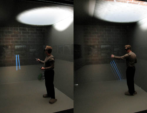
[Image: The CAVE at the Desert Research Institute in Reno, now called the CAVCaM].
I mentioned a week or two ago that I had been out to Reno, Nevada, visiting, among other things, the Desert Research Institute, where Nicola Twilley of Edible Geography, Mark Smout of Smout Allen, and I began a roadtrip down to Los Angeles, through San Francisco—less a city than a peninsular amphitheater of conflicting microclimates—by way of the Virtual Reality CAVE that you see pictured here.
[Image: Daniel Coming, Principle Investigator of the CAVCaM, manipulates geometries that don’t exist, and we photograph him as he does so].
The facility is no longer called the CAVE, I should add; it’s now the CAVCaM, or Center for Advanced Visualization, Computation and Modeling. CAVCaM “strives to maintain a state-of-the-art visualization system, improve data collections, simulations, and analyses of scientific information from the environment.”
Advancements will create new capabilities for multidisciplinary research, produce top tier visualization environments for use by the broader scientific community, and offer opportunities to improve management decisions including prediction, planning, mitigation, and public education throughout Nevada and the world.
It also blows the minds of landscape theorists and practitioners in the process.
[Image: Touring virtual light].
In most of the photos here you see Matthew Coolidge from the Center for Land Use Interpretation, Bill Gilbert from the Land Arts of the American West program, and activist landscape historian and theorist Lucy Lippard all trying their hands at setting virtual forest fires, chasing digital terrains off cliffs, and navigating a world of overlapping proximities that sewed together around us like high-end neurological garmentry—a perfectly tailored world of pharaonic nonexistence, standing in tombs of imagery and light—to become almost seamlessly 3D. Glimpsing, in advance, possible afterlives of the optic nerve.
[Image: Cthulhoid satellites appear in space before you, rotating three-dimensionally in silence].
Of course, these photos also show the inteprid Dr. Daniel Coming, “Principle Investigator” of the CAVCaM—a fantastic job title, implying that this strange machinic environment that the DRI has built isn’t so much put to use, in a dry, straight-forward, functional way, but investigated, researched, explored. Daniel showed us all how to use the hand controls, putting on a display of virtual light and shadows. Objects that were never built, reflecting light that isn’t real.
We were all there on an invitation from the staff of the Nevada Museum of Art—who don’t appear in these photographs, but were absolutely key in making this tour happen.
For whatever reason, meanwhile, that last photograph, above, featuring Matthew Coolidge, Bill Gilbert, and LucyLippard seemingly entranced—as we all were—by this new altarpiece of virtual surfaces, reminds me of the final lines from R.S. Thomas’s old poem “Once”:
Confederates of the natural day, We went forth to meet the Machine.
Or perhaps it was the Machine that has come to meet us.
[Image: The CAVCaM reboots after a universe of simulation].
 [Image: My own “crypto-forest of Utrecht,” via Google Maps].
 [Image: The Barasana Cosmos, via
 I think easily the most sobering thing I’ve read in a long time is that the BP Gulf oil spill
  [Image: The Duplicative Forest—17,000 acres of identical trees—awaits; photo courtesy of
  [Image: Archaeologists work at
 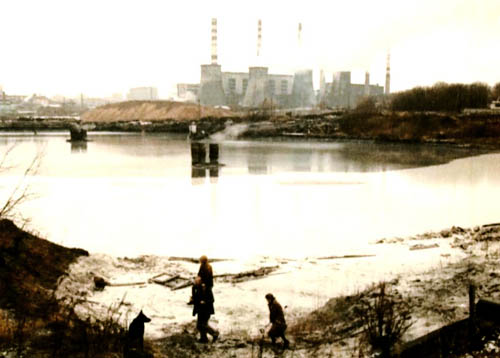 [Image: From
  [Image: Photo by

 [Images: The “steel giant” near Chernobyl; all photos via
 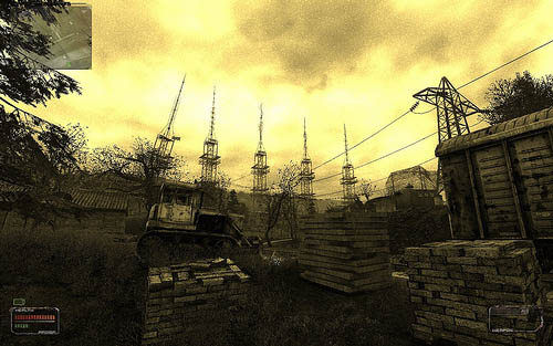 [Image: The “brain scorcher,” via
  [Image: From


 [Images: STALKER game images from this very extensive
  [Image: “Archive II” from the
 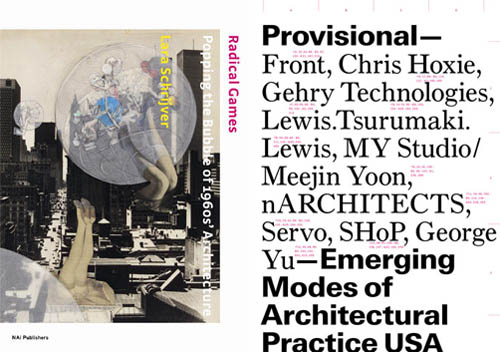 —
— —
— —
—  —
— —
— —
— —
— [Image: The Ladybower bellmouth at full drain, photographed by Flickr user
  [Image: The Ladybower bellmouth, photographed by John Fielding, via
  [Image: The Ladybower bellmouth, photographed by
  [Image: From Christopher Nolan’s film
  [Image: From Christopher Nolan’s film
  [Image: From

 [Images: From
  [Image: From
  [Image: From Christopher Nolan’s
  [Image: From
 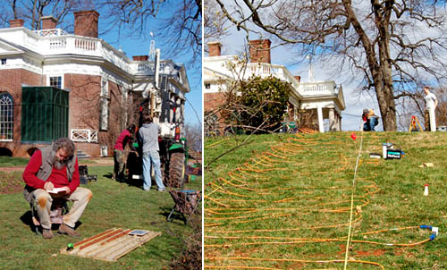 [Images: (left) An archaeologist examines soil cores. (right) Researchers plot lost roads across the grounds of Monticello. Courtesy of the
 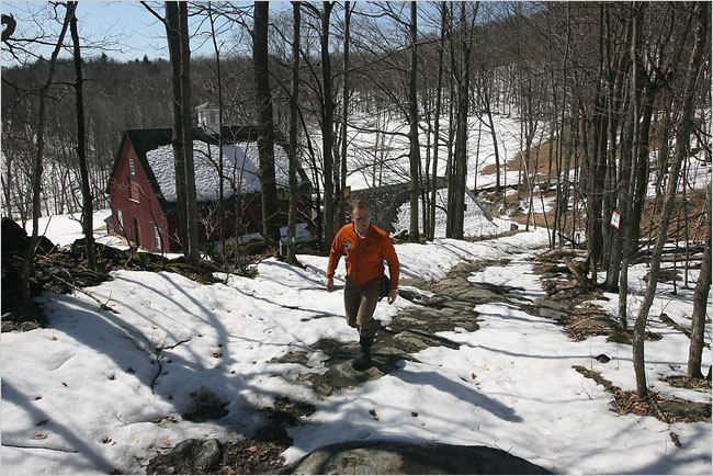 [Image: Walking an “ancient road” in Vermont; photo by
 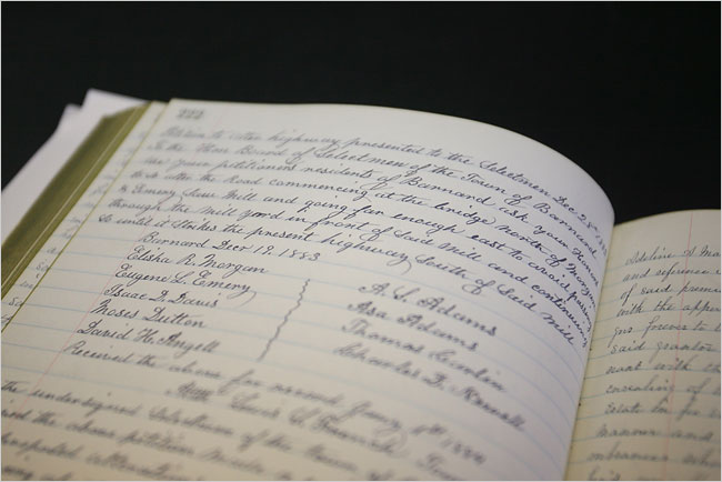 [Image: A hand-written inventory of Vermont’s ancient routes; photo by
 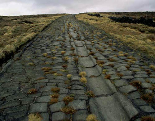 [Image: An old Roman road in Britain; photo via
 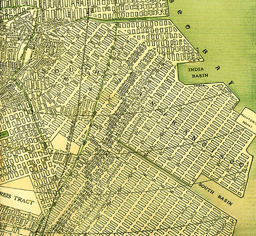 [Image: A map of San Francisco, including many “ghost streets,” courtesy of
 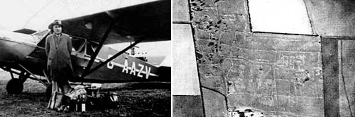 [Image: O.G.S. Crawford and his archaeological airplane; via Kitty Hauser’s
  [Image: California City, CA; view
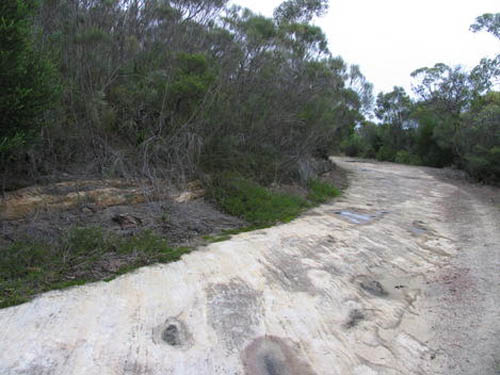
 [Image: Three views of Australia’s lost
  [Image: The CAVE at the Desert Research Institute in Reno, now called the
 [Image: Daniel Coming, Principle Investigator of the
  [Image: Touring virtual light].
 [Image: Cthulhoid satellites appear in space before you, rotating three-dimensionally in silence].


 [Images: Photos by BLDGBLOG and
  [Image: The