Shrink-Wrapped Superloads and Monumental Processions

rock[Image: Michael Heizer’s rock; Instagram by BLDGBLOG].

A long time ago, in a city far, far away, I audited a class about Archigram taught by Annette Fierro at the University of Pennsylvania.

One of many things I remember from the class was a description of how the Centre Pompidou, a building designed by Richard Rogers and Renzo Piano, was constructed.

Apparently, in order for the building to be assembled, huge pieces of structure had to be rolled through the streets in the middle of the night, long after traffic had died down and after almost everyone had gone to sleep.

Whole boulevards and intersections were closed to make way for the passage of these massive objects, as if the ribs and thigh bones of some colossal creature were being painstakingly assembled in a distant neighborhood, in the dark. The building began as a distributed network of large, chaperoned objects.

You can imagine Parisian insomniacs of the late 1970s, wandering the streets before—lo!—these oversized, monumental spans moving at a crawl through the city would come into view. It would have been as if Paris itself had somehow been caught dreaming new buildings into existence at 2am.

The Space Shuttle in front of a doughnut shop; photo by Pulitzer Prize-winning photographer Don Bartletti, courtesy Los Angeles Times].

This same sort of awe at the mis-fit between an object’s size and its urban context arose a few years ago when a somewhat underwhelming art project by Michael Heizer was hauled, street by street, to LACMA; and it then happened again when the Space Shuttle made its slow way through Los Angeles back in October 2012.

I remember talking to architecture critic Christopher Hawthorne around that time, and he compared the Shuttle’s 2mph roll through the city to a Roman Triumph, as if Angelenos were celebrating an imperial event of extra-planetary importance, this grand object—this throne room—being paraded out in public for all to see.

It’s worth recalling how Cambridge classicist Mary Beard described the Triumph in an old interview with BLDGBLOG. “Here you’ve got the most fantastic parade ever of Roman wealth and imperialism,” she explained:

The Romans score disgustingly big victories, massacring thousands, and they come and celebrate it in the center of the city, bringing the prisoners and the spoils and the riches and all the rest. At one level, this is a jingoistic, militaristic display that would warm the heart of every European dictator ever after—but, at the same time, scratch the surface of that. Look at how the Romans talked about it. That very ceremony is also the ceremony in which you see the Romans debating and worrying about what glory is, what victory is. Who, really, has won? It’s a ceremony that provides Rome with a way of thinking about itself. It exposes all kinds of Roman intellectual anxieties.

Moving the Space Shuttle—or, for that matter, Heizer’s rock—gave not just Los Angeles but the entire United States an unexpected “way of thinking about itself,” in Beard’s terms, not just of the city’s historical relationship with the U.S. space program but of the country’s larger, and not necessarily perpetual, impulse to explore beyond the planet.

shuttle[Image: The Space Shuttle Endeavour in Los Angeles; photo by Andrew Khouri, courtesy Los Angeles Times].

These sorts of mega-objects, transported at great expense across urban infrastructure, are what the Center for Land Use Interpretation (CLUI) has described as “big things on the move.”

CLUI suggests that Heizer’s rock was “a bit like a religious procession, with acolytes in hard hats and safety-vest vestments walking alongside the sacred monolith, all lit up and flashing.” When the Space Shuttle hit the street, however, “Much was said about the irony of a craft that had circled the earth 4,700 times at speeds up to 17,000mph taking three days to get through L.A. traffic.”

As CLUI points out, Heizer’s rock and NASA’s Shuttle were both dwarfed by the actual largest “superload” to move through L.A.’s nighttime streets.

This third object “had little in the way of promotion,” they write; “in fact, the owners of it were hoping it would pass through the city as unnoticed as possible,” despite being “the largest and heaviest vehicle to ever pass through the streets of Los Angeles.”

The cargo was a steam generator from the San Onofre Nuclear Generating Station on the coast just south of Orange County, which was being hauled to a disposal site in Utah, 830 miles away.
Though it was junk, it was radioactive, so cutting it into smaller pieces would just generate more contaminated material. A custom superload truck was made, with a total weight for the truck and load totaling 1.6 million pounds. The generator was covered in thick paint so pieces would not flake off.

To be absolutely sure of its safety, “armed guards stayed with the truck all the time, especially when it was parked for the day by the side of the road and the rest of the crew were sleeping in motels.”

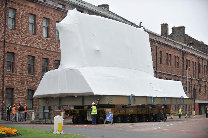
I mention all this after some photos were published this week in the Northwest Evening Mail, featuring huge, shrink-wrapped parts of a British Astute-class nuclear submarine being transported through the city of Barrow.

[Image: A shrink-wrapped section of a nuclear submarine; photo by Lindsey Dickings via the Northwest Evening Mail].

The newspaper warned that, while the “superstructure” made its sectioned way through the city, “car parking will be restricted.”

[Image: Photo by Lindsey Dickings via the Northwest Evening Mail].

In a sense, though, the sight of this dissected weapon of war is more artistic than an art project. A dream-like sequence of shrink-wrapped superstructures, abstract and white, channeling Christo or perhaps even the sculptures of Rachel Whiteread, inches forward street by street, shutting down secondary roads and sidewalks while waiting to be assembled in an eventual future shape, somewhere further down the road.

(Spotted via @CovertShores).

chill.once.waddle

what3words[Image: Screen-grab from what3words].

Using the bizarre three-word addressing system known as what3words, the now-destroyed curb in Hayward, CA, mentioned in the previous post, is located at a site called “chill.once.waddle.”

As you can tell, of course, what3words is not a descriptive language, and these phrases are not intended to mean anything: they are simply randomly-generated sets of words used to give any location on earth a physical address.

As Quartz explained the system back in 2015, it is, at heart, “a simple idea”:

…a combination of three words, in any language, could specify any three meter by three meter square in the world—more than enough to designate a hut in Siberia or a building doorway in Tokyo. Altogether, 40,000 words combined in triplets label 57 trillion squares. Thus far, the system has been built in 10 languages: English, Spanish, French, German, Italian, Swahili, Portuguese, Swedish, Turkish, and, starting next month, Arabic… All together, this lingua franca requires only five megabytes of data, small enough to reside in any smartphone and work offline. Each square has its identity in its own language that is not a translation of another. The dictionaries have been refined to avoid homophones or offensive terms, with short terms being reserved for the most populated areas

The addresses are poetically absurd—shaky.audit.detail, salsa.gangs.square, dozed.lamps.wing.

I mention this, however, because I meant to post last month that “Mongolia is changing all its addresses to three-word phrases.” Again, from Quartz:

Mongol Post is switching to the What3Words system because there are too few named streets in its territory. The mail network provides service over 1.5 million square km (580,000 square miles), an area that’s three times the size of Spain, though much of that area is uninhabited. Mongolia is among the world’s most sparsely populated countries, and about a quarter of its population is nomadic, according to the World Bank.

While, on one level, in an age of stacks and infinite addressability, this seems like a thrilling, almost science-fictional step forward for locating and mapping physical spaces, it also seems like an alarming example of national over-reliance on a proprietary address system, one that the state itself ultimately cannot control.

Imagine a nation-state losing influence over the physical coordinates of its own territory, or a population stuck living inside an outdated, even discontinued address network, and needing to start again, from scratch, renaming all its streets and buildings—not to mention all the lost local histories and significance of certain place names, from avenues to intersections, that need to be reclaimed.

Granted, in this particular case, the system is being adopted precisely because “there are too few named streets” in Mongolia, that does not change the fact that the country will soon be dependent upon the continued existence of what3words for its packages to be delivered, its services to run, and its spatial infrastructures to function. It will be interesting to see how the transition to the use of these peculiar place tags goes—but, even more so, how this decision looks in five or ten years’ time.

Robot War and the Future of Perceptual Deception

tesla
[Image: A diagram of the accident site, via the Florida Highway Patrol].

One of the most remarkable details of last week’s fatal collision, involving a tractor trailer and a Tesla electric car operating in self-driving mode, was the fact that the car apparently mistook the side of the truck for the sky.

As Tesla explained in a public statement following the accidental death, the car’s autopilot was unable to see “the white side of the tractor trailer against a brightly lit sky”—which is to say, it was unable to differentiate the two.

The truck was not seen as a discrete object, in other words, but as something indistinguishable from the larger spatial environment. It was more like an elision.

Examples like this are tragic, to be sure, but they are also technologically interesting, in that they give momentary glimpses of where robotic perception has failed. Hidden within this, then, are lessons not just for how vehicle designers and computers scientists alike could make sure this never happens again, but also precisely the opposite: how we could design spatial environments deliberately to deceive, misdirect, or otherwise baffle these sorts of semi-autonomous machines.

For all the talk of a “robot-readable world,” in other words, it is interesting to consider a world made deliberately illegible to robots, with materials used for throwing off 3D cameras or LiDAR, either through excess reflectivity or unexpected light-absorption.

Last summer, in a piece for New Scientist, I interviewed a robotics researcher named John Rogers, at Georgia Tech. Rogers pointed out that the perceptual needs of robots will have more and more of an effect on how architectural interiors are designed and built in the first place. Quoting that article at length:

In a detail that has implications beyond domestic healthcare, Rogers also discovered that some interiors confound robots altogether. Corridors that are lined with rubber sheeting to protect against damage from wayward robots—such as those in his lab—proved almost impossible to navigate. Why? Rubber absorbs light and prevents laser-based navigational systems from relaying spatial information back to the robot.
Mirrors and other reflective materials also threw off his robots’ ability to navigate. “It actually appeared that there was a virtual world beyond the mirror,” says Rogers. The illusion made his robots act as if there were a labyrinth of new rooms waiting to be entered and explored. When reflections from your kitchen tiles risk disrupting a robot’s navigational system, it might be time to rethink the very purpose of interior design.

I mention all this for at least two reasons.

1) It is obvious by now that the American highway system, as well as all of the vehicles that will be permitted to travel on it, will be remade as one of the first pieces of truly robot-legible public infrastructure. It will transition from being a “dumb” system of non-interactive 2D surfaces to become an immersive spatial environment filled with volumetric sign-systems meant for non-human readers. It will be rebuilt for perceptual systems other than our own.

2) Finding ways to throw-off self-driving robots will be more than just a harmless prank or even a serious violation of public safety; it will become part of a much larger arsenal for self-defense during war. In other words, consider the points raised by John Rogers, above, but in a new context: you live in a city under attack by a foreign military whose use of semi-autonomous machines requires defensive means other than—or in addition to—kinetic firepower. Wheeled and aerial robots alike have been deployed.

One possible line of defense—among many, of course—would be to redesign your city, even down to the interior of your own home, such that machine vision is constantly confused there. You thus rebuild the world using light-absorbing fabrics and reflective ornament, installing projections and mirrors, screens and smoke. Or “stealth objects” and radar-baffling architectural geometries. A military robot wheeling its way into your home thus simply gets lost there, stuck in a labyrinth of perceptual convolution and reflection-implied rooms that don’t exist.

In any case, I suppose the question is: if, today, a truck can blend-in with the Florida sky, and thus fatally disable a self-driving machine, what might we learn from this event in terms of how to deliberately confuse robotic military systems of the future?

We had so-called “dazzle ships” in World War I, for example, and the design of perceptually baffling military camouflage continues to undergo innovation today; but what is anti-robot architectural design, or anti-robot urban planning, and how could it be strategically deployed as a defensive tactic in war?

Subterranean Singapore

oil
[Image: A “Cavern Breathing Unit” from Subterranean Singapore by Finbarr Fallon, Bartlett School of Architecture, Unit 24].

Here is another project from my reviews the other week at the Bartlett School of Architecture; this one is called Subterranean Singapore, and it is by Finbarr Fallon, produced for Unit 24, which is taught by Penelope Haralambidou, Simon Kennedy, and Michael Tite.


[Image: “Concept Breathing Towers” from Subterranean Singapore by Finbarr Fallon, Bartlett School of Architecture, Unit 24].

Subterranean Singapore is presented as a speculative look at massive underground residential development in the city-state of Singapore over the next few decades.


[Images: Glimpses of a “high grade recreational space within an inflatable cave unit,” from Subterranean Singapore by Finbarr Fallon, Bartlett School of Architecture, Unit 24].

The city has run out of room to expand into the sea, and is thus forced to look downward, into the depths of the continental shelf, excavating beneath the surface of the city and heading partially out below the seabed.


[Image: From Subterranean Singapore by Finbarr Fallon, Bartlett School of Architecture, Unit 24].

As Fallon describes it, the project explores “the city-state of Singapore’s subterranean ambitions to suggest an imagined masterplan and spatial typology for deep-level underground living. While it may seem utopian to imagine that extensive deep living will become viable, the pressures of chronic land scarcity in Singapore may necessitate this outcome.”


[Image: The “Subterranean Development Institute: Designing Your Underground Future,” from Subterranean Singapore by Finbarr Fallon, Bartlett School of Architecture, Unit 24].

The construction process is kicked off with great imperial fanfare, involving a parade of excavation machines and robot carving arms marching their way forward through clouds of confetti. There is even a celebratory pamphlet.


[Images: From Subterranean Singapore by Finbarr Fallon, Bartlett School of Architecture, Unit 24].

The idea is not entirely science fiction, of course: Singapore is already excavating huge oil-storage facilities underground, and nearby Hong Kong is actively experimenting with the design and implementation of entire underground infrastructural zones.


[Images: From Subterranean Singapore by Finbarr Fallon, Bartlett School of Architecture, Unit 24].

For Fallon, however, such a proposal cannot be divorced from the question of who will be able to afford these spaces of underground luxury—complete with fish ponds, spas, and the soothing presence of exotic mechanical animals meant to bring an ironic touch of the natural world to those below.


[Image: A light-well looking down at Subterranean Singapore by Finbarr Fallon, Bartlett School of Architecture, Unit 24].

Let alone, of course, the question of human labor. Who, after all, will physically construct these things? Whose backs will be broken?


[Image: From Subterranean Singapore by Finbarr Fallon, Bartlett School of Architecture, Unit 24].

The accompanying film—in fact, the film is the core of the proposal—suggests that not everyone is pleased to see this triumphant underground utopia take root beneath Singapore, and hacker-saboteurs appear to take things into their own hands.

While the plot itself is not unusually complex, many of the images successfully wed the cinematic and the architectural, and were worth posting here.


[Images: From Subterranean Singapore by Finbarr Fallon, Bartlett School of Architecture, Unit 24].

With any luck, I’ll post a few more student projects here in the days to come; for now, don’t miss Matthew Turner’s project for a “New London Law Court.”

Glitch City

oil[Images: Via Wired UK].

Sites of urban infrastructure and other industrial facilities integral to municipal management, from fire stations to fuel depots, appear to be the target of deliberate erasure in Baidu’s street maps.

As photographer Jonathan Browning—who noticed odd moments of incomplete blurring, cloning, and other visual camouflage a few years ago—explains to Wired, “I don’t know who does it, if it’s an algorithm that gets GPS co-ordinates for each place and then somehow wipes it, or if an actual person goes to each one and cleans it with Photoshop.”

Either way, he adds, “It would be great to meet these people and see what they think about it. If they wanted to do it, why didn’t they do it properly?”

oil[Images: Via Wired UK].

The effects are, in their own way, actually quite interesting, as if some sort of representational glitch has slipped into the world by way of sites of Chinese infrastructure—a scrambling algorithm crawling out of the depths of digital compression to target all these marginal, back-stage spaces that help a 21st-century city operate.

A wildly applied cloning tool in the top set of images for example, actually creates what appear to be reeds, an emergent landscape of the New Aesthetic breaking through the cracks between pixels.

Read more over at Wired UK.

(Spotted via @samanthaculp and @larsonchristina. Vaguely related: The Hit List).

L.A. Recalculated

[Image: From L.A. Recalculated by Smout Allen and BLDGBLOG].

London-based architects Smout Allen and I have a project in the new issue of MAS Context, work originally commissioned for the 2015 Chicago Architecture Biennial and closely related to our project, L.A.T.B.D., at the University of Southern California Libraries.

Called L.A. Recalculated, the project looks at Greater Los Angeles as a seismically active and heavily urbanized terrain punctuated by large-scale scientific instrumentation, from geophysics to astronomy. This is explained in more detail, below.

Between the drawings and the text, it’s something I’ve been very enthusiastic about for the past year or so, and I’m thrilled to finally see it published. I thus thought I’d include it here on the blog; a slightly edited version of the project as seen on MAS Context appears below.

L.A. Recalculated
Commissioned for the 2015 Chicago Architecture Biennial

Los Angeles is a city where natural history, aerospace research, astronomical observation, and the planetary sciences hold outsized urban influence. From the risk of catastrophic earthquakes to the region’s still operational oil fields, from its long history of military aviation to its complex relationship with migratory wildlife, Los Angeles is not just a twenty-first-century megacity.

Its ecological fragility combined with an unsettling lack of terrestrial stability mean that Los Angeles requires continual monitoring and study: from its buried creeks to its mountain summits, L.A. has been ornamented with scientific equipment, crowned with electromagnetic antennae, and ringed with seismic stations, transforming Los Angeles into an urban-scale research facility, a living device inhabited by millions of people on the continent’s westernmost edge.

[Image: Models from the related project, L.A.T.B.D., by Smout Allen and BLDGBLOG; photo courtesy Stonehouse Photographic].

L.A. Recalculated can be seen as a distributed cartographic drawing—part map, part plan, part section—that takes conceptual inspiration from the book OneFiveFour by Lebbeus Woods. There, Woods describes a hypothetical city shaped by the existential threat of mysterious seismic events surging through the ground below. In order to understand how this unstable ground might undermine the metropolis, the city has augmented itself on nearly every surface with “oscilloscopes, refractors, seismometers, interferometers, and other, as yet unknown instruments,” he writes, “measuring light, movement, force, change.”

In this city of instruments—this city as instrument—“tools for extending perceptivity to all scales of nature are built spontaneously, playfully, experimentally, continuously modified in home laboratories, in laboratories that are homes,” exploring the moving surface of an Earth in flux. Architecture becomes a means for giving shape to these existential investigations.

Twenty-first-century Los Angeles has inadvertently fulfilled Woods’s speculative vision. It is less a city, in some ways, than it is a matrix of seismic equipment and geological survey tools used for locating, mapping, and mitigating the effects of tectonic faults. This permanent flux and lack of anchorage means that studying Los Angeles is more bathymetric, we suggest, than it is terrestrial; it is oceanic rather than grounded.

[Image: Models from the related project, L.A.T.B.D., by Smout Allen and BLDGBLOG; photo courtesy Stonehouse Photographic].

L.A. is also a graveyard of dead rocket yards and remnant physics experiments that once measured and established the speed of light using prisms, mirrors, and interferometers in the San Gabriel Mountains (an experiment now marked by historic plaques and concrete obelisks). Further, Los Angeles hosts both the Griffith and Mt. Wilson Observatories through which the region achieved an often overlooked but vital role in the history of global astronomy.

Seen through the lens of this expanded context, Los Angeles becomes an archipelago of scientific instruments often realized at the scale of urban infrastructure: densely inhabited, with one eye on the stars, sliding out of alignment with itself, and jostled from below with seismic tides.

[Image: From L.A. Recalculated by Smout Allen and BLDGBLOG].

—ONE—
The surface of Los Angeles is both active and porous. A constant upwelling of liquid hydrocarbons and methane gas is everywhere met with technologies of capture, mitigation, and control. In our proposal, wheeled seismic creepmeters measure the movement of the Earth as part of an experimental lab monitoring potentially hazardous leaks of oil and tar underground.

[Image: From L.A. Recalculated by Smout Allen and BLDGBLOG].

—TWO—
The speed of light was accurately measured for the first time just outside this city of sunshine and cinema. Using complex scientific instrumentation assembled from rotating hexagonal prisms, mirrors, and pulses of light, housed inside small, architecturally insignificant shacks in the mountains behind Los Angeles, one of the fundamental constants of the universe was cracked.

[Image: From L.A. Recalculated by Smout Allen and BLDGBLOG].

—THREE—
In the heart of the city, atop the old neighborhoods of Chavez Ravine, erased to make way for Dodger Stadium, we propose a series of 360º planetariums to be built. These spherical projections not only reconnect Los Angeles with the stars, constellations, and distant galaxies turning through a firmament its residents can now rarely see; they also allow simulated glimpses into the Earth’s interior, where the planet’s constantly rearranging tectonic plates promise a new landscape to come, a deeper world always in formation. The destroyed houses and streets of this lost neighborhood also reappear in the planetarium shows as a horizon line to remind visitors of the city’s recent past and possible future.

[Image: From L.A. Recalculated by Smout Allen and BLDGBLOG].

—FOUR—
As the city changes—its demography variable, its landscape forever on the move—so, too, do the constellations high above. These shifting heavens allow for an always-new celestial backdrop to take hold and influence the city. A complex architectural zodiac is developed to give a new narrative context for these emerging astral patterns.

[Image: From L.A. Recalculated by Smout Allen and BLDGBLOG].

—FIVE—
Seismic counterweights have long been used to help stabilize skyscrapers in earthquake zones. Usually found at the tops of towers, these dead weights sway back and forth during temblors like vast and silent bells. Here, a field of subterranean pendulums has been affixed beneath the city to sway—and counter-sway—with every quake, a kind of seismic anti-doomsday clock protecting the city from destruction.

[Image: From L.A. Recalculated by Smout Allen and BLDGBLOG].

—SIX—
All of the oil, tar, and liquid asphalt seeping up through the surface of the city can be captured. In this image, slow fountains attuned to these percolating ground fluids gather and mix the deeper chemistry of Los Angeles in special pools and reservoirs.

[Image: From L.A. Recalculated by Smout Allen and BLDGBLOG].

—SEVEN—
The endless jostling of the city, whether due to tectonic activity or to L.A.’s relentless cycles of demolition and construction, can be tapped as a new source of renewable energy. Vast flywheels convert seismic disturbance into future power, spinning beneath generation facilities built throughout the city’s sprawl. Los Angeles will draw power from the terrestrial events that once threatened it.

28_la_recalculated_08[Image: From L.A. Recalculated by Smout Allen and BLDGBLOG].

—EIGHT—
Through sites such as Griffith Observatory and the telescopes of Mt. Wilson, the history of Los Angeles is intimately connected to the rise of modern astronomy. The city’s widely maligned landscape of freeways and parking lots has been reinvigorated through the precise installation of gates, frames, and other architectural horizon lines, aligning the city with solstices, stars, and future constellations.

• • •

L.A. Recalculated was commissioned by the 2015 Chicago Architecture Biennial, with additional support from the USC Libraries Discovery Fellowship, the Bartlett School of Architecture, UCL, and the British Council. Special thanks to Sandra Youkhana, Harry Grocott, and Doug Miller.

Meanwhile, check out the closely related project, L.A.T.B.D.. Broadly speaking, L.A.T.B.D. consists of—among many other elements, including narrative fiction and elements of game design—3D models of the architectural scenarios described by L.A. Recalculated.

The Soft Spot

geoborder[Image: Close-up of the 2010 State Geologic Map of California].

An interesting story published last month in the L.A. Times explored the so-called “sweet spot” for digging tunnels along the California/Mexico border.

“Go too far west,” reporter Jason Song explained, “and the ground will be sandy and potentially soggy from the water of the Pacific Ocean. That could lead to flooding, which wouldn’t be good for the drug business. Too far east and you’ll hit a dead end of hard mountain rock.”

However, Song continues, “in a strip of land that runs between roughly the Tijuana airport and the Otay Mesa neighborhood in San Diego, there’s a sweet spot of sandstone and volcanic ash that isn’t as damp as the oceanic earth and not as unyielding as stone.”

More accurately speaking, then, it is less a sweet spot than it is a soft one, a location of potential porosity where two nations await subterranean connection. It is all a question of geology, in other words—or the drug tunnel as landscape design operation.

border[Image: Nogales/Nogales, via Google Maps].

With the very obvious caveat that this next article is set along the Arizona/Mexico border, and not in the San Diego neighborhood of Otay Mesa, it is nonetheless worth drawing attention back to an interesting article by Adam Higginbotham, written in 2012 for Bloomberg, called “The Narco Tunnels of Nogales.”

There, Higginbotham describes a world of abandoned hotel rooms in Mexico linked, by tunnel, to parking spots in the United States; of streets subsiding into otherwise unknown narco-excavations running beneath; and of an entire apartment building on the U.S. side of the border whose strategic value is only revealed later once drug tunnels begin to converge in the ground beneath it.

Here, too, though, Higginbotham also refers to “a peculiar alignment of geography and geology,” noting that the ground conditions themselves are particularly amenable to the production of cross-border subterranea.

However, the article also suggests that “the shared infrastructure of a city”—that is, Nogales, Arizona, and its international counterpart, Nogales, Mexico—already, in a sense, implies this sort of otherwise illicit connectivity. It is literally built into the fabric of each metropolis:

When the monsoons begin each summer, the rain that falls on Mexico is funneled downhill, gathering speed and force as it reaches the U.S. In the 1930s, in an attempt to control the torrent of water, U.S. engineers converted the natural arroyos in Nogales into a pair of culverts that now lie beneath two of the city’s main downtown streets, Morley Avenue and Grand Avenue. Beginning in Mexico, and running beneath the border before emerging a mile into the U.S., the huge tunnels—large enough to drive a car through—created an underground link between the two cities, and access to a network of subterranean passages beneath both that has never been fully mapped.

This rhizomatic tangle of pipes, tubes, and tunnels—only some of which are official parts of the region’s hydrological infrastructure—results in surreal events of opportunistic spelunking whereby “kids would materialize suddenly from the drainage grates,” or “you would see a sewer plate come up in the middle of the street, and five people would come up and run.”

Briefly, I’m reminded of a great anecdote from Jon Calame’s and Esther Charlesworth’s book Divided Cities, where the split metropolis of Nicosia, Cyprus, is revealed to be connected from below, served by a shared sewage plant “where all the sewage from both sides of the city is treated.” The authors interview the a local waste manager, who jokes that “the city is divided above ground but unified below.”

In any case, the full article is worth a read, but a tactical geological map revealing sites of likely future tunneling would be a genuinely fascinating artifact to see. I have to assume that ICE or Homeland Securitylet alone the cartels—already have such a thing.

(L.A. Times article originally spotted via Nate Berg).

“This is how you can shape a metropolis for generations”

moses[Image: Robert Moses, via Wikipedia].

I’ve been meaning to post about this since I first heard about it: a competition to design a game based on Robert Caro’s book The Power Broker: Robert Moses and the Fall of New York.

As Tim Hwang of the Infrastructure Observatory writes, “we are launching a competition that challenges game designers to adapt The Power Broker into a playable, interactive form that preserves the flavor and themes of the written work, while leveraging the unique opportunities the game medium provides.” They are “seeking submissions both in a video game category, as well in a separate tabletop game category.”

Although I am obviously already biased toward game-creation as a form of urban analysis, the possibilities here are incredibly interesting. If you missed Gothamist’s great interview with Robert Caro, meanwhile, it’s well worth reading, serving as an engagingly free-wheeling introduction to Caro’s now-classic book, including several damning insights into how Moses abused infrastructural design as a new form of political power.

“Moses came along with his incredible vision,” Caro explains, for example, “and vision not in a good sense. It’s like how he built the bridges too low.”

I remember his aide, Sid Shapiro, who I spent a lot of time getting to talk to me, he finally talked to me. And he had this quote that I’ve never forgotten. He said Moses didn’t want poor people, particularly poor people of color, to use Jones Beach, so they had legislation passed forbidding the use of buses on parkways.
Then he had this quote, and I can still [hear] him saying it to me. “Legislation can always be changed. It’s very hard to tear down a bridge once it’s up.” So he built 180 or 170 bridges too low for buses.
We used Jones Beach a lot, because I used to work the night shift for the first couple of years, so I’d sleep til 12 and then we’d go down and spend a lot of afternoons at the beach. It never occurred to me that there weren’t any black people at the beach.
So [my wife] Ina and I went to the main parking lot, that huge 10,000-car lot. We stood there with steno pads, and we had three columns: Whites, Blacks, Others. And I still remember that first column—there were a few Others, and almost no Blacks. The Whites would go on to the next page. I said, God, this is what Robert Moses did. This is how you can shape a metropolis for generations.

You have until April 29th to register for the game-design competition; you can find more information on the competition website.

Panopticops

blade[Image: Flying with the LAPD Air Support Division; Instagram by BLDGBLOG].

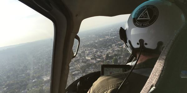
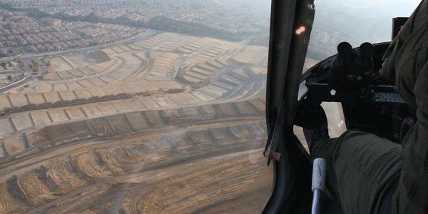
Over the past three years, I’ve gone on multiple flights with the LAPD Air Support Division, during both the day and night; my goal was to understand how police see the city from above.

freeway-webside-web[Image: Freeways and escape routes; Instagrams by BLDGBLOG].

Does the aerial view afford new insights into how distant neighborhoods are connected, for example, or how criminals might attempt to hide—or flee—from police oversight? Where are these other, illicit routes and refuges?

More importantly, are they temporary accidents of criminal behavior and urban geography, or are they much deeper flaws and vulnerabilities hidden in the city’s very design?

above-webgotaltitude-web[Images: Instagrams by BLDGBLOG].

Aerial patrols seems to promise a ubiquitous, and near-omniscient, amplification of police vision, even as the fabric of the city itself is put to alternative use by the activities of criminals.

I documented these flights through hundreds of photographs—many of which can be seen here—as well as in my forthcoming book, A Burglar’s Guide to the City.

However, an excerpt of that book has also been adapted for this weekend’s New York Times Magazine, including a look at Thomas More’s Utopia in the context of the LAPD, the navigational “rules of four,” and a look at the array of technical devices installed aboard each police helicopter.

screen-webdashboard-web[Images: Inside the airship; Instagrams by BLDGBLOG].

The “rules of four,” for example, as I write in the piece, are “guidelines [that] fall somewhere between a rule of thumb and an algorithm, and they allow for nearly instantaneous yet accurate aerial navigation.”

“The way the parcels work in the city of Los Angeles,” [LAPD Chief Tactical Flight Officer Cole Burdette explained to me], “is that Main Street and First Street are the hub of the city.” The street numbers radiate outward — by quadrant, east, west, north, south — with blocks advancing by hundreds (the 3800 block below 38th Street) and building numbers advancing by fours (3804, 3808, 3812, etc.). The rest is arithmetic.
(…)
With the rules of four, an otherwise intimidating and uncontrollable knot of streets takes on newfound clarity. It is no coincidence that the Los Angeles Police Department built its main headquarters at the center of it all, at the intersection of First and Main. It placed the department at the numerological heart of the metropolis, the zero point from which everything else emanates.

What fascinates me through all of this is how the city can be used as a tool of police authority, a seemingly endless crystalline grid of numbers and addresses continually re-scanned from above by helicopter—

binocs-webbinoculars-webshoulder-web[Image: Watchers; photo by BLDGBLOG].

—yet, at the same time, the city can also be manipulated from below, against those same figures of aerial power, becoming an instrument of criminal evasion and spatial camouflage.

matrix-web[Image: Night flight across the grid; Instagram by BLDGBLOG].
The very notion of the “getaway route” is revealing here for what it implies about a city’s secondary use as a means of escape, offering hidden lines of flight from figures of authority.

In the book, I explore this a bit more through, among other things, the work of Grégoire Chamayou, including his research into the history of manhunts and his brief look at the speculative re-design of Paris as a kind of immersive police catalog in which “every move will be recorded.”

subdivision-websuburbs-web[Image: Over Porter Ranch and the San Fernando Valley; photos by BLDGBLOG].

Paris, Chamayou writes, “was to be divided into distinct districts, each receiving a letter, and each being subdivided into smaller sub-districts.”

In each sub-district each street had accordingly to receive a specific name. On each street, each house had to receive a number, engraved on the front house—which was not the case at the time. Each floor of each building was also to have a number engraved on the wall. On each floor, each door should be identified with a letter. Every horse car should also bear a number plate. In short, the whole city was to be reorganized according to the principles of a rationalized addressing system.

In that context, the Air Support Division’s “rules of four” as a police-navigation strategy take on a particularly interesting nuance—as do hypothetical means of resistance to police power through the deliberate complication of local addressing systems.

mapping-webbanking-webpanopticops-web[Images: Moving maps and binoculars over L.A.; Instagrams by BLDGBLOG].

The book excerpt in the Times also briefly picks up on some themes elaborated in an article I wrote for Cabinet Magazine a few years ago, discussing how the infrastructure of Los Angeles itself inadvertently permits certain classes of criminal activity.

turning-web[Image: Night flying; photo by BLDGBLOG].

The most obvious example of this unintended side-effect of transportation planning is the so-called “stop-and-rob.” From The New York Times Magazine:

The construction of the city’s freeway system in the 1960s helped to instigate a later spike in bank-crime activity by offering easy getaways from financial institutions constructed at the confluence of on-ramps and offramps. This is a convenient location for busy commuters—but also for prospective bandits, who can pull off the freeway, rob a bank and get back on the freeway practically before the police have been alerted. The maneuver became so common in the 1990s that the Los Angeles police have a name for it: a “stop-and-rob.”

In any case, the book obviously elaborates on these themes in much greater length—and it comes out next week, so please consider pre-ordering a copy—but The New York Times Magazine excerpt is a great place to start.

points-web[Image: Somewhere over the San Fernando Valley; Instagram by BLDGBLOG].

Meanwhile, if you yourself are planning any illicit activities, as an added bonus the article includes insights from Air Support Division pilots and tactical flight officers on the limitations of their own surveillance techniques, such as how the streets around Los Angeles International Airport have become a popular hiding spot for criminals fleeing police helicopters by car and some especially unlikely tactics used to evade thermal detection by the LAPD’s Forward-Looking Infrared or FLIR cameras.

When in doubt—although this is not mentioned in the article—drive into the fog, where the helicopters can’t follow you.

horizon-web[Image: Urban horizon lines; Instagram by BLDGBLOG].
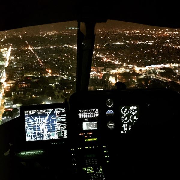
For now, here are a bunch of photos, including many Instagrams, taken from July 2013 to March 2016, including night flights in January 2014 and March 2016—

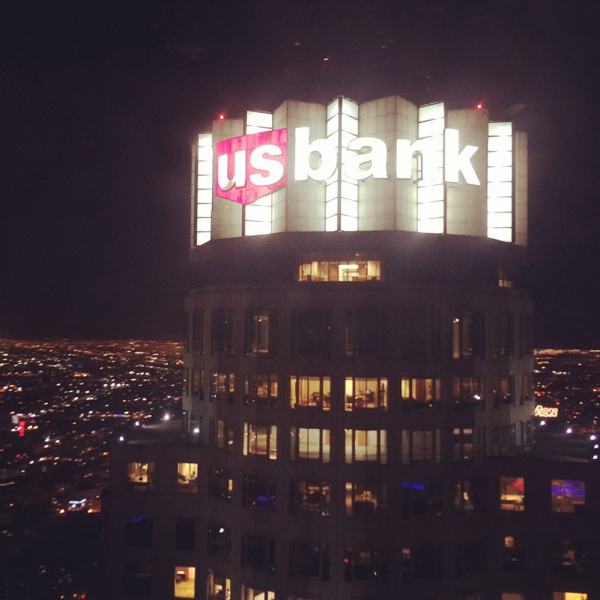
cockpit-webflying-webhollywood-webmorecityhall-webnighflight-webtennis-webbanktower-webusbank-webnickersonnight-webspot-web[Images: Night from above; photos & Instagrams by BLDGBLOG].
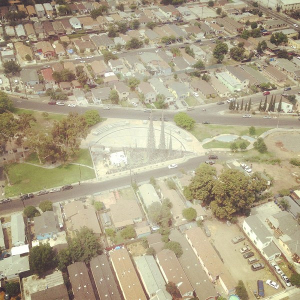
—as well as day and early evening flights taken in July 2013 and March 2016.

nickerson-webwattstowers-webgrid-webplane-web[Images: Note the shot of Watts Towers; Instagrams by BLDGBLOG].

Finally, a chunk of non-Instagram shots, in case those colored filters are making your eyes cross over.

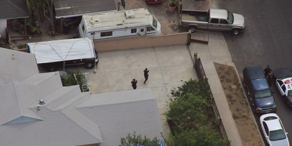
jiujitsu-webcops-webgunsdrawn-webtfo-webLAKings-weblooking-web[Images: Photos by BLDGBLOG, many featuring a home barricade call in Pacoima].

Check out the article—and let me know what you think of the book, once it’s published.

sunset-web[Image: Sunset approaching downtown L.A.; cropped Instagram by BLDGBLOG].

The Dam Industry’s Chernobyl

There’s an alarming new piece up at The New Yorker looking at two potential dam failures, in Iraq and Zambia, and the extraordinary effects these disasters would have. The collapse of Iraq’s Mosul Dam, for example, which the U.S. Army Corps of Engineers calls “the most dangerous dam in the world,” “could drown as many as five hundred thousand people downstream and leave a million homeless.” The collapse of Zambia’s Kariba Dam, meanwhile, and the resulting megaflood would be “the dam industry’s Chernobyl”: “three million people live in the flood’s path; most would die or lose their crops or possessions. About forty per cent of the electricity-generating capacity of twelve southern African nations would be eliminated.” (Spotted via @waltonwater)

Fly, Eagles, Fly

Speaking of animals being actively incorporated into urban infrastructure, Dutch police are training eagles to hunt drones. “What I find fascinating is that birds can hit the drone in such a way that they don’t get injured by the rotors,” explains a spokesperson for the National Audubon Society. “They seem to be whacking the drone right in the center so they don’t get hit; they have incredible visual acuity and they can probably actually see the rotors.”