Tactical Landscaping and Terrain Deformation

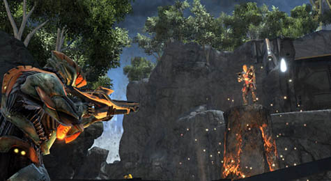
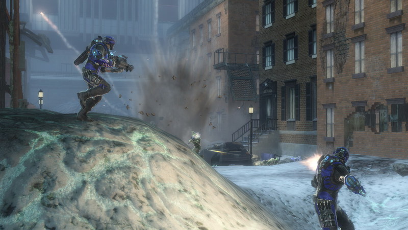
[Image: A screenshot from Fracture by LucasArts. Via Wired].

Over on Wired this weekend I read about a game called Fracture, by LucasArts, which features “terrain deformation” as a central factor in gameplay.

Fracture is “a game centered on the wanton reformation of land masses,” Wired reports; the author then goes on to introduce us to the game’s “terrain deformation mechanics.”

“Every player is equipped with a tool called an Entrencher,” we read. The Entrencher “gives them the ability to raise or lower most surfaces at will,” including the surface of the earth itself:

Gone are the days of studying a level, and simply memorizing sniper positions and the fastest routes. Resourceful players will be digging trenches, raising their own cover and manipulating level elements to fortify their positions… fundamentally altering the way levels are played.

Which means what, exactly?

Can’t find a way across that slime pit? Raise the ground underneath it. You can also terrain-jump by leaping as you raise the ground beneath your feet, launching yourself into the air.

“The rule of thumb,” the article adds, “is that if you can walk on it, you can probably alter it.”

Using weapons like the Tectonic Grenade, you can reshape the planet. Quoting from the official Fracture website:

The ER23-N Tectonic Grenade sets off localized shockwaves when detonated, causing small, concentrated earthquakes that raise the immediate terrain around the point of impact. The weapon is extremely useful for shaping the terrain and providing cover.

There’s also a Spike Grenade. As LucasArts explains, “Tectonic scientists discovered that lava tubes lying dormant deep below the surface of the earth could be stimulated to eject a pyroclastic column.” These columns can “be used as a ‘natural elevator’ of sorts, allowing a soldier to access hard to reach high elevation areas.”

[Image: A screenshot from Fracture, by LucasArts, showing a pyroclastic elevator at work].

There are even Subterranean Torpedoes that burrow into the planet and create landforms on the surface far away.

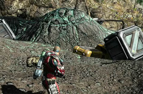
[Image: A screenshot from Fracture by LucasArts].

Of course, the idea that an instantaneous and semi-magmatic reshaping of the earth’s surface might have military implications is an interesting one – and probably not far from technological realization. I’ve written about the weaponization of the earth’s surface before, but Fracture seems to illustrate the concept in a refreshingly accessible way.

However, there are many historical precedents for the idea of politicized terrain creation, and these deserve at least a passing mention here.

I’m thinking, in particular, of David Blackbourn’s recent book The Conquest of Nature: Water, Landscape, and the Making of Modern Germany. The “making” in Blackbourn’s subtitle is meant literally, as the book looks at coastal reshaping, bog- and marsh-draining, and other projects of imperial hydrology; these were the activities through which the territory of Germany itself was physically shaped.

It was terrain deformation: a militarized reshaping of the earth’s surface under orders from Frederick the Great. Frederick sought to transform the lands of northern Germany – then called Prussia – in order to create more space to rule.

In his book, Blackbourn describes what these imperial “hydro-technicians” actually did:

The task of filling in the squares on Frederick’s grids remained. That meant ditching and diking the future fields, constructing sluices, uprooting the old vegetation and planting willows by the new drainage canals, preparing the still heavy, intractable soil, building paths and bridges, houses, farms, and schools, all the while maintaining the new defenses against the water.

These “new defenses” have since been so naturalized that we mistake them for a pre-existing terrain upon which modern Germany was founded – but they were and are constructed landforms, a “brave new world of dikes, ditches, windmills, fields, and meadows.”

These were lands created through military intervention in order to host a particular form of political governance.

In this context, then, Fracture would seem to be simply an accelerated – or what Sanford Kwinter might call an “adrenalated” – version of this tactical landscaping.

[Image: Celestial Impact].

Meanwhile, a commenter over on Wired points out that there are conceptual similarities between Fracture and another game called Celestial Impact.

In Celestial Impact, “the landscape is fully deformable in all directions.”

“Build and dig your way around the landscape in various strategic ways,” we read, ways that are “not limited to destruction”:

[T]he players also have the ability to add terrain to the landscape in the middle of combat using a special tool called Dirtgun. With the Dirtgun, players can add or remove terrain during combat as they see fit, simply by aiming and firing the dirtgun. Depending on the chosen action, this will either add or remove a chunk of dirt from the landscape. So as the teams are battling, the landscape receives vast changes opening up for various tactical approaches each team can use.

When your weapons are set on build-mode, the game’s creators explain, “the Dirtgun adds terrain in the form of a pre-selected shape in front of the player. The shapes could be a simple cube, a part of a bridge or even a defensive wall.”

In many ways, this sounds like a weaponized version of Behrokh Khoshnevis‘s building-printer – subject of one of the earliest posts on BLDGBLOG – here remade as a kind of propulsive instant-concrete mixer retrofit for imperial military campaigns.

As Discover described Khoshnevis’s machine back in 2005, “a robotically controlled nozzle squeezes a ribbon of concrete onto a wooden plank. Every two minutes and 14 seconds, the nozzle completes a circuit, topping the previous ribbon with a fresh one. Thus a five-foot-long wall rises – a wall built without human intervention.”

Now make an accelerated, portable, and fully weaponized version of this thing, put it in a videogame, and you’ve got something a bit like Celestial Impact.

Here are some screenshots.

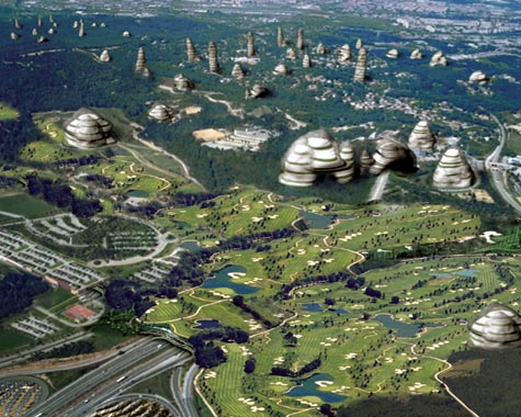
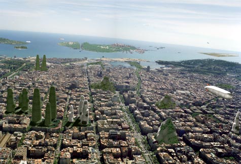
[Image: From The re-naturalization of territory by Vicente Guallart].

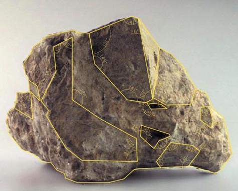
Finally, I couldn’t help but think here of architect Vicente Guallart. Guallart’s work consistently seeks to introduce new geological forms into the built infrastructure of the city – artificial mountains, for instance, and “new topographies” through which a city might expand.

[Image: From The re-naturalization of territory by Vicente Guallart].

I suppose one question here might be: what would a videogame look like as designed by Vicente Guallart? Would it look like Fracture? If Vicente Guallart and Behrokh Khoshnevis teamed up, would they have created Celestial Impact?

But a more interesting, and wide-ranging, question is whether designing videogame environments is not something of a missed opportunity for today’s architecture studios.

After all, how might architects relay complex ideas about space, landscape, and the design of new terrains if they were to stop using academic essays and even project renderings and turn instead to video games?

It seems like you can take your ideas about terrain deformation and instant landscapes and nomadic geology and you can license it to LucasArts, knowing that tens of thousands of people will soon be interacting with your ideas all over the world; or you can just pin some images up on the wall of an architecture class, make no money at all, and be forced to get a job rendering buildings for Frank Gehry.

So would more people understand Rem Koolhaas’s thoughts on cities if he stopped writing 1000-page books and started designing videogames – games set in some strange quasi-Asiatic desert world of Koolhaasian urbanism?

Or do all of these questions simply mistake popularity for engaged comprehension?

The larger issue, though, is whether or not architecture, increasingly popular as a kind of Dubai-inspired freakshow (rotating skyscrapers! solar-powered floating hotels!), is nonetheless not reaching the audience it needs.

[Image: From The re-naturalization of territory by Vicente Guallart].

If architects and architecture writers continue to use outmoded forms of publication, such as $25/copy university-sponsored magazines and huge books purchased by no one but college librarians, then surely they can expect only people currently enrolled in academic programs even to be aware of what they’re talking about, let alone to be enthusiastic about it or appreciative of the implications.

$100 hardcover books do absolutely nothing to increase architecture’s audience.

So what would happen if architects tried videogames?

[Image: The constructed geologies of Vicente Guallart, from How To Make a Mountain].

In any case, terrain deformation, dirtguns set on build-mode, and other forms of militarized landscape creation – these seem like good enough reasons to me to add gaming consoles to a design syllabus near you.

Deep in the basement of an ancient tenement on Second Avenue in the heart of midtown New York City, I was fishing

Last summer, on the extremely short-lived blog Urbablurb – which only managed five posts before dying, yet still remains interesting today – we read about the little-known phenomenon of people fishing in the basements of Manhattan.

[Image: A map of the lost rivers of Manhattan, via Urbablurb].

Urbablurb quotes from The New York Times:

We had a lantern to pierce the cellar darkness and fifteen feet below I clearly saw the stream bubbling and pushing about, five feet wide and upon its either side, dark green mossed rocks. This lively riverlet was revealed to us exactly as it must have appeared to a Manhattan Indian many years ago.
With plum-bob and line, I cast in and found the stream to be over six feet deep. The spray splashed upwards from time to time and standing on the basement floor, I felt its tingling coolness.
One day I was curious enough to try my hand at fishing. I had an old-fashioned dropline and baited a hook with a piece of sperm-candle. I jiggled the hook for about five minutes and then felt a teasing nibble. Deep in the basement of an ancient tenement on Second Avenue in the heart of midtown New York City, I was fishing.

The lost rivers of Manhattan are real; hundreds of streams and whole wetlands were paved over and filled so that the roots of buildings could safely grow. But whether or not you could ever fish in them – and this whole thing sounds like Dr. Seuss to me – is the subject of a post on the also now defunct blog, Empire Zone. There, a commenter informs us that fishing for eyeless carp in the underground cisterns of Istanbul is something of a national past-time.

Alas, we also learn that, as to the question of “whether any carp could be found swimming under Manhattan today,” the answer, sadly, is no.

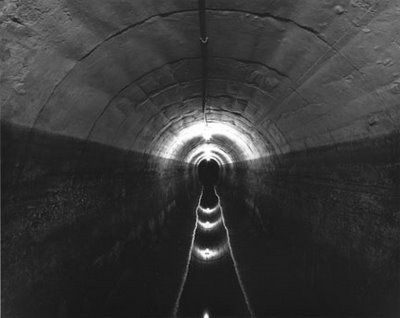
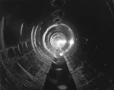
But how much would I love to find myself in New York City for a weekend, perhaps sent there by work to cover a story – when the phone rings in my hotel room. It’s 11pm. I’m tired, but I answer. An old man is on the other end, and he clears his throat and he says: “I think this is something you’d like to see.” I doubt, I delay, I debate with myself – but I soon take a cab, and, as the clock strikes 12am, I’m led down into the basement of a red brick tenement building on E. 13th Street.

I step into a large room, that smells vaguely of water – and six men are sitting around an opening in the floor, holding fishing poles in the darkness.

(Also on Urbablurb: Who is Jack Gasnick?).

N.A.W.A.P.A.

With drought on my mind, it was interesting to come across two new articles in The New York Times today, both about the United States of waterlessness.

The less interesting of the two tells us that “[w]ater levels in the Great Lakes are falling; Lake Ontario, for example, is about seven inches below where it was a year ago” – and, “for every inch of water that the lakes lose, the ships that ferry bulk materials across them must lighten their loads… or risk running aground.”

[Image: The Great Lakes are draining; photo by James Rajotte for The New York Times].

What’s causing this? “Most environmental researchers,” we read, “say that low precipitation, mild winters and high evaporation, due largely to a lack of heavy ice covers to shield cold lake waters from the warmer air above, are depleting the lakes.”

I’m reminded of something Alex Trevi sent me several weeks ago, in which writer and comedian Garrison Keillor speculates as to what might happen if the state of Minnesota sold all the water in Lake Superior.

Keillor describes a fantastical project called Excelsior, in which the Governor of Minnesota “will stand on a platform in Duluth and pull a golden lanyard, opening the gates of the Superior Diversion Canal, a concrete waterway the size of the Suez. Water from Lake Superior will flood into the canal at a rate of 50 billion gal. per hour and go south.”

It will flow into the St. Croix River, to the Mississippi, south to an aqueduct at Keokuk, Iowa, and from there west to the Colorado River and into the Grand Canyon and many other southwestern canyons, filling them up to the rims – enough water to supply the parched Southwest from Los Angeles to Santa Fe for more than 50 years.

The drained landscape left behind will be renamed the Superior Canyon – and the Superior Canyon, Keillor says, will put the Grand Canyon to shame. “It’s bigger, for one thing,” he writes, “plus it has islands and sites of famous shipwrecks. You’ll have a monorail tour of the sites with crumpled hulls of ships. Very respectful.”

By 2006, Keillor speculated (he was writing from the Hootie & the Blowfish-filled year of 1995):

Lake Superior will be gone, and its islands will be wooded buttes rising above the fertile coulees of the basin. A river will run through it, the Riviera River, and great glittering casinos like the Corn Palace, the Voyageur, the Big Kawishiwi, the Tamarack Sands, the Clair de Loon, the Sileaux, the Garage Mahal, the Glacial Sands, the Temple of Denture, the Golden Mukooda will lie across the basin like diamonds in a dish. Family-style casinos, with theme parks and sensational water rides on the rivers cascading over the north rim, plus high-rise hotels and time-share condominiums. Currently there are no building restrictions in Lake Superior; developers will be free to create high-rises in the shape of grain elevators, casinos shaped like casserole dishes, accordions, automatic washers. Celebrities will flock to the canyon. You’ll see guys on the Letterman show who, when Dave asks, “Where you going next month, pal?” will say, “I’ll be in Minnesota, Dave, playing four weeks at the Pokegama.” Tourism will jump 1,000%. Guys on the red-eye from L.A. to New York will look out and see a blaze of light off the left wing and ask the flight attendant, “What’s that?” And she’ll say, “Minnesota, of course.”

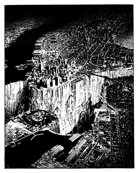
All of which actually reminds of Lebbeus Woods, and his vision of a drained Manhattan.

[Image: Lebbeus Woods, Lower Manhattan; view larger].

But perhaps such a willfully fictive reference overlooks the reality of the drought(s) now creeping up on the United States.

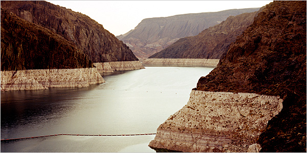
In a massive new article published this weekend in The New York Times, we’re given a long and rather alarming look at the lack of water in the American west, focusing on the decline of the Colorado River.

A catastrophic reduction in the flow of the Colorado River – which mostly consists of snowmelt from the Rocky Mountains – has always served as a kind of thought experiment for water engineers, a risk situation from the outer edge of their practical imaginations. Some 30 million people depend on that water. A greatly reduced river would wreak chaos in seven states: Colorado, Utah, Wyoming, New Mexico, Arizona, Nevada and California. An almost unfathomable legal morass might well result, with farmers suing the federal government; cities suing cities; states suing states; Indian nations suing state officials; and foreign nations (by treaty, Mexico has a small claim on the river) bringing international law to bear on the United States government.

And it will happen; this “unfathomable” situation will someday occur. The American West will run out of water.

[Image: Simon Norfolk, a photographer previously interviewed by BLDGBLOG, taken for The New York Times].

Or will it?

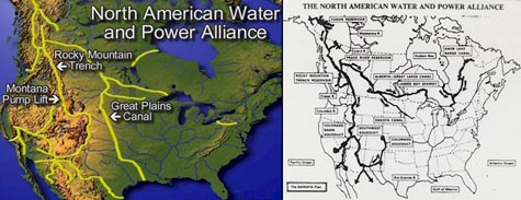
At one point in his genuinely brilliant book Cadillac Desert, Marc Reisner describes something called N.A.W.A.P.A.: the North American Water and Power Alliance. N.A.W.A.P.A. is nothing less than the gonzo hydrological fantasy project of a particular group of U.S. water engineers. N.A.W.A.P.A., Reisner tells us, would “solve at one stroke all the West’s problems with water” – but it would also take “a $6-trillion economy” to pay for it, and “it might require taking Canada by force.”

He quips that British Columbia “is to water what Russia is to land,” and so N.A.W.A.P.A., if realized, would tap those unexploited natural waterways and bring them down south to fill the cups of Uncle Sam. Canadians, we read, “have viewed all of this with a mixture of horror, amusement, and avarice” – but what exactly is “all of this”?

Reisner:

Visualize, then, a series of towering dams in the deep river canyons of British Columbia – dams that are 800, 1,500, even 1,700 feet high. Visualize reservoirs backing up behind them for hundreds of miles – reservoirs among which Lake Mead would be merely regulation-size. Visualize the flow of the Susitna River, the Copper, the Tanana, and the upper Yukon running in reverse, pushed through the Saint Elias Mountains by million-horsepower pumps, then dumped into nature’s second-largest natural reservoir, the Rocky Mountain Trench. Humbled only by the Great Rift Valley of Africa, the trench would serve as the continent’s hydrologic switching yard, storing 400 million acre-feet of water in a reservoir 500 miles long.

And that’s barely half the project!

The project would ultimately make “the Mojave Desert green,” we read, diverting Canada’s fresh water south to the faucets of greater Los Angeles – thus destroying almost every salmon fishery between Anchorage and Vancouver, and even “rais[ing] the level of all five [Great Lakes],” in the process.

After all, N.A.W.A.P.A. also means that the Great Lakes would be connected to the center of the North American continent by something called the Canadian–Great Lakes Waterway.

But N.A.W.A.P.A. is an old plan; it’s been gathering dust since the 1980s. No one now is seriously considering building it. It’s literally history.

But who knows – perhaps 2008 is the year N.A.W.A.P.A. makes a comeback. Or, perhaps, in January 2010, after another dry winter, Los Angeles voters will start to get thirsty. Perhaps some well-positioned Senators, in 2011, might even start making phonecalls north. Perhaps, in 2012, some recent graduates from water management programs at state-funded universities in Illinois or Utah might catch the itch of moral rebellion; they might then start redrawing their personal maps of the continent, going to bed at night with visions of massive dams in their heads, writing position papers for peer-reviewed hydrological engineering magazines.

Perhaps, in 2017, ten years from now, BLDGBLOG – if it’s still around – will even be reporting from the rims of these gigantic structures, thrown up overnight in the remote and untrafficked darkness of riverine western Canada. Long, perfectly calibrated concrete sluices and pumps will bring water thousands of miles south through redwood forests to the open basins of California’s reservoirs, and photographs of their incomprehensibly expensive and exactly poured geometry will elicit whistles of embarrassed awe from readers on the streets of Weehawken.

[Image: A fish-cleaning station in Las Vegas Bay, now abandoned by the West’s sinking waters; taken by Simon Norfolk for The New York Times].

Or perhaps it won’t be N.A.W.A.P.A. after all, but some titanic new project identical in all but name.

Will California wait for the coming drought to destroy it – or will the state take drastic measures?

Drains of Canada: An Interview with Michael Cook

[Image: The Toronto Power Company Tailrace at Niagara; this and all other photos in this post by Michael Cook].

Michael Cook is a writer, photographer, and urban explorer based in Toronto, where he also runs a website called Vanishing Point.
Despite its subject matter, however, Vanishing Point is more than just another website about urban exploration. Cook’s accounts of his journeys into the subterranean civic infrastructure of Canada and northern New York State – and into those regions’ warehouses, factories, and crumbling hospitals – often include plans, elevations, and the odd historical photograph showing the sites under construction.
For instance, his fascinating, inside-out look at the Ontario Generating Station comes with far more than just cool pictures of an abandoned hydroelectric complex behind the water at Niagara Falls, and the detailed narratives he’s produced about the drains of Hamilton and Toronto are well worth reading in full.
As the present interview makes clear, Cook’s interests extend beyond the field of urban exploration to include the ecological consequences of city drainage systems, the literal nature of public space, and the implications of industrial decay for future archaeology – among many other things we barely had time to discuss.
Or, perhaps more accurately phrased, Cook shows that urban exploration has always been about more than just taking pictures of monumentally abstract architectural spaces embedded somewhere in the darkness.

[Image: The Memorial Park Storage Chambers in Toronto’s Belt Line Drain; this is architecture as dreamed of by Adolf Loos: shaved of all ornament, exquisitely smooth, functional – while architecture schools were busy teaching Mies van der Rohe, civil engineers were perfecting the Modern movement beneath their feet].

As he writes on Vanishing Point:

The built environment of the city has always been incomplete, by omission and necessity, and will remain so. Despite the visions of futurists, the work of our planners and cement-layers thankfully remains a fractured and discontinuous whole, an urban field riven with internal margins, pockmarked by decay, underlaid with secret waterways. Stepping outside our prearranged traffic patterns and established destinations, we find a city laced with liminality, with borderlands cutting across its heart and reaching into its sky. We find a thousand vanishing points, each unique, each alive, each pregnant with riches and wonders and time.

This is a website about exploring some of those spaces, about immersing oneself in stormwater sewers and utility tunnels and abandoned industry, about tapping into the worlds that are embedded in our urban environment yet are decidedly removed from the collective experience of civilized life. This is a website about spaces that exist at the boundaries of modern control, as concessions to the landscape, as the debris left by economic transition, as evidence of the transient nature of our place upon this earth.

In the following conversation with BLDGBLOG, Cook discusses how and where these drains are found; what they sound like; the injuries and infections associated with such explorations; myths of secret systems in other cities; and even a few brief tips for getting inside these hyper-functionalist examples of urban infrastructure. We talk about ecology, hydrology, and industrial archaeology; and we come back more than once to the actual architecture of these spaces.
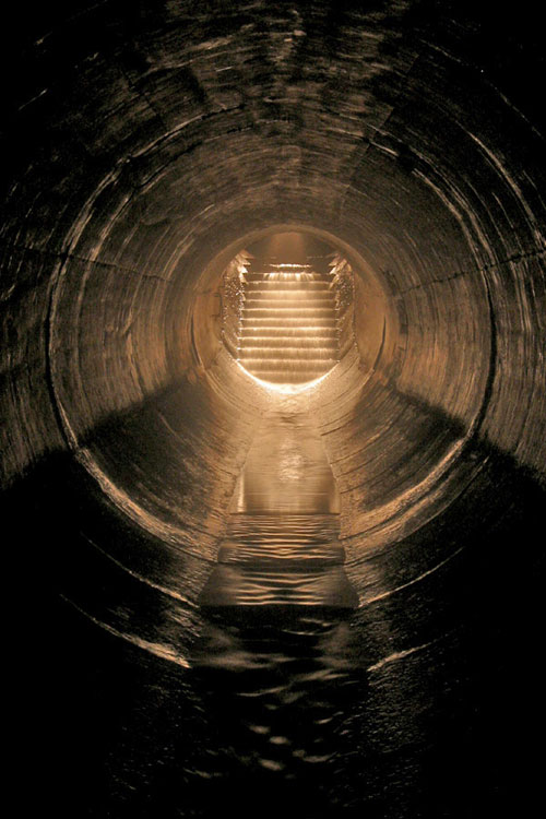
[Image: “Stairs” by Michael Cook, from the Westview Greenbelt Drain].

• • •

BLDGBLOG: Is there any place in particular that you’re exploring right now?

Michael Cook: I am trying to piece together entrance to a drain here in Toronto. It’s part of a larger system. As part of their efforts to improve Toronto’s water quality on the lake front, the city built this big storage tunnel called the Western Beaches Storage Tunnel. It intercepts and stores overflow from a number of combined sewers, as well as from several storm sewers along the western lake front. I guess this was finished in 2001, but they had various technical issues, with the mechanics of it, so it was only operational this past summer.

But there are three storm sewers, I guess, that are part of this system. One of them is on my site already – Pilgrimage – and then there’s a second one that’s large and possibly worth getting into. It’s just not something I’ve investigated thoroughly, so… I’ll probably go down and look for that.

[Images: (top) “Transition to CMP,” from Toronto’s Old Ironsides drain; (middle) “Junction with small sidepipe (falling in on the right)” inside Toronto’s Graphic Equalizer drain; (bottom) “Backwards junction” in Toronto’s Sisters of Mercy drain].

BLDGBLOG: How do you know that the system fits together – that all these storm sewers actually connect up with one another? Are there maps?

Michael Cook: In this case, I have an outfall list that was prepared in the late 80s for portions of Toronto – so I know, from this list, what the size of this storm sewer was at its outfall, before it was intercepted by the new system.

There was also a fair bit of media coverage when the system was being built, because it was a huge expenditure on the part of the city. So we know which combined sewers are part of the system, and I do know where a particular storm sewer is when they intersect – I just don’t necessarily know which residential streets it runs under.

Basically, I have a starting point – and the way I’m going to do this is just go down there on foot and walk around the various residential streets, starting at the lake and moving north. I’ll see if I can find any viable manhole entrances – which involves being by the side of the road or in the sidewalk, where it will be possible to enter and exit safely.

[Image: “Emerging in Wilson Heights,” out of Toronto’s Depths of Salvation drain].

BLDGBLOG: What do you actually bring with you? Do you have some kind of underground exploration kit? Full of Band-Aids and Advil?

Michael Cook: I have a pair of boots or waders, depending on the circumstances. I’ll also bring one or more headlamps, and a spotlamp, and various other lighting gear – plus a camera and a tripod. That basically sums it up.

I also have a manhole key – that’s basically just a loop of aircraft cable tied onto a bolt at one end and run through a piece of aluminum pipe that serves as a crude handle. Most of the manhole lids around here have between two and twenty square holes in them about an inch wide, and they’re reasonably light. Assuming the lid hasn’t been welded or bolted into the collar of the manhole, it’s relatively quick and painless to use this tool to pull the lid out. It’s only useful for light-weight lids, though. In Montreal, for instance, most of the covers are awkward, heavy affairs that sometimes need two people, each with their own crowbar, to dislodge safely. Real utilities workers use pickaxes – but those aren’t so easily carried in the pocket of a backpack.
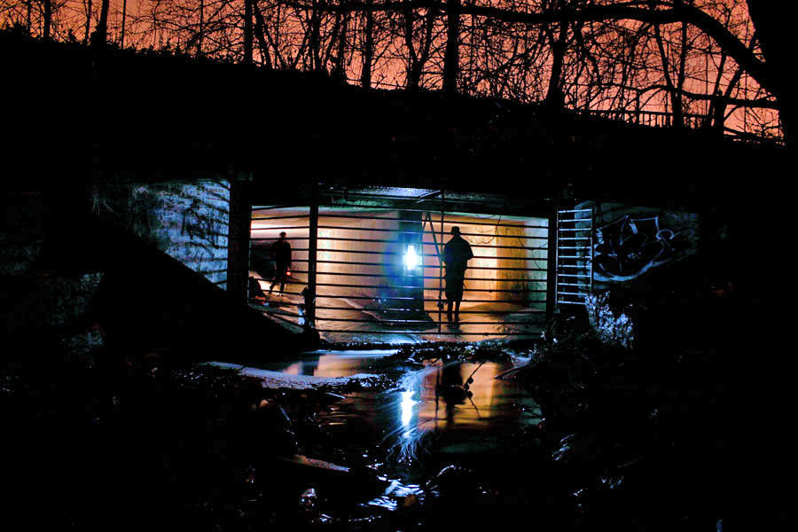
[Image: The outfall of Toronto’s Old Ironsides drain].

BLDGBLOG: Do you ever run into other people down there?

Michael Cook: That’s never happened to me, actually. It’s just not that popular a pursuit, outside of certain hotspots.

People can accept going into an abandoned building: you might run into someone you don’t want to run into there, or you might find that part of the building’s unstable – but it’s still just a building.

Even people I know who self-identify as urban explorers aren’t at all that interested in undergrounding – especially not in storm drains. A lot of them just don’t see the actual interest. It’s not a detail-rich environment. You can walk six kilometers underground through nearly featureless pipe – and there’s not something to see and photograph every five feet.
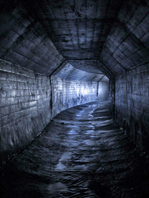
[Image: An “A-shaped conduit” in Toronto’s Belt Line Drain].

BLDGBLOG: Yet a lot – possibly most – of these drains are already named. Who names them, and how do the names get passed around and agreed on by everyone else?

Michael Cook: With people who drain, one of the first things you pick up is a respect for existing names – and the first person to explore a drain has naming rights over it. People generally respect that. Sometimes we’ll make exceptions – I know I’ve made exceptions a few times – but, ultimately, we depend on other people respecting our names.

It’s at once a completely pointless exercise; but, at the same time, it’s fairly meaningful in terms of having a way of discussing this with other people.

So that’s how it comes up. You then use that name, both offline and online. In Australia, they have a kind of master location list, that they keep within Cave Clan, but here we don’t have that level of organization, or that size of a community. It’s just a matter of publishing stuff on our websites.

That said, sometimes we’ll adopt the official name. This usually happens when we’ve been using that name for awhile before we find a way to actually get inside the system, and this usually comes about with something really big or historically significant. We’ll never rename the Western Beaches Storage Tunnel, for instance, though we call it the “Webster,” colloquially. When I find a way into Toronto’s storied Garrison Creek Sewer, the buried remains of our fabled “lost” creek, it won’t be the subject of renaming either. Those are the exceptions though; most of the time naming is one of the things we do to capture and communicate something of the magic of wading for three hours through a watery, feature-poor concrete tunnel underground.

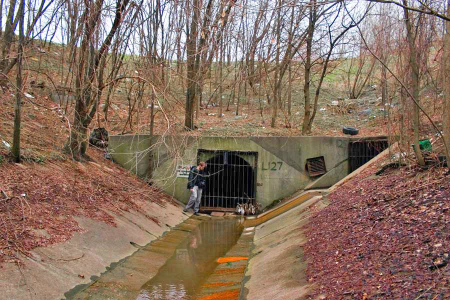
[Image: (top) “Outfall structure in the West Don Valley,” part of Toronto’s Depths of Salvation drain; (bottom) The outfall of Toronto’s Graphic Equalizer drain].

BLDGBLOG: A lot of these places look like surreal, concrete versions of all the streams and rivers that used to flow through the city. The drains are like a manmade replacement, or prosthetic landscape, that’s been installed inside the old one. Does the relationship between these tunnels and the natural waterways that they’ve replaced interest you at all?

Michael Cook: Oh, definitely – ever since I got into this through exploring creeks.

At their root, most drains are just an abstract version of the watershed that existed before the city. It’s sort of this alternate dimension that you pass into, when you step from the aboveground creek, through the inlet, into the drain – especially once you walk out of the reach of daylight.

Even sanitary sewers often follow the paths of existing or former watersheds, because the grade of the land is already ideal for water flow – fast enough, but not so fast that it erodes the pipe prematurely – and because the floodplains are often unsuitable for other uses.
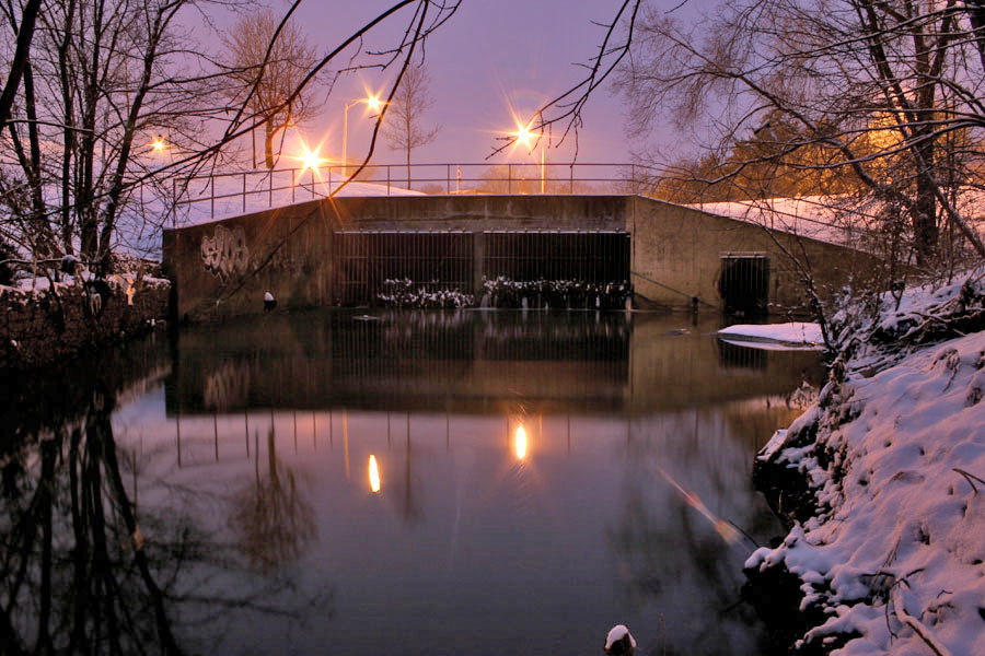
[Image: “Outfall in winter” at Toronto’s Gargantua drain].

BLDGBLOG: How does that affect your attitude toward this, though? Do you find yourself wishing that all these drains could be dismantled, letting the natural landscape return – or, because these sites are so interesting to explore, do you actually wish that there were more of them?

Michael Cook: It’s an awful toll that we’ve taken on the landscape – I’m not one to celebrate all this concrete. If it were conceivable to set it all right, I’d be the first one in line to support that. And the marginal progress being made in terms of environmental engineering – building storm water management alternatives to burial and to large, expensive pipes – is a great step forward; unfortunately, its success so far has been limited.

Ultimately, you just can’t change the fact that we’ve urbanized, and we continue to do so. That comes with a cost that can be managed – but it can’t be eliminated completely.

[Image: Looking out of a spillway at the Ontario Generating Station].

BLDGBLOG: So do you actually have an environmental goal with these photographs? Your explorations are really a form of environmental advocacy?

Michael Cook: Well, I want to find something that goes a bit further than just presenting these photos for their aesthetic value – but, at the same time, turning this into some sort of environmental advocacy platform doesn’t really come to mind, either.

I’m very interested in urban ecology and in the environmental politics that take place in the city – and I’ve done some academic work in that regard – but I’m not really prepared to distill the photography and these adventures into an activist exercise.
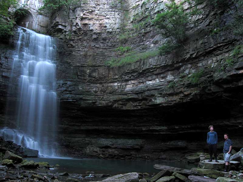
[Image: The “spectacular, formerly natural waterfall that the [Chedoke Falls Drain] now feeds,” in Hamilton, Ontario].

BLDGBLOG: I’m curious if you’ve ever been injured, or even gotten sick, down there. All that old, stagnant air – and the dust, and the germs – can’t be very good for you!

Michael Cook: I can’t say that I’ve ever gotten sick from it. Sometimes, the day after, you can feel almost hung-over – but I don’t know what that is. It could be dust, or it could be from the amount of moisture you breathe in. But it passes. It may even be an allergy I have.

I haven’t really done any exploration of sanitary sewers – that would be a different story. In Minneapolis/St. Paul they actually have a name for the sickness they sometimes come down with after a particularly intense sewer exploration: Rinker’s Revenge. It’s named after the engineer who designed the systems there. And a colleague caught a bout of giardia recently, which he believes he acquired exploring a section of combined sewer in Montreal.

So, obviously, there are disease risks in doing this, though they’re not as extensive as one might want to imagine.

The only serious situation I’ve ever been in, with a high potential for injury – and I was pretty lucky – was while exploring in Niagara. The surge spillways for the Ontario Generating Station used to carry overflow water from the surge tanks, and those were fed by the intake pipes. So the water would overflow from the intake pipes into the surge tanks, and then drain out through these helical spillways that spiral downwards to the bottom of the gorge. They then outfall in front of the plant into the river.

So we made an attempt to ascend both of these spillways, and we were successful in the first one; but the second one, we found, was more difficult toward the latter stages of the climb. We had to turn back just before reaching the surge tanks. On the way back down I lost my footing – I lost all grip on the surface, it was so steep and so slippery, and it was covered in very fine grit – and I ended up sliding all the way down to the bottom, nearly 200 vertical feet. And I was going at a very high speed by the time I reached the bottom.

I was very lucky to come away from that with just a few friction burns and a sprained thumb.
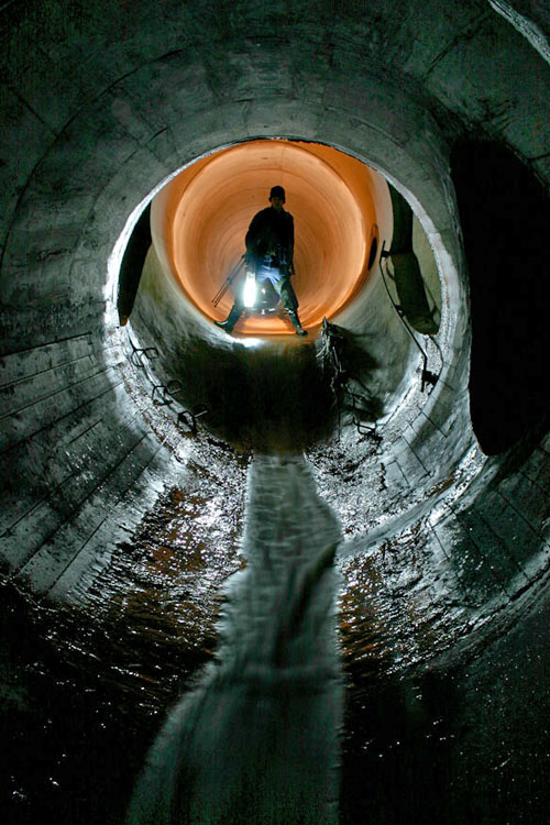
[Images: A “short drop” in Toronto’s beautifully torqued and ovoid Viceroy Drain].

BLDGBLOG: As far as the actual tunnels go, how connected is all this stuff? Is it like a big, underground labyrinth sometimes – or just a bunch of little tunnels that look connected only because of the way that they’ve been photographed?

Michael Cook: Well, most of the drainage systems I’ve been in are pretty linear. You have a main trunk conduit, and then sometimes you’ll get significant side pipes that are worth exploring. But as far as actual maze-quality features go, it’s pretty rare to find systems like that – at least in Ontario and most places in Canada. It requires a very specific geography and a sort of time line of development for the drains.

You might end up with a lot of side overflows and other things, which makes the system more complicated, if the drain has several different places where it overflows into a surface body of water – or if there’s a structure that allows one pipe to flow into another at excess capacity. That sort of thing allows for more complicated systems – but most of the time it doesn’t happen.

You can still spend hours in some of these drains, though, because of how long they are. And sometimes that makes for a fairly uninteresting experience: drains can be pretty featureless for most of their length.
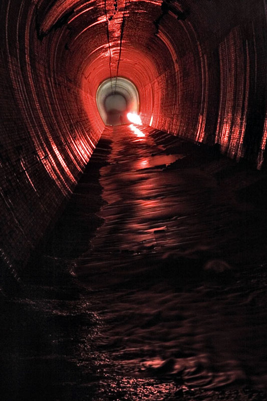
[Images: Four glimpses of the vaulted topologies installed inside the Earth at Niagara’s William Birch Rankine Hydroelectric Tailrace].

BLDGBLOG: Are the drains up there mostly poured concrete, or are they made of brick?

Michael Cook: We have recently opened up our first significant brick sewer in Toronto – The Skin of a Lion – which is built from yellow brick and would probably date to around the turn of the last century. So there are a few locations where you can find brick, but most are concrete.

[Images: (top) Leaving the William Birch Rankine Hydroelectric Tailrace, Niagara Falls; (bottom) Tailrace outlet, William B. Rankine Generating Station].

BLDGBLOG: Does that affect what the drains sound like, as far as echoes and reverb go? What sort of noises do you hear?

Michael Cook: I’d say that every drain is acoustically unique. Each has its own resonance points – and even different sections of the drain will resonate differently, based on where the next curve is, or the next room. It all shifts. I often explore that aspect a bit – probably to the annoyance of some of my colleagues. I’ll make noises, or hum. Even sing.

As far as environmental noises, the biggest thing is that, if there’s a rail line nearby, or a public transit line, you often get that noise coming back through the drain to wherever you are. It’s very frightening when you first hear it, till you figure out what it is – this rushing noise. It’s not a wall of water. [laughs]

But the most common recurring noise is the sound of cars driving over manhole covers – which gives you an idea of which covers you don’t want to exit through. It also helps you keep track of the distance, and where you are – that sort of thing.
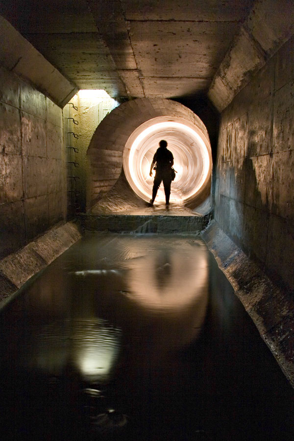
[Image: “Transitions” inside the Duncan’s Got Wood sewer, Toronto].

BLDGBLOG: What kind of legal issues are involved here – like trespassing, or even loitering? Do you have to go out at 2am, dressed like an official city worker, or wear a hood or anything like that?

Michael Cook: For draining, the legal issues are pretty grey. After all, you’re on public property the entire time – so the risk of a serious trespassing fine is a lot lower. There’s no private security company looking out for you, and there’s no private property owner who’s going to be irate if you’re found inside his building. It’s a municipal waterway – it just happens to run underground. A lot of times the outfalls aren’t even posted with notices telling you to stay out.

Now, some people have been given fines for trespassing – for having been inside drains in Ontario – but these have been for pretty minor sums of money. It’s not something that I’ve ever had a problem with – and definitely not something that requires me to go in the middle of the night.

The only thing that really dictates what time you can go is traffic conditions. If you have to use a street-side manhole, you generally don’t want to be doing that doing the day.

[Image: “Deep inside the century-old wheelpit that is the beginning of the Rankine Generating Station Tailrace” (view bigger)].

BLDGBLOG: Within Toronto itself, are you still finding new drains, or is the city pretty much exhausted by now?

Michael Cook: We are still finding new tunnels beneath Toronto, and we’re on the trail of others that we know about but just haven’t discovered access to yet. There are also still a few underground gems in Hamilton that haven’t been seen by anyone except municipal workers and a handful of journalists. These days though, Montreal and Vancouver are emerging hotbeds for new sewer and drainage finds in Canada, thanks to explorers in those cities.

When Siologen came over here he found a whole bunch of new drain systems in Toronto – systems nobody else knew about. He had the time and the inclination to go and scout out a whole lot of stuff that I’d never gotten around to doing.

BLDGBLOG: How’d he do that?

Michael Cook: Basically by riding all the buses. That, and looking at a lot of little creek systems, and searching around for manholes – all of that.

But there are people who happen to read in the paper about some new tunnel project, or whatever, and so they pass that on to people who do this sort of thing. Outside of that, I don’t really know what to say. I guess some people have even found stuff after it’s been featured in skateboarding magazines.

BLDGBLOG: [laughs]

Michael Cook: Some of the largest pipe in the world is used as spillways for hydroelectric projects – big dams and that sort of thing – and usually the first people who find out about this stuff are skateboarders. Usually they try to keep the locations pretty quiet – just as we do. But I’m sure that, at least once or twice, some tunnel explorer has found out about a system through the skateboarding community.
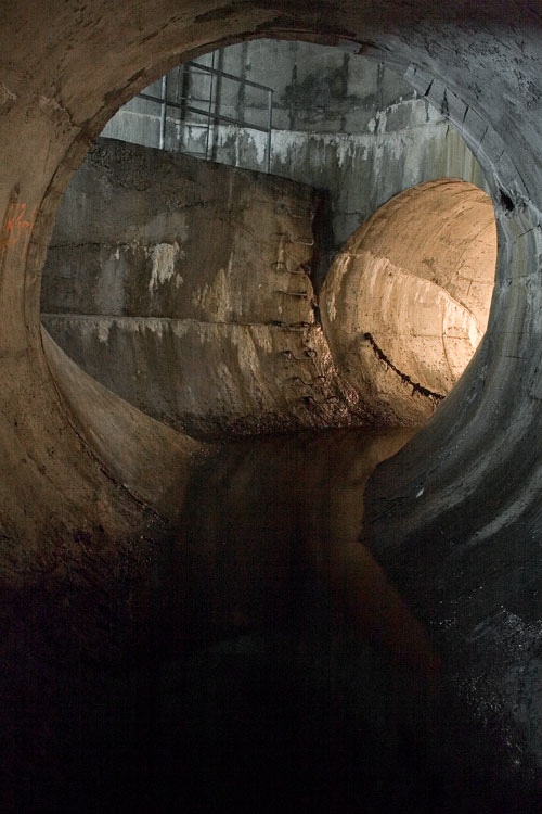
[Image: Ottawa’s Governor General’s Drain].

BLDGBLOG: I’m also curious if there’s some huge, mythic system out there that you’ve heard about but haven’t visited yet, or even just an urban legend about some tunnels that may not actually be real – secret government bunkers in London, for instance.

Michael Cook: I guess the most fabled tunnel system in North America is the one that supposedly runs beneath old Victoria, British Columbia. It’s supposedly connected with Satanic activity or Masonic activity in the city, and there’s been a lot of strange stuff written about that. But no one’s found the great big Satanic system where they make all the sacrifices.

You know, these legends are really… there’s always some sort of fact behind them. How they come about and what sort of meaning they have for the community is what’s really interesting. So while I can poke fun at them, I actually appreciate their value – and, certainly, these sort of things are rumored in a lot of cities, not just Victoria. They’re in the back consciousness of a lot of cities in North America.
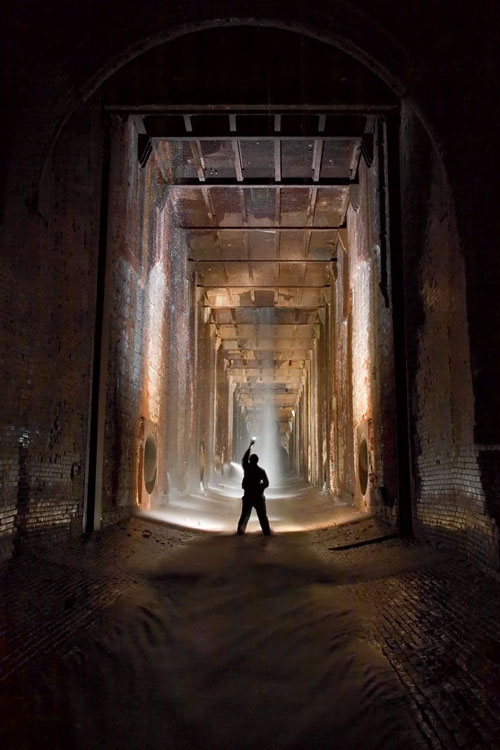
[Image: “Looking into the bottom of the William B. Rankine G.S. wheelpit from the Rankine tailrace“].

BLDGBLOG: Is there some system – a real system – that you’re really dying to explore?

Michael Cook: If I had unlimited funds, I’d really like to make a trip to South America and see some of the underground workings beneath Rio and São Paulo and Montevideo; and I want to go to Africa for a lot reasons but, obviously, it would also be really neat to see what’s built under some of the larger cities in Africa. It’s a place of real cleavages between modern development and the complete impossibility of expanding that development to the entire population. So great sums of money have been wasted on huge highway projects and huge downtown core projects that were completely unnecessary for anything other than creating the semblance of a modern city – but, undoubtedly, there’s subterranean infrastructure connected to all of it.

BLDGBLOG: As well as abandoned pieces of infrastructure just sitting up there on the surface – unused highway overpasses and derelict stadiums and things like that.

Michael Cook: Definitely. And huge mine workings, as well, in certain parts of Africa, that have been shut down.
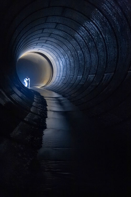
[Image: Inside a distributor tunnel at the Ontario Generating Station drain; meanwhile, I can’t help but imagine what it’d be like if architects began building hotel lobbies like this: you check into your boutique hotel in London – and nearly pass out in awe…].

BLDGBLOG: Meanwhile, urban exploration seems to be getting a lot of media attention these days – this interview included. How do you feel when you see articles in The New York Times about people exploring tunnels and drains?

Michael Cook: The problem I have with general interest reporting is that it almost invariably becomes, you know: look at this, isn’t this weird. Because that’s the easiest way of presenting what we do. It’s not about anything else – it’s entertainment.

So I’ve never really been interested in taking part in articles like that. They happen all the time in various places around the continent. Somewhere, there’s always a reporter who needs to file a story this week, or this month, and so they find an urban exploration site on the internet and they think, hey, that’s a great thing to write about, and then I can fill my quota. It’s not even that what they’re going to write is false or misleading, but it ultimately presents an incomplete and slightly cheapening image of what we do – and, in the end, it doesn’t really accomplish that much.

I think what I’m getting at is that the format of the newspaper article or the television news feature ultimately waters all this down and forces it into a specific block – that, while true of a certain segment of urban exploration, isn’t really representative of the whole. It has the effect of pigeon-holing the whole endeavor in a way.

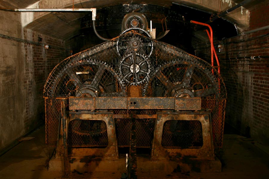
[Images: Disused hydroelectric machinery: top/bottom].

BLDGBLOG: That implies that there’s a way of looking at all this that you think needs more exposure. What parts of urban exploration should the media actually be covering?

Michael Cook: I think, even among explorers, that we don’t pay enough attention to process. I think every piece of infrastructure – every building – is on a trajectory, and you’re experiencing it at just one moment in its very extended life.

We see things, but we don’t often ask how they came about or where they’re going to go from here – whether there will be structural deterioration, or if living things will colonize the structure. We tend to ignore these things, or to see them in temporal isolation. We also don’t give enough time or consideration to how this infrastructure fits into the broader urban fabric, within the history of a city, and where that city’s going, and whose lives have been affected by it and whatever may happen to it in the future. I think these are all stories that really need to start being told.

Which is something I’m starting on. It’s just not something that necessarily comes naturally. It requires a lot of work, and a lot of thought while you’re on-site – which maybe you’re not really inclined to do, because you’re too busy paying attention to the immediate, sublime nature of the experience.

But the basic linear photo gallery really bores me at this point – especially when you’re seeing basically the same photos, just taken inside different buildings. It has no real, lasting value. A lot of people have fallen into that trap, and a lot of people defend that – saying that they’re making art or whatever, or that it’s just for their own personal interest.

BLDGBLOG: So it’s a matter of paying attention both to the site’s history and to how your own documentation of that site will someday be used as history.

Michael Cook: If you decide to take a purely historical approach to it, though, I think the real question is: are these photos of asylum hallways and drainage tunnels ultimately going to be useful to anyone else at some point in the future? And the answer is probably not. Probably we’re photographing the wrong things for that.

Some architect or materials historian is going to be cursing us for photographing some things and not others, or for not taking a close-up of something – or for not writing down any supplementary information at all to help them identify this stuff.

So that historical angle, to justify some of the stuff we’re doing, falls down on further analysis.

[Image: Abandoned cash registers].

BLDGBLOG: It’s like bad archaeology.

Michael Cook: What’s that?

BLDGBLOG: It’s like bad archaeology.

Michael Cook: Yeah, basically. It’s like we’re just digging things up and not paying attention to where they were placed, or what they were next to, or who might have put it there.

Ultimately, we need some sort of framework, and to put more effort into additional information beside just taking a photo. That doesn’t necessarily mean publishing all that information so that everyone can see it – but just telling stories in other ways, and creating narratives about the places and the things that we’re seeing.

Otherwise, these are just postcard shots. We’re taking postcard shots of the sublime.

[Image: Inside The Skin of a Lion, Toronto].

• • •

While we were editing the transcript for publication, Michael wrote:

I got into the storm sewer I mentioned [at the beginning of the interview], shortly after talking to you. It’s now on the site as Sisters of Mercy. Similar to Pilgrimage, it ends in a siphon, rather than a traversable passage into the Western Beaches Storage Tunnel, which I’m still working on finding. We’ve started exploring combined sewers as well here – so that opens up some other options. In the end, the access I found was directly above where the siphon begins, quite close to the lake.

So the explorations continue.
With a big thanks to Michael Cook for having this conversation – and for maintaining such a great website.

[Image: The “Three Musketeers” standing inside Toronto’s Westview Greenbelt Drain; Michael Cook is the one on the right; one of the other two is Siologen].

For a few more images, meanwhile, check out Vanishing Point – in particular, stop by the Daily Underground).

(More underground worlds and urban exploration on BLDGBLOG: Urban Knot Theory, London Topological, Derinkuyu, or: the allure of the underground city, Beneath the Neon, Valvescape, Subterranean bunker-cities, and Tunnels, mines, and the “upwardly migrating void”).
Lake Loss

A lake has disappeared: “Four sinkholes beneath a 285-acre lake in central Florida, and one in a nearby ridge, caused the lake to drain completely earlier this month, flooding two nearby homes and killing wildlife. An engineering firm in Lakeland, where Scott Lake is located, is repairing the damage.”

[Image: Scott Lake, minus Scott Lake. (Via)].

In the process, engineers have concluded that “a permanent plug must be installed in the throat of the sinkhole to stop the water drain. The lake shoreline, parts of which have sunk into the sinkhole, must also be restored. The firm must also determine how to refill the lake.” Good luck!

This, of course, reminds me of Lake Peigneur, Louisiana. There, an oil-drilling crew accidentally punctured the upper dome of a salt mine located directly beneath the lake in which the crew had been stationed:

Texaco, who had ordered the oil probe, was aware of the salt mine’s presence and had planned accordingly; but somewhere a miscalculation had been made, which placed the drill site directly above one of the salt mine’s 80-foot-high, 50-foot-wide upper shafts. As the freshwater poured in through the original 14-inch-wide hole, it quickly dissolved the salt away, making the hole grow bigger by the second. The water pouring into the mine also dissolved the huge salt pillars which supported the ceilings, and the shafts began to collapse… Meanwhile, up on the surface, the tremendous sucking power of the whirlpool was causing violent destruction. It swallowed another nearby drilling platform whole, as well as a barge loading dock, 70 acres of soil from Jefferson Island, trucks, trees, structures, and a parking lot. The sucking force was so strong that it reversed the flow of a 12-mile-long canal which led out to the Gulf of Mexico, and dragged 11 barges from that canal into the swirling vortex, where they disappeared into the flooded mines below.

Perhaps now the mines will become a scuba-diving park…

Walking over a valve chamber outside the Brooklyn Academy of Music

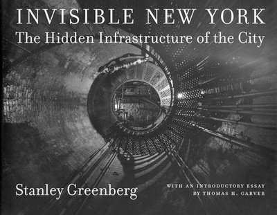
Whilst BLDGBLOG was out exploring the underside of Manhattan, from the island’s faucets to its outer city aqueducts, an email came through from Stanley Greenberg, photographic author of both Invisible New York: The Hidden Infrastructure of the City and Waterworks: A Photographic Journey through New York’s Hidden Water System.

He’s a fascinating guy.

“I started photographing the city’s infrastructure in 1992,” he explained, “after working in NYC government in the 1980s. A few things led me to the project. I felt that the water system was being taken for granted, partially because the government is so secretive about it. Places that were built as parks and destinations were now off-limits to everyone – especially after 9/11. I’m concerned that so many public spaces are being withdrawn from our society.”

The secrecy that now surrounds New York’s aquatic infrastructure, however, is “really just an acceleration of a trend,” Greenberg continued. “City Tunnel No. 3, the new water tunnel, has been under construction since 1970, and its entryways are: 1) well hidden, and 2) built to withstand nuclear weapons. While there were always parts of the system that were open to the public, there were other parts that became harder and harder to see. But even worse, I think, is the idea that we don’t even deserve to know about the system in ways that are important to us. It’s that much easier to privatize the system (as Giuliani tried to do). The Parks Department here just signed a contract with a private developer to turn part of Randall’s Island into a water park, which will not only take away public space, and probably be an environmental disaster, but will also institute an entrance fee for something that was free before. We don’t know how well our infrastructure is being taken care of and we’re not allowed to know, because of ‘national security.’ So how do we know if we’re spending too little money to take care of it?”

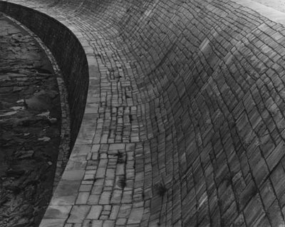
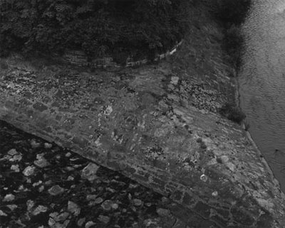
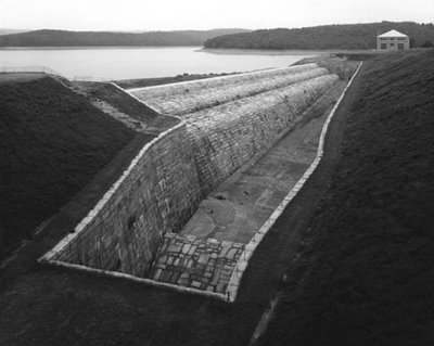
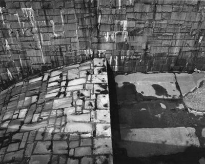
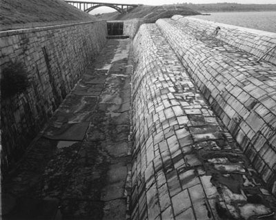
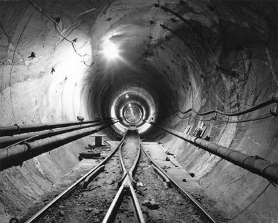
Greenberg’s photographic attraction is understandable. In his work, the New York City water supply reveals itself as a constellation of negative spaces: trapezoidal culverts, spillways, tunnels – cuts through the earth. His subject, in a sense, is terrain that is no longer there.

As Greenberg writes: “The water system today is an extraordinary web of places – beautiful landscapes, mysterious structures, and sites where the natural meets the man-made in enigmatic ways.”

These excavations, drained of their water, would form a networked monument to pure volume, inscribed into the bedrock of Hudson Valley.

“While the work is not meant to be a comprehensive record of the system,” Greenberg explained over email, “it is meant to make people think about this organism that stretches 1000 feet underground and 200 miles away. I did a lot of research, and spent some time helping to resurrect the Water Department’s archives, which had been neglected for 50 years, so I knew the system pretty well before I started. It got to the point where I could sense a water system structure without actually knowing what it was. My friends are probably tired of my telling them when they’re walking over a valve chamber, or over the place where City Tunnels 1, 2, and now 3 cross each other (near the Brooklyn Academy of Music), or some other obscure part of the system.”

Such tales of hidden topology, of course, do not risk boring BLDGBLOG. One imagines, in fact, a slight resonance to the ground, Manhattan’s sidewalks – or Brooklyn’s – very subtly trembling with echo to those who know what lies below. As if the water system could even have been built, say, as a subterranean extension to the Brooklyn Academy of Music, a strange and amazing instrument drilled through rock, trumpeting with air pressure – a Symphony for the Hudson Valves, Bach’s Cantatas played through imperceptible reverberations of concrete and clay?

“I did all my photographs with permission,” Greenberg continues. “For one thing, it’s hard to sneak around with a 4×5 camera. For another, many of the places are extremely secure. I went back and forth over several years, sometimes being allowed in, other times being a pariah (and a threat to national security, according to the city, since I knew too much about the system). For some reason in 1998 I was given almost total access. I guess they realized I wasn’t going to give up, or that they would fare better if I were the one taking the pictures. I finished taking pictures in spring 2001. After 9/11, I’m sure I would have had little access – and in fact the city tried to stop me from publishing the book. I contacted curators, museum directors and some well-known lawyers; all offered their support. So when I told the city I would not back down, they gave up trying to stop me, and we went to press.”

You can buy the book here; and you can read about Stanley Greenberg’s work all over the place, including here, here, and here (with photographic examples), and even on artnet.

Meanwhile, Greenberg has a show, open till 20 May, 2006, at the Candace Dwan Gallery, NYC. There, you’ll see Greenberg’s more recent photographs of “contemporary architecture under construction. Included in the show are photographs of works by Norman Foster, Frank Gehry, Zaha Hadid, Steven Holl, Daniel Libeskind, Yoshio Taniguchi, Winka Dubbeldam, and Bernard Tschumi.”

Earlier: Faucets of Manhattan and London Topological.

Faucets of Manhattan

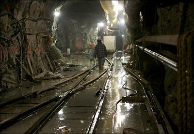
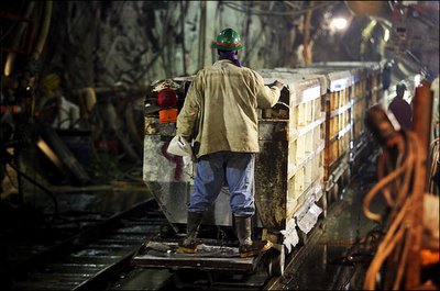
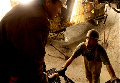
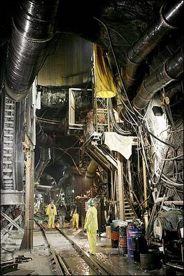
“About 600 feet deep in the bedrock that supports Midtown Manhattan,” we meet “a 450-ton tunnel-boring machine known as the Mole.”
The Mole is “digging City Tunnel No. 3 far beneath Manhattan’s street level, part of a 50-year, $6 billion project to upgrade New York City’s water system.”

[Image: By Ozier Muhammad for The New York Times].

As the New York Times describes, this is actually the “second phase of City Tunnel No. 3, a 60-mile tunnel that began in the Bronx in 1970 and is scheduled for completion in 2020. By then, the tunnel will be able to handle the roughly one billion gallons of water a day used in New York City that originates from rural watersheds to points throughout the city.” And though the tunnel “is one of the largest urban projects in history, few people will ever see it. But beginning next week, many New Yorkers will certainly feel and hear the construction.”

[Images: By Ozier Muhammad for The New York Times].

The speed of the excavation process “varies based upon the hardness of the rock it encounters. The task of determining what type of rock lies in its path falls to Eric Jordan, a geologist hired by the city. By drilling down and hand-picking rocks from the tunnels, Mr. Jordan has created a precise map of the type of rock under Manhattan. His involvement in the tunnel project makes his geologist friends jealous. ‘For a geologist,’ he said, ‘this is like going to Disneyland.'”
Jordan’s “precise map” of Manhattan bedrock would indeed be something to see; but until then, we can make an educated guess about the rock his tunnel will find by turning to Richard Fortey.
In his highly recommended book, Earth, Fortey visits Central Park. First you notice the skyline of towers, he writes. “Then you notice the rocks. Cropping out in places under the trees are dark mounds of rock, emerging from the ground like some buried architecture of a former race, partly exhumed and then forgotten… That New York can be built so high and mighty is a consequence of its secure foundations on ancient rocks. It pays its dues to the geology. This is just a small part of one of those old seams that cross the earth… relics of a deeper time when millennia counted for nothing.”

[Image: By Ozier Muhammad for The New York Times].

John McPhee picks up this lithic line of thought in Annals of the Former World. Archipelago New York, he writes, is made of “rock that had once been heated near the point of melting, had recrystallized, had been heated again, had recrystallized, and, while not particularly competent, was more than adequate to hold up those buildings… Four hundred and fifty million years in age, it was called Manhattan Schist.”
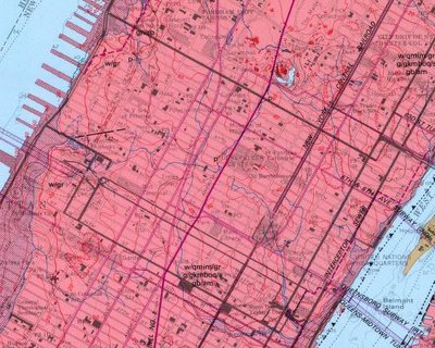
Of course, we can also turn to the U.S. National Geologic Map Database, and find our very own bedrock maps –


– which, awesomely, include Times Square, Carnegie Hall, Rockefeller Center, and the Museum of Modern Art, all floating above a sea of solid Manhattan Schist.
In any case, the new tunnel being dug to power the faucets of Manhattan are supplements to the pharaonic, 19th-century Croton hydrological network that keeps New York in taps (including the now derelict, yet Historically Registered, Old Croton Aqueduct). You can read about the Croton Dam, for instance, here or here; and there’s yet more to learn about the Croton project, including how to follow it by trail, here.

[Image: Photograph by Robert Polidori, from “City of Water” by David Grann, The New Yorker, September 1, 2003].
Finally, in 2003 The New Yorker published an excellent article by David Grann called “City of Water,” about, yes, City Tunnel No. 3. I’ll quote from it here briefly before urging you to find a copy at your local library and read it for yourself.
Until Grann actually accompanied the tunnel workers – called sandhogs – underground, he “had only heard tales of New York City’s invisible empire, an elaborate maze of tunnels that goes as deep as the Chrysler Building is high. Under construction in one form or another for more than a century, the system of waterways and pipelines spans thousands of miles and comprises nineteen reservoirs and three lakes. Two main tunnels provide New York City with most of the 1.3 billion gallons of water it consumes each day, ninety per cent of which is pumped in from reservoirs upstate by the sheer force of gravity. Descending through aqueducts from as high as fourteen hundred feet above sea level, the water gathers speed, racing down to a thousand feet below sea level when it reaches the pipes beneath the city.”
Two main tunnels, he writes – and, thus, City Tunnel No. 3.
But I’ll stop there – after I point out that toward the end of the ludicrously bad Die Hard III, Jeremy Irons temporarily escapes the less than threatening eye of Bruce Willis by driving out of Manhattan through similar such aqueducting tunnels.

(For more tunnels: See BLDGBLOG’s London Topological or The Great Man-Made River; then check out The Guardian on London’s so-called CTRL Project, with a quick visit to that city’s cranky old 19th-century sewers, the “capital’s bowels”… Enjoy!).

San Francisco Bay Hydrological Model

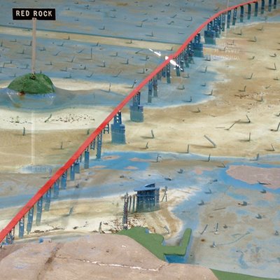
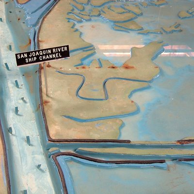
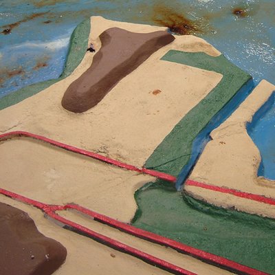
In Sausalito, CA, near a 7-11, one finds the San Francisco Bay Hydrological Model.


The Bay Model was built in 1957 by the Army Corps of Engineers; it is “over 1.5 acres in size and represents an area from the Pacific Ocean to Sacramento and Stockton, including: the San Francisco, San Pablo and Suisun Bays and a portion of the Sacramento-San Joaquin Delta.” Which means it’s larger than two American football fields. (I think).


The Model served “as a scientific research tool from 1958-2000 to evaluate circulation and flow characteristics of the water within the estuary system,” allowing Army Engineers “to simulate currents, tidal action, sediment movement and the mixing of fresh and salt water. Pollution, salt-water intrusion, barrier and fill studies were a few of the important research projects that have been undertaken at the Bay Model.”
It’s not in the greatest condition, and the faded primary color scheme leaves something to be desired, but the model is no less fascinating for that; any chance you get to walk the shores of a microcosm is a good chance to do some thinking.


If I may briefly quote William Blake

To see a world in a grain of sand
And a heaven in a wild flower
Hold infinity in the palm of your hand
And eternity in an hour

– I’ll then point out that the Bay Model exists within its own timezone: in the world of the Model, one day passes every 14.9 minutes. 30 full days elapse every 7.2 hours. Complete tidal cycles run 3.8 minutes. You can practically feel yourself aging in the presence of this copyscape, its wetlands and alluvial braids of artificial rivers running through fields of pumps and power cords.
Look closely and you’ll see a “Tide Hut” where little gods of the Model enact catastrophe and unleash floods upon the surrogate world spread out before them. Look closer, and you’ll see damage from a “hundred years of waves, subsidence, and boat wakes” – which, in Model time, is almost exactly one human year.


But I soon got to thinking about the politics of architectural models. Imagine what would happen, for instance, if some Navy SEALS raided a cave in Afghanistan and found the Bay Model sitting there: what on earth does al-Qaeda want with San Francisco’s water supply? FOX News screams. Or a model of Greater London’s Thames hydrology, complete with flood gates, Barriers and overflow sewers, which is one thing if it’s in the possession of Tony Blair, and quite another if found in the basement of, say, Abu Hamza or even Timothy McVeigh.
What were they trying to do with it?
It’s the politics of architectural models: an object of scientific curiosity in one person’s hands is an issue of national security in another’s.
Or: simulacra as a threat to national security.
A plot for a new Philip K. Dick novel, or a film by Charlie Kauffman, then came to mind: a man, perhaps a young Al Pacino, breaks into the Bay Model in the middle of the night. He barricades himself inside, turns on the power, and starts flooding the model, demolishing bridges, rerouting estuarial confluences. He jumps up and down, causing modelquakes, and then accelerates the tides, obliterating Golden Gate Park under the force of a single wave.
He calls all the local newspapers and takes responsibility for the disasters now befalling San Francisco outside; but what disasters? they ask, and he thinks they’re conning him, denying his rage, because he’s read William Blake and St. Thomas Aquinas and he believes that everything he throws at that simulacrum there before him will have effects in the real world…
Because it’s all building up to one moment, see, the big moment when he decides to flood the Bay Model’s model of the Bay Model, opening up a rift in the universe and blasting him head-first through the macrocosm.
Until the police break-in…

(Thanks to Chad for the tip, and to Nicola for coming with me!)

The Great Man-Made River

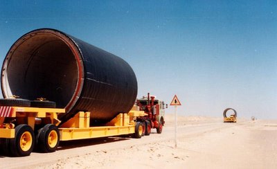
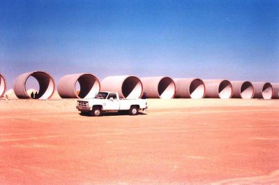
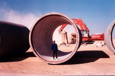
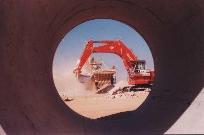
Libya’s Great Man-Made River is “an enormous, long-term undertaking to supply the country’s needs by drawing water from aquifers beneath the Sahara and conveying it along a network of huge underground pipes.”

[Images: The concrete skeleton of Libya’s future river, the “8th wonder of the world,” being trucked into place; photographed by Jaap Berk].

Not only does Libya bear the distinction of holding the world record for hottest recorded temperature (136º F), but most of the country’s terrain is “agriculturally useless desert” that receives little or no rainfall. The Great Man-Made River may not even successfully irrigate Libya’s governmentally-specified agricultural zones, but due to the region’s complete “absence of permanent rivers or streams” – and because the country’s “approximately twenty perennial lakes are brackish or salty” – the River’s expected 50-100 year lifespan is at least a start.

Indeed, Libya’s “limited water is considered of sufficient importance to warrant the existence of the Secretariat of Dams and Water Resources, and damaging a source of water can be penalized by a heavy fine or imprisonment.” George Orwell would perhaps call this watercrime.

However, I have to say that the prospect of spelunking through the Great Man-Made River’s subterranean galleries in 125 years, once those tunnels have dried-up, makes the brain reel. Imagine Shelleys of the 22nd century wandering through those ruins, notebooks in hand, taking photographs, footsteps echoing rhythmically beneath the dunes as they walk for a thousand kilometers toward the sea…

Yet some are skeptical of the project’s real purpose. Precisely because the Great Man-Made River consists of “a stupendous network of underground tunnels and caverns built with the help of Western firms to run the length and width of the country,” some consultants and engineers “have revealed their suspicion that such facilities were not meant to move water, but rather to conceal the movement and location of military-related activities.” The fact that water is flowing through some of the pipes, in other words, is just an elaborate ruse…

In any case, the Great Man-Made River Authority – “entrusted with the implementation and operation of the world’s largest pre-stressed concrete pipe project” – is already seeing some results.

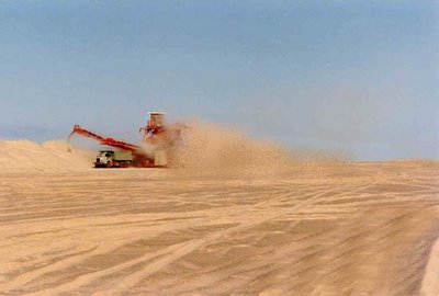
The network will criss-cross most of the country –

– and Phase III is under construction even as this post goes online.

Meanwhile, for more information on deep desert hydrology see UNESCO’s International Hydrological Programme or even Wikipedia.

Of course, you could also turn to J.G. Ballard, whose twenty year-old novel The Day of Creation is: 1) not very good, and 2) about a man who is “seized by the vision of a third Nile whose warm tributaries covered the entire Sahara.” That river will thus “make the Sahara bloom.” The book was modestly reviewed by Samuel Delany, if you want to know more.

On the other hand, I would actually recommend Dune – assuming you like science fiction.

[Image: A new river is born, excavated from the surface of the desert: soon the pipes will be installed and the currents will start to flow…].

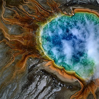
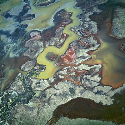
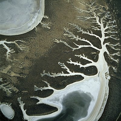
Silt

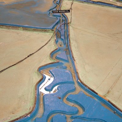
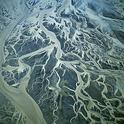
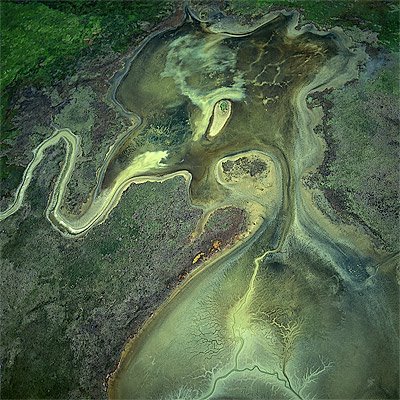
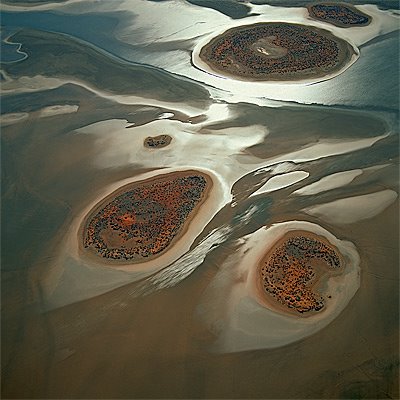
The surface of the planet renews itself through geothermal hydrology, sulfuric lakes, new continents of silt –


– as natural acids scour shapes in slow terrains.

These are all photographs by Bernhard Edmaier, whose work can be found on his own website


– and in the beautiful (if unfortunately named) Earthsong.

Meanwhile – though I repeat myself – these bring to mind J.G. Ballard’s novel The Drowned World, with its vision of a flooded, neo-tropical Europe, London become a backed-up toilet full of silt and Jurassic vegetation, “a nightmare world of competing organic forms returning rapidly to their Paleozoic past.”

Huge iguanas laze around in the heat. Buildings left and right are collapsing, their lower six floors immersed in polluted seawater, “miasmic vegetation… crowding from rooftop to rooftop.”

The city is fossilizing.

As Ballard writes: “A few fortified cities defied the rising water-levels and the encroaching jungles, building elaborate sea-walls around their perimeters, but one by one these were breached. Only within the former Arctic and Antarctic Circles was life tolerable.”

So the story goes that a research biologist is touring this neo-tropical London, boating from hotel to hotel across fetid lagoons, recording the types of plants that infest the city. Meanwhile monsoons are coming up from the south, everyone is dying of skin cancer and no one can sleep. The intensity of the sun’s radiation is making everything mutate.

In between some eyebrow-raising moments of ridiculous, pop-Nietzschean pseudo-philosophy – the surviving humans find themselves psychologically regressing down the totem pole of evolution toward… something or other; it’s all very psychedelic and 2001 – there are some cool descriptions of these new urban tropics:

“Giant groves of gymnosperms stretched in dense clumps along the rooftops of the submerged buildings, smothering the white rectangular outlines… Narrow creeks, the canopies overhead turning them into green-lit tunnels, wound away from the larger lagoons, eventually joining the six hundred-yard-wide channels which broadened outwards toward the former suburbs of the city. Everywhere the silt encroached, shoring itself in huge banks against a railway viaduct or crescent of offices, oozing through a submerged arcade… Many of the smaller lakes were now filled in by the silt, yellow discs of fungus-covered sludge from which a profuse tangle of competing plant forms emerged, walled gardens in an insane Eden.”

In any case, one could easily imagine Bernhard Edmaier’s photographs here bearing much in common with Ballard’s new alluvial world of fresh earth, architecture reduced to deltas of sand. Old eroded reefs of brickwork. Lagoons of pollution.


Erosion and hydrology, the most powerful urban forces on earth.

tropical.bldg

“Tropical Green” runs 9-10 February 2006, down in sunny Miami: “The two-day Tropical Green conference will be an invaluable experience for architects, interior designers, developers, city planners, politicians, and voters in search of learning the ways of 21st century design that will both help the environment and their wallets.” Check it out.

It’s funny, meanwhile, but I’m reading The Drowned World by J.G. Ballard, even as I post this, and his descriptions – written in 1962 – of a flooded, neo-tropical London have totally changed my conception of what “a tropical city” actually is.

In Ballard’s novel the sun has developed a kind of astrophysical Tourette’s Syndrome, and it’s started scorching the planet with radiation storms and UV bursts. This has melted the icecaps, raised the ambient global temperature to 120º+ and forced everyone to move to northern Canada and Siberia.

London has become a kind of backed-up toilet of silt and Jurassic vegetation, “a nightmare world of competing organic forms returning rapidly to their Paleozoic past.” Huge iguanas lumber around in the heat. Buildings left and right are collapsing, their lower six floors immersed in polluted seawater, “miasmic vegetation… crowding from rooftop to rooftop.”

The city is fossilizing.

As Ballard writes: “A few fortified cities defied the rising water-levels and the encroaching jungles, building elaborate sea-walls around their perimeters, but one by one these were breached. Only within the former Arctic and Antarctic Circles was life tolerable.”

[Image: The Drowned World‘s rather unimpressive cover…].

So the story goes that a research biologist is touring this neo-tropical London, boating from hotel to hotel across fetid lagoons, recording the types of plants that infest the city. Meanwhile monsoons are coming up from the south, everyone is dying of skin cancer and no one can sleep. The intensity of the sun’s radiation is making everything mutate.

In between some eyebrow-raising moments of bad pop-Nietzschean pseudo-philosophy – the surviving humans find themselves psychologically regressing down the totem pole of evolution toward… something or other; it’s all very psychedelic and 2001 – there are some cool descriptions of these new urban tropics:

“Giant groves of gymnosperms stretched in dense clumps along the rooftops of the submerged buildings, smothering the white rectangular outlines… Narrow creeks, the canopies overhead turning them into green-lit tunnels, wound away from the larger lagoons, eventually joining the six hundred-yard-wide channels which broadened outwards toward the former suburbs of the city. Everywhere the silt encroached, shoring itself in huge banks against a railway viaduct or crescent of offices, oozing through a submerged arcade… Many of the smaller lakes were now filled in by the silt, yellow discs of fungus-covered sludge from which a profuse tangle of competing plant forms emerged, walled gardens in an insane Eden.

Anyway, one could analyze the metaphors and all that – Ballard uses the word “competing” twice in the examples above (is he projecting a neo-Hobbesean vision onto Nature…? etc.) – but one could also find something better to do.

And, of course, one could also attend the sustainable design for tropical cities conference in Miami – and tell them you heard about it on BLDGBLOG…