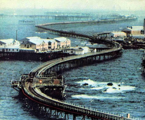
The Bay Line

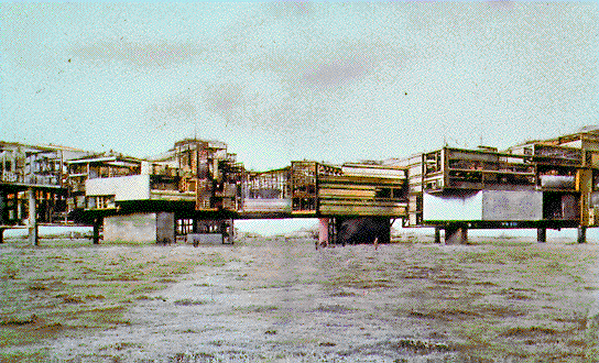
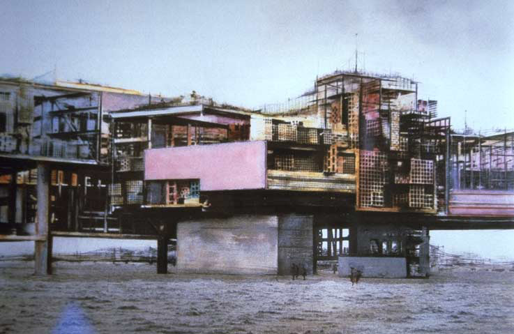
[Image: The Bay Line by Ronald Rael and Virginia San Fratello; modular additions can be seen bolted on from below. Read the project PDF].

Combining Rails to Trails, William Gibson’s Virtual Light, and the same repurposed-preservation strategies behind New York’s High Line, Bay Area architects Ronald Rael and Virginia San Fratello have called for stabilizing the disused – and soon to be entirely dismantled – portion of the Bay Bridge. They would then turn it into a pedestrianized urban park and outdoor sports attraction.

[Image: The Bay Bridge and its replacement; on the right is the piece that Rael San Fratello would like to see stabilized. Image via Wikipedia].

And if it works for the Bay Bridge, they suggest, it could work for other disused bridges elsewhere.

“This proposal seeks to repurpose abandoned and closed bridges as sites of potential for parks, cultural centers and housing,” the architects write in the project’s accompanying PDF. In the process, they hope “to demonstrate the potential for re-purposing historic American bridge infrastructure as possible sites for sustainable urban housing and linear parks.”

The immense load capacity of rail bridges allows for the support of program beyond that of parks, suggesting the urbanization of bridges. While the current economic climate suggests a surplus of housing, the economic reality also suggests a push towards urbanization and often the “affordable” housing constructed in suburban environments, which encroaches on the rural, is not what is needed. Instead, by using abandoned bridges in urban areas, we are creating opportunities for sustainable low-cost housing within the urban realm—creating the potential for creative speculation among housing developers by expounding upon the nascent potential of a layered housing-park-bridge typology.

While, on one level, this simply side-steps the immense financial implications associated with structurally maintaining these bridges, and, on another level, it bears an unfortunate resemblance to Boris Johnson’s recent – if not necessarily well-received – call for an inhabitable bridge across the Thames, it does also kick-start a conversation about what we might be able to do with the massive pieces of civic infrastructure that dot the U.S. and are currently scheduled for replacement and demolition.

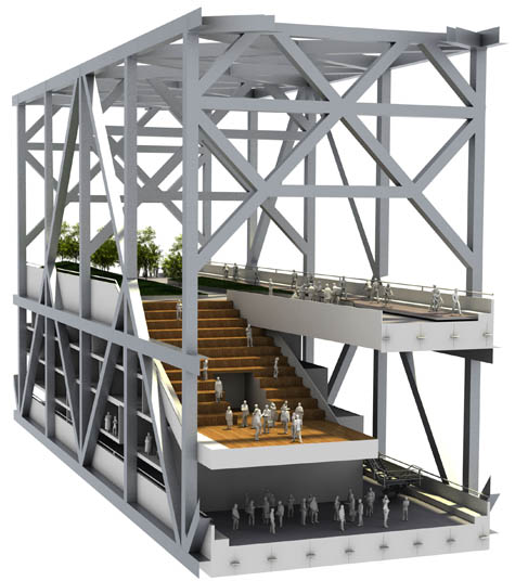
[Images: (top) Tennis court, bicycle path, and observation module; (middle) Outdoor auditorium; (bottom) swimming pool on the Bay Line by Ronald Rael and Virginia San Fratello].

And, I have to admit, it would simply be cool:

Imagine housing, recreational and cultural facilities connected to a continuous, lushly planted, green strip, floating above the water—an aerial garden, as the city’s newest park through which you could walk and wander and enjoy the most spectacular views of the bay.

Of course, critics like James Howard Kunstler might suggest that reusing rail infrastructure – or, in this case, highway infrastructure – as anything other than a rejuvenated national rail service is “decadence at its purest,” it is surely just as decadent to watch as functional pieces of infrastructure rot on all sides, as you sit there with your arms crossed, waiting for the nation’s taxpayers to agree with your views on reuse.
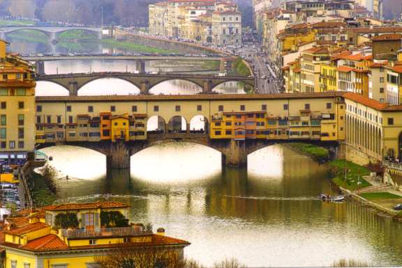
[Images: Other habitable bridge: (top) Florence’s Ponte Vecchio; (second) a painting by Peter Jackson of “Old London Bridge“; (third and bottom) Constant’s New Babylon].

In any case, as someone who literally never enjoyed driving across the Bay Bridge for seismic-safety reasons, I have to point out that this proposal still comes with its own set of earthquake-related issues. I was interested, however, to read in the Economist just this week that “there are few safe places to ride out an earthquake. Surprisingly, though, a recently constructed bridge is often one of them.”

Engineers have become good at designing bridges that are earthquake-resistant enough to preserve the lives of those caught crossing when a quake strikes. The problem is that the bridge is often unusable afterwards.

Nonetheless, if you had put millions of dollars’ worth of landscape and housing onto a bridge that was then left abandoned and “unusable” after an earthquake, it would be a very foolhardy investment, indeed.

[Image: Final render of the Bay Line by Ronald Rael and Virginia San Fratello].

But what of bridges in non-seismic zones? In Sydney, for instance, due to the peninsular nature of walks along Cremorne Point and through Kirribilli, there are places where the Sydney Harbor Bridge appears not to be crossing over water at all, but standing over the rooftops of the city, anchored into the neighborhood. It looks more like a new kind of inland megastructure, strung above the streets and restaurants, like something designed by Perdido Street Station-era China Miéville, than a harbor bridge. An industrial cathedral of exposed ribs and steel tension lines, arcing up into the skyline.

So what if you hung houses from it? What amazing typologies of bolt-on architectural prosthetics could we create, if bridges were aerial foundations and they carried not cars or locomotives but schools and piazzas?

In fact, I’m reminded of this unexpectedly inspiring – structurally speaking – proposal by Skidmore, Owings & Merrill, which sought to string the suspension cables of a new pedestrian bridge from inside the nearby buildings of a rebuilt Leamouth Peninsula (click through to their image gallery for more).

[Image: A proposal for London’s Leamouth Peninsula by Skidmore, Owings & Merrill].

Returning to Rael San Fratello‘s Bay Line, though, there are obviously still huge issues associated with the unusually catastrophic nature of structural failure when it comes to inhabitable bridges, as well as the financially prohibitive needs of regular maintenance, but treating suspension bridges simply as another type of district in the city is an undeniably interesting urban idea.

(Via Streetsblog SF and Ronald Rael. Meanwhile, Rael’s recently published book Earth Architecture is an excellent and thoughtful survey of earthen structures across the world and throughout building history; Rael’s old school blog, megablog, is also worth a read for its eye-popping and often literally world-altering architectural ambitions).

Extreme agricultural statuary

[Image: “Endothelium” by Philip Beesley & Hayley Isaacs].

I mentioned a recent issue of Mark Magazine the other day, but I deliberately saved one of the articles for a stand-alone post later on. That article was a long profile of the work of Philip Beesley, a Toronto-based architect and sculptor, whose project the “Implant Matrix” BLDGBLOG covered several years ago.

In issue #21 of Mark, author Terri Peters describes several of Beesley’s projects, but it’s the “Endothelium” that really stood out (and that you see pictured here).

[Image: “Endothelium” by Philip Beesley & Hayley Isaacs].

Peters refers to Beesley’s work as a “lightweight landscape of moving, licking, breathing and swallowing geotextile mesh” – a kind of pornography of ornament, or the Baroque by way of David Cronenberg. “Inspired by coral reefs,” she continues, “with their cycles of opening, clamping, filtering and digesting,” Beesley’s biomechanical sculpture-spaces are “immersive theatre environments” in which “wheezing air pumps create an environment with no clear beginning or end.”

I’m reminded of the penultimate scene in James Cameron’s film Aliens, when Ripley (Sigourney Weaver) meets the alien “queen.” The queen is laying eggs, we see, through a gigantic, semi-prosthetic, peristaltically-powered external ovarian sac – and the scene exemplifies the encounter with the grotesque in all its H.R. Giger-influenced, sci-fi extremes. Put another way, if organisms, too – not just buildings – can reach a point of ornamental excess, then James Cameron’s aliens are perhaps exhibit number one.

[Images: Screen grabs from James Cameron’s Aliens].

In any case, Beesley’s work is a fascinating hybrid of advanced textile design, geostructural modeling, and rogue biology experiment. Peters’s descriptions of the “Endothelium” are worth quoting at length:

[The structure consists of] a field of organic “bladders” that are self-powered and that move very slowly, self-burrowing, self-fertilizing and are linked by 3D printed joints and thin bamboo scaffolding. The bladders are powered using mobile phone vibrators and have LED lights. It works by using tiny gel packs of yeast which burst and fertilize the geotextile.

This latter detail – “using tiny gel packs of yeast which burst and fertilize the geotextile” – brings to mind something at the intersection of an improvised explosive device (or IED) and a green roof: you hire Philip Beesley to design a landscape-machine for installation atop a new building downtown, and, over the course of many decades, it vibrates, yeast-bursts, rotates, crawls, and grows through extraordinary cycles of grotesque architectural fertility. A solar-powered landscape of mold and microroots, generating its own soil. Within a few years, the original sculpture it all came from is gone, archaeologically undetectable beneath the vitality of the forms that have consumed it.

One wonders what Philip Beesley would think of the mushroom tunnel of Mittagong.

[Images: “Endothelium” by Philip Beesley & Hayley Isaacs].

Elsewhere in the article, Peters writes:

Endothelium is an automated geotextile, a lightweight and sculptural field housing arrays of organic batteries within a lattice system that might reinforce new growth. It uses a dense series of thin “whiskers” and burrowing leg mechanisms to support low-power miniature lights, pulsing and shifting in slight increments. Within this distributed matrix, microbial growth is fostered by enriched seed-patches housed within nest-like forms, sheltered beneath the main lattice units.

I’m a bit rhetorically stuck on “between” statements, I’m afraid, but it’s as if Beesley’s work falls somewhere between a loaf of sourdough bread and a sculpture by Jean Tinguely.

[Image: “Endothelium” by Philip Beesley & Hayley Isaacs].

I’m curious, meanwhile, if you could bury a Philip Beesley sculpture in the woods of rural England somewhere, and allowed it to articulate new ecosystems slowly, over the cyclic course of generations. In fact, I’m reminded of an article in the New York Times last week, spotted via mammoth, in which we learn that two abandoned landfills in Brooklyn have since been used as unlikely foundations for new ecosystems:

In a $200 million project, the city’s Department of Environmental Protection covered the Fountain Avenue Landfill and the neighboring Pennsylvania Avenue Landfill with a layer of plastic, then put down clean soil and planted 33,000 trees and shrubs at the two sites. The result is 400 acres of nature preserve, restoring native habitats that disappeared from New York City long ago.

“Once the plants take hold,” the article adds, “nature will be allowed to take its course, evolving the land into microclimates.” But what if those weren’t landfills down there but sculptures by Philip Beesley? Strategically sown seed-patches and gel packs of yeast wait underground for new roots to rediscover them.

It’s living geostatuary, buried beneath the surface of the earth – a kind of extreme agriculture, with soil-preparation by Philip Beesley.

[Images: “Endothelium” by Philip Beesley & Hayley Isaacs].

I’d genuinely like to see what Beesley might do if he was hired by, say, a NASA R&D program dedicated to terraforming other planets. Could you fly a modular, self-unfolding Philip Beesley sculpture into the depths of radiative space, land it on a planet somewhere, and watch as revolting pools of bacteriological mucus begin to coagulate and form new fungi?

Beesley’s whiskered vibrators begin to shiver with signs of piezoelectric life, as small crystals surrounded by radio transmitters and genetically engineerined space-seed-patches imperceptibly tremble, evolving into mutation-prone “organic batteries” unprotected beneath starlight. Give it a thousand years, and vast infected forests, the width of continents, take hold.

You’ve colonized a distant planet through architecture and yeast.

For more, check out Mark Magazine‘s issue #21. Beesley’s also got a book out, called Hylozoic Soil, that I would love to read.

Light Graphs in the Andes

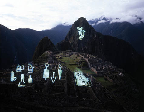
[Image: From “Imprints on the Andes” by Studio Orta].

While writing a post earlier this week about an exhibition in Paris, called Uninhabitable? Art of Extreme Environments, I stumbled upon this project by Lucy and Jorge Orta, aka Studio Orta.

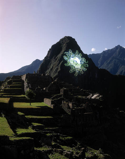
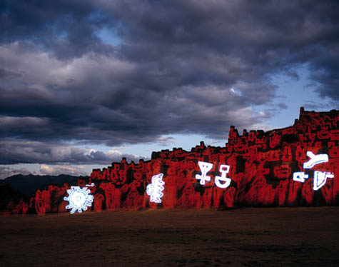
Performed fourteen years ago, “Imprints on the Andes” used “PAE light cannons,” which “enable[d] gigantic mobile images to be projected up to 1km in distance.” The artists thus projected massive hieroglyphic shapes onto the ruins of Macchu Picchu and on the mountainsides beyond.

In fact, the cannons are strong enough to be seen in broad daylight.

[Image: From “Imprints on the Andes” by Studio Orta].

The effect is quite amazing, especially if one were to encounter these things without foreknowledge of what they were or that they’d be there.

You hike over a remote rise in the mountainous deserts of Utah – and there, ahead, moving ever so slightly, is a strange shape, like an enemy ship from Space Invaders, a shining path of alien signs hovering on the geologies all around you.

[Images: From “Imprints on the Andes” by Studio Orta].

Unfortunately, the effect is not quite as exciting when used on buildings.

Gonzo Green

[Image: Preflooded Wetlands by Liam Young and Darryl Chen].
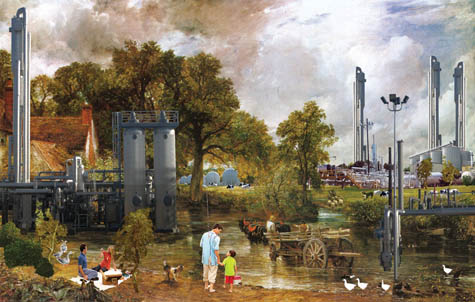
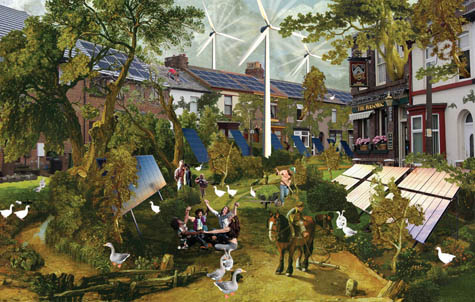
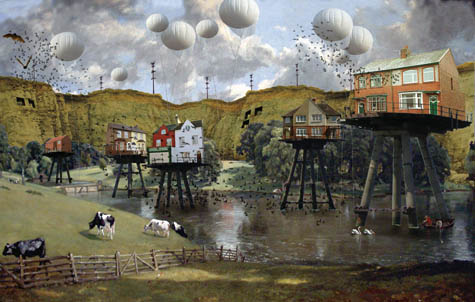
Unexpectedly apropos of the previous post, Liam Young of Tomorrow’s Thoughts Today, together with Darryl Chen, has created a series of quite beautiful images called “Postcards from a Green Future” – one of which, seen above, uses the Maunsell Sea Forts as a gantried foundation for suburban anti-flood design in an idyllic southeast England.

The entire suite of images is almost farcically green – it’s sustainability redone as Grand Guignol. These speculative scenes of “a green future” show us an over-the-top, solar-powered utopia of detached single-family houses and wind turbines, woven together with light rail and renewable energy technologies; it’s an Eden of sprawl spreading out into London’s most distant scattered cityscape.

[Image: Waste and Biogas and Permacultural Hinterland by Liam Young and Darryl Chen].
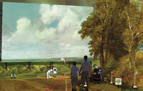
But the images also betray an interest in the murky borders between the synthetic and the geological, the organic and the mass-produced. What if those verdant fields of green out there are actually cloned and genetically-modified? What if that well-trimmed nature is simply an exhibition on display?

[Image: Primordial Garden Sanctuary and Incarceration Tower by Liam Young and Darryl Chen].

You can read about the entire project in new four-part series of blog posts over at Tomorrow’s Thoughts Today – just go to the righthand column (“Slow Thoughts”) and keep scrolling down…

Maunsell Towers

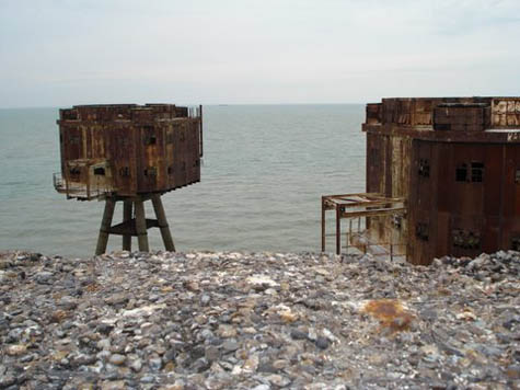
[Image: The Maunsell Sea Forts, photographed by Pete Speller, courtesy of Nick Sowers].
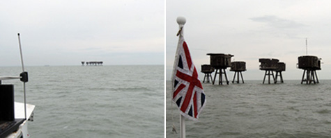
I missed an amazing opportunity the other week to visit the Maunsell Towers – aka the Maunsell Sea Forts – with Nick Sowers, author of an excellent Archinect school blog and one of my students from this summer’s studio down on Cockatoo Island in Sydney.

For the last year or so, Nick has been traveling around the world on a much-deserved John K. Branner Fellowship, documenting army bases, abandoned bunkers, and other sites of historical military interest. From South Korea to the Maginot Line, from classical war zones and medieval walled cities to “bunker recycling services” and D-Day, Nick’s itinerary is breath-taking. It is also, I hope, intriguing enough to catch the eye of future publishers or gallerists who might want to give Nick the space in which to break down all that he’s seen; there are very many of us who would love to learn more.

Of course, we could also hear more about his trip: Nick is acoustically-inclined, and he has been documenting the sounds of these militarized landscapes over on another blog he runs, called Soundscrapers.

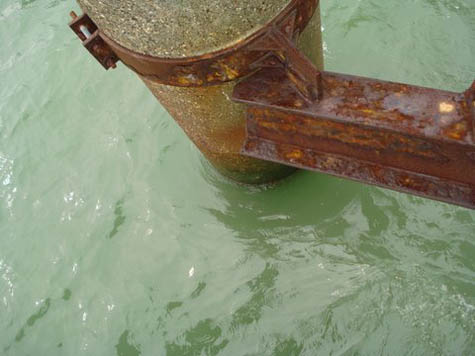
[Images: Photos by Nick Sowers].

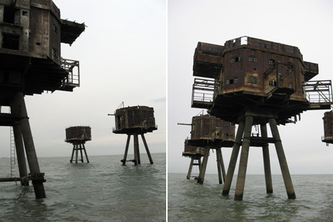
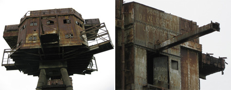
So Nick and his wife were in England the other week, and we unfortunately missed meeting up – but they managed to take a boat tour out to the Maunsell Sea Forts, iconic architectural structures in the Thames Estuary, inspirations for Archigram, and one of the few real-life buildings (if you can call them that) that gave me the idea to start BLDGBLOG. In fact, I’ve mentioned these places in lectures and I’ve posted about them on the blog before – but I’ve never had a chance to visit.

Nick’s photos, presented here, alongside photos by Pete Speller, will tell the story instead.

[Images: Photos by Nick Sowers].

As Underground Kent explains, “The Thames Estuary Army Forts were constructed in 1942 to a design by Guy Maunsell.”

Their purpose was to provide anti-aircraft fire within the Thames Estuary area. Each fort consisted of a group of seven towers with a walkway connecting them all to the central control tower. The fort, when viewed as a whole, comprised one Bofors tower, a control tower, four gun towers and a searchlight tower. They were arranged in a very specific way, with the control tower at the centre, the Bofors and gun towers arranged in a semi-circular fashion around it and the searchlight tower positioned further away, but still linked directly to the control tower via a walkway. All the forts followed this plan and, in order of grounding, were called the Nore Army Fort, the Red Sands Army Fort and finally the Shivering Sands Army Fort. All three forts were in place by late 1943, but Nore is no longer standing. Construction of the towers was relatively quick, and they were easily floated out to sea and grounded in water no more than 30m (100ft) deep.

They thus entered into the imaginations of speculative architects everywhere; they helped give visual shape to Archigram’s Walking City; and they continue to offer a kind of real-life spatial analogue for Constant’s New Babylon for anyone with access to a boat.

[Image: The Maunsell Sea Forts, photographed by Pete Speller, courtesy of Nick Sowers].

Nick explained in an email that he visited the structures with Tony Pine, a “sound engineer” – i.e. pirate radio operator – who spent the afternoon “telling stories of the days in the 60s when Archigram came out to visit the structures, and also about incredibly cold winters when they burned the wood-fibre linings of the tower interiors to stay warm.”

Also along for the ride was Robin Adcroft, director of Project Redsand, who “describes himself as the caretaker of the structures.” Adcroft points out the genealogical importance of these structures:

The Thames Sea Forts are the last in a long history of British Marine Defences. The Army Anti Aircraft forts have played a significant role in post World War 2 developments. Notably in offshore fuel exploration and drilling platforms. The successful rapid deployment of the Maunsell Forts soon after led to the construction of the first offshore oil platform in the Gulf of Mexico in the late 1940s.

Both conceptually and materially, the Maunsell Towers have an architectural legacy that seems oddly under-explored.

[Images: Inside the forts; photos by Pete Speller, courtesy of Nick Sowers].

But “it’s interesting,” Nick adds: “no one actually owns these things.”

Apparently the transport authority wanted to give Project Redsand a deed but they declined it, not wanting the liability. A ship crashed into Shivering Sand (an outpost which is visible from Redsand) in the 60s, taking out one of the towers and killing two maintenance personnel. Red Sand is not actually in the shipping lane, but it is very much a hazard. The original 1/4 inch plate steel is rusting through to a paper thickness. We had to wear hardhats when the boat pulled in next to the structures.

Project Redsand has more information about efforts to preserve the forts – and they link to this short YouTube video in which you can see how these clustered towers might be stabilized and maintained for generations to come.

[Images: Photos by Pete Speller, courtesy of Nick Sowers].
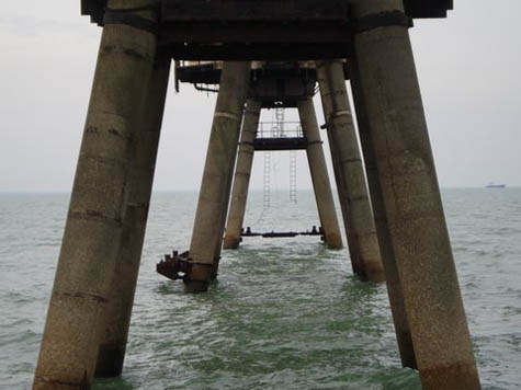
Meanwhile, be sure to follow Nick Sowers’s slowly-ending travels around the militarized world on his Archinect blog – and he can also be found on Twitter.

The Mushroom Tunnel of Mittagong

[Image: Shiitake logs on racks in the Mittagong mushroom tunnel. All photos by the author].

Note: This is a guest post by Nicola Twilley.

As Geoff mentioned here on BLDGBLOG a few weeks ago, we spent our last full day in Australia touring the Li-Sun Exotic Mushroom Farm with its founder and owner, Dr. Noel Arrold. Three weeks earlier, at a Sydney farmers’ market, we had been buying handfuls of his delicious Shimeji and Chestnut mushrooms to make a risotto, when the vendor told us that they’d all been grown in a disused railway tunnel southwest of the city, in Mittagong.

[Image: The mushroom tunnel, on the left, was originally built in 1886 to house a single-track railway line. By 1919, it had to be replaced with the still-functioning double-track tunnel to its right, built to cope with the rise in traffic on the route following the founding of Canberra, Australia’s purpose-built capital city. The tunnel is still state property: the mushroom farm exists on a five-year lease].
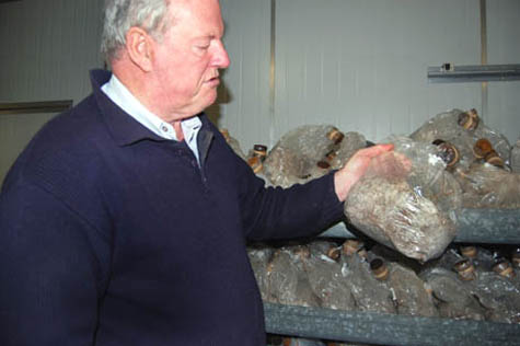
The idea of re-purposing abandoned civic infrastructure as a site for myco-agriculture was intriguing, to say the least, so we were thrilled when Dr. Arrold kindly agreed to take the time to give us a tour (Li-Sun is not usually open to the public).

Dr. Arrold has been growing mushrooms in the Mittagong tunnel for more than twenty years, starting with ordinary soil-based white button mushrooms and Cremini, before switching to focus on higher maintenance (and more profitable) exotics such as Shimeji, Wood-ear, Shiitake, and Oyster mushrooms.

[Images: (top) Dr. Arrold with a bag of mushroom spawn. He keeps his mushroom cultures in test-tubes filled with boiled potato and agar, and initially incubates the spawn on rye or wheat grains in clear plastic bags sealed with sponge anti-mould filters before transferring it to jars, black bin bags, or plastic-wrapped logs; (middle) Shimeji and (bottom) pink oyster mushrooms cropping on racks inside the tunnel. Dr. Arrold came up with the simple but clever idea of growing mushrooms in black bin bags with holes cut in them. Previously, mushrooms were typically grown inside clear plastic bags. The equal exposure to light meant that the mushrooms fruited all over, which made it harder to harvest without missing some].

A microbiologist by training, Dr. Arrold originally imported his exotic mushroom cultures into Australia from their traditional homes in China, Japan, and Korea. Like a latter-day Tradescant, he regularly travels abroad to keep up with mushroom growing techniques, share his own innovations (such as the black plastic grow-bags shown above), and collect new strains.

He showed us a recent acquisition, which he hunted down after coming across it in his dinner in a café in Fuzhou, and which he is currently trialling as a potential candidate for cultivation in the tunnel. Even though all his mushroom strains were originally imported from overseas (disappointingly, given its ecological uniqueness, Australia has no exciting mushroom types of its own), Dr. Arrold has refined each variety over generations to suit the conditions in this particular tunnel.

Since there is currently only one other disused railway tunnel used for mushroom growing in the whole of Australia, his mushrooms have evolved to fit an extremely specialised environmental niche: they are species designed for architecture.

[Images: (top) Logs on racks (Taiwanese style) and mounted on the wall (Chinese style) in the tunnel; (bottom) Wood-ear mushrooms grow through diagonal slashes in plastic bags filled with chopped wheat straw].

The tunnel for which these mushrooms have been so carefully developed is 650 metres long and about 30 metres deep. Buried under solid rock and deprived of the New South Wales sunshine, the temperature holds at a steady 15º Celsius. The fluorescent lights flick on at 5:30 a.m. every day, switching off again exactly 12 hours later. The humidity level fluctuates seasonally, and would reach an unacceptable aridity in the winter if Dr. Arrold didn’t wet the floors and run a fogger during the coldest months.

In all other respects, the tunnel is an unnaturally accurate concrete and brick approximation of the prevailing conditions in the mushroom-friendly deep valleys and foggy forests of Fujian province. This inadvertent industrial replicant ecosystem made me think of Swiss architecture firm Fabric‘s 2008 proposal for a “Tower of Atmospheric Relations” (pdf).

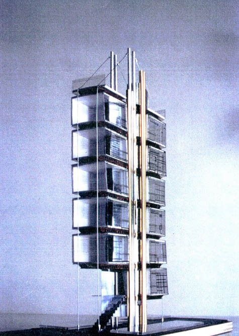
[Image: Renderings of Fabric’s “Tower of Atmospheric Relations,” showing the stacked volumes of air and the resulting climate simulations].

Fabric’s ingenious project is designed to generate a varying set of artificial climates (such as the muggy heat of the Indian monsoon, or the crisp air of a New England autumn day) entirely through the movements of the air that is trapped inside the tower’s architecture (i.e. by means of convection, condensation, thermal inertia, and so on).

If you could perhaps combine this kind of atmosphere-modifying architecture with today’s omnipresent vertical farm proposals, northern city dwellers could simultaneously avoid food miles and continue to enjoy bananas.

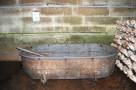
[Images: (top) Li-Sun employees unwrap mushroom logs before putting them on racks in the tunnel. The logs are made by mixing steamed bran or wheat, sawdust from thirty-year-old eucalyptus, and lime in a concrete mixer, packing it into plastic cylinders, and inoculating them with spawn. (middle) Fruiting Shiitake logs on racks in the tunnel. Once their mushrooms are harvested, the logs make great firewood. (bottom) The Shiitake log shock tank – Dr. Arrold explained that the logs crop after one week in the tunnel, and then sit dormant for three weeks, until they are “woken up” with a quick soak in a tub of water, after which they are productive for three or four more weeks. “Shiitake,” said Dr. Arrold, in a resigned tone, “are the most trouble – and the biggest market.”]

Outside of the tunnel, Dr. Arrold also grows Enoki, King Brown, and Chestnut mushrooms. These varieties prefer different temperatures (6º, 17º, and 18º Celsius respectively), so they are housed in climate-controlled Portakabins.

[Images: (top) The paper cone around the top of the enoki jar helps the mushrooms grow tall and thin. (second) Chestnut mushrooms grow in jars for seven weeks: four to fruit, and three more to sprout to harvest size above the jar’s rim. (third) Thousands of mushroom jars are stacked from floor to ceiling. Dr. Arrold starting growing these mushroom varieties in jars two years ago, and hasn’t had a holiday since. (fourth) Empty mushroom jars are sterilised in the autoclave between crops, so that disease doesn’t build up. (bottom) The clean jars are filled with sterilised substrate using a Japanese-designed machine, before being inoculated with spawn].

The fact that the King Brown and Chestnut mushrooms only thrive at a higher temperature than the railway tunnel provides makes their cultivation much more expensive. Their ecosystem has to be replicated mechanically, rather than occuring spontaneously within disused infrastructure.

I couldn’t help but wonder whether there might be another tunnel, cave, or even abandoned bunker in New South Wales that currently maintains a steady 17º Celsius and is just waiting to be colonised by King Brown mushrooms growing, like ghostly thumbs, out of thousands of glass jars.

[Image: Temperature map of the London Underground system (via the BBC, where a larger version is also available), compiled by Transport for London’s “Cool the Tube” team].

In the UK, for instance, Transport for London has kindly provided this fascinating map of summertime temperatures on various tube lines. Most are far too hot for mushroom growing (not to mention commuter comfort). Nonetheless, perhaps the estimated £1.56 billion cost of installing air-conditioning on the surface lines could be partially recouped by putting some of the system’s many abandoned service tunnels and shafts to use cultivating exotic fungi. These mushroom farms would be buried deep under the surface of the city, colonizing abandoned infrastructural hollows and attracting foodies and tourists alike.

[Image: A very amateur bit of Photoshop work: Li-Sun Mushrooms as packaged for Australian supermarket chain Woolworths, re-imagined as Bakerloo Line Oyster Mushrooms].

Service shafts along the hot Central line might be perfect for growing Chestnut Mushrooms, while the marginally cooler Bakerloo line has several abandoned tunnels that could replicate the subtropical forest habitat of the Oyster Mushroom. And – unlike Dr. Arrold’s Li-Sun mushrooms, which make no mention of their railway tunnel origins on the packaging – I would hope that Transport for London would cater to the locavore trend by labeling its varietals by their line of origin.

[Images: Shiitake logs on racks in the Mittagong mushroom tunnel].

Speculation aside, our visit to the Mittagong Mushroom Tunnel was fascinating, and Dr. Arrold’s patience in answering our endless questions was much appreciated. If you’re in Australia, it’s well worth seeking out Li-Sun mushrooms: you can find them at several Sydney markets, as well as branches of Woolworths.

[Image: Nicola Twilley is the author of Edible Geography, where this post has been simultaneously published].

Extreme Environments

Opening today in Paris is a new exhibition called Uninhabitable? Art of Extreme Environments. Featured artists include Catherine Rannou, Connie Mendoza, and Studio Orta, among many others.

[Image: From Numerical Desert by Connie Mendoza].

Rannou’s work has ranged from speculative building projects for spatially challenging sites in the city (seen below) to her work Colonisation 2041, featured in the exhibition. This latter project is “an installation reflecting the active and actual occupation that the development of scientific stations in Antarctica represents; energy dependence, waste management, roads and tunnels, planes, tractors, helicopters, and building materials all point to a form of ‘urbanisation’ that is clearly in progress.”

[Image: Parentheses, an “habiter dans les interstices de la ville,” by Catherine Rannou].
Meanwhile, Connie Mendoza produces diagrammatic artworks, analyses of the optical landscapes of mirages, and fascinating quasi-documentary photo-projects, including the stunning Moon Landscapes and Numerical Desert. Numerical Desert, which will be on display in Paris, explores the Atacama Large Millimeter Array through black-and-white photos; it comes with “drawings based on the data of the astronomical observation of stars and galaxies in coverage of the whole southern celestial hemisphere.” She’s also got a blog.

[Image: Antarctic Village by Studio Orta].

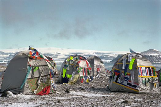
Studio Orta’s work touches on political questions associated with empty landscapes – including the question of whether or not one could ever be a citizen of Antarctica. Their Antarctic Village, for instance, pictured above, falls somewhere between an experiment in extreme camping and a stab at temporary utopian space unaffiliated with national governments.

Antarctic Village is emblematic of Ortas’ body of work, composed of what could be termed modular architecture and reflecting qualities of nomadic shelters and campsites. The dwellings themselves are hand stitched together by a traditional tent maker with sections of flags from countries around the world, along with extensions of clothes and gloves, symbolising the multiplicity and diversity of people.

For more information about the exhibition, check out the website.

(Thanks to William Fox for the tip!)

Pamphlet Infrastructure

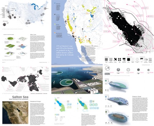
[Image: From InfraNet Lab’s submission to the WPA 2.0 competition, “centered on the twin dilemma of rising population and water shortages in the US southwest.”]

As a longtime fan of Mason White’s and Lola Sheppard’s work both at InfraNet Lab – an amazing web resource for anyone interested in cities, infrastructure, built landscapes, hydrological processes, international communications networks, and more – and at their architecture firm, Lateral Office – mentioned many times on BLDGBLOG before, from IceLink and A.I.R. Unit to Reykjavík’s Runways to Greenways – and as an enthusiast for Princeton Architectural Press’s Pamphlet Architecture series, I was absolutely thrilled to learn last week that InfraNet Lab will be authoring Pamphlet Architecture 30. Their book will be called Coupling: Strategies for Infrastructural Opportunism, and it will be published in 2010.

Along with Lola and Mason, Neeraj Bhatia and Maya Przbylski from Lateral Office will also be contributing – and this promises to be one of the best pamphlets yet. It’s also fantastic news for Lateral Office, who well deserve this exposure for their ideas and work. Congrats, guys! I can’t wait to see the results.

(By way of a brief PS, Mason will actually be speaking at the North American launch of The BLDGBLOG Book on Saturday, September 26, at Storefront for Art and Architecture in New York, along with Lebbeus Woods, another Pamphlet Architecture author).

Book of Space

[Image: A project by Johan Hybschmann].

One of the pleasures of participating in Urban Islands this past summer was meeting Johan Hybschmann, a recent graduate of the Bartlett School of Architecture and co-instructor, with Mark Smout, of one of the design studios hosted down there in Sydney. Johan is contagiously good-humored; even our pre-coffee, breakfast-less 7am ferry rides through cold winds across the Sydney Harbor in a surging boat were spent laughing. In fact, when I told him that my wife and I were about to celebrate our 7-year wedding anniversary… he started laughing.

Johan’s projects at the Bartlett were a fascinating mixture of ornate technical detailing and abstract ideas: simulation, reproduction, and the nature of spatial perception. “The idea of visually connecting spaces has been my architectural obsession for a long time,” he wrote to me in an email after we had all returned from Sydney, “and I find that perceptual/referential recognition [of specific spatial details] often plays a key role.”

One of Johan’s student projects, in particular, continues to astound me. What you’re looking at in the images reproduced here (alongside Johan’s answers to a series of questions I had posed over email) are painstakingly precise laser-cuts made into the pages of a blank sketchbook. As the book is opened and its pages begin to turn, these cuts work together to form a spatial representation of the single, highly choreographed 90-minute shot that is Alexander Sokurov’s film Russian Ark.

The book’s “content” is thus a three-dimensional, perspectivally accurate space.

[Image: A project by Johan Hybschmann].

From Johan:

The inspiration came directly from the single shot film sequence in Sokurov’s Russian Ark, where the camera is taken through the timeless spaces of the Winter Palace, jumping decades from one room to another. The distortion of time is, of course, interesting in terms of the timelessness of the spaces – but I was interested in the way that the camera never looks back. Even though the viewer never sees the full dimensions of these spaces, we are still left with a sense of coherence and wholeness. But what if the back of the room was mindblowingly different? It’s as if we constantly use the previous space to create an understanding of what should be behind us.
The book is an attempt to spatially prolong that perceptual idea. Two different spaces from the film sequence have been cut into each half of the book, as constructed perspectives. When the pages spread, the silhouettes of the elements visually collide, and the space within the book changes in character as the user travels through it by flicking through the pages.

You pick up a book, and you open the covers… and a series of rooms begins to pass by, like the frames of a film or sequences in a flipbook, and it’s all due to laser-cut gaps and remainders. How amazing to think that we could slice entire works of architecture into all the books around us, so that “reading” a book would actually be a forward-moving optical journey through page-sized rooms and hallways.

[Image: A project by Johan Hybschmann].

The physical realization of this was actually quite difficult to work out. As Johan explained over email:

The book is made from layered silhouettes with inbuilt distorted perspectives that are laser-cut into the individual pages of a standard sketchbook. There is a drawing for each page, and these are all cut separately: turning the page, loading up a new drawing and cutting, page by page.

Aside from the seemingly overwhelming task of working out exactly how much or how little needed to change with each page, Johan also achieved a kind of spatial layering effect: the turning pages add (or subtract) from the structure of each “scene” you see.

[Image: The diagram of architectural outlines that was laser-cut into the book’s pages, recreating the illusory volume of a cinematic space].

Rooms and perspectives shift; spaces blur one into the other, edited by laser; and the book re-enacts, on a bibliographic level, the act of watching Sokurov’s film.

[Image: A project by Johan Hybschmann].

This project has a lot in common with another of Johan’s student works.

In the following project, called “Replicating a Replica,” he proposed “a redesign of the Federal Hall on Wall Street in New York City.” Johan basically created two buildings that would occupy the same place at the same time, visually interlocking but spatially separate.

As you walk through the building, Johan explained, you would pass through a series of “choreographed viewpoints,” or visual positions at which the spaces around you would shift. Here you would feel as if you are inside one particular building (a Museum of the Constitution, Johan suggests); there, even if only steps away, you would feel as if you were inside another building altogether (a Court of Law, for instance).

Each building would exist as if tucked inside the optically complicated spaces of the other. After all, Johan added, he is “interested in the spatial potential of being in-between.”

The resulting model of the project was thus more like a small machine, moving between two states of being. In one state, it was simply a pile of loose wire frames and disconnected vaults; in the other, a battery-powered act of reanimation has brought these apparently discarded parts whirling back to life, forming a functional building space.

[Images: Another project by Johan Hybschmann].

The final images are fantastic: a building comes to life from whirring motors stored below.

[Images: By Johan Hybschmann].

Tying all of this together, and bringing us back to the laser-cut book project, Johan writes:

There is a scene in the film Blade Runner where Rick Deckard uses a machine to visually move around corners within a regular photograph. The machine traces all reflective surfaces in the “still-life” setting, and it collects information from objects represented from different spatial positions – but only from one viewpoint. This allows the machine to travel around the corner of the threshold within the photograph, but also to give an assumed image of what otherwise cannot be seen. Even though Rick Deckard gets a picture of a woman laying in a bed, we still have to consider that the image is constructed from distorted surfaces of mirrors and glass objects.

In some ways, the above description of Blade Runner could also be a description of the convex mirrors deployed throughout the Sir John Soane Museum, which distort and re-reflect the sarcophagi and Egyptian statuary scattered all around the place, making even the definition of a single room somewhat hard to settle on.

But it also ties in very nicely with the optical themes from Johan’s and Mark’s studio this summer in Sydney (which I hope to write about before too much longer): how we see architecture, how we visually comprehend built space, and what we might try to design in order to make this everyday experience both more complicated and more interesting.

Fire Lookout Towers

[Image: Courtesy of the U.S. Forest Service].

Constituting their own architectural typology, and falling perhaps somewhere between Lew Welch and Tom Kundig (someone hire Kundig to design the next Serpentine, please!), are the fire lookout towers of the Pacific Northwest.

Search the photo archives – assembled and maintained by Rex Kamstra, complete with lookout tower trivia – from Oregon and Washington to the hills of South Dakota (or just check out the site’s newsfeed) to explore these often extraordinarily remote structures in all their minimalist – and historically fascinating – glory.

And did you know that you can actually adopt a fire lookout?

[Image: Courtesy of the U.S. Forest Service].

While you’re at it, don’t miss the U.S. Forest Service’s own catalog of these overlooked minor building types: fire lookout towers in Sequoia National Forest, for instance, and Umatilla.

The fact that there are any lookout towers still standing at all is, it seems, slightly amazing. “In their heyday during the 1930s,” the Forest Service explains, “there were over 8,000 fire lookouts that dotted mountain tops across the United States with over 600 in California. Today there are only a few hundred in operation. Once considered a proud symbol of our nation’s conservation heritage, fire lookouts are a fading legacy. There are 10 lookouts left on the Sequoia National Forest.”

[Image: Courtesy of the U.S. Forest Service].

A definitive history of these timber structures and lonely cabins has not yet been written (attention Princeton Architectural Press!), although they constitute not only a distinctive family of structures, they also have a regional, ecosystemic importance that only the best pieces of civic infrastructure attain.

They also figure into the national mythology in a way that few other forms of architecture do; from Jack Kerouac disappearing off into the mountains for a summer of fire-spotting, to the poems of Gary Snyder, these awesomely elevated perspectives on the natural world – as well as sites of enforced introspection – deserve their NorCalMod moment. That is, they deserve their architectural rediscovery.

[Image: Courtesy of the U.S. Forest Service].

Instead of a definitive reference work, there are simply books (albeit still fascinating) like How to Rent a Fire Lookout in the Pacific Northwest: A Guide to Renting Fire Lookouts, Guard Stations, Ranger Cabins, Warming Shelters and Bunkhouses in the National Forests of Oregon and Washington; Adirondack Fire Towers: Their History and Lore; Lookouts: Firewatchers of the Cascades and Olympics; and the so-called “fire lookout research” of David E. Lorenz (now out of print). So people are clearly still interested in these structures. For instance, check out this photo-log of a hike up to the spectacular mountain views of the Mule Peak Lookout.

[Image: Courtesy of the U.S. Forest Service].

Even better, take a long read through the Skagit River Journal‘s look at the fire lookout towers of the Cascades. This latter link includes some amazing material, including references to interviews with former fire watchers and their colleagues:

They told many unusual stories of the watchers, who were prepared to be alone on a mountain ridge in a tower measuring less than 200 square feet. Towers were sometimes built on nearby ridges so that two watchers could combine their observations of a section of forest, which enabled them to triangulate and more accurately call in resources to fight fires. A broad spectrum of watchers developed, from college students to housewives to hermits and those who loved to be surrounded by wilderness and mountains. The authors discovered one watcher who was so frightened during a lightning storm that he ran all the way down the mountain.

There is also the story of Maxine Meyers, a former forest lookout.

More architecturally, the Skagit River Journal also gets into the ways and means of these towers’ construction: “Before mountain roads were built of a size to accomodate trucks, the materials were largely packed in on backs or on mules, and then another team had to slog through the brush, stringing telephone wire before the use of two-way radios.” Thus were distant structures assembled in the woods.

[Image: Courtesy of the U.S. Forest Service].

Plus, where, now, are the people who actually lived in these structures – stationed there for whole seasons at a time to eat canned peaches and watch the stars, looking out for signs of distant fires? Are they still alive, and, like Maxine Meyers, could you interview them? It’s an architectural form that comes with its own anthropology: narratives of use and inhabitation.

Further, who designed these structures – based on what plan, and from what material inspiration? What would a fire lookout tower, built today, look like? Perhaps like the awesome “Prairie Ladder” by Anderson Anderson?

And how do these towers frame the landscape, and to what extent could you put them into the visual tradition of things like panoramas?

These towers, after all, aren’t just towers; they have a kind of optical functionality, built specifically for the purpose of viewing the landscape in a certain, specific, highly regulated way. They spatially frame this act of disciplined surveillance. In a sense, they are like the British watchtowers so beautifully photographed by Donovan Wylie.

[Image: Courtesy of the U.S. Forest Service].

But, more to the point, where do fire lookout towers – as a minor design typology – fit into architectural history?

Oil Rocks

[Image: The offshore metropolis of Oil Rocks, Azerbaijan, via Wikipedia].

There are a number of massive artificial peninsulas extending offshore from the Azerbaijani city of Baku. The most famous of these is known as Oil Rocks, and it is an offshore metropolis of semi-abandoned oil extraction platforms in the Caspian Sea.

It even appears on a postage stamp.

[Image: The Oil Rocks postage stamp, via Wikipedia].

As Wikipedia informs us:

The facility is poorly maintained, with miles of roads now submerged beneath the sea. Around some workers’ dormitories, the waterline now stands at the second-floor windows. Although a full one-third of the Oil Rocks complex’s 600 wells are inoperative or inaccessible, operations have continued without a significant increase in investment. The site, despite its imperfections, still produces over half of the total crude oil output of Azerbaijan. The government has striven to attract foreign investment into Oil Rocks, resulting in several new additions being grafted onto the existing structure.

These “new additions… grafted onto the existing structure” are at least partially responsible for the epic nature of the place, as it seems to push ever further outward into the tides and weather.

Funded with private money, and created entirely for the purpose of extracting oil from the Caspian’s shallow seabed, these and other peninsular extensions of Baku are functional urbanism at its most giddy: uni-purpose structures like something dreamt up by Guy Maunsell, by way of the obligatory reference to Constant’s New Babylon.

This metropolis of platforms would not be out of place in a design studio themed around micronations, the future of private urbanism, or even failed utopias.

[Image: Other artificial peninsular cities of Baku, seen from above. View larger! Via Google Maps].
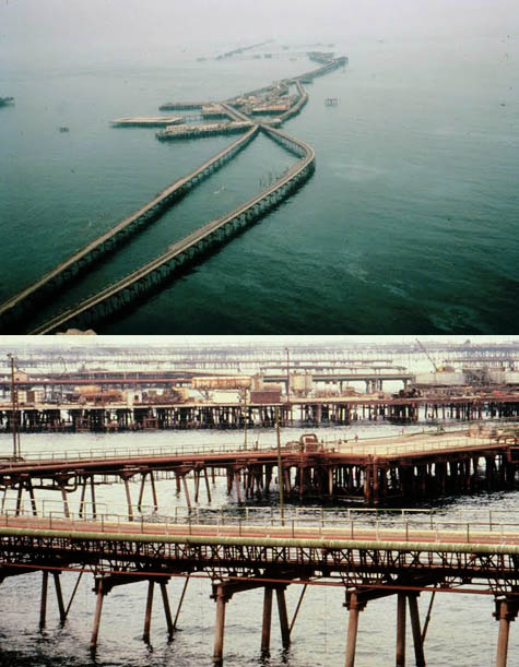
Oil Rocks, we read elsewhere, “is a full town on the sea: it has 200 km of streets built on piles and landfill… There are tall blocks of flats, a bakery, a cinema, a garden, [and] a school.” There are also helipads, helping to shorten the journey from the city’s outer architectural limits back to shore.

According to Statoil, meanwhile, Oil Rocks “looks from the air like a cobweb scattered with large drops of water.” Over-extending the metaphor a bit, they point out that a “closer inspection shows that the ‘web’ is made up of gangways across the sea, the ‘spider’ at its heart is the field centre and the ‘water drops’ are the many production installations.” Structurally speaking, “Sand and stone were shipped out to create dry land, and steel pillars attached to the seabed as the foundation for huge living quarters.”

Of course, it would interesting to see if something similar could be created if only we could connect all the unused ships of the global, recession-hit shipping industry together with gangways and thus institute our own Armada – but, until then, this is still absurdly interesting.

[Images: Photos of offshore oil structures in the Caspian by Stanley Greene; spotted via Artificial Owl].

In a recent issue of John Knechtel’s Alphabet City, called Fuel, there is a proposal by architect Maya Przybylski called “Occupying the Caspian Sea: A One Hundred Year Plan.” Przybylski specifically addresses the derelict – or soon to be derelict – extraction platforms of the Caspian. She approaches the sea as if seeing it “through the filter of oil operations: concession systems, contract blocks, pipelines, tanker ports and routes, national boundaries, bathymetric and climatic conditions, and the oil fields themselves.”

Przybylski focuses, among many things, on the fact that the architectural remains of the extraction industry are being gradually recolonized by the region’s wildlife. She writes, for instance, that “many birds have claimed abandoned oil rigs as resting points along their routes,” and that “the offshore oil installations have become an important alternative sanctuary,” both for birds and for fish. Indeed, “birds have begun to fly from rig to rig during their migration, avoiding contact with the shore altogether.” In many ways, and for obvious reasons, I’m reminded of the EcoRigs project (about which I’ve written a short paper for a forthcoming issue of New Geographies), which seeks to turn abandoned oil platforms in the Gulf of Mexico into new endoskeletons for specially curated ecosystems at sea.

While Przybylski does not, in fact, mention Oil Rocks, this stilted metropolis-at-sea is quite easy to think of it when she writes that, “When the oil companies begin to wind down their operations, the key to the proposed renewal of the sea will be the reexploitation of the relics they leave behind.” If Oil Rocks is one of these relics, then, in all of its sprawling, labyrinthine wonder, what could we do with it?

Whether subject to historic preservation or transformed into a Dubai-style resort, what might Oil Rocks yet become?