 [Image: “Thomas de Leu, engraver. Perspective view of an ideal city, 1602. From Jacques Perret, Architectura et perspectiva des fortifications & artifices de laques Perret. Courtesy CCA].
[Nearly a decade ago, I wrote a series of blog posts as part of a Fellowship at the Canadian Centre for Architecture. Those posts appear to be falling into an internet memory hole, so I thought I’d reproduce lightly edited versions of some of them here, simply for posterity.]
In 1564, the Tuscan urban planner, archaeologist, military theorist, mathematician, and writer Girolamo Maggi published a work of military urbanism called Della fortificatione delle città, written by his colleague Giacomo Fusto Castriotto.
That work, on the fortification of cities, devoted several passages to what might be called indirect or soft fortification: protecting an urban population from attack not through the use of heavy walls, inner citadels, or armed bastions—although the book is, of course, filled with such things—but through nothing more than a complex street plan.
Indirect streets and narrow walkways could be put to use, Castriotto argued, as agents of spatial disorientation, leading an invader everywhere but where they actually wanted to go. It was a kind of urban judo, or the city as martial art.
The city itself could be weaponized, in other words, its layout made militarily strategic: you could transform the speed at which your enemy arrives into exactly what would entrap him, lost, unable to retrace his footsteps, fatally vulnerable and spatially exposed.
The CCA exhibited much of its collected manuscripts on urban fortification seventeen years ago, under the name The Geometry of Defence: Fortification Treatises and Manuals, 1500–1800.
In the accompanying pamphlet, curator and former CCA historiographer Michael J. Lewis describes the geometric complexification that the fortified cities of the Renaissance underwent in the name of self-protection (Alberto Pérez-Gómez’s Architecture and the Crisis of Modern Science also contains a lengthy history of this same material and is worth consulting in full). A constantly shifting imbalance of power between the wall-builders and the invaders led to new spatializations of the metropolis. Whether due to the invention of gunpowder, massed assaults or simply new building techniques, the urban landscape was constantly reformatted according to the weapons that might be used against it.
Of course, this will be a very familiar story to most readers, so I don’t want to repeat it; I do, however, want to focus on the idea of forsaking mass—thick walls—for complexity in the name of strategic disorientation. There are well-known stories, for instance, of English coastal villages during World War II removing their road and street signs so as to prevent logical navigation by German aggressors, even erecting dummy signs to send confused Nazi paratroopers wandering off in the wrong direction.
But if the well-fortified Renaissance city could be seen, for the sake of argument, as something like the Hummer of military urbanism, what is the city-as-Bruce-Lee? A city that is lean, even physically underwhelming, but brilliantly fast and highly flexible? What is the city that needs no defensive walls at all?
 [Image: “Unknown engraver. Series of views showing the development of the modern bastion system from its medieval origins. Plate A from Matthias Dögen, Matthiae Dögen Dramburgensis marchici Architectura militaris moderna, 1st ed. (Amsterdam, Ludovic Elzevir, 1647).” Courtesy CCA].
There are a variety of possible answers here, all of which would be interesting to discuss; but I’m most struck by the possibility that the phenomenon recently dubbed the “feral city” is, in a sense, an anti-fortress in precisely this spatial sense.
In a now-canonical 2003 paper for the Naval War College Review, author Richard J. Norton describes the feral city as “a great metropolis covering hundreds of square miles. Once a vital component in a national economy, this sprawling urban environment is now a vast collection of blighted buildings, an immense petri dish of both ancient and new diseases, a territory where the rule of law has long been replaced by near anarchy in which the only security available is that which is attained through brute power.”
From the perspective of a war planner or soldier, Norton explains, the feral city is spatially impenetrable; it is a maze resistant to aerial mapping and far too dangerous to explore on foot. Indeed, its “buildings, other structures, and subterranean spaces would offer nearly perfect protection from overhead sensors, whether satellites or unmanned aerial vehicles,” Norton writes, creating, in the process, an environment where soldiers are as likely to die from rabies, tetanus, and wild dog attacks as they are from armed combat.
I’m led to wonder here what a twenty-first-century defensive literature of the feral city might look like—from temporary barricades to cartographically incoherent slums experimenting with limited forms of micro-sovereignty. If the feral city is a city with no external walls but an infinite interior—endless spaces made of oblique architecture and indirect streets—then its ability to defend itself comes precisely through letting invaders in and fatally disorienting them, not by keeping them out.
So if a city does away with defensive walls altogether, what specific spatial strategies are left for it to protect itself? For instance, can a city deliberately be made feral as an act of preemptive self-defense—and, if so, what architectural steps would be necessary to achieve such a thing? Channeling Archigram—or perhaps even Cisco—we might call this the insurgent instant city complete with its own infrastructural practices, its own rogue designers, and its own anti-architects.
How, then, could the spatial practice of urban feralization be codified, and what architectural lessons might be learned if this were to happen?
Michael J. Lewis, describing the treatises on display at the CCA nearly two decades ago for The Geometry of Defence, refers to “fortification literature” or “the literature of the fortification,” including the publishing practices peculiar to this—for its time—top secret field of study. For example, privately circulated manuscripts, incomplete essayistic reflections, and even word-of-mouth gradually solidified into full-length narratives; only at that point were they intended to communicate finely tuned, often firsthand, military knowledge of a city under siege to anyone who might want to discover it, whether that was a king, a layperson, or an enemy general (indeed, much of the literature of fortification went on to the form the core of an emergent field known as urban planning).
In another fifty, one hundred, or even five hundred years, will there be a defensive literature of the feral city, its systematic description, techniques for its defense (or obliteration), and its urban logic (or lack thereof)? Even if only on the level of urban form, this would be a fascinating journey, going from Castriotto’s and Maggi’s indirect streets to whole cities gone wild in the name of resisting outside intervention.
 [Image: Screen-grab from a YouTube compilation of Desert Storm missile strikes].
 [Image: YouTube].
 [Image: Robert Baden-Powell’s clever use of entomological sketches to hide enemy floorplans, from his essay “
 [Image: From
  [Image: From
  [Image: Michelangelo’s sketches for the fortification of Florence].
 [Image: Michelangelo’s sketches for the fortification of Florence].
 [Image: Michelangelo’s sketches for the fortification of Florence].
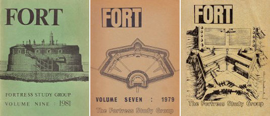 [Images: Covers from old copies of
 [Image: From “Baffles and Bastions: The Universal Features of Fortifications” by Lawrence H. Keeley, Marisa Fontana, and Russell Quick, courtesy of the
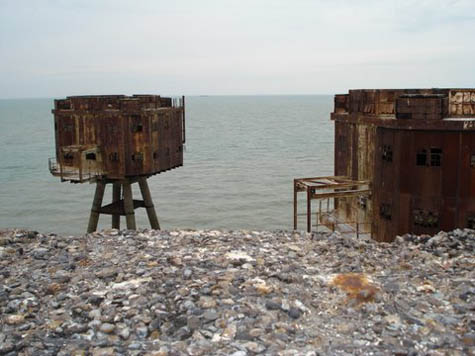
  [Image: The Maunsell Sea Forts, photographed by Pete Speller, courtesy of
 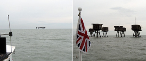 [Images: Photos by
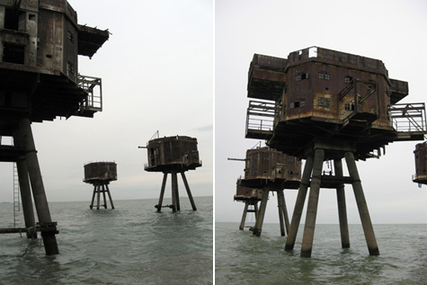
 [Images: Photos by
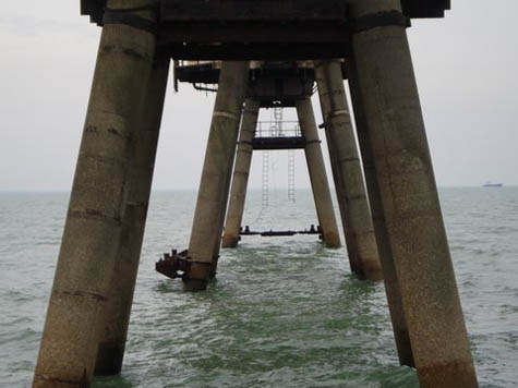
  [Image: The Maunsell Sea Forts, photographed by Pete Speller, courtesy of
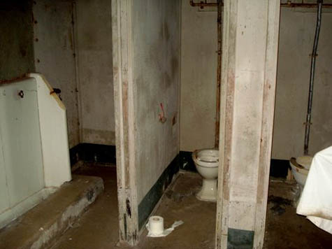

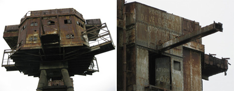
 [Images: Inside the forts; photos by Pete Speller, courtesy of


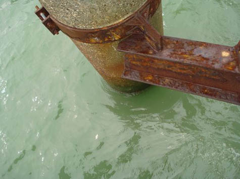
 [Images: Photos by Pete Speller, courtesy of