Nocturnes

merrell4[Image: Screen grab from Nocturnes].

Filmmaker Alec Earnest—who we last saw here for his short film about the death of a mysterious map collector in Los Angeles—is back with a mini-documentary about landscape painter Eric Merrell.

Merrell, we read, “might be best known for his rigorous approach to landscape painting. For several years Merrell has been working on Nocturnes, a series of abstract desert works that he has painted all over Southern California, each solely by the light of the moon.”

merrell6[Image: Screen grab from Nocturnes].

Earnest’s film follows Merrell into Joshua Tree National Park, “where night falls and the desert takes on a surreal and mysterious beauty, where edges blur and shapes transform, and solitude takes on a whole new meaning.”

The small crew used a new Sony A7S camera “that basically allowed us to shoot completely in the dark,” Earnest explained to me over email.

The film is embedded, below:

Of course, as the video makes clear, this is a slight—but only slight—exaggeration, in that Merrell uses a headlamp and small clip lights on his painting box to help illuminate the scene.

merrell11merrell2[Image: Screen grab from Nocturnes].

When those lights are switched off, however, the landscape takes on a silvered, almost semi-metallic lunar glow, as if bathed in ambient light.

merrell8merrell7[Image: Screen grab from Nocturnes].

Standing there in the darkness, Merrell comments on how working at night also comes with a peculiar kind of audio enhancement, with distant sounds riding the breeze with a peculiar clarity; and at one point a fortuitous lightning storm rolls by in the distance, as if to prove Merrell’s point with the atmospheric sonar of a thunder crash echoing over the otherworldly rocks of the National Park.

merrell12merrell13[Images: Paintings by Eric Merrell; screen grabs from Nocturnes].

Read a bit more at the L.A. Review of Books, and don’t miss Earnest’s earlier film here on BLDGBLOG.

(Related: In Search of Darkness: An Interview with Paul Bogard).

Ghost Streets of Los Angeles

[Image: Via Google Maps; view larger].

In a short story called “Reports of Certain Events in London” by China Miéville—a text often cited here on BLDGBLOG—we read about a spectral network of streets that appear and disappear around London like the static of a radio tuned between stations, old roadways that are neither here nor there, flickering on and off in the dead hours of the night.

For reasons mostly related to a bank heist described in my book, A Burglar’s Guide to the City, I found myself looking at a lot of aerial shots of Los Angeles—specifically the area between West Hollywood and Sunset Boulevard—when I noticed this weird diagonal line cutting through the neighborhood.

[Image: Via Google Maps; view larger].

It is not a street—although it obviously started off as a street. In fact, parts of it today are still called Marshfield Way.

At times, however, it’s just an alleyway behind other buildings, or even just a narrow parking lot tucked in at the edge of someone else’s property line.

[Image: Via Google Maps; view larger].

Other times, it actually takes on solidity and mass in the form of oddly skewed, diagonal slashes of houses.

The buildings that fill it look more like scar tissue, bubbling up to cover a void left behind by something else’s absence.

[Image: Via Google Maps; view larger].

First of all, I love the idea that the buildings seen here take their form from a lost street—that an old throughway since scrubbed from the surface of Los Angeles has reappeared in the form of contemporary architectural space.

That is, someone’s living room is actually shaped the way it is not because of something peculiar to architectural history, but because of a ghost street, or the wall of perhaps your very own bedroom takes its angle from a right of way that, for whatever reason, long ago disappeared.

[Image: Via Google Maps; view larger].

If you follow this thing from roughly the intersection of Hollywood & La Brea to the strangely cleaved back of an apartment building on Ogden Drive—the void left by this lost street, incredibly, now takes the form of a private swimming pool—these buildings seem to plow through the neighborhood like train cars.

Which could also be quite appropriate, as this superficial wound on the skin of the city is most likely a former streetcar route.

But who knows: my own research went no deeper than an abandoned Google search, and I was actually more curious what other people thought this might be or what they’ve experienced here, assuming at least someone in the world reading this post someday might live or work in one of these buildings.

[Image: Via Google Maps; view larger].

And perhaps this is just the exact same point, repeated, but the notion that every city has these deeper wounds and removals that nonetheless never disappear is just incredible to me. You cut something out—and it becomes a building a generation later. You remove an entire street—and it becomes someone’s living room.

I remember first learning that one of the auditoriums at the Barbican Art Centre in London is shaped the way it is because it was built inside a former WWII bomb crater, and simply reeling at the notion that all of these negative spaces left scattered and invisible around the city could take on architectural form.

Like ghosts appearing out of nowhere—or like China Miéville’s fluttering half-streets, conjured out of the urban injuries we all live within and too easily mistake for property lines and real estate, amidst architectural incisions that someday become swimming pools and parking lots.

*Update* Some further “ghost streets” have popped up in the comments here, and the images are worth posting.

[Image: Via Google Maps; view larger].

The one seen above, for example, is “another ghost diagonal that begins on 8th St. at Hobart, and ends at Pico and Rimpau,” an anonymous commenter explains.

Another example, seen below—

[Image: Via Google Maps; view larger].

—is “a block in the Pico-Robertson area,” a commenter writes:

I lived there as a teenager, but never noticed the two diagonals until I looked at it with google maps. There are some lots on the west side of the next two blocks north which also have diagonals. And if you continue north across Pico Blvd, you can see diagonal property lines around St. Mary Magdalene Catholic School and the church.

Thanks for all the tips, and by all means keep them coming, if you are aware of other sites like this, whether in Los Angeles or further afield; and be sure to read through the comments for more.

*Second Update* The examples keep coming. A commenter named Lance Morris explains that he did an MFA project “about this very thing, but in Long Beach. There’s a long diagonal scar running from Long Beach Blvd and Willow all the way down to Belmont Shore. I tried walking as closely to the line as I could and GPS tracked the results. There are even 2 areas where you can still see tracks!”

This inspired me to look around the area a little bit on Google Maps, which led to another place nearby, as seen below.

[Image: Via Google Maps; view larger].

Again, seeing how these local building forms have been generated by the outlines of a missing street or streetcar line is pretty astonishing.

Further, the tiniest indicators of these lost throughways remain visible from above, usually in the form of triangular building cuts or geometrically odd storage yards and parking lots. Because they all align—like some strange industrial ley line—you can deduce that an older piece of transportation infrastructure is now missing.

[Image: Via Google Maps; view a bit larger].

Indeed, if you zoom out from there in the map, you’ll see that the subtle diagonal line cutting across the above image (from the lower left to the upper right) is, in fact, an old rail right of way that leads from the shore further inland.

To give a sense of how incredibly subtle some of these signs can be, the diagonal fence seen in the below screen grab—

[Image: Via Google Maps; view larger].

—is actually shaped that way not because of some quirk of the local storage lot manager, but because it follows this lost right of way.

*Third Update* There are yet more interesting examples popping up now over in a thread on Metafilter.

There, among other notable comments, someone called univac points out that the streetcar scar that “begins on 8th St. at Hobart, and ends at Pico and Rimpau”—quoting an earlier commenter here on BLDGBLOG—”actually has one echo in the diagonally-stepped building here, and picks up again in the block bounded by Wilton, Westchester, 9th and San Marino, and ends at a crooked building just north of 4th and Olympic.”

[Image: Via Google Maps; view larger].

You can see the middle stretch of that route in the image, above. For more, check out the thread on Metafilter.

Not only this, however, but the old right of way followed by that commenter actually extends much further than that, all the way southwest to a small park at approximately Pico and Queen Anne Place.

[Image: Via Google Maps; view larger].

In the above image, you can see a small structure—a garage or a house—turned slightly off-axis in the northeast corner, indicating the line of the old streetcar line, with some open lawns and small paved areas revealing its obscured geometry as you look down to the southwest.

Five Parises of Emptiness

[Image: Via Curbed LA].

Citing a new report in the Journal of the American Planning Association, Curbed LA points out that “parking infrastructure takes up about 200 square miles of land in LA county.”

That’s more than four San Franciscos’ worth of space (46.87 square miles) and nearly five times the size of Paris (40.7 square miles). Or, as Janette Sadik-Khan wrote on Twitter, “LA County has 85% more parking spots than people, occupying more space than the entire city of Philly.”

Los Angeles, where it’s you and a bunch of parking lots.

L.A.T.B.D.

[Image: L.A.T.B.D. by Smout Allen for USC Libraries; photo by Stonehouse Photographic].

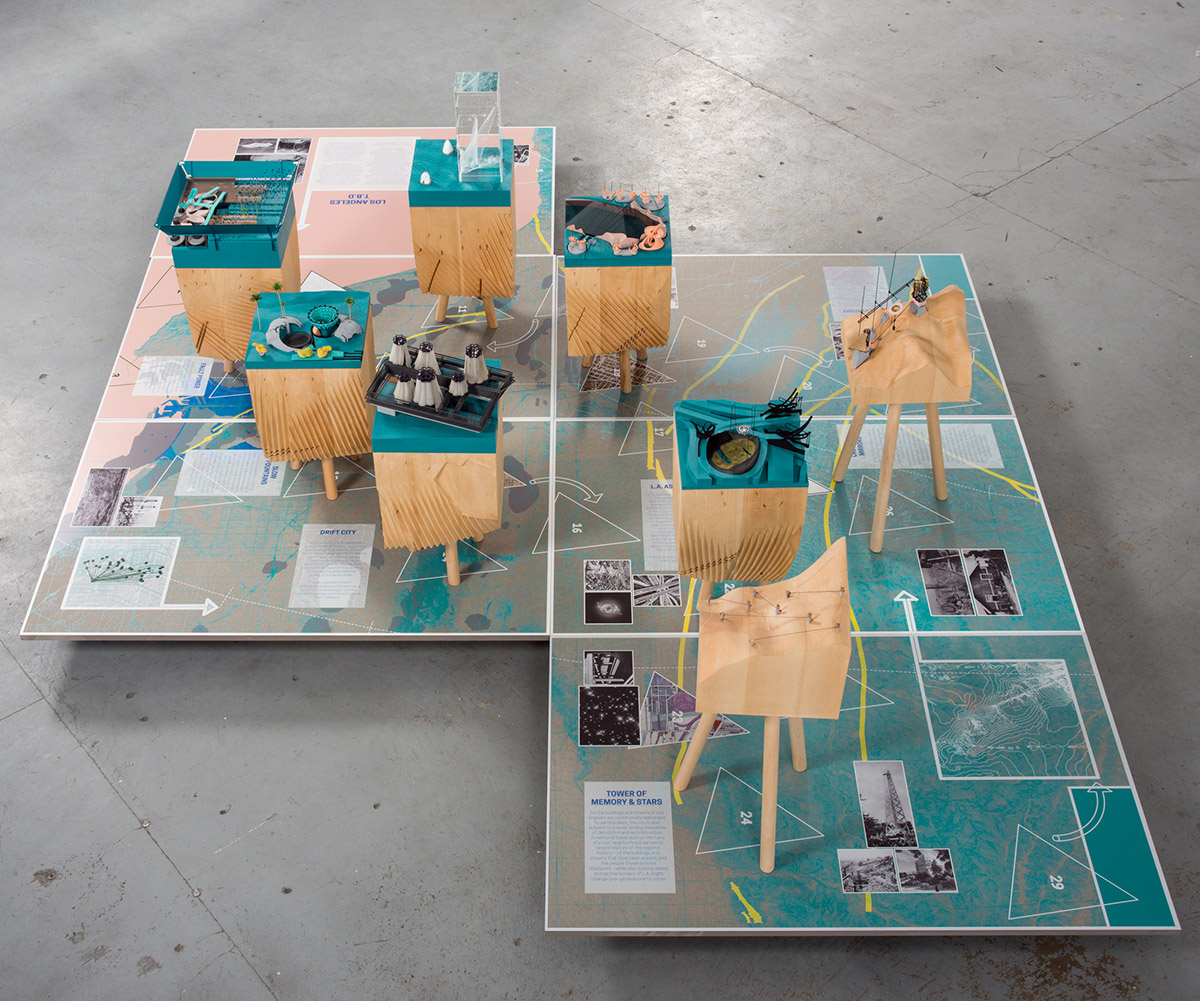
I wanted to give a quick heads up that a new collaborative exhibition will be opening to the public later today in the Doheny Memorial Library at USC here in Los Angeles, featuring work by myself and Smout Allen.

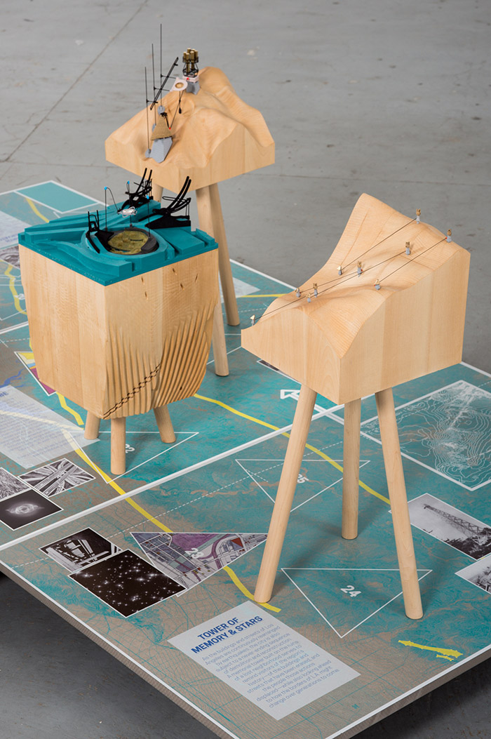
Called L.A.T.B.D., the project looks at diverse narrative, scientific, architectural, and landscape futures of Los Angeles. It is a city always yet to be determined—or L.A., T.B.D.

The exhibition actually comes at the very end of the 2015 USC Libraries Discovery Fellowship, which I’ve had the honor of holding this year, the challenge of which was to use the archival holdings of USC as a springboard for looking forward toward whatever Los Angeles might become.

Like plotting a ballistic trajectory, if we know where L.A. has been—if we can see the ingredients of its past, from its prehuman landscapes to the 2012 procession of the Space Shuttle—can we determine where the city might be, 10, 20, 100 years from now?

[Image: L.A.T.B.D. by Smout Allen for USC Libraries; photo by Stonehouse Photographic].

The overall curatorial idea was that, hidden within USC’s impressive and seemingly endless archival holdings, there might be glimpses of an L.A. yet to come, and that a project such as this should find a way of bringing that future version of the city into focus.

However, not one for prediction or prescriptive visions of tomorrow, I wanted this to be far more open-ended than that. We thus developed several parallel lines of materials for the show.

[Image: L.A.T.B.D. by Smout Allen for USC Libraries; photo by Stonehouse Photographic].

One, of course, are a series of gorgeous models designed and fabricated by Smout Allen, showing various hypothetical scenarios for the future city. In one, huge pendulums have been installed beneath the streets to act as seismic counterweights, protecting the city from earthquakes.

In another, the titanic forces released by plate tectonics can be captured by a new kind of power station, converting those otherwise threatening movements of the earth into a source of renewable energy.

In yet another, the city’s freeway system has been converted into a kind of immersive astronomical device, to help train the eyes of this city of stars on an older and more important firmament above.

This work also served as a direct source for the related project we did for this year’s inaugural Chicago Architecture Biennial.

[Image: L.A.T.B.D. by Smout Allen for USC Libraries; photo by Stonehouse Photographic].

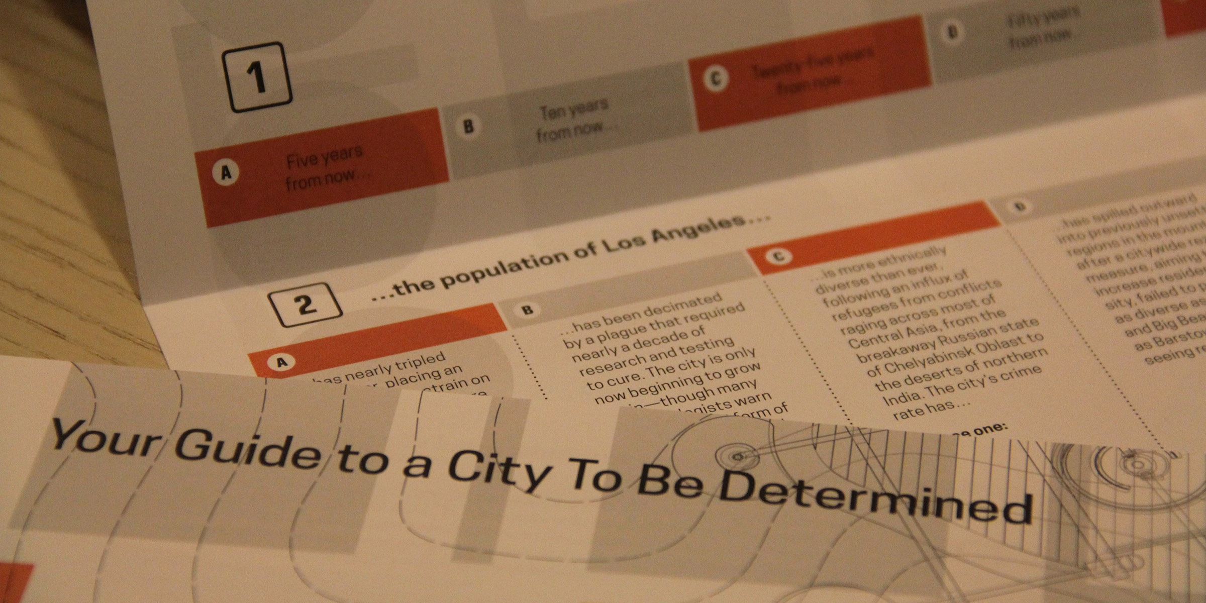
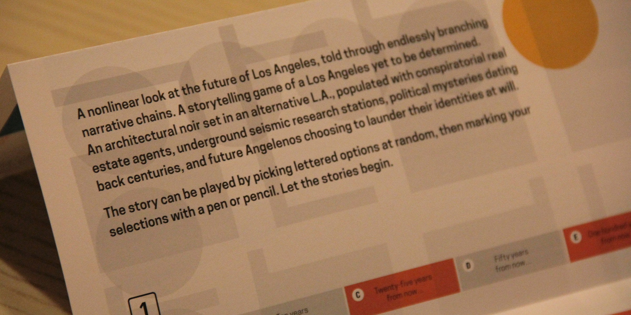
Another key part of the L.A.T.B.D. exhibition is an interactive text that allows visitors to, in a sense, choose their own future for the metropolis. This text combines a small-scale look at what sort of Los Angeles might yet greet our unborn descendants—complete with neighborhoods flooded by sea-level rise, widespread demographic shifts, and corrupt political machinations—with a subtext of noir or urban mystery.

Put another way, if this is a city known for its conspiracies and crimes—whether it’s Chinatown, O.J. Simpson, bank heists, or the novels of James Ellroy—can we use that same narrative register to explore the city’s future infrastructure?

[Images: L.A.T.B.D.‘s accompanying exhibition text, designed by David Mellen Design; terrible photos by Geoff Manaugh].

I started referring to this as a kind of architectural or infrastructural noir, and I’ve come to really like the phrase: the accompanying exhibition text is thus not at all what you’d expect to see in a typical gallery setting, but instead tells an endlessly branching “noir” about the next Los Angeles—by, in some ways, revealing what Los Angeles really was, all along.

[Image: L.A.T.B.D.‘s accompanying exhibition text, designed by David Mellen Design; terrible photo by Geoff Manaugh].

Finally, the exhibition includes a series of historical artifacts from the USC Libraries holdings, from old scientific reports to transportation policy papers, from obsolete urban predictions from the 1980s to board games set in a premodern L.A.

Here, working with designer David Mellen, we had a lot of fun, deliberately crossing and recrossing the line between fiction and reality: that is, not every artifact you see in the exhibition should be trusted, and things might not always be what they seem.

There’s much more to say about the exhibition, but I wanted to get a quick post up before the show opens later this afternoon. There is a reception tonight at 5:30pm in the library, or consider stopping by on Saturday, October 17, from noon to 1pm, to talk to myself and Smout Allen about the project. Saturday’s event is part of the “Archives Bazaar.”

L.A.T.B.D. was made possible by support from the USC Libraries Discovery Fellowship, the Bartlett School of Architecture, UCL, and the British Council. Special thanks are owed to Dean Catherine Quinlan; to Jeff Watson; to the USC Libraries staff; and to Harry Grocott, Doug Miller, and Sandra Youkhana.

Water & Power

[Image: Via the Library of Congress].

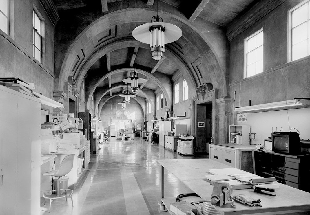
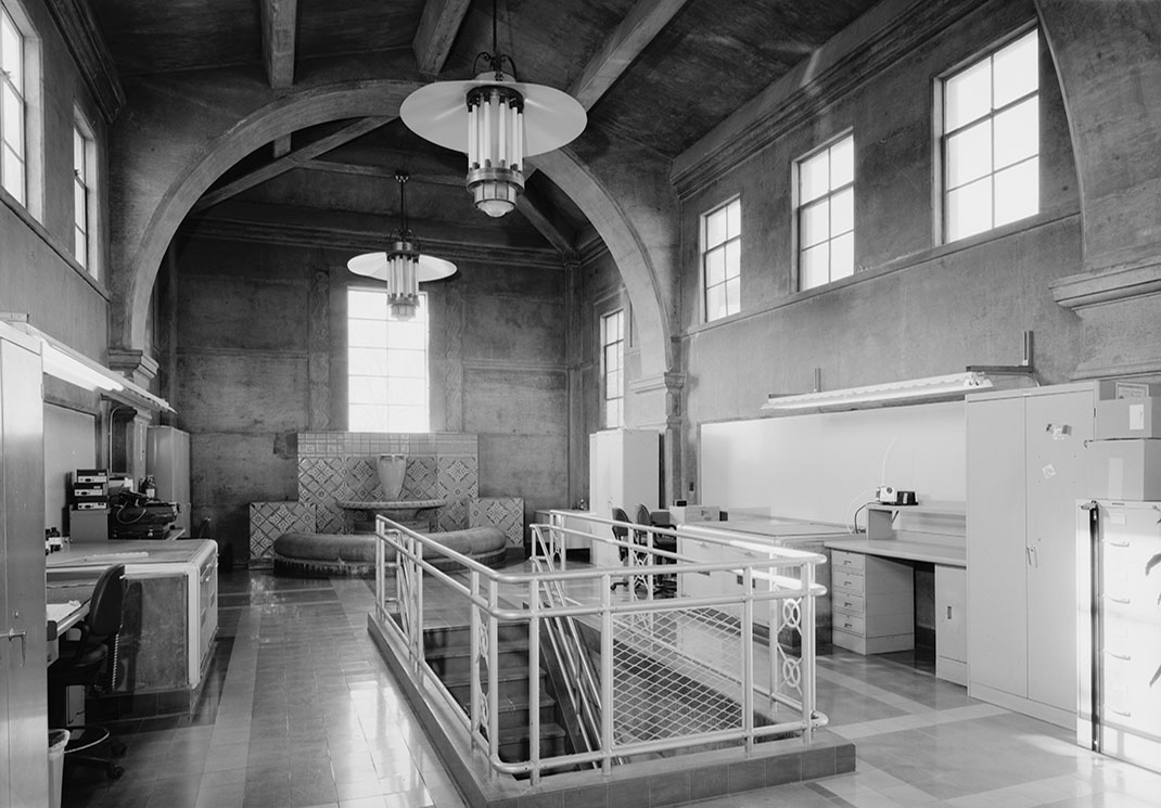
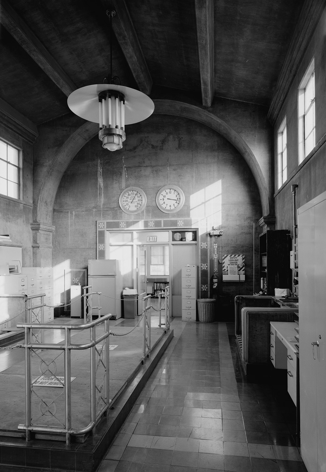
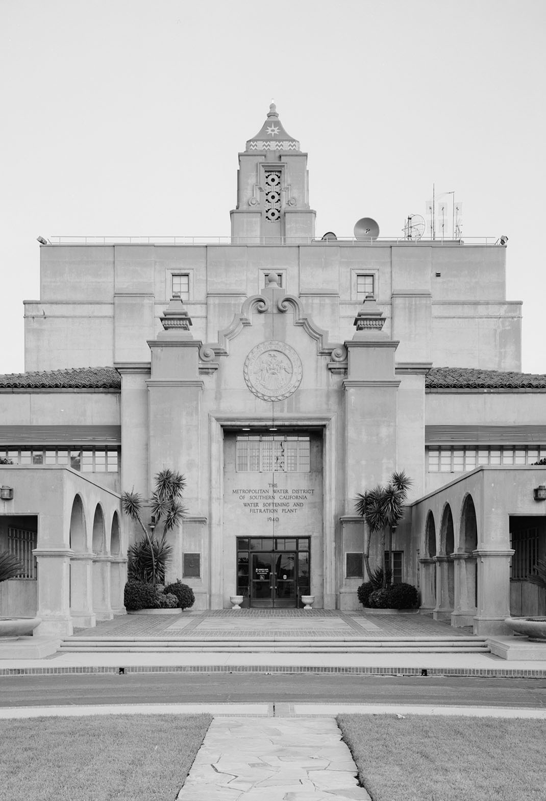
While going through a bunch of old photos of Los Angeles on the Library of Congress website for a project I’m doing at USC this year, I was amazed by these interior shots of the F. E. Weymouth Filtration Plant at 700 North Moreno Avenue in L.A.

Despite being designed for the administration of an urban water-processing site, the interiors seem to play with some strange, Blade Runner-like variation on Byzantine modernism, where federalist detailing meets a hydrological Babylon.

[Image: Via the Library of Congress].

As the open plan interior of a contemporary home, this place would almost undoubtedly show up on every design website today—imagine a better railing on the central staircase, a galley kitchen on one side, a bed lit by retro-styled fluorescent tubes at the far end, some bold moments of color—but it’s just a piece of everyday municipal infrastructure.

[Image: Via the Library of Congress].

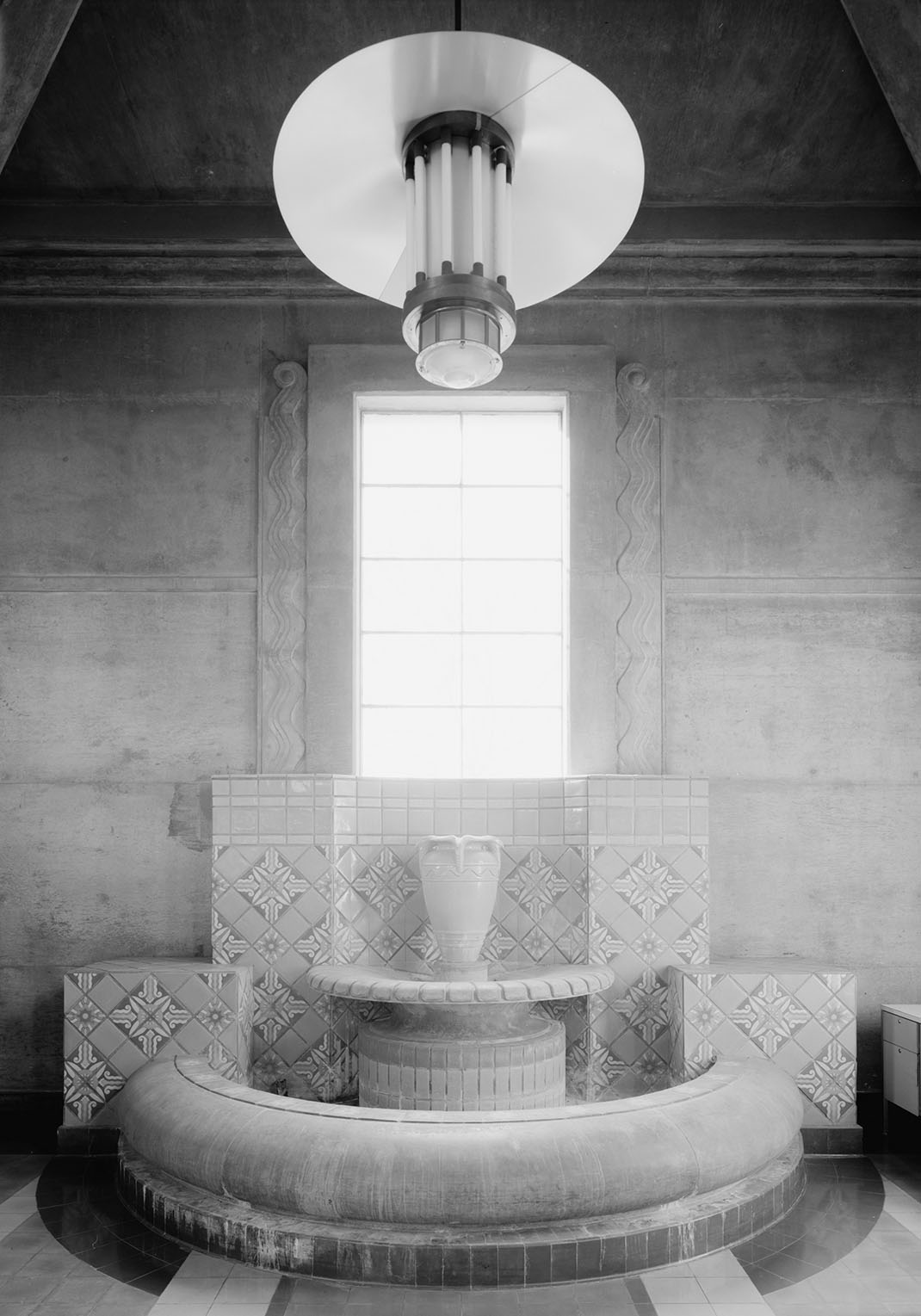
In any case, continuing the vaguely sci-fi feel, there is even a tiled fountain—a Mediterranean concession to the building’s role in water filtration—on one wall, emphasized by these amazing lighting features, yet it looks more like a film set, both ancient and futuristic.

[Image: Via the Library of Congress].

Alas, I’m not a huge fan of the exterior, although it is, in fact, a fairly amazing example of municipal design gone more sacred than profane. But an equally streamlined modernism in keeping with those interiors would have made this place totally otherworldly.

[Image: From the Library of Congress].

Finally, the marbled lobbies continue the surreal mix-up of styles, eras, and materials with something that could perhaps be described as Aztec corporatism with its huge graphic seal and other geometric motifs.

[Image: From the Library of Congress].

For shots of the actual waterworks, click through to the Library of Congress.

“It’s almost like he wanted to collect every map ever made”

Alec Earnest recently made an interesting documentary about a house in Los Angeles whose owner died, leaving behind a personal map collection so massive that, upon being acquired by the city’s public library, “it doubled the LAPL’s collection in a single day.”

When LAPL map librarian Glen Creason, interviewed for the film, first entered the house, his jaw dropped; “everywhere I looked in the house, there’s maps,” he explains in the film, including an entire floor that was “absolutely wall to wall with street guides.”

[Image: From Living History: The John Feathers Map Collection by Alec Earnest].

As the Los Angeles Times described Feathers’s house upon its discovery back in 2012, it held “tens of thousands of maps. Fold-out street maps were stuffed in file cabinets, crammed into cardboard boxes, lined up on closet shelves and jammed into old dairy crates. Wall-size roll-up maps once familiar to schoolchildren were stacked in corners. Old globes were lined in rows atop bookshelves also filled with maps and atlases.”

It went on and on and on: “A giant plastic topographical map of the United States covered a bathroom wall and bookcases displaying Thomas Bros. map books and other street guides lined a small den.”

Urban atlases, motoring charts, pre-Thomas Guide local street maps—Feathers collected seemingly any cartographic ephemera he could get his hands on.

[Image: From Living History: The John Feathers Map Collection by Alec Earnest].

Earnest’s short film has more information about Feathers himself, and can seen in full either above or over on YouTube.

Although the story of the collection would lend itself well to longer journalistic exploration—and map librarian Glen Creason has actually written up some thoughts for Los Angeles Magazine—it feels like an amazing jumping off point for a piece of fiction, either cinematic or literary.

Perhaps some sort of Chinatown or True Detective-like property speculation noir, where parcels of land and off-books deals are being tracked by a lone collector through generations of local maps, marking boundaries, street names, omissions; or perhaps something more like “X Marks the Spot,” where an old Spanish-affiliated property from the pre-Los Angeles era is rumored to have once had vast brick vaults stocked high with gold, buried beneath the main ranch house, a property long since absorbed into the supergrid of Greater Los Angeles… but the vaults are still down there—along with the gold—if only you can dig up the right map to go find it.

[Image: From Living History: The John Feathers Map Collection by Alec Earnest].

In fact, there could be a whole genre based purely on the unexpected narrative side-effects of people attempting—and failing—to map Los Angeles.

Buy a Los Angeles Sidewalk Corner

[Image: A sidewalk corner in Los Angeles, albeit not the one for sale; via Google Street View].

If you’ve been longing for a way to satisfy your inner Gordon Matta-Clark—the artist who, among many other things, once purchased an interstitial empire of “odd lots” throughout New York City, including the spaces between buildings and other “unusably small slivers of land sliced from the city grid through anomalies in surveying, zoning, and public-works expansion”—then now might be your chance.

Los Angeles is auctioning off a chunk of odd lots: “Offerings include transferable ‘air rights’ and, in one case, the corner of a sidewalk,” the Los Angeles Times reports, among what they describe as “tiny bits of land that were left over from big real estate developments, set aside like scraps of cloth cut from a garment.”

The properties for sale include a collection of oddly shaped and awkwardly encumbered lots acquired during decades of efforts to help developers build in blighted neighborhoods. A few of the parcels, though, are under name-brand Los Angeles institutions, such as the ground under the historic Angels Flight funicular railway on Bunker Hill and the land occupied by the Dolby Theatre in Hollywood, site of the Academy Awards.

You can peruse the full list of sites here. In all honesty, they are not immediately compelling. However, they do include an archipelago of air rights throughout the city; one property is only 26 square feet; and another appears to be the small strip of land located outside 1013 E. Adams Boulevard.

Purchase wisely.

(Previously on BLDGBLOG: Buy a Complex of Submarine Pits, Buy a Skyway, Buy a Fort, Buy a Lighthouse, Buy an Underground Kingdom, Buy a Prison, Buy a Tube Station, Buy an Archipelago, Buy a Map, Buy a Torpedo-Testing Facility, Buy a Silk Mill, Buy a Fort, Buy a Church).

The Los Angeles County Department of Ambient Music vs. The Superfires of Tomorrow

You might have seen the news last month that two students from George Mason University developed a way to put out fires using sound.

“It happens so quickly you almost don’t believe it,” the Washington Post reported at the time. “Seth Robertson and Viet Tran ignite a fire, snap on their low-rumbling bass frequency generator and extinguish the flames in seconds.”

Indeed, it seems to work so well that “they think the concept could replace the toxic and messy chemicals involved in fire extinguishers.”


There are about a million interesting things here, but I was totally captivated by two points, in particular.

At one point in the video, co-inventor Viet Tran suggests that the device could be used in “swarm robotics” where it would be “attached to a drone” and then used to put out fires, whether wildfires or large buildings such as the recent skyscraper fire in Dubai. But consider how this is accomplished; from the Washington Post:

The basic concept, Tran said, is that sound waves are also “pressure waves, and they displace some of the oxygen” as they travel through the air. Oxygen, we all recall from high school chemistry, fuels fire. At a certain frequency, the sound waves “separate the oxygen [in the fire] from the fuel. The pressure wave is going back and forth, and that agitates where the air is. That specific space is enough to keep the fire from reigniting.”

While I’m aware that it’s a little strange this would be the first thing to cross my mind, surely this same effect could be weaponized, used to thin the air of oxygen and cause targeted asphyxiation wherever these robot swarms are sent next. After all, even something as simple as an over-loud bass line in your car can physically collapse your lungs: “One man was driving when he experienced a pneumothorax, characterised by breathlessness and chest pain,” the BBC reported back in 2004. “Doctors linked it to a 1,000 watt ‘bass box’ fitted to his car to boost the power of his stereo.”

In other words, motivated by a large enough defense budget—or simply by unadulterated misanthropy—you could thus suffocate whole cities with an oxygen-thinning swarm of robot sound systems in the sky. Those “Ride of the Valkyries”-blaring speakers mounted on Robert Duvall’s helicopter in Apocalypse Now might be playing something far more sinister over the battlefields of tomorrow.

However, the other, more ethically acceptable point of interest here is the possible landscape effect such an invention might have—that is, the possibility that this could be scaled-up to fight forest fires. There are a lot of problems with this, of course, including the fact that, even if you deplete a fire of oxygen, if the temperature remains high, it will simply flicker back to life and keep burning.

[Image: The Grateful Dead “wall of sound,” via audioheritage.org].

Nonetheless, there is something awesomely compelling in the idea that a wildfire burning in the woods somewhere in the mountains of Arizona might be put out by a wall of speakers playing ultra-low bass lines, rolling specially designed patterns of sound across the landscape, so quiet you almost can’t hear it.

A hum rumbles across the roots and branches of burning trees; there is a moment of violent trembling, as if an unseen burst of wind has blown through; and then the flames go out, leaving nothing but tendrils of smoke and this strange acoustic presence buzzing further into the fires up ahead.

Instead of emergency amphibious aircraft dropping lake water on remote conflagrations, we’d have mobile concerts of abstract sound—the world’s largest ambient raves—broadcast through National Parks and on the edges of desert cities.

Desperate, Los Angeles County hires a Department of Ambient Music to save the city from a wave of drought-augmented superfires; equipped with keyboards and effects pedals, wearing trucker hats and plaid, these heroes of the drone wander forth to face the inferno, extinguishing flames with lush carpets of anoxic sound.

(Spotted via New York Magazine).

It Came From Below

Formless and ancient things from the depths of our planet move beneath Los Angeles, unexpectedly setting fire to sidewalks and burning whole businesses to the ground. Welcome to urban life atop a still-active oil field.

This post was originally published on The Daily Beast.

Sliding around beneath the surface of Los Angeles is something dark, primordial, and without clear form. It seeps up into the city from below through even the smallest cracks and drains. Infernal, it can cause fires and explosions; toxic, it can debilitate, poison, and kill.

Near downtown Los Angeles, at 14th Place and Hill Street, a small extraction firm called the St. James Oil Corporation runs an active oil well. In 2006, the firm presided over a routine steam-injection procedure known as “well stimulation.” The purpose was simple: a careful and sustained application of steam would heat up, liquefy, and thus make available for easier harvesting some of the thick petroleum deposits, or heavy oil, beneath the neighborhood.

But things didn’t quite go as planned. As explained by the Center for Land Use Interpretation—a local non-profit group dedicated to documenting and analyzing land usage throughout the United States—“the subterranean pressure forced oily ooze and smells out of the ground,” causing a nauseating “goo” to bubble over “into storm drains, streets, and basements” as far as two blocks away.

The sudden appearance of this black tide beneath the neighborhood even destabilized the nearby road surface, leading to its emergency closure, and 130 people had to be evacuated. It took weeks to pump these toxic petroleum byproducts out of the basements and to resurface the street; the firm itself was later sued by the city.

While this was an industrial accident, hydrocarbons are, in fact, almost constantly breaking through the surface of Los Angeles, both in liquid and gaseous form. These are commonly known as seeps, and the most famous example is also an international tourist attraction: the La Brea Tar Pits, with its family-friendly museum on Wilshire Boulevard.

The “tar” here is actually liquid asphalt or pitch, and it is one of many reasons why humans settled the region in the first place. Useful both for waterproofing and for its flammability, this sticky substance has been exploited by humans in the region for literally thousands of years—and it has also given L.A. some of its most impressive paleontological finds.

[Image: Tar pushes up through cracks in the sidewalk on Wilshire Boulevard, near the La Brea Tar Pits; photo by Geoff Manaugh].

In other words, precisely because they are so dangerous, the tar pits are a veritable archive of extinct species; these include mastodons, saber-toothed tigers, and dire wolves, examples of which have been found fatally mired in the black mess seeping up from the deep. Groups of these now long-dead creatures once wandered across an otherworldly landscape of earthquakes and extinct volcanoes, an active terrain pockmarked with eerie bubbling cauldrons of flammable liquid asphalt.

What’s so interesting about contemporary life in Southern California is that this surreal, prehistoric landscape never really went anywhere: it’s simply been relegated to the background, invisibly buried beneath strip malls, car dealerships, and sushi restaurants. Every natural tar seep and artificial oil well here can be seen as an encounter with this older, stranger world trying to break back through into our present experience.

What humans choose to do with this primordial stuff leaking through the cracks can often be almost comical. Architect Ben Loescher, who has given tours of the region’s oil infrastructure for the Center for Land Use Interpretation, points out that many buildings near Lafayette Park must contend with a constant upwelling of asphalt. He sent me a photograph showing a line of orange utility buckets arranged as an ingenious but absurd stopgap measure against the endless and unstoppable goo.

[Image: A makeshift system for capturing the near-constant tar and liquid asphalt leaking up from below a building near Lafayette Park; photo by Ben Loescher].

Nearby, Loescher added, parking lots are a great place to see the onslaught. Many are constantly but slowly flooding with tar and asphalt, to the point that one lot—run by a karaoke club—is struck so badly that the tar is actually visible on Google Maps. “That parking lot is riddled with seeps, as well. When it gets hot, the parking lot sort of re-asphalts itself,” Loescher explains, “and they have to put down tarps on top of it so the cars don’t get stuck.” A much larger gravel lot across the street also exhibits multiple sites of seepage, as if pixelating from below with black matter.

Loescher emphasized that these sites are by no means limited to the La Brea Tar Pits. They can be found throughout the Los Angeles basin, beneath sidewalks, yard, parking lots, and even in people’s basements. To exaggerate for dramatic effect, it’s as if the premise of The Blob was at least partially inspired by a true story—one that has been taking place for hundreds of thousands of years throughout Southern California, and that involves, instead of a visitor from space, something ancient and pre-human forcing its way up from below.

[Image: Liquid asphalt leaking upward into the parking lot of a Los Angeles karaoke club; photo by Geoff Manaugh].

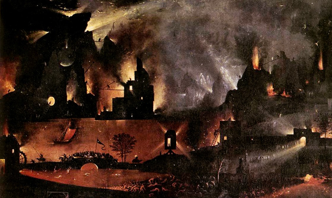
In a short book called Making Time: Essays on the Nature of Los Angeles, writer William L. Fox explores the remnant gas leaks and oil seeps of the city. At times, it reads as if he is describing the backdrop of a Hieronymus Bosch painting. Such is the strange and permanent apocalypse of 21st-century L.A.

Fox writes, for example, that “a methane vent opened up in the middle of Fairfax Street” back in 1985, and that it “burned uncontrollably for days before it could be put out.” At night, it was a world lit by flames. Astonishingly, he adds, in 1962 “a Hawthorne woman had a fire under her house—a house with no basement. She located the source of the problem when she went outside and touched a match to a crack in the sidewalk: A flame ran down to it.”

This city where sidewalks burn and sewers fill with oily ooze is a city built here almost specifically for that very reason; Los Angeles, in many ways, is a settlement founded on petroleum byproducts, and the oil industry for which the city was once known never actually left. It just got better at hiding itself.

It is already well known that there are oilrigs disguised in plain sight all over the city. The odd-looking tower behind Beverly Hills High School, for example, is actually a camouflaged oilrig; an active oil field runs beneath the classrooms and athletic fields. Even stranger, the enormous synagogue at Pico and Doheny is not a synagogue at all, but a movable drilling tower designed to look like a house of worship, as if bizarre ceremonies for conjuring a literal black mass out of the bowels of the Earth take place here, hidden from view. If you zoom in on Google Maps, you can just make out the jumbles of industrial machinery tucked away inside.

However, amidst all of this still-functional oil infrastructure, there are ruins: abandoned wells, capped drill sites, and derelict pumping stations that have effectively been erased from public awareness. These, too, play a role in the city’s subterranean fires and its poisonous breakouts of black ooze.

As Fox explains in Making Time, a labyrinth of aging pipelines and forgotten wells crisscrosses the city. He explains that the Salt Lake Oil Field—which underlies the La Brea Tar Pits, sprawls below an outdoor shopping center known as The Grove, and continues deep into the surrounding neighborhoods—once contained as many as 1,500 operative oil wells. However, most of these “have long since been abandoned and are virtually invisible,” he writes, and, alarmingly, “roughly 300 are unaccounted for.”

These “unaccounted for” oil wells are out of sight and out of mind—but it should not be assumed that they are safely or permanently capped. Indeed, the Salt Lake Oil Field actually “appears to be repressurizing with oil and water,” like an underground blister come back to life, Fox writes. This only raises the stakes of “a hazard already complicated by the lack of knowledge about the exact location of all the wells on the property.” Only 10 years ago, for example, “an orphaned well in Huntington Beach blew out in a gusher forty feet high, spraying oil and methane over one-half square mile, a hazardous-waste problem that will become more common.”
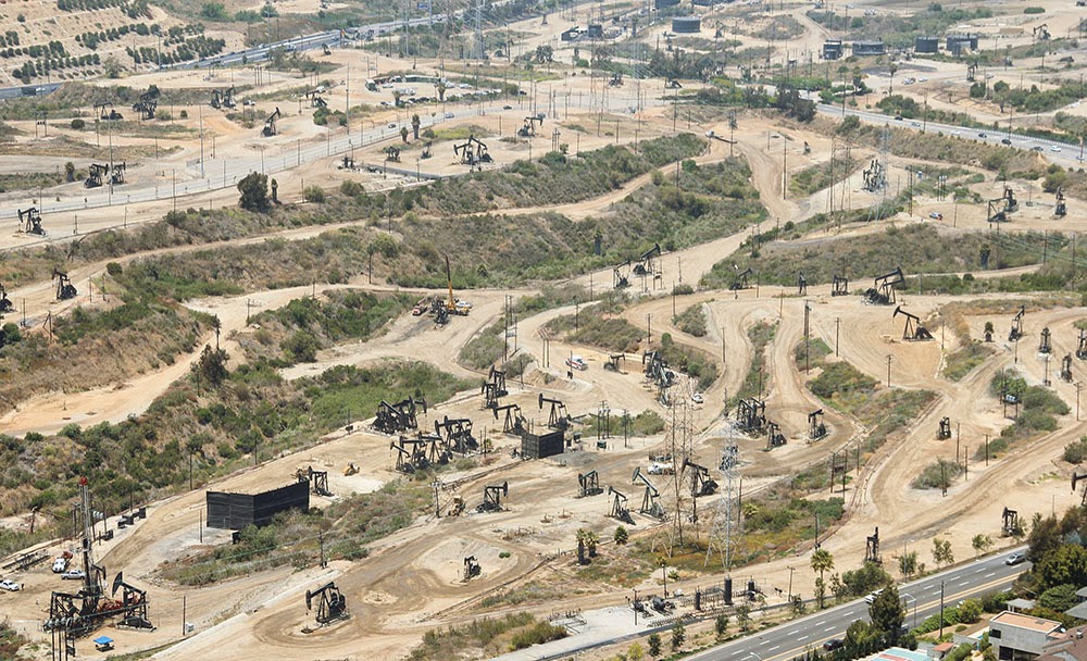
[Image: The Baldwin Hills old field; photo by Geoff Manaugh].

Due to its centrality, the Salt Lake field plays an outsized role in terms of strange petroleum events in the city. The Salt Lake was behind the multiday methane fire in the middle of Fairfax Avenue, for example, and behind arguably the most well known and certainly most destructive reminder of the city’s subterranean presence.

In 1989, in a busy strip mall at Fairfax and 3rd Street, a Ross Dress for Less began to fill with methane gas leaking up from a large pocket connected to the oil field below. Somehow, it had broken through the natural clay boundary that should have held it in place, and the methane thus easily seeped up into the storage rooms, closets, and retail galleries of the discount clothing giant.

Before long, the methane ignited and the entire store blew up.

[Image: Screen grab from YouTube].

This was by no means an insubstantial explosion—you should watch the aftermath on YouTube—as the entire façade of the building was blown to pieces, the roof collapsed, and dozens of people were disfigured by the detonation.

The resulting fires burned for hours. Small fires roared out of nearby sewer grates, and red and orange flames flickered out of even the tiniest cracks in the sidewalk, like some weird vision of Hell burning through the discount blouses and cheap drywall of this obliterated shopping center.
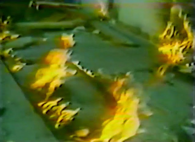
[Image: Flames burn through cracks in the sidewalk; screen grab from YouTube].

While reporting the tragedy, a local newscaster worryingly informed his viewers that it was simply “too early to tell where or when [the methane] might surface again”—in other words, that there could very well be further explosions. This paranoia—that there is something down there, some inhuman Leviathan stirring beneath the city, and that no one really knows when and where it will strike next—continues to this day.

Even at the time of the explosion, the possibility that city workers might inadvertently drill into a methane pocket beneath the neighborhood became one of the chief reasons for blocking the construction of a new subway line in the area. This same fear has recently resurfaced as the number one excuse for blocking a proposed subway through Beverly Hills.

Back in 2012, local parents released a video urging the city to stop the expansion of subterranean public transit through their neighborhood, concerned that it would cause Beverly Hills High School to explode. (The fact that stopping the subway would also keep certain economic undesirables out of their streets and shopping districts was just a fringe benefit.)

In any case, the narrative resonance of all this is impossible to deny. Formless and ancient things from the depths of our planet move beneath the city, unexpectedly setting fire to sidewalks and burning whole businesses to the ground. Taken out of context, this could be the plot of a new horror film—but it’s just urban life atop a still-active oil field.

As Matthew Coolidge, director of the Center for Land Use Interpretation, explained it to me, the city “is really just a giant scab of petroleum-fueled activities,” an impermanently sealed cap atop this buried monstrosity.

It is worth considering, then, next time you step over a patch of tar on the sidewalk, that the black gloom still bubbling up into people’s yards and basements, still re-asphalting empty gravel parking lots, is actually an encounter with something undeniably old and elementally powerful.

In this sense, Los Angeles is more than just a city; it is a kind of interface between a petrochemical lifestyle of cars and freeways and the dark force that literally fuels it, a subterranean presence that predates us all by millions of years and that continues to wander freely beneath L.A.’s tangled streets and buildings.

(Note: This piece was originally published on The Daily Beast. I have also written about the La Brea Tar Pits and William L. Fox’s book in Landscape Futures. Opening image: a close-up of Hell, from “The Garden of Earthly Delights” by Hieronymous Bosch, Museo del Prado, Madrid, Spain).

The Moving Mountain, or Terrain as Spectacle

[Image: Courtesy of the Los Angeles Times Photographic Archive, Department of Special Collections, Charles E. Young Research Library, UCLA, via KCET].

Nathan Masters remains one of the more interesting chroniclers of life and landscape in Southern California, as evidenced by his “L.A. as Subject” blog for KCET. I could (and should) just link to all his posts, to be honest—lost hills! buried rivers! conflicting grids!—but last week’s installment, albeit short, was particularly interesting.

“For a few days in late November 1937,” Masters writes, “it was the Southland’s greatest attraction—a landslide in slow motion, 1.5 million tons of an Elysian Park hillside creeping toward the Los Angeles River bed.”

Sensational news reports, printed in papers and broadcast on radio nationwide, described it as a “moving mountain,” and tourists came from afar to witness the geologic curiosity. One Oklahoma City police officer took a leave of absence to watch the slide. Two boys hopped freight trains from New York to see it. Some 10,000 sightseers came by the hour. Spectators pressed against police barricades along Riverside Drive, and enterprising vendors worked the throng like a baseball game, hawking peanuts, popcorn, and soda. Some even sold field glasses.

Even local astronomers showed up, telescopes in tow, in order to study the mobile mass, this blob of geology suddenly making a move into town.

After a catastrophic lurching of the slow-motion mountain, the terrain appeared to come to a standstill. “The next day, an estimated crowd of 500,000 converged on the site, munching on popcorn and hoping the mountain would move again.”

This pent-up dramaturgy of the landscape—the possibility that its newfound agency would continue—crawling, oozing, rolling, forcing its way into public consciousness—remains strong today, even if subsumed into other contexts.

In other words, I’d suggest that many Angelenos are still, in a sense, “munching on popcorn and hoping the [landscape] would move again,” and that this is the dark fascination of seismic instability, of what it means to live in an earthquake zone: that the land itself is active, motivated from within by a kind of a slow-motion sentience, a mineral energy that is as much an invigorating spectacle as it is an existential threat.

Read the rest of Masters’s post over at “L.A. as Subject.”

The Planetary Super-Surface of San Bernardino County

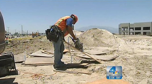
A surprisingly interesting business article in the Los Angeles Times this past weekend pointed out that an “industrial real estate boom” is underway east of the city: “Nestled on the windy plains at the foot of the San Bernardino Mountains,” we read, “once austere stretches of agricultural land have morphed into the country’s most desirable industrial real estate market, and it is growing faster than any other industrial region in the U.S.”

[Image: Construction work at a future Amazon.com warehouse in San Bernardino, courtesy of NBC Southern California].
What’s at stake? Eager buyers are snapping up “vast warehouses—some are bigger than 30 football fields under one roof—where they can store, process and ship merchandise such as clothes, books and toys to ever more online shoppers and handle the rising flood of goods passing through the ports of Los Angeles and Long Beach.”

It’s a logistics rush “so intense” that “developers are erecting more than 16 million square feet of warehouses on speculation, meaning they are gambling that buyers or renters will rush forward to claim the buildings by the time they are complete.”

As it happens, though, huge volumes of empty space framed by walls and ceilings are something of the ultimate testing ground for robot intelligence: “Once upon a time, a warehouse was where you stored things for weeks or months, such as toys and canned food that retailers would grab to restock their shelves. Sorting, organizing and moving the inventory was a constant challenge.”

However, now, in this age of empty architectural airspace, “Tracking goods in the modern age of bar codes, scanners and computers is a comparative breeze. The location of every widget can be identified with pinpoint accuracy and fetched by robots that can lift and carry 3,000-pound loads with ease.”

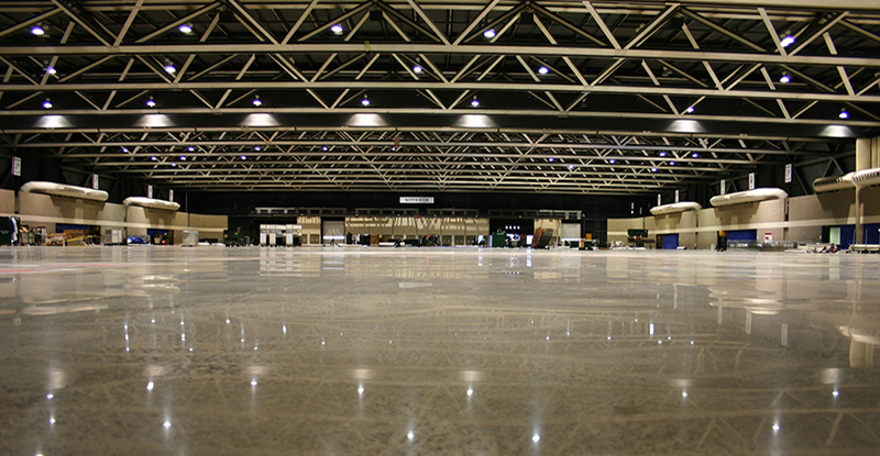
[Image: An unrelated warehouse photo from CCI Flooring].
I’m reminded of something novelist Zachary Mason said in an interview with BLDGBLOG three years ago. Mason, who has also worked in the field of artificial intelligence, pointed out the spatial problems faced by any truly emergent A.I.:

One of the problems with A.I. is that interacting with the world is really tough. Both sensing the world and manipulating it via robotics are very hard problems, and solved only for highly stripped-down special cases. Unmanned aerial vehicles, for instance, work well, because maneuvering in a big, empty, three-dimensional void is easy—your GPS tells you exactly where you are, and there’s nothing to bump into except the odd migratory bird. Walking across across a desert, though, or, heaven help us, negotiating one’s way through a room full of furniture in changing lighting conditions, is vastly more difficult.

The prospect of Artificial Intelligence finding its way into the world not by way of unmanned aerial vehicles flying in Mason’s “big, empty, three-dimensional void” but, instead, in the vast and echoing elsewhere of speculative warehouse space built in the desert outside Los Angeles is an incredible, and even somewhat frightening, thing to contemplate.

However, I started this post actually hoping to point out one small thing mentioned merely in passing at the end of the L.A. Times article.

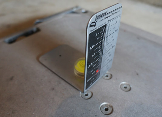
One of these warehouses, it turns out, is actually so huge it must be laser-leveled against the curvature of the earth.

[Image: A laser-leveling target used for calibrating car scales, taken by someone named “Butt Dyno,” via an evolutionm.net forum].
The building in question “has 32-foot ceilings and enough doors to load or unload 124 trucks at the same time,” presenting insane combinatorial possibilities that would make the bridges of Königsberg blush; but, even more unbelievably, this “480,000-square-foot facility recently built for Quaker Oats Co. on land that used to be part of Norton Air Force Base in San Bernardino… is so long at 1,000 feet that contractors laying the concrete floor used lasers to gently follow the curve of the Earth and keep the floor level.”

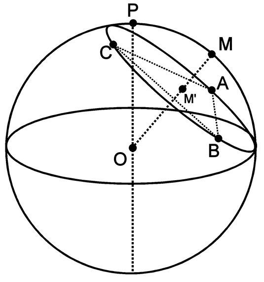
Of course, this means that you could also work in reverse, and thus deduce, from the precise leveling of the warehouse floor, the curvature of the planet it rests on, which, bizarrely enough, makes studying this building—an empty warehouse in the California desert—an unexpected subset of astronomical calculation.

Last week, for instance, we looked at various “benchmarks” that have been used for measuring the circumference of the Earth, but perhaps future generations will simply drive out to a cluster of warehouses somewhere on the fringes of Los Angeles—next century’s Stonehenge, a new Solomon’s Temple, or Superstudio meets Eratosthenes—ritually laser-level the floor on a hot summer afternoon, and thus deduce the limits of our world itself, all by way of the most “fundamental” of architectural interventions: the floor.


The logistical super-surface as planetary analogue.