Shrink-Wrapped Superloads and Monumental Processions

rock[Image: Michael Heizer’s rock; Instagram by BLDGBLOG].

A long time ago, in a city far, far away, I audited a class about Archigram taught by Annette Fierro at the University of Pennsylvania.

One of many things I remember from the class was a description of how the Centre Pompidou, a building designed by Richard Rogers and Renzo Piano, was constructed.

Apparently, in order for the building to be assembled, huge pieces of structure had to be rolled through the streets in the middle of the night, long after traffic had died down and after almost everyone had gone to sleep.

Whole boulevards and intersections were closed to make way for the passage of these massive objects, as if the ribs and thigh bones of some colossal creature were being painstakingly assembled in a distant neighborhood, in the dark. The building began as a distributed network of large, chaperoned objects.

You can imagine Parisian insomniacs of the late 1970s, wandering the streets before—lo!—these oversized, monumental spans moving at a crawl through the city would come into view. It would have been as if Paris itself had somehow been caught dreaming new buildings into existence at 2am.

The Space Shuttle in front of a doughnut shop; photo by Pulitzer Prize-winning photographer Don Bartletti, courtesy Los Angeles Times].

This same sort of awe at the mis-fit between an object’s size and its urban context arose a few years ago when a somewhat underwhelming art project by Michael Heizer was hauled, street by street, to LACMA; and it then happened again when the Space Shuttle made its slow way through Los Angeles back in October 2012.

I remember talking to architecture critic Christopher Hawthorne around that time, and he compared the Shuttle’s 2mph roll through the city to a Roman Triumph, as if Angelenos were celebrating an imperial event of extra-planetary importance, this grand object—this throne room—being paraded out in public for all to see.

It’s worth recalling how Cambridge classicist Mary Beard described the Triumph in an old interview with BLDGBLOG. “Here you’ve got the most fantastic parade ever of Roman wealth and imperialism,” she explained:

The Romans score disgustingly big victories, massacring thousands, and they come and celebrate it in the center of the city, bringing the prisoners and the spoils and the riches and all the rest. At one level, this is a jingoistic, militaristic display that would warm the heart of every European dictator ever after—but, at the same time, scratch the surface of that. Look at how the Romans talked about it. That very ceremony is also the ceremony in which you see the Romans debating and worrying about what glory is, what victory is. Who, really, has won? It’s a ceremony that provides Rome with a way of thinking about itself. It exposes all kinds of Roman intellectual anxieties.

Moving the Space Shuttle—or, for that matter, Heizer’s rock—gave not just Los Angeles but the entire United States an unexpected “way of thinking about itself,” in Beard’s terms, not just of the city’s historical relationship with the U.S. space program but of the country’s larger, and not necessarily perpetual, impulse to explore beyond the planet.

shuttle[Image: The Space Shuttle Endeavour in Los Angeles; photo by Andrew Khouri, courtesy Los Angeles Times].

These sorts of mega-objects, transported at great expense across urban infrastructure, are what the Center for Land Use Interpretation (CLUI) has described as “big things on the move.”

CLUI suggests that Heizer’s rock was “a bit like a religious procession, with acolytes in hard hats and safety-vest vestments walking alongside the sacred monolith, all lit up and flashing.” When the Space Shuttle hit the street, however, “Much was said about the irony of a craft that had circled the earth 4,700 times at speeds up to 17,000mph taking three days to get through L.A. traffic.”

As CLUI points out, Heizer’s rock and NASA’s Shuttle were both dwarfed by the actual largest “superload” to move through L.A.’s nighttime streets.

This third object “had little in the way of promotion,” they write; “in fact, the owners of it were hoping it would pass through the city as unnoticed as possible,” despite being “the largest and heaviest vehicle to ever pass through the streets of Los Angeles.”

The cargo was a steam generator from the San Onofre Nuclear Generating Station on the coast just south of Orange County, which was being hauled to a disposal site in Utah, 830 miles away.
Though it was junk, it was radioactive, so cutting it into smaller pieces would just generate more contaminated material. A custom superload truck was made, with a total weight for the truck and load totaling 1.6 million pounds. The generator was covered in thick paint so pieces would not flake off.

To be absolutely sure of its safety, “armed guards stayed with the truck all the time, especially when it was parked for the day by the side of the road and the rest of the crew were sleeping in motels.”

I mention all this after some photos were published this week in the Northwest Evening Mail, featuring huge, shrink-wrapped parts of a British Astute-class nuclear submarine being transported through the city of Barrow.

[Image: A shrink-wrapped section of a nuclear submarine; photo by Lindsey Dickings via the Northwest Evening Mail].

The newspaper warned that, while the “superstructure” made its sectioned way through the city, “car parking will be restricted.”

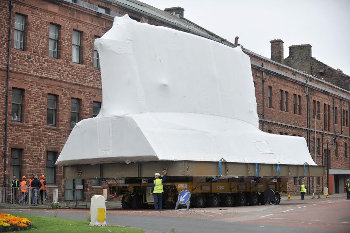
[Image: Photo by Lindsey Dickings via the Northwest Evening Mail].

In a sense, though, the sight of this dissected weapon of war is more artistic than an art project. A dream-like sequence of shrink-wrapped superstructures, abstract and white, channeling Christo or perhaps even the sculptures of Rachel Whiteread, inches forward street by street, shutting down secondary roads and sidewalks while waiting to be assembled in an eventual future shape, somewhere further down the road.

(Spotted via @CovertShores).

Please Don’t Take My Photochrome

05639v[Image: The Ghent Gate, Bruges, Belgium; via Library of Congress].

It’s easy to lose time clicking through the Library of Congress photochrome—or photochrom—collection.

05638v[Image: St. Croix Gate, Bruges, Belgium; via Library of Congress].

Each image has a strangely volumetric beauty, enhanced by subtle depths of shade, that results from a development and printing process that also produced these otherworldly intensities of color.

04949v[Image: Sevigne Gate, Bordeaux, France; via Library of Congress].

06570v[Image: Narrow Streets, Naples, Italy; via Library of Congress].

Houses, castles, mountains, rivers, ruins.

04978v[Image: The valley of Chamonix from the Aiguille du Floria, Chamonix Valley, France; via Library of Congress].

Utterly mundane subjects seem hallucinatory, like stills from an old animated film—

04936v[Image: Old house in Rue St. Martin, Bayeux, France; via Library of Congress].

—or even hand-colored illustrations from a fairy tale.

05683v[Image: The Rabot Gate, Ghent, Belgium; via Library of Congress].

Many look like paintings.

06011v[Image: The cathedral, Carthage, Tunisia; via Library of Congress].

Purely in the interests of weekend eye-candy, I just thought I’d post a bunch here.

06030v[Image: Sidi-Ben-Ziad, Tunis, Tunisia; via Library of Congress].

I could look at these all day—these old streets and roofscapes, honey-colored rocks and even brilliant white robes glowing with sunlight.

06029v[Image: Tresure Street, Tunis, Tunisia; via Library of Congress].

06026v[Image: Mosque of St. Catherine, Tunis, Tunisia; via Library of Congress].

05528v[Image: Red Sea street, Algiers, Algeria; via Library of Congress].

It’s also interesting to watch as small moments of modernity pop-up in the landscape, like funiculars or—in other images not included here—cable railways, train stations, and steamships.

05105v[Image: Cable railway, Marseille, France; via Library of Congress].

In other cases, it’s just the pure bulk of masonry and its interaction with sunlight that remains so visually compelling, where looking at the city almost meant looking at a geological formation, an artificial mountain chain that you knew was filled with rooms and hallways waiting to be explored.

05138v[Image: Abbey from the ramparts, Mont St. Michel, France; via Library of Congress].

05049v[Image: New Gate, Grasse, France; via Library of Congress].

05088v[Image: Basilica Fourviere, Lyons, France; via Library of Congress].

Finally, these old, looming roof profiles from buildings in Germany are spectacular.

Architects and engineers today should spend more time thinking about roofs, as spaces that can be inhabited, not merely as minimal surfaces used for no other purpose than to cover another space.

Roofs should be labyrinths you can walk through and get lost within. Roofs should have dimension; they should have windows and rooms. They should be spaces in their own right, not just lines where other spaces end.

00465v[Image: Knockenhauer Amtshaus, Hildesheim, Hanover, Germany; via Library of Congress].

00512v[Image: The Sack House, Brunswick (i.e., Braunschweig), Germany; via Library of Congress].

00451v[Image: Leibnitz House, Hanover, Germany; via Library of Congress].

00481v[Image: Das Rattenfangerhaus, Hameln, Hanover, Germany; via Library of Congress].

00522v[Image: Brusttuch, Goslar, Hartz, Germany; via Library of Congress].

00665v[Image: Holstengate, Lübeck, Germany; via Library of Congress].

In any case, last but not least, here are some still-standing “bridge houses” in Bad Kreuznach, Germany.

00762v[Image: Bridge houses, Kreuznach (i.e., Bad Kreuznach), Nahethal, Rhenish Prussia, Germany; via Library of Congress].

See many, many, many more photochrom prints over at the Library of Congress.

Zone for Game

[Image: Via TechCrunch].

There was finally something interesting to read about Pokémon Go. The game—which involves overlaying the physical world with a grab-bag of exotic creatures that players attempt to capture for points—might help catalyze a new form of virtual urban zoning.

In England, BuzzFeed reported earlier this week, “one person has been so unsettled by strangers turning up at their house that they’ve been forced to ask their member of parliament to intervene.” Apparently, the game’s virtual characters have been showing up within this person’s property lines, which has been “attracting people from far and wide to come and do battle.”

The peeved constituent presumably wants to establish some sort of legal mechanism for preventing uninvited virtual inhabitants from popping up on his or her private property.

[Image: Altered photo of an American front lawn, via Wikipedia].

In the U.S., meanwhile, a New Jersey man has also had enough of these sorts of pixellated guests.

As Kashmir Hill writes for Fusion, “So many people started showing up around [the New Jersey man’s] house, smartphones in hand, hunting Pokémon that he is now suing the makers of the game for creating a nuisance and unjustly enriching themselves by using his backyard as a virtual home for the game’s cartoon creatures.”

In a sense, the game’s designers are operating an illegal—albeit virtual—business on his property.

The New Jersey man’s legal complaint alleges that he “became aware that strangers were gathering outside of his home, holding up their mobile phones as if they were taking pictures. At least five individuals knocked on Plaintiff’s door, informed Plaintiff that there was a Pokémon in his backyard, and asked for access to Plaintiff’s backyard in order to ‘catch’ the Pokémon.”

Trespassing, unlicensed business activity, illegal occupancy, even burglary—as Hill points out, this has led to a rather fascinating challenge to the limits of personal property rights.

It is “quite a novel lawsuit,” she writes, referring specifically to the New Jersey case. “It is laughable, on the one hand, yet it does raise interesting questions around who owns the augmented reality space overlaid on people’s real world properties. When you own land, there are limits to how far above and below your house you own. A new question would be the extent of your rights to the new dimension on top of your property that is augmented reality.”

For Hill, this goes on to raise a series of related questions, including, “if augmented reality really catches on, and an internet environment overlaid on our real world surroundings becomes common, what will be the rules around using that augmented space? Could anyone put a virtual billboard on the front of your house or would they need your permission?”

Could you sell, lease, or subdivide the digital rights to your own home, yard, or lobby?

Could you extract a toll, tax, or commission from virtual usage?

[Image: “With the success of Pokémon Go, we set out to discover if any of the little monsters were hiding within the walls of our own L.A. Times newsroom.” Were those little monsters digitally trespassing? Photo via the L.A. Times].

A while back, we looked at zoning rules in the U.K., hoping to learn what those rules might reveal about the extent to which everyday citizens can use, or even fundamentally transform, personal real estate. What can the state regulate—what can zoning rules control—versus what a private property owner commands? What about digitally?

These Pokémon Go examples suggest something altogether more ominous, I might suggest, wherein a digital entertainment company could prove to have de facto access to your yard, your car, your front stoop, your place of business, using any one of those merely as a stage or platform for passive economic activity.

How much would I love to read a Supreme Court decision—and its dissent!—about these very questions, posing an absolute outside limit to personal digital property rights, where virtual homesteads begin and end, or the extent to which we have the right to populate other people’s space with augmentations and intrusions.

[Image: Skid Row, Los Angeles, via Wikipedia].

Briefly, it’s worth adding that this could also have urban-scale implications.

As Curbed L.A. pointed out this week, Los Angeles “is a veritable menagerie of diverse and unusual Poké-creatures,” which means that “the city may soon be overrun with Poké-tourists,” people from diverse geographic backgrounds hoping to capture high-value targets.

Pokémon Go will disappear from public memory relatively soon, of course, yet it is all but guaranteed to be replaced by other augmented-reality games that also rely on a quote-unquote real, physical location to determine the strategic value of player actions.

To what extent, then, will entire urban entities such as Los Angeles seek to collaborate with, or even directly fund, virtual inhabitants—virtual landmarks, virtual historic sites, virtual destinations—and what are the rules or regulations that might apply to them?

Finally—as anyone who has read Delirious New York or is familiar with the work of Hugh Ferriss knows—cities are fundamentally shaped by zoning laws, literally down to the shadows cast by individual buildings. What, then, might digital or virtual zoning actually look like? How might it shape urban environments to come?

What, as Kashmir Hill asked, is “the extent of your rights to the new dimension on top of your property that is augmented reality”?

*Update* In a slightly expanded version of this post syndicated by Motherboard, I point out that Thailand is already looking “to restrict zoning for the Pokémon Go game after receiving several complaints from people who are disturbed by the trainers, or players, of the game.”

The proposed blocklist would begin with sites of national security, removing them from the field of potential gameplay. However, it is not hard to imagine private citizens using their own political influence to help determine which homes—let alone which streets or entire neighborhoods—would be added to the no-game zone. Think of it as geofencing as a form of urban design.

More over at Motherboard.

(Thanks to @AnthonyAdler for tweeting about “virtual environment policy” a few days ago).

“We’re opening up the solar system”

[Image: Cropped Apollo mission panorama, courtesy Lunar and Planetary Institute, via @Rainmaker1973; view full].

Some lunar news: “The first company to apply for a commercial space mission beyond Earth orbit has just received approval from the federal government,” Ars Technica reports. “As part of the Google Lunar X Prize competition, Moon Express intends to launch a small, single-stage spacecraft to land on the Moon by the end of 2017.”

“We’re opening up the solar system,” company co-founder Bob Richards says, with at least some degree of over-statement.

As the Wall Street Journal suggested back in June, the mission could prove to be merely “the first in an array of for-profit ventures throughout the solar system,” and it is “expected to set important legal and diplomatic precedents for how Washington will ensure such nongovernmental projects comply with longstanding international space treaties.”

There will be a lot to watch for in the next few years, in other words, including the archaeological implications of these missions.

On a vaguely related note, the company’s other cofounder is Naveen Jain, who has what sounds like a pretty amazing private meteorite collection.

Global Positioning Shift

australia[Image: Australia, rendered by Neema Mostafavi for NASA].

Australia, it turns out, is not quite where maps think it is. Thanks to plate tectonics, the island nation is moving north by 1.5 centimeters a year, which means that the entire country is now nearly five feet further north than existing cartography suggests it should be.

As a result, Australia’s lat/long coordinates are going “to shift,” the BBC reports.

Interestingly, “the body responsible for the change said it would help the development of self-driving cars, which need accurate location data to navigate.” In other words, the navigational capabilities of autonomous vehicles and other self-driving robots are, at least indirectly, affected by plate tectonics—by the ground literally moving beneath their wheels.

“If the lines [of latitude and longitude] are fixed, you can put a mark in the ground, measure its co-ordinate, and it will be the same co-ordinate in 20 years,” explained Dan Jaksa of Geoscience Australia. “It’s the classical way of doing it.”
Because of the movement of the Earth’s tectonic plates, these local co-ordinates drift apart from the Earth’s global co-ordinates over time.
“If you want to start using driverless cars, accurate map information is fundamental,” said Mr Jaksa.
“We have tractors in Australia starting to go around farms without a driver, and if the information about the farm doesn’t line up with the co-ordinates coming out of the navigation system there will be problems.”

Put another way, gaps have been opening up between the world of robotic navigation and the actual, physical barriers those machines seek to navigate.

You could perhaps argue that there is our Australia—that is, a human Australia of streets, walls, and buildings—and then there is the machines’ Australia, a parallel yet intersecting world of skewed reference points and offset walls, a kind of ghost nation, inhabited only by robots, departing further and further from the limits of human geographic experience every day.

aussie
[Image: Via the Australian Intergovernmental Committee on Surveying and Mapping].

Of course, this would not be the first time that the accuracy of geographic information has a measurable effect on precision agriculture. However, it is also not the first time that geographers have realized that they don’t know precisely where a country really is.

In his recent book about GPS, Pinpoint, author Greg Milner writes about “the geopolitical importance of geodesy,” or the study of the Earth’s exact geometric shape (it is an “oblate spheroid”).

“The geopolitical significance of geodesy increased with the onset of the Cold War,” Milner writes. “In a very real sense, the West did not know the exact location of the USSR”—and, thus, did not know exactly how or where to target its missiles. “‘Missiles were the big drivers in getting the datums tied down,’ Gaylord Green remembers. ‘If I wanted to hit a target in Russia, I couldn’t hit squat if I didn’t have their datum tied down to mine.’”

Briefly, it’s worth pointing out a fascinating side-note from Milner’s book: “The trajectory a missile follows is influenced by the gravity field where it is launched, and its aim can be disrupted by the gravity at the target, so countries often kept their gravity data classified.” I love the John le Carré-like implications of classified gravity data, including what it might take to smuggle such info out of an enemy nation.

But let’s go back to the missile thing: in addition to the question of how farm equipment and other self-driving vehicles can successfully navigate the landscape when they don’t, in fact, have the correct terrestrial coordinates, Australia’s strange misplacement on global maps implies that every potential military target in the country would also have been roughly five feet away from where existing charts say they are.

An old, uncorrected missile system in a decaying military base somewhere mistakenly fires sixty years from now, rockets off toward Australia… and plummets into the sea, missing its coastal target by several feet. Plate tectonics as a slow national defense mechanism.

Read more at the BBC.

Inland Sea

For two closely related projects—one called L.A.T.B.D., produced for the USC Libraries, and the other called L.A. Recalculated, commissioned by the 2015 Chicago Architecture Biennial, both designed with Smout Allen—I wrote that Los Angeles could be approached bathymetrically.

Los Angeles is “less a city, in some ways, than it is a matrix of seismic equipment and geological survey tools used for locating, mapping, and mitigating the effects of tectonic faults. This permanent flux and lack of anchorage means that studying Los Angeles is more bathymetric, we suggest, than it is terrestrial; it is oceanic rather than grounded.”

pendulums
[Image: Underground seismic counterweights act as pendulums, designed to stabilize Los Angeles from below; from L.A. Recalculated by Smout Allen and BLDGBLOG].

Because of seismic instability, in other words, the city should be thought of in terms of depths and soundings, not as a horizontal urban surface but as a volumetric space churning with underground forces analogous to currents and tides.

This bathymetric approach to dry land came to mind again when reading last month that the land of Southern California, as shown by a recent GPS study, is undergoing “constant large-scale motion.”

It is more like a slow ocean than it is solid ground, torqued and agitating almost imperceptibly in real-time.

“Constant large-scale motion has been detected at the San Andreas Fault System in Southern California,” we read, “confirming movement previously predicted by models—but never before documented. The discovery will help researchers better understand the fault system, and its potential to produce the next big earthquake.”

fault
[Image: “Vertical velocities” along the San Andreas Fault; via Nature Geoscience].

This is true, of course, on a near-planetary scale, as plate tectonics are constantly pushing land masses into and away from one another like the slow and jagged shapes of an ice floe.

But the constant roiling motion of something meant to be solid is both scientifically fascinating and metaphorically rich—eliminating the very idea of being grounded or standing on firm ground—not to mention conceptually intriguing when put into the context of architectural design.

That is, if architecture is the design and fabrication of stationary structures, meant to be founded on solid ground, then this “constant large-scale motion” suggests that we should instead think of architecture, at least by analogy, more in terms of shipbuilding or even robotics. Architecture can thus be given an altogether different philosophical meaning, as a point of temporary orientation and solidity in a world of constant large-scale surges and flux.

Put another way, the ground we rely on has never been solid; it has always been an ocean, its motion too slow to perceive.

Subterranean Robotics on Other Worlds

pavonis-mons-skylight[Image: Possible cave entrance on Mars, via space.com].

There was an interesting article in last month’s issue of Air & Space about the design of subterranean robotics for exploring caves on other planets.

It primarily looks at “a robot called LEMUR, short for Limbed Excursion Mechanical Utility Robot.” LEMUR, we read, “is designed to climb the porous walls of a cave 150 million miles away, on Mars.”

lemur
[Image: The LEMUR robot in action; photo by Aaron Parness/JPL via Air & Space].

The article goes on to discuss the work of speleobiologist Penelope Boston, who you might remember from a long interview here on BLDGBLOG (originally recorded for Venue), as well as the challenges of sample-return missions, how robots might go spelunking on other planets, and more.

Check it out in full.

Supergrass, or the Anthropocene is Local

lawn
[Image: Artificial grass stretches onto a sidewalk in Somerville, MA; Instagram by BLDGBLOG].

While reading that “land use has already pushed biodiversity below the level proposed as a safe limit,” possibly setting the stage for an irreversible decline in biological variety around the world, it’s worth recalling a somewhat tragicomic article published last week warning that Britain has so many artificial lawns, these so-called permanent botanicals are now considered a threat to wildlife.

From the Guardian:

From local authorities who purchase in bulk for use in street scaping, to primary schools for children’s play areas and in the gardens of ordinary suburban family homes, the sight of pristine, green artificial grass is becoming a familiar sight. One company has registered a 220% year-on-year increase in trade of the lawns.
But as families, councils and schools take to turfing over their open spaces with a product which is most often made from a mix of plastics—polypropylene, polyurethane and polyethylene—there is growing alarm amongst conservationists and green groups.
They say the easy fix of a fake lawn is threatening the habitat of wildlife, including butterflies, bees and garden birds as well as creating waste which will never biodegrade.

I’m reminded of the artificial gardens of Don DeLillo’s new novel, Zero K, where plastic trees and flowers tremble lifelessly in an air-conditioned breeze, installed as part of a remote desert complex devoted to human immortality.

Only here, it’s the everyday landscape of Britain, slowly but surely being plasticized, replaced by a chemical surrogate for living matter, this ubiquitous manufactured stand-in for the picturesque English gardens of an earlier generation.

Lost butterflies flutter over plastic lawns, smelling nothing but petrochemicals. Bees land on the petals of polyester flowers and pick up the dust of industrial dyes rather than pollen. Excess drops of translucent glue glow in the afternoon sunlight.

The anthropocene is not only a global transformation; it takes place in—it takes the place of—your own backyard.

(Vaguely related: In the Garden of 3D Printers).

Schrödinger’s Speleology, or the Stalking of “Entranceless Caves”


[Image: A cave entrance in France, via Wikipedia].

I recently finished reading Last Words by Michael Koryta, a detective novel largely centered on an unmapped fictional cave system in southern Indiana, part of the great karst belt near the border with Kentucky.

One interesting thing about the novel is that this cave, known in the book as “Trapdoor,” operates on many different narrative levels. Most obviously, of course, there’s the unreliable memory of a major character suspected—yet never officially accused—of committing a murder there, where the darkness of Trapdoor’s linked subterranean spaces becomes a kind of mental model for his own inability to recall what really happened, when a woman was (apparently) murdered in the cave’s depths.

There is also a subplot, though, revealed quite late in the book, in which disguised real estate deals and obscure land trust deeds have been premised on the subterranean potential of this land snaking along the region’s old creeks and rivers, transactions inked with the belief that Trapdoor’s passages might continue beneath distant parcels; in this way, the cave comes to represent the conspiratorial intentions of people otherwise unwilling to state their true goals.

Finding the true outer limits of the cave—that is, finding the land parcels that the cave secretly connects from below—becomes coextensive with discovering the truth about what occurred underground there so many years earlier.


[Image: Cave in Venezuela, photographed by Vittorio Crobu, courtesy European Space Agency].

It was these latter parts of the novel—including a handful of plot points I won’t get into—that reminded me of notes I’d taken from a book called the Encyclopedia of Caves several years ago. That book includes a short entry written by Nevin W. Davis, called “Entranceless Caves, Discovery of.”

As Davis describes them, “entranceless caves” are like speleological versions of Schrödinger’s cat: they exist, but they have not been verified. They are real—but perhaps not. They are both in the ground and nowhere.

At times, Davis’s text is almost like a koan: “Suppose the cave is totally unknown and has no entrance,” he writes. What exactly is such a thing, and how can we account for its presence (or absence) in the landscape? After all, these are caves that have not been—and perhaps cannot ever be—located.

He goes on to describe mathematical models used to generate a probability of subterranean connection: the calculated likelihood that physically inaccessible voids might exist beneath the surface of things, linking one part of the world to another.


[Image: Cave in Mexico, photographed by Vittorio Crobu, courtesy European Space Agency].

“Another consideration in searching for caves,” Davis continues, “is entrance lifetime. Caves are long-term features under the landscape with lifetimes measured in millions of years, whereas entrances to them are fleeting features with lifetimes measured in millennia.”

Cave entrances come and go, in other words, while the caves they once led to remain. They can be covered over, woven shut by tree roots, erased.

As Davis describes it, “leaves and twigs will soon cover and block small vertical entrances. Pits less than a meter in diameter”—tiny holes that can nonetheless lead to huge systems, such as the real-life Mammoth Cave or the fictional Trapdoor—“can be totally blocked in one season. Leaves blocking a small entrance are soon followed by roots and more leaves and it is not long before all traces of an entrance are gone.”

This leads to an activity he calls “stalking the elusive entranceless cave”—which, for what it’s worth, seems like a perfect metaphor for part of Koryta’s novel, in which the book’s amnesia-stricken potential murderer undergoes hypnosis. His memory is a cave with no entrance.


[Image: Cave in Venezuela, photographed by Vittorio Crobu, courtesy European Space Agency].

In any case, there can also be “false positives,” Davis warns. These would be caves that appear to have been detected but that are not, in fact, real. A “stalker” of previously unknown caves might find herself misled by patches of melted snow, for example, or by other signs that wrongly give the impression of warm air rising from empty passages below.

“The best condition to search for snow melt,” Davis suggests, instead, “is with a new snowfall in midwinter with an overcast sky, since sunlight can also give false positives by shining through snow cover onto rocks and melting the snow. This is a tried-and-true method that has led to countless new caves.” It’s cave-discovery weather.

In essence, this is a process of reading the landscape: interpreting its surface features in order to gain knowledge of these other, deeper dimensions.


[Image: An artificially enlarged entrance to Carlsbad Caverns; Instagram by BLDGBLOG].

The next entry in the Encyclopedia is also worth reading; it is simply called “Entrances,” by William B. White. “Some caves,” White writes, continuing the strangely existential thread of Davis’s work, “may have no entrances at all.”

White adds a new category here, what he calls the “concealed entrance.”

At least from an architectural point of view, what’s interesting is that this allows White and other speleologists to challenge the idea of there being a clean dividing line between inside and outside, between a cave and the Earth’s surface.

Instead, he suggests, a cave’s entrance should actually be thought of as a transition: the “cave entrance zone,” White writes, “is, in effect, a continuous sequence of microclimates,” one that eventually leads to a point at which there is no direct access to sunlight or to rainfall.

It is only at that point that you are truly “inside” the Earth. You have transitioned to the great interior.


[Image: Photographer unknown; image via Discovery Communications].

Briefly, White also points out that cave entrances are not only unstable in the temporal sense—as Davis mentioned, cave entrances can completely disappear over time.

However, they are also unstable spatially: that is, they can physically migrate through the landscape over thousands, or even tens, of years.

Due to continual rockfall, for example, a cave entrance “not only migrates deeper into the hill but also migrates upward as rocks break away,” Davis writes. This can potentially push a cave entrance dozens and dozens of feet from its original location, while the cave itself remains stationary. Imagine a mouth migrating across your body while your stomach stands still.

Of course, this also means that an entrance to a given cave system can abruptly migrate onto someone else’s property, or that it can even pop open, suddenly and dramatically changing the value of a particular piece of land.

The next thing you know, following an unusually intense summer rainstorm, you own the entrance to a cave.

[Image: A salt cave in Israel; image via
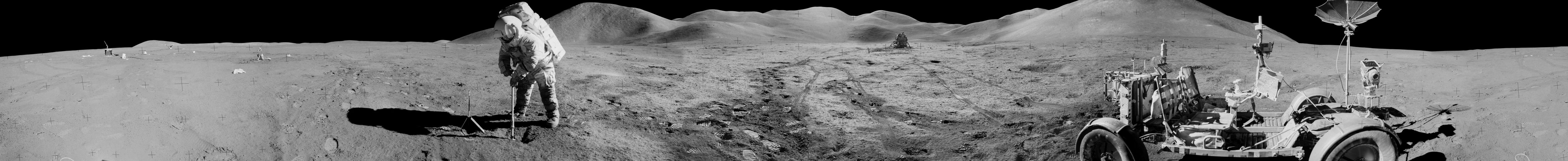
 Wikipedia].

Which brings us back to Michael Koryta’s novel. There, an unexpected opening into the unstable depths of Indiana’s fictional Trapdoor complex changes the lives of many characters not just for the worse, but for the tragic.

The cave, as Koryta depicts it, is a relentless and unsympathetic thing, a space always shifting, growing organically but not alive, invisible yet ubiquitous, moving beneath the surface of the landscape, connecting parcels of land, as well as the lives—and deaths—of the characters who thought they were just idly passing time above.

(Vaguely related: Life on the Subsurface: An Interview with Penelope Boston).

chill.once.waddle

what3words[Image: Screen-grab from what3words].

Using the bizarre three-word addressing system known as what3words, the now-destroyed curb in Hayward, CA, mentioned in the previous post, is located at a site called “chill.once.waddle.”

As you can tell, of course, what3words is not a descriptive language, and these phrases are not intended to mean anything: they are simply randomly-generated sets of words used to give any location on earth a physical address.

As Quartz explained the system back in 2015, it is, at heart, “a simple idea”:

…a combination of three words, in any language, could specify any three meter by three meter square in the world—more than enough to designate a hut in Siberia or a building doorway in Tokyo. Altogether, 40,000 words combined in triplets label 57 trillion squares. Thus far, the system has been built in 10 languages: English, Spanish, French, German, Italian, Swahili, Portuguese, Swedish, Turkish, and, starting next month, Arabic… All together, this lingua franca requires only five megabytes of data, small enough to reside in any smartphone and work offline. Each square has its identity in its own language that is not a translation of another. The dictionaries have been refined to avoid homophones or offensive terms, with short terms being reserved for the most populated areas

The addresses are poetically absurd—shaky.audit.detail, salsa.gangs.square, dozed.lamps.wing.

I mention this, however, because I meant to post last month that “Mongolia is changing all its addresses to three-word phrases.” Again, from Quartz:

Mongol Post is switching to the What3Words system because there are too few named streets in its territory. The mail network provides service over 1.5 million square km (580,000 square miles), an area that’s three times the size of Spain, though much of that area is uninhabited. Mongolia is among the world’s most sparsely populated countries, and about a quarter of its population is nomadic, according to the World Bank.

While, on one level, in an age of stacks and infinite addressability, this seems like a thrilling, almost science-fictional step forward for locating and mapping physical spaces, it also seems like an alarming example of national over-reliance on a proprietary address system, one that the state itself ultimately cannot control.

Imagine a nation-state losing influence over the physical coordinates of its own territory, or a population stuck living inside an outdated, even discontinued address network, and needing to start again, from scratch, renaming all its streets and buildings—not to mention all the lost local histories and significance of certain place names, from avenues to intersections, that need to be reclaimed.

Granted, in this particular case, the system is being adopted precisely because “there are too few named streets” in Mongolia, that does not change the fact that the country will soon be dependent upon the continued existence of what3words for its packages to be delivered, its services to run, and its spatial infrastructures to function. It will be interesting to see how the transition to the use of these peculiar place tags goes—but, even more so, how this decision looks in five or ten years’ time.

Curbed

10-HaywardCornerWEB[Image: Photo by Geoff Manaugh].

Lacking any sort of seismically-themed historic preservation plan, this seemed all but inevitable: a city works crew has fixed, and thus destroyed, the amazing offset curb at the intersection of Rose and Prospect in Hayward, California, where seismic “creep” has been inadvertently tracked for decades.

From the L.A. Times:

Since at least the 1970s, scientists have painstakingly photographed the curb as the Hayward fault pushed it farther and farther out of alignment. It was a sharp reminder that someday, a magnitude 7 earthquake would strike directly beneath one of the most heavily populated areas in Northern California.
Then, one early June day, a city crew decided to fix the faulty curb—pun intended. By doing what cities are supposed to do—fixing streets—the city’s action stunned scientists, who said a wonderful curbside laboratory for studying earthquakes was destroyed.

As you can see here, small black lines had been drawn on the curb as a visual aid for helping measure exactly how far its opposing sides had been displaced by so-called “fault creep.”

11-HaywardCornerWEB[Image: Photo by Geoff Manaugh].

The curb on the west is moving north—along with the rest of that part of Hayward, California—while the curb on the east basically marks the edge of a different tectonic plate.

I was there roughly two years ago, looking at fault creep up and down California—primarily along the San Andreas Fault—when I took these shots; at the time, I wrote that the intersection could be thought of as “something like an alternative orientation point for the city, a kind of seismic meridian—or perhaps doomsday clock—by which Hayward’s ceaseless cleaving can be measured.”

CurbsTwoWEBCurbsWEB[Images: Photos by Geoff Manaugh].

Alas, we’ll have to wait presumably until the 2050s before the curbs offset to anything like they were when these photographs were taken.

(Thanks to Wayne Chambliss for the heads up!)