Cities Under Siege

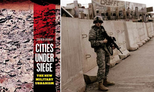
[Image: Stephen Graham’s Cities Under Siege].

In a 2003 paper for the Naval War College Review, author Richard J. Norton defined the term feral cities. “Imagine a great metropolis covering hundreds of square miles,” Norton begins, as if narrating the start of a film pitch. “Once a vital component in a national economy, this sprawling urban environment is now a vast collection of blighted buildings, an immense petri dish of both ancient and new diseases, a territory where the rule of law has long been replaced by near anarchy in which the only security available is that which is attained through brute power.”

With the city’s infrastructure having collapsed long ago—or perhaps having never been built in the first place—there are no works of public sanitation, no sewers, no licensed doctors, no reliable food supply, no electricity. The feral city is a kind of return to medievalism, we might say, back to the future of a dark age for anyone but criminals, gangs, and urban warlords. It is a space of illiterate power—strength unresponsive to rationality or political debate.

From the perspective of a war planner or soldier, the feral city is also spatially impenetrable, a maze resistant to aerial mapping. Indeed, its “buildings, other structures, and subterranean spaces, would offer nearly perfect protection from overhead sensors, whether satellites or unmanned aerial vehicles,” Norton writes.

This is something Russell W. Glenn, formerly of the RAND Corporation—an Air Force think tank based in Southern California—calls “combat in Hell.” In his 1996 report of that name, Glenn pointed out that “urban terrain confronts military commanders with a synergism of difficulties rarely found in other environments,” many of which are technological. For instance, the effects of radio communications and global positioning systems can be radically limited by dense concentrations of architecture, turning what might otherwise be an exotic experience of pedestrian urbanism into a claustrophobic labyrinth inhabited by unseen enemy combatants.

Add to this the fact that military ground operations of the near future are more likely to unfold in places like Sadr City, Iraq—not in paragons of city planning like Vancouver—and you have an environment in which soldiers are as likely to die from tetanus, rabies, and wild dog attacks, Norton suggests, as from actual armed combat.

Put another way, as Mike Davis wrote in Planet of Slums, “the cities of the future, rather than being made out of glass and steel as envisioned by earlier generations of urbanists, are instead largely constructed out of crude brick, straw, recycled plastic, cement blocks, and scrap wood. Instead of cities of light soaring toward heaven, much of the twenty-first-century urban world squats in squalor, surrounded by pollution, excrement, and decay.”

But feral cities are one thing, cities under siege are something else.
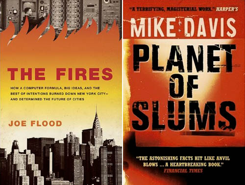
[Images: The Fires by Joe Flood and Planet of Slums by Mike Davis].

In his new book Cities Under Siege, published just two weeks ago, geographer Stephen Graham explores “the extension of military ideas of tracking, identification and targeting into the quotidian spaces and circulations of everyday life,” including “dramatic attempts to translate long-standing military dreams of high-tech omniscience and rationality into the governance of urban civil society.” This is just part of a “deepening crossover between urbanism and militarism,” one that will only become more pronounced, Graham fears, over time.

One particularly fascinating example of this encroachment of “military dreams… into the governance of urban civil society” is actually the subject of a forthcoming book by Joe Flood. The Fires tells the story of “an alluring proposal” offered by the RAND Corporation, back in 1968, “to a city on the brink of economic collapse [New York City]: using RAND’s computer models, which had been successfully implemented in high-level military operations, the city could save millions of dollars by establishing more efficient public services.” But all did not go as planned:

Over the next decade—a time New York City firefighters would refer to as “The War Years”—a series of fires swept through the South Bronx, the Lower East Side, Harlem, and Brooklyn, gutting whole neighborhoods, killing more than two thousand people and displacing hundreds of thousands. Conventional wisdom would blame arson, but these fires were the result of something altogether different: the intentional withdrawal of fire protection from the city’s poorest neighborhoods—all based on RAND’s computer modeling systems.

In any case, Graham’s interest is in the city as target, both of military operations and of political demonization. In other words, cities themselves are portrayed “as intrinsically threatening or problematic places,” Graham writes, and thus feared as sites of economic poverty, moral failure, sexual transgression, rampant criminality, and worse (something also addressed in detail by Steve Macek’s book Urban Nightmares). All cities, we are meant to believe, already exist in a state of marginal ferality. I’m reminded here of Frank Lloyd Wright’s oft-repeated remark that “the modern city is a place for banking and prostitution and very little else.”

In some of the book’s most interesting sections, Graham tracks the growth of urban surveillance and the global “homeland security market.” He points out that major urban events—like G8 conferences, the Olympics, and the World Cup, among many others—offer politically unique opportunities for the installation of advanced tracking, surveillance, and facial-recognition technologies. Deployed in the name of temporary security, however, these technologies are often left in place when the event is over: a kind of permanent crisis, in all but name, takes over the city, with remnant, military-grade surveillance technologies gazing down upon the streets (and embedded in the city’s telecommunications infrastructure). A moment of exception becomes the norm.

Graham outlines a number of dystopian scenarios here, including one in which “swarms of tiny, armed drones, equipped with advanced sensors and communicating with each other, will thus be deployed to loiter permanently above the streets, deserts, and highways” of cities around the world, moving us toward a future where “militarized techniques of tracking and targeting must permanently colonize the city landscape and the spaces of everyday life.”

In the process, any real distinction between a “homeland” and its “colonies” is irreparably blurred. Here, he quotes Michel Foucault: “A whole series of colonial models was brought back to the West, and the result was that the West could practice something resembling colonization, or an internal colonialism, on itself.” If it works in Baghdad, the assumption goes, then let’s try it out in Detroit.

This is just one of many “boomerang effects” from militarized urban experiments overseas, Graham writes.
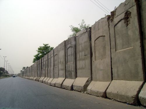
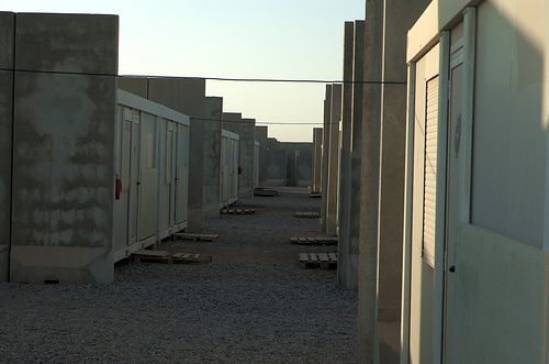
[Images: Blast walls in Iraq].

But what does this emerging city—this city under siege—actually look like? What is its architecture, its urban design, its local codes? What is its infrastructure?

Graham has many evocative answers for this. The city under siege is a place in which “hard, military-style borders, fences and checkpoints around defended enclaves and ‘security zones,’ superimposed on the wider and more open city, are proliferating.”

Jersey-barrier blast walls, identity checkpoints, computerized CCTV, biometric surveillance and military styles of access control protect archipelagos of fortified social, economic, political or military centers from an outside deemed unruly, impoverished and dangerous. In the most extreme examples, these encompass green zones, military prisons, ethnic and sectarian neighborhoods and military bases; they are growing around strategic financial districts, embassies, tourist and consumption spaces, airport and port complexes, sports arenas, gated communities and export processing zones.

Cities Under Siege also extensively covers urban warfare, a topic that intensely interests me. From Graham’s chapter “War Re-Enters the City”:

Indeed, almost unnoticed within “civil” urban social science, a shadow system of military urban research is rapidly being established, funded by Western military research budgets. As Keith Dickson, a US military theorist of urban warfare, puts it, the increasing perception within Western militaries is that “for Western military forces, asymmetric warfare in urban areas will be the greatest challenge of this century… The city will be the strategic high ground—whoever controls it will dictate the course of future events in the world.”

Ralph Peters phrased this perhaps most dramatically when he wrote, back in 1996 for the U.S. Army War College Quarterly, that “the future of warfare lies in the streets, sewers, high-rise buildings, industrial parks, and the sprawl of houses, shacks, and shelters that form the broken cities of our world.” The future of warfare, that is, lies in feral cities.

In this context, Graham catalogs the numerous ways in which “aggressive physical restructuring,” as well as “violent reorganization of the city,” is used, and has been used throughout history, as a means of securing and/or controlling a city’s population. At its most extreme, Graham calls this “place annihilation.” The architectural redesign of cities can thus be used as a military policing tactic as much as it can be discussed as a topic in academic planning debates. There are clearly echoes of Eyal Weizman in this.

On one level, these latter points are obvious: small infrastructural gestures, like public lighting, can transform alleyways from zones of impending crime to walkways safe for pedestrian use—and, in the process, expand political control and urban police presence into that terrain. But, as someone who does not want to be attacked in an alleyway any time soon, I find it very positive indeed when the cityscape around me becomes both safer by design and better policed. Equally obvious, though, when these sorts of interventions are scaled-up—from public lighting, say, to armed checkpoints in a militarized reorganization of the urban fabric—then something very drastic, and very wrong, is occurring in the city. Instead of a city simply with more cops (or fire departments), you begin a dark transition toward a “city under siege.”

I could go on at much greater length about all of this—but suffice it to say that Cities Under Siege covers a huge array of material, from the popularity of SUVs in cities to the blast-wall geographies of Baghdad, from ASBOs in London to drone helicopters in the skies above New York. Raytheon’s e-Borders program opens the book, and Graham closes it all with a discussion of “countergeographies.”

(Parts of this post, on feral cities, originally appeared in AD: Architectures of the Near Future, edited by Nic Clear).
Three Trees

1) And then there was computational wood.

For his master’s thesis, produced last year under the direction of Timo Arnall, Matt Jones, Jack Schulze, Lennart Andersson, and Mikael Wiberg, designer Matt Cottam directed this short video about a technique for growing electrical circuitry inside the trunks of living trees. Just inject the right trace metals, Cottam’s mad scientist narrator explains, do some more techno-magic, and simply let the wood grow…

If only it were true. But the day will come, my t-shirt will read, when all the trees around us are computers.

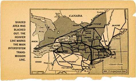
2) While researching blackouts for a seminar I am teaching this winter at Pratt, I stumbled on a strange anecdote from The New York Times, published back in 1986, about a plant physiologist at the Brooklyn Botanic Garden who was seeking a way to end the risk of “trees crashing down on power lines” (a major source of power interruptions).


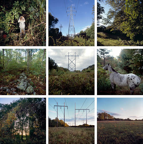
[Images: All photos by Adam Ryder, from On the Grid].

“One of the things we’re looking at,” the scientist explained, “is something that will directly retard the growth of trees”—that is, chemicals “that interfere with the basic growth hormones.” He was trying to develop, he adds, “a mild chemical” that would deliberately slow tree growth, “and instead of spraying we’re injecting [it] directly into the tree.”

Who knows where that research has now led them, twenty-four years later, but I’d suggest someone might want to mail them a copy of The Death of Grass. ASAP.


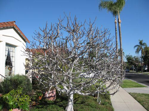
[Image: A fig tree grows in Los Angeles; photo by Pieter Severynen].

3) While going back through old bookmarks this morning, I rediscovered Tree of the Week, a series of articles run by the Los Angeles Times. The overall project could be described as a botanical cartography of the city: a catalog of Angeleno trees.

This week’s tree is the “highly productive fig“; last week’s was the Blackwood Acacia. With regard to the latter tree, Pieter Severynen, the series author, writes: “Given its negative properties it should be clear that a description of this tree, or for that matter any tree of the week, does not imply an endorsement to plant. Instead it is offered as a means to learn more about the existing trees that make up the fascinating urban forest surrounding us in the Southland.”

The “fascinating urban forest surrounding us in the Southland” includes the Weltwitschia, the “picturesque Aleppo pine,” and, of course, among many others, the apple, a tree genetically sculpted over the millennia through “hundreds of accidental and deliberate cross-hybridizations” around the world, Severynen writes.

Anyone interested in exploring the urban forests of Los Angeles would do well to check out the fruit maps of Fallen Fruit, who have discovered in the seemingly random dispersal of fruit trees around Silver Lake the remnant outlines of long-forgotten orchards; but if your curiosity goes further afield than L.A., the absolutely fantastic book Wildwood, by the late Roger Deakin, has truly unforgettable descriptions of walnut harvesting in Kazakhstan, old-growth Eastern European forests filled with war ruins and shrapnel, and Deakin’s own backyard in England. It is often astonishingly beautiful—and it also Deakin’s last major work.

Crime is a way to use the city

[Image: Published in the New York Tribune, September 11, 1910].
Someday I’d like to write a book about the architectural side of burglary—bank heists, home invasions, jewelry thefts, wall-scaling girl gangs of the Global South, trans-metropolitan tunnels dug vault-to-vault through crypts by men with names like Terry Leather, smoke & mirrors, props and decoys, CCTV control rooms, lock-pickers’ guides, hourly updated routes of gold trucks leaving Manhattan, deterritorialized histories of the getaway car, impersonations and forgeries, spatial camouflage, criminal blueprints and future dream-technologies of the ultimate break-in—all in the name of looking at buildings, and the city itself, as puzzles, spatial systems you try very hard to get into. The well-guarded entrance and its multiple delays. Kafka meets HSBC.

Perhaps an Architectural Guide to the Ultimate Bank Heist—a 108-page pamphlet of speculative break-ins—or Pamphlet Architecture #31, in which incomprehensible robberies are outlined, complete with floorplans and renderings, or even next year’s best-selling stocking stuffer, a quasi-sequel to 15 Lombard Street, the BLDGBLOG Field Guide to Robbery. Illustrated by eBoy.

Until then, I’ll just post images like this one, above, originally published in the New York Tribune on September 11, 1910, in which gangs of silent-airplane enthusiasts raid the metropolis from above. They coast down onto moonlit roofs while unsuspecting homeowners sleep soundly in the comfort of darkness.

Blackout

[Image: From The Night the Lights Went Out by the staff of the New York Times].

I’ll be leading a research seminar at the Pratt Institute’s School of Architecture this coming spring. I’ve decided to post the general course description here, simply because I think it might be of interest; I’m really looking forward to exploring this more in the spring.

BLACKOUT: Failures of Power and The City

In this guided research seminar we will look at blackouts—the total loss of electrical power and its impact on the built environment. From the blackouts of NYC in 1965 and 1977 to the complete blackout of the northeast in August 2003; from the “rolling blackouts” of Enron-era California to the flickering electrical supplies of developing economies; from terrorist attacks on physical infrastructure to aerial bombing campaigns in Iraq and beyond; loss of power affects millions of people, urban and rural, worldwide.

[Image: From The Night the Lights Went Out by the staff of the New York Times].

But how do blackouts also affect the form, function, social experience, and even ecology of the city? What do blackouts do to infrastructure—from hospitals to police and traffic systems—as well as to the cultural lives of a city’s residents? While blackouts can lead to a surge in crime and looting, they can also catalyze informal concerts, sleep-outs, and neighborhood festivities. Further, how do such things as “dark sky” regulations transform what we know as nighttime in the city—and how does the temporary disappearance of electrical light change the city for species other than humans? This raises a final point: before electricity, cities at night presented a fundamentally different spatio-cultural experience. That is, the pre-industrial night was always blacked-out (something to consider when we read that, according to the International Energy Agency, nearly 25% of the global human population currently lacks access to electricity).

We will look at multiple examples of blackouts—internationally and throughout history—exploring what caused them, what impacts they had, and what spatial opportunities exist for architects in a blacked-out city. On the one hand, we might ask: how do we make the city more resilient against future failures of electrical power? But, on the other: how might we take advantage of blackouts for a temporary re-programming of the city?

The Plague

What does a town under quarantine—walled off against the world, shutting its doors against commerce—feel like? What if those doors have been forcibly shut, against the citizens’ will? What is it like to be medically captive in a city? At the very least, how does one pass the time?

Nearly two years ago, while living and working in San Francisco, I would often spend my lunch breaks down at Stacey’s, an amazing bookstore that sadly went out of business this past spring. One of the books that I gravitated toward—and eventually purchased—was The Plague by Albert Camus.

Camus’s novel—about a quarantined city in North Africa called Oran, where the bubonic plague has erupted, originating in rats that have come crawling out into the streets to die en masse—seems to illustrate quite well the proposition that fiction is an extraordinarily effective medium through which to describe architectural and urban experiences. One of Camus’s characters, for instance, surveys the quarantined city laid out before him: “At that moment he had a preternaturally vivid awareness of the town stretched out below, a victim world secluded and apart, and of the groans of agony stifled in its darkness.”
Quarantine, Camus suggests, can have the effect of heightening the sensorial impact of certain urban details: “For in the heat and stillness, and for the troubled hearts of our townsfolk, anything, even the least sound, had a heightened significance. The varying aspects of the sky, the very smells rising from the soil that mark each change of season, were taken notice of for the first time.” The city has become amplified, so to speak, by its isolation. We even read that a “new paper has been launched: the Plague Chronicle,” as if all of these newly noticed details, and the alterations in daily routine that revealed them, were too numerous—and far too extraordinary—not to catalog.

But the city looms, stripped of vitality, anemic, its purpose gone; it is urbanism as depicted by Giorgio de Chirico.

The silent city was no more than an assemblage of huge, inert cubes, between which only the mute effigies of great men, carapaced in bronze, with their blank stone or metal faces, conjured up a sorry semblance of what the man had been. In lifeless squares and avenues these tawdry idols lorded it under the lowering sky; stolid monsters that might have personified the rule of immobility imposed on us, or, anyhow, its final aspect, that of a defunct city in which plague, stone, and darkness had effectively silenced every voice.

I won’t review the book here; it is worth reading, even if it’s emotionally imperfect, so to speak (and often a bit boring), but its literary merits are not what I’m concerned with. I’m concerned with its descriptions of space.

I thought, then, especially in light of the quarantine studio that kicks off in NYC this autumn, I would simply excerpt some of Camus’s more memorable thoughts on quarantine.

For instance, he writes, describing this strange state of medical siege-urbanism:

At first the fact of being cut off from the outside world was accepted with a more or less good grace, much as people would have put up with any other temporary inconvenience that interfered with only a few of their habits. But, now they had abruptly become aware that they were undergoing a sort of incarceration under that blue dome of sky, already beginning to sizzle in the fires of summer, they had a vague sensation that their whole lives were threatened by the present turn of events, this feeling of being locked in like criminals prompted them sometimes to foolhardy acts.

Oran, Camus continues, its city gates closed against foreign visitors, its citizens often sitting there, listless in the desert heat, “assumed a novel appearance.”

You saw more pedestrians, and in the slack hours numbers of people, reduced to idleness because shops and a good many offices were closed, crowded the streets and cafés. For the present they were not unemployed; merely on holiday. So it was that on fine days, toward three in the afternoon, Oran brought to mind a city where public rejoicings are in progress, shops are shut, and traffic is stopped to give a merry-making populace the freedom of the streets.

What is there to do in quarantine? Not much, it seems:

So now he drifted aimlessly from café to café. In the mornings he would sit on the terrace of one of them and read a newspaper in the hope of finding some indication that the epidemic was on the wane. He would gaze at the faces of the passers-by, often turning away disgustedly from their look of unrelieved gloom, and after reading for the nth time the shopsigns on the other side of the street, the advertisements of popular drinks that were no longer procurable, would rise and walk again at random in the yellow streets. Thus he killed time till nightfall, moving about the town and stopping now and again at a café or restaurant.

This level of ennui—”You could see them at street corners, in cafes or friends’ houses, listless, indifferent, and looking so bored that, because of them, the whole town seemed like a railway waiting-room”—unsurprisingly soon breeds violence (and, with it, glimpses of a new constitutional order):

It was incidents of this sort that compelled the authorities to declare martial law and enforce the regulations deriving from it. Two looters were shot, but we may doubt if this made much impression on the others; with so many deaths taking place every day, these two executions went unheeded—a mere drop in the ocean. Actually scenes of this kind continued to take place fairly often, without the authorities’ making even a show of intervening. The only regulation that seemed to have some effect on the populace was the establishment of a curfew hour. From eleven onwards, plunged in complete darkness, Oran seemed a huge necropolis.

For all of these descriptions, however, the question remains: what is the effect of quarantine on a city’s populace? Can public policy reach down into the emotions of a resident and predict how he or she might react? And how is urbanism itself transformed by states of temporary—but enforced—isolation?

For that, a much larger conversation about quarantine and the city must ensue.

Hexagonal Hydropolis

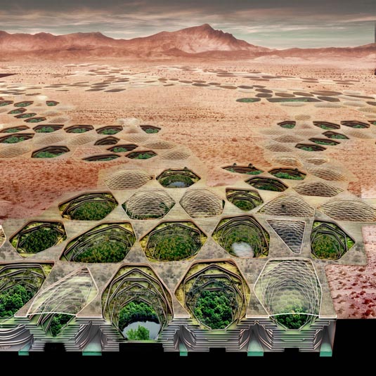
[Image: From Sietch Nevada by Matsys; renderings by Nenad Katic].

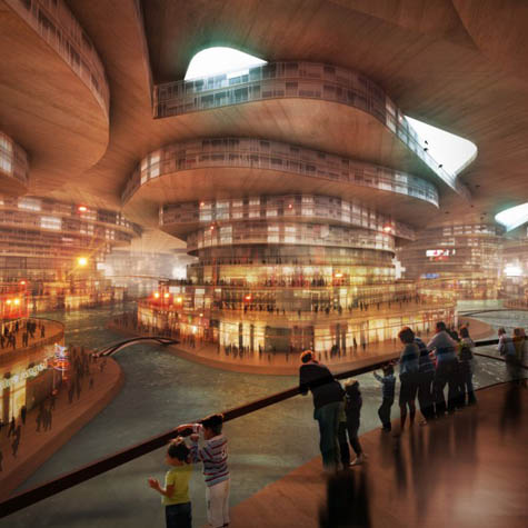
Andrew Kudless of Matsys recently proposed an extraordinary desert city of semi-subterranean terraces inspired by the novel Dune.

The images are fantastic, and the project description hooked me right away:

In Frank Herbert’s famous 1965 novel Dune, he describes a planet that has undergone nearly complete desertification. Dune has been called the “first planetary ecology novel” and forecasts a dystopian world without water. The few remaining inhabitants have secluded themselves from their harsh environment in what could be called subterranean oasises. Far from idyllic, these havens, known as sietch, are essentially underground water storage banks. Water is wealth in this alternate reality. It is preciously conserved, rationed with strict authority, and secretly hidden and protected.

The rest of the project combines an interest in drought hydropolitics in the U.S. southwest with the speculative architecture of “underground water banks.”

[Image: From Sietch Nevada by Matsys; renderings by Nenad Katic].

Continuing to quote at length:

Although this science fiction novel sounded alien in 1965, the concept of a water-poor world is quickly becoming a reality, especially in the American Southwest. Lured by cheap land and the promise of endless water via the powerful Colorado River, millions have made this area their home. However, the Colorado River has been desiccated by both heavy agricultural use and global warming to the point that it now ends in an intermittent trickle in Baja California. Towns that once relied on the river for water have increasingly begun to create underground water banks for use in emergency drought conditions. However, as droughts are becoming more frequent and severe, these water banks will become more than simply emergency precautions.

Accordingly, Kudless suggests that “waterbanking” will become “the fundamental factor in future urban infrastructure in the American Southwest.”

In this context, I would unhesitatingly recommend Marc Reisner’s classic book Cadillac Desert – the first hydrological page-turner I’ve ever read – as well as James Lawrence Powell’s recent Dead Pool: Lake Powell, Global Warming, and the Future of Water in the West (which I reviewed for The Wilson Quarterly earlier this year). Those two books are ideal references for Matsys’s project, as they each supply countless examples of hubristic, quasi-imperial waterbanking projects – projects that might still be functioning today but that are doomed, the authors convincingly show, to eventual dehydration.

Powell, in particular, offers genuinely disturbing descriptions of the looming silt-deposits that have accumulated behind the dams of the American west, amongst often extraordinarily poetic overviews of these dams’ inevitable failure. “One day every trace of the dams and their reservoirs will be gone,” Powell writes, “a few exotic grains of concrete the only evidence of their one-time existence.”

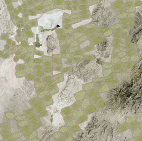
[Image: Matsys’s Sietch Nevada as seen from above; renderings by Nenad Katic].

In any case, the proposal seen here is “an urban prototype,” we read, “that makes the storage, use, and collection of water essential to the form and performance of urban life.”

A network of storage canals is covered with undulating residential and commercial structures. These canals connect the city with vast aquifers deep underground and provide transportation as well as agricultural irrigation. The caverns brim with dense, urban life: an underground Venice. Cellular in form, these structures constitute a new neighborhood typology that mediates between the subterranean urban network and the surface level activities of water harvesting, energy generation, and urban agriculture and aquaculture. However, the Sietch is also a bunker-like fortress preparing for the inevitable wars over water in the region.

Check out the full project on Matsys’s own website – and, while you’re there, the entire project database is worth a spin.

(Spotted on Architecture MNP. And read Dune!)

Pamphlet Infrastructure

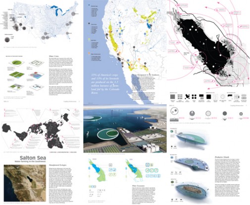
[Image: From InfraNet Lab’s submission to the WPA 2.0 competition, “centered on the twin dilemma of rising population and water shortages in the US southwest.”]

As a longtime fan of Mason White’s and Lola Sheppard’s work both at InfraNet Lab – an amazing web resource for anyone interested in cities, infrastructure, built landscapes, hydrological processes, international communications networks, and more – and at their architecture firm, Lateral Office – mentioned many times on BLDGBLOG before, from IceLink and A.I.R. Unit to Reykjavík’s Runways to Greenways – and as an enthusiast for Princeton Architectural Press’s Pamphlet Architecture series, I was absolutely thrilled to learn last week that InfraNet Lab will be authoring Pamphlet Architecture 30. Their book will be called Coupling: Strategies for Infrastructural Opportunism, and it will be published in 2010.

Along with Lola and Mason, Neeraj Bhatia and Maya Przbylski from Lateral Office will also be contributing – and this promises to be one of the best pamphlets yet. It’s also fantastic news for Lateral Office, who well deserve this exposure for their ideas and work. Congrats, guys! I can’t wait to see the results.

(By way of a brief PS, Mason will actually be speaking at the North American launch of The BLDGBLOG Book on Saturday, September 26, at Storefront for Art and Architecture in New York, along with Lebbeus Woods, another Pamphlet Architecture author).

Procedural Destruction and the Algorithmic Fiction of the City

[Image: From Procedural Modeling of Cities by Yoav Parish and Pascal Müller].

Note: This is a guest post by Jim Rossignol.

In 2001 Yoav Parish and Pascal Müller spoke at the SIGGRAPH conference in Los Angeles, California, to present a mathematical city. Their presentation contained an algorithmic approach for modeling city-like topologies. The results were remarkably realistic, and were one among a host of city-like generative systems to appear at the start of the decade.

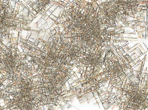
Another, Jared Tarbell’s Substrate (pictured) remains a fantastic example of how a mathematical approach to generating apparently urban patterns can also be artful.

[Image: From Jared Tarbell’s Substrate].

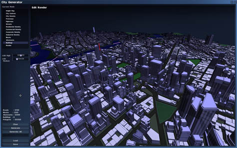
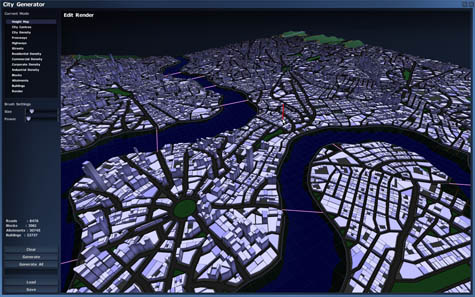
But it was looking at the work of Parish and Müller that inspired game designer Chris Delay to develop his most recent project: the cryptic (and as-yet-unexplained) Subversion, of which little is known, other than it relies on large, procedurally generated cities for the backbone of its game world.

Having already been burned by the problems of creating content “by hand,” Delay set out to let algorithms do the work of building buildings in his new game. Not only that, but he was determined to create an artistically interesting experience without artists.

[Images: From Chris Delay’s Subversion].

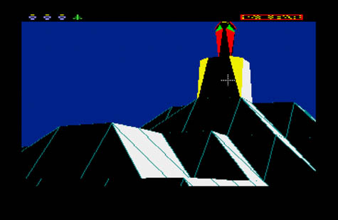
Of course, videogames have long been the home of procedurally generated landscapes where numbers and mathematical equations played the role of the visual designer. Early paranoid classic The Sentinel made use of these techniques to create an astonishingly atmospheric 10,000 levels in simple vector graphics, from just a few kilobytes of data. Other games have used similar techniques as a shortcut to creating solar systems and vast fractal landscapes.

But when it came to cities, well, it took a long time for anyone to take up the challenge.

[Image: From The Sentinel by Geoff Crammond].

Rather than opt for procedural techniques, game designers usually elect to build their cities by hand, often with startling results. The re-imagined contemporary New York that features in last year’s Grand Theft Auto 4 required a small army of well-paid artists and designers to hand-craft the entire world. Their accomplishment is unmatched, but the cost to the company behind the project is in the tens—and perhaps hundreds—of millions of dollars. To build up a living city from blank polygons is one of the most expensive possible projects in game design.

Delay, whose project is being undertaken with a tiny budget and by just a handful of staff based in Cambridge, UK, does not have the luxury of vast content teams. His vector-drawn city is far less realistic than Rockstar‘s textured, heaving metropolis, but there’s nevertheless a beauty to it. It’s a kind of mathematical map of the essential urban environment: there are roads, sidewalks, and a no-man’s land of corporate moats around great skyscrapers…

Identify the key equation that define urban patterns, and you, too, can summon a city into existence.

Delay has begun to show off how his cities emerge from the ground up in a series of videos, and he spoke to me about the process.

“I started out with road layouts, and then began to modify the parameters,” he explained. “Sometimes you’ll get lovely radial, spiral patterns, or you can tell it to create a really rigid Manhattan-style grid.” One set of numbers delivers the block logic of American cities, another is rather more like the spirals of Medieval European sprawls. The two merge to create something even more believable. “Every subsequent layer builds on the previous layer,” Delay points out, “so the very next layer looks for the spaces between layers, and makes judgments about ‘is this likely to be a skyscraper, or to be a house?’ Then you zoom in, and carry on. You do another procedural generation process for each layer of detail, filling in that world.”

[Image: From Chris Delay’s Subversion].

A few weeks after speaking with Delay I attended Thrilling Wonder Stories—a seminar at the Architectural Association in London, curated by Liam Young and BLDGBLOG—where I watched conceptual designer Viktor Antonov explain how he had created a science-fictionalized Paris (for a now-cancelled videogame called The Crossing).

Antonov approached the problem by altering just a few parameters in the standard architectural model. For instance, Antonov had noticed a few fundamental details about how the mid-nineteenth century neo-classical core of Paris had been constructed: big street-level floors, smaller attic spaces, complex chimney stacks. By increasing the emphasis on the lower floors, and stretching them out—and by emphasizing the height and complexity of the chimneys—Antonov was able to create a thematically consistent science fiction Paris.

Simply by altering a few basic architectural parameters, he said, you were able to fictionalize the city, whilst at the same time retaining its fundamental identity. His designs were still recognizably—even mathematically—Parisian, in other words, but they were also otherworldly.

[Image: By Viktor Antonov].

This idea instantly connected back to Delay’s project: what parameters would we need in order both to understand and create a science fiction Edinburgh, or Sao Paulo, or Vancouver? Identify the necessary fantasy logic within a procedural city-building system and you could recreate cities with their alternate identity in an instant. An accelerated future Moscow, or a retropunk Venice, instantly sprawling out of the monitor.

And perhaps this is not such an outlandish thing to aim for—especially when you consider the speed at which procedural city projects have been appearing across the tech landscape. Could one of these cities potentially be refitted to allow for this type of radical tweak?

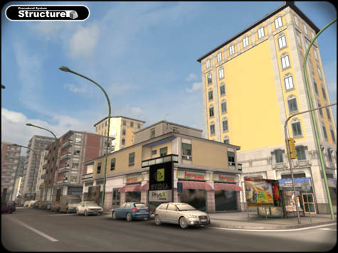
Projects like Shamus Young’s impressive PixelCity, or Marco Corbetta‘s Structure seem ripe for such strange fictions. Corbetta’s system is particularly impressive in its verisimilitude: he aims to create a basic engine for rapidly generating the kinds of cities that games like Grand Theft Auto 4 require, and consequently doing so for much cheaper.

Could Corbetta’s engine come with a Paris or a Barcelona preload, which could then be put through Photoshop-style filters for alternate reality logic in its architecture? A stronger skyline, weirder street furniture.

[Image: From Marco Corbetta’s Structure].
More exciting, at least for the thrill-seeking gamer in me, is the fact that Corbetta is aiming one notch higher than any of his peers: he’s aiming to make these cities procedurally destructible. His site contains a demonstration video of neatly arrange office interiors and a domestic library being blown to pieces with a machine-gun. What good is an imaginary city if you can’t go inside the buildings? What good is a virtual downtown if you can’t go crazy with a bazooka? Corbetta’s work preempts these questions.

Further, it conjures visions of massive demolition exercises in parallel worlds—entering an Antonov-algorithm for neo-Rome, where gladiatorial escapades see us going through the walls of the coliseum and into the randomly generated plazas beyond.

That, perhaps, is the greatest promise of procedural cities: that soon they’ll be real enough that their destruction will seem like tragedy.

[Jim Rossignol is a games critic for Offworld, an editor at Rock, Paper, Shotgun, and the author of the fantastic This Gaming Life: Travels in Three Cities. A full-length interview with Rossignol appeared on BLDGBLOG in May, and he has written a previous guest post, Evil Lair: On the Architecture of the Enemy in Videogame Worlds].

Landscapes of Quarantine: Call for Applications

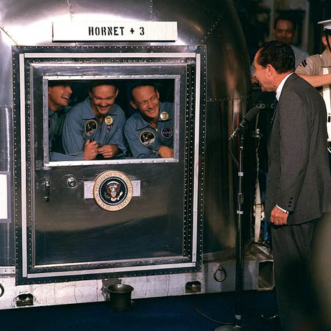
[Image: President Nixon addresses quarantined astronauts from the Apollo program; via NASA].

I’m incredibly excited to announce not only that BLDGBLOG will be living in New York City this fall, but that my wife and I will be hosting a design studio there called Landscapes of Quarantine – the results of which will be the subject of a public exhibition at Storefront for Art and Architecture in early 2010.

Meeting one evening a week this autumn in Manhattan, from October 6 to December 5, 2009, up to 14 studio participants will discuss the spatial implications of quarantine, each developing an individual design project in response to the studio theme.

Quarantine is both an ancient spatial practice and a state of monitored isolation, dating back at least to the Black Death – if not to Christ’s 40 days in the desert – yet it has re-emerged today as an issue of urgent biological, political, and even architectural importance in an era of global tourism and flu pandemics.

[Image: “Fear of Flu” by Mike Licht].

Quarantine touches on serious constitutional issues associated with involuntary medical isolation, as well as on questions of governmental authority, regional jurisdiction, and the limits of inter-state cooperation. Quarantine is as much a matter of national security, public safety, and agricultural biodiversity as it is an entry point into discussions of race, purity, and unacknowledged discrimination.

Quarantine is also a plot device increasingly seen in novels and films – from the aptly named Quarantine and Albert Camus’s The Plague to I Am Legend and The Last Town on Earth – even as it has become a source of arcane technical debate within plans for Martian exploration and Antarctic drilling rights.

The design implications of quarantine stretch from the ballast water of ships to the way we shape our cities, from the clothes in travelers’ suitcases to stray seeds stuck in the boot treads of hikers. Quarantine affects the pets we keep, the programs we download, and the machines we use in food-processing warehouses, worldwide.

Quarantine is about managing perimeters, controlling influence, and stopping contamination.

[Image: Cages for the laboratory testing of rats and mice by Innovive].

So how do we treat quarantine as a design problem?

Whether we design something to demonstrate that the very notion of quarantine might not be possible; whether we produce actionable plans for quarantine units, ready for implementation by the World Health Organization in hot zones around the world; whether we create quarantine-themed graphic novels, barrier-based urban games, or a series of ironic public health posters to be mounted around the city, how can we design for quarantine?

Quarantine also offers fertile territory for investigation through cartography and cultural documentation. After all, if we mapped the contents and locations of quarantine facilities worldwide, designed infographics to analyze the spread of invasive species, or recorded the oral histories of the quarantined, what sorts of issues might we uncover?

Bringing these very different techniques, media, and approaches together in the confines of a dedicated design studio will give participants an exciting opportunity to explore the overlooked spatial implications of quarantine.

[Image: A poster for Quarantine, directed by John Erick Dowdle].

We have already confirmed a fantastic list of participants, whose backgrounds include architecture, photography, illustration, games design, sound, landscape, food, and more; we are now opening the studio to a general call for interested participants.

The brief – which you can download here as a PDF or that you read as a JPG on Flickr – explains more; but potential applicants will be working with a truly stellar group as they meet once a week this fall and produce work eligible for inclusion in the “Landscapes of Quarantine” exhibition to be held at Storefront for Art and Architecture in early 2010.

If you are interested, please download the brief – which includes all necessary application info – and contact us at futureplural @ gmail by September 19, 2009.

[Image: Australian quarantine signage].

For ease of reference, I have decided to include the studio brief in full below:

Landscapes of Quarantine is an independent, multi-disciplinary design studio, based in New York City, consisting of eight Tuesday evening workshops, from October 6 to December 5, 2009, in which up to 14 participants will gather to discuss the spatial implications of quarantine. Quarantine is an ancient spatial practice characterized by a state of enforced immobility, decontamination, and sequestration; yet it is increasingly relevant—and difficult to monitor—in an era of global trade, bio-engineering, and mass tourism.

Studio participants will explore a wide variety of spatial and historical examples, including airport quarantine facilities, Level 5 biohazard wards, invasive species, agricultural regulations, swine-flu infected tourists confined to their hotel rooms, lawsuits over citizens’ rights to resist involuntary quarantine, horror films, World Health Organization plans for controlling the spread of pandemics, lunar soil samples, and more.

During the studio, participants will develop individual design projects in response to the problem of quarantine, with guidance and inspiration provided by readings, screenings, group discussions, and an evolving line-up of guest speakers and critics. These projects will then be eligible for inclusion in “Landscapes of Quarantine,” an exhibition hosted by the internationally renowned Storefront for Art and Architecture in early 2010.

By the end of the studio, each participant will have produced a complete design project. This could range from the speculative (plug-in biosecurity rooms for the American suburbs) to the documentary (recording the items and animals detained for quarantine on the U.S./Mexico border), and from the fantastical (plans for extra-planetary quarantine facilities) to the instructional (a field guide to invasive species control).

Landscapes of Quarantine is looking for applicants who are intrigued by the spatial possibilities and contingencies of quarantine, and who already possess the technical skills necessary to produce an exhibition-quality final design project or installation in their chosen medium. We hope to hear from people at all stages of their careers—from graduate school to retirees—and from a wide variety of design backgrounds. We are particularly excited to announce that we have already confirmed a select group of talented participants from fields as diverse as architecture, illustration, gaming, photography, and sound design.

The studio is both unaffiliated and independent (there is no college credit), and it is also free (though applicants will be responsible for all costs associated with producing their final project). We will be reviewing applications on a rolling basis until Friday, September 18, 2009, or until all studio positions have been filled. To learn more, and to submit an application, please email futureplural @ gmail with the information listed below.

1) Name
2) Email address
3) Telephone number(s)
Please indicate the best time to reach you
4) Mailing address
5) Education
• University/college name and country
• Dates attended
• Degree
6) Current affiliations and/or employment
7) 50-word (maximum) bio
8) Publications and/or personal blog
9) Portfolio
Attach a PDF of no more than 8 pages, or supply a link to online work
10) 300-word (maximum) statement of interest in the topic of quarantine
11) Candidate’s declaration
By submitting your application, you declare the following:
• I certify that the work submitted is entirely my own and/or my role is clearly stated
• I declare that all the statements I have provided are correct
• I agree that, if accepted into the studio, I will participate fully, attend all studio meetings unless previously discussed with the studio directors, and produce a finished final design project
12) Email addresses for two references

Landscapes of Quarantine is produced and organized by Future Plural, a project-based, independent design lab launching in October 2009 from a temporary base in New York City. Future Plural is Geoff Manaugh (BLDGBLOG) and Nicola Twilley (Edible Geography).

Finally, a major motivation behind starting Future Plural and hosting the Landscapes of Quarantine studio is to found a new institution without permanent location, dependence on grants, or academic affiliation. After all, as bloggers, why can’t we create our own groups, faculties, cultural spaces, and more? By bringing people together, on a project-by-project basis, to explore ideas and issues in a cross-disciplinary environment, we hope to demonstrate that, even in a time of recession, there is a broadly shared enthusiasm for creating something new.

The Bioluminescent Metropolis

[Image: “Lightning Bugs in York, PA,” by tom.arthur, courtesy of a Creative Commons license].

While traveling last week, I managed to re-read W.G. Sebald’s book The Rings of Saturn.
At one point, Sebald describes two entrepreneurial scientists from the 19th century, who he names Herrington and Lightbown; together, we’re told, they had wanted to capture the bioluminescent properties of dead herring and use that as a means of artificially illuminating the nighttime streets of Victorian London.
Sebald writes:

An idiosyncrasy peculiar to the herring is that, when dead, it begins to glow; this property, which resembles phosphorescence and is yet altogether different, peaks a few days after death and then ebbs away as the fish decays. For a long time no one could account for this glowing of the lifeless herring, and indeed I believe that it still remains unexplained. Around 1870, when projects for the total illumination of our cities were everywhere afoot, two English scientists with the apt names of Herrington and Lightbown investigated the unusual phenomenon in the hope that the luminous substance exuded by dead herrings would lead to a formula for an organic source of light that had the capacity to regenerate itself. The failure of this eccentric undertaking, as I read some time ago in a history of artificial light, constituted no more than a negligible setback in the relentless conquest of darkness.

Sebald goes on to write, elsewhere in the book, that, “From the earliest times, human civilization has been no more than a strange luminescence growing more intense by the hour, of which no one can say when it will begin to wane and when it will fade away.”
But it’s the idea that we could use the bioluminescent properties of animals as a technique of urban illumination that absolutely fascinates me.
In fact, I’m instantly reminded of at least three things:

1) Last month I had the pleasure of stopping by the Architectural Association’s year-end exhibition of student work. As part of a recent studio taught by Liam Young and Kate Davies, a student named Octave Augustin Marie Perrault illustrated the idea of a “bioluminescent bacterial billboard.”
From the project text: “A bioluminescent bacterial billboard glows across the harbour… We are constantly reminded of the condition of the surrounding environment as the bio indicators becomes an expressive occupiable ecology.”

[Image: Bioluminescent billboards on one of the Galapagos Islands, by Octave Perrault].
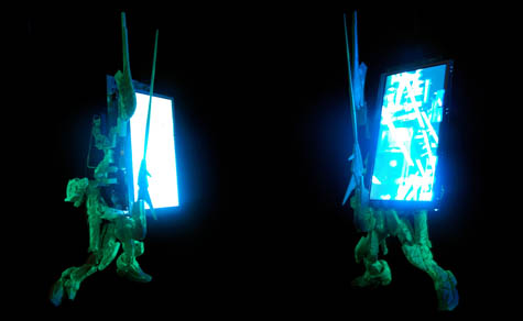
In many ways, Perrault’s billboards would be a bit like the River Glow project by The Living… only it would, in fact, be illuminated by the living. These bioluminescent bacteria would literally be a living window onto a site’s environmental conditions (or, of course, they could simply be used to display ads).
Liam Young, the studio’s instructor, has also designed a version of these bioluminescent displays, casting them more fantastically as little creatures that wander, squirrel-like, throughout the city. They pop up here and there, displaying information on organic screens of light.

[Image: Bioluminescent billboards by Liam Young].

I’m genuinely stunned, though, by the idea that you might someday walk into Times Square, or through Canary Wharf, and see stock prices ticking past on an LED screen… only to realize that it isn’t an LED screen at all, it is a collection of specially domesticated bioluminescent bacteria. They are switching on and off, displaying financial information.
Or you’re watching a film one night down at the cinema when you realize that there is no light coming through from the projector room behind you – because you are actually looking at bacteria, changing their colors, like living pixels, as they display the film for all to see.
Or: that’s not an iPod screen you’re watching, it’s a petri dish hooked up to YouTube.
This is what I imagine the world of screen displays might look like if Jonathan Ive had first studied microbiology, or if he were someday to team up with eXistenZ-era David Cronenberg and produce a series of home electronic devices.
Our screens are living organisms, we’ll someday say, and the images that we watch are their behavior.

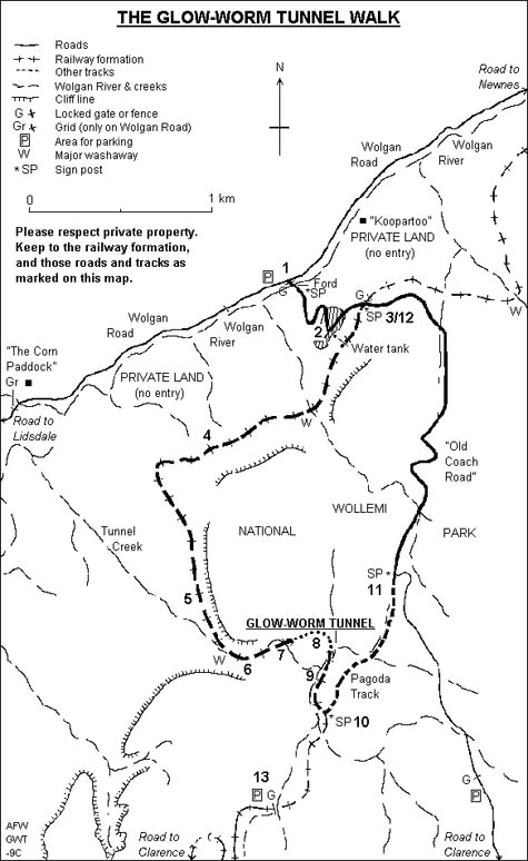
2) As I mentioned in an earlier post, down in the Blue Mountains of New South Wales is a tunnel called the Newnes Glow Worm Tunnel. It is a disused railway tunnel, bored through mountain sandstone 102 years ago, that has since become the home for a colony of glow worms.
As that latter link explains: “If you want to see the glow worms, turn off your torch, keep quiet and wait a few minutes. The larvae will gradually ‘turn on’ their bioluminescence and be visible as tiny spots of light on the damp walls of the tunnel.”

[Image: A map of the Glow Worm Tunnel Walk, New South Wales].

Incorporate this sort of thing into an architectural design, and it’s like something out of the work of Jeff VanderMeer – whose 2006 interview here is still definitely worth a read.
I’m picturing elaborate ballrooms lit from above by chandeliers – in which there are no lightbulbs, only countless tens of thousands of glow worms trapped inside faceted glass bowls, lighting up the faces of people slow-dancing below.
Or suburban houses surviving off-grid, because all of their electrical illumination needs are met by specially bred glow worms. Light factories!
Or, unbeknownst to a small town in rural California, those nearby hills are actually full of caves populated only by glow worms… and when a midsummer earthquake results in a series of cave-ins and sinkholes, they are amazed to see one night that the earth outside is glowing: little windows pierced by seismic activity into caverns of light below.

3) Several years ago in Philadelphia, my wife and I went out for a long evening walk, and we sat down on a bench in Washington Square Park – and everything around us was lit by an almost unbelievable density of fireflies, little spots of moving illumination passing by each other and overlapping over concrete paths, as they weaved in and out of aerial formations between the trees.
But what if a city, particularly well-populated with fireflies (so much more poetically known by their American nickname of lightning bugs) simply got rid of its public streetlights altogether, being so thoroughly drenched in a shining golden haze of insects that it didn’t need them anymore?
You don’t cultivate honeybees, you build vast lightning bug farms.
How absolutely extraordinary it would be to light your city using genetically-modified species of bioluminescent nocturnal birds, for instance, trained to nest at certain visually strategic points – a murmuration of bioluminescent starlings flies by your bedroom window, and your whole house fills with light – or to breed glowing moths, or to fill the city with new crops lit from within with chemical light. An agricultural lightsource takes root inside the city.
Using bioluminescent homing pigeons, you trace out paths in the air, like GPS drawing via Alfred Hitchcock’s The Birds.
An office lobby lit only by vast aquariums full of bioluminescent fish!
Bioluminescent organisms are the future of architectural ornament.

[Image: A bioluminescent tobacco plant, via Wikivisual].
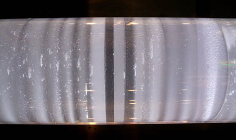
On the other hand, I don’t want to strain for moments of poetry here, when this might actually be a practical idea.
After all, how might architects, landscape architects, and industrial designers incorporate bioluminescence into their work?
Perhaps there really will be a way to using glowing vines on the sides of buildings as a non-electrical means of urban illumination.
Perhaps glowing tides of bioluminescent algae really could be cultivated in the Thames – and you could win the Turner Prize for doing so. Kids would sit on the edges of bridges all night, as serpentine forms of living light snake by in the waters below.
Perhaps there really will be glowing birds nesting in the canopies of Central Park, sound asleep above the heads of passing joggers.
Perhaps the computer screen you’re reading this on really will someday be an organism, not much different from a rare tropical fish – a kind of living browser – that simply camouflages new images into existence.
Perhaps going off-grid will mean turning on the lifeforms around us.

Romecore

[Image: A Greenland ice-core at the Hayden Planetarium; for further reading, visit the U.S. National Ice Core Laboratory. Photo by Planet Taylor, used under a Creative Commons license].

Note: This is a guest post by Nicola Twilley.

The Crypta Balbi is a relatively recent, low-profile addition to Rome’s museum compendium. It’s billed variously—and confusingly—as a museum of archaeology, a museum of ancient Rome, and a museum of the Dark Ages. All of these descriptions are, in fact, cumulatively accurate, because the site is actually a city-block-sized core sample of Rome, threaded through with staircases, tunnels, and elevated walkways for visitors.

Crypta Balbi is located in an irregular pentagonal plot in the Campus Martius, an area that, unlike many regions in the ancient city, remained largely inhabited through the Middle Ages. In fact, according to Filippo Coarelli’s authoritative Rome and Environs: An Archaeological Guide, the Campus Martius was originally supposed to be kept free of buildings altogether and “reserved for military and athletic exercises.” However, historian Suetonius describes the city’s gradual encroachment, explaining that: “During his reign Augustus often encouraged the leading men of Rome to adorn the city with new monuments or to restore and embellish old ones.”

[Image: A satellite view of the city-block core sample, via Google Maps].
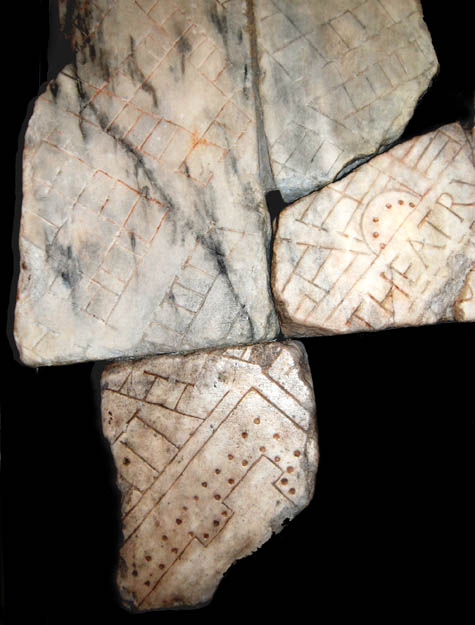
As a successful military general and favored member of Augustus‘s entourage, L. Cornelius Balbus the Younger stepped up to the plate, building a theater and attached crypta—a rectangular porticoed walkway where the theater’s scenery could be stored and around which the public might stroll, protected from the elements. Apparently, the Balbi Theater’s grand opening in 13 BC took place during one of the Tiber’s regular floods—meaning that it was, briefly, only accessible by boat. Nonetheless, the Theater and Crypta thrived, and they are depicted intact on a chunk of the Severan Forma Urbis, an amazing 60′-x-43′ incised marble map of the city created for public display in 203 AD.

Eventually, Rome’s earthquakes, fires, barbarian raids, and radical population shrinkage (from a million people in 367 AD to just 400,000 less than century later) combined with architectural re-use and the passage of time to take their toll. There isn’t much of the original Crypta left to see—a reconstructed stucco arch, and the massive travertine and tufa walls that now serve as foundations for modern houses in Via delle Botteghe Oscure and Via dei Delfini.

[Image: A fragment of the Forma Urbis, showing the Balbi Theater. For more on the Forma Urbis, visit the seemingly great but non-Mac-friendly Stanford Digital Forma Urbis Romae project].
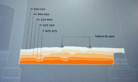
However, layered above the Crypta’s original floor plan are traces of this city block’s shifting usage—a condensed narrative of Rome’s destruction, accretion, and evolution. It is this series of transformations and reuses of both the Crypta and the urban space it occupies, rather than the fragmentary ancient ruins, that the museum aims to make visible. Like a series of stills from an impossible time-lapse film, the visitor who descends to the basement or climbs to the third floor can see this awkward cuboid chunk of city ruined, reshaped, reused, and reoriented over two thousand years of urban history.

Equally amazing are the expansive historical detours prompted by even trace elements in the urban core sample. For example, as early as the time of Hadrian, a “monumental” public latrine was inserted into a section of the Crypta. From the quantity of copper coins that fell, and weren’t worth recovering, archaeologists have extrapolated the amount of coinage in circulation in Western Europe during the latrine’s life-span. (Astonishingly, it was only in the 19th century that small change was to be this common again in Western Europe).

[Image: Museum display panel diagramming five distinct road levels wandering across the Crypta’s ruins (apologies for the quick snapshot)].

Two centuries later and a few feet higher, two graves bear witness to a city in ruins between the 5th and 7th centuries, as the prohibition against burial within city walls lapsed, and the dead were buried singly in abandoned buildings or beside roads. Ironically, in a museum that preserves the urban structures of each era equally, during the medieval period the Crypta actually housed one of the city’s largest lime-kilns, where the marble inscriptions, statues, and building blocks of classical Rome were brought to be crushed and melted down into lime (a key ingredient in the cement needed to build the city’s new Christian architecture).

In the 1940s, the convent that had occupied the site for the past four hundred years was demolished for a planned new Mussolini-era construction, which thankfully never materialized. Finally, in the 1980s, the Soprintendenza archeologica di Roma authorized the excavation of the abandoned city block; and, in 2002, the northwest corner was opened to the public, even as work continues on the rest of the site.

[Image: An interior view of the Crypta Balbi].

Aside from the execution, which is excellent, the very idea of a museum built into an urban core sample—a stratigraphic investigation of the shifting use of space over time—is incredibly exciting to me. Imagine a similar hollowing-out of urban space in Istanbul, Cairo, or Paris—residents as disoriented as tourists as they clamber through the hidden foundations and forms woven underneath and around their own city.

In New York, this might even be an idea whose time has come: as The New Yorker pointed out in December 2008, the expiration of a residential construction tax-abatement law encouraged builders to dig foundation trenches early, so as to secure better financing, but the subsequent recession has put many of these projects on hold, semi-permanently.

“What will become of the pits?” asks Nick Paumgarten, speculating that they could turn into “half-wild swimming holes, like the granite quarries of New England” or even “urban tar pits, entrapping and preserving in garbage and white brick dust the occasional unlucky passerby.” These are both attractive ideas, but with a little expenditure on zip-lines, elevated walkways, and interpretative signage, visitors could circulate around several millennia of Manhattan’s history, from the collision of the North African and American continental plates to the tangled evolution of New York’s water mains, via retreating glaciers and the housing bubble.

Meanwhile, back in Rome and less than a mile away from the Crypta, engineers have teamed up with the Soprintendenza to sink several new urban cores, this time in the guise of excavating the elevator and escalator shafts for a new subway line.

Angelo Bottini, director of the Soprintendenza, can hardly hide his excitement, telling the Wall Street Journal that, under usual circumstances, “We never get to dig in the center of Rome.” Sadly, it seems as though most of the finds will be documented and then destroyed, due to a shortage of museum space and the already astronomical construction costs (an estimated $375 million for one mile of track in the city center).

But how amazing would it be if the new subway station walkways and escalator shafts could themselves become Crypta Balbi-like museums of buried stratigraphy? Rome would be riddled with urban cores, awestruck tourists ascending and descending through sampled spatial histories across the city. Meanwhile the Sistine Chapel lies miraculously empty…

[Previous guest posts by Nicola Twilley include The Tree Museum, The Water Menu, Atmospheric Intoxication, and Park Stories].