The Hit List

I’m thrilled to have two articles in the new issue of Domus, issue 948. One of those articles—on the list of “critical foreign dependencies” (page is very slow to load) released by Wikileaks in December 2010—is reproduced, below; the other is a short look at the Open Source Ecology movement.

Keep your eye out for a copy of the magazine, however, because the following text is accompanied by a fold-out world map, featuring many of the sites revealed by Wikileaks.

• • •

We might say with only slight exaggeration that the United States exists in its current state of economic and military well being due to a peripheral constellation of sites found all over the world. These far-flung locations—such as rare-earth mines, telecommunications hubs, and vaccine suppliers—are like geopolitical buttresses, as important for the internal operations of the United States as its own homeland security.

However, this overseas network is neither seamless nor even necessarily identifiable as such. Rather, it is aggressively and deliberately discontiguous, and rarely acknowledged in any detail. In a sense, it is a stealth geography, unaware of its own importance and too scattered ever to be interrupted at once.

That is what made the controversial release by Wikileaks, in December 2010, of a long list of key infrastructural sites deemed vital to the national security of the United States so interesting. The geographic constellation upon which the United States depends was suddenly laid bare, given names and locations, and exposed for all to see.

The particular diplomatic cable in question, originally sent by Secretary of State Hillary Clinton to all overseas embassies in February 2009 and marked for eventual declassification only in January 2019, describes what it calls “critical foreign dependencies (critical infrastructure and key resources located abroad).” These “critical dependencies” are divided into eighteen sectors, including energy, agriculture, banking and finance, drinking water and water treatment systems, public health, nuclear reactors, and “critical manufacturing.” All of these locations, objects, or services, the cable explains, “if destroyed, disrupted or exploited, would likely have an immediate and deleterious effect on the United States.” Indeed, there is no back up: several sites are highlighted as “irreplaceable.”

Specific locations range from the Straits of Malacca to a “battery-grade” manganese mine in Gabon, Africa, and from the Southern Cross undersea cable landing in Suva, Fiji, to a Danish manufacturer of smallpox vaccine. The list also singles out the Nadym Gas Pipeline Junction in Russia as “the most critical gas facility in the world.”

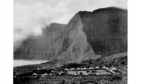
[Image: A manganese mine in Gabon, courtesy of the Encyclopedia Britannica].

The list was first assembled as a way to extend the so-called National Infrastructure Protection Plan (NIPP)—which focuses on domestic locations—with what the State Department calls its Critical Foreign Dependencies Initiative (CFDI). The CFDI, still in a nascent stage—i.e. it consists, for now, in making lists—could potentially grow to include direct funding for overseas protection of these sites, effectively absorbing them into the oblique landscape of the United States.

Of course, the fear that someone might actually use this as a check list of vulnerable targets, either for military elimination or terrorist sabotage, seemed to dominate news coverage at the time of the cable’s release. While it is obvious that the cable could be taken advantage of for nefarious purposes—and that even articles such as this one only increase the likelihood of this someday occurring—it should also be clear that its release offers the public an overdue opportunity to discuss the spatial vulnerabilities of U.S. power and the geometry of globalization.

The sites described by the cable—Israeli ordnance manufacturers, Australian pharmaceutical corporations, Canadian hydroelectric dams, German rabies vaccine suppliers—form a geometry whose operators and employees are perhaps unaware that they define the outer limits of U.S. national security. Put another way, the flipside of a recognizable U.S. border is this unwitting constellation: a defensive perimeter or outsourced inside, whereby the contiguous nation-state becomes fragmented into a discontiguous network-state, its points never in direct physical contact. It is thus not a constitutional entity in any recognized sense, but a coordinated infrastructural ensemble that spans whole continents at a time.

[Image: The Robert-Bourassa generating station, part of the James Bay Project by Hydro Québec; photo courtesy of Hydro Québec].

But what is the political fate of this landscape; how does it transform our accepted notions of what constitutes state territory; what forms of governance are most appropriate for its protection; and under whose jurisdictional sovereignty should these sites then be held?

In identifying these outlying chinks in its armor, the United States has inadvertently made clear a spatial realization that the concept of the nation-state has changed so rapidly that nations themselves are having trouble keeping track of their own appendages.

Seen this way, it matters less what specific sites appear in the Wikileaks cable, and simply that these sites can be listed at all. A globally operating, planetary sovereign requires a new kind of geography: discontinuous, contingent, and nontraditionally vulnerable, hidden from public view until rare leaks such as these.

(Thanks to Domus for the opportunity to explore this topic).

Border Town

[Image: Photo by m.joedicke, via Border Town].

From Border Town, an independent research and design workshop to be held in Toronto this summer, from 16 June-18 August, now seeking applications:

Your farm is completely surrounded by a foreign country because the king lost it in a game of cards. You live in Cooch Behar.

You are eating at a café when you are informed that it must close. If you’ll just shift to a table in the other country, service is still available. This café is in Baarle/Hertog.

You work in the mayor’s office. Down the hall is a parallel mayor’s office with a whole mirror set of city officials to govern the other half of your city. You work in Texarkana.

We believe that a great deal can be learned by investigating the strange edge cases of the world. Border towns are the extreme edge of where geography and politics collide. They throw the abstractions of governance into sharp physical relief. They are a fertile site for investigation into questions of security, freedom, architecture, immigration, trade, smuggling, sovereignty, and identity.

Border Town is a 10-week, multi-participant collaborative design studio that will investigate the conditions that surround life in cities situated on borders, divided by borders, or located in conflict zones. By investigating these strange specimens of political geography, we can being to think and design about the interaction of legal and physical architecture and how these forces shape the built environment and the lives of the people living in it.

The workshop is organized by Tim Maly and Emily Horne, and applications are due by 2 June.

By way of my own hypothetical reading list for such a course, I might suggest checking out a few of the following books: The City & The City by China Miéville, Divided Cities: Belfast, Beirut, Jerusalem, Mostar, and Nicosia by Jon Calame and Esther Charlesworth, Hollow Land: Israel’s Architecture of Occupation by Eyal Weizman, City of Walls: Crime, Segregation, and Citizenship in São Paulo by Teresa P. R. Caldeira, Divided Kingdom by Rupert Thomson, A Wall in Palestine by René Backmann, and any number of other books, films, essays, and chapters elsewhere on the subjects of smuggling, demilitarized zones, police jurisdiction, international espionage, the Berlin Wall, the Jewish ghetto, quarantine, border survey teams (and the equipment they utilize), segregation and apartheid, political gerrymandering, micronations, and much more.

In any case, Border Town promises to be an interesting experience for all involved—and I should add that it’s great to see people putting together this kind of independent educational workshop outside of the university system. If you end up being one of the participants, I’d love to hear how it goes.

Books Received: Climate Futures List

A rash of recent books about the geographic implications of climate change have crossed my desk. In this themed supplement to BLDGBLOG’s ongoing Books Received series, I thought I’d group them together into one related list.

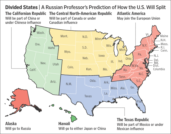
[Image: Courtesy of the Wall Street Journal].

What many of the books described in this post have in common—aside from their shared interest in what a climatically different earth will mean for the future of human civilization—is their use of short, fictionalized narratives set in specific future years or geographic regions as a way of illustrating larger points.

These narrative scenarios—diagnostic estimates of where we will be at some projected later date—come with chapter titles such as “Russia, 2019,” “China, 2042,” “Miami Beached,” and “Holland 2.0 Depolderized.” Among the various spatial and geopolitical side-effects of climate change outlined by these authors are a coming depopulation of the American Southwest; a massive demographic move north toward newly temperate Arctic settlements, economically spearheaded by the extraction industry and an invigorated global sea trade; border wars between an authoritarian Russia and a civil war-wracked China; and entire floating cities colonizing the waters of the north Atlantic as Holland aims to give up its terrestrial anchorage altogether, becoming truly a nation at sea.

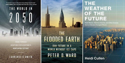
“Will Manhattan Flood?” asks Matthew E. Kahn in his Climatopolis: How Our Cities Will Thrive in the Hotter Future. What will Greenland look like in the year 2215, with atmospheric carbon dioxide levels at 1300 parts per million, according to Peter Ward’s The Flooded Earth: Our Future In a World Without Ice Caps? Will a “New North” rise as the Arctic de-ices and today’s economic powerhouses, from Los Angeles to Shanghai, stagnate under killer droughts, coastal floods, and heat waves, as Laurence C. Smith suggests in The World in 2050: Four Forces Shaping Civilization’s Northern Future?

[Image: Modeling sea-level rise in Florida, courtesy of Penn State].

However, climate change is only one of the world-altering forces under discussion in each of these six books. Demography, oil scarcity, natural resources, public hygiene, and accelerating globalization all play roles, to different extents, in these authors’ thinking. In one case, in particular—Float!: Building on Water to Combat Urban Congestion and Climate Change, the most practical book described here—new construction technologies, with immediate implications for architectural design, also take center stage.

In all cases, though, these books offer further evidence of an irresistible popular urge to discuss the future, and to do so through what can very broadly described as fiction. The recent speculative tone taken by much of today’s architecture writing is only part of this trend; from “design fiction” to speculative foreign policy blogs, and from “the world without us” to future food, a compulsion to understand what might happen to human civilization, in both the near and distant future, using fictional scenarios and speculative hypotheses seems to be at a high point of trans-disciplinary appeal.

As Heidi Cullen writes in The Weather of the Future: Heat Waves, Extreme Storms, and Other Scenes from a Climate-Changed Planet, there is something inherently difficult in comprehending the scale of climate change—what effects it might have, what systems it might interrupt or ruin. She thus imports lessons from cognitive psychology to understand what it is about climate change that keeps it so widely misinterpreted (though a hefty dose of media criticism, I’d argue, is far more apropos). It is interesting, then, in light of the apparent incomprehensibility of climate change, that fictional scenarios have become so popular a means of explaining and illustrating what Cullen calls our “climate-changed planet.”

This emerging narrative portraiture of climate change—exemplified by most of the books under discussion here, whether they present us with Atlanta running out of freshwater, frantic Chinese troops diverting rivers on the border with India, or a governmentally-abandoned Miami given over to anarchism and mass flooding—offers an imperfect but highly effective way of making a multi-dimensional problem understandable.

After all, if stories are an effective means of communicating culturally valuable information—if stories are pedagogically useful—then why not tell more stories about future climate change—indeed, why not tell more stories about architecture and buildings and emerging technologies and the spaces of tomorrow’s geopolitics?

Perhaps this is why so much of architecture writing today, both on blogs and elsewhere, so willfully crosses over into science fiction: if architecture literally is the design and proposal of a different world—one that might exist tomorrow, next year, next decade—then it is conceptually coextensive with the genre of scifi.

The current speculative turn in architecture writing is thus both unsurprising and highly appropriate to its subject matter—something worth bearing in mind by anyone hoping to find a larger audience for architectural critique.

[Image: “London as Venice” by Robert Graves and Didier Madoc-Jones, based on a photo by Jason Hawkes (part of an image series well-critiqued by the Guardian)].

An obvious problem with these preceding statements, however, is that we might quickly find ourselves relying on fiction to present scientific ideas to a popular audience; in turn, this risks producing a public educated not by scientists themselves but by misleading plotlines and useless blockbusters, such as The Day After Tomorrow and State of Fear, where incorrect popular representations of scientific data become mistaken for reports of verified fact.

In a way, one of the books cited in the following short list unwittingly demonstrates this very risk; Climate Wars: The Fight for Survival as the World Overheats would certainly work to stimulate a morally animated conversation with your friends over coffee or drinks, but there is something about its militarized fantasies of Arctic tent cities and Asian governments collapsing in civil free-fall that can’t help but come across as over-excitable, opening the door to disbelief for cynics and providing ammunition for extreme political views.

Indeed, I’d argue, the extent to which contemporary political fantasies are being narratively projected onto the looming world of runaway climate change has yet to be fully analyzed. For instance, climate change will cause the European Union to disband, we read in one book cited here, leaving Britain an agriculturally self-sufficient (though under-employed) island-state of dense, pedestrian-friendly urban cores; the U.S. will close its foreign military bases en masse, bringing its troops home to concentrate on large-scale infrastructural improvements, such as urban seawalls, as the middle class moves to high-altitude safety in the Rocky Mountains where it will live much closer to nature; Africa, already suffering from political corruption and epidemic disease, will fail entirely, undergoing a horrific population crash; and China will implode, leaving the global north in control of world resources once again.

It is important to note that all of these scenarios represent explicit political goals for different groups located at different points on the political spectrum. Perversely, disastrous climate change scenarios actually offer certain societal forces a sense of future relief—however misguided or short-term that relief may be.

Elsewhere, I’ve written about what I call climate change escapism—or liberation hydrology—which is the idea that climate change, and its attendant rewriting of the world’s geography through floods, is being turned into a kind of one-stop shop, like the 2012 Mayan apocalypse, for people who long for radical escape from today’s terrestrial status quo but who can find no effective political means for rallying those they see as forming a united constituency. Climate change thus becomes a kind of a deus ex machina—a light at the end of the tunnel for those who hope to see the world stood abruptly on its head.

Indeed, we might ask here: what do we want from climate change? What world do we secretly hope climate change will create—and what details of this world can we glimpse in today’s speculative descriptions of the future? What explicit moral lessons do we hope climate change will teach our fellow human beings?

[Image: “London-on-Sea” by Practical Action].

Of course, the six books listed below are by no means the only ones worth reading on these topics; in fact, the emerging genre of what I’ll call climate futures is an absolutely fascinating one, and these books should be seen as a useful starting place. I would add, for instance, that Charles Emmerson’s recent Future History of the Arctic clearly belongs on this list—however, I covered it in an earlier installment of Books Received. Further, Forecast: The Consequences of Climate Change, from the Amazon to the Arctic, from Darfur to Napa Valley by Stephan Faris is a commendably concise and highly readable introduction to what global climate change might bring, and Elizabeth Kolbert’s Field Notes from a Catastrophe: Man, Nature, and Climate Change has become something of a minor classic in this emerging field.

So, without further ado, here are six new books about climate futures.

The World in 2050: Four Forces Shaping Civilization’s Northern Future by Laurence C. Smith (Dutton). Smith’s book is a virtuoso example of what I would call political science fiction, extrapolating from existing trends in demography, natural-resource depletion, globalization, and climate change to see what will happen to the eight nations of the Arctic Rim—what Smith alternately calls the New North and the Northern Rim. “I loosely define this ‘New North,'” Smith writes, “as all land and oceans lying 45º N latitude or higher currently held by the United States, Canada, Iceland, Greenland (Denmark), Norway, Sweden, Finland, and Russia.”

I should point out that the book’s cover art depicts downtown Los Angeles being over-run by the cracked earth of a featureless desert, as clear an indication as any that Smith’s New North will benefit from negative—indeed, sometimes catastrophic—effects elsewhere.

In an article-slash-book-excerpt published last month in the Wall Street Journal, Smith wrote: “Imagine the Arctic in 2050 as a frigid version of Nevada—an empty landscape dotted with gleaming boom towns. Gas pipelines fan across the tundra, fueling fast-growing cities to the south like Calgary and Moscow, the coveted destinations for millions of global immigrants. It’s a busy web for global commerce, as the world’s ships advance each summer as the seasonal sea ice retreats, or even briefly disappears.” Further:

If Florida coasts become uninsurable and California enters a long-term drought, might people consider moving to Minnesota or Alberta? Will Spaniards eye Sweden? Might Russia one day, its population falling and needful of immigrants, decide a smarter alternative to resurrecting old Soviet plans for a 1,600-mile Siberia-Aral canal is to simply invite former Kazakh and Uzbek cotton farmers to abandon their dusty fields and resettle Siberia, to work in the gas fields?

Being an unapologetic fan of rhetorical questions—will speculative Arctic infrastructure projects be, in the early 2010s, what floating architecture was to the mid-2000s?—the overall approach of Smith’s book maintains a strong appeal for me throughout. The final chapter, in which, as Smith writes, we “step out of the comfort zone” into more open speculation, caps the book off nicely.

The Flooded Earth: Our Future In a World Without Ice Caps by Peter D. Ward (Basic Books). Ward, a paleontologist, has produced a disturbing overview of how terrestrial ecosystems might be fundamentally changed as sea levels rise—and rise, and rise. Ward has the benefit of calling upon data taken from extremely distant phases of the earth’s history, almost all of which becomes highly alarming when transposed to the present and near-future earth. “This book is based on the fact that the earth has flooded before,” he writes, including phases in which seas rose globally at rates of up to 15 feet per century.

Ward successfully communicates the fact that the stakes of climate change are urgent and huge. Indeed, he writes, “The most extreme estimate suggests that within the next century we will reach the level [of carbon dioxide in the atmosphere] that existed in the Eocene Epoch of about 55 million to 34 million years ago, when carbon dioxide was about 800 to 1,000 ppm. This might be the last stop before a chain of mechanisms leads to wholesale oceanic changes that are not good for oxygen-loving life.” That is, a cascade of terrestrial side-effects and uncontrollable feedback loops could very well begin, ultimately extinguishing all oxygen-breathing organisms and kickstarting a new phase of life on earth. Whatever those future creatures might be, they will live, as Ward has written in another book, under the specter of a “green sky.” Brief fictional scenarios—including future bands of human “breeding pairs” wandering through flooded landscapes—pepper Ward’s book.

The Weather of the Future: Heat Waves, Extreme Storms, and Other Scenes from a Climate-Changed Planet by Heidi Cullen (Harper). Cullen’s book is the one title listed here with which I am least familiar, having read only the opening chapter. But it, too, is organized by region and time frame: the Great Barrier Reef, California’s Central Valley, the Sahel in Africa, Bangladesh, New York City, and so on. The shared references to these and other locations in almost all contemporary books on climate change suggests an emerging geography of hotspots—a kind of climate change tourism in which authors visit locations of projected extreme weather events before those storms arrive. Cullen’s book “re-frightened” Stephen Colbert, for whatever that’s worth; I only wish I had had more time to read it before assembling this list.

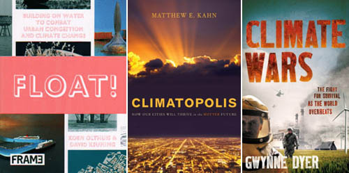
Float!: Building on Water to Combat Urban Congestion and Climate Change by Koen Olthuis and David Keuning (Frame). When David Keuning sent me a review copy of this book he joked that “offshore architecture has been relatively depleted of its novelty over the last few years”—an accurate statement, as images of floating buildings bring back strong memories of the architectural blogosphere circa 2005.

However, Keuning and Olthuis needn’t be worried about depleting the reader’s interest. A remarkably stimulating read, Float! falls somewhere between design textbook, aquatic manifesto, and environmental exhortation to explore architecture’s offshore future. Water-based urban redesign; public transportation over aquatic roadways; floating barge-farms (as well as floating prisons); maneuverable bridges; entire artificial archipelagoes: none of these are new ideas, but seeing them all in one place, in a crisply designed hardback, is an undeniable pleasure.

The book is occasionally hamstrung by its own optimism, claiming, for instance, that “Once a floating building has left its location, there will be nothing left to remind people of its former presence,” an environmentally ambitious goal, to be sure, but, without a clear focus on maritime waste management (from sewage to rubbish to excess fuel) such statements simply seem self-congratulatory. Having said that, Float! is an excellent resource for any design studio or seminar looking at the future of floating structures in an age of flooding cities.

Climatopolis: How Our Cities Will Thrive in the Hotter Future by Matthew E. Kahn (Basic Books). Kahn’s book is at once hopeful—that cities will energetically reconfigure themselves to function smoothly in a decarbonized global economy—and cautionary, warning that whole regions of the world might soon become uninhabitable.

Kahn’s early distinction between New York City and Salt Lake City—the former considered high-risk, due to coastal flooding and extreme weather events, the latter an example of what Kahn calls “safe cities”—is useful for understanding the overall, somewhat armchair tone of the book. Climatopolis is not hugely rigorous in its exploration of what makes a city “climate-safe,” and it overestimates the descriptive value of using “Al Gore” as a personality type, seeming to cite the politician at least once every few pages, but if your interests are more Planetizen than Popular Science, this is a useful overview of the urban effects of climate change over disparate cities and regions.

Climate Wars: The Fight for Survival as the World Overheats by Gwynne Dyer (Oneworld Publications). Dyer writes that his awareness of climate change was kicked off by two things: “One was the realization that the first and most important impact of climate change on human civilization will be an acute and permanent crisis of food supply.” The other “was a dawning awareness that, in a number of the great powers, climate-change scenarios are already playing a large and increasing role in the military planning process.” Putting two and two together, Dyer has hypothesized, based on a close reading of military documents outlining climate-change contingency plans, what he calls climate wars: wars over food, water, territory, and unrealistic lifestyle guarantees.

Dyer’s book utilizes the most explicitly fictionalized approach of all the books under discussion here—to the extent that I would perhaps have urged him literally to write a novel—and he is very quick to admit that the outcome of his various, geographically widespread scenarios often contradict one another. For those of you with a taste for the apocalypse, or at least a voyeuristic interest in extreme survivalism, this is a good one. For those of you not looking for what is effectively a military-themed science fiction novel in journalistic form, you would do better with one of the titles listed above.

* * *

All Books Received: August 2015, September 2013, December 2012, June 2012, December 2010 (“Climate Futures List”), May 2010, May 2009, and March 2009.

Working the Line

Tomorrow night in Los Angeles, at the Center for Land Use Interpretation, David Taylor will be presenting his project “Working the Line.”

[Image: U.S./Mexico border marker #184; photograph by David Taylor].

Taylor has been documenting “276 obelisks, installed between the years 1892 and 1895, that mark the U.S./Mexico boundary from El Paso/Juarez to San Diego/Tijuana. He will present this work, and describe his experiences along this often remote and dramatic linear and liminal space.”

As geographer Michael Dear—who spoke about border issues back at Postopolis! LA—describes these obelisks:

The monuments erected by the boundary survey played a pivotal role in securing the line after the Mexican-American War. These obelisks and stone mounds literally marked on the ground the southernmost edges of the nation; they became fundamental points of reference in subsequent boundary disputes (of which there were many) and in the resurvey of the border that took place at the end of the 19th century.

In the context of Taylor’s project, it’s interesting to read a 2006 discussion about “GeoCaching the Mexican Border Obelisk Monuments,” in which a project nearly identical to Taylor’s was presented as “extreme & dangerous,” and thus all but impossible to achieve. Rhetorically speaking, I also want to point out CLUI’s use of the terms “remote and dramatic” to describe what the geocaching site sees as “extreme & dangerous”—an intriguing insight into the spirit of the two approaches. In any case, the ensuing conversation there includes fascinating technical details of the obelisks themselves—their materiality and scale—as well as precise coordinate locations for several dozen of them.

The talk kicks off at 7pm, on Wednesday, August 4, at CLUI’s gallery space in Culver City; here’s a map.

(Random book link: Obelisk: A History).

#glacier #island #storm

By way of a quick update, several fantastic new posts have joined this week’s ongoing series of linked conversations, part of the Glacier/Island/Storm studio at Columbia’s GSAPP.

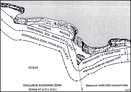
[Image: Map showing a straight baseline separating internal waters from zones of maritime jurisdiction; via a456].

Here is a complete list so far, featuring the most recent posts and going backward in temporal order from there [note: this list has been updated as of February 26]. By all means, feel free to jump in with comments on any of them:

—Nick Sowers of UC-Berkeley/Archinect School Blog Project on “Super/Typhoon/Wall

—Stephen Becker and Rob Holmes of mammoth on “saharan miami,” “translation, machines, and embassies,” and “islands draw the clouds, and glaciers are wind-catchers

— Mason White, Maya Przybylski, Neeraj Bhatia, and Lola Sheppard of InfraNet Lab on “Particulate Swarms

—David Gissen of HTC Experiments on “A contribution, a mini-review, a plug

—Enrique Ramirez of a456 on “Baselines Straight and Normal

InfraNet Lab on “Islands of Speculation/Speculation on Islands: Spray Ice” (nice comments on this one)


[Video: #climatedata by by Michael Schieben; via Serial Consign].

—Greg J. Smith of Serial Consign on “Glacier/Island/Storm: Three Tangents” (interesting comments developing here)

mammoth on “Thilafushi” and “The North American Storm Control Authority” (enthusiastic comments thread on the latter link)

—Tim Maly of Quiet Babylon on “Islands in the Net” (interesting comments also developing here)

—Nicola Twilley of Edible Geography on “The Ice Program” (great comments here, too!)

mammoth on “A Glacier is a Very Long Event” (another interesting comment thread)

InfraNet Lab on “LandFab, or Manufacturing Terrain

—Nick Sowers on “Design to Fail

Finally, I was excited to see that Ethel Baraona Pohl and César Reyes Nájera have jumped into the conversation, adding their own thoughts over at dpr-barcelona; and Alexander Trevi of Pruned has also supplied a Glacier/Island/Storm-themed guide to his own archives in this hashtag switchboard. And that’s in addition to some ongoing posts here on BLDGBLOG.

It’s been a great week for new content, I think, and all of the above are worth reading in full.

Alexander’s Gates

One of many books I’ve been enjoying this autumn is On Monsters by Stephen T. Asma, an extended look into where formal deviation occurs in the world and what unexpected, often emotionally disconcerting, shapes and forces can result.

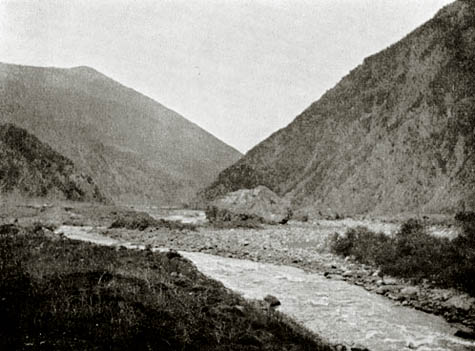
[Image: The Dariel Pass in the Caucausus Mountains, rumored possible site of the mythic Alexander’s Gates].

According to Asma, measuring these swerves and abnormalities against each other—and against ourselves—can shed much-needed light on the alternative “developmental trajectories” by which monsters come into being. This speculative monsterology, as he describes it it, would thus uncover the rules by which even the most stunning mutational transformations occur—allowing us to catalog extraordinary beings according to what Asma calls a “continuum of strangeness: first, nonnative species, then familiar beasts with unfamiliar sizes or modified body parts, then hybrids of surprising combination, and finally, at the furthest margins, shape-shifters and indescribable creatures.” Asma specifically mentions “mosaic beings,” beings “grafted together or hybridized by nature or artifice.”

In the book’s fascinating first-third—easily the book’s best section—Asma spends a great deal of time describing ancient myths of variation by which monsters were believed to have originated. From the mind-blowing and completely inexplicable discovery of dinosaur bones by ancient societies with no conception of geological time to the hordes of “monstrous races” believed to exist on the imperial perimeter, there have always been monsters somewhere in the world’s geography.

Of specific relevance to an architecture blog, however, are Alexander’s Gates.

[Image: Constructing the wall of Dhul-Qarnayn, mythic isotope to Alexander’s Gates].

Alexander’s Gates, Asma writes, were the ultimate wall between the literally Caucasian West and its monstrous opponents, dating back to Alexander the Great:

Alexander supposedly chased his foreign enemies through a mountain pass in the Caucasus region and then enclosed them behind unbreachable iron gates. The details and the symbolic significance of the story changed slightly in every medieval retelling, and it was retold often, especially in the age of exploration.

(…) The maps of the time, the mappaemundi, almost always include the gates, though their placement is not consistent. Most maps and narratives of the later medieval period agree that this prison territory, created proximately by Alexander but ultimately by God, houses the savage tribes of Gog and Magog, who are referred to with great ambiguity throughout the Bible, and sometimes as individual monsters, sometimes as nations, sometimes as places.

Beyond this wall was a “monster zone.”

[Image: The geography of Us vs. Them, in a “12th century map by the Muslim scholar Al-Idrisi. ‘Yajooj’ and ‘Majooj’ (Gog and Magog) appear in Arabic script on the bottom-left edge of the Eurasian landmass, enclosed within dark mountains, at a location corresponding roughly to Mongolia.” Via Wikipedia].

Interestingly, a variation of this story is also told within Islam—indeed, in the Koran itself. In Islamic mythology, however, Alexander the Great is replaced by a figure called Dhul-Qarnayn (who might also be a legendary variation on the Persian king Cyrus).

Even more interesting than that, however, the Koran’s own story of geographically distant monsters entombed behind a vast wall—the border fence as theological infrastructure—appears to be a kind of literary remix of the so-called Alexander Romance. To quote that widely known religious authority Wikipedia, “The story of Dhul-Qarnayn in the Qur’an… matches the Gog and Magog episode in the Romance, which has caused some controversy among Islamic scholars.” That is, the Koran actually includes a secular myth from 3rd-century Greece.

The construction of Dhul-Qarnayn’s wall against the non-Muslim monstrous hordes can specifically be found in verses 18:89-98. For instance:

“…Lend me a force of men, and I will raise a rampart between you and them. Come, bring me blocks or iron.”
He dammed up the valley between the Two Mountains, and said: “Ply your bellows.” And when the iron blocks were red with heat, he said: “Bring me molten brass to pour on them.”
Gog and Magog could not scale it, nor could they dig their way through it.

Think of it as a kind of religious quarantine—a biosafe wall through which no moral contagion could pass.

[Image: Constructing the wall of Dhul-Qarnayn, via Wikipedia].

But as with all border walls, and all imperial limits, there will someday be a breach.

For instance, Asma goes on to cite a book, published in the 14th century, called the Travels of Sir John Mandeville. There, we read how Alexander’s Gates will, on some future day blackened by the full horror of monstrous return, be rendered completely obsolete:

In the end, Mandeville predicts, a lowly fox will bring the chaos of invading monsters upon the heads of the Christians. He claims, without revealing how he comes by such specific prophecy, that during the time of the Antichrist a fox will dig a hole through Alexander’s gates and emerge inside the monster zone. The monsters will be amazed to see the fox, as such creatures do not live there locally, and they will follow it until it reveals its narrow passageway between the gates. The cursed sons of Cain will finally burst forth from the gates, and the realm of the reprobate will be emptied into the apocalyptic world.

In any case, the idea that the line between human and not-human has been represented in myth and religion as a very specifically architectural form—that is, a literal wall built high in the mountains, far away—is absolutely fascinating to me.

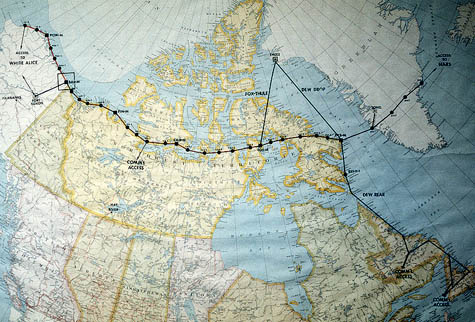
Further, it’s not hard to wonder how Alexander’s Gates compare, on the level of imperial psychology, to things like the Great Wall of China, the Berlin Wall, the U.S./Mexico border fence, or the Distant Early Warning Line—even London’s Ring of Steel—let alone the Black Gates of Mordor in Tolkien’s Lord of the Rings.

[Image: A map of the Distant Early Warning Line, an electromagnetic Alexander’s Gates for the Cold War].

Perhaps there is a kind of theological Hyperborder waiting to be written about the Wall of Gog and Magog.

Or could someone produce an architectural history of border stations as described in world mythology? I sense an amazing Ph.D. research topic here.

Plants Without Borders: An Interview with Sara Redstone

[Image: 55 of Europe’s most common plant pests in a wall poster found via the Scandinavian Fishing Year Book].

Sara Redstone is Plant Health and Quarantine Officer for the Royal Botanic Gardens at Kew, home of the world’s largest collection of living plants. In addition to screening and isolating all incoming or outbound plant material, she is currently overseeing the design and construction of a new quarantine facility for the gardens.

As part of our ongoing series of quarantine-themed interviews, Nicola Twilley of Edible Geography and I visited Redstone at Kew, where we drank tea outside the Orangery café. Over the course of nearly two hours, we talked about the impact of current and potential pest outbreaks, the ecological risks of open E.U. borders and global trade, and the complicated governmental infrastructure of plant protection. In addition, we touched on what plant quarantine at Kew actually looks like, in terms of the functional and technical challenges involved in Wilkinson Eyre Architects‘ design for a new Quarantine House. Along the way, we covered plant smuggling, invasive species, and the potential to create a Sudden Oak Death super-strain.

[Image: A diseased pear from the USDA Pomological Watercolor Collection].


• • •

BLDGBLOG: What do plant quarantine measures encompass—invasive species, plant diseases, or even genetically modified organisms? And who is in charge of enforcing plant quarantine in the UK?

Sara Redstone: Plant quarantine at the Royal Botanic Gardens, Kew, is concerned with controlling plant pests and diseases, to protect our living collections and the wider environment. In the UK, a number of different structures govern plant import restrictions, monitor invasives, and issue licenses for quarantine and for genetically-modified organism—GMO—research. The rules for working with GMOs are laid out and policed by the Health and Safety Executive, but issues that relate to plant health, quarantine, and potential pests and diseases of plants are actually monitored and controlled by an organization called FERA (the Food and Environment Research Agency), which is a new agency within DEFRA (the Department for Environment, Food and Rural Affairs).

It can get quite complicated! Different organizations deal with plant health issues depending on where the plants grow and what they are. Unfortunately, the type of information you can get online relating to plant health and quarantine is not always very user-friendly. For example, inquiries about plant health, imports, and restrictions in Scotland go to the Scottish Office, but in England they either go to FERA or the Forestry Commission, depending on the type of organism. Licenses to operate quarantine facilities depend on what type of material you are quarantining (plant or animal), the purpose of raising such material (to grow the plant itself or to grow potential pests or diseases), and various other factors. Meanwhile, GMOs fall under the Health and Safety Executive, as I said—but inquiries about GMO regulations go to DEFRA.

Ordinary members of the public quite understandably find this very confusing.

Edible Geography: What are some of the most worrying issues facing you in terms of plant pest control?

Redstone: One particularly nasty tree pest, which is also a potential human health hazard, is the Oak Processionary Moth. Kew is just one of many locations in southwest London that has experienced this pest. Like the Browntail and other moths, during various stages of their life-cycle the caterpillars are covered in really brittle hairs that have a toxin in them. It can give you a nasty rash and may cause breathing difficulties or affect your eyes on contact.

The moth came into the UK as eggs on imported trees from Holland—and the challenge we face is that we don’t typically quarantine trees from northern Europe. There is no legal requirement to quarantine material from within the EU, but the pest is widespread in the Benelux countries and in Germany, and it is increasing its range on the mainland.

[Images: (left) The Oak Processionary Moth, pictured in a 2007 Daily Mail article titled: “Gardeners are mercilessly hunting down moths with hairspray and flame-throwers.” (right) Tree infested with Oak Processionary Moth caterpillars. Photo taken by Ferenc Lakatos, University of West-Hungary; found via the Centre for Invasive Species and Ecosystem Health’s Bugwood Network].

What happens is that many Dutch, Belgian, and German nurseries raise trees and shrubs in southern Europe, in areas such as Italy, where the Oak Processionary Moth is already established. The climate and local conditions promote better growth than can be achieved in northern areas, so you get bigger plants faster. They then move the plants back north to grow them on the nursery for a period of time, to get the right shape, etc. This kind of movement of plants has resulted in a lot of pests increasing their range and moving northwards.

Once a pest is established in a those northern mainland European states, there’s no way to prevent it from spreading to the others—because there are no real boundaries. There are no geographic features that are going to prevent them from moving, and there are no trade barriers that are going to stop them, either.

Although Britain is an island, everything is very much geared toward free trade; unfortunately, quarantine is usually secondary to trade. Most people involved in pest & disease control and quarantine will tell you that we like to employ what we call “the precautionary principle”—but, for political and economic reasons, governments don’t always choose to operate that way.

One of my concerns is that we know about these tree movements on the European mainland, and we know that the Citrus Long-horned Beetle, for instance, is now fairly well established in the Lombardy district in Italy—which is not that far from some of the major tree-growing areas in Tuscany. But what’s going to prevent those Long-horneds from spreading to northern Europe, given the movement of plants, and then coming over to the UK?

We’ve already had an instance where infested Acers were grown in China, shipped over to mainland Europe, and then sold in the UK. The beetle has a long larval phase—two to three years when it is undetectable by normal means, though I understand stethoscopes are now being used by some plant inspectors in an effort to detect larvae feeding. Usually the only way to detect them is finding the emergence hole in the tree base—or finding the adult beetle, after the fact. Were all the infested trees found? Were all the beetles present in the consignment destroyed? We don’t even know where all those plants have gone. It’s really bad news.

[Image: Sample “Plant Passport” from DEFRA’s Plant Health Guide to Plant Passporting].

BLDGBLOG: What sort of measures are in place to deal with these threats?

Redstone: Material that comes in from the European Union is generally uncontrolled. There are “Plant Passport” regulations that apply to certain types of plant, but there’s no record of exactly what plant material is moving and where it’s from.

For instance, even if it says it is from, say, Holland, it doesn’t mean that that material originated in Holland. It may have arrived via Holland in a container ship from China.

Different countries have different standards for quarantine and plant health. You can understand that, in some countries where it’s really a struggle to make a living, different rules apply. There is an organization called the International Plant Protection Committee (IPPC), which makes recommendations—but there is a real lack of shared standards for plant quarantine.

One thing that would be really useful now would be a series of suggested blueprints for quarantine buildings. For example, quarantine houses in places like the tropics can be relatively simple: mesh-screen, poly-tunnel-type structures with restricted access are fine. You don’t always have to use chemicals to sterilize things—in the tropics, you can use heat. Even in the UK, we can quite often use solar gain in our glasshouses to sterilize an area, provided we know what we’re trying to kill. The same methods have been used for years in agriculture; farmers will put polythene over an area of land, and then rely on the sun to sterilize the soil.

[Image: Healthy and diseased plants in a side-by-side comparison, via the USDA Agricultural Research Service].

Edible Geography: Here at Kew, what is it that you are quarantining? Why does Kew need a quarantine house?

Redstone: We use plant quarantine—isolating, screening, and treating plants—for incoming and outgoing plants where we’ve determined they may be a risk associated with their movement. For example, if we want to repatriate material to a country as part of a conservation project, the last thing we would want to do is inadvertently introduce a new pest or disease; so we isolate and treat plants before moving them, to reduce that risk to an absolute minimum.

At present we’re in the process of planning a new quarantine facility. Our intention with the new building is that all plant material that is sent to Kew and to our sister-garden, Wakehurst Place in Sussex, will come to this one point—our new “plant reception”—regardless of its origin. This means we can improve our data capture; we can make sure that all incoming material is compliant with the necessary legislation; we can do an initial inspection; and, if we think there’s a risk, we can also do the isolation and screening.

England is not like the United States, where the USDA maintains the plant quarantine service. If, say, the New York Botanical Garden requests plant material from us, they will send us an import permit and shipping labels, and the labels will direct those materials to the USDA quarantine service, who then send the material on. But we operate quite a different system in the UK and European Union.

What happens here at Kew is that we have a licensed quarantine facility, which is approved by FERA and licensed by DEFRA. This gives us the ability to quarantine plant imports that come to the gardens from outside the European Union.

[Image: UK Phytosanitary Certificate, via the Plant Health (England) Order (2005)].

These usually fall into two main types. One is the type of material that comes in with a phytosanitary certificate.

If, for example, somebody went to Costa Rica and they wanted to bring back material from a botanic garden there, they would arrange for all the necessary permissions, but they would also arrange for an inspection by a representative of the national plant protection organization there. If the plant material was free of pests and diseases, it would be issued with a phytosanitary certificate. Normally, that’s only valid for two weeks—so there’s quite a short window of time in which the plant can travel. Once material reaches Kew, it then has to have another inspection—because, at the time it was inspected in Costa Rica, there may have been no visible signs of pests or diseases, but, in the time it takes to reach the UK, something might have developed. So that’s one kind of material that is received into quarantine.

The other type of material we receive into quarantine is what we call “natural source,” or “wild-collected,” material. We operate under a Letter of Authority to import wild-collected material whose movement would normally be prohibited or controlled. An example of that kind of material would be vines from Kyrgyzstan. Their movement is strictly controlled because, in the European Union, vines are a really important crop. You’ll find the same thing in most countries: a lot of cereal crops are controlled, for example, because they can have such a dramatic impact on the horticulture and agriculture of a country.

[Image: Kudzu-infested forest; photo courtesy John D. Byrd, Mississippi State University].

BLDGBLOG: Do you ever quarantine controlled or banned plants, such as kudzu or marijuana, to prevent them from entering the country?

Redstone: We wouldn’t normally consider that quarantine. It’s more a case of restricting access of non-authorized people to those plants, or restricting the release of non-native species into the environment. When we quarantine plants, it’s not to do with excluding a particular plant type so much as excluding the diseases or pests that those plants might be harboring.

Invasive plants like kudzu (Pueraria montana) aren’t banned, although we have a few species like Japanese Knotweed (Fallopia japonica) and Giant Hogweed (Heracleum mantegazzianum) which are illegal to intentionally allow to spread to natural areas.

I’m not sure whether UK authorities would prevent specific plants being imported. Marijuana (Cannabis sativa), whether in THC-containing forms or hemp, requires a Home Office license to produce and process.

We do also provide a service for UK customs authorities. If they make a CITES (the Convention on International Trade in Endangered Species) seizure, we have a department here that will go out to help identify the plant and tell them whether it’s been wild-collected and if it’s of conservation value.

Edible Geography: Can you give any examples of outbreaks that have happened while you’ve been here?

Redstone: We haven’t had any outbreaks here due to failure of quarantine. The impact of an outbreak on our collection could be very serious, particularly if it involves a known quarantine organism where the only sensible treatment is to destroy the plant material. That could cost tens or even hundreds of thousands of pounds to eradicate. It could also threaten rare species, restrict people’s access to the collections, and prevent us from supplying material for research to our own labs and to other botanic gardens.

We have had a couple of recent pest outbreaks in the UK. I’ve already referred to our ongoing Oak Processionary Moth problem. The interesting thing is that when that outbreak happened, the moth wasn’t even recognized as a quarantine organism and it wasn’t clear which government department was going to manage it.

The problem with all of these things is that it’s so much easier to prevent an outbreak than it is to deal with one that’s already in progress. Unlike in the U.S., where you seem to be more geared up to a rapid response once something has been identified, it takes us a long time in the UK and we need more resources in place to do the monitoring and undertake control.

One issue, for example, is making sure we have the right chemicals in place. It’s not enough to do a risk assessment; we also need a list of specific, recommended control measures. And if the recommendation is, for example, “Use this particular chemical,” then we need to make sure that somebody in the UK is able to supply it.

[Image: West Virginia Department of Agriculture’s pest collection, via the Massachusetts Introduced Pests Outreach blog].

BLDGBLOG: What’s involved in thinking through the design of a new quarantine facility?

Redstone: One of the design challenges is to make sure that we not only meet current legislation, but that we also anticipate some of the changes that might need to happen. Global trade and climate change are having an impact already.

Even trying to decide the scale of our building is a challenge: we want to build-in flexibility, and we don’t want to hamstring the organization in the future. At the same time, we have to be able to afford to run the facility!

What we know from the experience of others is that there have been lots of examples of institutions where they’ve spent vast sums of money—tens of millions of pounds—on creating fabulous infrastructure, but it has then been so expensive to run that they haven’t been able to operate it. We can’t afford that. That’s not what we’re about at Kew.

On the other hand, to contain pests and diseases, we need to assess the risks associated with every single plant movement. As a result, over the past few years we’ve routinely quarantined material that there’s no legal need to quarantine. However, we’ve felt that there was a practical need and a moral obligation to quarantine seed material that comes from, for example, California, or from other states where we know there’s a really severe problem with Sudden Oak Death. Particularly with the understory material, we’ve germinated it all in quarantine and grown it on so that we can screen it. The last thing we want to do is introduce Sudden Oak Death—particularly the American form, because there’s an American and a European strain, and the concern is that the two will meet and produce a super-strain.

The other factor is the human resource. It’s not enough just to have a building: you need to have people who are trained and who understand how to operate it.

[Image: Bay leaves showing symptoms of infection by Phytophthora ramorum, the “causal agent” of Sudden Oak Death. Photo courtesy D. Schmidt, Garbelotto Forest Pathology Lab, UC Berkeley, via the U.S. Department of Energy’s Joint Genome Institute].

Edible Geography: Quarantine is always a question of time. How do you decide how long to grow these understory plants, for example, before you can determine whether they are healthy or sick?

Redstone: That’s all part of the risk assessment process. I work with our local inspector and an excellent scientific support team at FERA to make those kinds of decisions. For example, the inspector might look at a batch of seedlings and say: “That group hasn’t grown very well—but this group is fine, and they’ve reached three months and we can see that they’re still healthy.” What he might then say is, “The healthy ones can move on”—and he’ll do me a release certificate—“but those other ones ought to stay for a little bit longer.” Or he might say: “I don’t like the look of that first group: destroy them.”

This is always decided on a case-by-case basis—which is very different from genetically-modified organisms, where there are fixed containment levels. What we’ve done with our new building is use the containment levels for GMOs as a guideline when talking to potential suppliers. For example, in terms of treating our water waste, we’re saying to them that we need an equivalent for containment level 3. That means we’re looking at steam-sterilizing all our liquid waste. We’ll take off the solid fraction, and that will be dried and incinerated—or it will be sent through the autoclave—but the liquid will all be steam-sterilized.

The other thing is that all the technology we use needs to be proven and validated. For example, I know of some places where they use an ultraviolet system for treating water, but there are potential problems with that, because if you have high levels of organic matter in the water, things can, in fact, survive. We just can’t take that risk, because it might result in us not getting a license. And if you put an awful lot of effort—and millions of pounds—into doing something, then it would be an awful shame to fail just for the sake of wanting to try something new and cool.
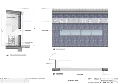
[Image: Proposed façade for the new Quarantine House at Kew, courtesy of Wilkinson Eyre architects].

Edible Geography: Where does the innovation and experimentation in quarantine design take place, if not in designing a new facility?

Redstone: That’s the problem—it doesn’t. It’s the kind of thing that somebody somewhere should do so that we can test new systems. The trouble is that resources are usually limited in this area and facilities tend to be expensive both to build and operate well. Usually you can’t afford to experiment.

We do test our systems once they’re in place, of course. With the steam-sterilization system that we’re planning to install, we’ll be regularly inoculating it with particular organisms and then testing the processed material to make sure it works. It’s simple, but it’s effective.

I’ll show you the plans as they stand now. [unfolds plans] In the scheme as it stands, we have a reception area which will receive all plant material that comes into Kew: seeds, bulbs, shrubs, trees, everything—whether it’s from the EU or not.

[Images: Site plan for the new Quarantine House at Kew, showing the proposed site (marked with red, top) and the proposed floor plan of the new structure (bottom). Courtesy of Wilkinson Eyre].

Edible Geography: What sort of volume is that?

Redstone: Kew receives, on average, between three to five and half thousand accessions a year, and an accession can be quite a large group of plants—it needn’t necessarily be a single plant, if they’re all genetically identical.

The material will then be processed via the inspection area and then either go into the licensed facility (medium and high containment pods) or into the unlicensed large specimen store. The large specimen store’s primary function is to enable us to hold, monitor and, if necessary, treat or destroy trees, shrubs and other plants originating from within the UK and EU.

The large specimen store is basically what we call a high hat. It has a solid roof, which can be shaded, and insect-proof sides. The insect-proofing is aphid proof, so it’s not particularly small—it’s around the 1mm² mark.

Adjoining the store will be the licensed quarantine facility, which will be split in two: high containment and medium containment. Both spaces will be governed by the licence issued by DEFRA. Both units have air cooling—though they each use a different cooling method—and they’re going to be kept at negative air pressure.

We also have to build in systems to allow for a failure in the power supply. As we’re on the edge of a flood risk zone, the building itself will sit on top of a concrete raft and the plants will be on benches. That will give us quite a lot of leeway as far as any risk from flooding goes. As added protection we also intend to have slots at the doorways; we can then put in barriers and reinforce them with sandbags, in the case of a serious flood. I also want to have an operating procedure that says, if we get advanced warning that there’s going to be a really catastrophic flood event, we’ll load everything in the incinerator and destroy it. Frankly, if that happens, most of London is going to be completely stuffed—so there’ll be bigger problems to deal with!

At the entrance to the licenced area, we’re putting in a cold lobby. It will be kept at 0ºC and it will have a freezer for lab coats. People will put on lab coats before they go into the medium and high containment areas and put them back in the freezer when they come out, where the coats will be sterilized. There will also be an air-circulation fan so that, if anything like seeds or pollen has got stuck to people, it will be blown off into the cold.

[Image: “Gradations of Containment” in the proposed floor plan for the new Quarantine House at Kew, courtesy of Wilkinson Eyre].

Edible Geography: Will there be chemical showers as well?

Redstone: No, that would be considered excessive, to be honest. It’s all about assessing and managing risk proportionately. We’re not a research facility raising pests or diseases for experimentation, so the risks are somewhat less. We have an emergency shower in case somebody’s been contaminated, during pesticide spraying, for example, but our working procedures and precautions like the cold lobby and freezing of lab coats should provide the appropriate level of bio-security.

At every stage, we’re assessing and trying to minimise risk. If we received particularly precious seeds that I thought might harbour a problem, what I would look to do is send them to the seed bank so that they can X-ray them and we can weed out the bad guys straight away, to be destroyed. We also use external treatments – for example, peroxide or other chemicals. Apart from anything else, peroxide is great because it can help trigger germination and is biodegradable.

With everything, you have to give it a bit of thought first. Which is why we say to staff, for goodness sake, please don’t turn up on the doorstep with plant material. We need advance notice so we can risk assess the material.

Other parts of the facility include the loading bay, where there’ll be some storage, the incinerator area, and the inspection bay.

[Image: Wall detail and section of the new Quarantine House at Kew, courtesy of Wilkinson Eyre].

BLDGBLOG: What do you do with the output from the incinerator?

Redstone: The ashes are usually incorporated into the soil heap. It doesn’t go into the compost because it blows around; instead, we usually dig it into the soil piles, so it doesn’t go to waste and it is recycled.

The facility also includes a potting area, which contains a small chemical store and a water-treatment area. And there are going to be insectocutors everywhere!

One important design feature is that the plant room is entirely separate, so that the only way people can enter is through that external door. This means that anyone coming to do maintenance on the electrics or whatever doesn’t have to go through any of the quarantine procedures, because they don’t have access to any other part of the building. It’s human nature to prop open the door if you’re feeling warm—but that sort of thing just can’t be allowed to happen inside the licenced areas.

Edible Geography: How will the temperature-control system work?

Redstone: For the individual zones within the greenhouse, each “pod” will have its own small unit climate control panel on the outside of the house, which will control air circulation, fans, and fogging. We’re going to use fogging not just to control relative humidity, but also, in part, to control temperature gain. It’s quite an effective way of modifying the temperature without huge energy input. And we’re going to use external shading—rollers in tracks—because that’s more efficient than internal shading. Although this is the UK, you may be shocked to hear that heat is the biggest problem we have in maintaining the right kind of environment for our glasshouses.

There’s going to be limited lighting because we’ll be either propagating material or maintaining material—we’re not trying to promote lush growth. There will also be a central computer that controls all the zones, and my intention with the new one is to have direct access from my mobile phone and home computer.

One of the intentions with the new building is to minimize energy costs as much as possible. The building also needs to be capable of being operated by only a few staff—it mustn’t be labor or energy intensive!

For plants that have really critical temperature requirements at the lower end of the spectrum—for example, we had some orchids in from Patagonia—it’s hard to provide those kind of environmental requirements reliably through a glasshouse system. So what we’re going to use is a couple of growth cabinets with lighting, because we feel that’s the most cost-effective solution to that particular headache. We’re also hoping to use rainwater harvesting for part of our irrigation system, and we’re trying to use the most energy-efficient materials.

One of the vendors we’re considering makes quarantine houses using curved polycarbonate sheets. You get a lot of lengthways expansion with polycarbonate sheets, and the curve helps accommodate the expansion and contraction, while maintaining a really good seal. The other thing I like is that we can pump air through a cold water spray and then actually circulate it up and over the curve of the structure, which can give a much more even temperature regime across the bays.

[Image: Curved polycarbonate sheets for glasshouse construction, courtesy Unigro].

BLDGBLOG: I see the facility has been designed by Wilkinson Eyre. How is working with them going?

Redstone: Well, the design isn’t finished yet. The final version will be designed and built within the restrictions we’ve incorporated—we are really getting into this now, I think. It’s quite different from anything else they’ve done and the combination of very specific needs, with a lack of specific technical guidelines, makes it a challenging and interesting exercise. We want the building to look attractive, but containment and functionality are its key priorities.

The other interesting design feature is that there’s a five-meter exclusion zone around the building—a completely solid surface with no plant material. We arrived at that measurement through discussion with the Plant Health and Safety Inspectorate, and it’s important to have a clearly marked exclusion zone. Although the old quarantine building began its life being relatively isolated, pressure to use every available square metre of behind-the-scenes space for support activities at Kew means this is no longer the case. We’ve located the new building so we can make use of some of the existing roadway as exclusion. That way we’re not wasting space, and we’re closer to some of the services.

This particular layout also enables us to add on another block, if we need to in the future.

[Images: Proposed elevations—from the NW, NE, SE, and SW—of the new Quarantine House at Kew, courtesy of Wilkinson Eyre].

Edible Geography: How many plant pest & disease quarantine facilities are there in the UK?

Redstone: A lot of universities have small quarantine facilities, often used for GMO work or raising pests & diseases rather than specifically quarantining plants. Rothamsted have a really excellent facility for experimental work. Central Science Labs at the FERA headquarters in York also have quarantine facilities.

Edible Geography: Does the Royal Horticultural Society have one?

Redstone: No, not that I’m aware of. The National Trust doesn’t have specific quarantine facilities either—although, having said that, they have been working very hard on biosecurity issues, triggered, as they will tell you, by outbreaks of Sudden Oak Death in their collections in the West Country. They have taken stock of the situation and realized that they, like many organizations across the UK, needed to improve current practices. I think it says a lot for the organization that they have been so open and self-critical.

The head of this program for the National Trust is Ian Wright, a head gardener from a Trust property in Cornwall. He realized that through lack of resources, budget challenges, and other difficulties, we’ve moved away from basic good practices: cleaning your materials, cleaning your boots, sterilizing your blades, all those kind of things. For example, if you bring in new plants, you should keep them isolated for a period of time, just to make sure they’re clean—but we seem to have lost a lot of those good habits.

So Ian has worked with David Slawson from FERA to produce a lot of information, as well as posters like this. [unfolds poster] These would go up inside potting sheds, to remind people that quarantine doesn’t have to be fancy. It can be something as simple as a poly-tunnel, or an area behind a shed, where you keep things separate. Containment can be as simple as remembering to wash your boots and wash your hands—basic good hygiene.

In fact, one of the things that we’ve been encouraged to think about by DEFRA is providing a limited commercial service, because there are so few plant quarantine facilities in the UK. This new quarantine facility at RBG Kew will be quite a major one, relative to what’s available in the UK. The thing I’m really excited about is the fact that we’ll have the capacity to control more tightly the stuff that comes in from the European Union and around the UK. That’s increasingly important.

[Image: The National Trust’s “Clean Leaf” plant quarantine poster].

Edible Geography: Did you have any qualms about the decision to locate such a major quarantine facility in the middle of one of the world’s greatest collections of rare and valuable plants?

Redstone: We are in a vulnerable location, in a number of ways. We’ve done a major environmental impact assessment, and even looked at the option of having it off-site, but that in itself created major problems. One of the real issues is that it’s not enough just to have the building; you have to have the human resource.

It also makes sense to have a quarantine facility where the movement occurs. We’re not just accessioning new plant material—we’re also doing quite a bit of repatriation. I think it’s really important that we should be able to return safe material to its country of origin, especially if it’s seriously endangered or on the verge of extinction. We have to be able to hold our hand on our heart and say, “It’s clean, there are no problems, and your only challenge will be making sure it grows and that something doesn’t eat it or squash it.”

It’s not just for stuff coming in—it’s for stuff we’re sending out that quarantine is crucial, too.

BLDGBLOG: How do you interact with the Millennium Seed Bank? Do you quarantine seeds for them?

Redstone: No, they have a quarantine area in their own lab for seed material. However, if they want to grow any controlled or prohibited seeds—for verification by herbarium staff, for example—then that has to be done within our facility. So they can examine seeds, but if they want to germinate them and grow them on, then they have to come here.

[Image: Electron micrograph images of seeds. (top) Lamourouxia viscosa; (bottom) Franklin’s sandwort, conserved at Kew’s Millennium Seed Bank. Photographs by Rob Kesseler and Madeline Harley, via the The Guardian].

Edible Geography: You mentioned that, in the UK, there isn’t a system where the government gives you the approved quarantine facility plans and you follow them to the letter. How can you be sure your design will qualify for the appropriate license?

Redstone: Well, that’s the case for plant quarantine—the system for GMOs is very different, and I don’t know how animal quarantine operates. In our case, I have constant contact with my colleagues in FERA who will be involved in evaluating the new build plans. If they have an issue with a particular system, they’ll let me know.

For example, I had an inspector on site yesterday who asked, “Have you thought about the door seals? I know that these are really good doors but, to get a good seal, what you want is a little up-stand at the bottom of the door for the seal to butt up against.” It’s all sorts of small details like that.

The difficulty with the project from my point of view has been to make sure it gets enough time and attention now—because I know that if I’m still here when it gets built, my ongoing sanity is going to rely on having made the right choices so that we can physically manage the building. I think that, for projects that are very specialized, like this one, the people who are going to use the buildings often don’t get enough time to actually sit and evaluate what the building needs to do.

Edible Geography: Just writing the brief for it must have been quite a challenge!

Redstone: To say the least. Version 10 got issued about three weeks ago. My biggest worry is that I’ve missed something. There’s just no wriggle room.

Edible Geography: Did you take any of your ideas for your plan from other facilities that you’ve seen?

Redstone Yes. I actually persuaded them to employ a colleague from Rothamsted, Julian Franklin, as a consultant. He is a major quarantine nerd—not only is he really knowledgeable about the plant side of things, but he’s obsessed by technology, so he can tell you that so-and-so needs to be at this many atmospheres, or amps, or whatever. He’s been a real find.

In fact, one of the risks of a project like this is that there are very few experts around—and, especially in the current climate, there are lots of companies who are desperate for work who may claim expertise they don’t really have.

BLDGBLOG: You said you need to avoid innovation at all costs, but is there any aspect of the facility that will be genuinely new or unprecedented?

Redstone:: Nobody’s built a screening house quite like ours, I don’t think, but it’s really just an adaptation of things that we’ve seen done elsewhere. Ultimately, it will all be technology that’s been used elsewhere, but perhaps not in quite the same way. Other facilities have air showers, for example, but most of those haven’t also had a cold lobby. We are combining things—but we’re also trying to play safe.

[Image: Air Shower diagram, via the U.S. Occupational Health and Safety Administration (OSHA)].

Edible Geography: What is the old quarantine facility like—and what will happen to it once the new building is completed?

Sara Redstone: It’s a modified commercial glasshouse, about twenty-five years old. It wasn’t specifically designed as a quarantine house: it has no automatic shading, and controlling the internal climates reliably can be a challenge. The water here is very hard, as well, so the building has had a lot of issues with equipment.

The new facility should be operational by late autumn 2010. This time next year, we’ll be thinking about doing the smoke tests and the pressure tests and so on. And once stuff has been screened in the new facility, it will go into the old house and be held there for short periods of time until it goes onward to the display houses.

[Image: A fairly standard list of materials that must be declared at the border and potentially quarantined to prevent the import of pests and diseases; this particular brochure is Canadian].

BLDGBLOG: I’m also curious about what happens off-site—for instance, if there is an outbreak somewhere in the Midlands or up in Yorkshire, do you have a field quarantine unit of some sort who can rush out and seal the place off in situ?

Redstone: Not yet, that I know of. You’d need to talk to DEFRA and the Non-Native Species Secretariat who monitor and deal with invasive alien species, or IAS. There is a working group working on developing a protocol for a rapid response against non-native species—NNS—but I’m not sure if they have agreed the way forward.

If the outbreak relates to plants then you’d have to notify—depending on what the host and pest or disease is—either FERA or the Forestry Commission. If the organism isn’t quarantine-listed, then a pest risk analysis (PRA) and other detailed work may be required, and this can take some time to do thoroughly. Depending on where the outbreak is and what it is, there’s then also the need to identify who will attempt to eradicate it and how—and where the resources will come from.

What we really need to do is make everybody aware of the dangers of moving plants. It doesn’t matter if you’re a business or an individual.

I had a person tell me recently that they deliberately altered their suitcase so that they could bring back cuttings from their holidays overseas without being detected. People get very confessional—when they hear what my job is, they have this urge to tell me about all of the plant material they’ve brought through customs without declaring, or all of the farms they visited overseas and didn’t mention on their immigration forms. It’s my worst nightmare.

There have been outbreaks of quite serious pest problems in botanic gardens and plant collections. These have probably, according to the experts at FERA, been the result of things like exotic flower arrangements or of bringing in fruits from around the world to explain to children about plants. Those routes need to be cut off, as well.

Individuals can sometimes be ignorant of the impact they could have by smuggling—in fact, sometimes they don’t even realize that they are smuggling—plant material into and out of the country. We’ve got a bit of money as part of the project to actually do some interpretation on site. I’m hoping that we can do quite a lot to explain to people the risks of moving plant material, and the impact of plant pests and diseases, by having signage in the display houses and in public areas on site.

For example, did you realize that there’s a risk, when you’re moving plants that have soil around the roots, of introducing a pest called the small hive beetle, which can eradicate honeybees? Bees are getting a lot of press at the moment—for very good reason—and so one of the things I’m hoping we can do is use that sort of example to show that the consequences when you smuggle that plant back from your holiday, or when you bring back a jar of local honey, or wax candles, or a wooden sculpture, may be more far reaching than you realize.

If you put things in context, most people are responsible enough not to flout the rules—I hope. We’re all in this together—we all share the same planet.

• • •

This autumn in New York City, Edible Geography and BLDGBLOG have teamed up to lead an 8-week design studio focusing on the spatial implications of quarantine; you can read more about it here. For our studio participants, we have been assembling a coursepack full of original content and interviews—but we decided that we should make this material available to everyone so that even those people who are not in New York City, and not enrolled in the quarantine studio, can follow along, offer commentary, and even be inspired to pursue projects of their own.

For other interviews in our quarantine series, check out Until Proven Safe: An Interview with Krista Maglen, One Million Years of Isolation: An interview with Abraham Van Luik, Isolation or Quarantine: An Interview with Dr. Georges Benjamin, Extraordinary Engineering Controls: An Interview with Jonathan Richmond, On the Other Side of Arrival: An Interview with David Barnes, The Last Town on Earth: An Interview with Thomas Mullen, and Biology at the Border: An Interview with Alison Bashford.

More interviews are forthcoming.

Until Proven Safe: An Interview with Krista Maglen

[Image: Airfield at Guantanamo Bay converted for the quarantine of 10,000 Haitian migrants; via Wikimedia].

Krista Maglen is Assistant Professor of History at Indiana University, where her research explores the nature of infectious disease prevention, including quarantine, during the latter part of the 19th century and beginning of the 20th century.

In her published work, which includes “‘In This Miserable Spot Called Quarantine’: The Healthy and Unhealthy in 19th Century Australian and Pacific Quarantine Stations” and “‘The First Line of Defense’: British Quarantine and the Port Sanitary Authorities in the 19th Century,” she focuses on the interrelationships between quarantine defenses, economic traditions, and medical restrictions on immigration.

As part of our ongoing series of quarantine-themed interviews, Nicola Twilley of Edible Geography and I spoke to Maglen about the ways in which different economic and cultural forces have shaped the practice of quarantine in Australia, the U.K., and the U.S.A. In this wide-ranging interview, we discuss the absence of a design philosophy for quarantine, quarantine’s potential for political misuse, and the differences between quarantine and other forms of incarceration.

• • •

Edible Geography: What led to your interest in quarantine?

Krista Maglen: My original interest was immigration, and I was looking at the way that immigrants had been restricted from coming into Britain for medical reasons. I had some assumptions about how that process occurred, but I realized it wasn’t as straightforward as in the U.S.A. or in Australia. When I looked a bit more deeply, I realized that this was because of the relationship that Britain had towards quarantine.

There is a long-standing opposition to quarantine in Britain, which meant that when Britain started to enact restrictions on immigration and immigrants, it was quite difficult, because those restrictions use many of the same mechanisms and much of the same language as quarantine. Both of them are designed to exclude certain groups of people, and they’re very closely interrelated.

That intersection between immigration and quarantine was where I began—and then I started to see all these amazing things about quarantine. It doesn’t only relate to medical and public health policy, or even just to immigration policy—it’s also very bound up with economic and political policy, as well. It is both shaped by, and a tool of, these larger geopolitical forces.

[Image: Map of the Australian Quarantine Service].

BLDGBLOG: I’m interested in your understanding of the relationship between quarantine and the construction of national borders.

Maglen: Quarantine differs very much depending on where a country is in relation to a disease source or perceived disease source. Australia, for example, has actually historically had one of the strictest quarantine policies, even though it’s so far away. Quarantine became a very big deal there. First of all, there’s a perceived proximity to Asia, which in the West has traditionally been seen as this great source of disease—the “Yellow Peril.” Quarantine is also a way to draw a line around White Australia, racially, just as much as it is to draw a line around the notion of a virgin territory that doesn’t have the diseases of the rest of the world.

Britain has a different relationship to quarantine because its borders are much more fluid. It can’t have borders as rigid as somewhere like Australia, for lots of different reasons: because of its empire; because it relies on maintaining open borders to let trade flow; and because Britain is itself quite undefined, in a way. It’s a composite of England, Ireland, Scotland, and Wales. The borders of Britain are much more fluid, so quarantine takes a different form there and has a very different history.

Edible Geography: You’re now based in the States, where I would assume quarantine is different again?

Maglen: Yes, exactly. Quarantine is closely tied to immigration in the United States: Ellis Island was a quarantine processing site, as well as an immigration processing site. Until the 1920s, immigrants arriving into the United States came into facilities that were also quarantine stations, and also places where you could isolate people for disease control reasons. Part of the processing of who can and can’t get into the United States is always about quarantine—what bodies are seen to be diseased and undesirable.

[Images: Asian immigrants arriving at the Angel Island immigration station, San Francisco, and a man quarantined at Ellis Island; courtesy of the National Library of Medicine].

Edible Geography: That raises an interesting question: By looking at a particular country’s quarantine regulations, can you construct in reverse what that country wishes it could be, or imagines it is?

Maglen: I think you can. Quarantine borders—just like national borders—are seeking to draw a line between us and them, inside and outside, desirable and undesirable, and so on. The United States is interesting because it has land borders as well as sea borders. The defining of a biological border, and its role in defining a national border, becomes more complex on land.

Edible Geography: Could you discuss the design of quarantine facilities and the way that also varied from country to country?

Maglen: When you’re thinking about quarantine, one really important thing to keep in mind is that there is a distinction between quarantine and isolation. Quarantine is a word that’s used quite freely. The way it’s used quite often now is to refer to the isolation of sick and infected people. But quarantine more accurately refers to the isolation of anyone who’s deemed to be a risk. That means that you can have perfectly healthy people in quarantine—and being held in quarantine for quite a long time.

One difference is that, in Australia, the quarantine facilities are designed to house all quarantined people—people who are sick and people who are healthy, but have either been in contact with an infected person or have come from somewhere that’s perceived to be an infected place. Australian quarantine stations have an isolation hospital—which is separated, but still part of the main facility—and then they have a big dormitory for all the healthy people who are having to be quarantined as well.

In Britain, the facilities that are set up are almost exclusively for the reception of sick and infected people. They’re really isolation facilities rather than quarantine facilities. Britain has a long history of taking the stance that quarantine is completely unnecessary, because you’re perfectly able to look after healthy people who may have been in contact with an infection if you have a public health system within the country, and that system works properly. From the 1870s or so onwards, Britain says that they’ve got the best sanitary system in the world, so they don’t need to worry about quarantine. Even today, there’s an argument made in Britain along very similar lines, which says that people arriving into Britain potentially carrying tuberculosis shouldn’t be excluded from the country or put into any type of isolation—they just need to be monitored within the National Health Service (NHS). The NHS, in this argument, has everything that is needed to control the spread of tuberculosis from immigrants to the population of Britain, so you don’t need to exclude immigrants on a medical basis.

[Image: “Testing an Asian immigrant” at the Angel Island immigration station, San Francisco; courtesy of the National Library of Medicine].

BLDGBLOG: Does some of the difference in attitudes towards quarantine stem from different national political traditions and notions of individual human rights? For example, do the British have a stronger history of arguing for the right to resist involuntary government-imposed detention?

Maglen: It’s an interesting question but, in my research, I haven’t found much of that. Quarantine is much more closely tied to economic political traditions. Britain has a tradition of economic liberalism and free trade, which requires, to a great extent, open borders. Trade requires ships to come in and out, and those ships carry people.

Of course, discussions about human rights and individual liberty are a little bit beyond my period—but everywhere, even now, the argument is made that there are times and instances where individual liberty has to be given over to the greater good. Quarantine, in that argument, is just one of these instances where an individual’s liberty has to be curtailed in order to protect the broader community.

Something that was talked about a lot in the nineteenth century, and still now, is the difference between quarantine and other sorts of incarceration. Quarantined people might be perfectly healthy—they’re not necessarily physically or mentally ill—and they don’t really fit into the normal categories of people with reasons to be incarcerated.

What’s interesting about quarantine is that it assumes that people have the potential to cause harm without having to prove it; it presupposes guilt, in a way.

There’s a quotation from the Australasian Sanitary Conference in 1884 that I think captures a very important aspect of quarantine. It says, “Quarantine differs from a measure of criminal police in this respect: That it assumes every person to be capable of spreading disease until he has proven his incapacity; whereas the law assumes moral innocence until guilt is proven.”

Quarantine is really one of the singular instances in a liberal democracy where it’s possible for the state to incarcerate somebody without proven guilt. It’s a complete inversion.

What I’ve found in my research—which is focused on the nineteenth-century and early twentieth-century, so I can’t speak for today—is that most people who were quarantined agreed in principle with their incarceration and with quarantine. They believed that it was a just thing for them to be quarantined—in principle. They often talk about that at the very beginning of their period of quarantine. Once they’ve been placed into quarantine, it all seems quite different.

So, in theory, people believe in quarantine—but when you’ve been sitting for two months in a facility that often isn’t very well-equipped for people to live there, because they’re set up just for the occasions they might be needed, and often they’re not very nice or comfortable places to be, things seem very different.

One of the things that comes across consistently in people’s quarantine experiences is boredom. They complain about the accommodation and the food, and they get sick of the people they’re quarantined with—all those very normal human responses.

[Image: Medical inspection station at Ellis Island. The 1891 U.S. immigration law called for the exclusion of “all idiots, insane persons, paupers or persons likely to become public charges, persons suffering from a loathsome or dangerous contagious disease,” as well as criminals. Courtesy of the National Library of Medicine].

Edible Geography: Following on from that, I’m interested in hearing more about your research into the experiences of the quarantined, but also about the experiences of those who were doing the quarantining. Are there recurring similarities or differences between those two points of view? And are there changes in the perception of their experience over time, or residual stigma, post-quarantine?

Maglen: The question about residual stigma is really interesting. My research hasn’t uncovered anything that reveals anything about that. If there was residual stigma, people aren’t talking about it. Not that I can find, in any case.

As I argue in my article, “In This Miserable Spot Called Quarantine,” it seems that quarantine is set up to deal with the singular problem of keeping people who are a potential risk away from the rest of the community. How that then works itself out in practice is really an afterthought. You put in place a facility, whether it’s on an island, a remote peninsula, or a huge moored boat, and you put in place the regulations that govern how a long a ship or people are supposed to stay in quarantine—but that’s about it. People are put there and forgotten about until it’s time for them to be released. Something that people who are being quarantined and people who work in quarantine both have in common is that most of them express great frustration at this.

It’s a “What do we now?” kind of thing: we’ve all got to sit around and wait, but there’s probably not sufficient accommodation for people, and we’ve been given these really crappy rations, and there’s no way of getting away from the other people held there.

[Image: Isolation Section, Sydney Quarantine Station].

Edible Geography: It’s as though the only design philosophy that exists for quarantine is keeping people away. You get a community that isn’t designed to function; it’s simply designed to contain. It’s a place that’s not designed as a place. It’s designed as a non-place.

Maglen: Exactly—that’s a perfect description. It’s designed as somewhere to deposit people temporarily—although, in some cases, that meant several months–but that’s about it. We just shut the doors and leave.

That’s what’s really great about reading the personal sources and stories of people who were in quarantine, because none of the official sources or government agencies see quarantine as anything other than a way to solve a problem. They don’t see it as individuals with their liberty being curtailed and their economic autonomy being frozen. They don’t see any of these problems; they’re just looking at the larger public health issue. It’s more of a macro view of disease control rather than a micro view of individual people’s lives.

[Image: A “Quarantine Act” banner from the Torrens Island Quarantine Station collection, held by the National Museum of Australia, Canberra].

BLDGBLOG: Talking about quarantine stations as a place simply to dump people reminds me of a bit of the architectural criticism of refugee camps. Refugee camps are often criticized as being nothing but utilitarian: built with no concern for community, culture, or how people will live once they’re placed there. Have you found other spatial types that are similar to quarantine facilities—whether that’s refugee camps or supermax prisons—where the same types of psychological and cultural issues emerge?

Maglen: Absolutely. The places I have studied that are similar are detention centers for asylum seekers in Australia.

There was a policy of mandatory detention for asylum seekers who arrived in Australia; they were put in horrible camps out in the middle of the desert until they could be processed. There was an assumption that if you were a “proper” refugee, you would have stayed in the refugee camps, in wherever it was that you were from, and waited until your application had been processed. You would have been given a visa saying that you were a refugee, and then you would have come to Australia on a plane and gone through the immigration line with the requisite stamp in your passport. This is obviously ridiculous—the life of a refugee doesn’t usually work that smoothly.

In any case, people who arrived in boats—or any way they could—in Australia and who didn’t have a refugee stamp in their passport—or a passport at all—were put in detention centers for long periods of time, sometimes years. The psychological problems that occurred amongst people who were isolated and detained in these places for that long were enormous. Not only were many of the people already psychologically damaged by the experiences that had led them to become asylum seekers and refugees, but they were then put into these temporary camps and isolated in the middle of nowhere.

The difference, however, between that example and people who have been put in quarantine, or people who are put in solitary confinement in prisons and so on, is that quarantine has a time limit. It’s limited, by definition—although, of course, it can be continued and extended. In fact, one of the problems of not setting quarantine facilities up properly is that you then get situations where poor design can lead to unnecessary extensions to the period of incarceration. So, for example, if I have been in quarantine for 15 days of a 20 day quarantine incarceration—with only 5 days left until I am released—and then you are newly placed in quarantine with me, if we are not adequately separated, I will have to start the 20 day quarantine period all over again—making my total quarantine 35 days. This is because I have been freshly exposed to a suspected disease source—you—and so my previous quarantine is rendered useless.

Quarantine facilities, therefore, need to be able to separate instances of exposure in order to avoid compounding the duration of incarceration. However, poor design of quarantine facilities—created essentially, as we said before, only to keep people away from the broader community and with little thought given to internal structures—has, at times, resulted in quarantines that have, unnecessarily, lasted for months.

Even so, there is always a limit with quarantine. First of all, epidemics only have a limited lifespan. Secondly, quarantine periods often have something to do with incubation periods, although the relationship is not as direct as you might think.

So, to speak to your question, I haven’t seen any long-term residual damage inflicted by quarantine, strictly as quarantine. When quarantine is strictly about disease, it doesn’t have the same kind of psychological effects, because you know that, in two months or so, you’re going to be let out. When quarantine is tied to other ideas, or when it becomes a way of keeping a particular class or race—or whatever category of people—outside, it quickly shades into something else.

[Image: View through the perimeter fence at Port Hedland Immigration Reception and Processing Centre in Western Australia, June 2002, from the Australian Human Rights Commission].

Edible Geography: If quarantine has an end date, then surely it doesn’t actually function to exclude people from a country. In that case, is the point to use quarantine as a way of reinforcing prejudice and social hierarchies, so that people know their place, as it were, before they even come in the door?

Maglen: Quarantine can do that. It can also be designed as a way to dissuade people from wanting to try to come to your country in the first place. Quarantine is also very much about reaffirming models and stereotypes within the community: to create a feeling that “everybody knows that people from a particular country or region are dangerous, because look, the government has to quarantine everybody from there.” It gives a seemingly scientific backing for ethnic or racial prejudice.

An example of that is people from Haiti being quarantined by the United States at Guantanamo Bay, because of the risk of HIV and AIDS. You can read much more about this in Howard Markel’s book, When Germs Travel. There’s a really interesting chapter in there called “No One’s Idea of a Tropical Paradise: Haitian Immigrants and AIDS.” In it, Markel talks about how Haitian immigrants were being quarantined off-shore because they might be HIV-positive, and how that just re-confirmed—and put a government stamp on—prejudices against Haitians as being a dangerous and untrustworthy people.

That raises another very interesting point about quarantine: it can manipulate the public’s understanding of a particular disease. A disease might not be transmissible person-to-person, or it might not be highly contagious, but the imposition of quarantine automatically implies that there’s a person-to-person mode of infection (in the sense that, if I was sick and I stood in the same room and breathed on you, you would get sick). Quarantining people with HIV/AIDS implies that just coming into contact with them will expose you to infection.

Edible Geography: It seems, then, by virtue of being a practice of detention, quarantine can be misused very easily.

Maglen: Absolutely. It’s not just because it’s a practice of detention, but because quarantine, unlike isolation, is about keeping people who are deemed to pose a risk to public health separate. They’re not known to be a danger, but they’re judged to be a risk—and it’s that idea of risk that can be very easily manipulated. Risk could mean that they’re carrying a pathogen, or it could be that the place that person has come from is deemed to be diseased. It’s a very loose and dangerous term.

Edible Geography: What direction is your research taking now? Are you still exploring aspects of quarantine, or has it led you on to somewhere else?

Maglen: At the moment, I’m working on a book to develop my work on quarantine in Britain. I’m particularly looking at the border, and the idea of British ports being in-between spaces—spaces that are much more fluid than their American or Australian equivalents. I’m using that idea to examine the reasons behind the difficult relationship the British have with quarantine and immigration control, and also to explore how Britain sees itself within the United Kingdom and its former empire. I’m hoping to show how looking at immigration and quarantine can help us understand what’s happening in Britain as a nation and why it behaves as it does, both internally and internationally.

In the future, I want to continue looking at quarantine, but I want to move back to looking at Australia, and in particular, the Western Pacific. The French, British, and German imperial forces came in and tried to divide the islands up between them, even though the island populations had a long history of moving around in completely different patterns. I want to look at how disease control and quarantine were then used by the imperial powers as a way to control that movement of people.

• • •

This autumn in New York City, Edible Geography and BLDGBLOG have teamed up to lead an 8-week design studio focusing on the spatial implications of quarantine; you can read more about it here. For our studio participants, we have been assembling a coursepack full of original content and interviews—but we decided that we should make this material available to everyone so that even those people who are not in New York City, and not enrolled in the quarantine studio, can follow along, offer commentary, and even be inspired to pursue projects of their own.

For other interviews in our quarantine series, check out One Million Years of Isolation: An Interview with Abraham Van Luik, Isolation or Quarantine: An Interview with Dr. Georges Benjamin, Extraordinary Engineering Controls: An Interview with Jonathan Richmond, On the Other Side of Arrival: An Interview with David Barnes, The Last Town on Earth: An Interview with Thomas Mullen, and Biology at the Border: An Interview with Alison Bashford.

More interviews are forthcoming.

Biology at the Border: An Interview with Alison Bashford

[Image: Thermal scanners at the Seoul international airport; photo by Jung Yeon-Je for Reuters, via Time].

Alison Bashford is Visiting Chair of Australian Studies at Harvard University’s Department of the History of Science, as well as Associate Professor of History at the University of Sydney. Her work has examined the politics, culture, and spaces of quarantine at a variety scales, from immigration law and geopolitics to the design of nineteenth-century hospitals. She is the author of Imperial Hygiene: A Critical History of Colonialism, Nationalism and Public Health, and co-editor of both Contagion: Historical and Cultural Studies and Medicine At The Border: Disease, Globalization and Security, 1850 to the Present.

[Image: Map of Lawlor Island Quarantine Station, showing 1st and 2nd Class accommodation].

As part of our ongoing series of quarantine-themed interviews, Nicola Twilley of Edible Geography and I spoke to Bashford about the ways in which quarantine can both define and blur borders, the use of vaccination scars as health passports, and quarantine’s role in enforcing social hierarchy and racial prejudice.

• • •

Edible Geography: To start with, how did you become interested in quarantine?

Alison Bashford: I got to quarantine through my early work on the concepts of purity and pollution. My first book, Purity and Pollution, was about how ideas about clean and dirty spaces and clean and dirty bodies, and the separation between them, came into being in the nineteenth century in the context of hospitals, and the discovery of germs, and so forth. After that first book, I started studying infectious disease management on a larger scale. I fairly quickly moved into looking at maps of early quarantine stations and the division of pure and polluted spaces there, as well as the various diseases that were managed that way.

My work is not always focused on Australia, but I quickly realized there was quite a particular Australian history to be sorted through here. Many diseases that have been endemic and epidemic in other parts of the world, such as cholera, never even arrived in Australia. In Australia, the quarantining of the entire continent came to be important in terms of keeping diseases out, but it was also symbolically incredibly important as part of the project of producing White Australia. I gradually realized what a rich history there was in terms of thinking about the racializing of the new nation in 1901 as, essentially, a public health project.

After that, I became very interested in island spaces as well—places where people with various diseases were quarantined in a much more permanent way. Amusingly, I live right next to the quarantine station in Manly. I’d written about quarantine for a long time—long before I lived there—and it’s just been terrific, living on the place that I was writing about for so many years.

[Images: (top) The North Head Quarantine Station, Manly, Australia; photo by Nicola Twilley. (bottom) Spa treatment at Q-Station hotel retreat, Manly, Australia].

Edible Geography: It’s interesting what they’ve done to the quarantine station at Manly, in terms of turning it into a luxury hotel. The afterlife of quarantine stations is a fascinating topic in and of itself.

Bashford: Yes, absolutely. The developer gave me a good tour around it just before it opened. It was extraordinary listening to him talk about the concept of putting a day spa on the site of the old hospital buildings, which is where the most infected were kept.

[Image: As Egypt and Sudan gained their independence from Britain, the border between the two countries was determined by drawing a straight line from the sea through Wadi Halfa, a quarantine station on the Nile (which is now an underwater archaeological site due to flooding caused by the construction of the Aswan Dam)].

BLDGBLOG: A great deal of your work examines the political nature of quarantine and the relationship between quarantine and the border. I was particularly struck by the fact that, in some cases, the biological border has preceded the national border, as in the case of the line between Egypt and Sudan.

Bashford: A lot of historians have written about borders, but I think what’s sometimes overlooked is that this temporary line, marked by quarantine practices that maintain a disease on one side of the border and not the other, is often the earliest sign of what later becomes a national, territorial border.

This is also the case with regional borders. The boundary between the nineteenth-century Orient (as the Near East used to be called) and Europe was the place where cholera was controlled. Various quarantine practices were set up every year in and around the Mecca pilgrimage, because there was constant European anxiety that this mass movement—in a place that is just adjacent to Europe—would introduce cholera into Europe itself. So that boundary, which was not an actual territorial border but, rather, an important part of how Europe defined itself in relation to its most adjacent neighbor, the Orient, was made meaningful through very specific, very grounded, practices of inspecting people, putting them in quarantine camps, and monitoring or restricting their movement.

[Images: Routes to Mecca, and pilgrims on the Hajj (second image via Gizmowatch)].

Edible Geography: You’ve also examined the way these kind of disease borders can define cities as well.

Bashford: Yes—in Imperial Hygiene, I really explored this idea of boundaries at different scales. I structured that whole book spatially. I started with a chapter about smallpox, vaccination, and the border of the body and skin, and I looked at the way that a vaccine introduces disease into the body, in order to create immunity.

Then I moved outwards to the scale of the city. I took Sydney as a place that had certain diseased zones that were quite disordered, and analysed the way in which the establishment of the quarantine station on North Head—in Manly—was an attempt to create clean and dirty spaces within an urban environment.

Then I moved outwards again to think about the entire Australian continent—and outwards again to consider international hygiene and quarantine measures, and the way that the entire globe, due to immigration restriction acts over the twentieth century, became criss-crossed by all kinds of lines of quarantine.

Edible Geography: In that context, I was particularly interested in your paper tracing the origins of the World Health Organization—and public health as a globally regulated phenomenon—back to the International Sanitary Conferences, which were themselves convened to implement quarantine.

Bashford: The question of how to manage infectious disease is foundational for the League of Nations Health Organization, and then the World Health Organization. In fact, even the large philanthropic organizations, like the Rockefeller’s International Health Board, were attempts to prevent infectious disease, both by quarantine and also by hygiene education. In nineteenth-century Europe, the International Sanitary Conventions and Conferences were, in the first instance, about cholera, and the concern about the annual pilgrimage.

What’s intrigued me for many years are the way immigration restriction lines dovetail as quarantine lines. In spatial terms, I’m fascinated by the way this division of pure and polluted spaces can be architectural at a very small and local level, but can also come to structure the globe as a whole.

Edible Geography: Can you give an example of an encounter with one of these quarantine lines today?

Bashford: Airports are places where the demarcations of quarantine lines are very clear, and biological or biomedical terms like “Sterile Zone” still cling to the various clean and polluted zones. “Sterile Zone” doesn’t actually mean sterile zone—it indicates a zone into which only authorized people can go.

Airports still make the link between quarantine and the regulation of movement very clear. Historically, quarantine laws were the main way in which people’s movement over national borders was regulated. Almost all of the immigration acts that proliferated around the globe in the nineteenth century (which we still live with, every time we hand over our passport) were about quarantine regulations. Every immigration restriction act across the world, even now, always has a “loathsome disease” clause in it.

[Image: An Italian Health Passport, via the Disinfected Mail Study Circle].

Edible Geography: Can you talk a little more about the relationship between health passports, or pratique, and quarantine?

Bashford: What’s interesting is that all of these identity documents—passports, visas, health vaccine certificates, and so forth—only become attached to an individual relatively late in time. Through most of the eighteenth and nineteenth centuries—and into the twentieth century, in some cases—these documents would refer to the vessel on which you arrived into a zone, rather than to you as an individual.

For a ship arriving in Sydney Harbor, for example, there would be a certificate of freedom from disease that pertained to the entire ship, and that would be determined by the route on which the ship had come. If the ship had come to Sydney from London via what was then Ceylon, and if there was known to be an epidemic of cholera or smallpox in Ceylon, then that entire ship would be understood to be diseased and it would be put in quarantine for a certain period of time. I’m very interested in the way that, in the maritime world, the passengers and ship became one body, which could then be categorised as infected or clean, irrespective of the health or otherwise of the individuals on board.

One thing that I’ve always wanted to do more work on is the actual bodily inspection of people to determine whether they’ve got a vaccine scar, from the smallpox vaccine. It’s something that I know was practiced, particularly during an epidemic. Historically, before you had a passport or even a piece of paper that authorized your movement from one zone into another, people were not infrequently checked for a vaccination scar. You could only move from what was understood to be an infected zone into a healthy zone if you had a vaccination scar. It became a kind of bodily passport.

The other fascinating thing about quarantine is that it dreams of being non-porous, but in fact, quarantine lines are always leaky. Quarantine, like today’s passports and visas, is much more about letting some people through and keeping other people out, than enforcing a total border.

BLDGBLOG: I’m also interested in the phenomenon of proto-states testing the limits of their power through bio-political practices—that is, experimenting with how they can control and regulate individual people, and doing so in the arena of medicine. Medical power becomes a kind of stepping stone toward national sovereignty.

Bashford: Certainly, the display of a line around a country—and hence territorial sovereignty—can be put into practice very clearly through quarantine practices. That’s where we started our conversation. Immigration restrictions and quarantine practices go hand-in-hand as the two intertwined practices that determine a border as a border for modern kinds of territory. This takes place at an imaginary level.

But there is a flip side to all of this: the apparent imperative to maintain hygiene and keep out disease sets up the territorial boundaries of a nation, but it also gives that nation an almost humanitarian license to step over its own border and into the territory of another state. Patrick Zylberman and Alexandra Minna Stern wrote about this in my book, Medicine at the Border.

Alexandra Minna Stern, in particular, writing about U.S. quarantine and yellow fever, discussed the way that quarantine at Ellis Island was about inspecting migrants and excluding some people, and thus setting up a sovereignty for the United States. She then went on to show us how the very concern about yellow fever was also a way in which the United States government could offer assistance to, intervene in, and set up hygienic measures in all of the nations adjacent to the south, as a kind of a first way in. Unsurprisingly, this was followed pretty quickly, either by territorial acquisition of those places or by transnational agreements and other extensions of influence. After the Spanish-American War, in a whole lot of places like Cuba, and eventually Panama, Puerto Rico, and even Guam, the first U.S. inroads were around quarantine and infectious disease measures.

So while quarantine and infectious diseases function to set up territorial borders and national sovereignties, for powerful nations and nations with pretty good internal health structures the management of infectious disease in a place over the border is quite a common way to extend sovereignty into that territory.

[Image: Tuberculosis seen via x-ray].

Edible Geography: So quarantine contributes to both a spatial out-sourcing or in-sourcing of the border?

Bashford: Exactly. One article that I wrote about quarantine and tuberculosis is called “Where is the border?” It came out of work I was doing with colleagues in the UK about the difference between the Australian history of quarantine and the British tradition.

In Australia, quarantine took place from the physical borders of the nation outwards—the border was pushed way back to the point of origin of any intending migrant. Most people came to Australia from England, and your certificates of health had to be secured before you even got on the ship. This is completely different to the British tradition, because the UK was not, until after World War II, a country of immigration. In fact, the UK had very, very weak, and sometimes completely absent, quarantine laws.

My UK colleagues told me that, today, if you have tuberculosis and you arrive at Heathrow airport, you’re not asked to get back on the plane or to get back on the ship as you would be in Australia. Instead, your name and address are taken and you’re asked to see a doctor in your local area. You’re entirely brought within the borders of the country, and then quarantined or monitored.

These island nations have very different histories of where the border is located. Recent British governments have tried to bring in what they call the Australian model—a system where people get their health checks done at the point of departure. It seems to be much more problematic in the UK than it is for nations that have a long history of rigid quarantine rules.

[Image: The leper colony at Molokai].

BLDGBLOG: Finally, what examples come to mind in terms of places of quarantine that are particularly striking for spatial reasons?

Bashford: Molokai, Hawaii—that’s one of the original leper colonies dating back to 1865. It’s currently managed by the National Park Service, but there’s a community of people with Hansen’s Disease still living there. It’s a fascinating place. It’s an island within a very remote archipelago, and it’s also on a peninsula. It juts out sensationally underneath the world’s tallest sea cliff. The cliff separated the lepers from everybody else, even on the island, and the island itself was clearly chosen to be separate from the other islands in Hawaii. Natural geographies are being put to use here as a way to create a place of quarantine and isolation.

In addition, nineteenth-century maps of quarantine stations are fascinating for the way that they demarcate zones even within spaces of quarantine. Usually they are divided by race and class—in the nineteenth century, there is typically a specific building within the quarantine station for Chinese passengers, for example. To me, these intricate divisions of space within quarantine stations capture social divisions instantly, and almost too obviously.

• • •

This autumn in New York City, Edible Geography and BLDGBLOG have teamed up to lead an 8-week design studio focusing on the spatial implications of quarantine; you can read more about it here. For our studio participants, we have been assembling a coursepack full of original content and interviews—but we decided that we should make this material available to everyone so that even those people who are not in New York City, and not enrolled in the quarantine studio, can follow along, offer commentary, and even be inspired to pursue projects of their own.

For other interviews in our quarantine series, check out Isolation or Quarantine: An Interview with Dr. Georges Benjamin, Extraordinary Engineering Controls: An Interview with Jonathan Richmond, On the Other Side of Arrival: An Interview with David Barnes, and The Last Town on Earth: An Interview with Thomas Mullen.

Many more interviews are forthcoming.

Pamphlet Infrastructure

[Image: From InfraNet Lab’s submission to the WPA 2.0 competition, “centered on the twin dilemma of rising population and water shortages in the US southwest.”]

As a longtime fan of Mason White’s and Lola Sheppard’s work both at InfraNet Lab – an amazing web resource for anyone interested in cities, infrastructure, built landscapes, hydrological processes, international communications networks, and more – and at their architecture firm, Lateral Office – mentioned many times on BLDGBLOG before, from IceLink and A.I.R. Unit to Reykjavík’s Runways to Greenways – and as an enthusiast for Princeton Architectural Press’s Pamphlet Architecture series, I was absolutely thrilled to learn last week that InfraNet Lab will be authoring Pamphlet Architecture 30. Their book will be called Coupling: Strategies for Infrastructural Opportunism, and it will be published in 2010.

Along with Lola and Mason, Neeraj Bhatia and Maya Przbylski from Lateral Office will also be contributing – and this promises to be one of the best pamphlets yet. It’s also fantastic news for Lateral Office, who well deserve this exposure for their ideas and work. Congrats, guys! I can’t wait to see the results.

(By way of a brief PS, Mason will actually be speaking at the North American launch of The BLDGBLOG Book on Saturday, September 26, at Storefront for Art and Architecture in New York, along with Lebbeus Woods, another Pamphlet Architecture author).

The Six Nations of 2010

[Image: Professor Igor Panarin’s six-fold vision of a disintegrated United States; I love how it will precisely follow today’s existing state lines – and that Kentucky will join the European Union].

In what sounds to be very obviously an act of wishful projection, a former KGB intelligence analyst turned public intellectual named Igor Panarin has explained to the Wall Street Journal that the United States only has about 18 months left to live. In the summer of 2010, it will “disintegrate” into six politically separate realms – and, conveniently for a thinker who clearly leans to the right, the borders of these realms will coincide with a new racial segregation.

Best of all, from Panarin’s perspective, Alaska – Sarah Palin included, looking out with alarm from her office window – will “revert” to Russian control.

Quoting at length:

[Prof. Panarin] predicts that economic, financial and demographic trends will provoke a political and social crisis in the U.S. When the going gets tough, he says, wealthier states will withhold funds from the federal government and effectively secede from the union. Social unrest up to and including a civil war will follow. The U.S. will then split along ethnic lines, and foreign powers will move in.

California will form the nucleus of what he calls “The Californian Republic,” and will be part of China or under Chinese influence. Texas will be the heart of “The Texas Republic,” a cluster of states that will go to Mexico or fall under Mexican influence. Washington, D.C., and New York will be part of an “Atlantic America” that may join the European Union. Canada will grab a group of Northern states Prof. Panarin calls “The Central North American Republic.” Hawaii, he suggests, will be a protectorate of Japan or China, and Alaska will be subsumed into Russia.

“People like him have forecast similar cataclysms before, he says, and been right,” the Wall Street Journal continues. Panarin then “cites French political scientist Emmanuel Todd. Mr. Todd is famous for having rightly forecast the demise of the Soviet Union – 15 years beforehand. ‘When he forecast the collapse of the Soviet Union in 1976, people laughed at him,’ says Prof. Panarin.”

In some ways, I’m reminded of Paul Auster’s newest novel, Man in the Dark, in which a civil war has set multiple regions of the United States against one another and against the so-called Federal Army. Or, for that matter, there’s also Rupert Thomson’s Divided Kingdom in which the UK has been split up along emotional lines.

But surely an ex-CIA operative, now milking the lecture circuit for all its worth, could also propose a realistic scenario in which the entire Russian east has been sold off, say, to a combination of Euro-American agribusiness firms and the Chinese government, who them embark upon an elaborate, generations-long act of industrial deforestation? Leaving Moscow a kind of irrelevant, feudal city full of Bulgari and handguns, its governmentally terrorized tower blocks populated almost entirely by unemployed and half-drunk retro-Stalinists?

I don’t mean to imply that I think the end of the United States is somehow politically unimaginable, but that, in a still-bipolar, post-Cold War international imagination, surely either side could convincingly outline the other’s demise?

(Earlier on BLDGBLOG: North America vs. the A-241/BIS Device and The Lonely Planet Guide to Micronations: An Interview with Simon Sellars).