Space Jack

[Image: “White Elephant” by Jimenez Lai, via Archinect].

Archinect is currently featuring a project called “White Elephant (Privately Soft)” by Jimenez Lai.

Lai describes it as “a building inside a building,” falling “somewhere between super-furniture and a small house.” It’s a flippable object, able to be tilted and set on any side. It tumbles, in the architect’s words, its cowhide-padded interior offering a place to sit in any orientation.

[Images: “White Elephant” by Jimenez Lai].

I’m basically just posting this here as eye-candy, but there is something awesomely compelling about the notion of super-furniture: hypertrophied spatial objects that are more like portable rooms, perfectly inhabiting the otherwise inexact and under-explored midspace between architecture and a bed or couch, between a house and the ergonomic equipment that fills out.

In fact, the sight of this thing looming all alone in an empty room makes it seem more powerful than it really is, I’d suggest, as it appears, in many ways, to invalidate the walls around it. In other words, why use the walls at all—why even furnish your own apartment—when you can just drop two or three of these white elephants inside it, perhaps lit from within, completing the space with their bulk? Your “bedroom” becomes spatially and materially coextensive with the bed itself.

[Images: “White Elephant” by Jimenez Lai].

It’s a thus a kind of instant room you throw into your house, like spatial jacks, an inhabitable in-between, or burrow space, that both divides the place it sits within and defines an interior of its own.

[Images: “White Elephant” by Jimenez Lai].

There are more photographs on Archinect showing the spatial object being flipped, as the following, truncated sequence demonstrates—

[Images: “White Elephant” by Jimenez Lai].

—and Lai’s diagrams reveal the variety of facets the project requires.

[Images: “White Elephant” diagrammed, by Jimenez Lai].

But it would also be interesting, given more time, to see many more spatial variations on the same basic idea, but also to explore the effect of different materials, finishes, and colors. Imagine building out a family of these objects the way you might build a BMW or specify a Mini Cooper. You select the geometry, the interior, the upholstery—maybe even small, medium, or large—and soon enough your very own piece of super-furniture arrives, ready for assembly.

[Images: “White Elephant” by Jimenez Lai].

See more at Archinect.

Submarine City

[Image: New York Harbor, mapped in 1966, courtesy of NOAA].

Going through old links this morning, I found a story originally published in New York Magazine back in 2009 about the waters of New York City—a maritime metropolis that, many forget, is also an archipelago.

“What, exactly, is down there?” the magazine asked, looking out at the urban waters. “For starters, a 350-foot steamship, 1,600 bars of silver, a freight train, and four-foot-long cement-eating worms.” There are also the now submerged ruins of “Coney Island’s great early theme parks,” discarded in the waters after the fun ran out.

[Image: New York Harbor, mapped in 1957, courtesy of NOAA].

It’s an incredibly interesting article, as it happens, but those silver bars might even inspire a few of you to change your life direction:

In 1903, a barge in the Arthur Kill—the oily, mucky arm of the harbor between Staten Island and New Jersey—capsized, spilling its cargo of silver ingots. It carried 7,678 bars; about 6,000 were recovered soon after. The rest are still down there. At today’s prices, they’re worth about $26 million. Every now and then, someone tries to find them. So far, no luck.

Hemispheres, the in-flight magazine of United Airlines, actually wrote a follow-up piece later in 2009 about a treasure-hunting scientist named Ken Hayes. (“I’m a scientist, not a treasure hunter,” says Hayes. “Treasure hunting is just an interesting application of the technology we utilize in the other things.”) As of 2009, Hayes was “working on his favorite—and potentially most profitable—project: finding the lost Guggenheim silver, valued at around $26 million.”

The whole story is pure Hollywood:

On the boat’s starboard side, shaded by the wheelhouse, Hayes produces a laminated photocopy of a New York Times article from October 17, 1903, which details the barge accident and recovery. It’s effectively a treasure map in article form, Hayes contends, replete with apparent red herrings that he believes could yield important clues. Since first hearing about the silver in the mid-’80s, Hayes has studied the piece like the Rosetta Stone, identifying words whose meanings have altered and dissecting logic gaps and inconsistencies in police reports. He’s plied local people for old rumors about the incident and tried to separate myth from historical fact. Tales abound of a local Native American man who resided in a nursing home with just one possession: an ingot of Guggenheim silver. Hayes never found him.

Here, below, is that 1903 article, if you’re curious.

[Image: From the New York Times, October 17, 1903].

In any case, New York Magazine also mentions a somewhat disconcerting detail in which we learn that the roof of the Lincoln Tunnel is actually being slowly eroded of its soil coverage by new river currents that were generated by the pilings of nearby Battery Park City. It’s a case of urban hydrodynamics at work:

The Hudson’s main current has, for all of recorded history, clung to lower Manhattan’s edge, skimming along the West Side. Battery Park City, built in the seventies, juts out into that flow, and since then, the current has been cutting a new channel, out toward the center of the river. That current is scraping mud off the top of the Lincoln Tunnel where it never did before; the underwater traffic tubes have lost 25 percent of their soil coverage in some spots. If the tubes ever became exposed, they would be at risk for shifting, cracking, and terrorist threats.

Check out these and other sites in New York’s aquatic geography in the original piece.

(Originally via Gideon Shapiro and, I believe, kottke.org).

Drone Landscapes, Intelligent Geotextiles, Geographic Countermeasures

[Image: The “buried cable intrusion detection sensor,” courtesy of G-Max Security].

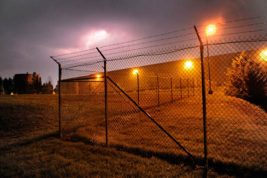
1) The Israeli-based company G-Max Security makes a “buried cable intrusion detection sensor” that is “totally concealed and operates effectively under any type of surface,” from open fields and highways to mountains, snow, and ice. It acts as a “perimeter detection ring” that uses “Passive Magnetic Detection” technology—that is, a buried cable-sensor network—assuring “effective Early Warning of any perimeter intrusion attempt.”

This security geotextile is, in effect, an electromagnetic nervous system in the ground.

[Image: The sensor after burial, courtesy of G-Max Security].

However, the system perhaps also foreshadows the implementation of much more complex, spatially ubiquitous, and locally intelligent geotextiles that could monitor, from below, in real-time, and with remarkable accuracy, everything that passes through the landscapes above them.

The most secure landscape in the world could thus someday be an open field—or friendly suburb—peppered with trees and flowers in which all of the surveillance technology is passive, omniscient, experientially invisible, and indistinguishable from the earth.

As a useful replacement for land mines and electrified fences, however, the very idea of a security geotextile brings an alarming potential for weaponization. For instance, what would stop such a system from being given the ability to electrify, stun, immobilize, or even kill a detected intruder? Perhaps this would be the malign or malevolent geotextile I ask about in my essay for Philip Beesley’s recent book, Hylozoic Ground.

Either way, it will be interesting—and unfortunately necessary—to track the potentially emergent field of weaponized geotextiles.

2a) The Dutch engineering firm TenCate offers a product called the GeoDetect system. It is “the first sensor enabled geotextile on the market to provide soil reinforcement, structural health monitoring and an early warning system into one package.”

It is a computational fabric that structurally strengthens and physically monitors the landscapes it is buried within.

“Our ‘intelligent geotextile,'” the company points out, “is the first system designed specifically for geotechnical applications and offers a technical solution for monitoring geo-structures for changes in strain, temperature or the combination of the two.” As such, it “incorporates a geocomposite fabric, fiber optics, instrumentation equipment and software to provide a innovative solution for the multi-functional requirements of a geotechnical application” (for example, stabilizing landfills and levees).

You can watch a short video about it here.

2b) To speculate a bit here, if TenCate’s GeoDetect is basically a 2D computer or sensor network, then, given further processing power and mechanically augmented with servomotors, a future version of this system could perhaps not only engage in locally autonomous decision-making—a kind of 2D supercomputer disguised as a landscape—but could also physically rearrange itself to protect against impending disasters (such as levee failure or an avalanche).

We might thus find that sentient artificial landforms built from networks of computational geotextiles and mobilized from within by servomotors could literally redesign landscapes in place, on their own, at will. This would, presumably, be for practical purposes (flood mitigation or landslide control), but could also be purely for aesthetics. Imagine a new park of crawling landforms—slow ripples moving through the grass, forming constantly refreshed hills and valleys, the soil pulsing in waves.

[Image: A photo by Toshio Shibata].

These speculative geotextiles, otherwise invisible beneath the ground, could use their own algorithms to monitor visitor activity and thus compute the appropriate spatial response to those visitors’ location in the park.

Given such a scenario, the entire Dutch coast could someday be, we might say, a robot: a self-intelligent system of interacting mechanical fabrics that rearrange on their own volition, on the scale of hundreds of miles, to keep Atlantic floodwaters at bay. The art of landscape photography is revolutionized. Bewildering art films are set amongst this crawling landscape. Slow hills move and dance in front of the sun.

[Image: An otherwise unrelated photo of concrete block installation atop a geotextile base, courtesy of the Directorate of Public Works, Ft. Jackson, South Carolina].

3) These technologies could, of course, be networked yet further, off-site, to other unmanned and interactive technologies. We might describe this as a semi-autonomous landscape-to-robot constellation.

In other words, a sensor-embedded stretch of earth—using a radio-transmitting variant of G-Max’s buried cables—could communicate directly with unmanned aerial vehicles, steering them in for precise landings. It is a kind of invisible runway. Or long strips of buried sensors on the perimeter of secure sites could guide UAVs flying high above; pilotless machines bank and turn in a constant loop, following the geotextiles below. They are locked in place—they are steered and guided—by transmissions from inside the ground. (The same could be true of unmanned ground vehicles, following otherwise invisible electromagnetic “roads” embedded in the soil.)

[Images: “An MQ-9 Reaper remotely piloted aircraft takes off July 17 from Joint Base Balad, Iraq. The Reaper can loiter over battlefields or targets for hours at a time without refueling and carries up to 3,750 pounds of laser-guided munitions, giving ground commanders unprecedented situational awareness and the ability to bring the right amount of force to bear on a target. (U.S. Air Force photo/Tech. Sgt. Richard Lisum)”].

In effect, this would terrestrialize the so-called robot-readable world: burying the signs and sensors that such machines require and disguising them in apparently natural circumstances. What appears to be a meadow is actually an electromagnetically active runway read and used by UAVs. What you think is a forest is a complex signaling landscape. What appears to be a garden is a computational geotextile interacting with driverless ground vehicles miles away.

4) In any case, all of the above ideas could, perhaps much more interestingly, be used to activate a kind of anti-drone defensive landscape. As the horrific possibility of drone proliferation looms, what spatial and geographic countermeasures could be implemented to mislead, confuse, detour (or détourn), and otherwise deflect pilotless vehicles?

The “perimeter detection ring” examined above, for instance, would instead be used to repel or otherwise blind “intruding” UAVs and UGVs; this could be used for everything from keeping a foreign power’s drones out of your sovereign airspace to preventing the IRS from flying drones over your suburb for property tax purposes.

In mythological terms, this would be the geotextile as talisman, or terrestrial ring of protection.

[Images: Geotextiles, courtesy of the U.S. Federal Highway Administration].

So what possibilities exist for landscape architects to, as it were, resist drones, using signal-jamming geotextiles, electromagnetic dazzle effects, or even bizarre new forms of robot-readable camouflage, in order to make drone warfare all but spatially impossible?

Could anti-drone landscapes be added to existing cities—urban spaces or architectural forms lethally confusing to robots—and what might such additions actually look like (if they would be visible to humans at all)?

(Thanks to Rob Holmes and Brett Milligan for first alerting me to the GeoDetect system).

Remnant Infrastructure

[Image: An otherwise unrelated photo of electric cables being installed in the Golden Gate Bridge, October 1935; courtesy of the NPS].

In an interestingly archaeological story from the world of digital infrastructure, engineers who discovered “an unused fibre optic cable in Mongolia” were able, after putting it back into service, to “shave milliseconds” from a British firm’s internet traffic between London and Hong Kong. After all, there is “unused cabling infrastructure around the world,” like forgotten limbs awaiting future reactivation.

“We’re finding unused cables all time, everywhere [from] China and Russia to parts of Brazil,” a manager named Scott Ritchie explains to Information Age. He continues:

Quite often, when electricity lines are put down, there’s underlying optical fibre as well, because if you’re digging a hole you may as well whack as many services in there as possible. Some of these assets have been decommissioned or just forgotten about after companies go bankrupt. And sometimes when military objectives change, all of a sudden a bunch of infrastructure becomes available.

And there are backstage geopolitics involved: “We found a cable that went from the Russian border directly down through Mongolia, which cuts out the Northern part of China,” Ritchie explains. But, he asks, “Why would there be a secret substation on the Russian border? You would need to ask the Chinese government.'”

It’s as if closed-door diplomacy and international espionage together work to leave spatial and infrastructural fossils: embedded fragments of obsolete, redundant, or otherwise forgotten—perhaps only recently declassified—systems that no longer serve their original purpose.

So they’re resurrected for business and finance, requiring astute forensic detective work to uncover: “Discovering cables like these is a matter of technical analysis and local market intelligence. ‘We have a dedicated team of network engineers whose sole job is to improve the performance of our network,’ explains Ritchie. ‘A major element of that is discovering new network systems'”—where “new,” in this specific example, refers instead to the remote archaeological remains of cross-border espionage projects, old spies’ wires brought back online for private telecommunicative purpose.

Imagine a modern descendent of Piranesi with a summer job for AT&T, sent off alone with a truck, a tent, and some wire-testing equipment to explore abandoned villages in the mountains, on the hunt for internets he must single-handedly reawaken.

(Thanks to Tim Stevens for the link!)

Loop Geography as Defensive Tactic

In a fascinating detail from a long series of articles published two years ago in the Washington Post, recently expanded as a stand-alone book called Top Secret America, we learn about one way to hide classified government infrastructure in plain sight.

[Image: Photo by Michael S. Williamson, courtesy of The Washington Post].

“[J]ust outside Washington,” authors Dana Priest and William Arkin explain, in the exurbs of depopulated office parks and “huge buildings with row after row of opaque, blast-resistant windows,” there can be found what the authors describe as “the capital of an alternative geography of the United States, one defined by the concentration of top-secret government organizations and the companies that do work for them.”

One such complex, called Fort Meade, “is the largest of a dozen such clusters across the United States.”

And it is cleverly camouflaged:

The existence of these clusters is so little known that most people don’t realize when they’re nearing the epicenter of Fort Meade’s, even when the GPS on their car dashboard suddenly begins giving incorrect directions, trapping the driver in a series of U-turns, because the government is jamming all nearby signals.

It’s an experiential trap street—an infinite loop—a deliberate cartographic error introduced into the mapping of the world so as to sow detour and digression. A kind of digital baffling, or recursive geography as state defensive tactic.

I’m also curious when we might see this privatized and domesticated—gated communities, for instance, blocking the GPS navigation of their streets in the misguided belief that this will help protect them from future burglary, effectively delisting themselves from public cartographic records. Perhaps the future of neighborhood security lies in the privatized repurposing of advanced signal-jamming technology, the misleading lamination of other, false maps onto the streets as they really exist.

(Detail spotted via @doingitwrong and [thisisaaronland]).

The Baffler

[Image: From “Baffles and Bastions: The Universal Features of Fortifications” by Lawrence H. Keeley, Marisa Fontana, and Russell Quick, courtesy of the Journal of Archaeological Research (5 March 2007)].

In a paper called “Baffles and Bastions,” published in the Journal of Archaeological Research, anthropologists Lawrence H. Keeley, Marisa Fontana, and Russell Quick offer a detailed history of militarized building design features such as “V-sectioned ditches, defended gates, and bastions.”

All of the features they subsequently analyze occur at peripheries, borders, and thresholds. In their own words, “the militarily functional ditch and gate features and bastions discussed below, in fact and by definition, are all distinguished by being part of enceintes (that is, surrounding barriers or enclosures). Enceintes are barriers that prevent access to and, almost always, obscure vision of a particular location.”

Their diagrams of “baffled” entryways, seen above, are particularly interesting—a kind of archaeological variation on floor plan porn—revealing the various techniques used to at fortified points of entry to gain an advantage over invaders. Through a navigational encounter with architecture, attackers are forced to show their vulnerabilities. “Baffled gates force attackers who enter them to expose their flanks and rear to defenders’ fire,” the authors write. “Ideally, they require attackers to turn left exposing their unshielded right side. Left-turning baffles also were useful against (typically) right-handed bowmen.”

Bioluminescent Billboards

[Images: A “living neon sign” made of bioluminescent bacteria; via UC San Diego].

Scientists at UC San Diego have made a bioluminescent bacterial billboard. They call it a “living neon sign composed of millions of bacterial cells that periodically fluoresce in unison like blinking light bulbs.” Making it all work “involved attaching a fluorescent protein to the biological clocks of the bacteria, synchronizing the clocks of the thousands of bacteria within a colony, then synchronizing thousands of the blinking bacterial colonies to glow on and off in unison.”

These are referred to as biopixels.

Two summers ago, we looked at the idea of a “bioluminescent metropolis,” where light-emitting organisms could be used to supplement—or even replace—a city’s existing sources of illumination, as if scaling the Newnes Glow Worm Tunnel up to size of a whole city (something that might be useful for places where streetlights are being turned off and even physically removed because paying tax in support of public infrastructure is socialist).

In that post, one of my personal favorites here on the blog, we looked at the work of architect Liam Young, who once proposed the creation of bacterial billboards, squirrel-like living screens that would crawl through and inhabit the city. They would nest in trees like LED ornaments and spring up whenever there’s news (or advertisements) to display.

[Image: Bioluminescent billboards by Liam Young].

So could this vision of a bioluminescent metropolis be far off? UC San Diego suggests that their “flashing bacterial signs are not only a visual display of how researchers in the new field of synthetic biology can engineer living cells like machines, but will likely lead to some real-life applications.” Surely it would not take much work—even if only as a media stunt—to make a full-scale functioning prototype of a bioluminescent streetlight? Or a bioluminescent bathroom nightlight for your kids?

But, then, of course, the inevitable escape from domestication, when invasive bioluminescent organisms, from genetically-modified kudzu and street weeds to super-bright worms and bacterial mats, conquer the city.

(Via Wired UK).

Ice Island Infrastructure

[Image: “From Seismic Arrays on Drifting Ice Floes: Experiences From Four Deployments in the Arctic Ocean” by C. Läderach and V. Schlindwein, from Seismological Research Letters].

In a paper published back in the July/August 2011 issue of Seismological Research Letters, authors C. Läderach and V. Schlindwein from the Alfred Wegener Institute for Polar and Marine Research discuss the benefits of tracking deepsea earthquakes using “seismic stations mounted on drifting ice floes.” Indeed, they write, because of the lack of fixed ground points, “mounting conventional land seismometers on drifting sea ice is the only way to acquire seismic data in the Arctic Ocean.”

In other words, they want to turn drifting fragments of Arctic sea ice into floating research stations, mapping earthquakes at sea.

[Images: “From Seismic Arrays on Drifting Ice Floes: Experiences From Four Deployments in the Arctic Ocean” by C. Läderach and V. Schlindwein, from Seismological Research Letters].

The authors have already seen considerable success with this method. In a short passage detailing how these systems are physically installed, we read that the seismic arrays “are deployed and recovered by helicopters operating from icebreaking vessels.” However, “the time for station installation is very limited,” due to weather and rough seas.

Station installation requires two people and a helping hand from the helicopter pilot, and takes about 30 minutes with the data loggers being programmed before the deployment flight. The limited time does not allow waiting for the sensor to equalize. Therefore, we only check the sensor response and locking of the GPS position before leaving the station.

While the authors compare this, briefly, to using buoys—indicating that their method is not all that different from other free-floating oceanographic instrumentation systems—the transformation of icebergs into scientifically useful platforms is a compelling example of how a natural phenomenon can become infrastructure with even the smallest addition of equipment. The iceberg has literally been instrumentalized: a temporary archipelago, too short-lived to appear on maps, turned into a scientific instrument.

In this context, it’s worth revisiting the story of Drift Station Bravo, one of many inhabited icebergs in the Cold War era that had its own postal system, complete with historically unique stamp cancellations. [Image: Drift Station Bravo postage cancellation mark, via Polar Philately].

As explained on the website Polar Philately, Colonel Joseph O. Fletcher, commander of an Air Force weather squadron stationed in the Arctic, discovered “a large tabular iceberg… that had broken off the Arctic ice shelf… [and] gone adrift.” This ice island was soon “codenamed T-1, taken from its original radar designation as a target.” Future “ice islands” were codenamed T-2 and T-3.

On March 19, 1952, the U.S. Air Force led by Colonel Fletcher and some scientists landed on this ice island [T-3] in a C-47 aircraft, setting up a weather observation station. Fletcher established a research station that was manned at this big ice sheet for roughly the next 25 years, despite a grim quote given by the head of the Alaska Air Command at the time, a General Old, who was quoted in a Life magazine article of the time as saying “I don’t see how any man can live on this thing.”

It’s worth repeating that Fletcher’s team operated this weather station on a repurposed ice floe for 25 years.

Fletcher’s Ice Island, and the research station that was located on it, rotated in circles in the Arctic Ocean, floating aimlessly along in the Arctic currents in a clockwise direction. The station was inhabited mainly by scientists along with a few military crewmen and was resupplied during its existence primarily by military planes operating from Barrow, Alaska.

The island—later renamed “Drift Station Bravo”—was inhabited long enough that it actually got its own postal network.

[Image: Letters postmarked from Drift Station Bravo, via Polar Philately].

From Polar Philately:

During the period of active habitation, T-3 covers [postage stamps] were serviced, each stamped with a variety of hand-stamped cachets and markings, dated, and often marked with a manuscript notation of the geographic position of the drifting station on that particular day of ops. The T-3/Bravo covers were often cancelled at Barrow or at a USAF base in Alaska, and then placed in the mailstream.

In other words, envelopes would be stamped with the latitude and longitude of the iceberg at the moment of a letter’s departure.

[Images: Postal marking and a letter from Drift Station Bravo, via Polar Philately].

The story takes on clear geopolitical dimensions when we remember that Drift Station Bravo and its ilk—such as Drift Station Alpha, about which you can watch an entire documentary film—were created in direct response to the Soviet Union’s own ice island program. The Soviets “already operated six drifting ice camps of this kind,” we read in the documentary transcript, downloadable as a 27kb PDF, but, “owing to the particular strategic importance and sensitivity of the Arctic Basin, little information from these early Soviet stations had reached the West.”

The transcript goes on to explain how the U.S managed to architecturally colonize these mobile platforms. Military civilization on the ice established itself as follows:

…a ski-equipped C-47 landed on the ice and deployed the first team of workers. It included an Air Force Major as camp commander and several soldiers with technical skills who had volunteered for 6 months duty on the ice, plus four of the typical tough and versatile Alaskan construction workers.

Modular buildings, called Jamesway huts, camp supplies, fuels, two small World War II Studebaker tractors, called Weasel, and a small bulldozer, were dropped by parachutes.

The story expands rapidly from here. In an article originally published in the September-October 1966 issue of Air University Review, we read that competitive Soviet drift stations apparently discovered a “second magnetic north pole… located near 80° N and 178° W, with magnetic medians extending across the Arctic Ocean,” and that sulfuric gas fumes from a badly timed undersea volcanic eruption killed at least one unlucky crew member. A particularly eye-popping detail comes when we read that these researchers deliberately generated earthquakes in the iceberg they lived on: “we generated tiny earthquakes in the ice. The propagation of the compressional waves generated in this way are used to study the elastic properties of the ice.”

This brings us back to C. Läderach and V. Schlindwein, whose paper in Seismological Research Letters examines the problem of “icequakes,” or seismic activity internal to the ice floe on which their equipment rests, thus interfering with accurate measurements. They even mention at least one occurrence of a so-called “bearquake,” when a curious polar bear came by to nudge the seismometer and see what was really going on. The authors refer to these events as “special signals.”

In any case, will this floating seismic network adrift in the waters of the Arctic also receive its own stamps and postal cancellations? Presumably not, but it would nonetheless be interesting to examine the becoming-infrastructure of these ice floes in a larger geographic context.

We Can Move It For You Wholesale

[Images: Moving Fort Moore High School in Los Angeles, 1886; photos courtesy of the Title Insurance and Trust/C.C. Pierce Photography Collection, USC Libraries].

In 1886, Los Angeles moved the Fort Moore High School. “A contractor who claimed he could accomplish the task hoisted the building onto scaffolding and, using rollers, horses, and human labor, slowly moved the schoolhouse toward its new location,” KCET explains. “After work was underway, the contractor decided that the task was impossible after all. The building remained where his crew left it”—unfortunately, not marooned on the stilts seen here, like some steampunk Walking City, but on its new ground-level site blocks away. Once lowered back to earth, it was “repurposed as a schoolhouse for younger students while a new, grander high school was built atop Fort Moore Hill.”

It’s as if, in a dreamtime state before any of us can remember, buildings once moved around Los Angeles, nomadic titans settling down only with the end of prehistory. Perhaps they will wake up and walk again, criss-crossing valleys, crawling over hills, rearranging roadways around themselves.

Eventually, most of Fort Moore Hill itself was physically removed from the city. “In 1949, construction crews transported away most of the hill by the truckload,” we read, turning it into one of the “lost hills of downtown Los Angeles.” If only the hill had disappeared, however, leaving all the buildings built upon it stranded on wooden scaffolds in the sunlight, a tablecloth trick in architectural form.

Return of the Brick Swarm

A short video has been released documenting the brick swarm project mentioned here last month, in which Swiss architects Gramazio & Kohler deploy semi-autonomous flying robots to assemble a structure of foam bricks. However, it’s as if the architects underestimate the interest of their own work, fast-forwarding through the bulk of the assembly process as if no one would want to watch such a thing (or perhaps their robots were less graceful than originally hoped). Either way, check out the results, embedded above.

(Thanks to phenrydelphia for the tip!)

Speleological Superparks

[Image: Downtown Reno on a Saturday night with people queuing up to climb the BaseCamp wall; photo by BLDGBLOG].

As part of an overall strategy to rebrand itself not as a city of gambling and slot machines—not another Las Vegas—but as more of a gateway to outdoor sports and adventure tourism—a kind of second Boulder or new Moab—Reno, Nevada, now houses the world’s largest climbing wall, called BaseCamp, attached to the side of an old hotel.

[Image: The wall; photo by BLDGBLOG].

BaseCamp is “a 164-foot climbing wall, 40 feet taller than the previous world’s highest in the Netherlands,” according to DPM Climbing. “The bouldering area will also be world-class with 2900 square feet of overhanging bouldering surface.”

You can see a few pictures of those artificial boulders over at DPM.

[Image: The wall; photo by BLDGBLOG].

Fascinatingly, though, the same company who designed and manufactured this installation—a firm called Entre Prises—also makes artificial caves.

One such cave, in particular, created for and donated to the British Caving Association, is currently being used “to promote caving at shows and events around the country. It is now housed in its own convenient trailer and is available for use by Member Clubs and organizations.”

[Image: The British Caving Association’s artificial cave, designed by Entre Prises; photo by David Cooke].

These replicant geological forms are modular, easily assembled, and come in indoor and outdoor varieties. Indoor artificial caves, we read, “are usually made from polyester resin and glass fibre as spraying concrete indoors is often not very practicable. Indoor caves provide the experience of caving without some of the discomforts of natural or outdoor caves: the air temperature can be relatively easily controlled, in most cases specialist clothing is not required [and] the passage walls are not very thick so more cave passage can be designed to go into a small area.”

Further, maintaining the exclamation point from the original text: “The modular nature of the Speleo System makes it possible to create any cave type and can be modified in minutes by simply unbolting and rotating a section! This means you can have hundreds of possible caving challenges and configurations for the price of one.”

It would be interesting to live in a city, at least for a few weeks, ruled by an insane urban zoning board who require all new buildings—both residential and commercial—to include elaborate artificial caves. Not elevator shafts or emergency fire exits or public playgrounds: huge fake caves torquing around and coiling through the metropolis. Caves that can be joined across property lines; caves that snake underneath and around buildings; caves that arch across corporate business lobbies in fern-like sprays of connected chambers. Plug-in caves that tour the city in the back of delivery trucks, waiting to be bolted onto existing networks elsewhere. From Instant City to Instant Cave. Elevator-car caves that arrive on your floor when you need them. Caves on hovercrafts and helicopters, detached from the very earth they attempt to represent.

This brings to mind the work of Carsten Höller, implying a project someday in which the Turbine Hall in London’s Tate Modern could be transformed into the world’s largest artificial cave system, or perhaps even a future speleo-superpark in a place like Dubai, where literally acres of tunnels sprawl across the landscape, inside and outside, aboveground and below ground, in unpredictably claustrophobic rearrangeable prefab whorls.

The “outdoor” varieties, meanwhile, are actually able “to be buried within a hillside”; however, they “must be able to withstand the bearing pressure of any overlying material, eg. soil or snow. This is usually addressed by making the caving structures in sprayed concrete that has been specifically engineered to withstand the loads. Alternatively the cave passages can be constructed in polyester resin and glass fibre but then they have to be within a structural ‘box’ if soil pressure is to be applied.”

In any case, here are some of the cave modules offered by Entre Prises, a kind of cave catalog called the Speleo System—though it’s worth noting, as well, that “To add interest within passages and chambers, cave paintings and fossils can be added. This allows for user interest to be maintained, creating an educational experience.”

[Image: The Speleo System by Entre Prises].

As it happens, Entre Prises is also in the field of ice architecture. That is, they design and build large, artificially maintained ice-climbing walls.

These “artificial ice climbing structures… support natural ice where the air temperature is below freezing point.” However, “permanent indoor structures,” given “a temperature controlled environment,” can also be created. These are described as “self generating real ice structures that utilize a liquid nitrogen refrigeration system.”

[Images: An artificial ice structure by Entre Prises for the Winter X Games].

Amongst many things, what interests me here is the idea that niche sports enthusiasts—specifically cavers and climbers—have discovered and, perhaps more importantly, financially support a unique type of architecture and the construction techniques required for assembling it that, in an everyday urban context, would appear quite eccentric, if not even avant-garde.

Replicant geological formations in the form of modular, aboveground caves and artificially frozen concrete towers only make architectural and financial sense when coupled with the needs of particular recreational activities. These recreational activities are more like spatial incubators, both inspiring and demanding new, historically unexpected architectural forms.

So we might say that, while architects are busy trying to reimagine traditional building typologies and architectural programs—such as the Library, the Opera House, the Airport, the Private House—these sorts of formally original, though sometimes aesthetically kitsch, designs that we are examining here come not from an architecture firm at all, or from a particular school or department, but from a recreational sports firm pioneering brand new spatial environments.

As such, it would be fascinating to see Entre Prises lead a one-off design studio somewhere, making artificial caves a respectable design typology for students to admit they’re interested in, while simultaneously pushing sports designers to see their work in more architectural terms and prodding architects to see niche athletes as something of an overlooked future clientele.