Burglary & Rabies


People of Denver! If you are around next week, MCA Denver‘s legendary Mixed Taste series roars along with a new installment on Thursday, August 6, dedicated to “Burglary & Rabies.”

I’m proud to be representing the burglary part of the evening, discussing some behind-the-scenes tales and spatial research from my forthcoming book, A Burglar’s Guide to the City, due out in Spring 2016; Bill Wasik and Monica Murphy, co-authors of Rabid: A Cultural History of the World’s Most Diabolical Virus, will be holding down the infectious vectors for the night’s darker half.

Rabies, Wasik and Murphy write, “is the most fatal virus in the world, a pathogen that kills nearly 100 percent of its hosts in most species, including humans.” Relentless and “like no other virus known to science, rabies sets its course through the nervous system, creeping upstream at one to two centimeters per day.”

However, seeing as one of the rules of Mixed Taste is that the speakers aren’t meant to reference one another’s themes—Mixed Taste consisting of “Tag Team Lectures on Unrelated Topics”—I’ll just leave it at that.

But please stop by if you’re in town: tickets are available here. I’ll be discussing everything from the geology of bank tunnels to roof jobs, LAPD helicopter flights to invisible architectural shapes perceptible only to lawyers.

Horizon Line

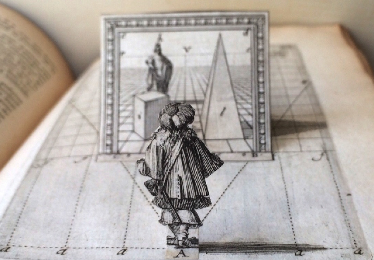
[Image: Here’s another image from the same French rare-book seller seen in an earlier post; this one comes from Thomas Alcock’s Travels in Russia, Persia, Turkey and Greece, printed in 1831. The scene depicted here equally resembles some strange act of theatrical scenography—a geologic backdrop shaded to resemble urban space—and a horizon-spanning speculative megastructure by Étienne Louis-Boullée (previously)].

A Well-Tailored Landscape

[Image: Sewn geology; photo by Matthew Cox of Kit Up!].

Earlier this summer, packaging and apparel manufacturing firm ReadyOne Industries debuted a new line of products: “moldable camouflage kits that can be customized to mimic virtually any type of rock formation or similar type of terrain.”

The sewn geological forms seen here—in photos taken by Matthew Cox of Kit Up!—use a multi-spectral concealment system called “VATEC,” further described by ReadyOne as a “Portable Battlefield Cryptic Signature and Concealment” system.

In the process, they give the word “geotextile” a new level of literality.

[Image: Lifting up fake rocks; photo by Matthew Cox of Kit Up!].

While you can read a tiny bit more about the product over at both Kit Up! and ReadyOne, what interests me here is the sheer surreality of portable artificial geology made by a garment manufacturing firm, or pieces of clothing blown up to the scale of landscape.

The unexpected implication is that those rocks you see all around you might not only be fake—they might also be pieces of clothing: camouflage garments that already mimicked natural forms simply taken to their obvious end point in the form of pop-up rocks and well-tailored geology.

This Is Only A Test

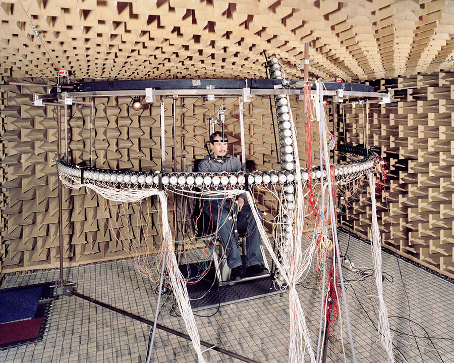
[Image: From Ways of Knowing by Daniel Stier, on display at the kulturreich gallery].

Photographer Daniel Stier has a new book out, and an accompanying exhibition on display at the kulturreich gallery, called Ways of Knowing.

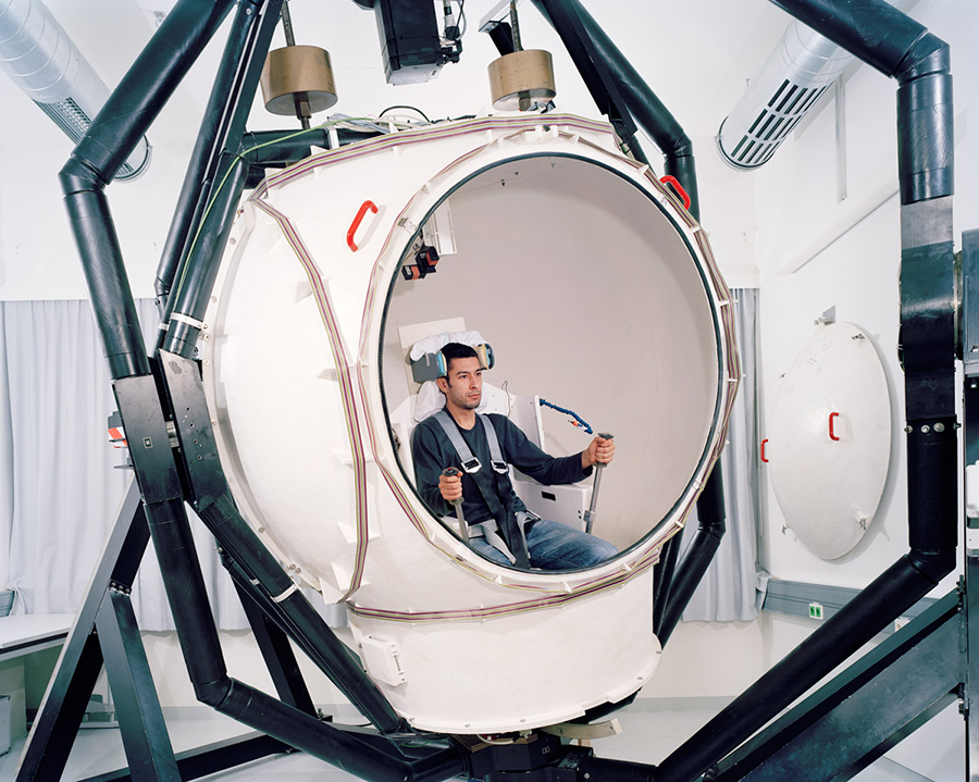
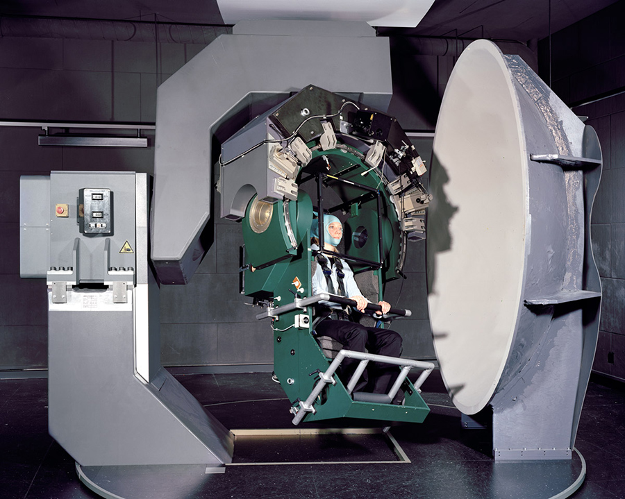
Skier’s photos depict human subjects immersed in, or even at the mercy of, spatial instrumentation: strange devices conducting experiments that function at the scale of architecture but whose purpose remains unidentified.

[Image: From Ways of Knowing by Daniel Stier, on display at the kulturreich gallery].

In Stier’s words, the overall series is “a personal project exploring the real world of scientific research. Not the stainless steel surfaces bathed in purple light, but real people in their basements working on selfbuilt contraptions. All shot in state of the art research institutions across Europe and the US, showing experiments with human subjects. Portrayed are the people conducting the experiments—students, doctorands and professors.”

In recent interviews discussing the book, Stier has pointed out what he calls “similarities between artistic and scientific work,” with an emphasis on the craft that goes into designing and executing these devices.

However, there is also a performative or aesthetic aspect to many of these that hints at resonances beyond the world of applied science—a person staring into multicolored constellations painted on the inside of an inverted bowl, for example.

[Image: From Ways of Knowing by Daniel Stier, on display at the kulturreich gallery].

Ostensibly an ophthalmic device of some kind, it could just as easily be an amateur’s attempt at OpArt.

In a sense, these are not just one-off scientific experiments but spatial prototypes: rigorous attempts at building and establishing a very particular kind of environment—a carefully calibrated and tuned zone of parameters, forces, and influences—then exposing people to those worlds as a means of testing for their effects.

[Image: From Ways of Knowing by Daniel Stier, on display at the kulturreich gallery].

In any case, here are a few more images to pique your curiosity, but many, many more photos are available in Stier’s book, which just began shipping this month, and, of course, over at Stier’s website.

[Images: From Ways of Knowing by Daniel Stier, on display at the kulturreich gallery].

(Originally spotted via New Scientist).

Village Design as Magnetic Storage Media

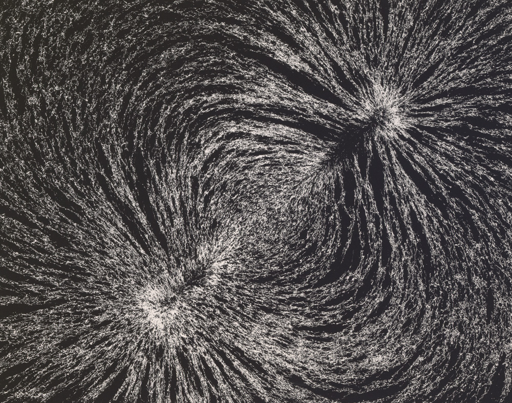
[Image: “Magnetic Field” by Berenice Abbott, from The Science Pictures (1958-1961)].

An interesting new paper suggests that the ritual practice of burning parts of villages to the ground in southern Africa had an unanticipated side-effect: resetting the ground’s magnetic data storage potential.

As a University of Rochester press release explains, the “villages were cleansed by burning down huts and grain bins. The burning clay floors reached a temperature in excess of 1000ºC, hot enough to erase the magnetic information stored in the magnetite and create a new record of the magnetic field strength and direction at the time of the burning.”

What this meant was that scientists could then study how the Earth’s magnetic field had changed over centuries by comparing more recent, post-fire alignments of magnetite in the ground beneath these charred building sites with older, pre-fire clay surrounding the villages.

The ground, then, is actually an archive of the Earth’s magnetic field.

If you picture this from above—perhaps illustrated as a map or floor plan—you can imagine seeing the footprint of the village itself, with little huts, buildings, and grain bins appearing simply as the outlines of open shapes.

However, within these shapes, like little windows in the surface of the planet, new magnetic alignments would begin to appear over decades as minerals in the ground slowly re-orient themselves with longterm shifts in the Earth’s magnetic field, like differently tiled geometries contrasting with the ground around them.

[Image: “Untitled” by Larry Bell (1962), via the L.A. Times].

What really blows me away here, though, is the much more abstract idea that the ground itself is a kind of reformattable magnetic data storage system. It can be reformatted and overwritten, its data wiped like a terrestrial harddrive.

While this obviously brings to mind the notion of the planetary harddrive we explored a few years ago—for what it’s worth, one of my favorite posts here—it also suggests something quite strange, which is that landscape architecture (that is, the tactical and aesthetic redesign of terrain) and strategies of data management (archiving, cryptography, inscription) might someday go hand in hand.

(Via Archaeology).

Buy a Los Angeles Sidewalk Corner

[Image: A sidewalk corner in Los Angeles, albeit not the one for sale; via Google Street View].

If you’ve been longing for a way to satisfy your inner Gordon Matta-Clark—the artist who, among many other things, once purchased an interstitial empire of “odd lots” throughout New York City, including the spaces between buildings and other “unusably small slivers of land sliced from the city grid through anomalies in surveying, zoning, and public-works expansion”—then now might be your chance.

Los Angeles is auctioning off a chunk of odd lots: “Offerings include transferable ‘air rights’ and, in one case, the corner of a sidewalk,” the Los Angeles Times reports, among what they describe as “tiny bits of land that were left over from big real estate developments, set aside like scraps of cloth cut from a garment.”

The properties for sale include a collection of oddly shaped and awkwardly encumbered lots acquired during decades of efforts to help developers build in blighted neighborhoods. A few of the parcels, though, are under name-brand Los Angeles institutions, such as the ground under the historic Angels Flight funicular railway on Bunker Hill and the land occupied by the Dolby Theatre in Hollywood, site of the Academy Awards.

You can peruse the full list of sites here. In all honesty, they are not immediately compelling. However, they do include an archipelago of air rights throughout the city; one property is only 26 square feet; and another appears to be the small strip of land located outside 1013 E. Adams Boulevard.

Purchase wisely.

(Previously on BLDGBLOG: Buy a Complex of Submarine Pits, Buy a Skyway, Buy a Fort, Buy a Lighthouse, Buy an Underground Kingdom, Buy a Prison, Buy a Tube Station, Buy an Archipelago, Buy a Map, Buy a Torpedo-Testing Facility, Buy a Silk Mill, Buy a Fort, Buy a Church).

Driving on Mars and the Theater of Machines

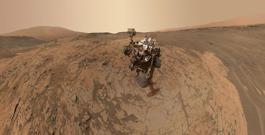
[Image: Self-portrait on Mars; via NASA].

Science has published a short profile of a woman named Vandi Verma. She is “one of the few people in the world who is qualified to drive a vehicle on Mars.”

Vera has driven a series of remote vehicles on another planet over the years, including, most recently, the Curiosity rover.

[Image: Another self-portrait on Mars; via NASA].

Driving it involves a strange sequence of simulations, projections, and virtual maps that are eventually beamed out from planet to planet, the robot at the other end acting like a kind of wheeled marionette as it then spins forward along its new route. Here is a long description of the process from Science:

Each day, before the rover shuts down for the frigid martian night, it calls home, Verma says. Besides relaying scientific data and images it gathered during the day, it sends its precise coordinates. They are downloaded into simulation software Verma helped write. The software helps drivers plan the rover’s route for the next day, simulating tricky maneuvers. Operators may even perform a dry run with a duplicate rover on a sandy replica of the planet’s surface in JPL’s Mars Yard. Then the full day’s itinerary is beamed to the rover so that it can set off purposefully each dawn.

What’s interesting here is not just the notion of an interplanetary driver’s license—a qualification that allows one to control wheeled machines on other planets—but the fact that there is still such a clear human focus at the center of the control process.

The fact that Science‘s profile of Verma begins with her driving agricultural equipment on her family farm in India, an experience that quite rapidly scaled up to the point of guiding rovers across the surface of another world entirely, only reinforces the sense of surprise here—that farm equipment in India and NASA’s Mars rover program bear technical similarities.

They are, in a sense, interplanetary cousins, simultaneously conjoined and air-gapped across two worlds..

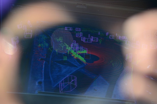
[Image: A glimpse of the dreaming; photo by Alexis Madrigal, courtesy of The Atlantic].

Compare this to the complex process of programming and manufacturing a driverless vehicle. In an interesting piece published last summer, Alexis Madrigal explained that Google’s self-driving cars operate inside a Borgesian 1:1 map of the physical world, a “virtual track” coextensive with the landscape you and I stand upon and inhabit.

“Google has created a virtual world out of the streets their engineers have driven,” Madrigal writes. And, like the Mars rover program we just read about, “They pre-load the data for the route into the car’s memory before it sets off, so that as it drives, the software knows what to expect.”

The software knows what to expect because the vehicle, in a sense, is not really driving on the streets outside Google’s Mountain View campus; it is driving in a seamlessly parallel simulation of those streets, never leaving the world of the map so precisely programmed into its software.

Like Christopher Walken’s character in the 1983 film Brainstorm, Google’s self-driving cars are operating inside a topographical dream state, we might say, seeing only what the headpiece allows them to see.

[Image: Navigating dreams within dreams: (top) from Brainstorm; (bottom) a Google self-driving car, via Google and re:form].

Briefly, recall a recent essay by Karen Levy and Tim Hwang called “Back Stage at the Machine Theater.” That piece looked at the atavistic holdover of old control technologies—such as steering wheels—in vehicles that are actually computer-controlled.

There is no need for a human-manipulated steering wheel, in other words, other than to offer a psychological point of focus for the vehicle’s passengers, to give them the feeling that they can still take over.

This is the “machine theater” that the title of their essay refers to: a dramaturgy made entirely of technical interfaces that deliberately produce a misleading illusion of human control. These interfaces are “placebo buttons,” they write, that transform all but autonomous technical systems into “theaters of volition” that still appear to be under manual guidance.

I mention this essay here because the Science piece with which this post began also explains that NASA’s rover program is being pushed toward a state of greater autonomy.

“One of Verma’s key research goals,” we read, “has been to give rovers greater autonomy to decide on a course of action. She is now working on a software upgrade that will let Curiosity be true to its name. It will allow the rover to autonomously select interesting rocks, stopping in the middle of a long drive to take high-resolution images or analyze a rock with its laser, without any prompting from Earth.”

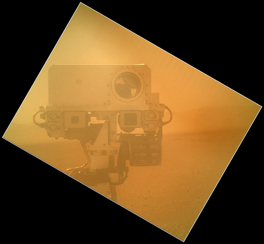
[Image: Volitional portraiture on Mars; via NASA].

The implication here is that, as the Mars rover program becomes “self-driving,” it will also be transformed into a vast “theater of volition,” in Levy’s and Hwang’s formulation: that Earth-bound “drivers” might soon find themselves reporting to work simply to flip placebo levers and push placebo buttons as these vehicles go about their own business far away.

It will become more ritual than science, more icon than instrument—a strangely passive experience, watching a distant machine navigate simulated terrain models and software packages coextensive with the surface of Mars.

Touring the Gruen Transfer

[Image: Gruen Day 2015].

One of the most interestingly sinister things I studied a million years ago while writing an undergraduate thesis about shopping and agoraphobia is the so-called “Gruen transfer.”

Named after Victor Gruen, pioneer of American shopping mall design, the Gruen transfer is the moment at which, confronted by an unexpected array of choices—other products, rival goods, similar services, different options—a shopper loses sight of what he or she originally came out to purchase. That shopper originally just wanted new socks; now he wants jeans, a t-shirt, and, oh, that coffee place across the hall is looking mighty tempting right now…

The shopper’s desire has been transferred, against their will, onto another item altogether—and this transfer is a deliberately cultivated, if not entirely predictable, side-effect of how the shopping space itself has been designed.

I say “shopping space” rather than “shopping mall,” because the Gruen transfer is clearly alive and well and living online: speaking only from personal experience, the amount of random add-ons I’ve thrown into an Amazon cart at the last minute over the years, or even the extra songs I’ve bought on Bandcamp, is testament to how easy it can be to convince oneself that something you had no idea you were searching for is suddenly a must-have.

[Image: One of many malls by Victor Gruen].

What was infinitely more interesting to me, however, was the fact that, when taken to an interpretive extreme, becoming hyper-aware of the possibility that the Gruen transfer might be influencing you can lead to a strange, not particularly enjoyable state of paranoia, in which every decision you make—after all, you went to the mall to buy socks, but perhaps even wanting socks was the result of a Gruen transfer, one that began in the peace of your own home, for example, when you first noticed that you would need new shoes in another month or two, only to realize that, hey, a new pair of socks right now would be awesome… You’ve been transferred.

This can be true whether or not it even involves a purchase. Making the decision to move to a new city, or going to a museum there with a new friend, or even having that new friend in your life in the first place—these all might actually be the end results of multiple, cultivated mis-steps, a much more sinister and far-reaching Gruen transfer as you were silently but comprehensively duped by the world around you.

Pushed to this level, the Gruen transfer takes on a weird, paranoid ubiquity, a disturbing omnipresence that appears to be coextensive with desire in the first place. We are, in a sense, always and already being Gruen transferred, making decisions in a state of otherwise undetectable distraction.

In any case, Victor Gruen’s spatial contribution to the American landscape—how he influenced urban form and set a multi-generational path for the design of retail environments—is the subject of a new tour hosted by the Bay Area Infrastructure Observatory. July 18, 2015, is Gruen Day 2015:

Victor Gruen (July 18, 1903–Feb 14, 1980) was an Austrian-born visionary architect most remembered for his pioneering work popularizing the enclosed, climate-controlled shopping center in the United States.

On July 18, the Bay Area Infrastructure Observatory (BAIO) invites you to celebrate the lofty aspirations and historical legacy of the suburban shopping center at Gruen Day 2015.

Festivities will include an afternoon of talks, tours, and hanging out in the food court at Bay Fair Center, which opened in 1957 as one of the first Gruen designed shopping centers in the country.

Tickets are $30—but the first ten people to email event co-organizer Tim Hwang saying that you read about the tour on BLDGBLOG will get a free ticket. Email him at tim (at) infraobservatory (dot) com, and tell him I said hey.

[Image: Victor Gruen gestures at a mall of his making; photo originally via The Fox is Black].

This is technically irrelevant, meanwhile, but it is nonetheless worth remembering that science fiction author Ray Bradbury—whose house of half a century was torn down by, of all people, architect Thom Mayne of Morphosis— claimed to have invented the indoor shopping mall.

Indeed, Bradbury recommended “giant malls as the cure to American urban decay,” Steve Rose explains in The Guardian. “‘Malls are substitute cities,’ [Bradbury] said at the time, ‘substitutes for the possible imagination of mayors, city councilmen and other people who don’t know what a city is while living right in the center of one. So it is up to corporations, creative corporations, to recreate the city.'”

In an essay posthumously published by The Paris Review, Bradbury anecdotally recounted a conversation he once had with architect Jon Jerde. Jerde asked Bradbury if he had ever visited a mall called the Glendale Galleria:

I said, “Yes, I have.” 
“Did you like it?” he asked. I said, “Yes.” 
He said, “That’s your Galleria. It’s based on the plans that you put in your article in the essay in the Los Angeles Times.” I was stunned. I said, “Are you telling me the truth? I created the Glendale Galleria?” 
“Yes, you did,” he said. “Thank you for that article that you wrote about rebuilding L.A. We based our building of the Glendale Galleria completely on what you wrote in that article.”

What Bradbury wrote in that article was the idea that the vast interiors of future shopping malls would supply ersatz urban landscapes “where people could spend an afternoon, getting safely lost, just wandering about.”

[Image: Guy Debord maps psychogeographic routes through Paris; perhaps, all along, psychogeography was just a confused first-person experience of the Gruen transfer on an urban scale].

It was a psychogeography of the interior, as weary shoppers tracked whatever down-market dérive they could find amidst the mirrored escalators and mannequins.

Who knows if Ray Bradbury will come up during Gruen Day 2015, but be sure report back if you take the tour; be sure to email Tim Hwang if you’d like a free ticket.

Lost Highways

[Image: Reviewing old property deeds and land surveys; photo by Geoff Manaugh].

A story I’ve been obsessed with since first learning about it back in 2008 is the problem of “ancient roads” in Vermont.

Vermont is unusual in that, if a road has been officially surveyed and, thus, added to town record books—even if that road was never physically constructed—it will remain legally recognized unless it has been explicitly discontinued.

[Image: More Granville property deeds; photo by Geoff Manaugh].

This means that roads surveyed as far back as the 1790s remain present in the landscape as legal rights of way—with the effect that, even if you cannot see this ancient road cutting across your property, it nonetheless persists, undercutting your claims to private ownership (the public, after all, has the right to use the road) and making it difficult, if not impossible, to obtain title insurance.

Faced with a rising number of legal disputes from homeowners, Vermont passed Act 178 back in 2006. Act 178 was the state’s attempt to scrub Vermont’s geography of these dead roads.

[Image: Geographic coordinates for lost roadways; photo by Geoff Manaugh].

The Act’s immediate effects, however, were to kick off a rush of new research into the state’s lost roadways.

This meant going back through property deeds and mortgage records, dating back to the late 18th-century, deciphering old handwriting, making sense of otherwise location-less survey coordinates, and then reconciling all this with on-the-ground geologic features or local landmarks.

[Image: Zooming into survey descriptions of rods and chains; photo by Geoff Manaugh].

Not every town was enthusiastic about finding them, hoping instead that the old roads would simply disappear.

Other towns—and specific townspeople—responded with far more enthusiasm, as if finding an excuse to rediscover their own histories, the region’s past, and the lives of the other families or settlers who once lived there.

Anything they found and officially submitted for inclusion on Vermont’s state highway map would continue to exist as a state-recognized throughway; anything left undocumented, or specifically called out for discontinuance, would disappear, losings its status as a road and becoming mere landscape.

July 1, 2015, was the deadline, after which anything left undiscovered is meant to remain undiscovered.

[Image: Ancient road descriptions; photo by Geoff Manaugh].
I had an amazing opportunity to visit the tiny town of Granville, Vermont, ten days ago, where I met with a retired forester and self-enlisted local historian named Norman Arseneault.

Arseneault became so involved in the search for Granville’s ancient roads that he is not only self-publishing an entire book documenting his quest, but he was also pointed out to me as an exemplar of rigor and organization by Johnathan Croft, chief of the Mapping Section at the Vermont Agency of Transportation (where there is an entire page dedicated to “Ancient Roads“).

His hunt for old roads seems to fall somewhere between Robert Macfarlane’s recent work and the old Western trail research of Glenn R. Scott.

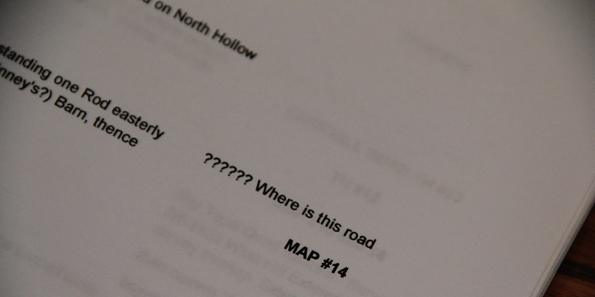
[Image: “?????? Where is this road”; photo by Geoff Manaugh].
While I was there in Granville, Arseneault took me into the town vault, flipping back through nearly 225 years of local property deeds. We then hit the old forest roads in his pick-up truck, to hike many of the “ancient roads” his research had uncovered.

I wrote up the whole experience for The New Yorker, and I have to say it was one of the more interesting article research processes I’ve ever been involved with; check it out, if any of this sounds of interest.

It’s worth pointing out, meanwhile, that the problem of “ancient roads” is not, in fact, likely to go away; the recent introduction of LiDAR data, on top of some confusingly written legal addenda, make it all but certain that other property owners will yet find long-forgotten public routes crossing their land, or that a future private development count still find its unbuilt plots placed squarely atop invisible roads made newly available to town use.

The hows and whys of this are, I hope, explained a bit more over at The New Yorker.

Slingshots of the Oceanic

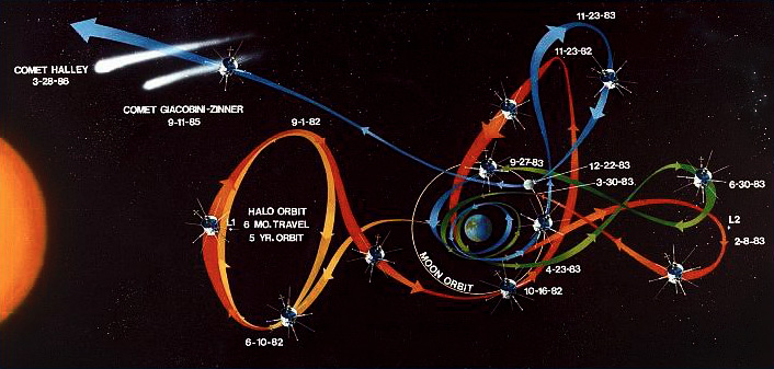
[Image: A diagram of the elaborate loops and ribbons of self-intersecting movement allowed by gravity-assisted travel, in this case heading toward a comet; original artist unknown].
Gravity-assisted space travel is when you use the gravitational pull of one planet or other celestial body as a fuel-efficient way to “slingshot” yourself toward another, more distant goal, someplace you could not have reached without assistance, either in terms of your velocity or even your basic direction.

You head toward one place to get to another—or “by indirections find directions out,” we might say.

These “gravity assists” can be pieced together to form almost a kind of invisible jungle gym, helping send probes into the outer solar system or even toward Mercury and the sun. As the Planetary Society explains:

Voyager 2 famously used gravity assists to visit Jupiter, Saturn, Uranus and Neptune in the late 1970s and 1980s. Cassini used two assists at Venus and one each at Earth and Jupiter in order to reach Saturn. New Horizons will arrive at Pluto in 2015 thanks to an assist at Jupiter. And Messenger used assists at Earth, Venus and three times at Mercury itself not to speed up, but to slow down enough to finally be captured by Mercury.

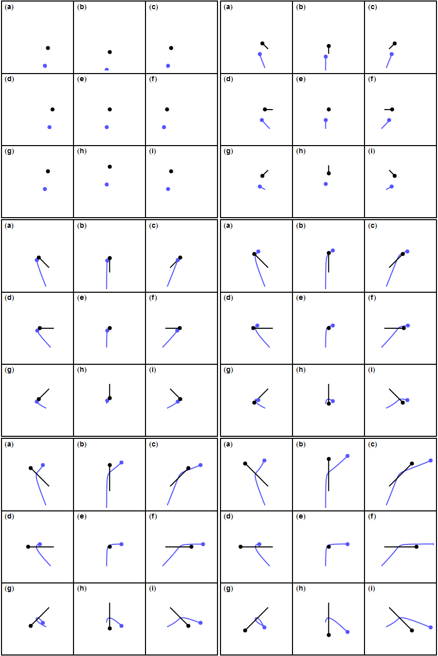
This can result in all sorts of insane weaving maneuvers, as objects can be made to loop stars, double back on themselves, veer off unpredictably, or even stop moving altogether, effectively parking themselves in space, as this GIF by David Shortt illustrates.

[Image: GIF by David Shortt, via The Planetary Society].

It’s like gravitational judo: using the speed and mass of your opponent as a counterbalance to perform something extraordinary yourself. Or perhaps it’s more like interplanetary spirography, where you could even loop-the-loop and slingshot your way between stars.

In any case, these types of assists can be made far more fuel-efficient—if not even possible in the first place—if you launch your journey at certain times rather than at others. In other words, you deliberately wait until the orbital cycles of Mars or Jupiter bring them near particular locations in space so that you can better use them to loop further outward toward, say, Neptune, a destination whose future position you will also have calculated in advance. If you want to use as little fuel and energy as possible, or even just to be as graceful as you can, you don’t just launch whenever you want and hope for the best.

The metaphoric potential of all this is obviously incredibly rich, but the real reason I’m writing this is because of a fascinating comment or two found in Brian Fagan’s book Beyond the Blue Horizon.

While discussing the human settlement of extremely remote islands in the South Pacific, what Fagan calls “remote Oceania,” he explains how ancient mariners relied on “seasonal winds” and celestial navigation to push “ever farther east” to the most extreme outer island edges of Polynesia. These seasonal winds formed part of what he calls “the Pacific’s waltz of atmosphere and ocean,” whereby known or predictable climatological events could be used to help propel people from one archipelago to another.

Here, Fagan writes that “[e]arly human settlement of the offshore Pacific revolved, in part, around enduring, large-scale meteorological phenomena that are still little understood. Ultimately, most of them depend on what one might call an elaborate, usually slow-moving waltz involving two partners—the atmosphere and the ocean.”

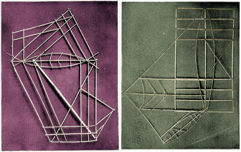
[Images: Polynesian “stick charts,” via The Nonist].

What fascinates me here is the idea that we can draw a rough analogy between Fagan’s “enduring, large-scale meteorological phenomena that are still little understood” and gravity-assisted space travel.

You can imagine, in other words, a well-organized group of extreme maritime navigators standing on the shores of a remote Pacific island chain, looking further out to sea together, knowing that there are distant land masses out there, implied by the winds and currents—but, more crucially, knowing that they will need a particular atmospheric event strong enough to take them there. They are thus timing their launch.

As people basically sat around waiting till the skies were right, Fagan’s “enduring, large-scale meteorological phenomena” would have produced amazing local mythologies of storms yet to come and other atmospheric folklore.

Like NASA scientists calculating the positions of Mars and Jupiter as they hoped to slingshot themselves beyond the black horizon of the solar system, these beach-going super-navigators would have known that the regional winds move in seven- or ten-year cycles, or even that a one-hundred year storm is required to bring them further out into the oceanic. They thus temporarily become land-based, settling there on a particular island chain and raising their children on tales of a journey yet to come. Navigators in waiting.

[Images: Polynesian “stick charts,” via The Nonist].

Imagine the diagrams or folklore that might have explained all this, like Arthur C. Clarke tales passed down family to family a thousand years ago on a windswept atoll—a science fiction not of interplanetary travel but a kind of anthropological Star Trek of outer-sea navigation.

Then the winds pick up, or strange Antarctic clouds begin to appear again for the first time in a generation, and everyone knows what it means: the signs are right and the skies are clicking back into place, and they start to build canoes, those little wooden space probes for pushing the limits of a maritime universe.

It’s just a different kind of slingshotting: not slingshotting yourself between planets using gravity, but slingshotting yourself from island chain to island chain, riding the long tail of predictable winds you know can’t last and that only appear once per generation. Those future storms will take you to distant archipelagoes where your descendants will have to wait another decade—or century or millennium—memorizing wind patterns and plotting their woven way through Fagan’s “slow-moving waltz” of rhythmic wind patterns and currents.