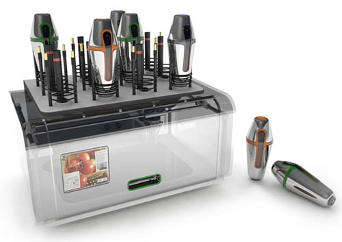
 [Image: The Cornucopia Digital Fabricator, “a personal, three-dimensional printer for food,” by Marcelo Coelho and Amit Zoran; Coelho will be speaking this Saturday at Foodprint NYC].
1) Foodprint NYC is this Saturday, February 27, at Studio-X in New York City: “Foodprint NYC is the first in a series of international conversations about food and the city. From a cluster analysis of bodega inventories to the cultural impact of the ice-box, and from food deserts to peak phosphorus, panelists will examine the hidden corsetry that gives shape to urban foodscapes, and collaboratively speculate on how to feed New York in the future. The free afternoon program will include designers, policy-makers, flavor scientists, culinary historians, food retailers, and others, for a wide-ranging discussion of New York’s food systems, past and present, as well as opportunities to transform our edible landscape through technology, architecture, legislation, and education.” It is free and open to the public, and the speaker line-up is amazing. The whole thing goes from 1-5:30pm. Here is a map. Foodprint NYC is organized by Nicola Twilley and Sarah Rich.
2) Here is a great design competition: “Currently, over 100,000 people each year follow informal trails through wetlands and over active train tracks to gain access to the surf breaks at Trestles,” we read. “These impromptu manmade paths present a safety hazard with passing trains and threaten the fragile ecosystem of Trestles.”
In response, a coalition of concerned groups organized by the volunteer non-profit organization Architecture for Humanity, are launching “Safe Trestles,” an open-to-all, two-stage design competition to create a safe pathway to serve surfers, the local coastal community and day visitors to San Onofre State Beach. This coalition is looking for cohesive designs that eliminate the danger of crossing active train tracks, help to restore wetlands that have been damaged by the present path, preserve and improve vistas, and offer education about the history of the site and the beach marsh environment.
Registration deadline: March 17, 2010; submission deadline: April 17, 2010
 [Images: From 49 Cities by workAC].
3) workAC‘s 49 Cities exhibition travels to San Francisco next month, where it opens at the San Francisco Planning and Urban Research Association (SPUR. “A survey of utopian urbanism, 49 Cities provides a remarkable insight into the contemporary metropolis and our efforts over time to make cities more controllable, monumental, organic, taller, denser, sparser or greener.” A newly expanded reprint of the accompanying 49 Cities book, published by Storefront for Art and Architecture, will be for available for purchase. Amale Andraos, principal architect (with Dan Wood) of workAC will be speaking at Foodprint NYC.
4) Follow the agricultural practices and economic landscapes of cocaine production. Watch heavily processed leaves be transformed from gasoline-infused paste to powder. Then watch this radically alchemized form of plantlife be smuggled across the U.S. border.
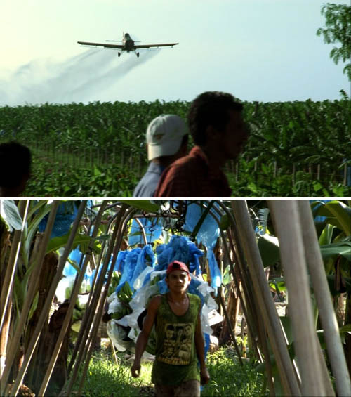 [Images: From BANANAS!*].
5) Then go back out into the fields and watch this trailer for a Swedish documentary about bananas.
6) Coastlines: Images of Land and Sea opens at the Dallas Museum of Art on April 25, 2010. The exhibition explores “how modern and contemporary artists—from Childe Hassam and Edward Hopper to Willem De Kooning, Gerhard Richter and Catherine Opie—have drawn upon coastal landscapes as a source of inspiration, metaphor and mystery in their work. Through selections from the Museum’s rich collections and important local holdings, Coastlines: Images of Land and Sea will juxtapose coastal landscapes from around the world and from a range of different artistic traditions.”
7) Pruned supplies his newest list of quick links—and they’re all worth reading: Prunings LIII. In particular, don’t miss the $100 million, seven-story aquarium being planned for Times Square: a Canadian developer hopes to “install tanks featuring sharks, rays, penguins, otters, and other animals in the bottom floors of the 40-story building, known as 11 Times Square, hoping to attract some of the 35 million people who pass through Manhattan’s major crossroads every year.”
8) The new issue of Vague Terrain has been released; its theme is Architecture/Action. “Where is the boundary that separates space from computation?” the issue asks. “What is this territory that lies between interaction design, gaming, physical computing, and architecture?”
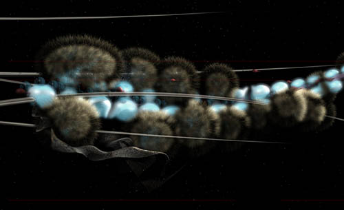 [Image: Unknown image, via Interactive Architecture].
9) Speaking of computation, Unconventional Computing & Architecture will be held this Friday, February 26, at the Building Centre in London. “This one-day conference explores new materials for architectural practice in the 21st century. International architects and scientists will explore the decision-making properties of matter and how this may be applied to create increasingly life-like buildings.”
10) Built for the Bush is now on display in the Australian city of Albury, showcasing “green architecture for rural Australia.” The exhibition “explores some of the energy efficient features of Australia’s 19th century country homes and the reappearance of many of these traditional practices in contemporary green architecture.”
 [Image: Unknown image, via Interactive Architecture].
And one to grow on: Alberto Pérez-Gómez will be speaking tomorrow night, Tuesday, February 23, in the Great Hall of New York City’s Cooper Union. His talk—”The Splendor of Architectural Shadows in a Nihilistic Age”—is free and begins at 6:30pm.
(Some links found via Design Under Sky, Some landscapes, Foodprint [Dutch], Super Colossal, Interactive Architecture, and possibly elsewhere; Quick Links 1, 2, 3, 4, 5, and 6).
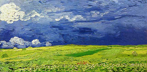 [Image: Vincent Van Gogh, “Wheatfields under Thunderclouds” (1890)].
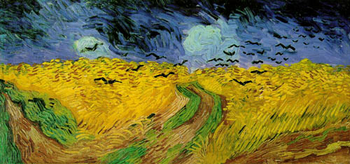 [Image: Vincent Van Gogh, “Wheatfield with Crows” (1890)].
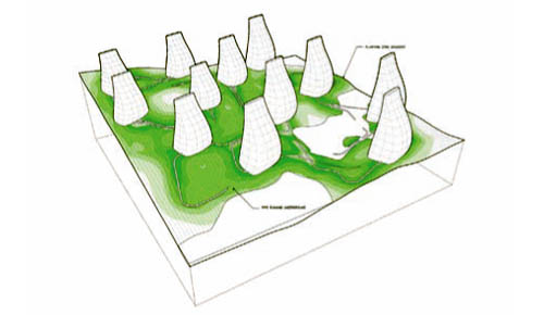 [Image: “Reykjavik Botanical Garden” by Andrew Corrigan and John Carr].
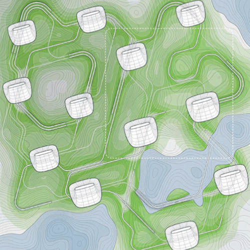 [Image: “Reykjavik Botanical Garden” by Andrew Corrigan and John Carr].
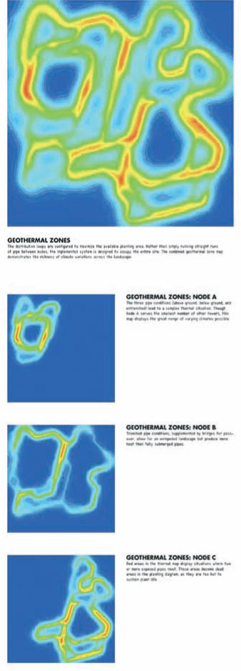 [Image: “Reykjavik Botanical Garden” by Andrew Corrigan and John Carr].
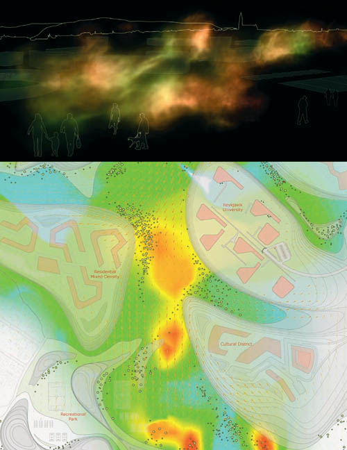 [Image: Produced for the “Vatnsmyri Urban Planning Competition” by Sean Lally, Andrew Corrigan, and Paul Kweton of
 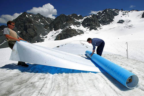 [Image: Glacier-protection services in the Swiss Alps; photo by Olivier Maire/Epa/Corbis, via the
  [Image: From
  [Image: From
  [Image: Via
  [Image: From
  [Image:
  Like a culinary version of
  [Image: “There are two basic types of taco trucks,” we read; “the first and most common is the transient truck which is a truck that stops at approximately 20 different locations at 20-minute intervals during an 8-hour shift, typically beginning at 6am and ending at 2pm. The second type is the semi-permanent truck, which is a truck that has found a location that has a density of clientele to sustain it for an extended period of the day, creating a nearly fixed presence in a particular community.” From
  [Image: From