Mysterious Chinese Tunnels

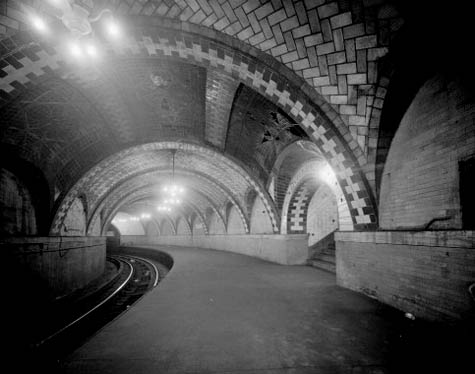
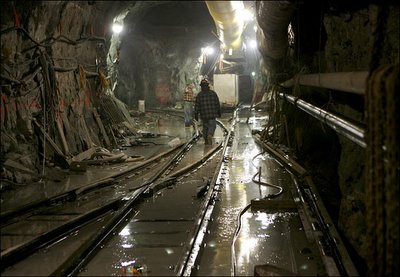
[Image: The brick-arched entryway to a “mysterious Chinese tunnel” in the Pacific Northwest (via)].

72 years ago, a man named William Zimmerman sat down with a to tell an agent of the U.S. government to tell a story about “mysterious Chinese tunnels” beneath the Pacific Northwest. His interview was conducted as part of the Federal Writers’ Project, and it can be read online in a series of typewritten documents hosted by the Library of Congress.

Zimmerman claims that “mysterious” tunnels honeycombed the ground beneath the city of Tacoma, Washington. These would soon become known as “Shanghai tunnels,” because city dwellers were allegedly kidnapped via these underground routes – which always led west to the city’s docks – only to be shipped off to Shanghai, an impossibly exotic urban world across the ocean. There, they’d be sold into slavery.

[Image: The cover page for one of many U.S. government documents called “Mysterious Chinese Tunnels“].

Subterranean space here clearly exists within an interesting overlap of projections: fantasies of race, exoticism, and a subconscious fear of the underworld all wrapped up into one narrative package. White Europeans had expanded west all the way to the Pacific Ocean – only to find themselves standing in a fog-covered marsh, on earthquake-prone ground, with a “mysterious” race of Chinese dock workers tunneling toward them through the earth, looking for victims… It’s like a geography purpose-built for H.P. Lovecraft: down in the foundations of your city is a mysterious network of rooms, excavated by another race, through which unidentified strangers move at night, conspiring to abduct you.

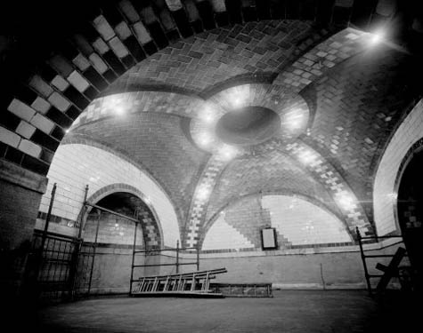
[Image: Another “mysterious Chinese tunnel” in the Pacific Northwest (via)].

In any case, because “construction of the Northern Pacific Railroad required large numbers of railroad laborers,” Zimmerman’s tale begins, “many Chinese coolies” had to be smuggled into the “rapidly growing city of Tacoma.” They “arrive[d] mysteriously,” he says, “smuggled in on ships, and even Indian canoes, from British Columbia.”

Several opium joints were known to be operating in Tacoma. And there was no question in the minds of many people that the narcotic was smuggled in through tunnels from their dens to cleverly hidden exits near the waterfront. They were also convinced that the tunnels were dug by Chinese, either as a personal enterprise or at the behest of white men of the underworld, as no white workmen would burrow the devious mole-like passageways and keep their labors secret.

Zimmerman adds that the Chinese “were forcibly expelled from Tacoma in 1885, but ever [sic] so often the story of the Chinese tunnels bobs up whenever workmen come across them in excavation work.”

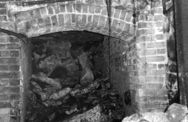
[Image: Entries to Tacoma’s mysterious Chinese underworld? Photo by Stephen Cysewski (via)].

Meanwhile, the same year as Zimmerman’s interview – 1936 – a 39-year old man named V.W. Jenkins also sat down with a representative of the Federal Writers’ Project, and he had this story to tell:

In the spring of 1935 when the City Light Department was placing electric power conduits under ground, workmen digging a trench in the alley between Pacific Avenue and ‘A’ Street at a point about 75 feet south of 7th Street, just back of the State Hotel, crosscut an old tunnel about ten feet below the surface of the ground. This tunnel was about three feet wide by five feet high, and tended in a southwesterly direction under the State Hotel, and in the opposite direction southeasterly toward Commencement Bay. I entered the tunnel and walked about 40 or 50 feet in each direction from the opening which we had encountered. There it went under the hotel the tunnel dipped sharply to pass under the concrete footings of the rear wall, proving that the tunnel was dug after the hotel had been built. In the other direction the tunnel had a sharp turn to the left, and after several feet, a gradual curve to the right, so that it was again tending in the same direction as at the opening. About 50 feet from the opening on the Bay side the tunnel began to dip and in another ten feet began to decline very sharply so that it would have been necessary to use a rope to descend safely on the met slippery floor. The brow of the bluff overlooking the waterfront is but a short distance from this point, explaining the need for the rapid downward slope, although it is probable that farther on there is a turn, either right or left, and that the tunnel was dug at an easier grade before emerging at a lower level.

Jenkins then offers this bizarrely wonderful explanation for what else might have formed those tunnels:

Some persons contend that these openings found in the vicinity of Tacoma were caused by trees buried in the glacial age, and after decaying, left the openings in the glacial drift. If this is the true explanation for the tunnel I have described, then the tree that made it must have been a giant that grow such in the shape of a corkscrew.

Of course, there are also “Shanghai tunnels” beneath Portland, Oregon. “All along the Portland waterfront,” we read, “…’Shanghai Tunnels’ ran beneath the city, allowing a hidden world to exist. These ‘catacombs’ connected to the many saloons, brothels, gambling parlors, and opium dens, which drew great numbers of men and became ideal places for the shanghaiers to find their victims. The catacombs, which ‘snaked’ their way beneath the streets of what we now call Old Town, Skidmore Fountain, and Chinatown, helped to create an infamous history that became ‘cloaked’ in myth, superstition, and fear.”

The same website linked above describes the actual process of so-called Shanghai’ing:

The victims were held captive in small brick cells or makeshift wood and tin prisons until they were sold to the sea captains. A sea captain who needed additional men to fill his crew notified the shanghaiiers that he was ready to set sail in the early-morning hours, and would purchase the men for $50 to $55 a head. ‘Knock-out drops’ were then slipped into the confined victim’s food or water.
Unconscious, they were then taken through a network of tunnels that ‘snaked’ their way under the city all the way to the waterfront. They were placed aboard ships and didn’t awake until many hours later, after they had ‘crossed the bar’ into the Pacific Ocean. It took many of these men as long as two full voyages – that’s six years – to get back to Portland.

It all sounds like some prehistoric narrative of the afterlife – a shaman’s tale of a near-death experience: you’re blacked out and led through mysterious tunnels inside the earth, only to wake up surrounded by the oceanic, on your way to another world.

This site offers quite a lot of history of the Tacoma tunnels, and ten minutes of Googling will reveal at least a dozen blog posts and assorted minor newspaper articles about the phenomenon; but there’s something particularly intriguing about an official oral history, conducted by the U.S. government, in which tales of subterranean geography are revealed. The papers have the feel of a kind of national psychoanalysis, where each session takes the form of geographic speculation. More practically, such interviews are a fantastic premise for a short novel or film.

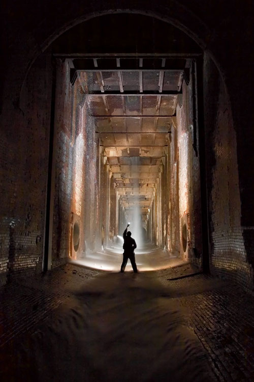
[Image: Photo by Michael Cook. “Looking into the bottom of the William B. Rankine G.S. wheelpit from the Rankine tailrace“].

Briefly, though, I’m also reminded of BLDGBLOG’s interview with Michael Cook, an urban explorer based in Toronto, posted last summer.

Toward the end of that interview, I asked Cook “if there’s some huge, mythic system out there that you’ve heard about but haven’t visited yet” – some long-rumored underworld that might only be speculation. Cook replies:

I guess the most fabled tunnel system in North America is the one that supposedly runs beneath old Victoria, British Columbia. It’s supposedly connected with Satanic activity or Masonic activity in the city, and there’s been a lot of strange stuff written about that. But no one’s found the great big Satanic system where they make all the sacrifices.
You know, these legends are really… there’s always some sort of fact behind them. How they come about and what sort of meaning they have for the community is what’s really interesting. So while I can poke fun at them, I actually appreciate their value – and, certainly, these sort of things are rumored in a lot of cities, not just Victoria. They’re in the back consciousness of a lot of cities in North America.

(With huge thanks to Alexis Madrigal, who sent me a link to the Tacoma tunnels last summer).

Geology in the Age of the War on Terror

A few months after September 11th, the New York Times published a kind of geological look at the War on Terror.
In a short but amazingly interesting – albeit subscriber-only – article, the NYTimes explored how ancient landscape processes and tectonic events had formed the interconnected mountain caves in which Osama bin Laden was, at that time, hiding.

[Image: The topography of Afghanistan, a sign of deeper tectonics. In a cave somewhere amidst those fractal canyons sat Osama bin Laden, in the darkness, rubbing his grenades, complaining about women, Jews, and homosexuals…].

“The area that is now Afghanistan started to take shape hundreds of millions of years ago,” the article explains, “when gigantic rocks, propelled by the immense geological forces that continuously rearrange the earth’s landforms, slammed into the landmass that is now Asia.”
From here, rocks “deep inside the earth” were “heated to thousands of degrees and crushed under tremendous pressures”; this caused them to “flow like taffy.” And I love this next sentence: “Just like the air masses in thunderstorms, the warmer rocks rise and the cooler ones sink, setting up Ferris wheel-shaped circulations of magma that drag along the crust above them. Over time, these forces broke off several pieces off the southern supercontinent of Gondwanaland – the ancient conglomeration of South America and Africa – and carried them north toward Asia.”
Of course, Afghanistan – like most (but not all) of the earth’s surface – was once entirely underwater. There, beneath the warm waves of the Tethys Seaway, over millions of year, aquatic organisms “were compressed into limestone.”
Limestone, incidentally, is less a rock than a kind of strange anatomical by-product – something the living can become.
In any case, these massive and shuddering tectonic mutations continued:

Minerals from the ocean floor, melted by the heat of the interior, then flowed back up near the surface, forming rich deposits of copper and iron (minerals that could someday finance an economic boom in Afghanistan). The limestone along the coasts of Asia and India buckled upward, like two cars in a head-on collision. Water then ate away at the limestone to form the caves. Though arid today, Afghanistan was once warm and wet. Carbon dioxide from decaying plants dissolves into water to form carbonic acid, and in water-saturated underground areas, the acid hollowed out the limestone to form the caves, some several miles long.

The story gets really interesting here, then; think of it as the CIA-meets-geology.

[Image: Via the Telegraph].

What happened was that Osama bin Laden, in hiding after 9/11, started releasing his famous videotapes – but those tapes included glimpses of cave walls and rocky hillsides behind him.
When John F. Shroder – a geologist specializing in the structure of Himalayan Afghanistan – saw the tapes, he tried to interpret their setting and background, looking for mineralogical clues as to where bin Laden might be. Like a scene from The Conversation – or, hermeneutics gone geo-cinematic – Shroder pored over the tapes, fast-forwarding and rewinding, scanning for subtle signs…
It was the surface of the earth on TiVo.
“Afghanistan’s fighters find shelter in the natural caves,” the New York Times continues. “They also make their own, often in the mountains of crystalline rock made of minerals like quartz and feldspar, the pieces of Afghanistan that were carried in by plate tectonics. ‘This kind of rock is extremely resistant,’ Dr. Shroder said. ‘It’s a good place to build bunkers, and bin Laden knows that.’ Dr. Shroder said he believed that Mr. bin Laden’s video in October was taken in a region with crystalline rocks like those south of Jalalabad.”
All of which makes me think that soldiers heading off to Afghanistan could do worse than to carry bulletproof copies of Jules Verne’s Journey to the Center of the Earth along with them.
As another New York Times article puts it: “Afghanistan is a virtual ant farm of thousands of caves, countless miles of tunnels, deeply dug-in bases and heavily fortified bunkers. They are the product of a confluence of ancient history, climate, geology, Mr. bin Laden’s own engineering background – and, 15 years back, a hefty dose of American money from the Central Intelligence Agency.”
Bin Laden et al could thus “take their most secret and dangerous operations to earth,” hidden beneath the veil of geology.

(Elsewhere: Bryan Finoki takes a tour of borders, tunnels, and other Orwellian wormholes; see also BLDGBLOG’s look at Terrestrial weaponization).

Faucets of Manhattan

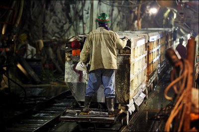
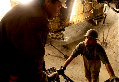
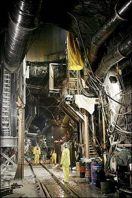
“About 600 feet deep in the bedrock that supports Midtown Manhattan,” we meet “a 450-ton tunnel-boring machine known as the Mole.”
The Mole is “digging City Tunnel No. 3 far beneath Manhattan’s street level, part of a 50-year, $6 billion project to upgrade New York City’s water system.”

[Image: By Ozier Muhammad for The New York Times].

As the New York Times describes, this is actually the “second phase of City Tunnel No. 3, a 60-mile tunnel that began in the Bronx in 1970 and is scheduled for completion in 2020. By then, the tunnel will be able to handle the roughly one billion gallons of water a day used in New York City that originates from rural watersheds to points throughout the city.” And though the tunnel “is one of the largest urban projects in history, few people will ever see it. But beginning next week, many New Yorkers will certainly feel and hear the construction.”

[Images: By Ozier Muhammad for The New York Times].

The speed of the excavation process “varies based upon the hardness of the rock it encounters. The task of determining what type of rock lies in its path falls to Eric Jordan, a geologist hired by the city. By drilling down and hand-picking rocks from the tunnels, Mr. Jordan has created a precise map of the type of rock under Manhattan. His involvement in the tunnel project makes his geologist friends jealous. ‘For a geologist,’ he said, ‘this is like going to Disneyland.'”
Jordan’s “precise map” of Manhattan bedrock would indeed be something to see; but until then, we can make an educated guess about the rock his tunnel will find by turning to Richard Fortey.
In his highly recommended book, Earth, Fortey visits Central Park. First you notice the skyline of towers, he writes. “Then you notice the rocks. Cropping out in places under the trees are dark mounds of rock, emerging from the ground like some buried architecture of a former race, partly exhumed and then forgotten… That New York can be built so high and mighty is a consequence of its secure foundations on ancient rocks. It pays its dues to the geology. This is just a small part of one of those old seams that cross the earth… relics of a deeper time when millennia counted for nothing.”

[Image: By Ozier Muhammad for The New York Times].

John McPhee picks up this lithic line of thought in Annals of the Former World. Archipelago New York, he writes, is made of “rock that had once been heated near the point of melting, had recrystallized, had been heated again, had recrystallized, and, while not particularly competent, was more than adequate to hold up those buildings… Four hundred and fifty million years in age, it was called Manhattan Schist.”
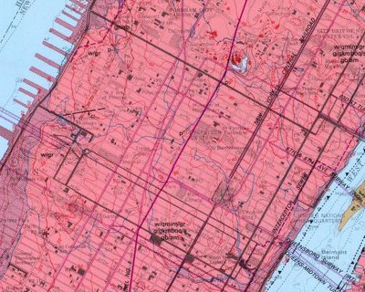
Of course, we can also turn to the U.S. National Geologic Map Database, and find our very own bedrock maps –


– which, awesomely, include Times Square, Carnegie Hall, Rockefeller Center, and the Museum of Modern Art, all floating above a sea of solid Manhattan Schist.
In any case, the new tunnel being dug to power the faucets of Manhattan are supplements to the pharaonic, 19th-century Croton hydrological network that keeps New York in taps (including the now derelict, yet Historically Registered, Old Croton Aqueduct). You can read about the Croton Dam, for instance, here or here; and there’s yet more to learn about the Croton project, including how to follow it by trail, here.

[Image: Photograph by Robert Polidori, from “City of Water” by David Grann, The New Yorker, September 1, 2003].

Finally, in 2003 The New Yorker published an excellent article by David Grann called “City of Water,” about, yes, City Tunnel No. 3. I’ll quote from it here briefly before urging you to find a copy at your local library and read it for yourself.
Until Grann actually accompanied the tunnel workers – called sandhogs – underground, he “had only heard tales of New York City’s invisible empire, an elaborate maze of tunnels that goes as deep as the Chrysler Building is high. Under construction in one form or another for more than a century, the system of waterways and pipelines spans thousands of miles and comprises nineteen reservoirs and three lakes. Two main tunnels provide New York City with most of the 1.3 billion gallons of water it consumes each day, ninety per cent of which is pumped in from reservoirs upstate by the sheer force of gravity. Descending through aqueducts from as high as fourteen hundred feet above sea level, the water gathers speed, racing down to a thousand feet below sea level when it reaches the pipes beneath the city.”
Two main tunnels, he writes – and, thus, City Tunnel No. 3.
But I’ll stop there – after I point out that toward the end of the ludicrously bad Die Hard III, Jeremy Irons temporarily escapes the less than threatening eye of Bruce Willis by driving out of Manhattan through similar such aqueducting tunnels.

(For more tunnels: See BLDGBLOG’s London Topological or The Great Man-Made River; then check out The Guardian on London’s so-called CTRL Project, with a quick visit to that city’s cranky old 19th-century sewers, the “capital’s bowels”… Enjoy!).

The Great Man-Made River

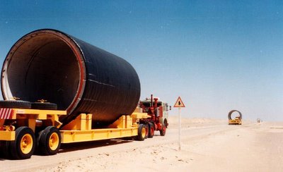
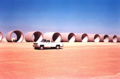
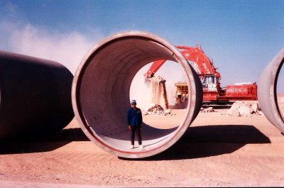
Libya’s Great Man-Made River is “an enormous, long-term undertaking to supply the country’s needs by drawing water from aquifers beneath the Sahara and conveying it along a network of huge underground pipes.”

[Images: The concrete skeleton of Libya’s future river, the “8th wonder of the world,” being trucked into place; photographed by Jaap Berk].

Not only does Libya bear the distinction of holding the world record for hottest recorded temperature (136º F), but most of the country’s terrain is “agriculturally useless desert” that receives little or no rainfall. The Great Man-Made River may not even successfully irrigate Libya’s governmentally-specified agricultural zones, but due to the region’s complete “absence of permanent rivers or streams” – and because the country’s “approximately twenty perennial lakes are brackish or salty” – the River’s expected 50-100 year lifespan is at least a start.

Indeed, Libya’s “limited water is considered of sufficient importance to warrant the existence of the Secretariat of Dams and Water Resources, and damaging a source of water can be penalized by a heavy fine or imprisonment.” George Orwell would perhaps call this watercrime.

However, I have to say that the prospect of spelunking through the Great Man-Made River’s subterranean galleries in 125 years, once those tunnels have dried-up, makes the brain reel. Imagine Shelleys of the 22nd century wandering through those ruins, notebooks in hand, taking photographs, footsteps echoing rhythmically beneath the dunes as they walk for a thousand kilometers toward the sea…

Yet some are skeptical of the project’s real purpose. Precisely because the Great Man-Made River consists of “a stupendous network of underground tunnels and caverns built with the help of Western firms to run the length and width of the country,” some consultants and engineers “have revealed their suspicion that such facilities were not meant to move water, but rather to conceal the movement and location of military-related activities.” The fact that water is flowing through some of the pipes, in other words, is just an elaborate ruse…

In any case, the Great Man-Made River Authority – “entrusted with the implementation and operation of the world’s largest pre-stressed concrete pipe project” – is already seeing some results.

The network will criss-cross most of the country –

– and Phase III is under construction even as this post goes online.

Meanwhile, for more information on deep desert hydrology see UNESCO’s International Hydrological Programme or even Wikipedia.

Of course, you could also turn to J.G. Ballard, whose twenty year-old novel The Day of Creation is: 1) not very good, and 2) about a man who is “seized by the vision of a third Nile whose warm tributaries covered the entire Sahara.” That river will thus “make the Sahara bloom.” The book was modestly reviewed by Samuel Delany, if you want to know more.

On the other hand, I would actually recommend Dune – assuming you like science fiction.

[Image: A new river is born, excavated from the surface of the desert: soon the pipes will be installed and the currents will start to flow…].

London Topological

[Image: Embankment, London, ©urban75].

As something of a sequel to BLDGBLOG’s earlier post, Britain of Drains, we re-enter the sub-Britannic topology of interlinked tunnels, drains, sewers, Tubes and bunkers that curve beneath London, Greater London, England and the whole UK, in rhizomic tangles of unmappable, self-intersecting whorls.

[Images: The Bunker Drain, Warrington; and the Motherload Complex, Bristol (River Frome Inlets); brought to you by the steroidally courageous and photographically excellent nutters at International Urban Glow].

Whether worm-eaten by caves, weakened by sink-holes, rattled by the Tube or even sculpted from the inside-out by secret government bunkers – yes, secret government bunkers – the English earth is porous.

“The heart of modern London,” Antony Clayton writes, “contains a vast clandestine underworld of tunnels, telephone exchanges, nuclear bunkers and control centres… [s]ome of which are well documented, but the existence of others can be surmised only from careful scrutiny of government reports and accounts and occassional accidental disclosures reported in the news media.”

[Images: Down Street, London, by the impressively omnipresent Nick Catford, for Subterranea Britannica; I particularly love the multi-directional valve-like side-routes of the fourth photograph].

This unofficially real underground world pops up in some very unlikely places: according to Clayton, there is an electricity sub-station beneath Leicester Square which “is entered by a disguised trap door to the left of the Half Price Ticket Booth, a structure that also doubles as a ventilation shaft.”

This links onward to “a new 1 1/4 mile tunnel that connects it with another substation at Duke Street near Grosvenor Square.”

But that’s not the only disguised ventilation shaft: don’t forget the “dummy houses,” for instance, at 23-24 Leinster Gardens, London. Mere façades, they aren’t buildings at all, but vents for the underworld, disguised as faux-Georgian flats.

(This reminds me, of course, of a scene from Foucault’s Pendulum, where the narrator is told that, “People walk by and they don’t know the truth… That the house is a fake. It’s a façade, an enclosure with no room, no interior. It is really a chimney, a ventilation flue that serves to release the vapors of the regional Métro. And once you know this you feel you are standing at the mouth of the underworld…”).

[Image: The Motherload Complex, Bristol – again, by International Urban Glow].

There is also a utility subway – I love this one – accessed “through a door in the base of Boudicca’s statue near Westminster Bridge.” (!) The tunnel itself “runs all the way to Blackfriars and then to the Bank of England.”

Et cetera.

[Images: The Works Drain, Manchester; International Urban Glow].

My personal favorite by far, however, is British investigative journalist Duncan Campbell’s December 1980 piece for the New Statesman, now something of a cult classic in Urban Exploration circles.

[Image: Motherload Complex, Bristol; International Urban Glow].

“Entering, without permission, from an access shaft situated on a traffic island in Bethnal Green Road he descended one hundred feet to meet a tunnel, designated L, stretching into the distance and strung with cables and lights.” He had, in other words, discovered a government bunker complex that stretched all the way to Whitehall.

On and on he went, all day, for hours, riding a folding bicycle through this concrete, looking-glass world of alphabetic cyphers and location codes, the subterranean military abstract: “From Tunnel G, Tunnel M leads to Fleet Street and P travels under Leicester Square to the then Post Office Tower, with Tunnel S crossing beneath the river to Waterloo.”

[Image: Like the final scene from a subterranean remake of Jacob’s Ladder (or a deleted scene from Creep [cheers, Timo]), it’s the Barnton Quarry, ROTOR Drain, Edinburgh; International Urban Glow].

Here, giving evidence of Clayton’s “accidental disclosures reported in the news media,” we read that “when the IMAX cinema inside the roundabout outside Waterloo station was being constructed the contractor’s requests to deep-pile the foundations were refused, probably owing to the continued presence of [Tunnel S].”

[Image: Motherload, Bristol; International Urban Glow].

But when your real estate is swiss-cheesed and under-torqued by an unreal world of remnant topologies, the lesson, I suppose, is you have to read between the lines.

A simple building permissions refusal might be something else entirely: “It was reported,” Clayton says, “that in the planning stage of the Jubilee Line Extension official resistance had been encountered, when several projected routes through Westminster were rejected without an explanation, although no potential subterranean obstructions were indicated on the planners’ maps. According to one source, ‘…the rumour is that there is a vast bunker down there, which the government has kept secret, which is the grandaddy of them all.'”

[Image: The Corsham Tunnels; see also BLDGBLOG].

Continuing to read between the lines, Clayton describes how, in 1993, after “close scrutiny of the annual Defence Works Services budget the existence of the so-called Pindar Project was revealed, a plan for a nuclear bomb-proof bunker, that had cost £66 million to excavate.”

All of these places have insane names—Pindar, Cobra, Trawlerman, ICARUS, Kingsway, Paddock—and they are hidden in the most unlikely places. Referring to a government bunker hidden in the ground near Reading: “Inside, they tried another door on what looked like a cupboard. This was also unlocked, and swung open to reveal a steep staircase leading into an underground office complex.”

[Images: The freaky stairs and tunnels, encrusted with plaster stalactites, of King William Street].

Everything leads to everything else; there are doorways everywhere. It’s like a version of London rebuilt to entertain quantum physicists, with a dizzying self-intersection of systems hitting systems as layers of the city collide.

[Image: Belsize Park, from the terrifically useful Underground History of Hywel Williams].

There is always another direction to turn.

[Image: The Shorts Brothers Seaplane Factory and air raid shelter, Kent; photo by Underground Kent].

This really could go on and on; there are flood control complexes, buried archives, lost rivers sealed inside concrete viaducts – and all of this within the confines of Greater London.

[Images: London’s Camden catacombs – “built in the 19th Century as stables for horses… [t]heir route can be traced from the distinctive cast-iron grilles set at regular intervals into the road surface; originally the only source of light for the horses below” – as photographed by Nick Catford of Subterranea Brittanica].

Then there’s Bristol, Manchester, Edinburgh, Kent…

[Image: Main Junction, Bunker Drain, Warrington; International Urban Glow].

And for all of that, I haven’t even mentioned the so-called CTRL Project (the Channel Tunnel Rail Link); or Quatermass and the Pit, an old sci-fi film where deep tunnel Tube construction teams unearth a UFO; or the future possibilities such material all but demands.

[Image: Wapping Tunnel Vent, Liverpool, by International Urban Glow; a kind of subterranean Pantheon].

Such as: BLDGBLOG: The Game, produced by LucasArts, set in the cross-linked passages of subterranean London, where it’s you, a torch, some kind of weapon, a shitty map and hordes of bird flu infected zombies coughing their way down the dripping passages – looking for you