In 1919, Russian artist Vladimir Tatlin proposed a 400m-high Monument to the 3rd International.

Once constructed, it would have stood nearly 100m taller than the Eiffel Tower, giving physical expression to the social and artistic dynamism of the Russian Revolution. Intended as a kind of archi-sculptural testament to the strength of the world’s workers, the Tower was ultimately never built.
Or was it?
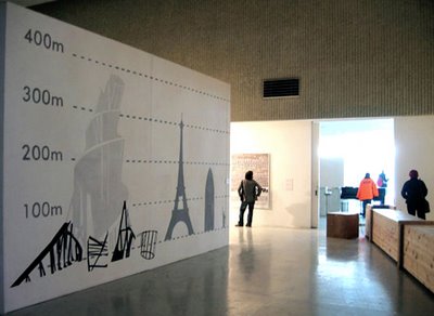
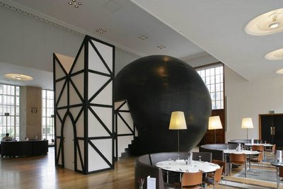
[Image: Sara De Bondt].
Recently, a British group called Henry VIII’s Wives has made artistic waves with their proposal to build the Tower in its entirety – although in pieces, distributed throughout the world. Thus the Tower will exist, albeit in an unassembled, ironically incomplete form. An art gallery in Sydney, a wine cellar in Rome, a cupboard in outer Rajasthan – there you will find small, unique and official pieces of Tatlin’s Tower.
Advertisements for this future “unrealized Tower” even began appearing on the walls of the London Underground.

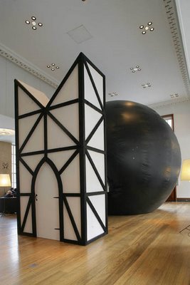
[Image: Sara De Bondt/Lucy Skaer].
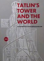
Then, tonight, 19 March 2006, at an event in the Bern Kunsthalle, Switzerland, the group formally presented their plan – alongside Tatlin-inspired presentations by unbuilt-monument specialist Takehiko Nagakura, novelist Zoë Strachan and others. BLDGBLOG was also invited to submit a short text, which I’ve reproduced below. (Thanks to Bob Grieve for commissioning it!)
The unbuilt status of Vladimir Tatlin’s Monument to the 3rd International – or Tatlin’s Tower – is both befuddling and possibly contentious. In other words, are we sure that Tatlin’s Tower has not actually been built? Can this state of unconstruction be proven?
Perhaps Tatlin’s Tower exists after all – but we’ve been looking in all the wrong places.
There is, in fact, no logical reason to assume that Tatlin’s Tower, once built, would even be architectural. Indeed, there is no logical reason to assume that Tatlin’s Tower, in its full realization, its exact structural form, is something that can even be seen.
But if Tatlin’s Tower does exist – and, as you’ll hear, it probably does – we may find that it’s been built not just once or even twice; we may find that the Tower exists in a constant state of construction, a never-ending condition of being-built. Tatlin’s Tower is constructed – and destructed – from scratch, everyday, every instant – and the Tower will go on being built, ritualistically, every moment for eternity.
If that’s really the case, however, where are we supposed to find it? It is hard, after all, to misplace a 400m high Communist Tower; if it now stands, where exactly is it standing?
For starters, perhaps stand is the wrong word. It is important to realize that the Tower is a vertical grid of spatial relationships, a physical rhythm of structure in space. Once we establish that, we see that the proportion of gap to girder forms a mathematical ratio that can be applied anywhere – at the very least, it can be perceived anywhere.
It is then that the Tower’s helical super-symmetry becomes evident on every scale, in every location.
The Tower already exists.
As but one example, in the time spent between visiting a pub once, then visiting it again – and then again, two weeks later – there is the structure of Tatlin’s Tower, measured precisely, to the second, in the chasm between drinks. You have lived the rhythm of the structure, its buttresses and cantilevered gantries. One day, two days, one hour: the ratios and rhythms match exactly to the Tower’s form.
The Tower, in other words, does not have to be architectural.
I even discovered while writing this text that the space between myself and the computer screen, if you include the short distance to the floor, forms an oblong triangle; and it dawned on me: this is a section of Tatlin’s Tower, right here, surrounding me, inscribed into the space I inhabit. Tatlin’s entire 400m-high Babel can be reverse-derived from the data.
In this context it is quite extraordinary to reveal that Dr. Simon X, a musicologist from Leeds University, has found indisputable evidence that Tatlin’s Tower was translated into a series of Indian ragas. Whilst vacationing in Tamil Nadu in 1974 – and suffering from a stomach bug due to questionable local hygiene – Dr. X found that the nightly concerts he and his wife had been attending were actually musicalized versions of the mathematics found inside Tatlin’s Tower. He didn’t know if the musicians had planned this.
X’s recordings have become something of a myth in the field of Tatlin’s Tower-spotting, but his musical logic remains impeccable, even obvious: you can very clearly hear the outline of Tatlin’s symmetrical structuring in the recurrence of certain south Indian octaves.
Indeed, X’s recent papers suggest, if one were to transcribe Tatlin’s Tower directly as a musical score, the folk songs of Tamil Nadu would be as accurate a result as any.
But it gets yet more interesting, when one considers contemporary cinematic choreography. Tatlin’s closest friend from university went on to marry a woman whose sister taught dance, first in Moscow, then in Paris, then in New York in exile. The school she started in New York to support herself during the war included, at one point, a young Beatriz X – who would later befriend world famous film editor Walter Murch.
It is rumored now that Murch – editor of such features as Apocalypse Now – would edit raw film stock into the proportions suggested by a poster of Tatlin’s Tower pinned up on his studio wall. Intriguingly, then, the movements of characters through the cinematic space of Apocalypse Now – or the more recent Iraq War film, Jarhead – actually carefully circumscribe the upward coiling vertical movement of Tatlin’s monumental iron tower.
This can be glimpsed most clearly in a scene from The Conversation, which Murch also edited, in which Gene Hackman, taller than the other actors he appears with, seems to mimic the precise angle of tilt at which Tatlin’s Tower was meant to repose.
And so forth.
The importance, here, is in the realization that if the Tower was designed to be of the people, a monument to international popular sovereignty, then it is also in the people, and amongst them, literally: it is medically present in the space between cells, resonating in cobwebs of bone marrow, as much as it is traced again and again within the four dimensions of urban space by the passage of workday pedestrians.
The sliver of empty asphalt between your car and the lorry overtaking you, multiplied by the time it takes to get anywhere, inevitably adds up to frame the gantries in Tatlin’s Tower.
The Tower is everywhere. It is something we enact, performed here in the present, indeed in the hesitations between every letter that I type. It is negatively present in the foundations of buildings, in natural crevasses carved by streams through the ice of Antarctic deserts. Even American astronaut Neil Armstrong, some have claimed, found evidence of Tatlin’s Tower impressed into the surface of the moon, an almost exact reproduction eroding there in faint stratigraphies of colorless rock.
The ultimate “Communist monument,” then, if there is such a thing, is the one that we’re living inside of, the proportional numerologies that frame and contain us. The brilliance of Tatlin’s Tower was that it was already built from the moment he first designed it – or perhaps I should say: transcribed it.
Tatlin knew this; now so do we.

[Note: Not every claim made in this text should be considered factual].


 [Image: Caver Chris Nicola looks at markings left in Priest’s Grotto;


 [Image: By Ozier Muhammad for
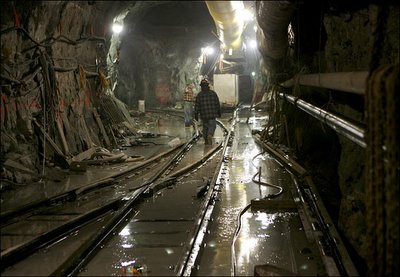
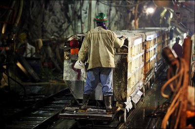
 [Images: By Ozier Muhammad for
 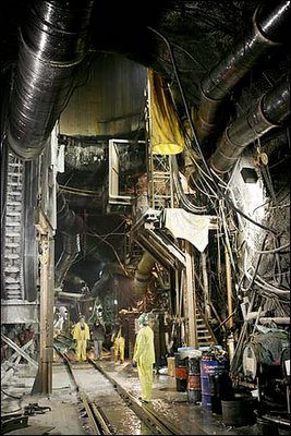 [Image: By Ozier Muhammad for
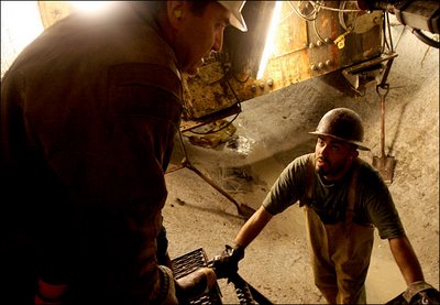

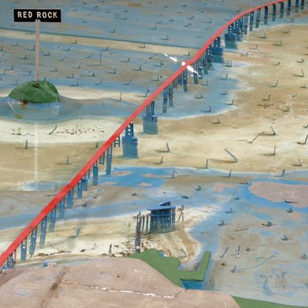
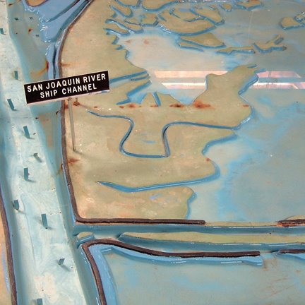
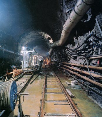 [Image: Photograph by Robert Polidori, from “City of Water” by David Grann, The New Yorker, September 1, 2003].