The Auditory Configuration of Hell

[Image: The howling of Hell, illustrated by Gustave Doré for Dante’s Inferno].

Nearly seven years ago, we took a brief art historical look at the “landscape architecture of Hell,” quoting critic Adrian Searle‘s description of the medieval abyss:

Terraced, pinnacled, travelling forever downward, the ledges, cities and basements of hell are furnished with sloughs, gorges and deserts; there are cities, rivers of boiling blood, lagoons of scalding pitch, burning deserts, thorny forests, ditches of shit and frozen subterranean lakes. Every kind of sin, and sinner, is catered for. Here, descending circle by circle, like tourists to Bedlam, came Dante and Virgil. Following them, at least through Dante’s poem, came Botticelli.

In a recent issue of The Wire, writer and composer David Toop, in a short article about the various cultural uses of bass, comes to this topic from a different angle, asking what the netherworld of the damned might sound like.

He calls this, citing the Aeneid and Paradise Lost both, the “auditory configuration of Hell”: “The auditory configuration of Hell is an opposition of low homogeneous moan and confused Babel, of deep tones and threnodic shrieks, as if combining the outer extremes of human perception is the most authentic expression of damnation.” There is acoustic “distress,” Toop writes, somewhere “between roaring water and the tumult of the wandering helpless unburied,” where dogs howl and angels whirling to their doom are deafened by “the bellowing of the Earth itself.”

Toop refers to the recent work of Hillel Schwartz, who has pointed out, in Toop’s words, that “Hell was largely silent until Virgil”—a place of total silence—not the pandemonium of noise it seems in popular imagination to have since become.

So let’s hear it for a much longer paper cataloging the shifting sounds of Hell—an interesting thesis topic for an comparative literature department somewhere, at the very least.

Morse Road

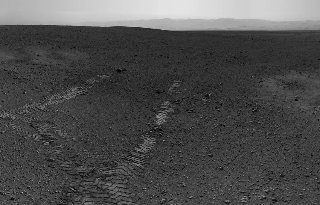
[Image: Curiosity‘s tire treads, courtesy of NASA and the nation’s taxpayers].

It turns out that Bradbury Landing is also a kind of literary site, an interplanetary Newspaper Rock: the tracks left behind by the Curiosity rover are actually a form of Morse code.

The tire treads—wheeled hieroglyphs—spell out JPL, for the Jet Propulsion Laboratory here on earth.

[Image: Curiosity reveals its Morse code, courtesy of NASA].

From a JPL press release: “Careful inspection of the tracks reveals a unique, repeating pattern, which the rover can use as a visual reference to drive more accurately in barren terrain. The pattern is Morse code for JPL, the abbreviation for NASA’s Jet Propulsion Laboratory in Pasadena, Calif., where the rover was designed and built, and the mission is managed.”

This trackable terrain augmentation is a clever form of so-called visual odometry: “The purpose of the pattern is to create features in the terrain that can be used to visually measure the precise distance between drives,” such that the visual appearance of the inscribed code will reveal signs of slippage and, thus, a need to re-chart or correct the rover’s navigation. This will be especially useful on “featureless terrain.”

[Image: Curiosity’s tire treads, courtesy of NASA].

The example NASA uses is a picket fence:

“Imagine standing in front of a picket fence, and then closing your eyes and shifting to the side. When you open your eyes, you wouldn’t be able to tell how many pickets you passed. If you had one picket that was a different shape though, you could always use that picket as your reference,” said [Matt Heverly, lead rover driver at JPL]. “With Curiosity, it’s a similar problem in featureless terrain like sand dunes. The hole pattern in the wheels gives us one ‘big picket’ to look at.”

In other words, somewhere on the surface of Mars, codes from Earth—a new Linear A—will slowly drift apart over the years, becoming an unreadable road in the sand.

(Thanks to Nicola Twilley for the tip).

Bradbury Landing

[Image: Bradbury Landing, via the Planetary Society; courtesy of NASA and the nation’s taxpayers].

Bradbury Landing is the first named site on Mars not marked by an object, but by ephemeral burn scars from [Curiosity‘s] landing thrusters. Project scientist John Grotzinger describes the site as ‘four scour marks with wheel tracks that basically begin from nowhere.'”

British Exploratory Land Archive

Speaking of the 2012 Venice Architecture Biennale, I’m thrilled to be an exhibitor this year in the UK pavilion, as part of a collaborative project undertaken with Mark Smout and Laura Allen of Smout Allen.

[Image: The British Exploratory Land Archive’s “capture blanket” in use on Hampstead Heath, London; photo by Mark Smout].

Smout Allen are the authors of Augmented Landscapes, easily one of my favorite installments in the Pamphlet Architecture series, as well as long-time instructors at the Bartlett School of Architecture—in fact, many of their students’ projects have been featured here on the blog over the last half-decade—and working with Mark and Laura on a project such as this has been fantastic.

Specifically, as part of the “Venice Takeaway” project curated by Vicky Richardson and Vanessa Norwood, Smout Allen and I have proposed what we call the British Exploratory Land Archive (or BELA).

The British Exploratory Land Archive is, in essence, a British version of the Center for Land Use Interpretation, albeit one defined as much by the use of unique instruments designed specifically for BELA as by its focus on sites of human land-use in the United Kingdom as by.
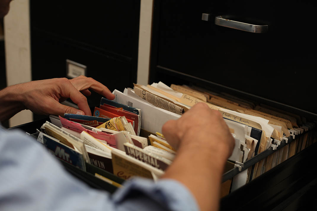
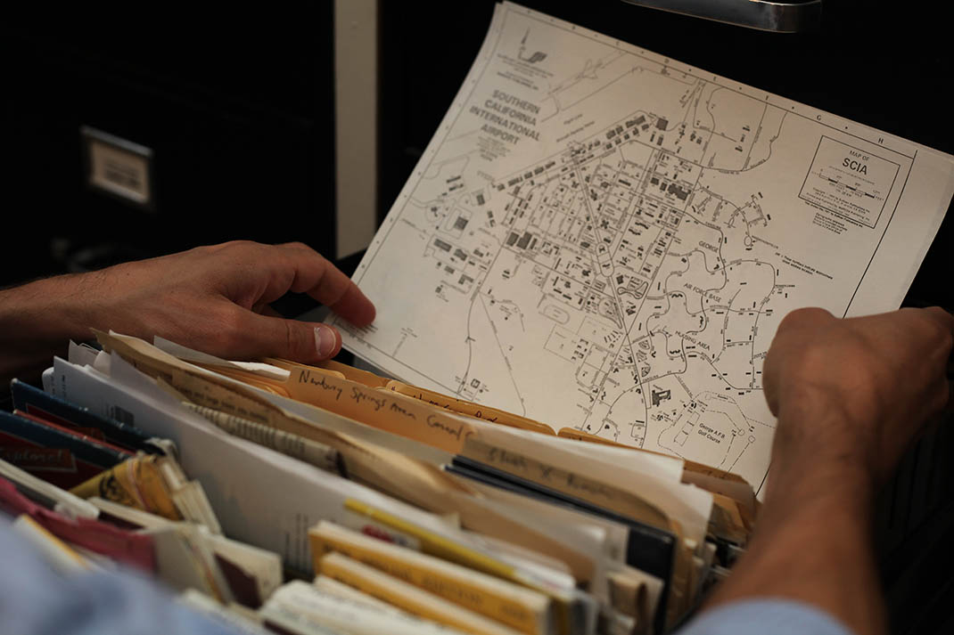
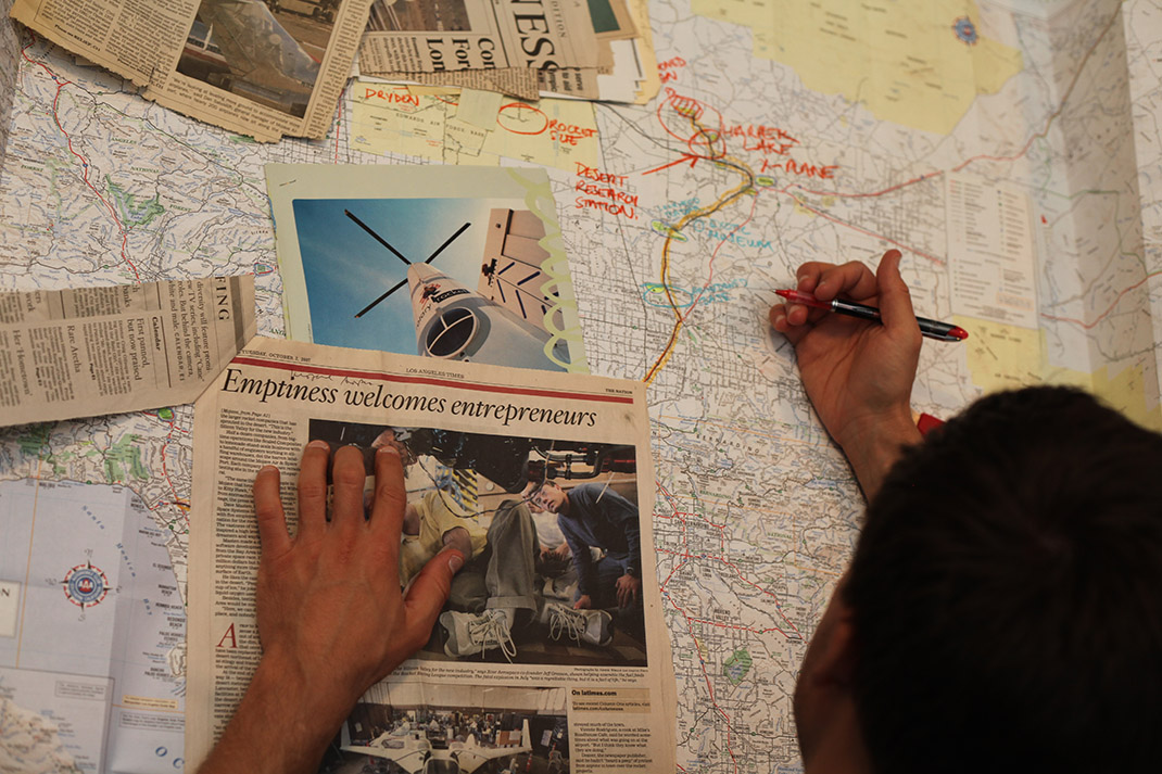
[Images: Going through the archives, maps, and files of the Center for Land Use Interpretation, including one of my favorite headlines of all time: “Emptiness welcomes entrepreneurs”; photos by Mark Smout].

In an essay for the Venice Takeaway book, we describe the inspiration, purpose, and future goals of the—still entirely hypothetical—British Exploratory Land Archive:

BELA is directly inspired by the Los Angeles-based Center for Land Use Interpretation (CLUI). It aims to unite the efforts of several existing bodies—English Heritage, Subterranea Britannica, the Airfields of Britain Conservation Trust and even the Department for Transport, among dozens of others—in a project of national landscape taxonomy that will combine catalogues created by distinct organisations into one omnivorous, searchable archive of human-altered landscapes in Britain… From military bases to abandoned factories, from bonded warehouses to national parks, by way of private gardens, council estates, scientific laboratories and large-scale pieces of urban infrastructure, BELA’s listings are intended to serve as something of an ultimate guide to both familiar and esoteric sites of human land use throughout the United Kingdom.

In the end, a fully functioning BELA would offer architects, designers, historians, academics, enthusiasts, and members of the general public a comprehensive list of UK sites that have been used, built, unbuilt, altered, augmented and otherwise transformed by human beings, aiming to reveal what we might call the spatial footprint of human civilization in the British Isles.

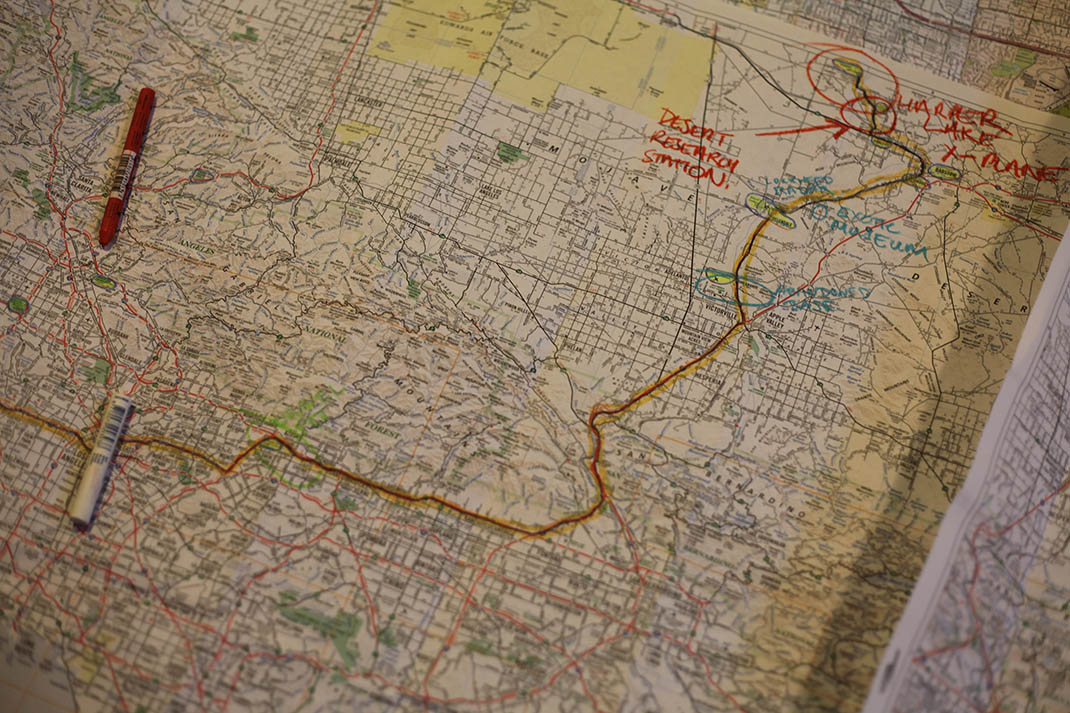
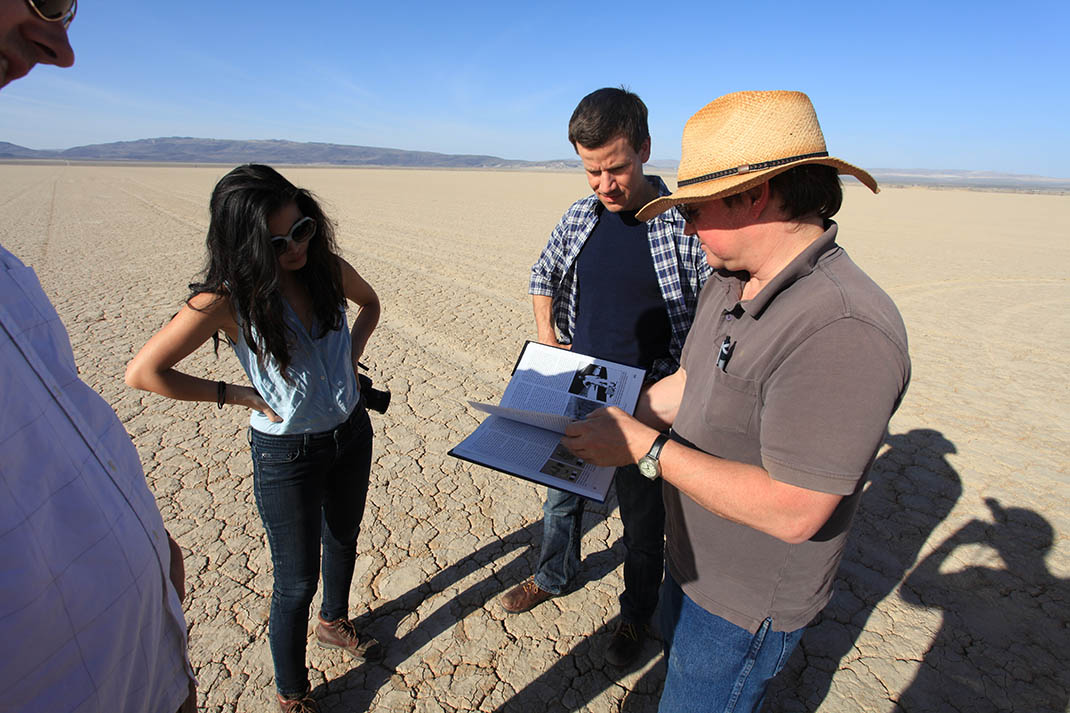
Thanks to the generosity of the Venice Takeaway organizers, with funding from the British Council, Mark Smout and I had the pleasure of traveling to Los Angeles back in April 2012 specifically to meet with Matthew Coolidge, Sarah Simons, Ben Loescher, and Aurora Tang at the Center for Land Use Interpretation. Even better, we were able to take Matt, Ben, and Aurora out on a daylong road-trip through gravel pits, dry lake beds, Cold War radar-testing facilities, airplane crash sites, logistics airfields, rail yards, abandoned military base housing complexes, and much more orbiting the endlessly interesting universe of Greater Los Angeles.
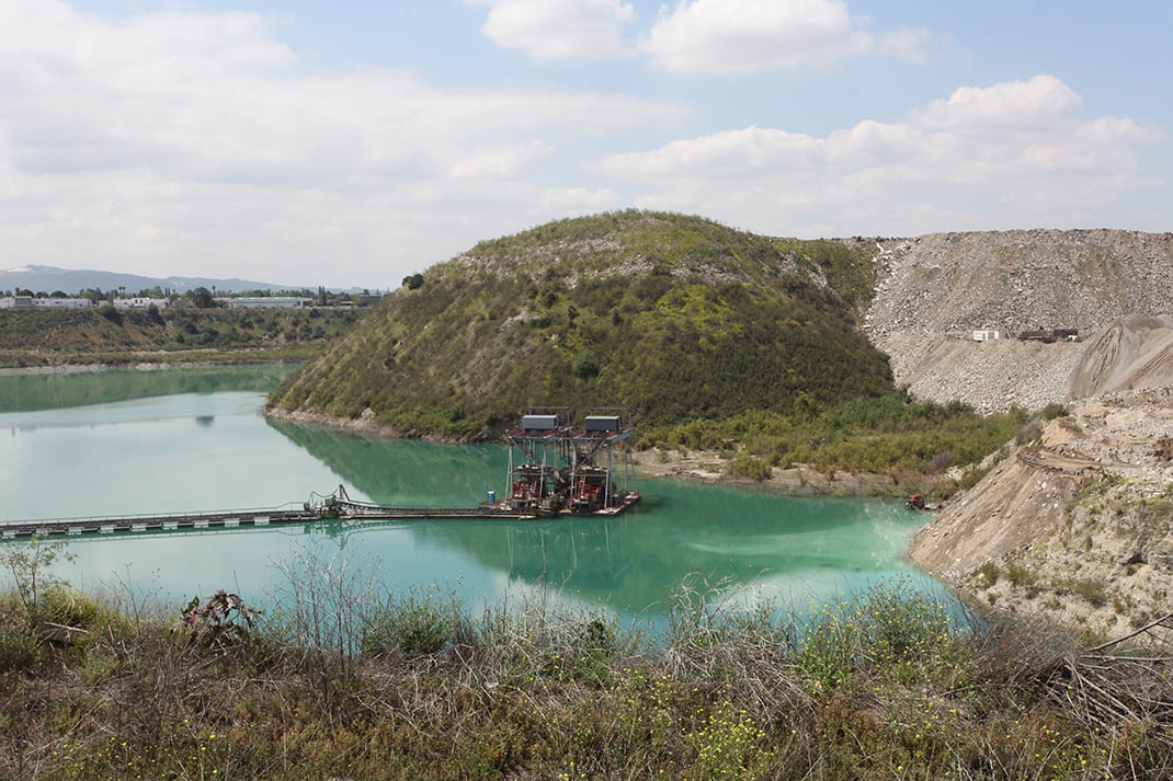
[Images: Exploring Greater Los Angeles with Matthew Coolidge, Ben Loescher, and Aurora Tang; photos by Mark Smout].

That trip was documented in a series of photographs, in a (very) short film, and in the essay mentioned above, all of which will be available for perusal at the UK pavilion for the duration of this year’s Biennale.

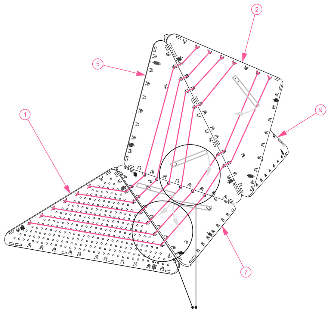
I’ll also include here a few diagrams depicting one the instruments Smout Allen and I devised as part of our land-investigation tools—making BELA a kind of second-cousin to Venue—with the real objects, including a portable explorer’s hut, also on display in Venice.

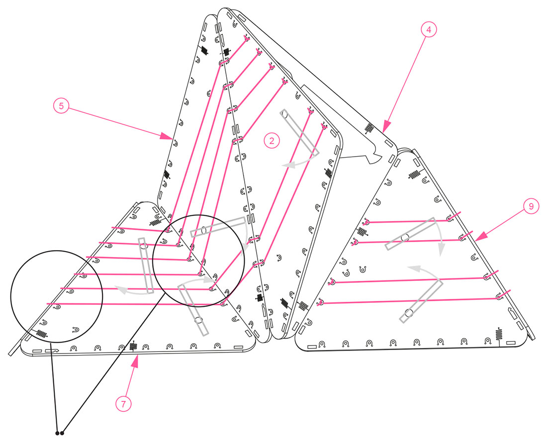
[Images: Assembly diagrams for the BELA “clinometer,” a speculative device “for the measurement of variable slopes on sites such as scrap yards, landfills, slag heaps and other industrial dumping grounds… functioning as an easily readable survey tool and as a unique design object that calls public attention to the process of measuring artificial landscapes”].

Taken together, these are what we call, in the essay, “prototypical future survey instruments and experimental site-identification beacons.” They are “both semi-scientific and speculative, portable and permanently anchored.”

From telescopes to Geiger counters, from contact microphones to weather satellites, the devices and scales with which we measure and describe the landscapes around us determine, to a large extent, what we are able to see. BELA will thus work to pioneer the design, fabrication and expeditionary deployment of new landscape survey tools—instruments and devices both functional and speculative that will aid in the sensory cataloguing and interpretive analysis of specific locations.

While the British Exploratory Land Archive is, for now, merely a proposition, I think Mark, Laura, and I are all equally keen to see something come of that proposition, perhaps someday even launching BELA as a real, functioning resource through which the various human-altered landscapes of Britain can be catalogued and studied.

For now, those of you able to visit Venice, Italy, before the end of the 2012 Biennale can see our instruments, photos, drawings, and texts as they currently exist, and, in the process, learn more about the possibilities for a British Exploratory Land Archive.

(Thanks to Sandra Youkhana for her invaluable help with the project, and to Matthew Coolidge, Sarah Simons, Ben Loescher, and Aurora Tang at the Center for Land Use Interpretation for hosting us back in April).

As if dilating with the secret knowledge of great powers

One of many things you might be missing at the 2012 Venice Biennale of Architecture—which opens this week and runs till November 25th—is a new acoustic installation by Katarzyna Krakowiak inside the Polish Pavilion.

Her piece, called Making the walls quake as if they were dilating with the secret knowledge of great powers is, in the words of Michal Libera, the pavilion’s curator, a controlled “amplification of the Polish Pavilion as a listening-system.”

[Image: A sound-study of the 2012 Polish Pavilion by Andrzej Kłosak for Katarzyna Krakowiak].

In an interesting accompanying essay that foregrounds the acoustic experience of space, Libera goes on to suggest that “we live, work and play in gigantic complexes of sounds—their distribution is what we call architecture.”

Architectural micro-deformations of the building’s walls and floor, the renovation of the ventilation system, and reinforcement of the resonant frequencies serve to bring this latent acoustic experience to the fore. The focus is on the secret but audible knowledge inscribed in the niches, apses, bays and vestibules, full of long-acknowledged deficiencies and forgotten paradoxes. None of the sounds in the Pavilion are alien to the building. They are all always already there.

One of the techniques deployed by Krakowiak, for instance, is to reinforce architecturally the Pavilion’s own resonant frequencies; this leads to “excessive reverberation” that will make “even regular conversation difficult” inside as visitors are enveloped in echoes, everything out-of-synch and returning again in time-delay. Further:

To enhance the experience of being immersed in sound, the floor and one of the walls are tilted at a slight angle. The introduction of a different material (a wooden floor) and the incline itself will also influence sound propagation. With 50 sound sources, the interior of the Polish Pavilion will take the visitor to the heart of an unknown, unfathom- able realm of sound.

Libera describes in detail how Krakowiak partially dismantled the Pavilion itself, performing a kind of acoustic surgery on the various surfaces and materials used inside, analyzing them for their sonic side-effects and picking and choosing which spaces—”the niche, the vestibule and the walls”—to augment, tune, or dampen.

[Image: Another sound-study of the 2012 Polish Pavilion by Andrzej Kłosak for Katarzyna Krakowiak].

While reading about Krakowiak’s work, I was reminded of a short piece by Richard Pinnell in a recent issue of The Wire. There, Pinnell describes the, for him, uncomfortable experience of hearing sound artists Mark and John Bain perform under a railway arch in London, work themed “on the principle of self-destruction.” Mark Bain has been mentioned many times here on BLDGBLOG for his ongoing interest in the possibility of architectural demolition using nothing but bass, and this particular performance seems like one of a piece with those earlier explorations.

Pinnell describes how the “American sibling duo” of the Bain brothers used “seismic sensors to translate the feedback of the actual building itself into heavy, really heavy droning bass tones. The wall of subsonic pressure that hit me as I squeezed alongside others into the arch space threatened to turn my ribcage inside out.” More to the point, he quips that, “If the shock of how physical the sound was caught me off guard, I was even less prepared for the small chunks of crumbling masonry that began to intermittently fall from the bare brick archway above my head as the Victorian building itself struggled against the assault.” We could level whole cities with sound. Building and anti-building with LRAD.

The Bains’ “architectural bass tremors” haunted Pinnell’s sense of equilibrium so much that, he jokes, now, “whenever I enter a room under a railway arch I keep one eye looking over my shoulder,” lest the Bain brothers arrive, acoustic weaponry in hand.

In any case, while Krakowiak’s installation is not premised on the idea of demolition—and thus the connection between these two stories is entirely anecdotal—I am nonetheless struck by the idea of a pavilion, perhaps some future version of the Serpentine, that deliberately interferes with, or manipulates through time-delay, the acoustic events taking place inside it, whether those are human conversations or simply monstrous waves of sub-bass rumbling up from a concert in the basements below.

In fact, you could imagine some strange new art form, a kind of acoustic variation on Noh theater, that takes place only inside buildings tuned to echo at precise intervals, with whole new forms of dialogue—an entire literary genre—written with actors playing the roles of multiple characters, speaking lines perfectly timed for an endless return of disorienting synchronizations, ten, even fifteen, minutes later still listening for the delayed lines of an earlier phase of self-conversation.

Or, for that matter, a mis-built suburban house somewhere lost in echoes, driving its owner insane, as everything said inside is destructively echoed and reverbed to the point of utter incomprehension, for whole days at a time. A tragi-comedy starring Tom Hanks, muttering to himself in a roaring airplane engine of noise—things he said yesterday!—sitting at the dinner table, starring at a salt shaker, unable to talk to his date.

Striper

Speaking of the accidental artistry of colorful street markings, artist Simon Rouby became fascinated by the ongoing painting and repainting of traffic lines on the freeways and streets of Los Angeles, like some vast and unacknowledged readymade art project.

[Images: Photos by Simon Rouby for “Yellow Line“].

Could this huge urban painting apparatus be temporarily repurposed, Rouby wondered—leading him to contact Caltrans directly and embark upon a project with the rather straightforward name of “Yellow Line.”

That project, Rouby explains, introduced him “to the California Transportation ‘Striping Crew.’ I followed them while they poured miles of yellow paint onto the concrete of Los Angeles. With them I got to know the biggest and most congested network of freeways in the United States, and built my understanding of Los Angeles, a gigantic city where people meet everyday, but at 60 miles per hour on the freeways. Millions of cars per day, from which 75% drive alone, despite traffic and smog.”

“We also did canvases,” Rouby adds, “painted directly with their trucks.”

[Image: From “Yellow Line” by Simon Rouby].

Nonetheless, it’s not those canvases but the project’s most basic conceptual move—putting the Caltrans striping crews into the same context as, say, Jackson Pollack or Marcel Duchamp—that interests me the most here, implying new possibilities for interpretation, even whole new futures for art history and landscape criticism, with this recognition of avant-garde projects going on disguised as the everyday environment.

[Image: From “Yellow Line” by Simon Rouby].

Pushing this further, the transportation system itself becomes an earthworks project that dwarfs the—by contrast—embarrassingly unambitious Michael Heizer or Robert Smithson, revealing Caltrans, not Field Operations or any other white-collar design firm, as one of the most high-stakes landscape practitioners—a parallel civilization of mound builders hidden in plain sight—at work in the world today.

In any case, Simon Rouby’s “Yellow Line” is on display at the Caltrans District 7 Building—100 South Main Street, Los Angeles—until 28 September 2012.

Dot Urbanism

[Image: From Nick Foster’s “Hidden Signals” project].

Intrigued by the colorful dots he found spray-painted on the streets of San Francisco, always near drains, Nick Foster began photographing them.

[Images: From Nick Foster’s “Hidden Signals” project].

He soon learned that these marks are not some emerging genre of street art—at least not intentionally—but are, in fact, quasi-Pynchonian signals left behind by the San Francisco Mosquito Abatement Courier Team, or SFMAC.

Formed in 2005 following the rapid increase of West Nile Virus in California, this band of pest controllers cycles around San Francisco dispatching sachets of Vectolex into the drains to kill the little biters before they breed. After each drain is treated, the courier sprays a little dot of paint to mark it as completed—this season’s color is blue.

Like full-spectrum hieroglyphs, these spray-painted dots are “infrastructural forensic evidence,” in Foster’s words, marking the ritualistic elimination of insects from urban space.

Maze Machine Garden

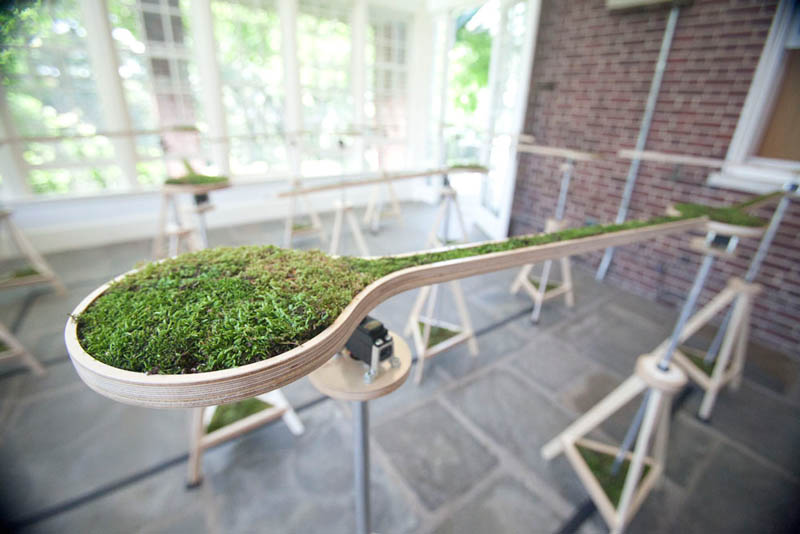
[Image: From “Landscape Abbreviated” by Nova Jiang].

Landscape Abbreviated” by Chinese-born, New York-based artist Nova Jiang is “a garden that is simultaneously a machine.” It is an algorithmically controlled “kinetic maze”—a different kind of switching labyrinth—”that periodically generates new pathways for the viewers to follow.”

The resulting landscape, Jiang explains, is controlled by “a software program that continuously generates new maze patterns based on mathematical rules; they rotate to form shifting pathways that encourage visitors to change direction and viewpoints as they move through the space.” In a sense, they are landscape turnstiles, blocking or enabling pedestrian movement.

[Image: From “Landscape Abbreviated” by Nova Jiang].

Individual rotating “modules” in the animated landscape have been “planted with moss gathered from backyards, sidewalks and subway grates around New York,” we read, and, although the project is, for now, confined to a gallery space, the artist hopes to produce a larger, more robust outdoor version, perhaps even at the urban scale, imagining it “taking over a town square somewhere, where the inhabitants wake up each morning to find a new pathway for them to explore.”

[Images: From “Landscape Abbreviated” by Nova Jiang].

The photos shown here give only a relative sense for the landscape’s machinations in small-scale, but a short video is also available on Jiang’s website.

Roundhouse Foundations

[Image: Aerial photo of the roundhouses site, courtesy of Network Rail].

Another short piece from Archaeology this month highlights the discovery, earlier this year, of the remains of railway “roundhouses” outside York, England. Sadly, they’ll soon be covered over by new construction: “Archaeologists are working to record and preserve the site, which is still called by its nineteenth-century name, ‘The Engineers’ Triangle,’ before the new buildings are erected on top of the roundhouses.”

It would be a fascinating design challenge to incorporate the oddly shaped foundations into the plans or local street pattern of any future construction, even—or perhaps especially—if the resulting building is not itself circular. Inside, strangely nested curved rooms, ramps, and corridors corkscrew down to the basement, where, embedded in the ground like a mandala, are the unexplained stained bricks of an earlier industrial era, still influencing the movements of people above.

New York City Sand Pit

The previous post reminded me of a site I’ve meant to post about literally for years now, ever since first reading about it in Michael Welland’s book Sand.

[Images: Sand mines, via Michael Welland’s excellent blog Through the Sandglass].

Toward the end of his book, Welland points out the role sand plays in the making of concrete—and, of course, the role concrete plays in the making of a city like New York. But where, he asks, did all the sand that made the concrete that made Manhattan actually come from?

“In 1865,” we read, “mining began on the northern shore of Long Island to collect sand washed out from retreating ice age glaciers.”

Immigrant workers from Europe, many from Sardinia, first hauled sand with wheelbarrows; the excavations grew with mechanization, and eventually the cliffs and the landscape were leveled. Port Washington was the center of the business, as endless convoys of barges carried the sand to Manhattan. The last sandpit closed in the 1990s, by which time more than 200 million tons of sand had been excavated to build the city—bridges, highways, the Empire State Building, the Chrysler Building, and the World Trade Center.

As the New York Times reported back in 2008, a “monument honoring the sand mining industry” has since been erected in Port Washington, from whence more than 140 million tons of sand were excavated. There is still one open tunnel there, as well as “the remains of a conveyor,” in the landscape—which has since been turned into a golf course. Historic photos of the site in its sand-mining heyday are pretty incredible.

A helpful website exists, meanwhile, courtesy of the Port Washington Public Library, offering a wide swath of resources about “the geography and geology of the sandmines; the machines used by the sandminers; occupational culture and folklife; immigration history; recreational activities in the sandbanks; sand company enterprises; and the accidents and disasters that befell the sandminers and scow captains who transported raw materials to New York City and beyond.” Anyone with an interest in landscapes of dredge would do well to take a read through the site’s many transcripts and oral histories with former sand miners.

(Earlier on BLDGBLOG: New York Quarry].

War Sand

[Image: Geologist Earle McBride’s microscopic images of war sand on the beaches of Normandy].

A short piece in the September/October 2012 issue of Archaeology magazine highlights the presence of spherical magnetic shards—remnants of the D-Day operations of World War II—found hidden amongst natural sand grains on the beaches of Normandy. “Up to 4 percent of the sand is made up of this shrapnel,” the article states; however, “waves, storms, and rust will probably wipe this microscopic archaeology from the coast in another hundred years.”

This is not a new discovery, of course. In Michael Welland’s book Sand, often cited here on BLDGBLOG, we read that, “on Normandy beaches where D-Day landings took place, you will find sand-sized fragments of steel”—an artificial landscape of eroded machines still detectable, albeit with specialty instruments, in the coastal dunes.

I’m reminded of a line from The Earth After Us: What Legacy Will Humans Leave in the Rocks?, a speculative look by geologist Jan Zalasiewicz at the remains of human civilization 100 million years from now. There, we read that “skyscrapers and semi-detached houses alike, roads and railway lines, will be reduced to sand and pebbles, and strewn as glistening and barely recognizable relics along the shoreline of the future.”

The oddly shaped magnetic remains of World War II are thus a good indication of how our cities might appear after humans have long departed.