Bering Bridge

If you could design a bridge across the Bering Strait, connecting the U.S. to Russia, what would it look like? Come up with something good and you could win as much as $80,000 ($20,000, if you’re a student).
From the competition website:

This project is a dream project attempting to connect two continents. In a wide sense, it includes building a tunnel or a bridge at both ends of the strait, extending [the] existing railways of the United States and Russia, and laying a world highway around the coasts of the world, which require a massive amount of construction.

Your only two requirements are to design “a peace park with a bridging structure using the two islands, Big Diomede and Little Diomede at the Bering Strait,” and a “proposal of how to connect two continents.”
Of course, Russian engineers have already been considering digging a tunnel between the two continents, and the Discovery Channel has chimed in about how a bridge might actually be built across that “iceberg-swirled ocean near the Arctic Circle.”
But neither of those plans came with a total of $200,000 in prize money…
There’s a confusing clock ticking away on the competition website, but you appear to have until March 24, 2009, to register.

Of networks, grids, and infrastructures, or: How to make a planet

If I have several blogging resolutions for 2009 – and I do – one of them is definitely to read InfraNet Lab more often.

[Image: Offshore energy islands, via InfraNet Lab].

Easily one of the most interesting architecture blogs out there today – though it’s really an infrastructure blog, hopefully heralding a new focus for design writers in the next few years – and written by Toronto-based architects Mason White and Lola Sheppard, along with two contributors named Maya and Neeraj, it tracks massive infrastructure, waste, energy, and design projects across the global landscape, taking in geology, engineering, network economics, ecology, construction innovation, future fuels, and much more.

Read it and you’ll know how to “harvest energy from the earth’s rotation” using mega-gyroscopes, you’ll discover how a more efficient offshore seaweed industry might work, you’ll pick up clues for how to design a mountain and then how to connect that mountain to others using aerial tramways, you’ll get an architectural glimpse of habitat meshing, you’ll take an hallucinatory tour through Taiwanese mushroom farms, you’ll visit underground waste isolation sites in New Mexico, you’ll turn around and go the opposite vertical direction – into the sky – to farm water from the atmosphere, and you’ll even punt around the artificial inland waterways of Britain using strange mechanized structures and seeing that archipelago as hydrology first, geography later.

So go check it out – and make 2009 the year of networks, grids, and infrastructures.

The Six Nations of 2010

[Image: Professor Igor Panarin’s six-fold vision of a disintegrated United States; I love how it will precisely follow today’s existing state lines – and that Kentucky will join the European Union].

In what sounds to be very obviously an act of wishful projection, a former KGB intelligence analyst turned public intellectual named Igor Panarin has explained to the Wall Street Journal that the United States only has about 18 months left to live. In the summer of 2010, it will “disintegrate” into six politically separate realms – and, conveniently for a thinker who clearly leans to the right, the borders of these realms will coincide with a new racial segregation.

Best of all, from Panarin’s perspective, Alaska – Sarah Palin included, looking out with alarm from her office window – will “revert” to Russian control.

Quoting at length:

[Prof. Panarin] predicts that economic, financial and demographic trends will provoke a political and social crisis in the U.S. When the going gets tough, he says, wealthier states will withhold funds from the federal government and effectively secede from the union. Social unrest up to and including a civil war will follow. The U.S. will then split along ethnic lines, and foreign powers will move in.

California will form the nucleus of what he calls “The Californian Republic,” and will be part of China or under Chinese influence. Texas will be the heart of “The Texas Republic,” a cluster of states that will go to Mexico or fall under Mexican influence. Washington, D.C., and New York will be part of an “Atlantic America” that may join the European Union. Canada will grab a group of Northern states Prof. Panarin calls “The Central North American Republic.” Hawaii, he suggests, will be a protectorate of Japan or China, and Alaska will be subsumed into Russia.

“People like him have forecast similar cataclysms before, he says, and been right,” the Wall Street Journal continues. Panarin then “cites French political scientist Emmanuel Todd. Mr. Todd is famous for having rightly forecast the demise of the Soviet Union – 15 years beforehand. ‘When he forecast the collapse of the Soviet Union in 1976, people laughed at him,’ says Prof. Panarin.”

In some ways, I’m reminded of Paul Auster’s newest novel, Man in the Dark, in which a civil war has set multiple regions of the United States against one another and against the so-called Federal Army. Or, for that matter, there’s also Rupert Thomson’s Divided Kingdom in which the UK has been split up along emotional lines.

But surely an ex-CIA operative, now milking the lecture circuit for all its worth, could also propose a realistic scenario in which the entire Russian east has been sold off, say, to a combination of Euro-American agribusiness firms and the Chinese government, who them embark upon an elaborate, generations-long act of industrial deforestation? Leaving Moscow a kind of irrelevant, feudal city full of Bulgari and handguns, its governmentally terrorized tower blocks populated almost entirely by unemployed and half-drunk retro-Stalinists?

I don’t mean to imply that I think the end of the United States is somehow politically unimaginable, but that, in a still-bipolar, post-Cold War international imagination, surely either side could convincingly outline the other’s demise?

(Earlier on BLDGBLOG: North America vs. the A-241/BIS Device and The Lonely Planet Guide to Micronations: An Interview with Simon Sellars).

Zones of Exclusion

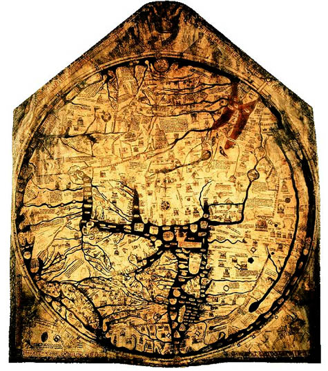
[Image: The charismatic boundaries of an earlier worldview – here, the Hereford Mappa Mundi].

Note: This is a guest post by Nicola Twilley.

Another question for the topic of whether or not a “dense assortment of buildings” can ever be a real city: What is London for an eighteen-year old whose entire urban experience is confined to 200-square meters and who has never seen the Thames?

Researchers at the University of Glasgow, sponsored by the Joseph Rowntree Foundation, have spent the past two years asking young residents of Bradford, Peterborough, London, Glasgow, Sunderland, and Bristol to draw maps of their own individual urban experience in order to explore micro-territoriality as both a cause and a symptom of social exclusion. You can read the full PDF of their report here.

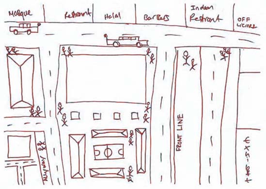
“In Glasgow, Sunderland and Bradford,” they found, “a recognizable territory might be as small as a 200-meter block or segment.” In Tower Hamlets, London, fifteen and sixteen-year old boys mapped their world into three streets, a football pitch, a barber shop, mosque, Indian restaurant, and – just beyond the clearly marked “Front Line” – an off-license, or liquor store.

[Image: From the Joseph Rowntree Foundation report, “Young people and territoriality in British cities” (download the PDF)].

Some of the sketches even remind me of medieval maps: the known world is an island of familiarity, simultaneously shown much larger than scale but made tiny and precious by the monsters of “Terra Incognita” that surround it. In the case of a 15-year-old girl from Bradford, today’s dragons are “moshers,” “chavs,” “Asians,” and “posh people” – all “Enemys.” The researchers found that teenage boys display an even more complete ignorance of the world beyond their perceived boundaries: these two maps of the same area in Glasgow were drawn by young men in the same class at the same school, who live on different sides of the same road.

[Images: From the Joseph Rowntree Foundation report, “Young people and territoriality in British cities” (download the PDF)].

The report’s authors examined the causes, nature, and impact of micro-territorialization. Their research uncovered Bristol’s “postcode wars,” where gangs spray-paint their postcode in rival areas as a form of aggression, as well as descriptions of the maneuvers involved in going to school in one part of Bradford that match the Schlieffen Plan in strategic complexity. “In some places,” they note with reference to Glasgow and Sunderland, “territoriality was a leisure activity, a form of ‘recreational violence.’” In other words, bored and economically deprived teenagers are transforming 1960s council estates and Victorian terraces into a real-world, multiplayer World of Warcraft.

Of course, excessive loyalty to the local, and the resulting lack of mobility, has a significant and negative impact on access to education, services, and job opportunities. In the words of one interviewee from Glasgow:

If your horizons are limited to three streets, what is the point of you working really hard at school? What is the point of passing subjects that will allow you to go to college or university if you cannot travel beyond these streets? What’s the point of dreaming about being an artist, a doctor, etc., if you cannot get on a bus to get out of the area in which you live?

The report points out an interesting irony here: current policies in urban regeneration are dominated by strategies to increase “place attachment” as a means “to reinforce social networks and maintain the quality of an area through pride.” However, the areas that actually generate such loyalties are, in the authors’ words “often ones that have little that conventionally invokes pride.”

It was difficult to say which was more depressing – the relentless defense of a featureless piece of open space on the fringes of a Glasgow housing scheme where there is nothing whatsoever by way of amenities, or the confinement to a socially isolated but densely populated and built-up quarter-square-mile of London of young men for whom the culture and wealth of one of the world’s great cities might as well be on another continent.

The report goes on to identify 244 anti-territorial projects (ATPs) currently in progress across the UK. Most use sports or other “hook” activities to encourage association and to teach networking skills. Disappointingly, none tackle the issue in terms of the design of physical space.

So what does the anti-territorial city look like? Some things to consider: unsurprisingly, the report found that most conflicts “occurred on boundaries between residential areas, which were typically defined by roads, railways, vacant land or other physical features.” The city center also becomes a venue for bigger showdowns: a youth worker in Peterborough explains that “the flashpoints are in the city center, the ‘big stage,’ the one place they all, you know, congregate on a Saturday.” Finally, the researchers found that micro-territorialization took place across the spectrum of low-income housing stock, from “high-density, flatted, inner-city estates; traditional, pre-1914 areas of terraced housing; and suburban, often council-built environments.”

As the authors rightly point out, lack of jobs and economic hardship are key structural forces contributing to “problematic territoriality.” But what role does urban planning, landscape design and the built environment have to play?

Can the design of the city itself generate – or mitigate against – territoriality?

(Note: Read the Guardian‘s take on the Joseph Rowntree Foundation report here and here).

Baarle-Hertog

In response to the previous post, a reader kindly pointed me to the fascinating town of Baarle-Hertog, Belgium.
Baarle-Hertog borders the Netherlands – but, because of its unique history of political division, the town is sort of marbled with competing national loyalties. In other words, pockets of the town are Dutch; most of the town is Belgian. You can thus wander from country to country on an afternoon stroll, as if island-hopping between sovereignties.
Check out the town map.

[Image: The strange, island-like spaces of micro-sovereignty within the town of Baarle-Hertog; a few more maps can be seen here, and you can read more in this two-page article].

Being in a bit of a rush at the moment, I’ll simply have to quote Wikipedia:

Baarle-Hertog is noted for its complicated borders with Baarle-Nassau in the Netherlands. In total it consists of 24 separate pieces of land. Apart from the main piece (called Zondereigen) located north of the Belgian town of Merksplas, there are twenty Belgian exclaves in the Netherlands and three other pieces on the Dutch-Belgian border. There are also seven Dutch exclaves within the Belgian exclaves. Six of them are located in the largest one and a seventh in the second-largest one. An eighth Dutch exclave lies in Zondereigen.

The border is so complicated that there are some houses that are divided between the two countries. There was a time when according to Dutch laws restaurants had to close earlier. For some restaurants on the border it meant that the clients simply had to change their tables to the Belgian side.

Sarah Laitner, at the Financial Times, adds that “women are able to choose the nationality of their child depending on the location of the room in which they give birth.”
Another website, apparently drawing from the Michelin Guide to the Netherlands, explains the origins of Baarle-Hertog’s bizarre geography: it can all be traced back to the 12th century, it seems, when the town was first divided. The northern half of the town became part of the Barony of Breda (later home to the Nassau family), and the southern half went to the Duke of Brabant (Hertog means Duke in Dutch).
But that same website also mentions this:

The municipality limits are very complicated. Nowadays, each municipality has its city hall, church, police, school and post office. The houses of the two nationalities are totally mixed. They are identified by the shield bearing their number: the national flag is included on it.

I hate to refer to Thomas Pynchon twice, in back-to-back blog posts, but there something’s remarkably Pynchon-esque about this final detail.
In any case, also check out this site for more historical information.
While we’re on the subject of micro-sovereignties, though, be sure to check out Neutral Moresnet, a tiny, politically independent non-state formed around a zinc mining operation in eastern Belgium. There’s also Cospaia, “a small former republic in Italy” which “unexpectedly gained independence in 1440” after Pope Eugene IV sold the land it stood on. “By error,” we read, “a small strip of land went unmentioned in the sale treaty, and its inhabitants promptly declared themselves independent.”
The Free State Bottleneck, Åland Islands, and the Sovereign Military Order of Malta are all also worth checking out.
Finally, of course, I’d be remiss if I didn’t point out BLDGBLOG’s earlier interview with Simon Sellars, co-author of The Lonely Planet Guide to Micronations.

(With huge thanks to Scott Gosnell, Christopher, Claus Moser, and Blinde Schildpad for the tips!)

Drains of Canada: An Interview with Michael Cook

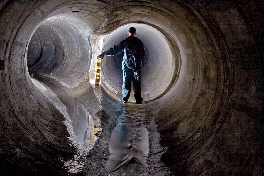
[Image: The Toronto Power Company Tailrace at Niagara; this and all other photos in this post by Michael Cook].

Michael Cook is a writer, photographer, and urban explorer based in Toronto, where he also runs a website called Vanishing Point.
Despite its subject matter, however, Vanishing Point is more than just another website about urban exploration. Cook’s accounts of his journeys into the subterranean civic infrastructure of Canada and northern New York State – and into those regions’ warehouses, factories, and crumbling hospitals – often include plans, elevations, and the odd historical photograph showing the sites under construction.
For instance, his fascinating, inside-out look at the Ontario Generating Station comes with far more than just cool pictures of an abandoned hydroelectric complex behind the water at Niagara Falls, and the detailed narratives he’s produced about the drains of Hamilton and Toronto are well worth reading in full.
As the present interview makes clear, Cook’s interests extend beyond the field of urban exploration to include the ecological consequences of city drainage systems, the literal nature of public space, and the implications of industrial decay for future archaeology – among many other things we barely had time to discuss.
Or, perhaps more accurately phrased, Cook shows that urban exploration has always been about more than just taking pictures of monumentally abstract architectural spaces embedded somewhere in the darkness.

[Image: The Memorial Park Storage Chambers in Toronto’s Belt Line Drain; this is architecture as dreamed of by Adolf Loos: shaved of all ornament, exquisitely smooth, functional – while architecture schools were busy teaching Mies van der Rohe, civil engineers were perfecting the Modern movement beneath their feet].

As he writes on Vanishing Point:

The built environment of the city has always been incomplete, by omission and necessity, and will remain so. Despite the visions of futurists, the work of our planners and cement-layers thankfully remains a fractured and discontinuous whole, an urban field riven with internal margins, pockmarked by decay, underlaid with secret waterways. Stepping outside our prearranged traffic patterns and established destinations, we find a city laced with liminality, with borderlands cutting across its heart and reaching into its sky. We find a thousand vanishing points, each unique, each alive, each pregnant with riches and wonders and time.

This is a website about exploring some of those spaces, about immersing oneself in stormwater sewers and utility tunnels and abandoned industry, about tapping into the worlds that are embedded in our urban environment yet are decidedly removed from the collective experience of civilized life. This is a website about spaces that exist at the boundaries of modern control, as concessions to the landscape, as the debris left by economic transition, as evidence of the transient nature of our place upon this earth.

In the following conversation with BLDGBLOG, Cook discusses how and where these drains are found; what they sound like; the injuries and infections associated with such explorations; myths of secret systems in other cities; and even a few brief tips for getting inside these hyper-functionalist examples of urban infrastructure. We talk about ecology, hydrology, and industrial archaeology; and we come back more than once to the actual architecture of these spaces.
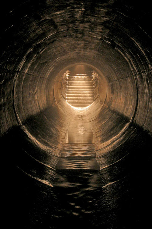
[Image: “Stairs” by Michael Cook, from the Westview Greenbelt Drain].

• • •

BLDGBLOG: Is there any place in particular that you’re exploring right now?

Michael Cook: I am trying to piece together entrance to a drain here in Toronto. It’s part of a larger system. As part of their efforts to improve Toronto’s water quality on the lake front, the city built this big storage tunnel called the Western Beaches Storage Tunnel. It intercepts and stores overflow from a number of combined sewers, as well as from several storm sewers along the western lake front. I guess this was finished in 2001, but they had various technical issues, with the mechanics of it, so it was only operational this past summer.

But there are three storm sewers, I guess, that are part of this system. One of them is on my site already – Pilgrimage – and then there’s a second one that’s large and possibly worth getting into. It’s just not something I’ve investigated thoroughly, so… I’ll probably go down and look for that.

[Images: (top) “Transition to CMP,” from Toronto’s Old Ironsides drain; (middle) “Junction with small sidepipe (falling in on the right)” inside Toronto’s Graphic Equalizer drain; (bottom) “Backwards junction” in Toronto’s Sisters of Mercy drain].

BLDGBLOG: How do you know that the system fits together – that all these storm sewers actually connect up with one another? Are there maps?

Michael Cook: In this case, I have an outfall list that was prepared in the late 80s for portions of Toronto – so I know, from this list, what the size of this storm sewer was at its outfall, before it was intercepted by the new system.

There was also a fair bit of media coverage when the system was being built, because it was a huge expenditure on the part of the city. So we know which combined sewers are part of the system, and I do know where a particular storm sewer is when they intersect – I just don’t necessarily know which residential streets it runs under.

Basically, I have a starting point – and the way I’m going to do this is just go down there on foot and walk around the various residential streets, starting at the lake and moving north. I’ll see if I can find any viable manhole entrances – which involves being by the side of the road or in the sidewalk, where it will be possible to enter and exit safely.

[Image: “Emerging in Wilson Heights,” out of Toronto’s Depths of Salvation drain].

BLDGBLOG: What do you actually bring with you? Do you have some kind of underground exploration kit? Full of Band-Aids and Advil?

Michael Cook: I have a pair of boots or waders, depending on the circumstances. I’ll also bring one or more headlamps, and a spotlamp, and various other lighting gear – plus a camera and a tripod. That basically sums it up.

I also have a manhole key – that’s basically just a loop of aircraft cable tied onto a bolt at one end and run through a piece of aluminum pipe that serves as a crude handle. Most of the manhole lids around here have between two and twenty square holes in them about an inch wide, and they’re reasonably light. Assuming the lid hasn’t been welded or bolted into the collar of the manhole, it’s relatively quick and painless to use this tool to pull the lid out. It’s only useful for light-weight lids, though. In Montreal, for instance, most of the covers are awkward, heavy affairs that sometimes need two people, each with their own crowbar, to dislodge safely. Real utilities workers use pickaxes – but those aren’t so easily carried in the pocket of a backpack.
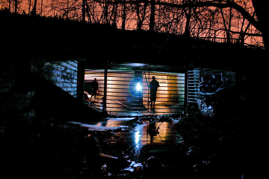
[Image: The outfall of Toronto’s Old Ironsides drain].

BLDGBLOG: Do you ever run into other people down there?

Michael Cook: That’s never happened to me, actually. It’s just not that popular a pursuit, outside of certain hotspots.

People can accept going into an abandoned building: you might run into someone you don’t want to run into there, or you might find that part of the building’s unstable – but it’s still just a building.

Even people I know who self-identify as urban explorers aren’t at all that interested in undergrounding – especially not in storm drains. A lot of them just don’t see the actual interest. It’s not a detail-rich environment. You can walk six kilometers underground through nearly featureless pipe – and there’s not something to see and photograph every five feet.
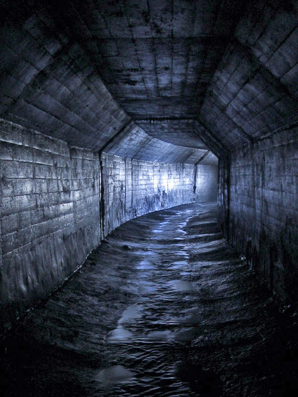
[Image: An “A-shaped conduit” in Toronto’s Belt Line Drain].

BLDGBLOG: Yet a lot – possibly most – of these drains are already named. Who names them, and how do the names get passed around and agreed on by everyone else?

Michael Cook: With people who drain, one of the first things you pick up is a respect for existing names – and the first person to explore a drain has naming rights over it. People generally respect that. Sometimes we’ll make exceptions – I know I’ve made exceptions a few times – but, ultimately, we depend on other people respecting our names.

It’s at once a completely pointless exercise; but, at the same time, it’s fairly meaningful in terms of having a way of discussing this with other people.

So that’s how it comes up. You then use that name, both offline and online. In Australia, they have a kind of master location list, that they keep within Cave Clan, but here we don’t have that level of organization, or that size of a community. It’s just a matter of publishing stuff on our websites.

That said, sometimes we’ll adopt the official name. This usually happens when we’ve been using that name for awhile before we find a way to actually get inside the system, and this usually comes about with something really big or historically significant. We’ll never rename the Western Beaches Storage Tunnel, for instance, though we call it the “Webster,” colloquially. When I find a way into Toronto’s storied Garrison Creek Sewer, the buried remains of our fabled “lost” creek, it won’t be the subject of renaming either. Those are the exceptions though; most of the time naming is one of the things we do to capture and communicate something of the magic of wading for three hours through a watery, feature-poor concrete tunnel underground.

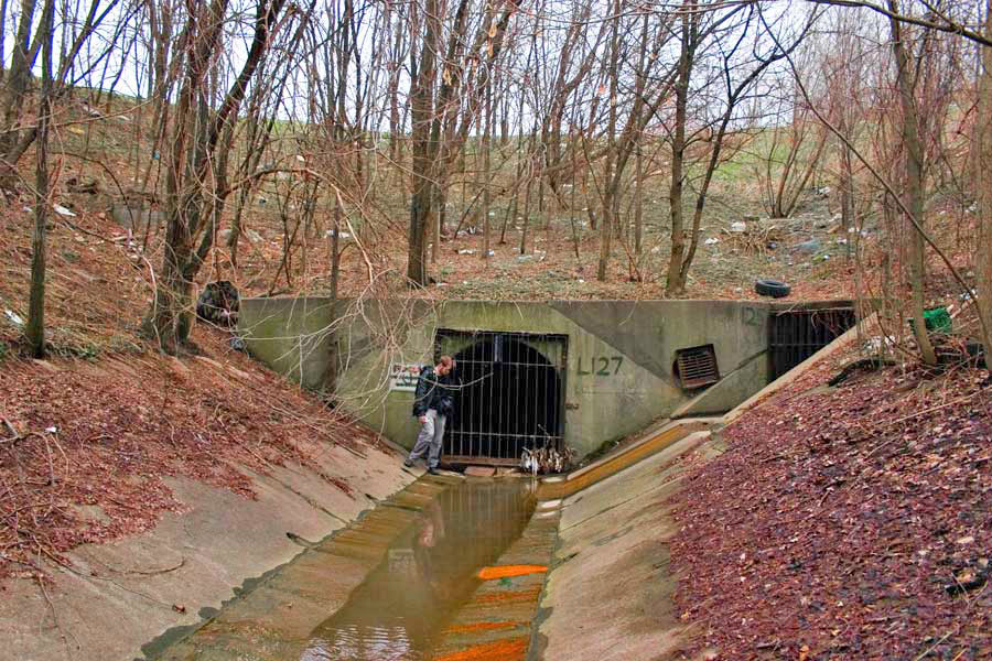
[Image: (top) “Outfall structure in the West Don Valley,” part of Toronto’s Depths of Salvation drain; (bottom) The outfall of Toronto’s Graphic Equalizer drain].

BLDGBLOG: A lot of these places look like surreal, concrete versions of all the streams and rivers that used to flow through the city. The drains are like a manmade replacement, or prosthetic landscape, that’s been installed inside the old one. Does the relationship between these tunnels and the natural waterways that they’ve replaced interest you at all?

Michael Cook: Oh, definitely – ever since I got into this through exploring creeks.

At their root, most drains are just an abstract version of the watershed that existed before the city. It’s sort of this alternate dimension that you pass into, when you step from the aboveground creek, through the inlet, into the drain – especially once you walk out of the reach of daylight.

Even sanitary sewers often follow the paths of existing or former watersheds, because the grade of the land is already ideal for water flow – fast enough, but not so fast that it erodes the pipe prematurely – and because the floodplains are often unsuitable for other uses.
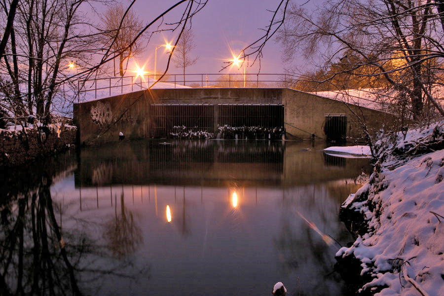
[Image: “Outfall in winter” at Toronto’s Gargantua drain].

BLDGBLOG: How does that affect your attitude toward this, though? Do you find yourself wishing that all these drains could be dismantled, letting the natural landscape return – or, because these sites are so interesting to explore, do you actually wish that there were more of them?

Michael Cook: It’s an awful toll that we’ve taken on the landscape – I’m not one to celebrate all this concrete. If it were conceivable to set it all right, I’d be the first one in line to support that. And the marginal progress being made in terms of environmental engineering – building storm water management alternatives to burial and to large, expensive pipes – is a great step forward; unfortunately, its success so far has been limited.

Ultimately, you just can’t change the fact that we’ve urbanized, and we continue to do so. That comes with a cost that can be managed – but it can’t be eliminated completely.

[Image: Looking out of a spillway at the Ontario Generating Station].

BLDGBLOG: So do you actually have an environmental goal with these photographs? Your explorations are really a form of environmental advocacy?

Michael Cook: Well, I want to find something that goes a bit further than just presenting these photos for their aesthetic value – but, at the same time, turning this into some sort of environmental advocacy platform doesn’t really come to mind, either.

I’m very interested in urban ecology and in the environmental politics that take place in the city – and I’ve done some academic work in that regard – but I’m not really prepared to distill the photography and these adventures into an activist exercise.
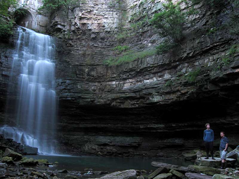
[Image: The “spectacular, formerly natural waterfall that the [Chedoke Falls Drain] now feeds,” in Hamilton, Ontario].

BLDGBLOG: I’m curious if you’ve ever been injured, or even gotten sick, down there. All that old, stagnant air – and the dust, and the germs – can’t be very good for you!

Michael Cook: I can’t say that I’ve ever gotten sick from it. Sometimes, the day after, you can feel almost hung-over – but I don’t know what that is. It could be dust, or it could be from the amount of moisture you breathe in. But it passes. It may even be an allergy I have.

I haven’t really done any exploration of sanitary sewers – that would be a different story. In Minneapolis/St. Paul they actually have a name for the sickness they sometimes come down with after a particularly intense sewer exploration: Rinker’s Revenge. It’s named after the engineer who designed the systems there. And a colleague caught a bout of giardia recently, which he believes he acquired exploring a section of combined sewer in Montreal.

So, obviously, there are disease risks in doing this, though they’re not as extensive as one might want to imagine.

The only serious situation I’ve ever been in, with a high potential for injury – and I was pretty lucky – was while exploring in Niagara. The surge spillways for the Ontario Generating Station used to carry overflow water from the surge tanks, and those were fed by the intake pipes. So the water would overflow from the intake pipes into the surge tanks, and then drain out through these helical spillways that spiral downwards to the bottom of the gorge. They then outfall in front of the plant into the river.

So we made an attempt to ascend both of these spillways, and we were successful in the first one; but the second one, we found, was more difficult toward the latter stages of the climb. We had to turn back just before reaching the surge tanks. On the way back down I lost my footing – I lost all grip on the surface, it was so steep and so slippery, and it was covered in very fine grit – and I ended up sliding all the way down to the bottom, nearly 200 vertical feet. And I was going at a very high speed by the time I reached the bottom.

I was very lucky to come away from that with just a few friction burns and a sprained thumb.
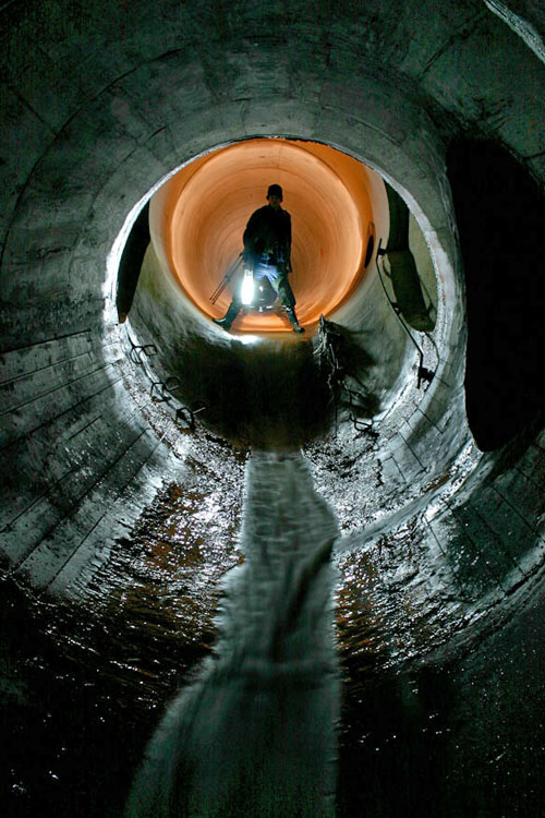
[Images: A “short drop” in Toronto’s beautifully torqued and ovoid Viceroy Drain].

BLDGBLOG: As far as the actual tunnels go, how connected is all this stuff? Is it like a big, underground labyrinth sometimes – or just a bunch of little tunnels that look connected only because of the way that they’ve been photographed?

Michael Cook: Well, most of the drainage systems I’ve been in are pretty linear. You have a main trunk conduit, and then sometimes you’ll get significant side pipes that are worth exploring. But as far as actual maze-quality features go, it’s pretty rare to find systems like that – at least in Ontario and most places in Canada. It requires a very specific geography and a sort of time line of development for the drains.

You might end up with a lot of side overflows and other things, which makes the system more complicated, if the drain has several different places where it overflows into a surface body of water – or if there’s a structure that allows one pipe to flow into another at excess capacity. That sort of thing allows for more complicated systems – but most of the time it doesn’t happen.

You can still spend hours in some of these drains, though, because of how long they are. And sometimes that makes for a fairly uninteresting experience: drains can be pretty featureless for most of their length.
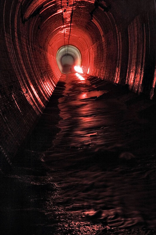
[Images: Four glimpses of the vaulted topologies installed inside the Earth at Niagara’s William Birch Rankine Hydroelectric Tailrace].

BLDGBLOG: Are the drains up there mostly poured concrete, or are they made of brick?

Michael Cook: We have recently opened up our first significant brick sewer in Toronto – The Skin of a Lion – which is built from yellow brick and would probably date to around the turn of the last century. So there are a few locations where you can find brick, but most are concrete.

[Images: (top) Leaving the William Birch Rankine Hydroelectric Tailrace, Niagara Falls; (bottom) Tailrace outlet, William B. Rankine Generating Station].

BLDGBLOG: Does that affect what the drains sound like, as far as echoes and reverb go? What sort of noises do you hear?

Michael Cook: I’d say that every drain is acoustically unique. Each has its own resonance points – and even different sections of the drain will resonate differently, based on where the next curve is, or the next room. It all shifts. I often explore that aspect a bit – probably to the annoyance of some of my colleagues. I’ll make noises, or hum. Even sing.

As far as environmental noises, the biggest thing is that, if there’s a rail line nearby, or a public transit line, you often get that noise coming back through the drain to wherever you are. It’s very frightening when you first hear it, till you figure out what it is – this rushing noise. It’s not a wall of water. [laughs]

But the most common recurring noise is the sound of cars driving over manhole covers – which gives you an idea of which covers you don’t want to exit through. It also helps you keep track of the distance, and where you are – that sort of thing.
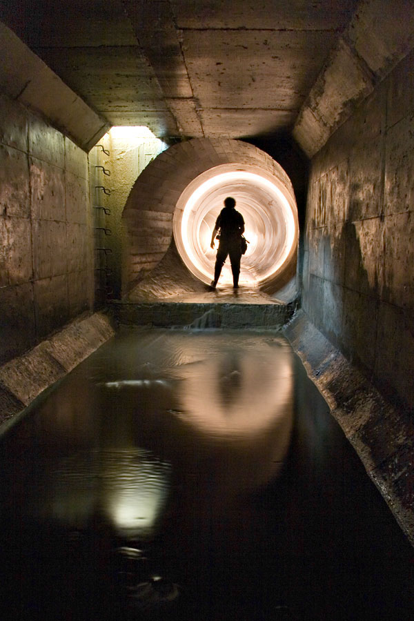
[Image: “Transitions” inside the Duncan’s Got Wood sewer, Toronto].

BLDGBLOG: What kind of legal issues are involved here – like trespassing, or even loitering? Do you have to go out at 2am, dressed like an official city worker, or wear a hood or anything like that?

Michael Cook: For draining, the legal issues are pretty grey. After all, you’re on public property the entire time – so the risk of a serious trespassing fine is a lot lower. There’s no private security company looking out for you, and there’s no private property owner who’s going to be irate if you’re found inside his building. It’s a municipal waterway – it just happens to run underground. A lot of times the outfalls aren’t even posted with notices telling you to stay out.

Now, some people have been given fines for trespassing – for having been inside drains in Ontario – but these have been for pretty minor sums of money. It’s not something that I’ve ever had a problem with – and definitely not something that requires me to go in the middle of the night.

The only thing that really dictates what time you can go is traffic conditions. If you have to use a street-side manhole, you generally don’t want to be doing that doing the day.

[Image: “Deep inside the century-old wheelpit that is the beginning of the Rankine Generating Station Tailrace” (view bigger)].

BLDGBLOG: Within Toronto itself, are you still finding new drains, or is the city pretty much exhausted by now?

Michael Cook: We are still finding new tunnels beneath Toronto, and we’re on the trail of others that we know about but just haven’t discovered access to yet. There are also still a few underground gems in Hamilton that haven’t been seen by anyone except municipal workers and a handful of journalists. These days though, Montreal and Vancouver are emerging hotbeds for new sewer and drainage finds in Canada, thanks to explorers in those cities.

When Siologen came over here he found a whole bunch of new drain systems in Toronto – systems nobody else knew about. He had the time and the inclination to go and scout out a whole lot of stuff that I’d never gotten around to doing.

BLDGBLOG: How’d he do that?

Michael Cook: Basically by riding all the buses. That, and looking at a lot of little creek systems, and searching around for manholes – all of that.

But there are people who happen to read in the paper about some new tunnel project, or whatever, and so they pass that on to people who do this sort of thing. Outside of that, I don’t really know what to say. I guess some people have even found stuff after it’s been featured in skateboarding magazines.

BLDGBLOG: [laughs]

Michael Cook: Some of the largest pipe in the world is used as spillways for hydroelectric projects – big dams and that sort of thing – and usually the first people who find out about this stuff are skateboarders. Usually they try to keep the locations pretty quiet – just as we do. But I’m sure that, at least once or twice, some tunnel explorer has found out about a system through the skateboarding community.
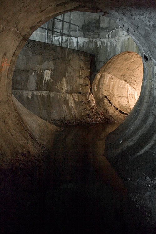
[Image: Ottawa’s Governor General’s Drain].

BLDGBLOG: I’m also curious if there’s some huge, mythic system out there that you’ve heard about but haven’t visited yet, or even just an urban legend about some tunnels that may not actually be real – secret government bunkers in London, for instance.

Michael Cook: I guess the most fabled tunnel system in North America is the one that supposedly runs beneath old Victoria, British Columbia. It’s supposedly connected with Satanic activity or Masonic activity in the city, and there’s been a lot of strange stuff written about that. But no one’s found the great big Satanic system where they make all the sacrifices.

You know, these legends are really… there’s always some sort of fact behind them. How they come about and what sort of meaning they have for the community is what’s really interesting. So while I can poke fun at them, I actually appreciate their value – and, certainly, these sort of things are rumored in a lot of cities, not just Victoria. They’re in the back consciousness of a lot of cities in North America.
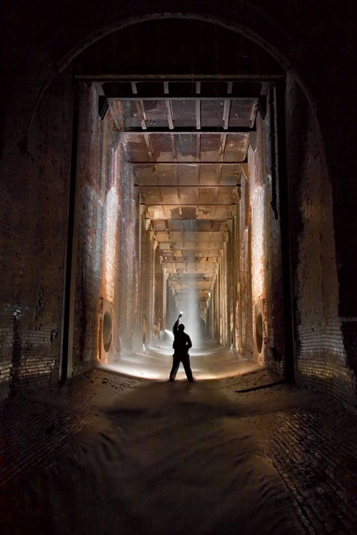
[Image: “Looking into the bottom of the William B. Rankine G.S. wheelpit from the Rankine tailrace“].

BLDGBLOG: Is there some system – a real system – that you’re really dying to explore?

Michael Cook: If I had unlimited funds, I’d really like to make a trip to South America and see some of the underground workings beneath Rio and São Paulo and Montevideo; and I want to go to Africa for a lot reasons but, obviously, it would also be really neat to see what’s built under some of the larger cities in Africa. It’s a place of real cleavages between modern development and the complete impossibility of expanding that development to the entire population. So great sums of money have been wasted on huge highway projects and huge downtown core projects that were completely unnecessary for anything other than creating the semblance of a modern city – but, undoubtedly, there’s subterranean infrastructure connected to all of it.

BLDGBLOG: As well as abandoned pieces of infrastructure just sitting up there on the surface – unused highway overpasses and derelict stadiums and things like that.

Michael Cook: Definitely. And huge mine workings, as well, in certain parts of Africa, that have been shut down.
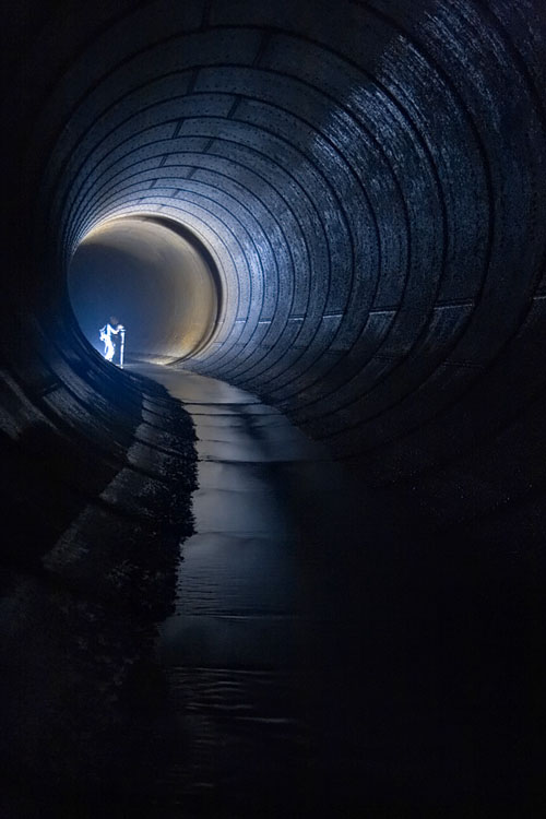
[Image: Inside a distributor tunnel at the Ontario Generating Station drain; meanwhile, I can’t help but imagine what it’d be like if architects began building hotel lobbies like this: you check into your boutique hotel in London – and nearly pass out in awe…].

BLDGBLOG: Meanwhile, urban exploration seems to be getting a lot of media attention these days – this interview included. How do you feel when you see articles in The New York Times about people exploring tunnels and drains?

Michael Cook: The problem I have with general interest reporting is that it almost invariably becomes, you know: look at this, isn’t this weird. Because that’s the easiest way of presenting what we do. It’s not about anything else – it’s entertainment.

So I’ve never really been interested in taking part in articles like that. They happen all the time in various places around the continent. Somewhere, there’s always a reporter who needs to file a story this week, or this month, and so they find an urban exploration site on the internet and they think, hey, that’s a great thing to write about, and then I can fill my quota. It’s not even that what they’re going to write is false or misleading, but it ultimately presents an incomplete and slightly cheapening image of what we do – and, in the end, it doesn’t really accomplish that much.

I think what I’m getting at is that the format of the newspaper article or the television news feature ultimately waters all this down and forces it into a specific block – that, while true of a certain segment of urban exploration, isn’t really representative of the whole. It has the effect of pigeon-holing the whole endeavor in a way.

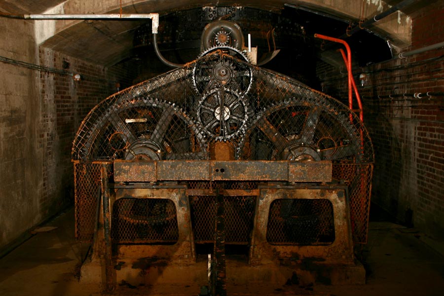
[Images: Disused hydroelectric machinery: top/bottom].

BLDGBLOG: That implies that there’s a way of looking at all this that you think needs more exposure. What parts of urban exploration should the media actually be covering?

Michael Cook: I think, even among explorers, that we don’t pay enough attention to process. I think every piece of infrastructure – every building – is on a trajectory, and you’re experiencing it at just one moment in its very extended life.

We see things, but we don’t often ask how they came about or where they’re going to go from here – whether there will be structural deterioration, or if living things will colonize the structure. We tend to ignore these things, or to see them in temporal isolation. We also don’t give enough time or consideration to how this infrastructure fits into the broader urban fabric, within the history of a city, and where that city’s going, and whose lives have been affected by it and whatever may happen to it in the future. I think these are all stories that really need to start being told.

Which is something I’m starting on. It’s just not something that necessarily comes naturally. It requires a lot of work, and a lot of thought while you’re on-site – which maybe you’re not really inclined to do, because you’re too busy paying attention to the immediate, sublime nature of the experience.

But the basic linear photo gallery really bores me at this point – especially when you’re seeing basically the same photos, just taken inside different buildings. It has no real, lasting value. A lot of people have fallen into that trap, and a lot of people defend that – saying that they’re making art or whatever, or that it’s just for their own personal interest.

BLDGBLOG: So it’s a matter of paying attention both to the site’s history and to how your own documentation of that site will someday be used as history.

Michael Cook: If you decide to take a purely historical approach to it, though, I think the real question is: are these photos of asylum hallways and drainage tunnels ultimately going to be useful to anyone else at some point in the future? And the answer is probably not. Probably we’re photographing the wrong things for that.

Some architect or materials historian is going to be cursing us for photographing some things and not others, or for not taking a close-up of something – or for not writing down any supplementary information at all to help them identify this stuff.

So that historical angle, to justify some of the stuff we’re doing, falls down on further analysis.

[Image: Abandoned cash registers].

BLDGBLOG: It’s like bad archaeology.

Michael Cook: What’s that?

BLDGBLOG: It’s like bad archaeology.

Michael Cook: Yeah, basically. It’s like we’re just digging things up and not paying attention to where they were placed, or what they were next to, or who might have put it there.

Ultimately, we need some sort of framework, and to put more effort into additional information beside just taking a photo. That doesn’t necessarily mean publishing all that information so that everyone can see it – but just telling stories in other ways, and creating narratives about the places and the things that we’re seeing.

Otherwise, these are just postcard shots. We’re taking postcard shots of the sublime.

[Image: Inside The Skin of a Lion, Toronto].

• • •

While we were editing the transcript for publication, Michael wrote:

I got into the storm sewer I mentioned [at the beginning of the interview], shortly after talking to you. It’s now on the site as Sisters of Mercy. Similar to Pilgrimage, it ends in a siphon, rather than a traversable passage into the Western Beaches Storage Tunnel, which I’m still working on finding. We’ve started exploring combined sewers as well here – so that opens up some other options. In the end, the access I found was directly above where the siphon begins, quite close to the lake.

So the explorations continue.
With a big thanks to Michael Cook for having this conversation – and for maintaining such a great website.

[Image: The “Three Musketeers” standing inside Toronto’s Westview Greenbelt Drain; Michael Cook is the one on the right; one of the other two is Siologen].

For a few more images, meanwhile, check out Vanishing Point – in particular, stop by the Daily Underground).

(More underground worlds and urban exploration on BLDGBLOG: Urban Knot Theory, London Topological, Derinkuyu, or: the allure of the underground city, Beneath the Neon, Valvescape, Subterranean bunker-cities, and Tunnels, mines, and the “upwardly migrating void”).

The Lonely Planet Guide to Micronations: An Interview with Simon Sellars

[Images: The book and one of its authors, Simon Sellars].
Simon Sellars runs Ballardian from his home in Melbourne, Australia. Our shared interest in J.G. Ballard led to Simon’s interviewing me this past summer about architecture, urban space, psychopathology, international airport departure lounges, and Ballard’s novels. In the process, however, our conversation came to include a great many things not included in the final interview; and one of those things was Simon’s recent work as co-author, with John Ryan and George Dunford, of The Lonely Planet Guide to Micronations. BLDGBLOG and Leah Beeferman had only just announced their own micronation – The Helicopter Archipelago – and so a new interview began to take shape. The tables were turned. I was asking the questions.
The results appear below.

• • •

BLDGBLOG: How did the book come about? Did you pitch it to Lonely Planet, or did they come looking for you?

Simon Sellars: The book is the brainchild of John Ryan, who invited George Dunford and myself to co-author it. When I worked in-house at Lonely Planet as an editor, I overheard John talking about a pitch he was about to present to the bosses – regarding a book about micronations. When I later heard that the proposal had been given the green light, I pestered the poor bastard for about six months until he let me work on it. I began by hammering John with heavy emails about the political significance of micronations until he finally said, “Simon, we want it to be funny.” Fortunately, there are a lot of laughs in the micronational world, so it was no problem toning down the revolutionary rhetoric.

BLDGBLOG: What’s the origin of your own interest in micronations?

Sellars: It comes from reading science fiction as a kid and getting right into the concept of parallel worlds and alternative universes. Anything that distorts or reflects or comments on the “real” world – or sets up an alternative world – sends me into an orgy of navel gazing. This can extend to even the most everyday scenarios. To give you an example: I’m not a huge sports fan, but I’m fascinated by the fact that American football sprang from rugby union. Actually, American football is a distortion, a twisted mirror image of rugby – amplified, stretched and extrapolated to degrees never thought possible by stuffy British types – in everything from the rules to the tactics to the uniforms. For similar reasons, although I’ve never been there, Canada fascinates me – as a parallel USA.

BLDGBLOG: Which country would be the distortion in that case?

Sellars: That’s tricky. A lot of what I know about Canada has been learnt from South Park and David Cronenberg films. Cronenberg presents it as a parallel universe, recognisably North American, but cool, detached, ironic – America on sedatives. Whereas South Park paints it as crass, loud and derivative. And Canada did host the World Rock Paper Scissors Championship, a truly lame sporting competition worthy of any micronation. So, let’s vote for Canada as the distortion. But I also remember reading a recent poll that claimed 38% of Americans wanted the US to annex Canada, and then reading an article that said British Canadians – aside from the more well-known Quebec separatists – wanted to secede from Canada. The US wants to go macro, Canada wants to go micro – polar opposites, then?

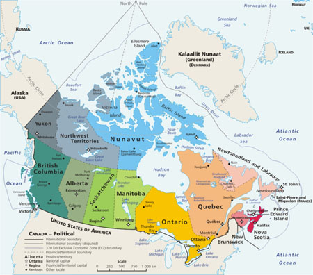
[Image: Canada].

BLDGBLOG: Have you ever declared your own micronation?

Sellars: Yes. I grew up in the suburb of Bentleigh, in Melbourne, Australia. It was an exceedingly boring place, like a retirement village – it seemed like I was the only teenager around at times. So I founded the Independent Republic of Bentleigh, declared myself President, and claimed the whole of Bentleigh as territory. Our national anthem was “We Can’t Be Beaten,” a song by the toughest band in the land, Rose Tattoo.

BLDGBLOG: What happened to it?

Sellars: We were beaten – the IRB was invaded by Poland. The Polish kid next door already hated me, but when he saw me poncing up and down the back yard draped in my IRB flag, he was enraged even more than usual. He jumped over the fence, punched me in the mouth and stole my lunch money – and that was all the IRB’s assets gone, just like that. He also stepped on my toy tanks and melted my plastic soldiers with a cigarette lighter, which meant the IRB had no defence force, and that was the end of it, really. My mother banned me from starting up a micronation ever again, unless I could back it up with sufficient armoury and investment capital, which of course I never could, being a very lazy kid.

BLDGBLOG: Are you still plotting revenge…?

Sellars: No, no – it’s fine. He was stronger, smarter, more committed and far more organised than me. It’s a good lesson for any start-up nation: you will be at the mercy of predators, so you’d best bulk up.

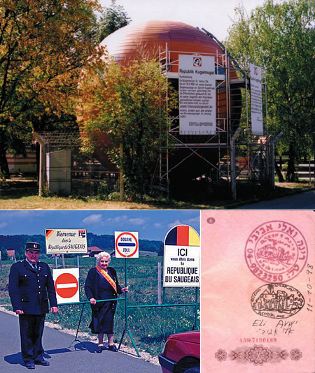
[Images: The Republic of Kugelmugel (top); former President of the Republic of Saugeais, Gabrielle Pourchet, stands on her well-guarded border (bottom-left); and a postage mark from Akhzivland (bottom-right)].

BLDGBLOG: Returning to the book, I’m curious if you found the travel guide format a bit limiting. Was there more to say beyond climate, history, population, and so on; or was the format actually a liberating way to organize your research?

Sellars: It was liberating. You could write a heavy political treatise on the significance of micronations, but who would read it? Lonely Planet certainly wouldn’t publish it. Our mantra was always to focus on places that travellers could actually visit – that is, micronations with actual land, rather than cybernations, or micronations on the moon – so the guidebook format seemed ideal. These places set themselves up as real countries, for the most part, and a good proportion of them take their statehood very seriously, so it was an interesting exercise to outline their “visa requirements” and their laws and regulations as a way of testing the validity of their claims.

Take the Empire of Atlantium: it’s described in the book as a “secular humanist utopia” that advocates a single world government, abortion rights and legalized euthanasia. By according the Empire the same weight (and the same text headings) as, say, the Netherlands in Lonely Planet’s Western Europe guidebook, we can determine whether it really is, as Atlantium’s Emperor Georgius claims, “a unique type of transitional progressive political and social group entity that maintains the forms and structures of a sovereign state as a means of giving concrete form to its general ideology, and as a way of wrapping up a diverse range of messages in a form that is easily understood and digested.”

So, does it have population of more than one? Yes. A currency? Yes. A citizenship program? Yes. A constitution? Yes. A postal agency? Yes. A flag? Yes. A pompous official portrait of the head of state? Yes. Has it been at war? Yes. Can you visit it? Yes. Does it have an eclectic socially tolerant agenda? Yes. Then it certainly does “maintain the forms and structures of a sovereign state in order to present a diverse range of messages” – much like the Netherlands, for that matter.

We just aimed for the facts, and figured the rest would follow – we’ll leave the grey areas for Wikipedia’s sandbox.

[Images: Kevin Baugh, President of the Republic of Molossia (top-left); King Adam from the Sovereign Kingdom of Kemetia, shaking hands with his Minister of Security, Samuel Simpson-Crew (bottom-left); and King Nicholas, Chav Slayer, of the Copeman Empire (right)].

BLDGBLOG: It seems many of the kings, queens, prime ministers, etc., featured in the book are actually teenage boys, or eccentric older men, many of whom have goatees.

Sellars: Yes. It does appear to be an especially male enterprise, starting up your own micronation. It’s like piecing together a model train set, I think – that common little-boy fantasy of building, managing and controlling every single aspect of a miniature world. But then again, little girls have dollhouses and tea sets, and that’s a virtual world as well, with its own rules for social interaction.

BLDGBLOG: John’s introduction suggests that many of these micronations have been run as “enormous, time-consuming, intricate jokes.” However, I’m curious what the book might have been like if you had included the “separatist cults,” white supremacists, and “lunatic fringe” that you chose to exclude. Did you ever want to write-up these other, less humorous micronations – multinational private security firms, corporate tax havens, seaborne pirate states off Somalia – or would that have made the book too political?

Sellars: Ah yes, the good old lunatic fringe. Quite often these types of micronations are not very well documented, and – at least the ones we came across – were riddled with incoherent policy and ill-thought out constitutions, with zero recognition from either the real world or the micronational world. I’m guessing that if a white-supremacist micronation came along that was intelligently modelled – and I’m talking geographically, of course – and that had interactions with other micronations, even if it was to invade them – plus some kind of tangible effect in the real world, such as being invaded by a real nation – then we might consider including it. It’s not enough to declare yourself a nation – you have to interact in some way, preferably for the benefit of others, or at least in a libertarian manner.

As it is, the micronations we’ve included have had some kind of independently verified interaction with a third party. Prime examples include Sealand, which was engaged in a diplomatic crisis with Germany after surviving an attempted coup, which successfully fended off the UK’s claims on its territory, and which now has national mini-golf, football and slot-car teams that compete in international competition; the Republic of Molossia, which is a world leader in micronational affairs, having inaugurated the Intermicronational Olympic Movement and hosted the first Intermicronational Olympic Games; and the Hutt River Province, which seceded from Australia after a dispute over wheat quotas, and now exports wildflowers, agricultural produce, stamps and coins, and continues to have low levels of interaction with the Australian government.

In the end, the mock-guidebook format sealed the selection criteria. On one level you could argue that the Waco compound was a micronation, although as far as I can tell they didn’t print stamps, or formally elect a head of state, or draw up a constitution. I’m certainly interested in exploring the parameters outlined in your question, but that would have required a very different methodology. Edwin Strauss has covered it to some extent, in his book How to Start Your Own Country, which takes a pre-9/11 approach to micronationalism, including advocating the deployment of “basement nukes” to get your own way.

The bottom line is that this is a dangerous area for a travel publisher to get into – and we are not white supremacists, cultists, or terrorists, so it would be a particularly bitter pill to swallow just for the sake of being inclusive.

[Images: Emperor Georgius II of the Empire of Atlantium (top-left); citizens of the Kingdom of Elleore (bottom-left); and King Leo III of Elleore (right)].

BLDGBLOG: What kind of future do you see for the micronational model? Tourist gag or the next phase of political sovereignty?

Sellars: Surely gated suburbs, housing only the filthy rich, are the future of micronationalism. Gated communities have their own security forces, their own infrastructure… it must be only a matter of time before the most powerful and self-contained of them secede. Going by this model, Johannesburg – by all accounts – will be composed of nothing but micronations.

BLDGBLOG: Any plans for a Micronations 2?

Sellars: The book is apparently selling quite well, so we’ll keep our fingers crossed. I hope there’ll be a sequel, for John’s sake – he showed a lot of vision to get this happening, or to at least pitch the idea well before the recent television interest in micronations and some time before the current fad for fake guidebooks. This recent media attention has only validated that vision. Actually, I hope the book inspires more people to form their own micronations, so that we have no choice but to write a follow up – I think the urge is strong, if the popularity of Max Barry’s Nation States site is any indication.

BLDGBLOG: Finally, how does this work intersect with your interest in J.G. Ballard?

Sellars: Ballard highlights the social Darwinism that occurs when communities are completely mediated by technology – whether it’s the motorway feeder roads in Crash, the business park in Super-Cannes, the patch of underpass in Concrete Island, the urban war zones in High-Rise. All of these settings are implicitly micronational – and explicitly in Ballard’s latest book, Kingdom Come, in which a shopping centre is overrun by consumers, sealed off by paramilitary goons, and declared an independent republic.

Ballard’s protagonists are forever setting up psychopathological thought labs, where people are free to test the limits of their perversions within controlled conditions, with the outside world fading into a background blur. Quite often their actions are gross inversions of real-world scenarios, and by stepping into this surrealistic inverse ratio, we are really seeing ourselves – and the world around us – reflected back at us. That’s the classic gambit of science fiction, and Ballard’s trick is to situate it in the present day, rather than the future.

So, your typical Ballardian scenario is not a million miles away from Molossia, which has formulated its very own space program, consisting of the Rufus T. Firefly Memorial National Observatory (a single home telescope) and a probe launch – the “Hypérion Balloon Flight and Aerial Survey” – designed to photograph the nation from the upper atmosphere. Sadly, the probe, a camera attached to 40 balloons, was destroyed during take off, when it got stuck in a tree. Later, their home-made rocket, Astrocam, took just one blurry aerial photo that didn’t reveal anything at all.

Sounds a lot like the US space program to me…

• • •

The Lonely Planet Guide to Micronations was written by John Ryan, George Dunford, and Simon Sellars. For a bit more about the book, check out this conversation between John Ryan and Alex Chadwick of NPR, originally broadcast on the morning of November 1st. For even more info, take a look at this interview, involving all three of the book’s authors.
Meanwhile, to win a free copy of The Lonely Planet Guide to Micronations, enter BLDGBLOG’s Invent-a-Micronation contest before December 8th…

London Topological

[Image: Embankment, London, ©urban75].

As something of a sequel to BLDGBLOG’s earlier post, Britain of Drains, we re-enter the sub-Britannic topology of interlinked tunnels, drains, sewers, Tubes and bunkers that curve beneath London, Greater London, England and the whole UK, in rhizomic tangles of unmappable, self-intersecting whorls.

[Images: The Bunker Drain, Warrington; and the Motherload Complex, Bristol (River Frome Inlets); brought to you by the steroidally courageous and photographically excellent nutters at International Urban Glow].

Whether worm-eaten by caves, weakened by sink-holes, rattled by the Tube or even sculpted from the inside-out by secret government bunkers – yes, secret government bunkers – the English earth is porous.

“The heart of modern London,” Antony Clayton writes, “contains a vast clandestine underworld of tunnels, telephone exchanges, nuclear bunkers and control centres… [s]ome of which are well documented, but the existence of others can be surmised only from careful scrutiny of government reports and accounts and occassional accidental disclosures reported in the news media.”

[Images: Down Street, London, by the impressively omnipresent Nick Catford, for Subterranea Britannica; I particularly love the multi-directional valve-like side-routes of the fourth photograph].

This unofficially real underground world pops up in some very unlikely places: according to Clayton, there is an electricity sub-station beneath Leicester Square which “is entered by a disguised trap door to the left of the Half Price Ticket Booth, a structure that also doubles as a ventilation shaft.”

This links onward to “a new 1 1/4 mile tunnel that connects it with another substation at Duke Street near Grosvenor Square.”

But that’s not the only disguised ventilation shaft: don’t forget the “dummy houses,” for instance, at 23-24 Leinster Gardens, London. Mere façades, they aren’t buildings at all, but vents for the underworld, disguised as faux-Georgian flats.

(This reminds me, of course, of a scene from Foucault’s Pendulum, where the narrator is told that, “People walk by and they don’t know the truth… That the house is a fake. It’s a façade, an enclosure with no room, no interior. It is really a chimney, a ventilation flue that serves to release the vapors of the regional Métro. And once you know this you feel you are standing at the mouth of the underworld…”).

[Image: The Motherload Complex, Bristol – again, by International Urban Glow].

There is also a utility subway – I love this one – accessed “through a door in the base of Boudicca’s statue near Westminster Bridge.” (!) The tunnel itself “runs all the way to Blackfriars and then to the Bank of England.”

Et cetera.

[Images: The Works Drain, Manchester; International Urban Glow].

My personal favorite by far, however, is British investigative journalist Duncan Campbell’s December 1980 piece for the New Statesman, now something of a cult classic in Urban Exploration circles.

[Image: Motherload Complex, Bristol; International Urban Glow].

“Entering, without permission, from an access shaft situated on a traffic island in Bethnal Green Road he descended one hundred feet to meet a tunnel, designated L, stretching into the distance and strung with cables and lights.” He had, in other words, discovered a government bunker complex that stretched all the way to Whitehall.

On and on he went, all day, for hours, riding a folding bicycle through this concrete, looking-glass world of alphabetic cyphers and location codes, the subterranean military abstract: “From Tunnel G, Tunnel M leads to Fleet Street and P travels under Leicester Square to the then Post Office Tower, with Tunnel S crossing beneath the river to Waterloo.”

[Image: Like the final scene from a subterranean remake of Jacob’s Ladder (or a deleted scene from Creep [cheers, Timo]), it’s the Barnton Quarry, ROTOR Drain, Edinburgh; International Urban Glow].

Here, giving evidence of Clayton’s “accidental disclosures reported in the news media,” we read that “when the IMAX cinema inside the roundabout outside Waterloo station was being constructed the contractor’s requests to deep-pile the foundations were refused, probably owing to the continued presence of [Tunnel S].”

[Image: Motherload, Bristol; International Urban Glow].

But when your real estate is swiss-cheesed and under-torqued by an unreal world of remnant topologies, the lesson, I suppose, is you have to read between the lines.

A simple building permissions refusal might be something else entirely: “It was reported,” Clayton says, “that in the planning stage of the Jubilee Line Extension official resistance had been encountered, when several projected routes through Westminster were rejected without an explanation, although no potential subterranean obstructions were indicated on the planners’ maps. According to one source, ‘…the rumour is that there is a vast bunker down there, which the government has kept secret, which is the grandaddy of them all.'”

[Image: The Corsham Tunnels; see also BLDGBLOG].

Continuing to read between the lines, Clayton describes how, in 1993, after “close scrutiny of the annual Defence Works Services budget the existence of the so-called Pindar Project was revealed, a plan for a nuclear bomb-proof bunker, that had cost £66 million to excavate.”

All of these places have insane names—Pindar, Cobra, Trawlerman, ICARUS, Kingsway, Paddock—and they are hidden in the most unlikely places. Referring to a government bunker hidden in the ground near Reading: “Inside, they tried another door on what looked like a cupboard. This was also unlocked, and swung open to reveal a steep staircase leading into an underground office complex.”

[Images: The freaky stairs and tunnels, encrusted with plaster stalactites, of King William Street].

Everything leads to everything else; there are doorways everywhere. It’s like a version of London rebuilt to entertain quantum physicists, with a dizzying self-intersection of systems hitting systems as layers of the city collide.

[Image: Belsize Park, from the terrifically useful Underground History of Hywel Williams].

There is always another direction to turn.

[Image: The Shorts Brothers Seaplane Factory and air raid shelter, Kent; photo by Underground Kent].

This really could go on and on; there are flood control complexes, buried archives, lost rivers sealed inside concrete viaducts – and all of this within the confines of Greater London.

[Images: London’s Camden catacombs – “built in the 19th Century as stables for horses… [t]heir route can be traced from the distinctive cast-iron grilles set at regular intervals into the road surface; originally the only source of light for the horses below” – as photographed by Nick Catford of Subterranea Brittanica].

Then there’s Bristol, Manchester, Edinburgh, Kent…

[Image: Main Junction, Bunker Drain, Warrington; International Urban Glow].

And for all of that, I haven’t even mentioned the so-called CTRL Project (the Channel Tunnel Rail Link); or Quatermass and the Pit, an old sci-fi film where deep tunnel Tube construction teams unearth a UFO; or the future possibilities such material all but demands.

[Image: Wapping Tunnel Vent, Liverpool, by International Urban Glow; a kind of subterranean Pantheon].

Such as: BLDGBLOG: The Game, produced by LucasArts, set in the cross-linked passages of subterranean London, where it’s you, a torch, some kind of weapon, a shitty map and hordes of bird flu infected zombies coughing their way down the dripping passages – looking for you

Nova Arctica

it is a false and feverous state for the Centre to live in the Circumference
(Coleridge)

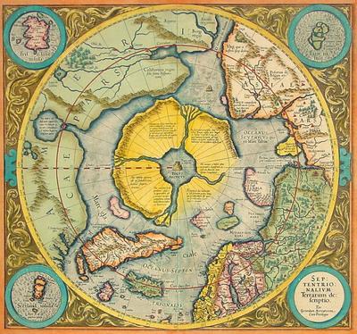
[Image: “The first map dedicated to the North Pole, by the great Gerard Mercator,” titled Septentrionalium Terrarum descriptio, reprinted 1623].

The North Pole’s melting ice cap is apparently creating something of an Arctic real estate boom.

Or a shipping route boom, more specifically: new Arctic sea channels are opening up almost literally every season, and new – or revived – ports are being opened – or renovated – to serve them.

Pat Broe, for instance, “a Denver entrepreneur,” bought a “derelict Hudson Bay port from the Canadian government in 1997” – for $7. That $7 port, however, could eventually “bring in as much as $100 million a year as a port on Arctic shipping lanes [made] shorter by thousands of miles” due to thawing sea ice.

Such Arctic routes are predicted to grow in importance quite rapidly “as the retreat of ice in the region clears the way for a longer shipping season.”


But the world is full of Pat Broes. Accordingly, “the Arctic is undergoing nothing less than a great rush for virgin territory and natural resources worth hundreds of billions of dollars. Even before the polar ice began shrinking more each summer, countries were pushing into the frigid Barents Sea, lured by undersea oil and gas fields and emboldened by advances in technology. But now, as thinning ice stands to simplify construction of drilling rigs, exploration is likely to move even farther north.”

Aside from the inevitable and ecologically unfortunate discovery of new Arctic oil reserves (“it’s the next energy frontier,” a Russian energy worker says), the “polar thaw is also starting to unlock other treasures… perhaps even the storied Northwest Passage.”

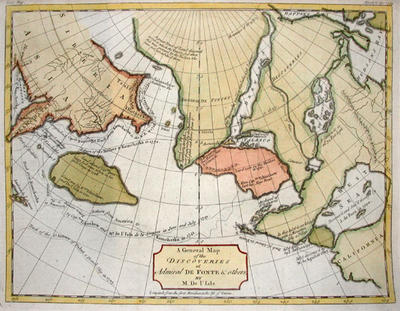
[Image: A 1754 De Fonte Map of the Northwest Passage].

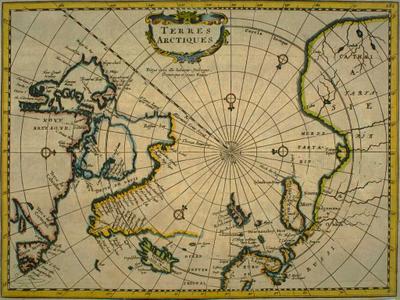
Something of a land grab – or sea grab – is now underway: “Under a treaty called the United Nations Convention on the Law of the Sea, territory is determined by how far a nation’s continental shelf extends” offshore – adding a somewhat Freudian dimension to Arctic real estate. (Or perhaps we could call it the Arctic Real, where “the true coordinates are much better hidden than we realize.”)

In any case: “Under the treaty, countries have limited time after ratifying it to map the sea floor and make claims.” What kind of claims? “[C]laims of expanded territory.”

But it soon gets interesting. “In a 2002 report for the Navy on climate change and the Arctic Ocean, the Arctic Research Commission, a panel appointed by the president, concluded that species were moving north through the Bering Strait.” [Emphasis added]. Territorial alterations and geographic changes at the pole, in other words, are leading to unexpected seaborne migrations, repositionings of the planetary gene pool.

Surely there’s a James Cameron film in there, or at least some kind of Arctic pulp fiction thriller dying to be written?

In any case, as new territories, both aquatic and terrestrial, appear at the Earth’s poles, we might do well to reconsider what Victoria Nelson calls “the Polar gothic,” or “the literary genre of mystical geography,” part of a “psychotopography” of the Earth…

Either way I want to mention – as Nelson does – a text by H.P. Lovecraft. In his slightly goofy 1931 novella, At the Mountains of Madness, Lovecraft sends a group of geologists to the south pole where they’re meant to collect “deep-level specimens of rock and soil from the antarctic continent.” Under “great barren peaks of mystery” and “desolate summits” made of “Jurassic and Comanchian sandstones and Permian and Triassic schists, with now and then a glossy black outcropping suggesting a hard and slaty coal,” they go snowshoeing, dogsledding, and hiking some more – till, drilling through ice into the ancient metamorphic prehistory of a once-tropical antarctic mountain range, they begin “to discern new topographical features in areas unreached by previous explorers.”

Soon they find weird marine fossils.

Then ancient, apparently manmade artifacts turn up.

At night they hear things.

Then they find a city.


This antarctic city is “of no architecture known to man or to human imagination, with vast aggregations of night-black masonry embodying monstrous perversions of geometrical laws. (…) All of these febrile structures seemed knit together by tubular bridges crossing one to the other at dizzying heights,” including “various nightmare turrets,” crowding “the most utterly unknown stretches of the aeon-dead continent.” Etc.

Lovecraft’s polar gothic now continues apace, however, at the opposite end of the Earth, as the planet’s northernmost currents of melting ice bring new rivers, new migrations, and even new instant cities deep into the waters of thawing Arctic archipelagos.