Brooklyn Vent

[Image: Disguised infrastructure; photo by BLDGBLOG].

In the novel Foucault’s Pendulum, two characters discuss a house that is not what it appears to be. People “walk by” this house in Paris, we read, but “they don’t know the truth. That the house is a fake. It’s a facade, an enclosure with no room, no interior. It is really a chimney, a ventilation flue that serves to release the vapors of the regional Métro. And once you know this you feel you are standing at the mouth of the underworld…”

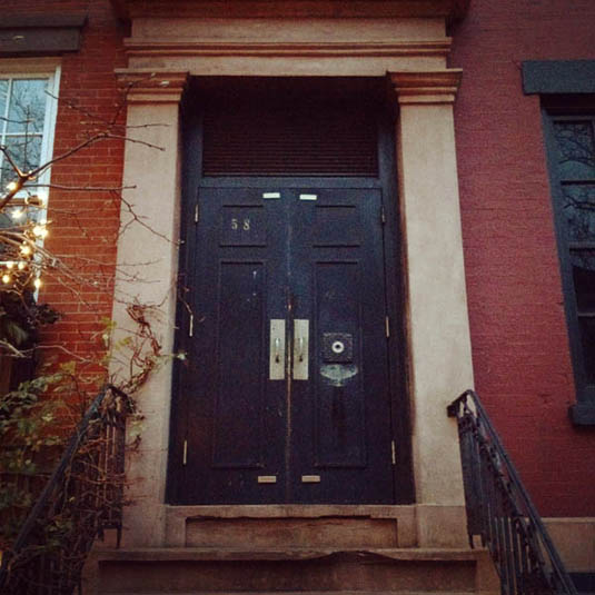
[Image: The door to the underworld; photo by BLDGBLOG].

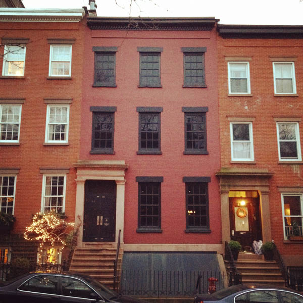
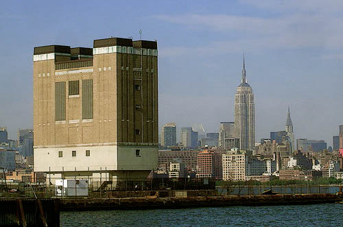
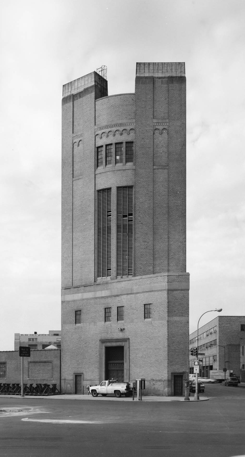
Two days ago, Nicola Twilley and I went on an early evening expedition over to visit the house at 58 Joralemon Street in Brooklyn, with its blacked out windows and its unresponsive front door.

This “house” is actually “the world’s only Greek Revival subway ventilator.” It is also a disguised emergency exit for the New York City subway.

[Image: Disguised infrastructure; photo by BLDGBLOG].

According to a blog called the Willowtown Association, “the ventilator was a private brownstone dating from 1847. The substation was built in 1908 in conjunction with the start of subway service to Brooklyn. As reported in the BKLYN magazine article, the building’s ‘cavernous interior once housed a battery of electrical devices that converted alternating current to the 600-volt direct current needed to power the IRT.'”

[Image: A view through the front door of 58 Joralemon Street; photo by BLDGBLOG].

It is New York’s more interesting version of 23/24 Leinster Gardens in London. As the Brooklyn Daily Eagle wrote last year, “the exit disguised as a brownstone leads to a grimy-lit set of metal stairs that ascend past utility boxes and ventilation shafts into a windowless room with a door. If you opened the door, you would find yourself on a stoop, which is just part of the façade.”

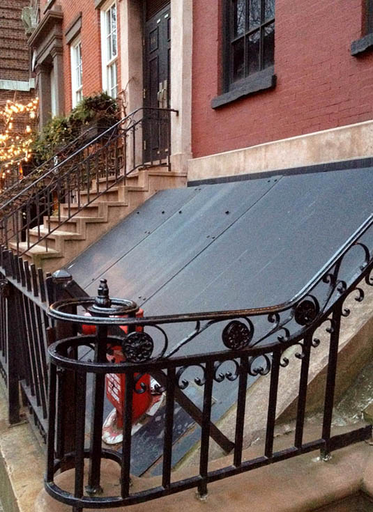
[Image: Photo by BLDGBLOG].

You’ll notice on Google Maps that the 4/5 subway line passes directly beneath the house, which brings to mind an old post here on BLDGBLOG in which we looked at the possibility that repurposed subway cars could be used someday as extra, rentable basement space—that is, “temporary basements in the form of repurposed subway cars,” with the effect that “each private residence thus becomes something like a subway station, with direct access, behind a locked door, to the subterranean infrastructure of the city far below.”

Then, for a substantial fee—as much as $15,000 a month—you can rent a radically redesigned subway car, complete with closets, shelves, and in-floor storage cubes. The whole thing is parked beneath your house and braked in place; it has electricity and climate control, perhaps even WiFi. You can store summer clothes, golf equipment, tool boxes, children’s toys, and winter ski gear.
When you no longer need it, or can’t pay your bills, you simply take everything out of it and the subway car is returned to the local depot.
A veritable labyrinth of moving rooms soon takes shape beneath the city.

Perhaps Joralemon Street is where this unlikely business model could be first tried out…

In any case, Nicola and I walked over to see the house for a variety of reasons, including the fact that the disguised-entrance-to-the-underworld is undoubtedly one of the coolest building programs imaginable, and would make an amazing premise for an intensive design studio; but also because the surface vent structures through which underground currents of air are controlled have always fascinated me.

These vents appear throughout New York City, as it happens—although Joralemon, I believe, is the only fake house—serving as surface articulations of the larger buried networks to which they are connected.

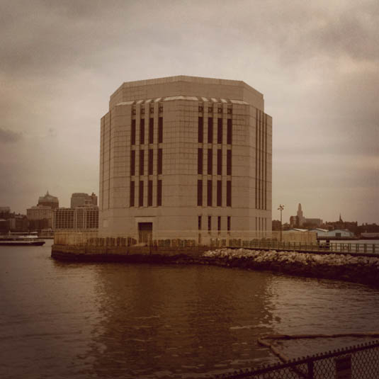
[Image: Two views of the tunnel vent on Governors Island; photos by BLDGBLOG].

The Battery Tunnel has a particularly noticeable vent, pictured above, and the Holland Tunnel also vents out near my place of work.

[Image: Holland Tunnel exhaust tower; photo via SkyscraperPage.com].

As historian David Gissen writes in his excellent book Subnature: Architecture’s Other Environments, New York’s ventilation control structures are “strange buildings” that have “collapsed” the difference between architecture and civil engineering:

The Holland Tunnel spanned an enormous 8,500 feet. At each end, engineers designed ten-story ventilation towers that would push air through tunnels above the cars, drawing the vehicle exhaust upward, where it would be blown back through the tops of the towers and over industrial areas of the city. The exhaust towers provided a strange new building type in the city—a looming blank tower that oscillated between a work of engineering and architecture.

As further described in this PDF, for instance, Holland Tunnel has a total of four ventilation structures: “The four ventilation buildings (two in New Jersey and two in New York) house a total of 84 fans, of which 42 are blower units, and 42 are exhaust units. They are capable, at full speed, of completely changing the tunnel air every 90 seconds.”

[Image: The Holland Tunnel Land Ventilation Building, courtesy of Wikipedia].

Several years ago a friend of ours remarked that she didn’t like staying in hotels near Columbus Circle here in New York because that’s the neighborhood, she said, where all the subways vent to—a statement that appears to be nothing more than an urban legend, but that nonetheless sparked off a long-term interest for me in finding where the underground weather systems of New York City are vented to the outside. Imagine an entire city district dedicated to nothing but ventilating the underworld!

[Image: The house on Joralemon Street; photo by BLDGBLOG].

This is a topic I will no doubt return to at some point soon—but, for now, if you want to see a disguised entrance to the 4/5 line, walk down Joralemon Street toward the river and keep your eyes peeled soon after the street turns to cobblestones.

(The house on Joralemon Street first discovered via Curbed).

Drone Tax

[Image: An otherwise unrelated image of the unmanned Draganflyer X8 system, courtesy of Draganfly].

A post on sUAS News—a blog tracking the “small unmanned aviation system industry”—we read about the possibility of drone aircraft being used to enforce residential property tax.

Citing a recent court ruling in Arkansas that “has approved the use of aerial imagery to collect data on property sizes,” and making reference to the already-controversial state deployment of aerial surveillance tools, sUAS suggests that drones could someday be used to manage a near-realtime catalog of local property expansions, transfers, and other tax-relevant land alterations.

Whether enforcing local building codes—keeping an eye, for instance, on illegally built structures such as the so-called Achill Henge in Ireland—or reconciling on-the-ground property lines with their administrative representations back in the city land archives, how soon will drones become a state tool for regional landscape management?

[Images: Might semi-autonomous systems such as this someday track residential property lines? Images courtesy of Draganfly].

“Imagine your local planning officer having access to your back garden at a moment’s notice!” sUAS writes with alarm. “With the pullback from Iraq and other spots under way, this scenario is much easier to imagine. Perhaps it’s already happening.”

(Thanks to Ruth Lyons for the Achill Henge link).

A 7-Mile Rainbow for Kim Jong-il

[Image: Assembling the 7-mile rainbow one ring at a time, by Ben Masterton-Smith].

Ben Masterton-Smith, recipient of the inaugural RIBA Norman Foster Traveling Scholarship in 2007, visited North Korea for a period of architectural and spatial research. One of the many outcomes of that trip was Ben’s diploma project, part of which proposed a farcical realization of a 7-mile rainbow reportedly seen on the occasion of Kim Jong-il‘s birth.

[Image: Assembling the rainbow; images by Ben Masterton-Smith].

Truckloads of vinyl are delivered to the capital city; teams of “volunteers” pump vast amounts of air into the unfolding structures—the imperial inflatable as architectural type; and, lo, the titanic pink and purple form ascends to its nostalgic place in the public firmament, assembled ring by ring across the sky.

[Image: The glorious 7-mile rainbow takes form].

While I have cherry-picked only one aspect of Ben’s overall North Korean research project, and thus this might seem like a bit of a one-note flute, I have to say that the absurdly over-the-top scale of the proposal actually seems spot-on for an architectural critique of Kim Jong-il’s surreal stage-managing of North Korean life.

In many ways, this spatial realization of the state’s own ridiculous mythology serves as a sadly necessary—because totally delirious—over-compensation for the otherwise monumentally vacuous cityscapes of North Korean urbanism, as if the grotesque political spectacle of a pink rainbow soaring seven miles over the city might retroactively justify that city’s empty stagecraft.

[Images: Rainbow diagrams by Ben Masterton-Smith].

In the annals of dictatorial natural history—where, apparently, “even nature is mourning” the death of Kim Jong-il—the tongue-in-cheek architectural manifestation of an otherwise impossible worldly phenomena acts not as celebration but as spatial parody. It is sarcasm, we might say, given architectural form.

[Image: The rainbow under construction; image by Ben Masterton-Smith].

In any case, a few more images from the project are available on Ben’s Flickr page.

Portfolio Futures

[Image: From the Morpholio app].

A few of my colleagues at Columbia have just released a free portfolio app called Morpholio, with the aim of creating “a new platform for presentation, critique, and collaboration relevant to all designers, architects, artists, or members of any image driven culture.”

As such, the app aims to be “both a utility and a community”—part social network, part alternative portfolio. “Capable of communicating with multiple devices,” the accompanying press release says, Morpholio “organizes image collections in a comprehensible and accessible format that makes sharing and presenting work seamless, and infinitely flexible.”

[Images: From the Morpholio app].

As the app’s co-creators explain it, “re-imagining the portfolio” like this in the form of interactive digital media was inspired by asking: “what would happen if you could merge processes of presentation, critique and collaboration into a single elastic platform?”

The app is optimized for iPad—so I haven’t been able to test it out—but you can download it for free and give it a spin.

House of the Cave Bear

[Image: The erstwhile basement hibernator, photographed by Brendan Kuty/Patch.com, via Gothamist].

I’m a sucker for tales of the after-market animal reuse of domestic architectural structures—such as wildcats taking over foreclosed California suburbs, bees colonizing the internal walls of a single-family house until honey drips from the electrical outlets, or the strangely elaborate saga of a pack of coyotes living in a burned-out home in Glendale—so I can’t resist this story, in which a man from the cable company descends into a basement in Hopatcong, New Jersey, only to find that a black bear had taken up residence there and had apparently been living in the basement for weeks.

According to the police, the bear had even “fashioned a den of his own in the basement, bringing in twigs and leaves, in anticipation of a winter-long stay.” The architecturally inclined bear—building a more comfortable bed for himself—was getting ready to hibernate.

(Thanks, Nicky!)

Mine Plug

[Image: The museum inserted underground, by Brandon Mosley].

The town of Picher, Oklahoma, offers a range of spatial conditions that support speculative design projects.

On the most basic level, the town is “at risk of cave-ins” due to the “abandoned mines beneath the city”; this means that “trucks traveling along the highway are diverted around Picher for fear that the hollowed-out mines under the town would cause the streets to collapse under the weight of big rigs.”

Further, the now-defunct lead mines generated so much waste that the town is now surrounded by massive artificial mountain ranges of carcinogenic material called “chat,” as the creation of voids beneath the streets generated surreal landforms on the city’s edge. Third, a great deal of the town was destroyed in a tornado in 2008—and that’s all in addition to the fact that the town is under voluntary buy-out for the U.S. government, as it is considered too dangerous to live there.

[Images: Photos of Picher’s artificial landforms, courtesy of the USGS].

In any case, Brandon Mosley, a recent graduate from Louisiana Tech University, explored some possible future architectures for the town of Picher.

Mosley specifically proposes a kind of museum of abandoned mines, inserted directly into one of the old entry shafts.

[Images: A museum of mines in Picher, Oklahoma, by Brandon Mosley].

The local history of the region can thus be physically re-experienced, as well as visually represented, with museum visitors descending into the old mineworks along a spiraling ramp that has been inserted into the earth.

[Images: Sections through the museum, by Brandon Mosley].

It functions like a giant periscope in reverse, peering down into the planet, as the ramp leads visitors into the darkness of an open cavern where, standing atop a glass floor, they can gaze out into the artificially generated terrestrial void that surrounds them.

[Image: Inside the “cavern observation room,” by Brandon Mosley].

There is even a camera obscura there, for projecting images of Picher’s current, semi-ruined state on the walls of the underground space, powerfully placing blame on these subterranean excavations for serving as the engine of the town’s ill health and eventual demise. This is the landscape your creation destroyed, the project would seem to say.

As an idea for spatially explaining to visitors a region’s economic and environmental history, this is a powerful and intriguing idea; and, as an architectural form—a more interesting version of the so-called groundscraper in Mexico City that’s been making the rounds online recently—Mosley’s project has much to recommend it. A museum of the earth, drilled into the earth.

(Earlier on BLDGBLOG: Tar Creek Supergrid).

Urban by Nature

[Image: Untitled, Diana Balmori (2010), via Architect’s Newspaper].

On Thursday, December 8, at 6:30pm, landscape architect Diana Balmori will join architect Joel Sanders for a lively conversation hosted by the Museum of the City of New York, addressing what they call Urban by Nature: Healing the Landscape/Architecture Divide in NYC. From the event description:

Nowhere is the divide between nature and culture, country and city, seemingly more stark than in New York City, where concrete, glass, and steel long ago tamped down the native flora and fauna of Manhattan. How can architecture and landscape architecture, themselves the product of the nature/culture divide, help mend this physical and philosophical rift?

Balmori and Sanders recently co-edited the book Groundwork: Between Landscape and Architecture. There, in his introductory essay, Sanders writes that it is “imperative” today for “design professionals—architects and landscape architects—to join forces to create integrated designs to address ecological issues.” However, he mourns, “longstanding disciplinary divisions frustrate this crucial endeavor.” In part, Sanders looks back to the very idea of wilderness—that is, a pristine world separate from human activity—as a limit to discovering these “integrated” practices. In his words, “the idea of wilderness is so engrained in the American conscience—through literature, philosophy, and even notions of gender and sexuality—that it has effectively shaped the design approaches and even codes of professional conduct that in many ways still define the relationship between architecture and landscape practice.”

So how can this divide be overcome? What specific projects could we propose in order to demonstrate the “integrated designs” whose absence Sanders highlights? And if the remedy is not a design project at all but a more subtle, philosophical shift in how we think about—and even believe in the concept of—wilderness, what is the proper arena for definitive action?

Sanders and Balmori will discuss these and other questions in the context of their ongoing collaboration for a new linear park system and proposed streetscape redesign here in New York City, which they will also present in an opening slideshow. As you’ll see on Thursday evening, that project envisions a truly massive pedestrian park stretching the length of northern Broadway, and their pitch for it is not to be missed.

I’m also thrilled to say that I will be moderating their discussion, bringing many themes and questions of my own and drawing, for instance, on the recent work of such figures as Emma Marris, Caroline Fraser, Janette Sadik-Khan, Liam Young, landscape anthropologist Clark Erickson, and others. The ensuing Q&A will thus range from future materials (such as robotic geotextiles) and controversial technologies (such as genetic modification) available to landscape architects; the legacies, both toxic and generous, of previous urban planning administrations; the incredible challenge of preemptive landscape design in the context of global climate change; and specific urban sites where ecological redesign is most clearly needed.

You’ll find more information, including how to buy tickets, over at the Museum of the City of New York website. I hope to see some of you there!

Sutured San Francisco

[Image: “Sunset Bulbs” by Leigh Merrill from Streets].

The Streets series by photographer Leigh Merrill perfectly captures the often unexpectedly suburban architecture of San Francisco, a city that—away from its famed Victorian houses and its picturesque skyline—can be relentlessly dull. The featureless white skies of that peninsular metropolis and the anemic pastels of its painted stucco facades always seem strangely out of synch with the city’s otherwise vibrant human atmosphere.

[Images: (top) “Convergence” and (bottom) “Christmas” by Leigh Merrill from Streets].

“Upon moving to the San Francisco Bay Area in 2007,” the artist writes, “I began looking at the complexity of its urban environment. The Bay Area presents a unique blend of residential living that sits between urban and suburban in a way that never quite reconciles one with the other.”

Merrill’s photos, on the other hand, are inventions.

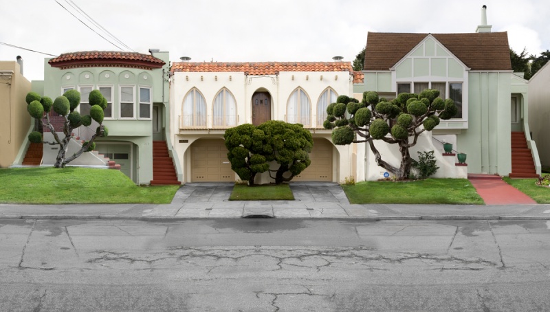
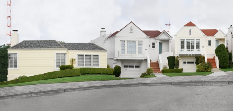
[Images: (top) “White Street,” (second from top) “Ocean Circle”, (second from bottom) “Jean Street,” and (bottom) “Caraway Street,” all by Leigh Merrill from Streets].

She continues:

In investigating this landscape I photographed thousands of homes throughout the area and then digitally assembled these images together to create new and illogical structures and streets. At first these images look plausible, however, closer inspection reveals their fabrication. The reconstructed homes and neighborhoods appear skewed, revealing their underlying and sometimes unconscious intentions. These constructs highlight the ways in which our built environments pull from a variety of different architectural and landscape styles and reflect cultural ideas of beauty and perfection. In working with the Bay Area as a site for investigation, I explore what our built environments tell us about our own individual desires as well as our collective culture and ideals.

Similar to the work of Filip Dujardin, Merrill’s images assemble believable structures just up to the limit of surreality. Weird topiaries and stained concretes reappear image to image and impossible vanishing points force odd symmetries on the opposing edges of single compositions.

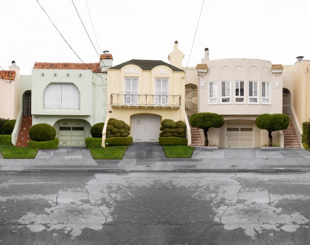
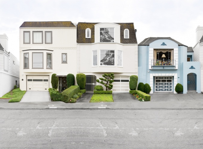
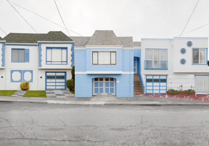
[Images: (top) “Bushes” and (bottom) “Pebble Street” by Leigh Merrill from Streets].

San Francisco seems surprisingly well-represented by this technique, I have to say, and Merrill’s digital skills are incredible. And, lest her approach somehow seem possible only within the repetitive suburban architecture of outer San Francisco, Merrill has embarked upon a similar project featuring the low-slung buildings and storefronts of north Texas with equally interesting results.

[Image: “The Dragon” by Leigh Merrill from Into the Sunset].

The idea of the imaginary view brings to mind the distortionary engraving techniques of Piranesi, who similarly fabricated exaggerated, impossible, and critical views of the city—in his case, Rome. Only, in this case, it’s as if Piranesi had moved to the Sunset District or the Outer Richmond of San Francisco, that supposedly beautiful city, with a high-res camera and a copy of Creative Suite.

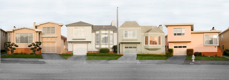
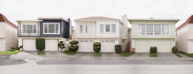
[Images: (top) “Ocean Place” and (bottom) “Ocean Street” by Leigh Merrill from Streets].

Meanwhile, Merrill’s work is available in a new print from Small Batch Editions. Small Batch Editions “is dedicated to bringing together a carefully curated selection of photographs from around the world, and making them available for a wider audience. To this end, we proudly publish limited edition prints, working closely alongside each artist to ensure the highest standards of quality.”

Check out their back catalog—and more of Leigh Merrill’s work—when you get a chance.

(Thanks to Melissa Stafford of Small Batch Editions for the tip).

The Architecture of Banana Control

[Image: A nearly empty banana truck; photo by the author].

I had the pleasure two weeks ago of tagging along on a field trip led by Nicola Twilley, of Edible Geography, for a seminar she’s teaching this fall at Columbia’s GSAPP. Called “The Artificial Cryosphere,” the class is an extended look at spaces and technologies of artificial refrigeration, from morgues to ice cream plants, from sperm banks to indoor hockey rinks, from spacecraft testing rooms to the transportation needs of organ-donation networks.

The field trip itself started off early at a banana-ripening and fruit distribution warehouse in Queens, extending from there to one of the largest refrigerated food warehouses in the country and ending with a series of visits to semi-automated modified-atmosphere packing lines and other meat-processing facilities, complete with fat-covered chainsaws attached to the ceiling and mandatory hairnets.

Nicola has written up the first part of that trip, describing in detail her class’s journey through the architecture of banana ripening. “Nearly two million bananas pass through these ripening rooms,” we read on Edible Geography, “on their journey to New York consumers each week—a vital link in the largely invisible, highly specialized architecture of artificial refrigeration that has enabled the banana to become and remain America’s favourite fruit.” Much of this is about dissimulation, artificially inducing the fruit-ripening process using “pressurized, temperature- and atmosphere-controlled rooms that fool the banana into thinking it is still back on the plant in tropical Ecuador.” It is architecture pretending toward a condition of ideal nature.

Further, we learned how boxes of bananas are first designed—with holes in their cardboard boxes—and then stacked—in orderly aisles, leading to wall-sized fans that suck air through the room—so as to maximize ventilation, and that it is more or less an entirely nocturnal operation, with the warehouse only opening at 10pm. In particular, though, it’s hard to forget walking into the ethylene-dosing chambers with their massive 20′-doors, like something out of a story by H.P. Lovecraft, promising some strange and vaguely sinister vegetative presence on the other side.

[Image: The Lovecraftian doors of the banana crypt; photo by the author].

In any case, Edible Geography has a much longer write-up, and it’s well worth checking out in full.

The Rounds

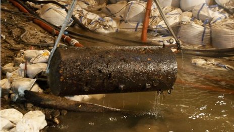
[Image: The defused Koblenz bomb is lifted to safety].

1) The German city of Koblenz was partially evacuated over the weekend so that two still active WWII-era bombs—including one weighing 1.8 tons—could be defused. The bombs “were discovered when water levels fell because of a prolonged dry spell,” the BBC reports. As it happens, “600 tons of old munitions from two world wars [are] discovered every year” in Germany, with this perhaps being one of the few examples of discovery-by-drought.

2) Elsewhere, drought in parts of Europe has become so extreme that Switzerland’s ski resorts have no snow. “The autumn has been the driest on record in the country.”

3) Over in Texas, meanwhile, a record-setting drought has lent an archaeological air to the region’s weather. “The historic drought that has devastated crops and forced millions of Texans in small towns and large cities to abide by mandatory water restrictions,” the New York Times explains, “has had at least one benefit: As lake levels have dropped around the state, objects of all kinds that had been submerged for years, decades and even centuries are being revealed.” Human skulls, tombstones, the bodies of suicide victims, and even “a piece of debris from the Space Shuttle Columbia” have been found in “roughly 200 previously unreported archaeological sites resulting from lowered lake levels.” The chairman of a local historical commission quips that “everybody hates the drought, but I needed the drought.” “I knew it was there,” he adds, referring to a cemetery for freed slaves that has been revealed by the receding waters. The image is remarkable: a whole state of archaeologists, landowners, and historians waiting patiently on the shores of shrinking lakes for some forgotten landscape or artifact to be revealed.

[Image: Part of the Space Shuttle Columbia; photo courtesy of the Nacogdoches Police Department via the New York Times].

4) Politics by geography: “There are no guard towers, or Checkpoint Charlies, or even walls. But scores of American cities, counties and metropolitan areas are being divided again—splitting apart families, neighbors and, most important, voters with similar interests and needs—as states engage in the once-a-decade process of drawing the lines of new Congressional districts.” However, “when urban and metropolitan areas are broken up and combined with rural areas, mayors say, fewer voices are left to vigorously push an urban or metropolitan agenda in Washington.” And so cities are underserved by the political process. This latter point is perhaps reminiscent of an earlier discussion here on BLDGBLOG: Minor landscapes and the geography of American political campaigns.

5) “Imagine a lush forest: silent but for the chirping of birds flying through a dense canopy overhead, and damp, aromatic earth underfoot. Now picture a mountain of incinerated trash, 12 million tons of what was once a toxic heap of rotting fish and vegetables, old clothes, broken furniture, diapers and all manner of discarded items.” This describes a new project by architect Tadao Ando called the Sea Forest. The Sea Forest “will transform 88 hectares of reclaimed land, a 30-meter deep mound of alternating layers of landfill, into a dense forest of nearly half a million trees” in Tokyo Bay. Ando adds that it is also an experiment in climate-engineering, or weather control as the future of urban design: “not only will [the forest] become a refreshing retreat for stressed out city workers, it will also create a cool ocean breeze to sweep through the capital and cool its sweaty denizens in summer.”

[Images: Spreads from Project Japan, courtesy of Taschen].

6) The new book Project Japan by Rem Koolhaas and Hans Ulrich Obrist is an incredible document, in both physical and intellectual terms. The design, by Irma Boom, is gorgeous, and the contents—consisting of long, illustrated interviews with such figures as Arata Isozaki, Kenzo Tange’s Tange Lab, Kiyonori Kikutake, Kisho Kurokawa, and many others, scattered amongst historical imagery and present-day site photos—offer a fascinating oral history of the Metabolist movement. As Koolhaas sums it up, Metabolism offered “a manifesto for the total transformation of the country” based on three specific principles. Still quoting Koolhaas:

a) The archipelago has run out of space: mostly mountainous, the surfaces fit for settlement are subdivided in microscopic, centuries old patchworks of ownership
b) Earthquakes and tsunamis make all construction precarious; urban concentrations such as Tokyo and Osaka are susceptible to potentially devastating wipeouts [ed. note: cf. today’s calls for a “back-up Tokyo“]
c) Modern technology and design offer possibilities for transcending Japan’s structural weakness, but only if they are mobilized systematically, almost militaristically, searching for solutions in every direction: on the land, on the sea, in the air…

Architecture thus becomes the literal geopolitical extension of the state, constructing new territory—such as floating forests and artificial islands—over which to govern. It’s a kind of proactive gerrymandering, we might say: not redesigning the district map, but constructing new districts. In any case, I recommend the book.

7) Cities in the jungle:

a) “Forgoing the plan to build independent floating cities away from chafing laws, some libertarians—led by Milton Friedman’s grandson, no less—have found something better: desperate countries willing to allow the founding of autonomous libertarian cities within their borders.”
b) “The inventor of the concept of cities with special laws designed to spur the lagging economies of failing states talks about the latest attempts by the Free Cities Institute to found a charter city in Central America.”
c) “The newest—and nicest—road in Myanmar is, paradoxically, one of the emptiest as well: Only a handful of cars travel along the desolate four-lane highway to nowhere, or so it seems. But in fact, it leads to Naypyitaw, a new city in one of the world’s poorest countries, carved out of the jungle and built from scratch by an aging, autocratic leader who then moved the nation’s seat of government there, lock, stock and barrel.”

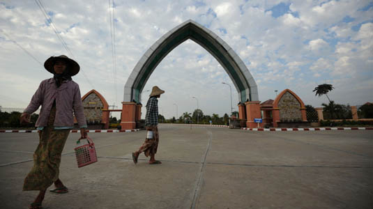
[Images: Photos by Soe Than Win/AFP/Getty Images, courtesy of NPR].

8) Quantum geology: “A pair of diamond crystals has been linked by quantum entanglement.” This is, as Nature describes it, “a weirdly connected quantum state… [in which] both crystals were simultaneously vibrating and not vibrating.” It’s extraordinary to think about the possibility of much larger-scale quantum entanglement, for instance planet-scale mineral deposits vibrating in tune with one another, like the so-called “diamond planet” discovered earlier this year.

9) Galactic GPS: Autonomous spacecraft could someday navigate the universe based on directional information taken from pulsars. “Pulsars are rapidly rotating neutron stars that are observable as variable celestial sources of electromagnetic radiation. Their periodic signals have timing stabilities comparable to atomic clocks and provide characteristic temporal signatures that can be used as natural navigation beacons, quite similar to the use of GPS satellites for navigation on Earth.”

10) I meant to link this months ago: an office complex in Santa Monica uses trained falcons to ward off other birds. It’s called “falconry-based bird abatement.” In a weird sort of bird-building cyborg assembly, the falcons are kept “tethered to 10-pound blocks” on the edge of an artificial lake in order “to keep them from flying off and landing in harm’s way in the congested area around 26th Street and Olympic Boulevard.” The falcons are even “equipped with tiny transmitters” in case “they get disoriented by the unfamiliar surroundings of Santa Monica. But they always respond to [the trainer’s] call when it’s time to take up their positions around the courtyard pond.” It gets weirder: “They spend their nights in large perch boxes in the Water Garden’s subterranean parking garage.” Perhaps all buildings should come with living bird-ornaments…

11) …or robots. By now, you’ve no doubt read that “robotic prison wardens” are set “to patrol [a] South Korean prison.” According to the BBC, “the machines will monitor inmates for abnormal behavior.” What could possibly go wrong?

12) Or we could combine animals and robots in the name of urban safety: “Insect Cyborgs May Become First Responders.” According to ScienceDaily, tiny “cameras, microphones and other sensors and communications equipment” could be mounted directly on the backs of insects, and “we could then send these ‘bugged’ bugs into dangerous or enclosed environments where we would not want humans to go.”

[Image: An “insect cyborg” via ScienceDaily].

13) A former U.S. military base in Iraq has been turned into a surreal new hotel where “guests are greeted by a jumble of concrete blocks, sand bags and barbed wire—the hotel’s front gate.” The hotel “relies on hundreds of American military residential trailers, known as CHUs, from the acronym for containerized housing unit. They had once accommodated guards.” Now, however, hoteliers have “installed indoor plumbing in some, creating the guest rooms.” On the other hand, the New York Times adds, “besides the few upgrades to the trailers, the prison remains unaltered and eerily empty, the wind whistling through the old guard towers.” Trailers go for roughly $190 a night.

[Image: Photo by Andrea Bruce for the New York Times].

14) There is a growing incidence of archaeological looting in the U.S. led by meth addicts. According to a recent study, “since meth labs are often found in isolated areas, just like archaeological sites, geographical coincidence may explain the complaints. Meth addicts are known for repetitive behavior and may find digging at sites soothing.” This would make an interesting premise for a film: desperate meth heads excavating unmarked burial mounds in the middle of the night, loading up their trucks under the moon.

15) Finally, for now, were the first human architects actually Neanderthals? “Neandertals are stumping for bragging rights as the first builders of mammoth-bone structures, an accomplishment usually attributed to Stone Age people. Humanity’s extinct cousins constructed a large, ring-shaped enclosure out of 116 mammoth bones and tusks at least 44,000 years ago in West Asia,” ScienceNews reports. “The bone edifice, which encircles a 40-square-meter area in which mammoths and other animals were butchered, cooked and eaten, served either to keep out cold winds or as a base for a wooden building.” Elsewhere: Who was the Archigram of mammoth bones?

(Some links via Archinect, @nicolatwilley, @namhenderson, and elsewhere. Previously: Quick Links 15, 14, 13, 12, 11, 10, 9, 8, 7, 6, 5, 4, 3, 2, and 1).

Horizon Repair

[Image: Window by Susanna Battin, courtesy of the artist].

If you’re out driving in Los Angeles this coming Friday, December 2, consider using the second lane from the left, heading south on I-15 immediately after the 91 Freeway interchange and before the East Ontario exit: artist Susanna Battin‘s new work, Window, will be on display on a digital billboard overlooking the highway, and will be best viewed from that lane. There, “Los Angeles freeway commuters [will] briefly witness the billboard transform into a window,” Battin explains, in “an attempt to repair the visually severed mountain range” beyond. Battin’s elevated digital image also accounts for “thirteen of San Bernardino’s varying smog conditions,” so the overlap will hopefully work by blending in with the local weather.

Here’s a map of where to be.

Meanwhile, I’m curious if you could achieve something vaguely similar, but without the digital billboard—something like the optical effects of Felice Varini, but applied at a particular curve in the freeway, using different overlapping space frames partially installed on different rooftops, or various painted outlines distributed across other billboards and facades. They would all lock together for a brief and fleeting instant, from one very specific angle, perhaps even too fast to notice, and thus “repair” the surrounding landscape. I suppose, in some mythical world where insurance liability is not an issue, Felice Varini, Susanna Battin, and Caltrans could team up to make the California highway system itself into a massive and perceptually instantaneous optical installation, visible in full effect only at certain exact velocities and angles.

In any case, if you see the installation, and don’t risk crashing your car, consider taking a picture and sending it in; I’d love to see if this works.