Building Blogs

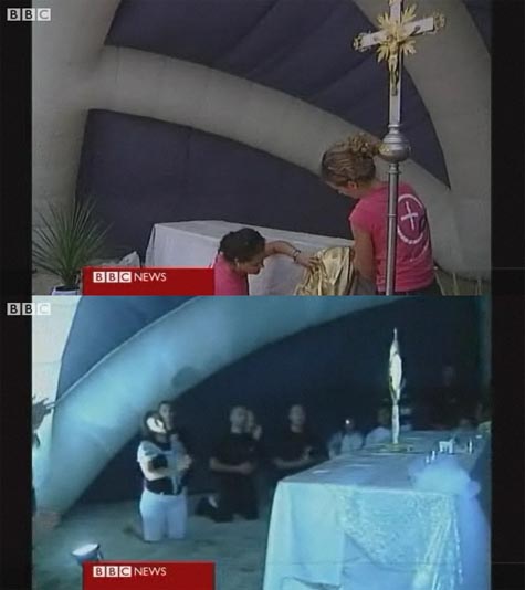
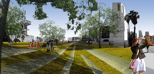
BLDGBLOG got a nice shout-out today on Current TV.

[Images: From Current TV’s short segment, “Building Blogs“].
In addition to Current‘s description of BLDGBLOG in that short video, they write: “What can you say? Right now, THE blog of the contemporary architecture world.” Also deservedly mentioned in their brief tour of architecture blogs are Life Without Buildings, Tropolism, City of Sound, and Archidose – all bloggers I’ve actually met. For members of a globally distributed blogosphere, we’re not as disembodied as you’d think…
While I’m tooting my own horns here, though I don’t normally point out things like visitor numbers, BLDGBLOG has been seeing more than 175,000 – and as many as 205,000 – unique visitors per month this summer; so I owe everyone a huge thanks for stopping by!

An Architectural Pathway to Artificial Life

[Image: NASA’s ANTS].

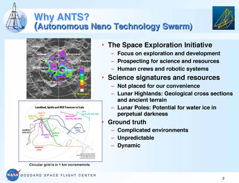
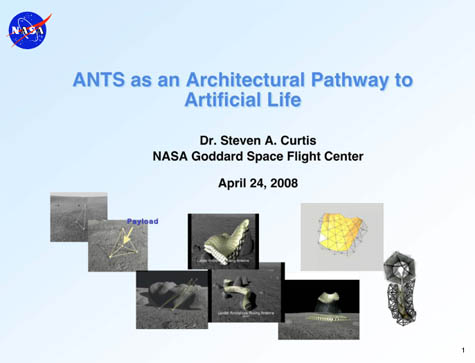
Alex Trevi sent me a link last week – which he later posted – about the so-called ANTS program. ANTS is an “autonomous nano technology swarm” developed by NASA for possible use in the “lunar base infrastructure” of tomorrow.
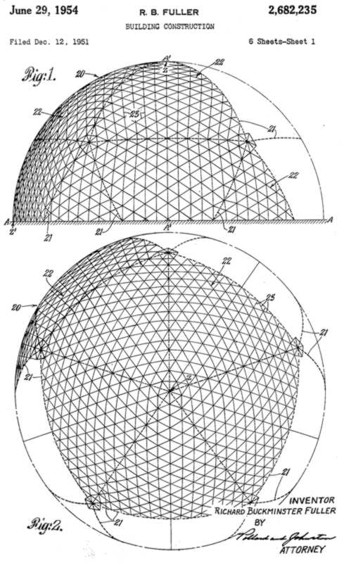
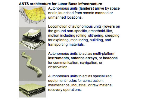
ANTS consist of “highly reconfigurable networks of struts, acting as 3D mesh or 2D fabric to perform a range of functions on demand.”

The ANTS approach harnesses the effective skeletal/muscular system of the frame itself to enable amoeboid movement, effectively ‘flowing’ between morphological forms. ANTS structures would thus be capable of forming an entire mobile modular infrastructure adapted to its environment.

However, I was especially excited to see that the ANTS system has been hypothesized as “an architectural pathway to artificial life.”
Might the artificial biology of tomorrow be buildings that have come to life?

[Images: NASA’s ANTS].

I’m reminded here of Philip Beesley’s Implant Matrix, or Theo Jansen’s Strandbeesten, machine-architectures that cross over into animation and back, convincingly evincing signs of life.
But NASA’s recent research into ANTS suggests that these units could actually be used to build whole bases and instant cities under extreme – and literally lunar – living conditions, where the village itself would not be just a substrate or infrastructure but a kind of artificially intelligent labyrinth of living architecture that coils round itself in a cascade of walls and air locks. All under the constant radiative glare of the sun.

[Image: NASA’s ANTS].

These “autonomous remote systems,” as NASA refers to them, are already coming into existence, of course; one need only look as far as the skies of the Middle East, for instance, which now buzz with unmanned aerial drones, or at the deep desert labs of the U.S. Air Force, where shape-shifting airplanes are taking (and re-taking) shape.
But is there a drone architecture?
Unmanned buildings – server farms, parking garages, airport terminals, and offshore cargo-processing warehouses (or RoboVault, say) – that, given mobility, could approach the condition of biology?
And is this what the haunted house genre has always been about: a fear of architecture that has come to life?

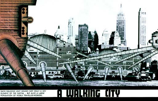
[Image: Ron Herron’s Walking City, first proposed in Archigram 4 (1964)].

It’s NASA meets Archigram meets Manuel de Landa meets Theo Jansen – a walking city gone off-world, communicating via secure satellite to earthbound observers back home.

(See also Pruned‘s take on this).

An Earth Without Its Surface

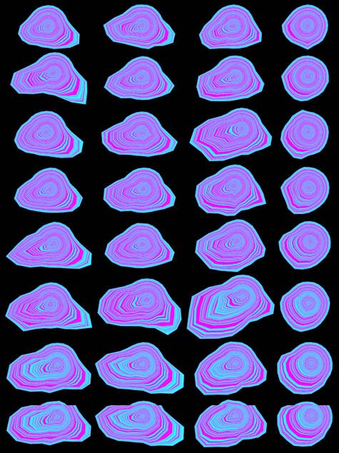
The British Geological Survey has teamed up with fledgling science organization OneGeology to show us what the earth would look like without soil – or water, or cities, or anything, really, but geology.
View larger.
I have to admit, on the other hand, that, as cool as this image is – revealing the semi-liquid mixtures of underground terrains that we walk over everyday – it’s an absurd way to present the information. Badly colored and with a 1970s funk album sunrise coming round the planet?
Surely, with such a signature image, they could have made a better globe?

The Psychiatric Infrastructure of the City

A few years ago, the Boston Globe looked at what we might call the psychiatric impact of that city’s Big Dig project. The Big Dig was a massively expensive urban engineering project that put Boston’s Central Artery underground, freeing up space on the earth’s surface for parks and businesses.

The project, however, was plagued with cost over-runs, engineering difficulties, and the periodic collapse of public support (even the periodic collapse of the ceiling).

From the Globe:

In the short term, mental health experts say, tempers may flare as the public deals with the logistical inconvenience of detours, lingering uncertainty about the safety of the tunnels, and mounting cynicism about the project. (…) And there may be long-term effects as well – ones that could subtly reshape the city’s identity.

What interests me here is not the obvious fact that bad traffic might cause tempers to flare, but the idea that people might develop historically unique psychiatric conditions because of a work of public infrastructure under construction somewhere in their city.

A new tunnel, say, is being dug between Manhattan and New Jersey, and moods in the city begin to darken. Psychiatrists notice a strange surge in patients; people come in complaining of nightmares of forced reunion, being in the same room again with an annoying relative they thought they’d left behind long ago. Homeowners wake at 3am each night, convinced someone’s trying to break into the basement. The whole island is ill at ease.

And it’s all because of that new tunnel getting closer and closer to completion.

Or, say, a new flood barrier is under construction outside London – a gleaming wall of metal that will rise from the tidal murk. Would it change the dreams of city residents? Would this distant piece of hydro-infrastructure affect how Londoners feel about their city – or about themselves? A new confidence. Dreams of survival. Psychoanalysts report that no one dreams of drowning anymore.

On one level here, the answers are both uninteresting and obvious: of course, these sorts of projects would affect the dreams, thoughts, and nightmares of a city’s residents – after all, those new landmarks would be a part of the world these people live within.

But a less obvious, or less easily tracked, impact might be postulated here – that, say, a new bridge between San Francisco and Oakland might subtly change how San Franciscans think about their peninsular city, and that this only becomes obvious in retrospect, when someone notices that prescription rates have changed or the divorce rate has plummeted: it was the psychiatric implication of a new bridge that did it.

Put another way, if a new highway can have a measurable, and easily detected, impact on a city’s economic health and administrative well-being, then could a new highway – or bridge, or tunnel, or flood wall, or, for that matter, sewage treatment plant – have a detectable impact on the city’s mental health? After all, these sorts of massive public works “may carry a psychological burden,” the Boston Globe wrote back in 2006.

It’s the psychiatric infrastructure of the city.

(Thanks to Josh Glenn, Eric Fredericksen, and the Hermenautic Circle for the Boston Globe link).

15 Lombard Street

[Image: The cover and a spread from 15 Lombard St. by Janice Kerbel].

15 Lombard St. is a book by artist Janice Kerbel, published back in 2000. It presents itself as “a rigorously researched masterplan of how to rob a particular bank in the City of London.”

By observing the daily routine in and around the bank, Kerbel reveals the most detailed security measures such as: the exact route and time of money transportation; the location of CCTV cameras in and around the bank along with precise floor plans that mark the building’s blind spots.
Kerbel’s meticulous plans include every possible detail required to commit the perfect crime.

The book was pointed out to me by Sans façon in relation to an earlier post here on BLDGBLOG about the city re-seen as a labyrinth of possible robberies and heists that have yet to be committed – a geography of tunnels yet to be dug and vaults yet to be emptied.

But is there a literary genre of the crime plan? An attack or robbery outlined in its every detail. Is this fiction, or some new form of illicit literature, detailing speculative and unrealized crimes hidden in the city around us? Is robbing a building just another type of architectural analysis? Or does one put such a thing into the category of counter-geography – a minor cartography, a rogue map? Or perhaps radical cartography, as the saying now goes? Would there be an impulse toward censorship here?

There’s a fascinating series of interviews waiting to be done here with people who work in building security – how a building is deliberately built to anticipate later actions. Or, should we say: how a building is built to contain the impulse toward certain, more radical uses.

When the burglars get to this door, they’ll become frustrated and will try to break through the nearby window, instead – so we must reinforce this window and put a camera nearby.

The building has within it certain very specific possible crimes, the way this house contained a “puzzle.” I’m reminded of the famous Bernard Tschumi line, and I’m paraphrasing: Sometimes to fully appreciate a work of architecture you have to commit a crime.

Architectural space becomes something like an anticipatory narrative – the exact size and shape of a future heist, nullified. It outlines future crimes the way a highway outlines routes.

(Thanks again to Sans façon for the tip!)

The Atlas of All Possible Bank Robberies

[Image: From The Bank Job].

It occurred to me that you could make a map—a whole book of maps—detailing all possible routes of bank robbery within the underground foundations of a city. What basements to tunnel through, what walls to be hammered down: you make a labyrinth of well-placed incisions and the city is yours. Perforated from below by robbers, it rips to pieces. The city is a maze of unrealized break-ins.

A whole new literary genre could result. Booker Prizes are awarded. You describe, in extraordinary detail, down to timetables and distances, down to personnel and the equipment they would use, how all the banks in your city might someday be robbed. Every issue of The New Yorker, for instance, includes a short, 600-word essay about breaking into a different bank somewhere in Manhattan, one by one, in every neighborhood. Ideas, plans, possibilities. Scenarios. Time Out London does the same.

It soon becomes a topic of regular conversation at dinner parties; parents lull their kids to sleep describing imaginary bank robberies, tales of theft and architectural transgression. Buildings are something to be broken into, the parents whisper. It’s what buildings have inside that’s your goal.

Mysterious Chinese Tunnels

[Image: The brick-arched entryway to a “mysterious Chinese tunnel” in the Pacific Northwest (via)].

72 years ago, a man named William Zimmerman sat down with a to tell an agent of the U.S. government to tell a story about “mysterious Chinese tunnels” beneath the Pacific Northwest. His interview was conducted as part of the Federal Writers’ Project, and it can be read online in a series of typewritten documents hosted by the Library of Congress.

Zimmerman claims that “mysterious” tunnels honeycombed the ground beneath the city of Tacoma, Washington. These would soon become known as “Shanghai tunnels,” because city dwellers were allegedly kidnapped via these underground routes – which always led west to the city’s docks – only to be shipped off to Shanghai, an impossibly exotic urban world across the ocean. There, they’d be sold into slavery.

[Image: The cover page for one of many U.S. government documents called “Mysterious Chinese Tunnels“].

Subterranean space here clearly exists within an interesting overlap of projections: fantasies of race, exoticism, and a subconscious fear of the underworld all wrapped up into one narrative package. White Europeans had expanded west all the way to the Pacific Ocean – only to find themselves standing in a fog-covered marsh, on earthquake-prone ground, with a “mysterious” race of Chinese dock workers tunneling toward them through the earth, looking for victims… It’s like a geography purpose-built for H.P. Lovecraft: down in the foundations of your city is a mysterious network of rooms, excavated by another race, through which unidentified strangers move at night, conspiring to abduct you.

[Image: Another “mysterious Chinese tunnel” in the Pacific Northwest (via)].

In any case, because “construction of the Northern Pacific Railroad required large numbers of railroad laborers,” Zimmerman’s tale begins, “many Chinese coolies” had to be smuggled into the “rapidly growing city of Tacoma.” They “arrive[d] mysteriously,” he says, “smuggled in on ships, and even Indian canoes, from British Columbia.”

Several opium joints were known to be operating in Tacoma. And there was no question in the minds of many people that the narcotic was smuggled in through tunnels from their dens to cleverly hidden exits near the waterfront. They were also convinced that the tunnels were dug by Chinese, either as a personal enterprise or at the behest of white men of the underworld, as no white workmen would burrow the devious mole-like passageways and keep their labors secret.

Zimmerman adds that the Chinese “were forcibly expelled from Tacoma in 1885, but ever [sic] so often the story of the Chinese tunnels bobs up whenever workmen come across them in excavation work.”

[Image: Entries to Tacoma’s mysterious Chinese underworld? Photo by Stephen Cysewski (via)].

Meanwhile, the same year as Zimmerman’s interview – 1936 – a 39-year old man named V.W. Jenkins also sat down with a representative of the Federal Writers’ Project, and he had this story to tell:

In the spring of 1935 when the City Light Department was placing electric power conduits under ground, workmen digging a trench in the alley between Pacific Avenue and ‘A’ Street at a point about 75 feet south of 7th Street, just back of the State Hotel, crosscut an old tunnel about ten feet below the surface of the ground. This tunnel was about three feet wide by five feet high, and tended in a southwesterly direction under the State Hotel, and in the opposite direction southeasterly toward Commencement Bay. I entered the tunnel and walked about 40 or 50 feet in each direction from the opening which we had encountered. There it went under the hotel the tunnel dipped sharply to pass under the concrete footings of the rear wall, proving that the tunnel was dug after the hotel had been built. In the other direction the tunnel had a sharp turn to the left, and after several feet, a gradual curve to the right, so that it was again tending in the same direction as at the opening. About 50 feet from the opening on the Bay side the tunnel began to dip and in another ten feet began to decline very sharply so that it would have been necessary to use a rope to descend safely on the met slippery floor. The brow of the bluff overlooking the waterfront is but a short distance from this point, explaining the need for the rapid downward slope, although it is probable that farther on there is a turn, either right or left, and that the tunnel was dug at an easier grade before emerging at a lower level.

Jenkins then offers this bizarrely wonderful explanation for what else might have formed those tunnels:

Some persons contend that these openings found in the vicinity of Tacoma were caused by trees buried in the glacial age, and after decaying, left the openings in the glacial drift. If this is the true explanation for the tunnel I have described, then the tree that made it must have been a giant that grow such in the shape of a corkscrew.

Of course, there are also “Shanghai tunnels” beneath Portland, Oregon. “All along the Portland waterfront,” we read, “…’Shanghai Tunnels’ ran beneath the city, allowing a hidden world to exist. These ‘catacombs’ connected to the many saloons, brothels, gambling parlors, and opium dens, which drew great numbers of men and became ideal places for the shanghaiers to find their victims. The catacombs, which ‘snaked’ their way beneath the streets of what we now call Old Town, Skidmore Fountain, and Chinatown, helped to create an infamous history that became ‘cloaked’ in myth, superstition, and fear.”

The same website linked above describes the actual process of so-called Shanghai’ing:

The victims were held captive in small brick cells or makeshift wood and tin prisons until they were sold to the sea captains. A sea captain who needed additional men to fill his crew notified the shanghaiiers that he was ready to set sail in the early-morning hours, and would purchase the men for $50 to $55 a head. ‘Knock-out drops’ were then slipped into the confined victim’s food or water.
Unconscious, they were then taken through a network of tunnels that ‘snaked’ their way under the city all the way to the waterfront. They were placed aboard ships and didn’t awake until many hours later, after they had ‘crossed the bar’ into the Pacific Ocean. It took many of these men as long as two full voyages – that’s six years – to get back to Portland.

It all sounds like some prehistoric narrative of the afterlife – a shaman’s tale of a near-death experience: you’re blacked out and led through mysterious tunnels inside the earth, only to wake up surrounded by the oceanic, on your way to another world.

This site offers quite a lot of history of the Tacoma tunnels, and ten minutes of Googling will reveal at least a dozen blog posts and assorted minor newspaper articles about the phenomenon; but there’s something particularly intriguing about an official oral history, conducted by the U.S. government, in which tales of subterranean geography are revealed. The papers have the feel of a kind of national psychoanalysis, where each session takes the form of geographic speculation. More practically, such interviews are a fantastic premise for a short novel or film.

[Image: Photo by Michael Cook. “Looking into the bottom of the William B. Rankine G.S. wheelpit from the Rankine tailrace“].

Briefly, though, I’m also reminded of BLDGBLOG’s interview with Michael Cook, an urban explorer based in Toronto, posted last summer.

Toward the end of that interview, I asked Cook “if there’s some huge, mythic system out there that you’ve heard about but haven’t visited yet” – some long-rumored underworld that might only be speculation. Cook replies:

I guess the most fabled tunnel system in North America is the one that supposedly runs beneath old Victoria, British Columbia. It’s supposedly connected with Satanic activity or Masonic activity in the city, and there’s been a lot of strange stuff written about that. But no one’s found the great big Satanic system where they make all the sacrifices.
You know, these legends are really… there’s always some sort of fact behind them. How they come about and what sort of meaning they have for the community is what’s really interesting. So while I can poke fun at them, I actually appreciate their value – and, certainly, these sort of things are rumored in a lot of cities, not just Victoria. They’re in the back consciousness of a lot of cities in North America.

(With huge thanks to Alexis Madrigal, who sent me a link to the Tacoma tunnels last summer).

landscape.mp3: An Interview with Smout Allen

[Image: Sketches by Smout Allen].

I’ve uploaded an edited MP3 from BLDGBLOG’s interview with Mark Smout and Laura Allen, recorded two weeks ago in London at the Storefront for Art and Architecture.
We discuss everything from active vs. passive landscapes to mudflats, river deltas, and the architectural form of managed retreat on the British coast; from the design implications of climate change to artificially refrigerated Chinese tundra in Tibet; from Smout Allen’s educational work with Unit 11 at the Bartlett School of Architecture to their work as documented in the excellent and highly recommended Pamphlet Architecture book Augmented Landscapes.

[Images: Sketches by Smout Allen; these images are also briefly explored in the forthcoming BLDGBLOG Book].

The MP3 comes in at about 37 minutes. If you have any thoughts, let me know! I’d love to discuss this further.
Special thanks go out to Mark Smout and Laura Allen themselves, and to Joseph Grima and the Storefront for Art and Architecture for hosting the event.

Spaces, Repeating: An Interview with Tom McCarthy

[Image: Tom McCarthy and Remainder].

I’ve uploaded an MP3 from BLDGBLOG’s interview with novelist Tom McCarthy, recorded on the 4th of July at the Storefront for Art and Architecture in London. We cover a range of topics, from memory and architecture to trauma and the spatial nature of repetition, via Italo Calvino, Marcel Proust, Friedrich Nietzsche, and William Burroughs – plus a bit of James Joyce – during a long talk about McCarthy’s novel Remainder (previously described here).
The file is available for download at this link; if you’ve never used Megaupload before, just enter the letters that you see, wait 30-40 seconds as per the instructions, and then knock yourself out.
Of course, I’d love to discuss this discussion further, so if you have any thoughts, please feel free to chime in.
Thanks again to Tom McCarthy for coming out for the conversation, and to Joseph Grima and the Storefront for Art and Architecture for hosting it.

Chemical Nature

[Images: Poison ivy, resplendent in high-CO2 environments. Photos by Steve Legato for The New York Times].

One of the oft-repeated myths of the present day is that climate change cannot possibly be bad for the living environment; plants will simply thrive in the increased levels of atmospheric CO2. After all, some people call it pollution while others call it life, right?
Well, it turns out that at least one plant unfortunately does like all that carbon dioxide: poison ivy is not only thriving, it is growing more virulent.
The New York Times today reports that “Researchers at Duke University who studied the weed between 1999 and 2004 in a controlled forest area near Chapel Hill, N.C., where high levels of CO2 are pumped into test plots, found that poison ivy not only grew more vigorously, but also produced a more toxic form of urushiol, the resin that causes its rash.”
First, let me briefly say that I’ve actually been to that forest. I once lived, and went to college, in the area, and I had friends who’d developed fascinating conspiracy theories about all those strange devices pumping something – some kind of invisible gas – into the forest… It was all very X-Files.
Second, the article goes on to interview a local horticulturist who now makes a living killing poison ivy. However, he quietly expresses hope that Americans will someday “discover some use for the plant,” referring to poison ivy as a kind of overlooked decorative resource. “In China and Japan,” he says, “they made lacquer out of their resin plants, so they understand and value it… Whereas we just see it as that darn weed over there.”
Of course, it’s interesting to project a direct relationship here between the amount of lacquered furniture being produced in the United States and the intensity of global climate change – that as the latter goes up, so does the former – but such speculation would miss a more interesting point, which is that climate change will not only alter the atmospheric composition of the planet, it will alter the chemical nature of the life that’s able to thrive on it.

Baarle-Hertog

In response to the previous post, a reader kindly pointed me to the fascinating town of Baarle-Hertog, Belgium.
Baarle-Hertog borders the Netherlands – but, because of its unique history of political division, the town is sort of marbled with competing national loyalties. In other words, pockets of the town are Dutch; most of the town is Belgian. You can thus wander from country to country on an afternoon stroll, as if island-hopping between sovereignties.
Check out the town map.

[Image: The strange, island-like spaces of micro-sovereignty within the town of Baarle-Hertog; a few more maps can be seen here, and you can read more in this two-page article].

Being in a bit of a rush at the moment, I’ll simply have to quote Wikipedia:

Baarle-Hertog is noted for its complicated borders with Baarle-Nassau in the Netherlands. In total it consists of 24 separate pieces of land. Apart from the main piece (called Zondereigen) located north of the Belgian town of Merksplas, there are twenty Belgian exclaves in the Netherlands and three other pieces on the Dutch-Belgian border. There are also seven Dutch exclaves within the Belgian exclaves. Six of them are located in the largest one and a seventh in the second-largest one. An eighth Dutch exclave lies in Zondereigen.

The border is so complicated that there are some houses that are divided between the two countries. There was a time when according to Dutch laws restaurants had to close earlier. For some restaurants on the border it meant that the clients simply had to change their tables to the Belgian side.

Sarah Laitner, at the Financial Times, adds that “women are able to choose the nationality of their child depending on the location of the room in which they give birth.”
Another website, apparently drawing from the Michelin Guide to the Netherlands, explains the origins of Baarle-Hertog’s bizarre geography: it can all be traced back to the 12th century, it seems, when the town was first divided. The northern half of the town became part of the Barony of Breda (later home to the Nassau family), and the southern half went to the Duke of Brabant (Hertog means Duke in Dutch).
But that same website also mentions this:

The municipality limits are very complicated. Nowadays, each municipality has its city hall, church, police, school and post office. The houses of the two nationalities are totally mixed. They are identified by the shield bearing their number: the national flag is included on it.

I hate to refer to Thomas Pynchon twice, in back-to-back blog posts, but there something’s remarkably Pynchon-esque about this final detail.
In any case, also check out this site for more historical information.
While we’re on the subject of micro-sovereignties, though, be sure to check out Neutral Moresnet, a tiny, politically independent non-state formed around a zinc mining operation in eastern Belgium. There’s also Cospaia, “a small former republic in Italy” which “unexpectedly gained independence in 1440” after Pope Eugene IV sold the land it stood on. “By error,” we read, “a small strip of land went unmentioned in the sale treaty, and its inhabitants promptly declared themselves independent.”
The Free State Bottleneck, Åland Islands, and the Sovereign Military Order of Malta are all also worth checking out.
Finally, of course, I’d be remiss if I didn’t point out BLDGBLOG’s earlier interview with Simon Sellars, co-author of The Lonely Planet Guide to Micronations.

(With huge thanks to Scott Gosnell, Christopher, Claus Moser, and Blinde Schildpad for the tips!)