Planet Glove

It’s quite hard to get excited about stories like this: “Scientists are monitoring the progress of a 390-metre wide asteroid discovered last year that is potentially on a collision course with the planet.” The asteroid is called Apophis, after an ancient Egyptian spirit of “evil and destruction, a demon that was determined to plunge the world into eternal darkness.”
Scientists are now “imploring governments to decide on a strategy for dealing with it” – because the earth is in danger…! Again.
Only this time, the story has inspired an architectural idea.


[Image: The Roman Coloseum, photographed from space].

The exact trajectory of Apophis is apparently well-calculated (albeit with a few minor blindspots, such as whether or not it will actually come anywhere near the planet).
But surely you could just use a bigger computer – or cancel your lab workers’ vacation time – and soon you’d know, to the exact square-meter – to the very time of day! – where Apophis will land.
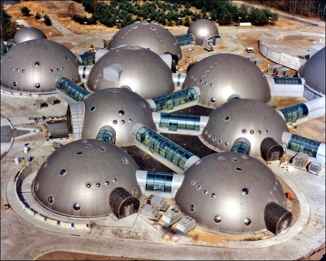
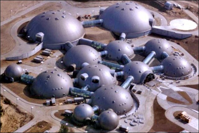
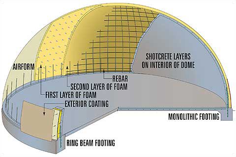
At which point we’ll build a huge baseball glove.


[Image: Michael Sorkin, Chavez Ravine, Los Angeles (with a new Dodgers Stadium); from the excellent, Christmas gift-worthy Wiggle].

Massive amounts of fiber-glass padding and reinforced concrete – plus entire subterranean, manmade lakes – will deflect the tectonic pressure of the asteroid’s impact, softening the outward-rippling aftershocks; the glove will even collapse in upon itself, blocking the explosion of dust that would otherwise cloud the atmosphere.
Best of all, we’ll know the exact moment of arrival, so the whole thing will be captured on film. A billion dollars’ worth of ad time has already been sold.
But maybe the calculations are off, you’re thinking. Perhaps we know Apophis will hit in 2029 – but what if it’s outside Springdale, Utah, or somewhere in the Gobi Desert, maybe even in the middle of the sea.
No problem: we’ll just build huge, kilometer-wide baseball gloves all over the planet. Floating through the Pacific. In 2016 an artist will apply for a one-year residency on one of the floating gloves, and her notes and photographs will be published the next year to great critical and commercial acclaim.
Then, in 2029, live on TV: catastrophe averted.
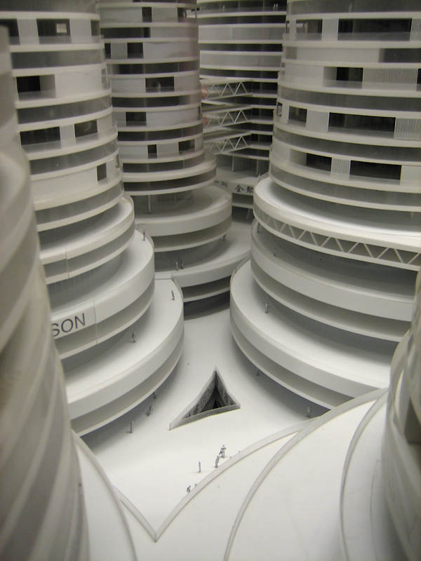
The glove-stadium actually works.


[Image: Planet Glove, by BLDGBLOG].

(Inspired by a brief discussion on Archinect; see also BLDGBLOG’s earlier post, The Torino Scale, for more on the architecture of impact).

Beijing Boom Tower


The Dynamic City Foundation describes Beijing Boom Tower by architect Neville Mars as an “inspiration against sprawl,” through which “an entirely new urban reality is being created.”


The Boom Tower, they say, is an example of “the market responding to all future demands: suburban living in the heart of China’s capital.” Which is interesting, because this is possibly the least suburban thing I’ve ever seen.


Be sure to dress colorfully.
“Can the city withstand 15 more years of uncontrolled expansion?” they ask. “Can architecture even comprehend the scale of the urban problem? Can the mixed-use megastructure combat our segregating society?”
Why the answer to these questions is a city within a city, constructed from what look like huge stacks of white film canisters plastered with corporate logos, is beyond me – but as a set for a science fiction film?
Go for it.


At least it would attract a lot of tourists.
If you want to learn more about the complex, you can actually watch this (often surreal) short film, wherein you will learn that Beijing Boom Tower… includes a driving range.
Or just download this PDF, which contains an interview with project architect Neville Mars, including his thoughts about the desegregated garden-city towers of the future.


(Originally spotted at we make money not art).

It’s parking space time

Any public parking space can be prime real estate: well-located, easy to access, convenient. You rent the space out for a given time while you park your car – but surely you could engage in other activities while there? You’ve paid your money; the space is yours for two hours; why not have a barbecue, or play a game of chess, have a picnic… even open a short-term public park?


This was the premise behind PARK(ing), by the San Francisco-based group Rebar (also responsible for the Cabinet National Library – a filing cabinet in the middle of the desert).
As Rebar writes, “more than 70% of San Francisco’s downtown outdoor space is dedicated to the private vehicle, while only a fraction of that space is allocated to the public realm. Feeding the meter of a parking space enables one to rent precious downtown real estate, typically on a 1/2 hour to 2 hour basis. What is the range of possible occupancy activities for this short-term lease?”
How about “a metered parking spot for public recreational activity”? In other words, a temporary public park.
Take a look:


Rebar’s caption for that last photograph is: “the need for green open space is apparent.” Indeed.

Aurora Britannica

[Image: Jan Curtis].

The Northern Lights are on the move.
“The Earth’s north magnetic pole is drifting away from North America so fast that it could end up in Siberia within 50 years, scientists have said.”

[Image: Jan Curtis].

“The shift could mean that Alaska will lose its northern lights, or auroras, which might then be more visible in areas of Siberia and Europe” – including, of course, the cities: Northern Lights coiling above cathedrals, bus routes, and sidewalk cafes.

[Image: Jan Curtis; see BLDGBLOG’s Radio Aurora New York for another].

Auroras have already been spotted as far south as Rome, crackling above the Pantheon; following these recent, accelerating movements of the earth’s magnetic field, however, Roman auroras might occur every night.
Hotel rates will skyrocket.

[Image: “The magnetosphere is a kind of elastic fire. It forms where the Earth’s magnetic field meets the hot plasma – the ionised gases – at the edge of the planet’s atmosphere.” It is “occasionally rocked by an explosive convulsion that flings some of its energies at the Earth, switching on spectacular auroras, damaging satellites, and knocking out electric power grids”].

At least one possible architectural project here would be to construct a tower of some sort, or a superstadium full of ring magnets and electromagnetic coils; these would attract, then trap, the planet’s north magnetic pole.
The pole would be permanently anchored; its terrestrial migration – and ultimate reversal – would stop.
The stadium would hum quietly, and all compasses would point toward it.
Massive sheets of auroral light would then torque downward every night at high speed – breaking away at the last minute to fold off toward the suburbs. You could stand on the roof and drink beer with your mates. Forget fireworks.
It’s a Project for a New North Pole.

Globes

[Image: “Preferred Continental Drift”].

[Image: Global life expectancy].

[Image: “Nameless Places”].

[Image: Satellite blind spots].

[Image: The Cold War].

[Image: Energy consumption].

[Image: “Population Volume”].

[Image: Global seafloor].

[Image: Nuclear energy dependency].

Literally hundreds more of these globes can be found at Ingo Günther’s Worldprocessor globe catalog.

(Thanks Leah!)

Deep Space Hilton

[Image: The “inflatable multilayered polymer hull” of this orbiting hotel room “will be around 30 centimetres thick and will contain layers of Kevlar – as used in bullet-proof vests – to provide some protection against micrometeorites and space debris” – as well as from rowdy hotel guests. Click on to enlarge; from New Scientist].

Might future space tourists need an inflatable space hotel? Of course – and “Las Vegas hotelier Robert Bigelow is aiming to supply it. Bigelow made his fortune as the owner of the Budget Suites of America hotel chain, and he is now launching a $500 million effort to expand his business off-planet.”
The design for Bigelow’s space hotel was taken from “TransHab, a never-used NASA design for an inflatable space station.” (TransHab also appears in an old BLDGBLOG post on astrobiology).
The space hotel “will provide 330 cubic metres of living space for space tourists or industrial researchers” – or even maximum security prisoners…? Instead of a secret prison city, they build a secret prison satellite-archipelago… Forget the death penalty: you’re sent alone into outer space.
Setting up the prison break film of the century.
They whiz you up there in a space elevator

[Images: Check out the Space Elevator blog, the LiftPort website and image gallery (“dedicated to building a mass transportation system to open up access to the inner solar system”), and some other technical drawings here].

– but don’t forget to pack your toothbrush.
If the your hotel room begins to wander, of course, a space tether could save you (a “100-kilometre-long ‘fishing line’ that spins freely in space may one day catch and fling satellites to higher orbits… using just solar power and the Earth’s magnetic field”); and if the tether fails, you can always use Richard Gott’s map of the universe to find your way home. (“Gott realised that… if he drew our galaxy to fit on the page, he’d need another 100 kilometres of paper to show the most distant quasar” – skip to bottom of link to see how he made the map work).
Or it serves as home for an exiled author, writing back from deep space.

(With thanks to the excellent Interactive Architecture dot Org, as well as the always ahead of its time we make money not art).

Where cathedrals go to die


When large container ships can contain or ship no more, they’re sent halfway round the world to so-called “breaking yards,” where they’re dismantled (basically by hand), their metal is salvaged, and their intact structures, down to the doors and toilet seats, are put back onto the global marketplace.
Today, these yards tend to be in Bangladesh or India – but location is just a question of cheap labor and (nonexistent) environmental regulations.
It’s toxic work.


In his book The Outlaw Sea, William Langewiesche visits the Alang shipbreaking yard in Gujarat, India. It is “a shoreline strewn with industrial debris on the oily Gulf of Cambray, part of the Arabian Sea.”
His descriptions are great: “Dawn spread across the gargantuan landscape. Alang, in daylight, was barely recognizable as a beach. It was a narrow, smoke-choked industrial zone six miles long, where nearly two hundred ships stood side by side in progressive states of dissection, yawning open to expose their cavernous holds, spilling their black innards onto the tidal flats… Night watchmen were swinging the yard gates open now, revealing the individual plots, each demarcated by little flags or other markers stuck in the sand, and heavily cluttered with cut metal and nautical debris.”


He visits a hull rerolling mill where “perhaps a hundred emaciated men moved through soot and heavy smoke, feeding scrap to a roaring furnace leaking flames from cracks in the side. The noise was deafening. The heat was so intense that in places I thought it might sear my lungs. The workers’ clothes were black with carbon, as were their hair and their skin. Their faces were so sooty that their eyes seemed illuminated.”


These photographs of a shipbreaking yard in Bangladesh are all by Edward Burtynsky, however, which makes this at least my fourth post about the man – but what can I say? His work is amazing.
There’s something almost mythological in the sight of men standing round campfires amidst the toxic debris of a structure they themselves have taken apart. A displaced landscape of rare metals leaching into the sand beneath them, poisonous deltas flowing to the sea. Metallurgical micro-hydrology.
Surviving – or not – on the scraps of a first world that sent its waste elsewhere.


But what I was actually thinking – what this post was supposed to be about, in fact – was how cool it’d be if old buildings weren’t destroyed by wrecking balls, bulldozers, or well-placed explosives – they were instead uprooted in their entirety, packed onto Panamax cargo ships and dropped onto some beach somewhere, in a tropical archipelago. Complete, intact, ready for salvage. Two hundred old stone cathedrals lined up in the mist at dawn, arches ready for cutting, naves yawning open like hulls of old tankers. Behind them, American football stadiums.
On another island, skyscrapers.
Notre-Dame is collapsing? Well, ship it to the islands, where flying buttresses, arches, and colonnades are stacked round like an inland reef.
Chartres has irrepairable structural damage? The cathedral in Köln? St. Peter’s? The entire arabesque’d core of Venice? Off to the islands! Strapped to the flatbeds and cargo holds of unregistered ships, the Houses of Parliament go floating by.
The Seagrams Building? Swiss Re? Canary Wharf? The Empire State Building? The White House?
Stonehenge?


Recognizable chunks of famous architecture litter the island shores of a barely visited archipelago. Sent there on a rusting fleet of container ships.
European cathedrals overgrown with palm trees, half-buried in sand, their crypts exposed, stained glass catching every sunset. Wind-blown bank towers lilt to one side, covered in creeper vines and home to bats.
The intact floors of formerly grand 5th Avenue high-rises, complete with chandeliers, are laid-out in familiar rooms and corridors – but now they’re infested with crocodiles and half-burnt by fire.
A photojournalist arrives, walking stunned through the python-infested arches of what was once Westminster Abbey…


(With thanks to Leah Beeferman for the tip, and with the oddly synchronicitous realization that gravestmor just linked to Burtynsky’s shipbreaking photos, too…)

The Arbonian Sea

[Image: Dallol, Afar Desert, Ethiopia].

A brand new ocean basin has formed in the Afar Desert of northeastern Ethiopia. Following an earthquake in September 2005, the remote desert region simply split: “the split is the beginning of a long process, which will eventually lead to Ethiopia’s eastern part tearing off from the rest of Africa, a sea forming in the gap.”

Soon the basin will flood; someday it will be an ocean.

Already it’s thirteen feet wide.

[Image: “Ash and pumice was thrown out at vent sites along the 60km segment.” BBC].

If you’re hoping to sail across it, however, you’ll have to wait at least a million years. (Something I’m fully prepared to do, by the way).

And maybe Leah Beeferman can map the future coastline…?

(Via Archinect‘s resident aquaman, Javier Arbona).

Mapping Gowanus


Leah Beeferman, independent artist and graphic designer for Cabinet Magazine, has produced her own map of Brooklyn’s Gowanus Canal: a mix of “history, fact & fantasy.” Combining cartography, myth, speculation, and history, the map can be downloaded from her website and printed out for your own navigational needs.


“I’d been curious about the canal for the year I’d been living in Brooklyn,” Beeferman writes. “I did a lot of internet research, looked at maps and photos, went on a walking tour of the neighborhood with a woman who runs the Gowanus Dredgers (the canoe club that operates on the canal), walked around and took pictures. Also got a neighborhood guide to Gowanus and Red Hook from the Brooklyn Historical Society, and looked through their photo archives. (…) The locations are approximate, to help maintain the speculative aspect of the project. When the front was done, I used a light table to mirror the canal on the back and put in the underground sewer elements.”


[Image: A close-up of the map: “Next to the water around 5th Street is one of the two remaining active industries on the canal. From the subway, look for gravel moving on conveyor belts as it is mixed to make concrete”].


[Image: A close-up of the map: “The concrete walls of the canal, built in the 1850s, prevent any natural water purification from occurring by the land that would normally intersect the canal. Before the flushing tunnel and pump were repaired in 1999, the waters lay stagnant for 40 years”].


[Image: Gowanus Canal; New York Times. “The streets alongside it are practically deserted, the silence broken by the rumble of concrete mixers and oil tankers or the screech of buzz saws”].

In fact, the area is now gentrifying, with residential lofts and even a new Whole Foods moving in. The local argument, predictably, is whether upscale development or post-industrial dereliction is best.
To build or not to build?
Returning to cartography, however, I was at a talk the other night by Henry Wendt, head of Quivira Vineyards and now something of a full-time map aficionado.


[Image: William Faden, Chart of the N.W. Coast of America and the N.E. Coast of Asia, Explored in the Years 1778 and 1779 (London 1784, 1794)].

One of the maps in his collection, now on display at the University of Pennsylvania’s Arthur Ross Gallery, is this coastal chart, pictured above, by William Faden. Faden (and I might get this wrong, so forgive me) was Captain Cook’s onboard cartographer; this chart documents Cook’s journeys round the northern Pacific, including the coastline of what is now British Columbia.
The reason I’m including it, however, is that if you go to the Arthur Ross Gallery in person and look closely at the map, you’ll see it’s full of weird little notes, a kind of on-going travelogue: “made canoes here,” “the Spaniards saw volcanoes here in 1755,” “an island of ice was seen here by Charles” – etc.
It’s somewhere between text and map, in other words, “history, fact & fantasy.” Narrative cartography.
It’s Leah Beeferman’s map of Gowanus, on the scale of an entire coastline.

The Monolithic Dome Institute


[Image: The headquarters of Poland’s Radio Muzyka Fakty Sp.z oo. As if stunned by their own work, the architects add: “This is a completed facility! This is NOT a drawing or a scene out of Star Wars.” More on that project here].

You can’t get much simpler than “monolithic.com,” the website for the Monolithic Dome Institute. “Today, Monolithic is a family of companies sharing a mutual goal: to improve the lives of people worldwide through the introduction and construction of Monolithic Domes.”
And aren’t domes the #1 suggested gift for 13th wedding anniversaries…?


[Image: That same Polish radio station].

The Monolithic Dome Institute operates a number of subsidiary companies, all with wonderfully abstract names: Monolithic Construction Management, Monolithic Equipment (what kind of equipment, you ask…?), Monolithic Airforms, and Dome Living Rentals.


[Image: Anatomy of a dome: “The Monolithic Dome is a super-insulated, steel reinforced concrete structure used for homes, schools, gymnasiums, bulk storage facilities, churches, offices, and many other uses”].

The company is surprisingly earnest in its attempt to design affordable, safe, and easily constructed shelters that are apparently lightning-proof, earthquake-safe, and even “disaster-resistant.” They even run something called the Domes for the World Foundation.


[Image: Domes built in “emerging countries“].

The company even seems to claim an architectural genealogy that stretches back to Hagia Sophia and Rome’s Pantheon.
They’ve done sports facilities, so-called podular gyms, fertilizer storage units –


– and even churches


– including this one in Birmingham, Alabama.


[Image: Faith Chapel Christian Church, Birmingham, Alabama].

Then there are the houses.


[Images: A home near Aguilar, Colorado; images supplied by Michael Wenzl].


[Image: Another monolithic dome home in Colorado].

Interested? Plan yours today.
How much would a BLDGBLOG pod village cost, for instance? Could it look like this?:


[Image: The Willard family dome – check out Orion’s belt!].

BLDGBLOG’s Topographic Map Circus


[Images: The sheer, extraordinary beauty of these maps is hardly even the start of one of the biggest time-traps I’ve ever found on the internet: the National Geologic Map Database of the United States Geological Survey. You can click through regions, or go state by state, and some of the most giddily unbelievable, breathtaking images I’ve ever seen can be zoomed-in on to a detail that nearly pixelizes it’s so close. Preliminary bedrock topography! Interpretive geologic cross sections of Death Valley! The possible mythic overtones make the brain reel. Mapping time-dependent changes in soil-slip-debris-flow probability! What!? The vocabulary alone is worth the visit. Distribution of hydrogeologic units – just look at this map! And this one! Map fetish! It’s the weird and wonderful world of abstract terrestrial science. Look at this one! And this one! In fact, just click on Kentucky and you’ll go nuts].


[For other unforgettable maps, don’t forget these].