City Idols

The urban coats of arms made me think of the amazing city models that are to some extent the antithesis to the postage stamp icon.
Dubrovnik probably has the most intimate relationship with their city model. Throughout the gates, one finds sculptures of their bishop holding the model of the city – a reference to the complete reconstruction of the city after a 1667 earthquake.


Similarly, Berlin houses an enormous model of the present day city, as well as a replica of the Soviet plans that were only partially built.


I believe the largest of the these city models is of Shanghai.


Koolhaas talks about the 1845 model of New York as an act of self-idolatry – both possessive and communicative. Unlike the icon, the model is aspirational.

Bigsexyland

“As the World Cup approaches,” we read in The Economist, “Berlin’s businesses are positioning themselves for best advantage. The latest manifestation of this trend is a new, luxury mega-brothel, which opened in late September, just three train stops away from the Olympic Stadium, the tournament’s main venue.”


[Image: The interior of the Artemis, Berlin; from Der Spiegel].

“With plush red curtains,” Der Spiegel writes, “leopard-print cushions and more gold than you’d find at Posh and Beck’s wedding,” the so-called Artemis boasts €5 million worth of refurbishments, including “saunas, jacuzzis, cinemas and a swimming pool, complete with the requisite mini-tropical island. Leopard skin textiles and strategically-placed mirrors abound” – transforming the brothel into a kind of sexualized Sir John Soane’s museum.
Further, the Artemis “can cater for up to 100 prostitutes and 650 male clients. The women are not actually employed: along with the men, they pay a €70 entrance fee and then keep the money they earn,” says The Economist.
But what if there are women clients? And would male sex workers be able to “employ themselves” there, as well? Or will the building financially reinforce expected sex roles?


[Image: The Artemis; from Der Spiegel].

According to Norman Jacob, lawyer for the Artemis (and he says this with apparent sincerity): “[Any female sex worker] can go into the sauna or the swimming pool, get food and non-alcoholic drinks for free. She can even spend the night here and just sleep. And if she has sex she earns money.”
I suppose this is considered a good deal.
But what about the architecture?
As Der Spiegel writes, “the outside of the building is about as erotic as a corporate office park, the interior is a bizarre cross between mid-1990s Las Vegas and a cheezy British ‘Carry-On’ film. The historical decorative flourishes, presumably designed to give the place a touch of class, are almost overwhelming: Greek and Roman statues nestle under Moorish arches, pseudo art deco frescos adorn the walls and even the odd Chinese character on black lacquer is thrown in for good measure. Pretty much every era which has ever been deemed erotic is represented.”
Or, eroticism as a function of architectural ornamentation.
Adolf Loos must be spinning in his grave (or perhaps he’s just humping the coffin…).

Roadhenge


A short essay in the new issue of Architectural Record (October 2005) introduces us to Charles Ross’s Star Axis, a geo-architectural earth-installation in the New Mexican desert.


Using “stone forms that spring directly from planetary and stellar geometry,” Ross has aligned Star Axis, Stonehenge-like, with the larger, macrocosmic movements of space.


As Ross himself says: “Star Axis is an architectonic earth/star sculpture,” consisting entirely of “earth-to-star alignments built to human scale.”


“Ross has been building Star Axis bit by granite bit, conducting aerial surveys, topographic mapping, and astronomical calculations to align its features with the cosmos.”


The complex consists of an Equatorial Chamber, a Star Tunnel, and a Solar Pyramid. “The angles of its Solar Pyramid,” for instance, “were determined by the sun’s position during the summer and winter solstices.”
Elsewhere, “[g]ranite buttresses 6 feet thick and 52 feet high enclose a horseshoe-shaped entry area” that “took more than 10 years to carve.” (10 years! He should have used the Jardinator).


But I’m reminded here of a drive I find myself on quite frequently: at one point I have to turn right, at an intersection with a stone church, near a school and some tennis courts, to get onto a long, flat road – and there, in the distance, blinking red in the clouds, always, are a tall series of suburban radio towers, like timed constellations turning on and off every night over the peripheral hills. Radio supercluster.
Then, however, further on, there’s another road that, every spring, has the moon rising over it – you’re driving over a bridge when you see it; then yet another road with Orion clear and hovering above it in the winter (or so I tell myself); etc.
And it occurred to me, then, that a whole city could serve as a kind of accidental astronomical device – Star Axis on the metropolitan scale – a space-measurement machine, made of solstices and full moons and boulevards; and that perhaps a fortuitous coincidence of urban design and high-rise architecture – and exurban motorways and backroads and well-timed traffic lights – could all add up to produce an analogue of the heavens here, now, in the form of a city.
As above, so below.


Roadhenge.
The roads themselves, in other words, would follow and frame constellational events in the sky. At the end of every street – if you could see past the Dunkin’ Donuts franchises and the endless car parks and the redundant, publicly-funded football stadiums that sit there in the off-season, empty, like expensive bowls of air – there, perfectly aligned above the abstract symmetries of concrete and tarmac, are the stars of Gemini, or the blinking double-lights of Algol, or Orion’s belt playing hide and seek in an arc behind the Barbican.
Or there’s a truck in the way, but no mind: the roads of the city, in different seasons, correspond to different stars and routes of precession. Take the Great Northern Road to see Jupiter in March; take Western Ave to see the moon rise in October; use the car park at Charles Ross/Star Axis Memorial Hospital for a view of the solar eclipse.
Urban design as a function of astronomy.
There could be a road that everyone drives once a year, or a footpath, that perfectly frames the changing constellations above – but only on the night of the summer solstice. Guidebooks could be produced; people could come from all over the country; when you’re in a bad mood you could walk the path the wrong way…
You could even deliberately seek out all those streets in the city that have no superlunary correspondence at all, that map to no stars, that refer to no constellations, refusing to emulate the ways of heaven.
Which actually raises the quite interesting possibility that an entire city could be built, zoned, and constructed to the precise heights and locations necessary to block all views of the cosmos. You’d never even know the stars existed. And this could happen accidentally, over time, with no one planning it or expecting it to happen; you take a new job, and move to a new city, and one night you go out for a walk only to realize, my god, you can’t see a single fucking star…
The buildings perfectly blot out the sky…
Anti-Star-Axis City.

Evacuating Manhattan

On September 11th, 2005, Sam Roberts of The New York Times found himself wondering aloud how mighty island Manhattan could be evacuated in case of emergency.
“Today,” he writes, “four years after the Sept. 11th, 2001, attacks and in the wake of Hurricane Katrina, there is still no single plan to evacuate all of New York, which virtually no one believes is possible.”


No one?
Could this be it, then? The greatest opportunity of all time for an ambitious urban performance artist? To evacuate Manhattan? Leaving behind an unpopulated void of steaming sewer lines, windswept avenues? The entire archipelago reduced to silence, almost instantly prehistoric; birds soar in the self-reflecting absence between bank towers.
Forget David Blaine and his stupid transparent box over the Thames


– you’ve just made 8 million people go to Weehawken.
So what would evacuating Manhattan actually look like? “‘It would not be easy and it would not be pretty,’ said Jerome M. Hauer, the city’s former emergency management director.”
Accordingly, we’re told to “imagine trying to move more than eight million New Yorkers – including the high number of people without cars – through streets that are clogged on an ordinary day and then through the tunnels and over the bridges that connect New York’s islands to the mainland and to one another.”
OK – but as Houston just proved, private car owners do not make large-scale evacuations any easier. In fact, leaving such evacuations to the private sphere – that is, to people who own and maintain private automobiles – is illogical from the very beginning.


[Image: Private automobile owners fleeing Hurricane Rita – now imagine them all trying to merge into Lincoln Tunnel].

Even so, the evacuation of Manhattan has been simulated for decades.
“[A]fter a test-run,” for instance, using “a flotilla of 20 ferries, barges and tugboats up the East River in 1951, officials figured [that] 100,000 [people] an hour could be spirited away for six hours; [but] then the flow ‘would taper off for lack of equipment'” – leaving everyone else to fend for themselves. (It is worth adding the obvious here: the population of Manhattan has grown substantially since 1951 – 600,000 people would hardly even be noticed).
Sensing disaster, someone soon proposed that the city could build “two cross-town expressways to speed the escape from Manhattan” – or, urban space as advance imprint of impending catastrophe.
Still, evacuating Manhattan “would be fraught with nightmarish challenges, like rescuing people from hospitals and nursing homes and reversing traffic flows. ‘It’s a matter of where you put all those people when you get them out of Manhattan,’ [Jerome M. Hauer] said.” (Have they considered Brooklyn?)
It is interesting, sarcasm aside, to consider what new feats of urban design could preemptively account for this future, inevitable evacuation of the iron island. A series of pedestrian bridges to New Jersey, perhaps? Or some helipads? Tax breaks for evacuation taxi drivers? Pedestrian tunnels, leading to Queens, Brooklyn, New Jersey, and even Staten Island?
A light rail? More boats?
Perhaps the entirety of the Lower East Side could literally stand up – buildings and all – and just walk away?


[Image: Ron Herron/Archigram, “A Walking City”].

New maps of national absence

As per the architectural averages of Meggan Gould, Jason Salavon, self-styled photographic king of the averaged image, has declared war on the US housing market through a really almost awe-inspiring photographic series called “Homes for Sale.”
By taking the visual average of, for instance, 114 homes for sale in the Dallas/Ft. Worth area –


[Image: 114 Homes for Sale, Dallas/Ft. Worth Metroplex].

– Salavon really just obliterates any claim to individuality – let alone architectural interest – that the (literally) average American home now has.
The housing market, in other words, has broken.


[Image: 124 Homes for Sale, The 5 Boroughs].


[Image: 117 Homes for Sale, Chicagoland].

How do you even know where you are? New York? Chicago?
St. Louis?
What’s so exciting about these images is how sarcastically condemnatory, rigorously critical, and yet strangely beautiful they really are. Of course the promising landscape of “America” is being destroyed by its own architecture; of course that country is falling victim to bad – or utterly absent – planning.
But Salavon’s images make this visually obvious, graphically accessible; they take what every American sees, everyday – driving through the exurbs, living in the midst of the homogeneous – and these images give it an iconography.
They represent the total mediocrity of America’s anarchitectural establishment.
Everyone’s houses look the same.


[Image: 121 Homes for Sale, LA/Orange County].


[Image: 112 Homes for Sale, Miami-Dade County].

Do you live in LA, or do you live in Miami? How the fuck can you even tell?
The symmetry and abstraction is by now so complete that America could fold in on itself through some complicated topological procedure, coast to coast, heartland to homeland, LA to Miami… and it could utterly disappear.


[Image: 109 Homes for Sale, Seattle/Tacoma].

Toward the end of Mark Rothko‘s life, as he drifted closer and closer to an unavoidable suicide, the paintings he produced grew more and more monochrome, lunar, enveloped in black and white, monumental, voidlike, immense.


[Image: Mark Rothko, Untitled, 1969].

As the color and vibrancy and detail and expressive individualism – even the ironic beauty – of the American housing market continues to flatline, it will be interesting to see if, in several years’ time, as the decades turn, as the millennium ages, perhaps Jason Salavon can return to this series and produce more maps of the architectural void, the evening-out, the swan song, the facade of national absence, to see if the architecture of an entire nation has succeeded in committing suicide.


[Image: Mark Rothko, Untitled (No. 4), 1964].

Until then, millions and millions of American homes will continue to be for sale.


(Via, and with thanks to, Abe Burmeister at Abstract Dynamics).

Foodscaping

Akiko Ida and Pierre Javelle (a French pastry chef/arts photography team) create landscapes out of food: mushrooms, kiwis, salads, ice cream, watermelons, cakes. Cauliflower, even.
The result is actually really funny and great, and can be seen through the duo’s own photographs:


[Image: Week-end].


[Image: Escargot (in a different photograph, there is a large snail creeping through the salad)].


[Image: Peinture fraîche].


[Image: Mouton (aka Le prédateur)].

Gastronomic landscapes, or gastronomescapism, perhaps.
For those curious, of course, there’s more to be read at the Galerie Fraîch’Attitude (in French); and, if you have a lot of patience and a high tolerance for slow and completely unnecessary Flash, then you can visit their own website for some more images – some really, really great images – making all the frustrating Flash b.s. almost worthwhile.


[Image: Pastèque (aka Les épépineurs)].

(Via things magazine).

The mining industry


[Image: P.R.S. Gallery].

In his unfortunately titled but excellent book Encounters with the Archdruid, John McPhee receives, from mining industry consultant Charles Park, a crash course in exploration geology (there’s “the rootlessness of the life of an exploration geologist… ‘You’re just wandering. You’re on the loose'”), as well as a quick introduction to the modern process of gold mining – which sounds a lot like medieval alchemy:
“The rock, Park explained, is taken to the surface and crushed until it is fine sand. Mercury is poured through the sand. The mercury adroitly picks up gold, and nothing else. The mercury is then boiled away. Cyanide is poured into the sand and dissolves from it even more gold. Zinc is then put into the gold-cyanide solution. The zinc dissolves, and replaces the gold, which falls as metal to the bottom. The sand is put back in the mine, where concrete is poured on it to make platforms for upward mining. Thus, the mine consumes its own tailings” – in a perfect architectural-alchemical loop that owes much to Ouroboros, the self-devouring, occult world serpent:


A few quick questions, then – because this is not a website about alchemy or the occult – or even about Ouroboros – it’s a website about architecture, dammit:
If alchemy is considered a “religion” – and not just a form of speculative metallurgy – when America’s gold mining industry receives federal tax subsidies, does that violate the separation of church and state?
Accordingly, are exploration geologists really Earth-worshipping pagans in an alchemical conspiracy against the U.S. Constitution?
Should somebody warn President Bush…?

[More on mines: Bingham Pit and Mirny Mine].

Urban coats of arms

How do you represent a city?


What decisions would you make – graphically, textually, even musically – in order to produce something sufficiently emblematic of an urban experience, something people all over the world could recognize and relate to?


[Image: Need a hint? Think Oprah].

If you had to represent New York, for instance – or London, or Shanghai, or New Orleans – or Atlantis, for that matter – what, first of all, does such a question even mean? How do you “represent” “Shanghai”?
“You.”
Well, let’s just say that we’ve answered those questions: what, then, would you choose? The people? The landscape? The skyline?
The architecture?

A series of digital city guides, produced by The Economist, uses unique graphic emblems to represent each city under discussion – in the process, making clear artistic decisions about what does or does not constitute “London” or “Sydney” or “Tokyo.”
Overwhelmingly (if unsurprisingly), these graphics – like urban coats of arms for the 21st century – choose landmark architectural sites and streetscapes for their centerpiece.
From the obvious –


– to the slightly less obvious –


(why obscure Berlin’s TV tower in clouds? why not include the Reichstag? and is that really the best Brandenburg Gate they could draw?)


(here, why hide the Golden Gate Bridge to focus on a cable car – which, as drawn, looks like every other tram on earth?)

– to the downright ugly –


(that’s Tokyo!)


(Dubai!)


(is that a UFO invading New York? why not a flaming World Trade Center?)

– to the surreal or overly abstract:


Those last two? Mexico City and Toronto.
Bilbao, Rome, Rio, Las Vegas, Montreal, Marrakech, Cairo, Baghdad – all emblemizable, so to speak: but what would those emblems depict? And what of so-called minor cities, from Glasgow to Winnipeg, Frankfurt to Xian?
What about The City of Lost Children?
What about Guantanamo Bay?
If we were to develop a new series of international coats of arms for all our global cities, what buildings or spaces or skylines – or bodies of water, or atmospheric events, or exposed geological formations, or even emblematic animals or famous disasters – earthquakes, fires, floods, terrorist attacks, atom bombs – would be included?
How do you represent a city?

Nova Arctica

it is a false and feverous state for the Centre to live in the Circumference
(Coleridge)

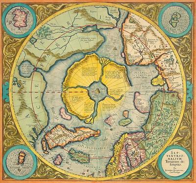
[Image: “The first map dedicated to the North Pole, by the great Gerard Mercator,” titled Septentrionalium Terrarum descriptio, reprinted 1623].

The North Pole’s melting ice cap is apparently creating something of an Arctic real estate boom.

Or a shipping route boom, more specifically: new Arctic sea channels are opening up almost literally every season, and new – or revived – ports are being opened – or renovated – to serve them.

Pat Broe, for instance, “a Denver entrepreneur,” bought a “derelict Hudson Bay port from the Canadian government in 1997” – for $7. That $7 port, however, could eventually “bring in as much as $100 million a year as a port on Arctic shipping lanes [made] shorter by thousands of miles” due to thawing sea ice.

Such Arctic routes are predicted to grow in importance quite rapidly “as the retreat of ice in the region clears the way for a longer shipping season.”


But the world is full of Pat Broes. Accordingly, “the Arctic is undergoing nothing less than a great rush for virgin territory and natural resources worth hundreds of billions of dollars. Even before the polar ice began shrinking more each summer, countries were pushing into the frigid Barents Sea, lured by undersea oil and gas fields and emboldened by advances in technology. But now, as thinning ice stands to simplify construction of drilling rigs, exploration is likely to move even farther north.”

Aside from the inevitable and ecologically unfortunate discovery of new Arctic oil reserves (“it’s the next energy frontier,” a Russian energy worker says), the “polar thaw is also starting to unlock other treasures… perhaps even the storied Northwest Passage.”

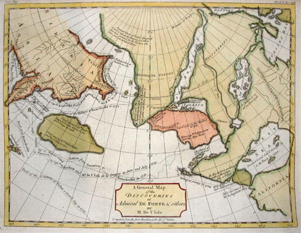
[Image: A 1754 De Fonte Map of the Northwest Passage].

Something of a land grab – or sea grab – is now underway: “Under a treaty called the United Nations Convention on the Law of the Sea, territory is determined by how far a nation’s continental shelf extends” offshore – adding a somewhat Freudian dimension to Arctic real estate. (Or perhaps we could call it the Arctic Real, where “the true coordinates are much better hidden than we realize.”)

In any case: “Under the treaty, countries have limited time after ratifying it to map the sea floor and make claims.” What kind of claims? “[C]laims of expanded territory.”

But it soon gets interesting. “In a 2002 report for the Navy on climate change and the Arctic Ocean, the Arctic Research Commission, a panel appointed by the president, concluded that species were moving north through the Bering Strait.” [Emphasis added]. Territorial alterations and geographic changes at the pole, in other words, are leading to unexpected seaborne migrations, repositionings of the planetary gene pool.

Surely there’s a James Cameron film in there, or at least some kind of Arctic pulp fiction thriller dying to be written?

In any case, as new territories, both aquatic and terrestrial, appear at the Earth’s poles, we might do well to reconsider what Victoria Nelson calls “the Polar gothic,” or “the literary genre of mystical geography,” part of a “psychotopography” of the Earth…

Either way I want to mention – as Nelson does – a text by H.P. Lovecraft. In his slightly goofy 1931 novella, At the Mountains of Madness, Lovecraft sends a group of geologists to the south pole where they’re meant to collect “deep-level specimens of rock and soil from the antarctic continent.” Under “great barren peaks of mystery” and “desolate summits” made of “Jurassic and Comanchian sandstones and Permian and Triassic schists, with now and then a glossy black outcropping suggesting a hard and slaty coal,” they go snowshoeing, dogsledding, and hiking some more – till, drilling through ice into the ancient metamorphic prehistory of a once-tropical antarctic mountain range, they begin “to discern new topographical features in areas unreached by previous explorers.”

Soon they find weird marine fossils.

Then ancient, apparently manmade artifacts turn up.

At night they hear things.

Then they find a city.


This antarctic city is “of no architecture known to man or to human imagination, with vast aggregations of night-black masonry embodying monstrous perversions of geometrical laws. (…) All of these febrile structures seemed knit together by tubular bridges crossing one to the other at dizzying heights,” including “various nightmare turrets,” crowding “the most utterly unknown stretches of the aeon-dead continent.” Etc.

Lovecraft’s polar gothic now continues apace, however, at the opposite end of the Earth, as the planet’s northernmost currents of melting ice bring new rivers, new migrations, and even new instant cities deep into the waters of thawing Arctic archipelagos.