Your Concrete Utopia


Johnston Atoll, which consists of “four small man-made islands enclosed in an egg-shaped reef approximately 21 miles in circumference,” located 718 miles from Hawaii, is for sale.
The current owner, however – the wonderfully named U.S. Office of Property Disposal – wonders if potential buyers might be “unaware that all buildings had been removed” from the island, and that “there were no functioning utilities or water supply, the runway was iffy, the golf course disintegrated, the seawall containing the nuclear waste dump was insufficient, and that nearest services of any kind are over 700 miles away.”


If you purchase the island despite all that, your land deed “will contain use restrictions because the atoll was used by the Defense Department for storage of chemical munitions and as a missile test site in the 1950’s and 60’s. The island can be used as a residence or vacation getaway” – but “the airstrip and the golf course are closed.”
Today, the Center for Land Use Interpretation tells us, Johnston Atoll is nothing but “a scab of concrete, slowly being covered in bird droppings.”


Meanwhile, the atoll’s history as a U.S. nuclear test-site is fascinating: “In 1962,” CLUI continues, “Johnston was used for a series of nuclear tests as part of Operation Dominic, which included the only U.S. test of an operational ballistic missile with a live warhead. For this test a Polaris missile was launched from a submarine, and traveled 1200 miles through space and the atmosphere, until detonating 11,000 feet above the ocean near Johnston. Also that year, the newly constructed rocket launch pad at Johnston was used for a number of extremely high altitude nuclear tests. On June 20, during ‘Starfish,’ the Thor rocket engine cut out a minute after launch, and the missile was intentionally destroyed, at 30,000 feet. Large pieces of the rocket, including some plutonium–contaminated wreckage, rained down on the atoll.”
And so forth.
If you buy the island, of course, let me know…

(With images from CLUI – and with huge thanks to Mark, who recently tipped me on the island’s existence. For more info, there is also this Wikipedia article. And if you’re in the market for other strange real estate, consider purchasing this subterranean bunker-city).

[Note: Apparently, Johnston Atoll was never for sale. The advertisement claiming otherwise was accidentally put onlin e and then picked up by search engines. Alas…]

Sand/Rake Diptych


[Images: Sand raked into earthworks, then photographed from above with a kite – a process all but perfected by Lenny, a photographer based on the island of Guernsey, whose art and idea these are. Both photos taken from his Flickr set. The first photo, above, I find almost unbelievably gorgeous].

(Discovered via Xenmate, whose blog will also tell you about starling murmurations).

Lightning Map


Geology.com presents us with a very interesting map of global lightning strikes – high-resolution version available here. Central Africa is clearly the lightning hotspot of the world, and by a fairly stunning magnitude, I might add. (Black indicates the most active regions).


I wonder what you’d do, on the other hand, if your own brain showed up on this map… A moving black spot, crashing harddrives, frying satellites, starting fires in the deserts of sub-Saharan Africa. Or the canyons of Manhattan, funneling frictive clouds of geomagnetic energy down avenues, lighting up this map with darkness.
For that matter, if, instead, spinning out in the middle of the Pacific you find a weird eye of unexpected hydro-electrical activity, dooming ships, hiding islands, setting up the storyline for King Kong 2
In any case, yet more information about lightning, etc., can be found at the Center for Lightning and Atmospheric Electricity Research.

Eclipse Camps

[Image: Via Pruned].

In 2002, Alex Pang of the Institute for the Future published a book called Empire and the Sun: Victorian Solar Eclipse Expeditions.

In the Victorian era, Pang explains, “British astronomers carried telescopes and spectroscopes to remote areas of India, the Great Plains of North America, and islands in the Caribbean and Pacific to watch the sun eclipsed by the moon.” These journeys are referred to as “eclipse fieldwork.”

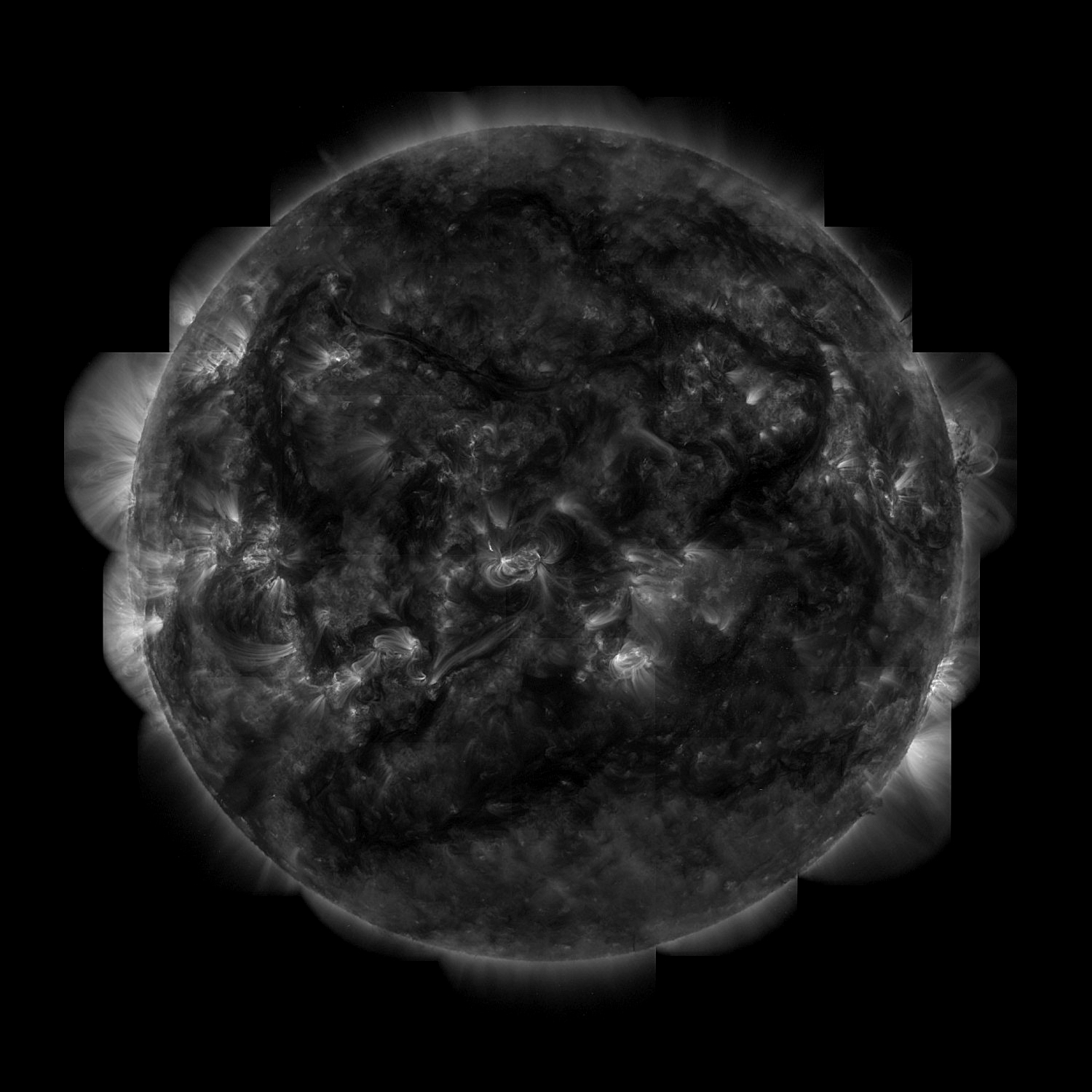
[Image: Stellar depression, or a total eclipse of the sun; from an astrophotography site].

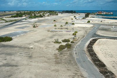
Victorian eclipse expeditions established “eclipse camps,” or instant cities geographically calculated to lie exactly on the forthcoming path of totality. This was, we might say, urban planning as a function of astronomy; or, solar cycles dictating city form.

Observations here could be made of the temporarily extinguished sun, a black star shining over regions so remote they were often entirely unpopulated. On the other hand, Pang writes, locations close to railways were always preferred, as “a small town, easily accessible by railroad, with clear observing conditions and no clouds or dust,” could forestall the inconvenience of camping in the middle of nowhere.

“The first step,” of course, “was to find out the path of totality. By the nineteenth century, the mathematics required to divine the location of the ‘shadow path’ was well developed, and predictions to within a few hundred yards were possible, an excellent level of accuracy since the shadow path itself was more than a hundred miles wide.”

It was here, within this slim zone of moving darkness, spheres of heaven casting shadows on the earth, that an eclipse camp could be established.

[Image: A solar eclipse as seen from space; photographed by Mir].

Battling cobras, tigers, cholera, and sunstroke—”less fortunate parties” even faced “epidemics” and “small wars,” perhaps suggesting Indiana Jones and the City of Eclipses—these expeditionary eclipse observers soon established a “standard form” for the camps.

Call it eclipse urbanism: cities built specifically to see, and photograph, the absence of solar light, producing highly accurate films of darkness.:

Every camp had shelter for instruments and baggage, and a darkroom for developing photographic plates. Observers setting up in monasteries [like monks contemplating a black sun, or the eclipse as solar adversary], villas, or estate gardens simply occupied existing buildings, while in unsettled areas, tents or huts were erected, and brick foundations and pedestals built. Eclipse stations were also easily identified by the temporary observatories that parties built. These buildings were usually rectangular, and built of wood on a brick or stone foundation; they housed the larger and more valuable telescopes, spectroscopic cameras, and darkroom, and appeared everywhere between Iowa City and Africa.

The architecture itself was hyper-specialized, designed to assist in recording the Apollonian withdrawal of the total eclipse: “The sensitivity and precision of astrophysical instruments created a demand for spaces that protected them from temperature variations, damp, vibration, and other distractions,” Pang writes. “Consequently, heating systems were designed to stabilize ambient temperatures and minimize temperature gradients from one room to another, or between rooms and stairwells or closets. As telescopes became larger, vibrations from street traffic or motors became intolerable. Engineers responded by designing massive, vibration-free piers, often made of granite or stone, resting on foundations independent of the floors and other parts of the observatory.”

Even “guards were posted” at the peripheries of these specially marked eclipse camps “to keep the curious from playing with instruments, disturbing the astronomers, or even carrying away mementos.” Further, decorative individuation was practiced at each camp: “Bunting or flags were sometimes placed over a camp’s entrance to emphasize its separate identity.”

[Image: A map of solar eclipses projected, amazingly, for 2981AD-3000AD; many, many more maps at NASA’s World Atlas of Solar Eclipse Paths].

As Mircea Eliade writes in The Sacred & The Profane—a survey of spatial practices in “religious myth, symbolism, and ritual”—”some parts of space are qualitatively different from others,” and therefore need to be differentiated. Eliade calls these “sanctuaries that are ‘doors of the gods’ and hence places of passage between heaven and earth.” Eliade—whose textual approach to world religions is outdated and translation-dependent but nonetheless totally fascinating—describes how re-organizing space for purposes that exceed the mundane, even becoming supernatural, should be considered a “cosmicization of unknown territories.” This means the “establishment in a particular place” of a new form of human inhabitation, with a new purpose, holy or even astronomical in nature, thus re-establishing something called the “cosmic pillar.” Eventually that place will be considered “the center of the world.”

Etc. etc.

[Image: A solar eclipse, from this MIT photo collection].

In any case, at least two quick things interest me throughout all of this: 1) Are there any examples of eclipse camps that, once the eclipse was over and gone, did not disband, becoming, over time, fully functioning towns or cities? What marks, if any, did that astronomical origin leave in the urban fabric? 2) Given loads of money and a huge amount of land, could you build a railroad that extends for hundreds of miles down the center of a future eclipse path – even an eclipse that isn’t due for decades, or perhaps hundreds of years? You ride from LA to Chicago, or Istanbul to Munich, Beijing to Bangkok, unaware that the skies will turn black along that very route, the train windows will darken, your passage across the earth will enact a moment of astronomy? It’s a pilgrimage route for manic depressives, industrially sprawled across the planet.

[Image: From the BBC. What unearthly flowers would grow by the light of a suicidal sun?].

Cities of Amorphous Carbonia

“A novel, glass-like form of carbon dioxide has been created in the laboratory by Italian scientists,” New Scientist reports. “Under extreme pressures the researchers found that CO2 forms a crystalline solid, dubbed ‘amorphous carbonia’ (a-CO2).” This new material “could shed light on the way CO2 behaves under pressure inside planets.” Instead of bedrock, for example, on these alien planets, you’d have miles and miles of transparent carbon dioxide glass spiraling downward beneath your feet, forming fissures and caves; a San Andreas fault of windowed canyons, shattering over millions of years. Glass continents.
As Jules Verne once wrote: “Look down well! You must take a lesson in abysses.” In this case, those abysses may well reflect you.


After being compressed under artificial, near-planetary pressures – or “400,000 to 500,000 atmospheres” – “CO2 molecules react to these conditions by forming an irregular crystalline, or amorphous, structure with oxygen molecules. The resulting material is transparent, tough, and has an atomic structure resembling that of ordinary window glass.”
Although amorphous carbonia “cannot [yet] exist outside of a pressure chamber,” some scientists have already imagined using the material for “new, less environmentally harmful ways to dispose of CO2.”
This could mean, for example, creating huge transparent cubes of carbon dioxide glass; these would then store excess CO2, locking it into perfect Euclidean forms, instead of letting more gas escape into the atmosphere where it would trap solar heat. The more cars and factories are put into operation anywhere in the world, pumping out yet more carbon dioxide, the larger these cubes will get, growing, reflective, looming on the edge of the city. Peripheral, abstract geometries of the purest architectural avant-garde.
Create enough and you could build whole cities with them.
Or, airlifted into the desert and buried there, future caves of glass will soon form, eroding from the surface down, abraded by sand-heavy winds. Years later, you’ll take walking tours of the Glass Caverns of Utah, staying in towns such as New Carbonia – even Carbonia an der Oder, or Carbonia-on-Thames – where everything is made from weird glass blocks, and windows look out upon a faceted abyss of crystalline landscapes, cubed mazes of self-generating reflections where future backpackers of the world will re-discover existentialism, writing abstract poetry in old notebooks before being driven mad.
A confrontation with your double that never ends.
Meanwhile, the skies have cleared of all excess carbon dioxide, and these cubes around the world continue to grow…


(With a nod, of course, to J.G. Ballard; of similar concern: BLDGBLOG’s A Natural History of Mirrors).

The cantilevered void house


[Image: What is it? Who knows. Though, as Mervyn Peake describes the buildings of Gormenghast: “Standing immobile throughout the day, these vivid objects, with their fantastic shadows on the wall behind them shifting and elongating hour by hour with the sun’s rotation, exuded a kind of darkness for all their color.” Cantilevered structures self-supported over the void. Via Archinect].

Urban Sound Walks

“In 2003,” Cabinet Magazine tells us, “Berlin-based sound artist Christina Kubisch began an ongoing project called ‘Electrical Walks.'”
For this project, Kubisch has employed “specially built headphones that receive electromagnetic signals from the environment,” transforming those signals “into sound.” In the process, “Kubisch maps a given territory, noting ‘hot spots’ (ATM machines, security systems, electronic cash registers, subway systems, etc.) where the signals are particularly strong or interesting.” In other words, she performs a kind of audial psychogeography, zones of the city turned into MP3s, “very beautiful, very dense sounds… like a movie, an audio movie.”
The images, below, represent the sound files those sounds produced, digital noise-maps of urban space.


Whether you’re listening to the mellow, down-tempo techno of this light advertisement from Japan, or the sci-fi drone of a Taiwanese subway (which Cabinet covertly, and somewhat fascistically, editorializes as a region of China) – or even the minimal, repetitive heartbeat of this security gate in Oxford, England, the mournful buzz of a Bratislava tram, which Kubisch describes as “almost like a choir,” or the empty Ballardian hum of a control tower at Heathrow airport – these are the electromagnetic sounds of modern urbanism.
“What I would really like to do,” Kubisch says, “is to make a map of several cities and continents. In a large city, for example, where are the electromagnetic fields? Where are the security gates? You could just mark them with little dots. They even have the same sound systems all over the world. It’s the globalization of sound. This is something that I think would be very interesting: to see a network of little dots showing where things are and where they are spreading. Every time I do an ‘Electrical Walk,’ it adds to this general map of sound that I’m collecting. It’s artistic work, but it’s a kind of social research, too.”
There are thirty tracks in all. Knock yourself out.

(Related and elsewhere: we make money not art discusses Kubisch’s project as well as “sound performances produced by people scanning their Oyster cards as they access London tube stations.”)

Transformer Houses


In 1987, Canadian photographer Robin Collyer began documenting houses that aren’t houses at all – they’re architecturally-disguised electrical substations, complete with windows, blinds, and bourgeois landscaping.

“During the 1950s and 1960s,” Collyer explains in a recent issue of Cabinet Magazine, “the Hydro-Electric public utilities in the metropolitan region of Toronto built structures known as ‘Bungalow-Style Substations.’ These stations, which have transforming and switching functions, were constructed in a manner that mimics the style and character of the different neighborhoods.”


[Images: Robin Collyer].

Simulacra meant to reflect how it looks to be domestic and Canadian, “there are about 100 of these structures located on residential streets in the central and the suburban parts of the greater Toronto area.” Pictured here are only five of them. So if you live in suburban Toronto and your neighbor’s house is humming – perhaps now you know what’s really going on inside.

Meanwhile, the address 555 Spadina – i.e. the third image, above – shows up in this list of 322 properties owned by the city of Toronto. If anyone out there knows something about the other 321 buildings, be in touch!

(Note: These images come courtesy of the Centre for Contemporary Canadian Art – with the exception of the first, which appeared in Cabinet Magazine).

Feng Shui Detector

Motorola has patented a Feng Shui detector: “The device houses a camera that checks the colour of the property, a microphone that listens for noise from nearby roads and factories and a compass to find north – a crucial factor for Feng Shui enthusiasts. It can also measure the strength of AM and FM radio signals from local radio transmitters and connect to the nearest mobile phone base station to check for indications of cellphone signal strength.”
Read the patent application here.
Perhaps coming soon: a field unit, designed for landscapes – gardens, campsites, caverns… Attachable to airplanes, so the flight can adapt in progress to the most psychologically calming path…
Or, Feng Shui for Machine Gun Nests.

Landscape futures

What does the earth have in store for itself? The next million years, Discovery Channel News informs us, will be just like “the last million years. That means plenty of meteor impacts, supervolcanic eruptions, megaquakes and worse.”


As Steven Dutch, a geologist at the University of Wisconsin, Green Bay, claims: “Events that are rare or unknown in recorded history become almost inevitable, even frequent, in the near geologic future.” This means that some unbelievably exciting things will happen on an Earth that I, certainly, will not be around to see – and that, perhaps, no human at all will witness.
These landscape futures include the relocation of Niagara Falls. The hard, dolomite cliffs over which the Falls currently plunge “are eroding at a rapid clip,” we read. “Once worn away, the softer rock upstream will erode even faster until it encounters another layer of hard rock at Tonawanda, NY, and creates another set of falls there in about 14,000 years.” Then, in California, “the temperamental San Andreas fault will set off about 7,000 earthquakes of magnitude eight in the next million years, offsetting the geography of San Francisco more than 15 miles. That will split the San Francisco Peninsula into a fork. Over the same million years the Hawaiian Islands will have moved about 60 miles northwest.” This will happen at the same time that Loihi, a currently active undersea volcano, will grow into “a new island rivaling today’s Mauna Loa.”
Elsewhere, “the Mississippi River outlet will shift in location many times, leaving today’s New Orleans far from the river, but still sinking.”
Potentially more interesting still, “even the stars will show obvious signs of change in as few as 10,000 years.” In other words, “our solar system will have moved 7.5 light years in its orbit around the center of the Milky Way, altering the shapes of familiar constellations.” This, of course, opens up the possibility of naming this future zodiac in advance – even devising moving constellations, animated images shifting as the planet moves, astral films starcasted across a million years.
But it is also worth remembering that London is sinking – indeed, the whole of southeast England is sinking – roughly 8″ every century. That may not sound like much, but there are 10,000 centuries in a million years; so, providing such a rate remains constant, London – amazingly, sadly, absurdly, excitingly – will be more than 6500-feet below ground, buried more than a mile in the muck and clay. The whole city will then fossilize.
Elsewhere, Taiwan will continue to move toward mainland China, setting off earthquakes – and complicating any long-term hopes of political independence; the Alps will continue to rise as the Mediterranean is squeezed shut by the northern approach of Africa; and, if recent information is to be believed, most of Italy could be adrift with Saharan dunes, the equatorial deserts of the world expanding both north and south.
Rome, abraded with overheated breezes, where statues of saints are reduced to sand.

Student projects 5: ship.bldg


A project I’ve been meaning to write about ever since it won first place at RIBA’s 2005 President’s Medals awards is Luke Pearson‘s maritime exploration of “the ship as a ‘dry-docked’ architecture.”


“The scheme is a retirement home for elderly fisherman that also houses a working men’s club for members of Newcastle’s fishing community,” Pearson writes. “As a reflection of the separation and torpor of this unique society, the scheme takes the notion of the ship in an architectural context, to create an ersatz environment which interacts with the city around it as if it were a dry docked vessel. The environmental technologies and the ways in which the notional ship has been translated into an architectural system are the focus of this study.”


In other words, you dock the ship for so long it becomes architecture, an extension of the earth’s surface into the sea.
Pearson’s ship/building – perhaps ship.bldg – would include a “heated superstructure” and a “microcosmic ocean upon deck” (both pictured above).
Then there is Pearson’s technique of “Alephographic drawing.” Pearson describes this part of the project as having been “inspired by Borges“; the image, below, “sees everything revealing the technologies and notorieties that exist within the Vessel.”


Now a similar such project needs to be worked out with a train, stopped for so long in the center of a city it becomes architectural, permanently anchored and settled there on tracks, perhaps with moving rooms, parts of a building detach then reattach to other buildings; then further projects with other forms of transport: helicopters, lorries, school buses, hovercraft… The future architecture of stalled vehicles.
Or, to quote Thomas Pynchon, who is here referring to a missile if I remember correctly: “The moving vehicle is frozen, in space, to become architecture, and timeless. It was never launched. It will never fall.”

(Luke Pearson’s project spotted long, long ago on Archinect; see also Student projects 4, 3, 2, and 1).