Geospatial Holograms

A firm called Zebra Imaging tells us about “geospatial holograms“—including the awesome handheld flashlight-sized projector seen below.

[Images: All images courtesy of Zebra Imaging].

Heavily pitching this as a military technology, citing its usefulness in “battle-space visualization” and “line-of-site analysis for sniper activity,” Zebra seems to under-appreciate the intense levels of interest this thing might generate in the civilian sphere. Hook one of these up to a projector phone and shine 3D holograms of urban space all around you. 3D narrative films of the future!

Geospatial holograms used in commercial and government applications typically enhance conventional 2D maps, aerial photos, and 3D physical scale models. Complex environments can be well understood using geospatial holograms much faster than with conventional 2D media.

But imagine the gaming possibilities with this thing, let alone the architectural applications: you step up to the front of the class and shine a hologram of your final thesis project onto the blank tabletop before you… Architectural lightsabers.

I don’t at all doubt the usefulness of portable holograms when it comes to invading enemy cities, but I have to wonder what a few games design students in New York or San Francisco could do with this.

Replace all the streetlights on 5th Avenue next year with Zebra Imaging technology and, instead of Christmas decorations, baroque mansions shine in holographic 3D… a new one every half-block for more than a mile, outlined against winter snow.

Or fly black airships over Rome and shine holograms of missing buildings down onto the city below you, ancient walls reappearing in a Batman-like flicker of urban unreality, people looking out their windows, stunned, at this laser archaeology from the sky.

(Link originally spotted via @geoparadigm).

Muscatatuck

[Images: Inside Muscatatuck; photos by Mashid Mohadjerin for The New York Times].

Before shipping out to Afghanistan, the U.S. Army and members of the Indiana National Guard have been training inside a simulated Afghan village—using what the New York Times describes as a “vaguely foreboding institution that once served as a farm colony for ‘feeble-minded’ boys, and later was a state mental hospital.”

The Army and the Indiana National Guard have turned the windswept complex, known as Muscatatuck, into a simulacrum of a war-torn Afghan city, with a courthouse, a jail and a graffiti-smeared marketplace. While the table-flat farmland around here hardly evokes the Hindu Kush, this is where the government trains Americans who are part of the most ambitious civilian campaign the United States has mounted in a foreign country in generations—a “civilian surge” intended to improve the lives of Afghans.

The facility’s own website enumerates its architectural benefits, as it comes complete with “1,000 Acres, 70 Buildings, 2,000+ Rooms, (…) 9 Buildings with basements, [and] One mile of tunnels.”

This is, of course, only the most recent example of these sorts of facilities to receive media attention; it is but one part of the massive network of militarized simulations that have been built throughout the United States since 9/11 (and these facilities, of course, are themselves nothing new nor are they unique to the United States: there are historical precedents dating back millennia, as any competent military since the dawn of invasion has simulated its spatial tactics in advance). One such facility even hired actor Carl Weathers, of Apollo Creed fame, to serve as an “acting coach” for the simulated insurgents.

But the passage of U.S. Army trainees through a repurposed mental hospital—in fact, “a farm colony for ‘feeble-minded’ boys”—with the implication that this will help to prepare them for the violence of foreign wars, is extraordinary.

The Burj Dubai as Storm Machine

In a recent article about Dubai—the world’s easiest architectural target, and a city whose only true believers were money launderers and U.S.-based green architecture blogs—Der Spiegel describes the soon-to-open Burj Dubai as “an impressive, supremely elegant edifice.”

[Image: The Burj Dubai, photographed by Karim Sahib for the Agence France Press].

Aside from that remark, however, the magazine is far from complimentary; it includes, for instance, a laundry list of dictatorial building projects around the world (which would encompass, by extension, the Burj Dubai):

President Nursultan Nazarbayev of Kazakhstan had Astana, an entire city of monumental avenues, triumphal arches and pyramids built as his new capital, where marble contrasts with granite, buildings are topped by gigantic glass domes and, on the Bayterek Tower, every subject can place his or her hand in a golden imprint of the president’s hand.

In the Burmese jungle, dictatorial generals had an absurd new capital, Naypyidaw, or “Seat of the Kings,” conjured up out of nothing. Yamoussoukro, the capital of Côte d’Ivoire and a memorial to the country’s now-deceased first president, Félix Houphouët-Boigny, is even a step closer to the brink. The city is filled with grandiose buildings, but there are hardly any people to be seen. The Basilica of Notre Dame de la Paix is a piece of lunacy inspired by the Basilica of St. Peter in the Vatican, but the African church is even bigger than St. Peter’s. Indeed, it is the world’s largest Catholic church.

From St. Petersburg to Macchu Picchu, the article lays out oblique evidence for an “excessive building of cities and towers” on behalf of people with political clout (and a halo of military protection).

But it is Der Spiegel‘s continued description of the Burj Dubai that deserves more attention here, in particular this reference to the tower’s meteorological variability:

The tower is so enormous that the air temperature at the top is up to 8 degrees Celsius (14 degrees Fahrenheit) lower than at the base. If anyone ever hit upon the idea of opening a door at the top and a door at the bottom, as well as the airlocks in between, a storm would rush through the air-conditioned building that would destroy most everything in its wake, except perhaps the heavy marble tiles in the luxury apartments. The phenomenon is called the “chimney effect.”

This takes on atmospherically intriguing possibilities when we read that, on June 6, 2007, “the weather service at the [Dubai] airport e-mailed” to the building’s construction director “a satellite image showing a cyclone that had developed over the Indian Ocean, the biggest storm ever recorded in the region, which was heading directly for the Strait of Hormuz. ‘That was the only day in five years,’ says Hinrichs [the construction director], ‘when we had to close the construction site.'”

But, someday, might one negate the other? The Burj Dubai becomes a James Bondian anti-cyclone device: you strategically open certain off-limits doors, with special keys and voice-recognition airlocks, and you park certain elevators at pressure-sensitive sites within their shafts, and soon you’re modifying wind-flow over whole minor continents.

A vertical Maginot Line, fluted to control—and even generate—inclement weather.

Crash State

The L.A. Times reports that, “Over the next six months, a budget-induced employee retirement program will shrink [L.A.’s] civilian workforce—a group that excludes the Department of Water and Power—by at least 9%. Some policymakers have only begun grasping the magnitude of the exodus of librarians, building inspectors, traffic officers, city planners and other workers, many of them the city’s most experienced employees.”

Imagining Los Angeles without “librarians, building inspectors, traffic officers, [and] city planners” will sound, to many, as if nothing has changed in the city at all—but this governmental downsizing comes just as speculation about California’s impending bankruptcy grows.

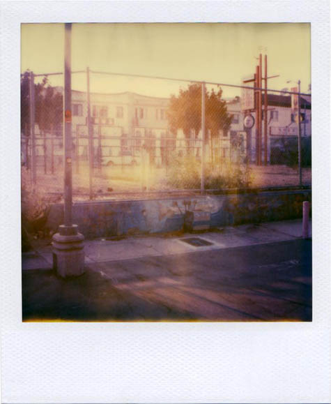
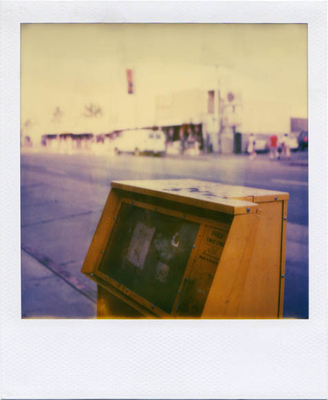
[Image: “free” by Flickr-user Fliegender, from the Lost Angeles set].

Two months ago, the Guardian, paraphrasing historian Kevin Starr, asked whether California might actually become “America’s first failed state“—a question that generated nearly 7500 comments on the Huffington Post.

“The state that was once held up as the epitome of the boundless opportunities of America has collapsed,” the Guardian writes.

From its politics to its economy to its environment and way of life, California is like a patient on life support. At the start of summer the state government was so deeply in debt that it began to issue IOUs instead of wages. Its unemployment rate has soared to more than 12%, the highest figure in 70 years. Desperate to pay off a crippling budget deficit, California is slashing spending in education and healthcare, laying off vast numbers of workers and forcing others to take unpaid leave.

Yet, for the time being, water stills flows from California’s taps, the traffic signals still work, and rural towns still have electricity—but what might happen if California really did “collapse”? What would it look like if the state actually did declare bankruptcy, defaulting on billions of dollars in public debt?

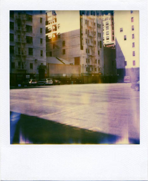
[Image: “the lot” by Flickr-user Fliegender, from the Lost Angeles set].

Newgeography.com attempted to answer a variation on that question in an article posted several days ago:

Ideally, we’d see a court-supervised, orderly bankruptcy similar to what we see when a company defaults. All creditors, including direct lenders, vendors, employees, pensioners, and more would share in the losses based on established precedent and law. Perhaps salaries would be reduced. Some programs could see significant changes. (…) Unfortunately, a formal bankruptcy is not the likely scenario. There is no provision for it in the law. Consequently, absent framework and rules of bankruptcy, the eventual default is likely to be very messy, contentious and political.

The article continues, raising the stakes:

The worst case would be the mother of all financial crises. According to the California State Treasurer’s office, California has over $68 billion in public debt, but the Sacramento Bee’s Dan Walters has tried to count total California public debt, including that of local municipalities, and his total reaches $500 billion.

It’s worth bearing in mind here that recent economic shocks caused by the fear that Dubai might default on its debt involved a mere $59 billion; nonetheless, Bank of America analysts, according to the New York Times, suggested that Dubai’s debt could “escalate into a major sovereign default problem, which would then resonate across global emerging markets in the same way that Argentina did in the early 2000s or Russia in the late 1990s.” In other words, a $500 billion default by the state of California—if that’s indeed what the numbers turn out to be—would clearly have near-catastrophic effects on world markets.

In any case, Newgeography.com takes us all the way up to the brink, speculating that “the worst case is also the more likely case.” After all, “every month brings new bad news” about the state of things in California, and “the risk” is that “one of those news events triggers a crisis.”

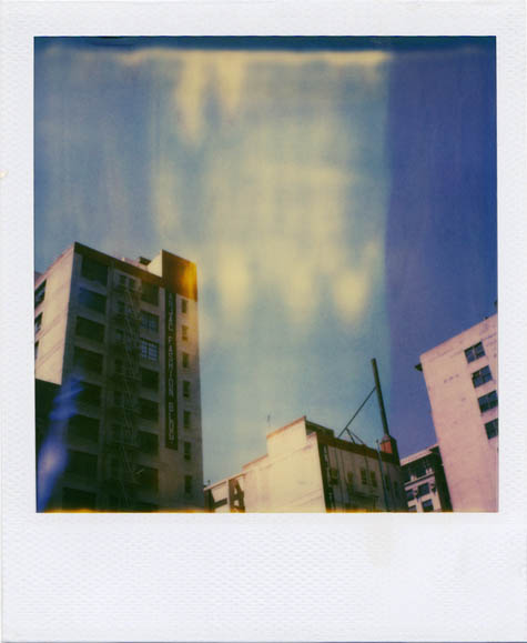
[Image: “temple” by Flickr-user Fliegender, from the Lost Angeles set].

But what will this crisis actually look like? What really is the worst case scenario? Detroit? John Steinbeck? New York in the 1970s? Bosnia?

Possible clues to this future landscape come to us from all directions, frankly, with articles about the housing crisis alone supplying horrific visions of homeowner suicide, copper-thieving gangs tearing apart foreclosed houses in a quest for scrap metal, abandoned swimming pools turning into mosquito-breeding grounds, and even wildcats moving down from the mountains to take over empty cul-de-sacs, like some strange new Disney film awaiting its screenplay’s green light.

Sticking with the articles I’ve already cited here, however, the Guardian offers some details of this emerging world, describing “a travelling medical and dental clinic” set-up inside a Los Angeles venue for rock concerts; 500,000 people moving out of the state to seek jobs elsewhere; entire towns destroyed by alcoholism and near-50% unemployment; and “a squatter’s camp of newly homeless labourers sleeping in their vehicles” that “has grown up in a supermarket car park—the local government has provided toilets and a mobile shower.”

So what new cultures, forms of settlement, and even, generations from now, new religions might spring up from these convulsions of economic geography? Less abstractly, if the Los Angeles Police Department is defunded to half its size, what will start to happen in the city? If the sewers aren’t cleaned and the bridges break down and the bus services halt, what will actually happen?

Of course, it’s worth pointing out that, for many Angelenos, the situation described here—with its lack of police security, broken infrastructure, no public transport, and an “exodus of librarians”—has already arrived, and it’s called everyday life.

[Image: “anjac” by Flickr-user Fliegender, from the Lost Angeles set].

But there is a part of me undeniably fascinated by what we might call DIY, Kim Stanley Robinson-esque, quasi-anarchic salvage cultures—Mad Max meets Mickey Muennig, say—but it’s one thing to foresee a new, post-collapse Californian urbanism in which neighbors happily come together to manage community gardens and sidewalk-repaving projects and quite another to think that MAKE-reading locals in the year 2015 might successfully repair the Bay Bridge using hand-me-down home toolkits.

However, it’s too easy to rely on fantasies of violent apocalypse here—with visions of U.S. cities given over to gang warfare and mass rape, their outer suburbs scoured clean by wildfires, huge blooms of unfiltered sewage filling the waters of Marina del Rey, whole neighborhoods walled off in experiments with micro-sovereignty, drug lords ensconced behind machine gun nests in the Hollywood Hills (while federal troops sleep in derelict movie theaters in the valleys below…). All of it shivering with the odd 7.0 earthquake.

While that does make for an intriguing science fiction scenario, I’ve conversely been very strongly struck by Rebecca Solnit’s new, if quite uneven (and excessively anti-military) book A Paradise Built in Hell.

Solnit’s basic thesis is that, throughout history, public disasters have actually inspired the formation of altruistic communities based in generosity and cooperation—that, “in the wake of an earthquake, a bombing, or a major storm, most people are altruistic, urgently engaged in caring for themselves and those around them, strangers and neighbors as well as friends and loved ones. The image of the selfish, panicky, or regressively savage human being in times of disaster has little truth to it.” With this in mind, then, how do we realistically predict—even architecturally represent—California as a state in genuine free-fall?

[Image: “chinatown” by Flickr-user Fliegender, from the Lost Angeles set].

I’m torn here between two very different but equally compelling visions of what might happen if such circumstances were to arise.

On the one hand, there is Solnit. She describes the informal urbanism and flexible infrastructures of street hospitals and soup kitchens, strangers helping strangers through the half-ruined streets of cities darkened by blackouts. There are “disaster utopias,” she writes, and “Citizens themselves in these moments constitute the government—the active decision-making body—as democracy has always promised and rarely delivered.”

These remarkable societies suggest that, just as many machines reset themselves to their original settings after a power outage, so human beings reset themselves to something altruistic, communitarian, resourceful, and imaginative after a disaster, that we revert to something we already know how to do. The possibility of paradise is already within us as a default setting.

Solnit puts great emotional emphasis on this latter point throughout the book: “The possibility of paradise hovers on the cusp of coming into being, so much so that it takes powerful forces to keep such a paradise at bay.”

Of course, the disasters to which Solnit refers are, by definition, temporary—so the giddiness that she perceives as coextensive with the human spirit might simply be a fleeting sense that one has to take advantage of unexpected conditions, like a sunny day in Cole Valley, while they last. Several decades of living amidst rubble might make those early nights out barbecuing in the streets with strangers seem oddly naive in retrospect.

Because then, on the other hand, there is something Kim Stanley Robinson said in an interview with BLDGBLOG two years ago. This offers a very dramatic counterpoint. Quoting Robinson at length:

For one thing, modern civilization, with six billion people on the planet, lives on the tip of a gigantic complex of prosthetic devices—and all those devices have to work. The crash scenario that people think of, in this case [specifically, global climate change and civilizational collapse], as an escape to freedom would actually be so damaging that it wouldn’t be fun. It wouldn’t be an adventure. It would merely be a struggle for food and security, and a permanent high risk of being robbed, beaten, or killed; your ability to feel confident about your own—and your family’s and your children’s—safety would be gone. People who fail to realize that… I’d say their imaginations haven’t fully gotten into this scenario.

The obvious answer to the many rhetorical questions in this post is that there will be varying degrees of each of these scenarios, in different locations at different times, involving different people for unpredictable reasons.

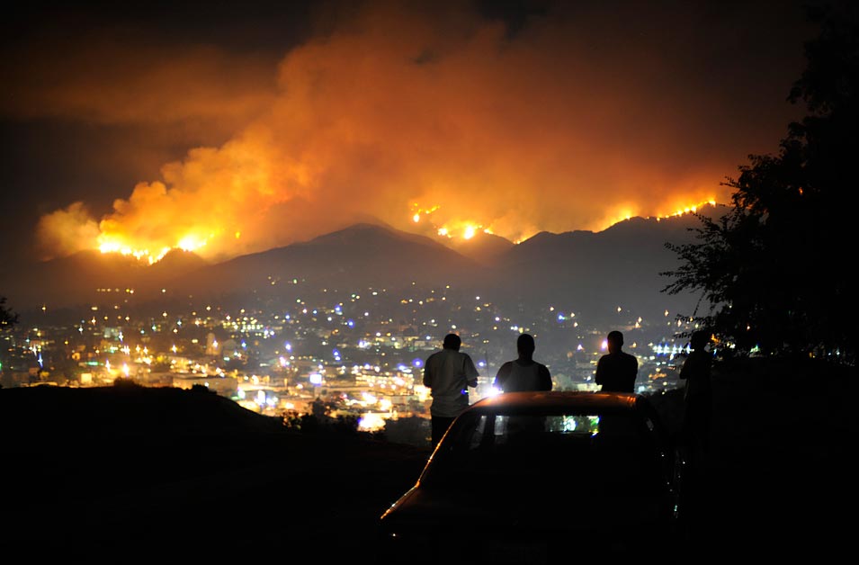
[Image: “A group of young men watch the Station fire from a hill overlooking Tujunga. The fire, which began Aug. 26 near the Angeles Crest Highway, killed two firefighters and burned more than 160,000 acres. The cause of the blaze, which burned 250 square miles of the Angeles National Forest, was arson, officials said.” Photo by Wally Skalij for The Los Angeles Times].

But if the state of California goes into anything like long-term financial catastrophe (with no police, no fire departments, no hospitals, schools, electricity, clean water, and so on, even as I admit that my own descriptions gravitate toward sci-fi), how do we push this radical loss of infrastructure closer to Solnit than to Robinson?

How do we open what Solnit calls “the doorway in the ruins” and invent whole new urbanisms in the wake of economic collapse?

On Bombs and Preservation

A U.S. Naval Air Warfare testing ground contains what might be one of the most important collections of prehistoric rock art in the world, reports the New York Times. In fact, “there may be as many as 100,000 images carved into the dark volcanic canyons above the China Lake basin,” we read, “some as old as 12,000 to 16,000 years, others as recent as the mid-20th century.”

Everywhere we looked, for a mile or so down canyon, there were images pecked or scratched into the rock faces: stylized human figures in a variety of headgear, stick figures with bows and arrows, dogs or coyotes, bear paws with extra digits, all manner of abstract geometric patterns, zigzags and circles and dots, and hundreds upon hundreds of what looked like bighorn sheep, some small, some larger than life size.

David Whitley, an archaeologist interviewed by the NYT, sees the figures as early, graphic “evidence of cognitive sophistication.”

[Images: Three photos by Bill Becher for The New York Times].

The actual location of these glyphs, however, is inside an extensive Naval Air Weapons Station—descriptions of which verge on the Sebaldian in tone:

Floating across a landscape strewn with more than a half-century’s weapons-testing debris—observation towers, armored vehicles, projectile-riddled shipping containers—I tried to fathom that people had been coming here and making art since at least 90 centuries before the founding of Rome.
“It was a very different place then,” Mr. Whitley explained, conjuring the end of the last ice age, 18,000 years ago, the melting of glaciers, the system of saline lakes across what is now called the Great Basin. “This had water over 100 feet deep,” he said. Mammoths, saber-toothed cats and giant Pleistocene bison still roamed the upland peninsulas.

This spatial elision between landscapes of aerial bombing and historically invaluable archaeological sites brings to mind another article, published several weeks ago in the Air Force Times. The objectivity of the following statements clearly deserve some skepticism—as the U.S. military is not widely lauded for its archaeological sensitivity—but there is a fascinating idea under the surface here:

War games and live fire are expected on this military bombing range. But there are also delicate reminders—cultural traces—of a people who lived here beginning around 10,000 B.C. This desert, both severe and beautiful, is home to some of the best-preserved archaeological sites in the Southwest. They remain because the military—with an arsenal of overwhelming force—practices its craft with an eye on preserving history on the nearly 3,000 square miles of desert.

As it happens, U.S. military bases can often overlap with beautifully preserved landscapes—the reason you can hike the Marin Headlands north of San Francisco, for instance, without walking through backyard hot tubs, Ferris Bueller-style, is because all of that land used to be owned by the military (and was thus removed from the sphere of private real estate development). The Korean DMZ is another, well-known example of this phenomenon—war, the great preserver.

But I’m less excited by the idea of compiling a list of militarily-preserved landscapes than by the surreal intermixture of bomb fragments, prehistoric rock art, and ancient artifacts that can be found in the wake of military use and occupation. For instance, the fact that, as the BBC reported four years ago, U.S. Army sandbags “have been filled with precious archaeological fragments” by forces stationed in the civilization-defining ruins of Babylon, marks a scene of amnesia-laden catastrophe even as it will someday present archaeologists with a scene of near-overwhelming interpretive complexity.

You zoom into the very grain of the world only to find, in that moment of observational precision, all of its fragments have been knocked out of place. History is undone by unexpected proximities. Perhaps human history will be like the archaeology of a hurricane.

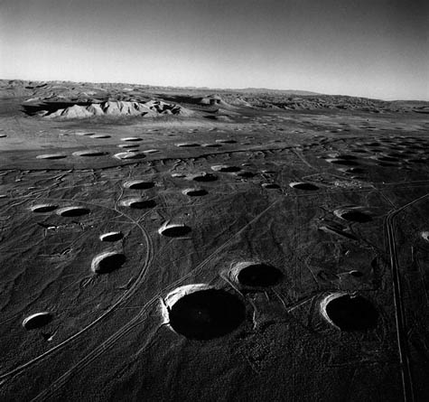
[Image: A photo of subsidence craters, the spatial aftermath of underground nuclear tests, taken by Emmet Gowin; via the Boston Globe].

In any case, the irony that 16,000-year-old petroglyphs might actually be better preserved precisely because they are located inside the canyons of a 21st-century desert bombing range is equal in weight to the sheer tragedy that such incongruous land use practices might result in those petroglyphs’ total destruction. It’s an unintentional—but also socially invisibleBamiyan, as the traces of human history are scratched out by shrapnel and tank treads, one at a time.

So will the legacy of the United States by the replacement of things like Newspaper Rock with a new system of monumental desert signs—speaking to the ages through a language of craters—the bomb site as national park? Or will these early glyphs remain legible in centuries to come precisely because they were exiled to the edge and forgotten there, placed in the void alongside live-fire exercises and smart-bomb runs?

(Air Force Times article found via the always excellent Archaeology news service; New York Times article spotted by @stevesilberman).

A User’s Guide to New York City pt. 2: Street Vendor Guide

[Image: Vendor Power! by Candy Chang].

This is the second of two posts about design projects by Candy Chang; here’s the first. This one features a detailed poster and booklet about street vendor’s rights in New York City.

In Chang’s own words, “The guide also serves as an educational/advocacy tool and includes a poster full of fun facts on the history and challenges of NYC street vending, personal vendor stories, and policy reform recommendations.”

[Images: Two views of Vendor Power! by Candy Chang].

Called Vendor Power! A Guide to Street Vending in New York City, the impressively multi-lingual poster is intended to help street vendors know their legal and commercial rights in the city:

As part of Making Policy Public, Candy collaborated with The Street Vendor Project and the Center for Urban Pedagogy (CUP) to research, compile, and design this guide to street vending in New York City. Many vendors are being fined $1000 for little things like parking their cart too far away from the curb, not “conspicuously” wearing their vending license, and other rules buried in the City’s regulation book full of intimidating jargon that would make even the most patient person cry. This guide helps clarify the rules through diagrams and minimal text in English, Bengali, Arabic, Chinese and Spanish, so NYC’s diverse vendors can understand their rights, avoid fines, and earn an honest living.

Again, I just think this is great; using design skills to assemble legible, economically accessible, and legally useful guides to the urban environment is so much more exciting to me than making new boutique objects for the modern home.

Plus, this poster and its accompanying guidebook fall somewhere between grass-roots vendor-empowerment and straight-ahead small business advocacy; the fact that this applies specifically to mobile street businesses gives it an allure of the poetic, but it would be just as socially important if it outlined the legal dos and don’ts for family shops in the San Fernando Valley.

[Image: From Vendor Power!].

In fact, realizing that these sorts of posters could be made—similar to Chang’s flashcard deck, as mentioned in the previous post—for other legal situations is like downing a quadruple espresso; how awesome would it be to design posters like this for urban agriculture, roof gardens, community parks, and more? Even suburban lemonade stands, for that matter.

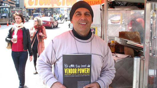
[Images: Vendors reading Vendor Power!].

In any case, taken together, Chang’s Vendor Power! and Tenant Flash Cards projects offer two fantastic examples of how graphic design can be put to use in clarifying everyday, seemingly uninteresting legal situations—and I would love to see similar such endeavors occur elsewhere. The rights of the homeless in Los Angeles! Flashcards for international border crossers; your legal rights in quarantine; how to use the city in an electrical blackout. Or, for that matter, your rural hunting rights. Or the Geneva Convention! The rights of walkers in the British countryside. The possibilities are bewilderingly wide-ranging.

The New York Times covered the project back in April, meanwhile, if you want to read their take.

A User’s Guide to New York City pt. 1: Tenants’ Rights Flashcards

[Image: Tenants’ rights flashcards by Candy Chang].

This will be the first of two posts about recent projects by designer Candy Chang; each presents an awesome example of what a user’s guide to New York City might look like.

[Images: Tenants’ rights flashcards by Candy Chang].

The images shown here document Chang’s tenants’ right flashcards, a deck of cards with legal advice for apartment renters in New York City.

As the project description itself reads: “The flash cards translate New York’s official Tenants’ Rights Guide into a fun and friendly format that covers everything from security deposits and subletting to paint and privacy so residents can enjoy good times while becoming empowered residents.”

[Image: Tenants’ rights flashcards by Candy Chang].

“What’s my landlord required to repair?” Chang asked herself at the beginning of the project, realizing that there was very little about New York City’s legal renters’ rights that the general public really knew. “How does rent stabilization work? When can my landlord enter my apartment?”

But now you can just bust out this flashcard deck and remind yourself.

[Images: Tenants’ rights flashcards by Candy Chang].

It’s such a great idea, and the design possibilities for other legal situations are almost literally endless. From photographers’ rights in the UK to a pamphlet my college housemate once made about your rights as a driver on the U.S. highway system (vis-a-vis police searches and “probable cause”), there seem to be hundreds of highly useful card decks just waiting to happen. London zoning code, translated into a card deck. Municipal water rights in California—or standards of water safety and cleanliness.

What makes this particular card deck even better, I think, is Chang’s use of graphic design in the legal service of a specific community in a specific city—and it’s an approach that she used again in another project that I will be posting about here soon.

Check out the flashcards, meanwhile (including how to order a deck for only $10), here.

Love in the Time of Home Quarantine

Nicola Twilley has pointed out this awesomely over-the-top post about home quarantine measures taken in the face of swine flu.

From sealing off your home ventilation system to turning the basement into a functioning medical ward—stashing “Pandemic Go-Kits” in the trunk of your car and wearing a full biohazard suit along the way—this is certainly one, albeit rather extreme, way to keep yourself safe from catching the flu. To the author’s credit, however, he does mention that one of his children is quite sick.

But the architectural transformations implied here—a suburban house in Utah becomes a post-apocalyptic medical ward with just a quick trip to Home Depot in between—is remarkable. In fact, a fantastic article could be written about the vernacular architecture of American survivalism, with an emphasis on the incidental equipment necessary for living in home quarantine.

In any case, the setting:

I live in a 2 story house, the basement is designed as a separate apartment; there is a kitchen, laundry room and 3 bedrooms down there, with a separate outside entrance. I live in the country on 50 acres and there are very few people around us. I have 8 children, 7 of whom live at home.

And here, specifically, is “the quarantine plan,” if you’ll excuse my quoting at great length:

The entire basement will immediately become the sick ward. The air vents, doorways and the upstairs entrance to the basement will be sealed off with 6 mil plastic to deter air flow. The window to the sick room will be open to allow fresh air circulation. I plan to get a UV Air filtration system to use in the basement as well. The sick person will be confined to a bedroom while in the house and will be allowed to play outside in a designated area that the other children will not be allowed to go to. The bathroom will become a decon room to dress and undress for entry into the sick rooms. The basement laundry room will be the only place the sick person and caretakers laundry will be done. All dishes used by the sick person will be washed in the sink downstairs. The sick person will be required to wear an N95 mask anytime someone is in the room with them, anyone going into the room will need full protective gear on (more on that in a minute). The sick rooms will be sanitized twice a day including changing and washing all linens on the bed. All paper trash (kleenexes, etc) that is able will be burned in our fire pit daily. All other trash will be collected into a garbage bags and disposed of twice daily.

To get this stage, “several specific preps” are required; these include purchasing the right breathing masks. The author points out, for instance, that “the filters I have for my respirator are 95% (like N95) filters—meaning they miss 5%. I’m planning on getting N100 filters to replace them. I’ll be doing that in the next week or two.”

On a side note, there is such a thing as too much filtration. Last week, for instance, a Miami hotel accidentally gave some of its guests Legionnaire’s Disease by installing filters so powerful that they prevented even bacteria-killing chlorine from entering the drinking water; this led to a bloom of the often-fatal Legionella bacteria. As Miami county’s “top epidemiologist” points out in the article, “What’s ironic is the hotel installed a special filtration system to enhance the quality of their drinking water.”

Home preparation doesn’t end with filters, however; there is psychological preparation, as well. Feelings of cabin fever and claustrophobia inspired by the spatial condition of quarantine can be partially relieved, we read, through playing “classic games like Clue, Pictionary, and Scrabble“… while the rest of your family is locked behind an air-seal in the basement.

A commenter on the original post writes: “It’s good to be prepared, but, stop a minute and think about it. Tyvek® hazmat suits? Full-face respirators? You’re likely to scare your kid to death with the Moon Suit!” But the blog has its sights set on more important things; its tagline is nothing less than “Ready for anything.”

Cracking the Planet

[Image: By Jack van Wijk, Eindhoven University of Technology].

My brother pointed out this series of maps over at New Scientist. Combining a Buckminster Fuller-like interest in the most efficient way to map a sphere in two dimensions with a deployment of new algorithms, the maps show alternative ways of representing the earth’s surface.

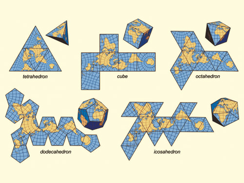
[Images: By Jack van Wijk, Eindhoven University of Technology].

“Making truly accurate maps of the world is difficult,” New Scientist points out, “because it is mathematically impossible to flatten a sphere’s surface without distorting or cracking it. The new technique developed by computer scientist Jack van Wijk at the Eindhoven University of Technology in the Netherlands uses algorithms to ‘unfold’ and cut into the Earth’s surface in a way that minimises distortion, and keeps the distracting effect of cutting into the map to a minimum.”

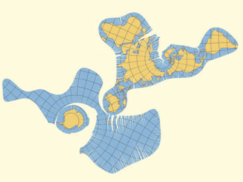
[Image: The world as a near-continuous coastline around one global ocean. By Jack van Wijk, Eindhoven University of Technology].

In van Wijk’s own abstract, published by The Cartographic Journal, we read that these “myriahedral projections,” as they’re called, “are a new class of methods for mapping the earth”:

The globe is projected on a myriahedron, a polyhedron with a very large number of faces. Next, this polyhedron is cut open and unfolded. The resulting maps have a large number of interrupts, but are (almost) conformal and conserve areas. A general approach is presented to decide where to cut the globe, followed by three different types of solution. These follow from the use of meshes based on the standard graticule, the use of recursively subdivided polyhedra and meshes derived from the geography of the earth.

It would be amazing to see what effect this technique might have on a much smaller scale—if, for instance, you could run one of these cuts through a populated area like London, say, and watch as parts of the city fractal off to opposite sides of the planet, the city’s roads opened up into algorithmic fissures.

(Thanks, Kevin!)

Pirate Radio Speleology

For those of you who have enjoyed the posts here about music, sound, noise, urban acoustics, glacial reverberatories, and their like, I will be on the radio tonight speaking about those very things, in conversation with DJ /rupture on his show Mudd Up!.

[Image: And they ascend the antenna… Photographer unknown; photo from a 1969 issue of Broadcaster magazine].

You can stream it live internationally, if you’re so inclined; it will run from 7-8pm EST tonight, Monday, December 14. Expect some archaeology, some radio cave-mapping, some sonic warfare, and even a few of my own favorite rekkids.

Eat the Earth

Over on Edible Geography, Nicola Twilley takes a look at the under-appreciated art of geophagy: eating soil. There is apparently a whole subculture around the practice, Twilley writes, in one case coming complete with “tasting notes for soil, which draw heavily on the vocabulary of wine appreciation.”

At one such earthen event, participants are actually served “two or three wine glasses, each filled with soil from a different organic farm”—and these samplings of different geographies do matter. “In other words, if the earth on which your farm sits has ‘grassy,’ ‘olive,’ or ‘smoky’ notes, those flavours will recur in the organic spinach or goat’s milk cheese you produce. Smelling the soil first simply helps you become aware of the continuity.”

I don’t see myself sprinkling farm-fresh soil on my salads any time soon, I’m afraid, but check out the rest of the post over at Edible Geography.