Buy a Border Patrol Station

[Image: Courtesy U.S. Government Services Administration].

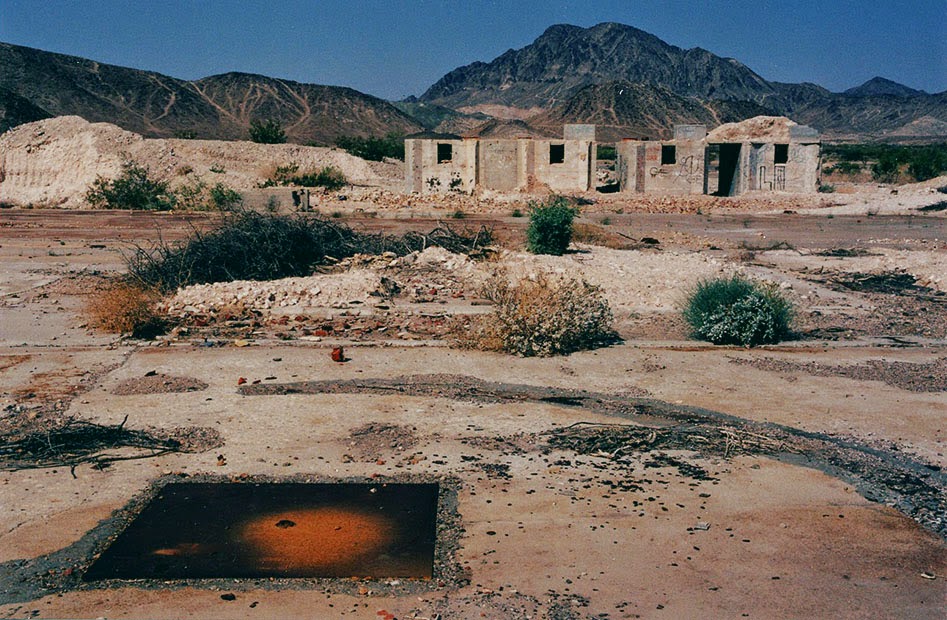
Somewhat amazingly, a former U.S. Border Patrol station is for sale outside the town of Gila Bend, Arizona.

The minimum bid is only $8,000—but the property doesn’t look too good and is “not warranted,” so buyer beware.

[Image: Courtesy U.S. Government Services Administration].

Structural conditions notwithstanding, this could be an amazing opportunity to create a Border Museum, a desert arts center, a writers’ retreat, an urban explorers’ redoubt, a remote branch of the Center for Land Use Interpretation, a field school for an avant-garde university geography program, a pop-up site for an architecture school to host student installations, a future restaurant, a weird Father’s Day gift, a place to store your favorite Paul Manafort trial memorabilia, an asbestos-exposure demonstration facility, or just a roadside site to park your pick-up truck.

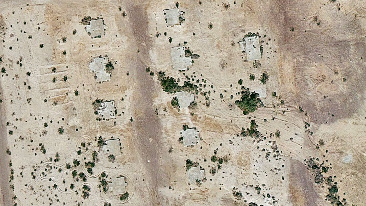
Here is the facility on Google Maps.

[Image: Courtesy U.S. Government Services Administration].

Bidding begins on August 28th.

[Image: Courtesy U.S. Government Services Administration].

Note that there is an open house on Friday morning, August 17th, 2018, at 9am, for those of you near Gila Bend.

(Previously on BLDGBLOG: Buy a Los Angeles Sidewalk Corner, Buy a Complex of Submarine Pits, Buy a Skyway, Buy a Fort, Buy a Lighthouse, Buy an Underground Kingdom, Buy a Prison, Buy a Tube Station, Buy an Archipelago, Buy a Map, Buy a Torpedo-Testing Facility, Buy a Silk Mill, Buy a Fort, Buy a Church).

500 Years of Utopia

[Image: Thomas More’s Utopia].

2016 marks the 500th anniversary of the publication of Thomas More’s Utopia. More not only coined the term now used interchangeably with visions of an ideal society, he also linked the concept of just government specifically with the management and administration of a well-designed metropolis: the perfect society in Utopia is also an urban one.

There are many moral, political, and—for that matter—architectural flaws in More’s work, but it has nonetheless, for half a millennium, served as a synonym in the West for a perfect world. What does “utopia” really mean today, however—and who has access to it? Is utopia already here—but, to paraphrase novelist William Gibson, it remains unevenly distributed?

For the next few months, I’ll be working with the University of Southern California’s Doheny Memorial Library, to explore 500 Years of Utopia. An exhibition at the University will open in November 2016, including a gorgeous 16th-century edition of More’s work, and it will be joined by a series of public events discussing the legacy of Utopia today and what it means for the future.

The first of these events takes place this coming Saturday, October 15th, on the subject of “Governing Paradise.”

[Image: Thomas More’s Utopia].

At 1pm that day, we’ll be hosting Santa Monica city manager Rick Cole, planning historian & USC Price professor David Sloane, and researcher & curator Aurora Tang from the Center for Land Use Interpretation to discuss the peculiar relationship between the city of Los Angeles and the linked concepts of utopia and dystopia.

What role should government play in bringing about a state of Earthly paradise—or is utopia precisely a condition in which government is meant to play no role? From heroic works of public infrastructure to intentional private communities, and from limited natural resources to visions of infinite prosperity, Los Angeles has long been emblematic of the difficulties and rewards of governing paradise.

On November 9, meanwhile, we’ll be hosting “Designing Utopia,” looking at the architecture and landscape of the ideal city, and on February 7, 2017, we’ll discuss “Utopian Representations.” Both of those events are going to be fantastic, and I will have more information about them soon.

So stop by on Saturday—more info here—and please also mark your calendar for Wednesday, November 9, when our exhibition, 500 Years of Utopia, officially opens.

Shrink-Wrapped Superloads and Monumental Processions

rock[Image: Michael Heizer’s rock; Instagram by BLDGBLOG].

A long time ago, in a city far, far away, I audited a class about Archigram taught by Annette Fierro at the University of Pennsylvania.

One of many things I remember from the class was a description of how the Centre Pompidou, a building designed by Richard Rogers and Renzo Piano, was constructed.

Apparently, in order for the building to be assembled, huge pieces of structure had to be rolled through the streets in the middle of the night, long after traffic had died down and after almost everyone had gone to sleep.

Whole boulevards and intersections were closed to make way for the passage of these massive objects, as if the ribs and thigh bones of some colossal creature were being painstakingly assembled in a distant neighborhood, in the dark. The building began as a distributed network of large, chaperoned objects.

You can imagine Parisian insomniacs of the late 1970s, wandering the streets before—lo!—these oversized, monumental spans moving at a crawl through the city would come into view. It would have been as if Paris itself had somehow been caught dreaming new buildings into existence at 2am.

The Space Shuttle in front of a doughnut shop; photo by Pulitzer Prize-winning photographer Don Bartletti, courtesy Los Angeles Times].

This same sort of awe at the mis-fit between an object’s size and its urban context arose a few years ago when a somewhat underwhelming art project by Michael Heizer was hauled, street by street, to LACMA; and it then happened again when the Space Shuttle made its slow way through Los Angeles back in October 2012.

I remember talking to architecture critic Christopher Hawthorne around that time, and he compared the Shuttle’s 2mph roll through the city to a Roman Triumph, as if Angelenos were celebrating an imperial event of extra-planetary importance, this grand object—this throne room—being paraded out in public for all to see.

It’s worth recalling how Cambridge classicist Mary Beard described the Triumph in an old interview with BLDGBLOG. “Here you’ve got the most fantastic parade ever of Roman wealth and imperialism,” she explained:

The Romans score disgustingly big victories, massacring thousands, and they come and celebrate it in the center of the city, bringing the prisoners and the spoils and the riches and all the rest. At one level, this is a jingoistic, militaristic display that would warm the heart of every European dictator ever after—but, at the same time, scratch the surface of that. Look at how the Romans talked about it. That very ceremony is also the ceremony in which you see the Romans debating and worrying about what glory is, what victory is. Who, really, has won? It’s a ceremony that provides Rome with a way of thinking about itself. It exposes all kinds of Roman intellectual anxieties.

Moving the Space Shuttle—or, for that matter, Heizer’s rock—gave not just Los Angeles but the entire United States an unexpected “way of thinking about itself,” in Beard’s terms, not just of the city’s historical relationship with the U.S. space program but of the country’s larger, and not necessarily perpetual, impulse to explore beyond the planet.

shuttle[Image: The Space Shuttle Endeavour in Los Angeles; photo by Andrew Khouri, courtesy Los Angeles Times].

These sorts of mega-objects, transported at great expense across urban infrastructure, are what the Center for Land Use Interpretation (CLUI) has described as “big things on the move.”

CLUI suggests that Heizer’s rock was “a bit like a religious procession, with acolytes in hard hats and safety-vest vestments walking alongside the sacred monolith, all lit up and flashing.” When the Space Shuttle hit the street, however, “Much was said about the irony of a craft that had circled the earth 4,700 times at speeds up to 17,000mph taking three days to get through L.A. traffic.”

As CLUI points out, Heizer’s rock and NASA’s Shuttle were both dwarfed by the actual largest “superload” to move through L.A.’s nighttime streets.

This third object “had little in the way of promotion,” they write; “in fact, the owners of it were hoping it would pass through the city as unnoticed as possible,” despite being “the largest and heaviest vehicle to ever pass through the streets of Los Angeles.”

The cargo was a steam generator from the San Onofre Nuclear Generating Station on the coast just south of Orange County, which was being hauled to a disposal site in Utah, 830 miles away.
Though it was junk, it was radioactive, so cutting it into smaller pieces would just generate more contaminated material. A custom superload truck was made, with a total weight for the truck and load totaling 1.6 million pounds. The generator was covered in thick paint so pieces would not flake off.

To be absolutely sure of its safety, “armed guards stayed with the truck all the time, especially when it was parked for the day by the side of the road and the rest of the crew were sleeping in motels.”

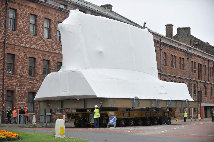
I mention all this after some photos were published this week in the Northwest Evening Mail, featuring huge, shrink-wrapped parts of a British Astute-class nuclear submarine being transported through the city of Barrow.

[Image: A shrink-wrapped section of a nuclear submarine; photo by Lindsey Dickings via the Northwest Evening Mail].

The newspaper warned that, while the “superstructure” made its sectioned way through the city, “car parking will be restricted.”

[Image: Photo by Lindsey Dickings via the Northwest Evening Mail].

In a sense, though, the sight of this dissected weapon of war is more artistic than an art project. A dream-like sequence of shrink-wrapped superstructures, abstract and white, channeling Christo or perhaps even the sculptures of Rachel Whiteread, inches forward street by street, shutting down secondary roads and sidewalks while waiting to be assembled in an eventual future shape, somewhere further down the road.

(Spotted via @CovertShores).

An exceptional, extreme, and largely unexplored place

gunnison
The always interesting Center for Land Use Interpretation is seeking proposals from artists, writers, designers, architects, and more to “explore the land and waterscape of the north arm of the Great Salt Lake, known as Gunnison Bay.”

It’s a landscape they describe as “an exceptional, extreme, and largely unexplored place”:

The construction of a filled-in railroad causeway in the late 1950s cut the original lake in half, creating a new, anthropogenic entity, more isolated and saline, that has evolved into a landscape of desiccation that resembles another planet, or this one in some past or future time.

They specifically hope that you’ll include in your exploration of this seemingly parallel terrestriality the so-called Great Salt Lake Exploration Platform, or GSLEP, a pontoon structure built by Chris Taylor and Steve Badgett (it’s a boat).

Proposals are due March 1, 2016.

There is much more information over at CLUI’s website, so check out the full call-for-proposals.

It Came From Below

Formless and ancient things from the depths of our planet move beneath Los Angeles, unexpectedly setting fire to sidewalks and burning whole businesses to the ground. Welcome to urban life atop a still-active oil field.

This post was originally published on The Daily Beast.

Sliding around beneath the surface of Los Angeles is something dark, primordial, and without clear form. It seeps up into the city from below through even the smallest cracks and drains. Infernal, it can cause fires and explosions; toxic, it can debilitate, poison, and kill.

Near downtown Los Angeles, at 14th Place and Hill Street, a small extraction firm called the St. James Oil Corporation runs an active oil well. In 2006, the firm presided over a routine steam-injection procedure known as “well stimulation.” The purpose was simple: a careful and sustained application of steam would heat up, liquefy, and thus make available for easier harvesting some of the thick petroleum deposits, or heavy oil, beneath the neighborhood.

But things didn’t quite go as planned. As explained by the Center for Land Use Interpretation—a local non-profit group dedicated to documenting and analyzing land usage throughout the United States—“the subterranean pressure forced oily ooze and smells out of the ground,” causing a nauseating “goo” to bubble over “into storm drains, streets, and basements” as far as two blocks away.

The sudden appearance of this black tide beneath the neighborhood even destabilized the nearby road surface, leading to its emergency closure, and 130 people had to be evacuated. It took weeks to pump these toxic petroleum byproducts out of the basements and to resurface the street; the firm itself was later sued by the city.

While this was an industrial accident, hydrocarbons are, in fact, almost constantly breaking through the surface of Los Angeles, both in liquid and gaseous form. These are commonly known as seeps, and the most famous example is also an international tourist attraction: the La Brea Tar Pits, with its family-friendly museum on Wilshire Boulevard.

The “tar” here is actually liquid asphalt or pitch, and it is one of many reasons why humans settled the region in the first place. Useful both for waterproofing and for its flammability, this sticky substance has been exploited by humans in the region for literally thousands of years—and it has also given L.A. some of its most impressive paleontological finds.

[Image: Tar pushes up through cracks in the sidewalk on Wilshire Boulevard, near the La Brea Tar Pits; photo by Geoff Manaugh].

In other words, precisely because they are so dangerous, the tar pits are a veritable archive of extinct species; these include mastodons, saber-toothed tigers, and dire wolves, examples of which have been found fatally mired in the black mess seeping up from the deep. Groups of these now long-dead creatures once wandered across an otherworldly landscape of earthquakes and extinct volcanoes, an active terrain pockmarked with eerie bubbling cauldrons of flammable liquid asphalt.

What’s so interesting about contemporary life in Southern California is that this surreal, prehistoric landscape never really went anywhere: it’s simply been relegated to the background, invisibly buried beneath strip malls, car dealerships, and sushi restaurants. Every natural tar seep and artificial oil well here can be seen as an encounter with this older, stranger world trying to break back through into our present experience.

What humans choose to do with this primordial stuff leaking through the cracks can often be almost comical. Architect Ben Loescher, who has given tours of the region’s oil infrastructure for the Center for Land Use Interpretation, points out that many buildings near Lafayette Park must contend with a constant upwelling of asphalt. He sent me a photograph showing a line of orange utility buckets arranged as an ingenious but absurd stopgap measure against the endless and unstoppable goo.

[Image: A makeshift system for capturing the near-constant tar and liquid asphalt leaking up from below a building near Lafayette Park; photo by Ben Loescher].

Nearby, Loescher added, parking lots are a great place to see the onslaught. Many are constantly but slowly flooding with tar and asphalt, to the point that one lot—run by a karaoke club—is struck so badly that the tar is actually visible on Google Maps. “That parking lot is riddled with seeps, as well. When it gets hot, the parking lot sort of re-asphalts itself,” Loescher explains, “and they have to put down tarps on top of it so the cars don’t get stuck.” A much larger gravel lot across the street also exhibits multiple sites of seepage, as if pixelating from below with black matter.

Loescher emphasized that these sites are by no means limited to the La Brea Tar Pits. They can be found throughout the Los Angeles basin, beneath sidewalks, yard, parking lots, and even in people’s basements. To exaggerate for dramatic effect, it’s as if the premise of The Blob was at least partially inspired by a true story—one that has been taking place for hundreds of thousands of years throughout Southern California, and that involves, instead of a visitor from space, something ancient and pre-human forcing its way up from below.

[Image: Liquid asphalt leaking upward into the parking lot of a Los Angeles karaoke club; photo by Geoff Manaugh].

In a short book called Making Time: Essays on the Nature of Los Angeles, writer William L. Fox explores the remnant gas leaks and oil seeps of the city. At times, it reads as if he is describing the backdrop of a Hieronymus Bosch painting. Such is the strange and permanent apocalypse of 21st-century L.A.

Fox writes, for example, that “a methane vent opened up in the middle of Fairfax Street” back in 1985, and that it “burned uncontrollably for days before it could be put out.” At night, it was a world lit by flames. Astonishingly, he adds, in 1962 “a Hawthorne woman had a fire under her house—a house with no basement. She located the source of the problem when she went outside and touched a match to a crack in the sidewalk: A flame ran down to it.”

This city where sidewalks burn and sewers fill with oily ooze is a city built here almost specifically for that very reason; Los Angeles, in many ways, is a settlement founded on petroleum byproducts, and the oil industry for which the city was once known never actually left. It just got better at hiding itself.

It is already well known that there are oilrigs disguised in plain sight all over the city. The odd-looking tower behind Beverly Hills High School, for example, is actually a camouflaged oilrig; an active oil field runs beneath the classrooms and athletic fields. Even stranger, the enormous synagogue at Pico and Doheny is not a synagogue at all, but a movable drilling tower designed to look like a house of worship, as if bizarre ceremonies for conjuring a literal black mass out of the bowels of the Earth take place here, hidden from view. If you zoom in on Google Maps, you can just make out the jumbles of industrial machinery tucked away inside.

However, amidst all of this still-functional oil infrastructure, there are ruins: abandoned wells, capped drill sites, and derelict pumping stations that have effectively been erased from public awareness. These, too, play a role in the city’s subterranean fires and its poisonous breakouts of black ooze.

As Fox explains in Making Time, a labyrinth of aging pipelines and forgotten wells crisscrosses the city. He explains that the Salt Lake Oil Field—which underlies the La Brea Tar Pits, sprawls below an outdoor shopping center known as The Grove, and continues deep into the surrounding neighborhoods—once contained as many as 1,500 operative oil wells. However, most of these “have long since been abandoned and are virtually invisible,” he writes, and, alarmingly, “roughly 300 are unaccounted for.”

These “unaccounted for” oil wells are out of sight and out of mind—but it should not be assumed that they are safely or permanently capped. Indeed, the Salt Lake Oil Field actually “appears to be repressurizing with oil and water,” like an underground blister come back to life, Fox writes. This only raises the stakes of “a hazard already complicated by the lack of knowledge about the exact location of all the wells on the property.” Only 10 years ago, for example, “an orphaned well in Huntington Beach blew out in a gusher forty feet high, spraying oil and methane over one-half square mile, a hazardous-waste problem that will become more common.”
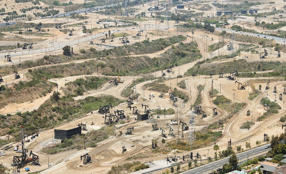
[Image: The Baldwin Hills old field; photo by Geoff Manaugh].

Due to its centrality, the Salt Lake field plays an outsized role in terms of strange petroleum events in the city. The Salt Lake was behind the multiday methane fire in the middle of Fairfax Avenue, for example, and behind arguably the most well known and certainly most destructive reminder of the city’s subterranean presence.

In 1989, in a busy strip mall at Fairfax and 3rd Street, a Ross Dress for Less began to fill with methane gas leaking up from a large pocket connected to the oil field below. Somehow, it had broken through the natural clay boundary that should have held it in place, and the methane thus easily seeped up into the storage rooms, closets, and retail galleries of the discount clothing giant.

Before long, the methane ignited and the entire store blew up.

[Image: Screen grab from YouTube].

This was by no means an insubstantial explosion—you should watch the aftermath on YouTube—as the entire façade of the building was blown to pieces, the roof collapsed, and dozens of people were disfigured by the detonation.

The resulting fires burned for hours. Small fires roared out of nearby sewer grates, and red and orange flames flickered out of even the tiniest cracks in the sidewalk, like some weird vision of Hell burning through the discount blouses and cheap drywall of this obliterated shopping center.
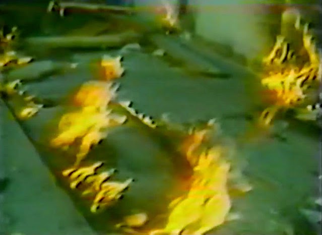
[Image: Flames burn through cracks in the sidewalk; screen grab from YouTube].

While reporting the tragedy, a local newscaster worryingly informed his viewers that it was simply “too early to tell where or when [the methane] might surface again”—in other words, that there could very well be further explosions. This paranoia—that there is something down there, some inhuman Leviathan stirring beneath the city, and that no one really knows when and where it will strike next—continues to this day.

Even at the time of the explosion, the possibility that city workers might inadvertently drill into a methane pocket beneath the neighborhood became one of the chief reasons for blocking the construction of a new subway line in the area. This same fear has recently resurfaced as the number one excuse for blocking a proposed subway through Beverly Hills.

Back in 2012, local parents released a video urging the city to stop the expansion of subterranean public transit through their neighborhood, concerned that it would cause Beverly Hills High School to explode. (The fact that stopping the subway would also keep certain economic undesirables out of their streets and shopping districts was just a fringe benefit.)

In any case, the narrative resonance of all this is impossible to deny. Formless and ancient things from the depths of our planet move beneath the city, unexpectedly setting fire to sidewalks and burning whole businesses to the ground. Taken out of context, this could be the plot of a new horror film—but it’s just urban life atop a still-active oil field.

As Matthew Coolidge, director of the Center for Land Use Interpretation, explained it to me, the city “is really just a giant scab of petroleum-fueled activities,” an impermanently sealed cap atop this buried monstrosity.

It is worth considering, then, next time you step over a patch of tar on the sidewalk, that the black gloom still bubbling up into people’s yards and basements, still re-asphalting empty gravel parking lots, is actually an encounter with something undeniably old and elementally powerful.

In this sense, Los Angeles is more than just a city; it is a kind of interface between a petrochemical lifestyle of cars and freeways and the dark force that literally fuels it, a subterranean presence that predates us all by millions of years and that continues to wander freely beneath L.A.’s tangled streets and buildings.

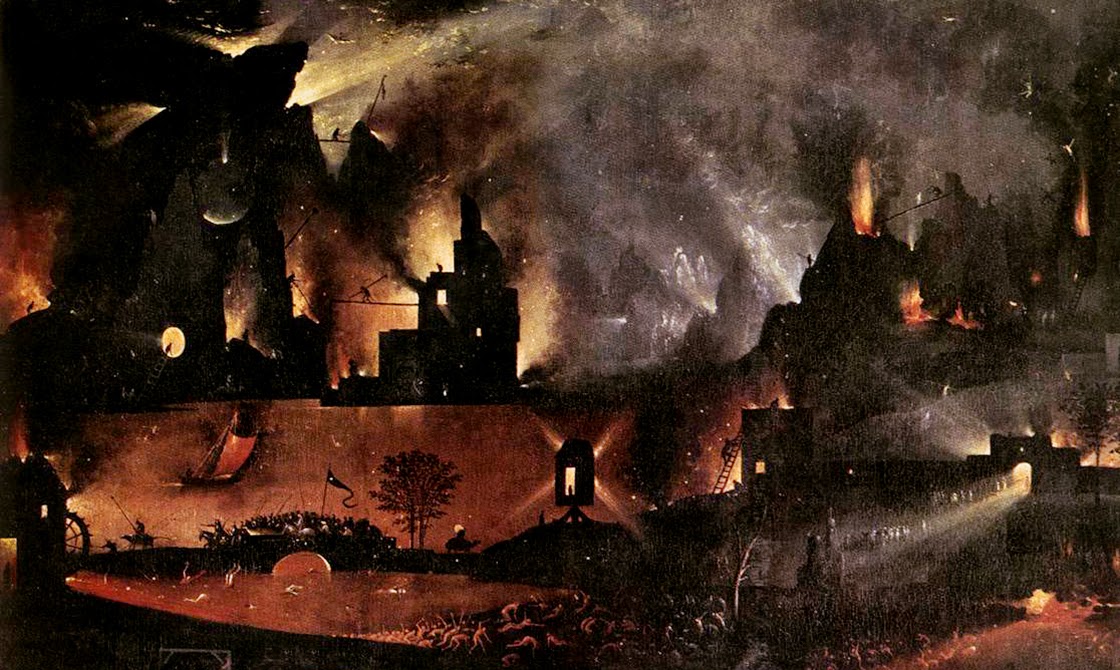
(Note: This piece was originally published on The Daily Beast. I have also written about the La Brea Tar Pits and William L. Fox’s book in Landscape Futures. Opening image: a close-up of Hell, from “The Garden of Earthly Delights” by Hieronymous Bosch, Museo del Prado, Madrid, Spain).

The Snow Mine

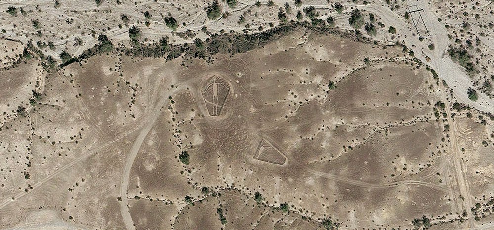
[Image: The “Blythe Intaglios,” via Google Maps].

After reading an article about the “Blythe geoglyphs”—huge, 1,000-year old images carved into the California desert north of Blythe, near the border with Arizona—I got to looking around on Google Maps more or less at random and found what looked like a ghost town in the middle of nowhere, close to an old mine.

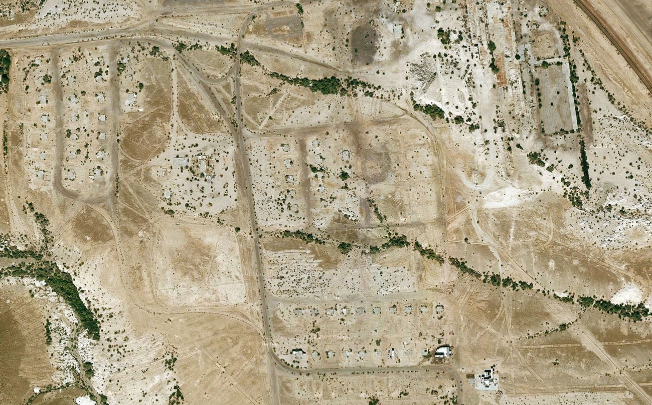
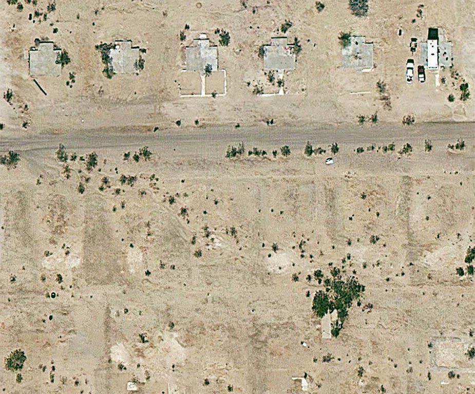
Turns out, it was the abandoned industrial settlement of Midland, California—and it’s been empty for nearly half a century, deliberately burned to the ground in 1966 when the nearby mine was closed.

[Image: Midland, California, via Google Maps].

What’s so interesting about this place—aside from the exposed concrete foundation pads now reused as platforms for RVs, or the empty streets forming an altogether different kind of geoglyph, or even the obvious ease with which one can get there, simply following the aptly named Midland Road northeast from Blythe—is the fact that the town was built for workers at the gypsum mine, and that the gypsum extracted from the ground in Midland was then used as artificial snow in many Hollywood productions.

[Image: Midland, California, via Google Maps].

As the L.A. Times reported back in 1970—warning its readers, “Don’t Go To Midland—It’s Gone”—the town served as the mineral origin for Hollywood’s simulated weather effects.

“Midland was started in 1925 as a tent city,” the paper explained, “with miners in the middle of the Mojave Desert digging gypsum out of the Little Marias to meet the demands of movie studios. All the winter scenes during the golden age of Hollywood were filmed with ‘snowflakes’ from Midland.”

[Image: The abandoned streets of Midland, former origin of Hollywood’s artificial snow; photo via CLUI].

Like some strange, artificial winter being mined from the earth and scattered all over the dreams of cinemagoers around the world, Midland’s mineral snow had all the right qualities without any of the perishability or cold.

See, for example, this patent for artificial snow, filed in 1927 and approved in 1930, in which it is explained how gypsum can be dissolved by a specific acid mix to produce light, fluffy flakes perfect for the purposes of winter simulation. Easy to produce, with no risk of melting.

[Image: Midland, California, via Google Maps].

I’ve long been fascinated by the artificial snow industry—the notion of an industrially controlled climate-on-demand, spraying out snowflakes as if from a 3D printer, is just amazing to me—as well as with the unearthly world of mines, caves, and all things underground, but I had not really ever imagined that these interests might somehow come together someday, wherein fake glaciers and peaceful drifts of pure white snow were actually something scraped out of the planet by the extraction industry.

As if suggesting the plot of a deranged, Dr. Seussian children’s book, the idea that winter is something we pull from a mine in the middle of the California desert and then scatter over the warm Mediterranean cities of the coast is perhaps all the evidence you need that life is always already more dreamlike than you had previously believed possible.

(Very vaguely related: See also BLDGBLOG’s earlier coverage of California City).

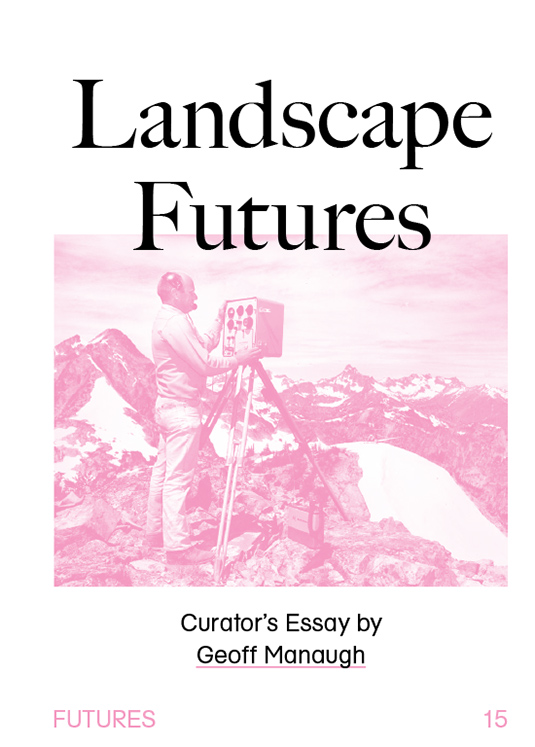
Landscape Futures

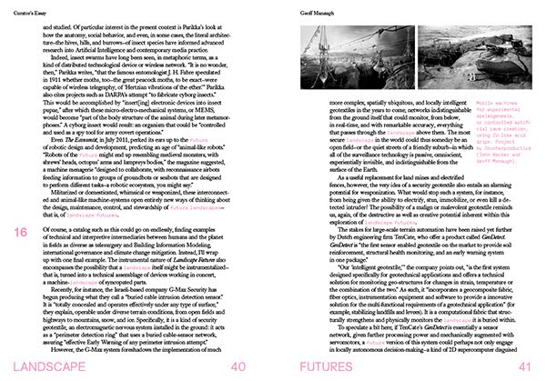
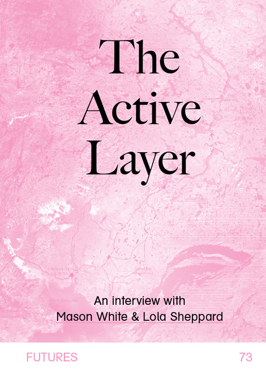
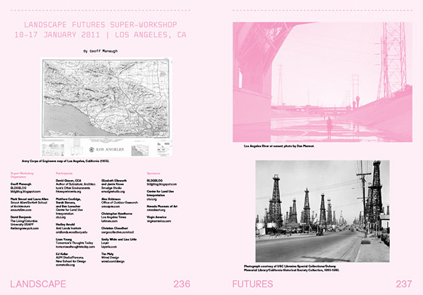
[Images: The cover of Landscape Futures; book design by Brooklyn’s Everything-Type-Company].

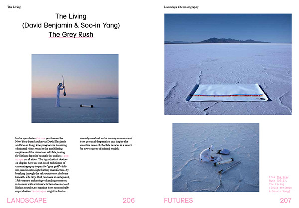
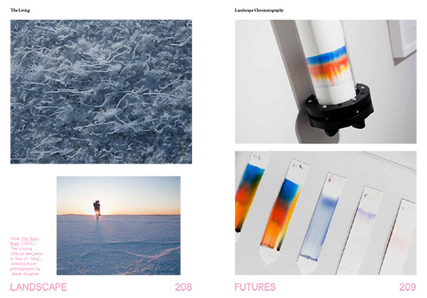
I’m enormously pleased to say that a book project long in the making will finally see the light of day later this month, a collaboration between ACTAR and the Nevada Museum of Art called Landscape Futures: Instruments, Devices and Architectural Inventions.

On a related note, I’m also happy to say simply, despite the painfully slow pace of posts here on the blog, going back at least the last six months or so, that many projects ticking away in the background are, at long last, coming to fruition, including Venue, and, now, the publication of Landscape Futures.

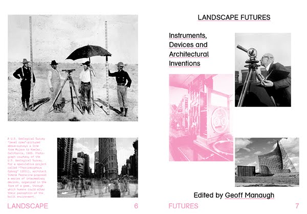
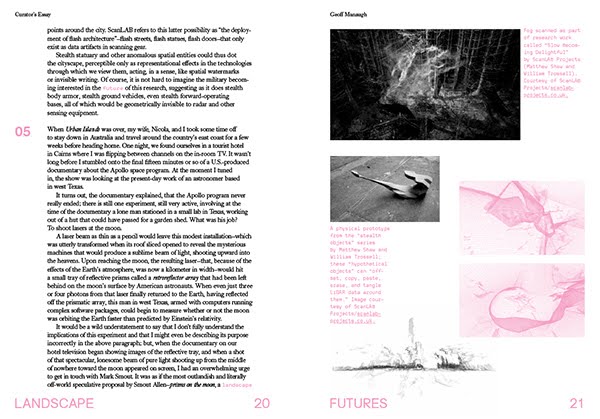
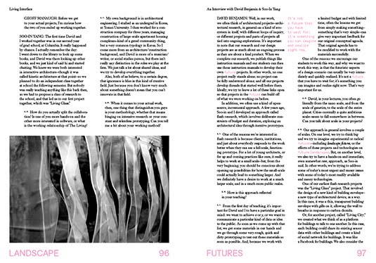
[Images: The opening spreads of Landscape Futures; book design by Everything-Type-Company].
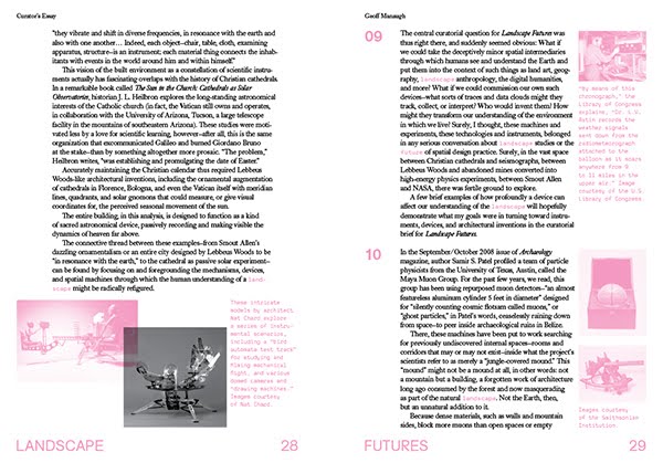
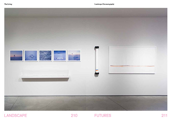
Landscape Futures both documents and continues an exhibition of the same name that ran for a bit more than six months at the Nevada Museum of Art in Reno, from August 2011 to February 2012. The exhibition was my first solo commission as a curator and by far the largest project I had worked on to that point. It was an incredible opportunity, and I remain hugely excited by the physical quality and conceptual breadth of the work produced by the show’s participating artists and architects.

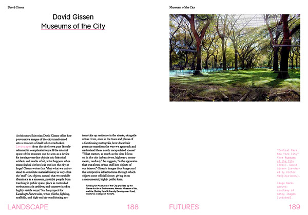
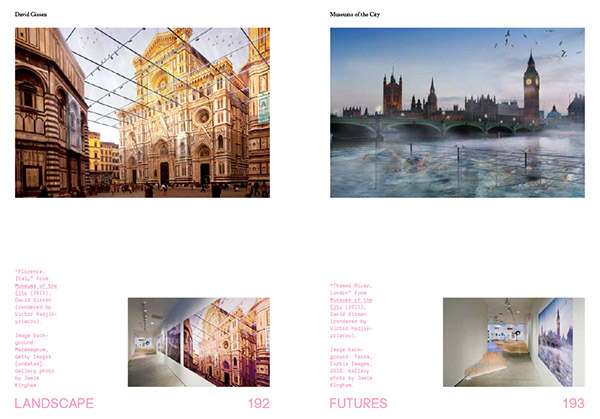
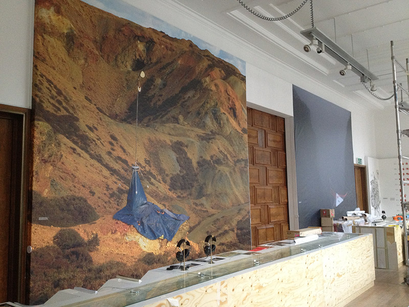
Best of all, I was able to commission brand new work from many of the contributors, including giving historian David Gissen a new opportunity to explore his ideas—on preservation, technology, and the environmental regulation of everyday urban space—in a series of wall-sized prints; finding a new genre—a fictional travelogue from a future lithium boom—with The Living; and setting aside nearly an entire room, the centerpiece of the 2,500-square-foot exhibition, for an immensely complicated piece of functioning machinery (plus documentary photographs, posters, study-models, an entire bound book of research, and much else besides) by London-based architects Smout Allen.

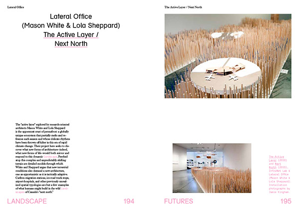
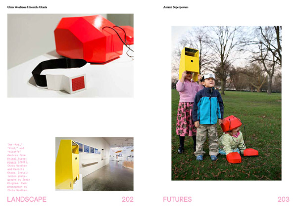
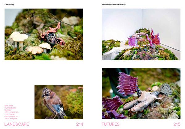
Those works joined pre-existing projects by Mason White & Lola Sheppard of Lateral Office and InfraNet Lab, whose project “Next North/The Active Layer” explored the emerging architectural conditions presented by climate-changed terrains in the far north; Chris Woebken & Kenichi Okada, whose widely exhibited “Animal Superpowers” added a colorful note to the exhibition’s second room; and architect-adventurer Liam Young, who brought his “Specimens of Unnatural History” successfully through international customs to model the warped future ecosystem of a genetically-enhanced Galapagos.

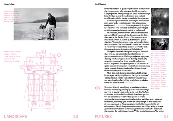
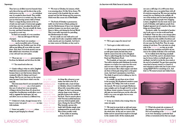
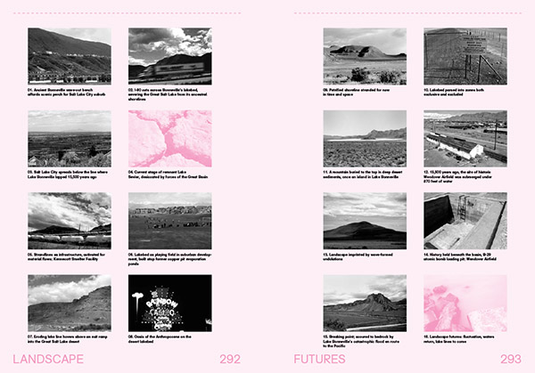
[Images: More spreads from Landscape Futures; book design by Everything-Type-Company].

But the book also expands on that core of both new and pre-existing work to include work by Rob Holmes, Alex Trevi (edited from their original appearance on Pruned), a travelogue through the lost lakes of the American West by Smudge Studio, a walking tour through the electromagnetic landscapes of Los Angeles by the Center for Land Use Interpretation, and a new short story by Pushcart Prize-winning author Scott Geiger.

These, in turn, join reprints of texts highly influential for the overall Landscape Futures project, including a short history of climate control technologies and weather warfare by historian James Fleming, David Gissen‘s excellent overview of the atmospheric preservation of artifacts in museums in New York City (specifically, the Temple of Dendur at the Metropolitan Museum of Art), and a classic article—from BLDGBLOG’s perspective, at least—originally published in New Scientist back in 1998, where geologist Jan Zalasiewicz suggests a number of possibilities for the large-scale fossilization of entire urban landscapes in the Earth’s far future.

Even that’s not the end of the book, however, which is then further augmented by a long look, in the curator’s essay, at the various technical and metaphoric implications of the instruments, devices, and architectural inventions of the book’s subtitle, from robot-readable geotextiles and military surveillance technologies to the future of remote-sensing in archaeology, and moving between scales as divergent as plate-tectonic tomography, radio astronomical installations in the the polar north, and speculative laser-jamming objects designed by ScanLAB Projects.

To wrap it all up and connect the conceptual dots set loose across the book, detailed interviews with all of the exhibition’s participating artists, writers, and architects fill out the book’s long middle—and, in all cases, I can’t wait to get these out there, as they are all conversations that deserve continuation in other formats. The responses from David Gissen alone could fuel an entire graduate seminar.

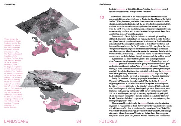
The spreads and images you see here all come directly from the book.

[Images: Spreads from Landscape Futures; book design by Everything-Type-Company].

Of course, the work itself also takes up a large section in the final third or so of the book; consisting mostly of photographs by Jamie Kingham and Dean Burton, these document the exhibition contents in their full, spatial context, including the double-height, naturally lit room in which the ceiling-mounted machinery of Smout Allen whirred away for six months. This is also where full-color spreads enter the book, offering a nice pop after all the pink that came before.

[Images: Installation shots from the Nevada Museum of Art, by Jamie Kingham and Dean Burton, including other views, from posters to renderings, from Landscape Futures; book design by Everything-Type-Company].

Which brings us, finally, to the Landscape Futures Sourcebook, the final thirty or forty pages of the book, filled with the guest essays, travelogues, walking tours, photographs, a speculative future course brief by Rob Holmes of Mammoth, and the aforementioned short story by Scott Geiger.

[Images: A few spreads from the Landscape Futures Sourcebook featured in Landscape Futures; book design by Everything-Type-Company].

Needless to say, I am absolutely thrilled with the incredible design work done by Everything-Type-Company—a new and rapidly rising design firm based in Brooklyn, founded by Kyle Blue and Geoff Halber—and I am also over the moon to think that this material will finally be out there for discussion elsewhere. It’s been a long, long time in the making.

In any case, shipping should begin later this month. Hopefully the above glimpses, and the huge list of people whose graphic, textual, or conceptual work is represented in the book, will entice you to support their effort with an order.

Enjoy!

(Thank you to all the people and organizations who made Landscape Futures possible, including the Nevada Museum of Art and ACTAR, supported generously by the Graham Foundation for Advanced Study in the Fine Arts, the National Endowment for the Arts, and the Andy Warhol Foundation for the Visual Arts).

Floating Cities and Site Surveys

[Image: Photo by Mark Smout of a photo by Mark Smout, for the British Exploratory Land Archive].
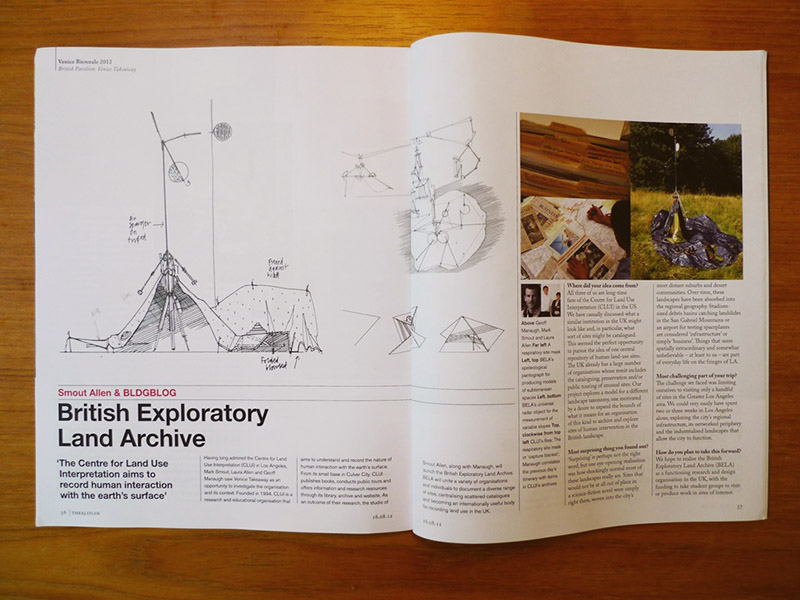
I’m delighted to say that work originally produced for the British Pavilion at last summer’s Venice Biennale will go on display this week at the Royal Institute of British Architects in London, beginning tomorrow, 26 February.

This will include, among many other projects, from studies of so-called “new socialist villages” in China to floating buildings in Amsterdam, to name but a few, the British Exploratory Land Archive (BELA) for which BLDGBLOG collaborated with architects Smout Allen in proposing a British version of the Center for Land Use Interpretation in Los Angeles. BELA would thus survey, catalog, explore, tour, document, and archive in one location the huge variety of sites in Britain altered by and used by human beings, from industrial sites to deserted medieval villages, slag heaps to submarine bases, smuggler’s hideouts to traffic-simulation grounds. A few of these sites have already been documented in massive photographs now mounted at the RIBA, also featuring architectural instruments designed specifically for the BELA project and assembled over the summer in Hackney.

[Image: From the British Exploratory Land Archive].

However, if you’re curious to know more and you happen to be in London on Thursday, 28 February, consider stopping by the Architectural Association to hear Smout Allen and I speak in more detail about the project. That talk is free and open the public, and it kicks off at 6pm; I believe architect Liam Young will be introducing things. Meanwhile, the aforementioned study of floating architecture in Amsterdam will be presented by its collaborative team—dRMM—at the RIBA on Tuesday night, 26 February, so make your calendars for that, as well (and check out the full calendar of related talks here).

The RIBA is at 66 Portland Place and the AA is in Bedford Square.

Landscape Futures Super-Trip

I’m heading off soon on a road trip with Nicola Twilley, from Edible Geography, to visit some incredible sites (and sights) around the desert southwest, visiting places where architecture, astronomy, and the planetary sciences, to varying degrees, overlap.

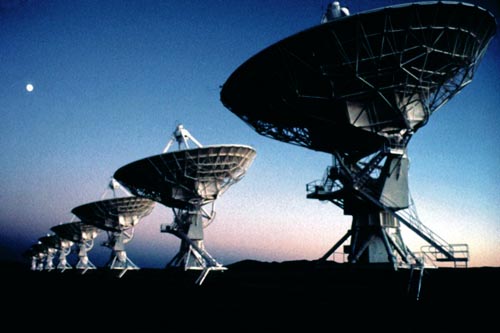
[Image: The Very Large Array].

This will be an amazing trip! Our stops include the “world’s largest collection of optical telescopes,” including the great hypotenuse of the McMath-Pierce Solar Telescope, outside Tucson; the Very Large Array in west-central New Mexico; the Controlled Environment Agriculture Center at the University of Arizona, aka the “lunar greenhouse,” where “researchers are demonstrating that plants from Earth could be grown without soil on the moon or Mars, setting the table for astronauts who would find potatoes, peanuts, tomatoes, peppers and other vegetables awaiting their arrival”; the surreal encrustations of the Salton Sea, a site that, in the words of Kim Stringfellow, “provides an excellent example of the the growing overlap of humanmade and natural environments, and as such highlights the complex issues facing the management of ecosystems today”; the Fred Lawrence Whipple Observatory, with its automated scanning systems used for “robotic searches for variable stars and exoplanets” in the night sky, and its gamma-ray reflectors and “blazar lightcurves” flashing nearby; the Grand Canyon; Red Rocks, outside Sedona; the hermetic interiorities of Biosphere 2; White Sands National Monument and the Trinity Site marker, with its so-called bomb glass; the giant aircraft “boneyard” at the Pima Air & Space Museum; and, last but not least, the unbelievably fascinating Lunar Laser-ranging Experiment at Apache Point, New Mexico, where they shoot lasers at prismatic retroreflectors on the moon, testing theories of gravitation, arriving there by way of the nearby Dunn Solar Telescope.

[Image: The “Electric Aurora,” from Specimens of Unnatural History, by Liam Young].
The ulterior motive behind the trip—a kind of text-based, desert variation on Christian Houge’s study of instrumentation complexes in the Arctic—is to finish up my curator’s essay for the forthcoming Landscape Futures book.

That book documents a forthcoming exhibition at the Nevada Museum of Art called Landscape Futures: Instruments, Devices and Architectural Inventions, featuring work by David Benjamin & Soo-in Yang (The Living), Mark Smout & Laura Allen (Smout Allen), David Gissen, Mason White & Lola Sheppard (Lateral Office), Chris Woebken, and Liam Young.

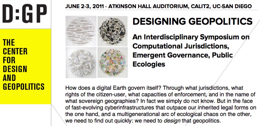
Finally, Nicola and I will fall out of the car in a state of semi-delirium in La Jolla, California, where I’ll be presenting at a 2-day symposium on Designing Geopolitics, “an interdisciplinary symposium on computational jurisdictions, emergent governance, public ecologies,” organized by Benjamin Bratton, Daniel Rehn, and Tara Zepel.

That will be free and open to the public, for anyone in the San Diego area who might want to stop by, and it will also be streamed online in its entirety; the full schedule is available at the Designing Geopolitics site.

(Earlier on BLDGBLOG: Landscape Futures Super-Workshop, Landscape Futures Super-Dialogue, and Landscape Futures Super-Media).

Landscape Futures Super-Dialogue

[Image: The electromagnetic infrastructure of Los Angeles; photo by the Center for Land Use Interpretation].

I’ve deliberately waited to the last minute to mention this event, simply because there will only be room for five or six people to join us, but the Landscape Futures Super-Workshop pops out in public today for a live event beginning at 1pm at the Center for Land Use Interpretation in Culver City.

It features, in order of appearance:

Matthew Coolidge, Center for Land Use Interpretation
David Gissen, Subnature / HTC Experiments / California College of the Arts
David Benjamin, The Living
Liam Young, Tomorrow’s Thoughts Today / Architectural Association
Mark Smout and Laura Allen, Smout Allen / Barlett School of Architecture
Elizabeth Ellsworth and Jamie Kruse, Smudge Studio / Friends of the Pleistocene

Students from the Arid Lands Institute will also have a casebook of research drawings on display, and the day will conclude with a panel discussion, kicking off at 4pm, featuring all of the above speakers in addition to Arid Lands Institute faculty and Los Angeles Times architecture critic Christopher Hawthorne.

[Image: “Topping-out ceremony” at the Onkalo nuclear-waste sequestration site, Finland; photo by Posiva/Jari Hakala, via Friends of the Pleistocene].

In addition to the work of each practitioner listed above, we’ll be discussing everything from the coastal-expansion infrastructures of Los Angeles, urban aridity, future climates and their spatial implications, and the architecture of dynamic landscapes to the cognitive difficulties associated with geologic time, the Super-Workshop‘s own recent experience of L.A., L.A. itself as a site for interventions both speculative and real, and the layered ecologies of the city.

Things kick off at 1pm at the Center for Land Use Interpretation. Due to the size of our own group, however, I should point out again that there will be limited space, and I’d thus suggest arriving early.

Working the Line

Tomorrow night in Los Angeles, at the Center for Land Use Interpretation, David Taylor will be presenting his project “Working the Line.”

[Image: U.S./Mexico border marker #184; photograph by David Taylor].

Taylor has been documenting “276 obelisks, installed between the years 1892 and 1895, that mark the U.S./Mexico boundary from El Paso/Juarez to San Diego/Tijuana. He will present this work, and describe his experiences along this often remote and dramatic linear and liminal space.”

As geographer Michael Dear—who spoke about border issues back at Postopolis! LA—describes these obelisks:

The monuments erected by the boundary survey played a pivotal role in securing the line after the Mexican-American War. These obelisks and stone mounds literally marked on the ground the southernmost edges of the nation; they became fundamental points of reference in subsequent boundary disputes (of which there were many) and in the resurvey of the border that took place at the end of the 19th century.

In the context of Taylor’s project, it’s interesting to read a 2006 discussion about “GeoCaching the Mexican Border Obelisk Monuments,” in which a project nearly identical to Taylor’s was presented as “extreme & dangerous,” and thus all but impossible to achieve. Rhetorically speaking, I also want to point out CLUI’s use of the terms “remote and dramatic” to describe what the geocaching site sees as “extreme & dangerous”—an intriguing insight into the spirit of the two approaches. In any case, the ensuing conversation there includes fascinating technical details of the obelisks themselves—their materiality and scale—as well as precise coordinate locations for several dozen of them.

The talk kicks off at 7pm, on Wednesday, August 4, at CLUI’s gallery space in Culver City; here’s a map.

(Random book link: Obelisk: A History).