Giambattista Nolli’s 1748 Map of Rome –
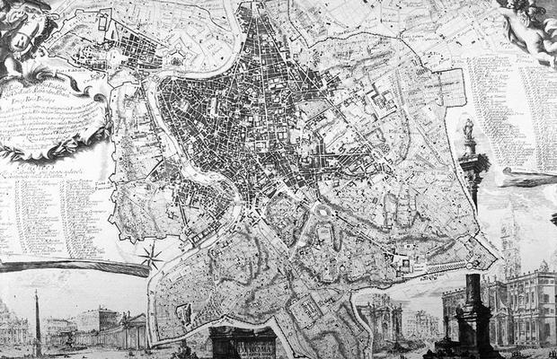
– “is widely regarded by scholars as one of the most important historical documents of the city ever created. This project is a collaborative exploration of the exquisite Nolli engraving, through its historic significance and contemporary application.”

In other words, two professors at the University of Oregon have made it interactive: you can focus on the Tiber, on the city walls, zoom in, zoom out, switch to a satellite view…
Plus this guide to Nolli’s cartographic symbols:

Symbols used thusly:

(Nolli link originally spotted on Archinect; also see Pruned).
In this context, however, I can’t resist putting up some of Piranesi’s Rome images, as I have a somewhat irrational love for Piranesi:


Please also note that the great Nolli Map (“la Nuova Topografia di Roma”) from 1748 is now available in a truly interactive mobile edition: Nolli App for iPhone and iPad. Enjoy this masterpiece of mapmaking from the comfort of your armchair or while walking in Rome. All indices have been digitised. Simply tap on a number on the map to get the information you want. Or search for particular features in spotlight. Or browse the index by category or Rione. Or compare the current situation in overlay mode with the Nolli Map. All historic information is available offline, no internet connection is required. Get it from the App Store.